This is an outstanding site visible for miles around in just about every direction – so getting here is easy! If you’re coming from Harrogate, south down the A658, turn right and go thru North Rigton. Ask a local. If you’re coming north up the A658 from the Leeds or Bradford area, do exactly the same! (either way, you’ll see the crags rising up from some distance away) As you walk to the main crags, instead of going to the huge central mass, you need to follow the line of walling down (south) to the extended cluster of much lower sloping rocks. Look around and you’ll find it!
Archaeology & History
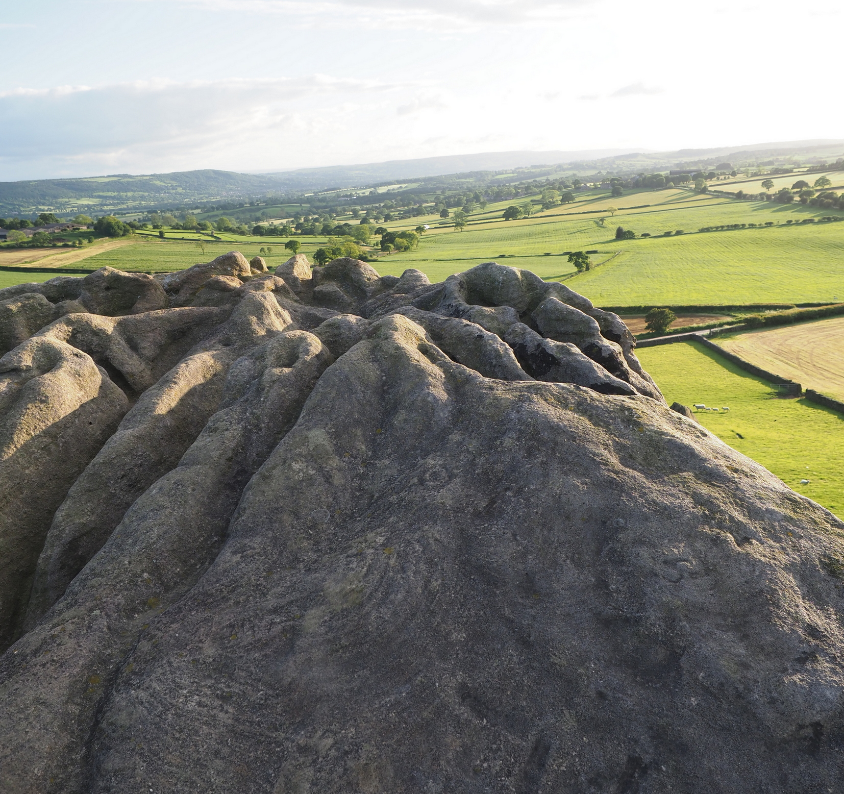
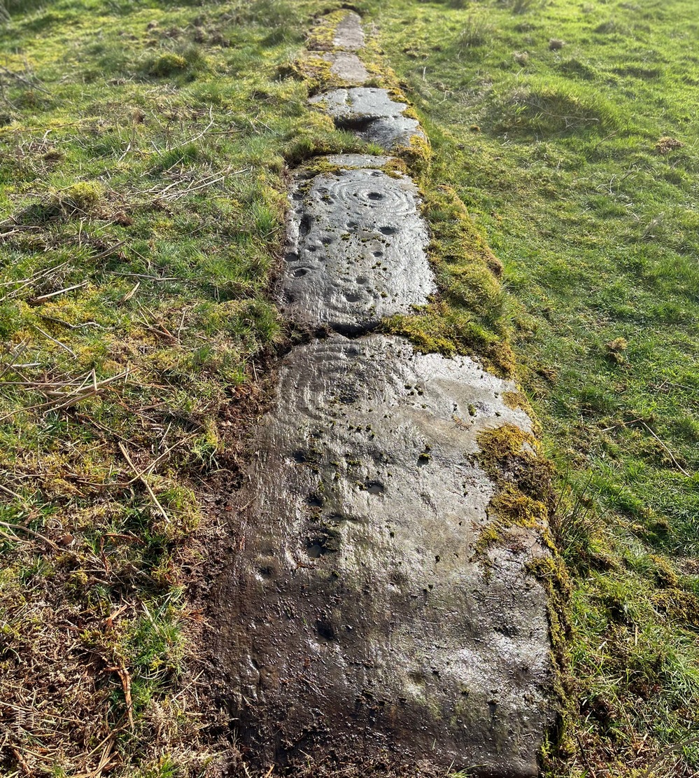
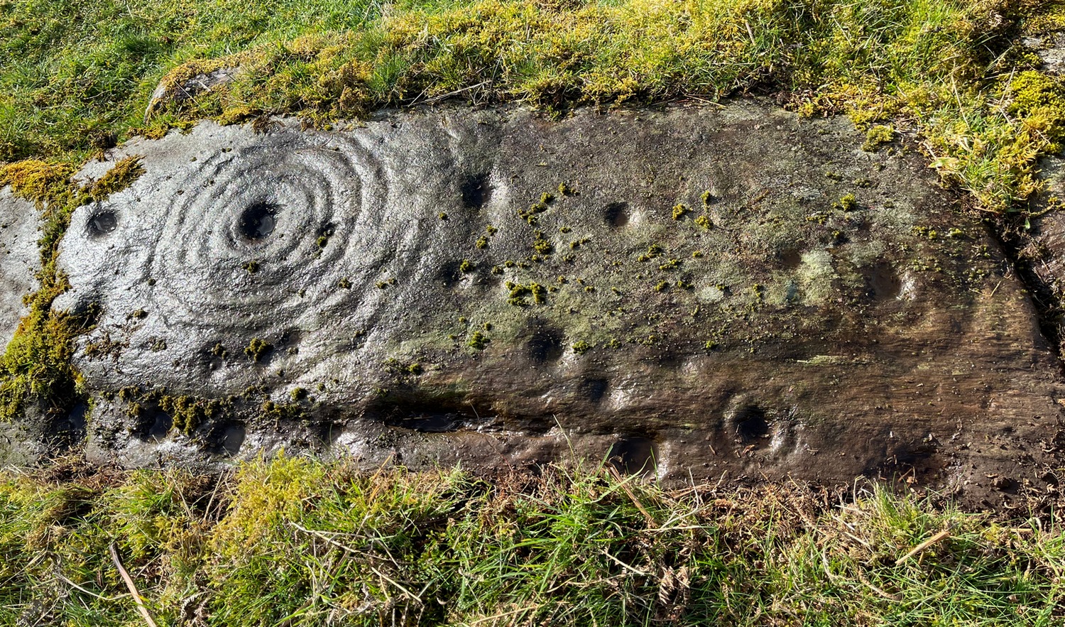
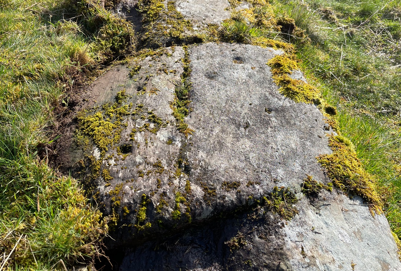
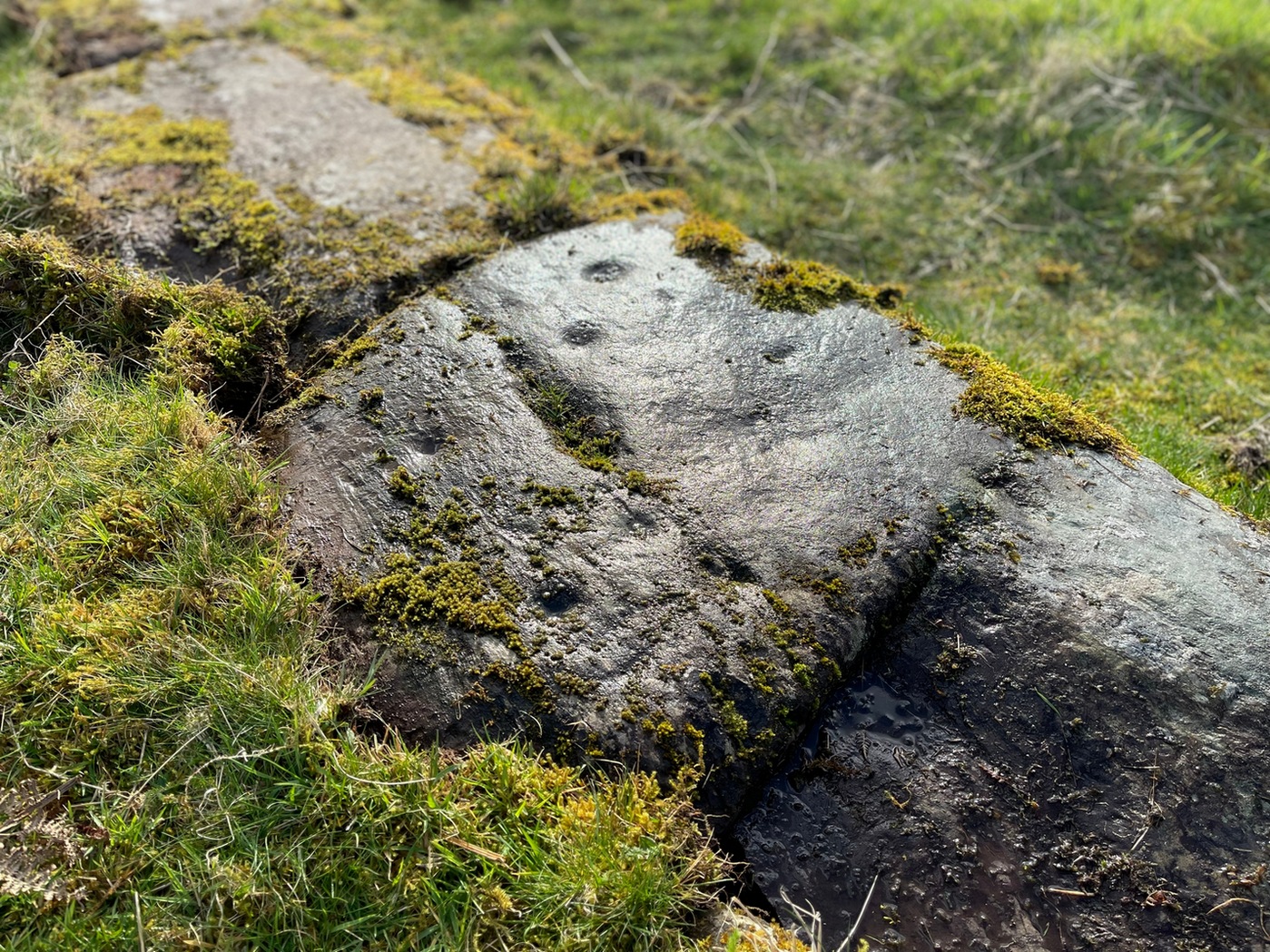
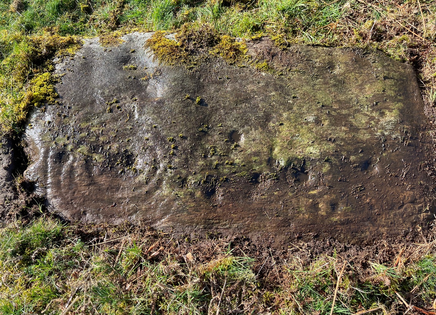
On the evening of May 27, 2024, I received a phone call from a Mr James Elkington of Otley. He was up Almscliffe Crags and the wind was howling away in the background, taking his words away half the time, breaking the sentences into piecemeal fragments. But through it all came a simple clarity: as the sun was setting and the low light cut across the rocky surface, a previously unrecorded cup-and-ring design emerged from the stone and was brought to the attention of he and his compatriot Mackenzie Erichs. All previous explorations for rock art here over the last 150 years had proved fruitless—until now!
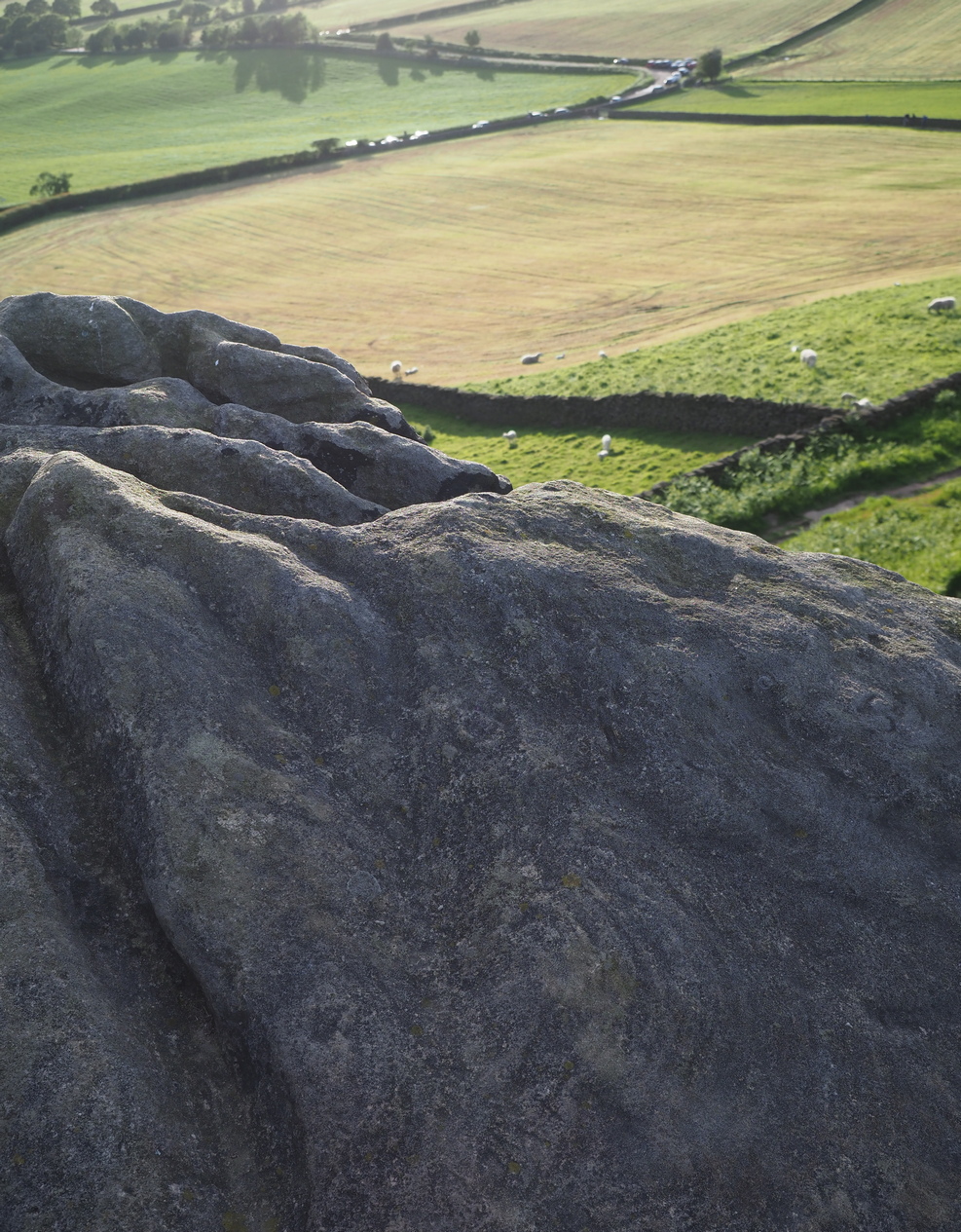
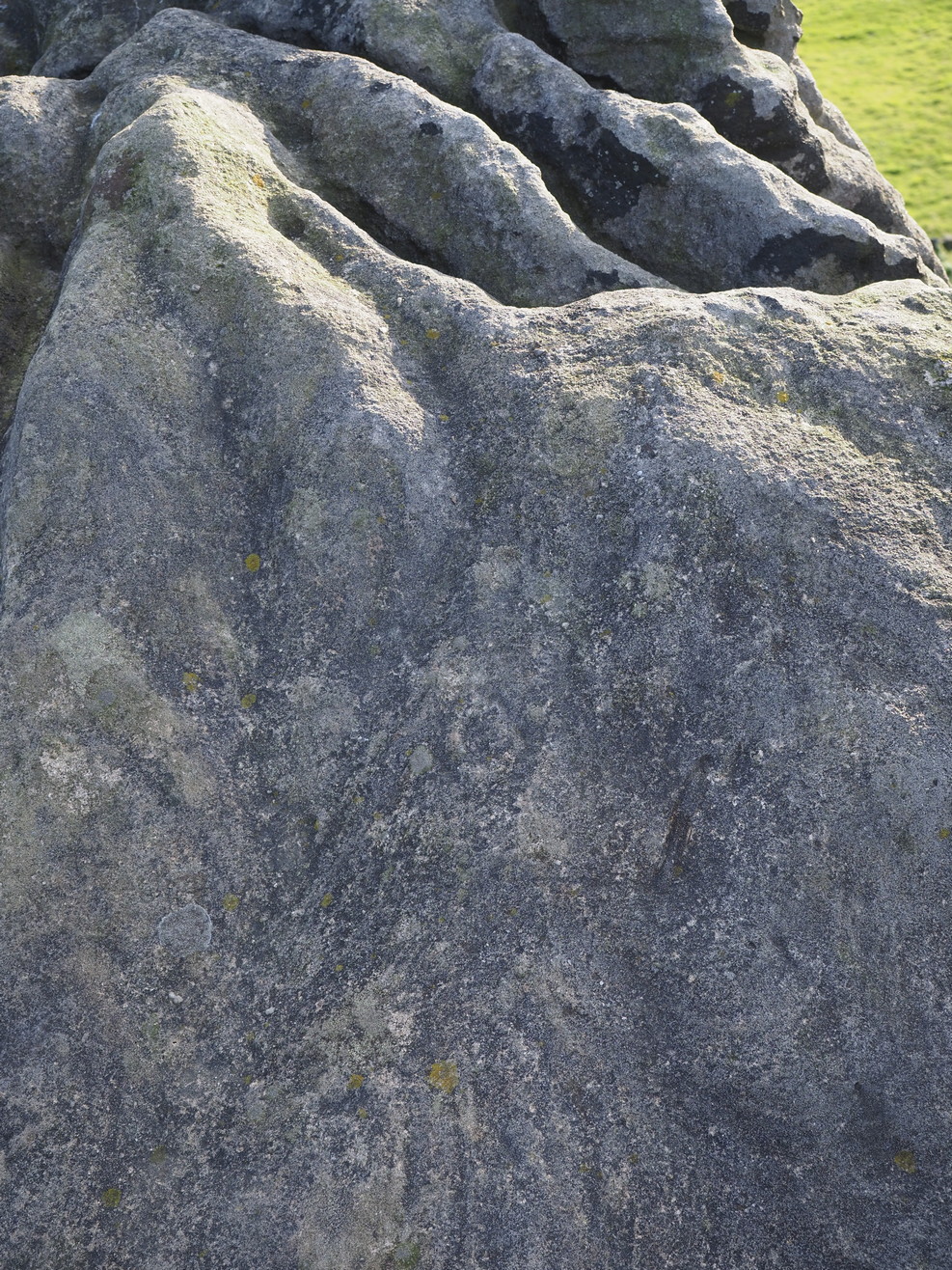
Looking northwestCentral cup-&-ring
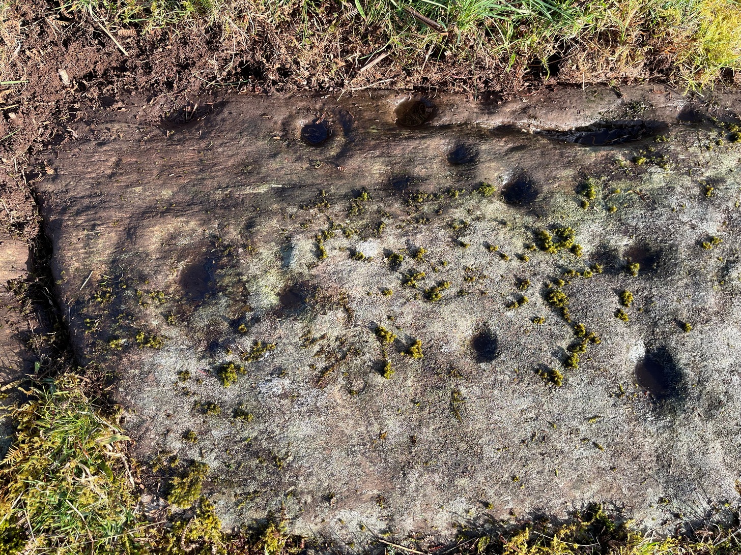
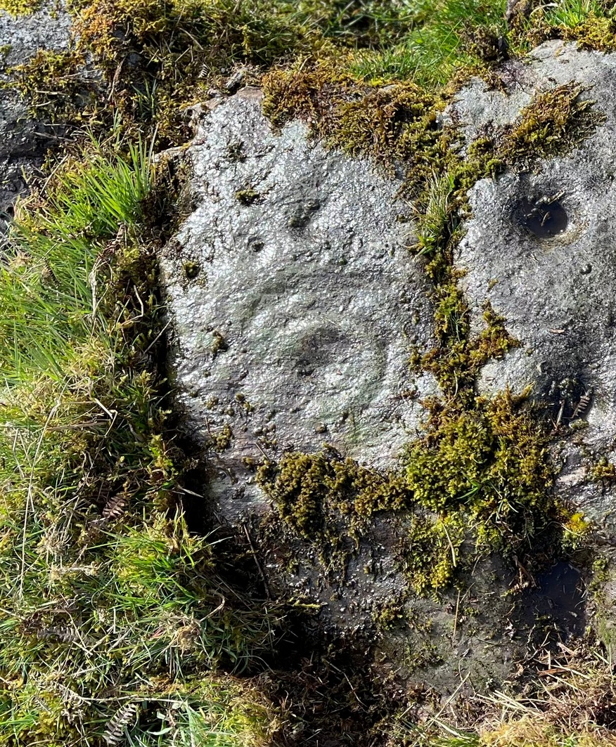
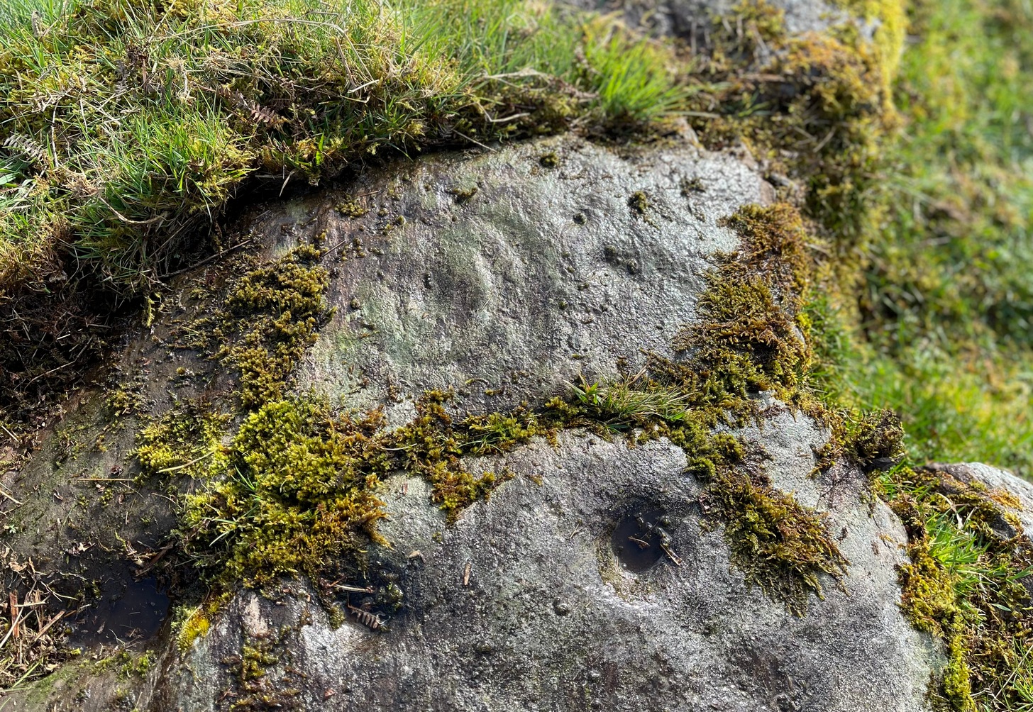
On the east-facing slope of the stone, just below the curvaceous wind-and-rain hewn shapes at the very top of the boulder, is a singular archetypal cup-and-ring. It’s faint, as the photos show, but it’s definitely there. What might be another cup-and-ring is visible slightly higher up the sloping face, but the site needs looking at again when lighting conditions are just right! (you can just about make it out in one of the photos) But, at long last, this giant legend-infested mass of Almscliffe has its prehistoric animistic fingerprint, bearing fruit and giving watch to the countless heathen activities going back centuries. Rombald’s wife Herself might have been the mythic artist of this very carving! (if you want to read about the many legends attached to the major Almscliffe rock outcrop, check out the main entry for Almscliffe Crags)
On the A81 road from Aberfoyle to Strathblane, about a mile south of Aberfoyle take the tiny right turn (keep your eyes peeled!) to Gartmore. Along the tiny curving road for exactly 1km (0.61 miles), where the road has straightened out there’s a small dirt-track with a parking spot along it. A few hundred yards along there’s a crossroads of dirt-tracks: walk to your left (SW) for nearly a mile (or exactly 1.5km) keeping your eyes peeled for a small distinct footpath leading down-slope on your left. Walk along this undulating path for just over 200 yards till you go through the gate, then walk immediately to your right down the side of the fence in the field for about 20 yards. Y’ can’t miss it!
Archaeology & History
Blarnaboard (3), NE-SW
Located on the land of the early bards of Gartmore, we could speculate that those early orators told tales of, and from this old stone—but that’s all it would be: dreamy speculation. Instead, passing that aside, the petroglyph itself brings us a feast to drool over!
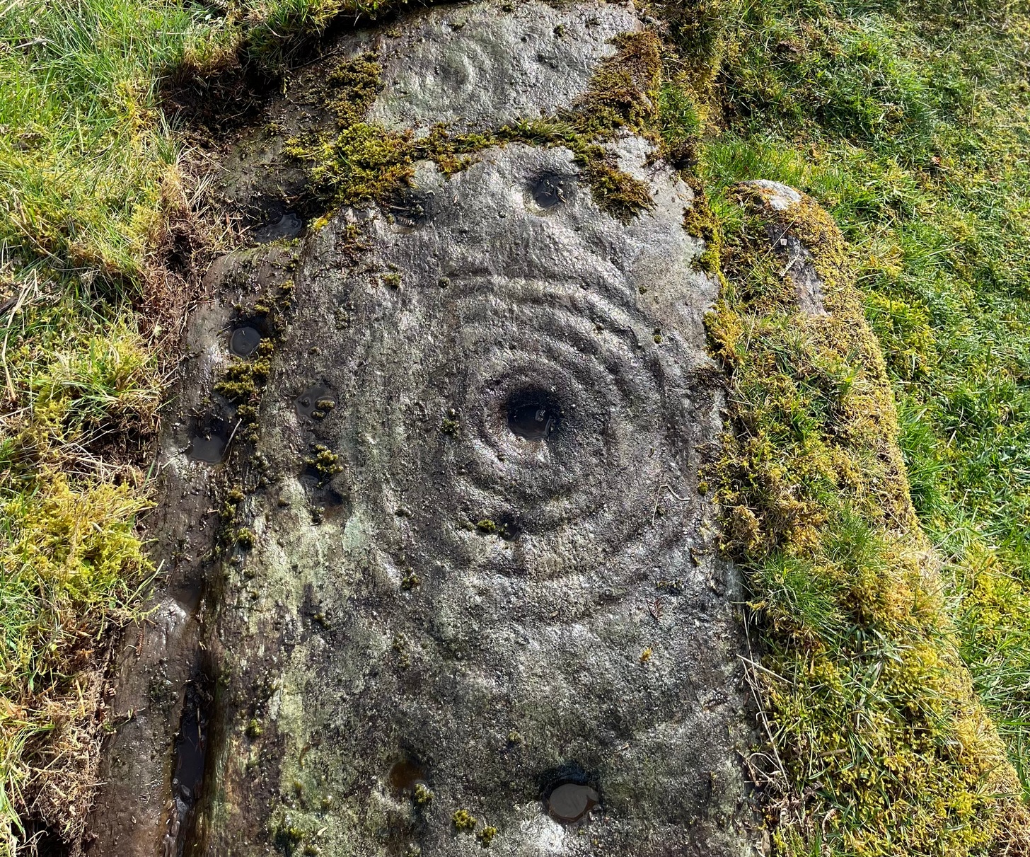
Made up of four distinct carved sections of almost interconnecting rock, this flat thin line of stone is covered with an impressive array of cups and multiple rings. Running downhill in a northeast to southwest line, it would appear to have been written about for the first time by Lorna Main (1988) who subsequently described it in the usual archaeological shorthand, simply telling that,
“There are at last 28 cups, 3 cup and one ring, 4 cup and two rings, 2 cup and three rings, 1 cup and five rings and 1 cup and seven rings.”
Multiple ringed elementSection 1 overview
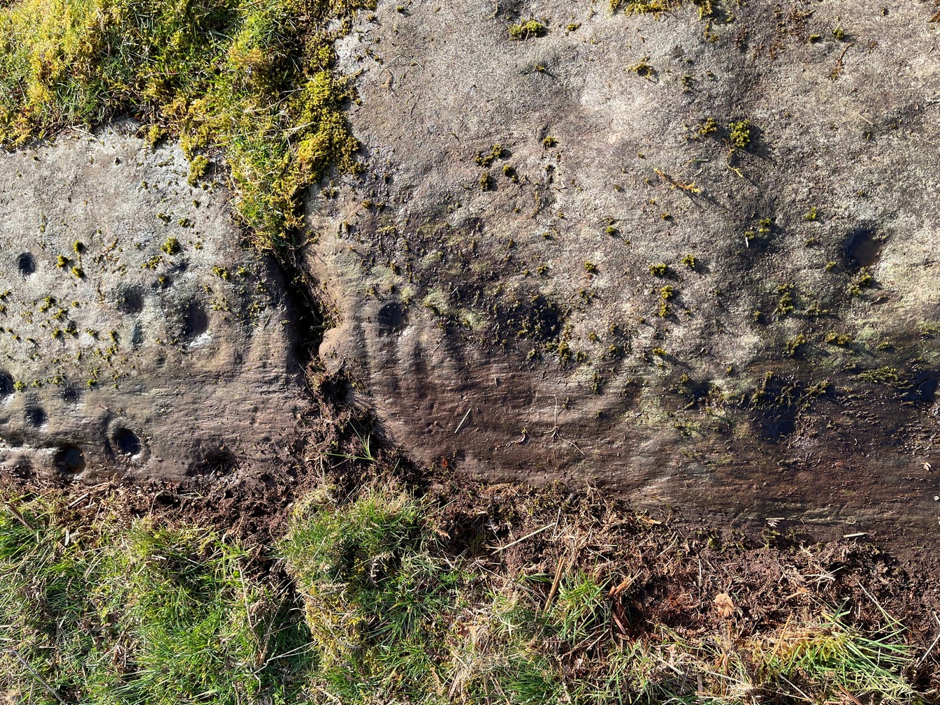
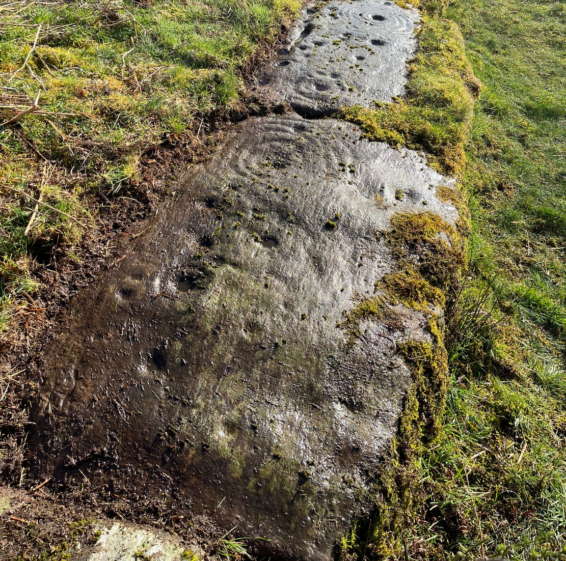
…But, as usual, there’s much more to be said of it than that. Of the four sections, we’ll start at the uppermost northeastern section and work down the sloping ridge, looking at the respective symbols as we go. Section 1 has the largest surface area, but isn’t the most decorated of the bunch. Nonetheless, what we find here is impressive. About a dozen single cup-marks of various ages are scattered over the surface in what initially seems to be no recognizable order; these are accompanied by two single cup-and-rings: one of which could be said to be of standard size and form, whilst the other has a much larger and broken ring, near the middle of the rock, about 12 inches across. This larger ring has two or three of the cup-marks incorporated into its outer edges. The most impressive element of Section 1 is the large multiple-ringed design, five in all, radiating outwards or funneling inwards (depending on what was intended) around a central cup. The outer ring of this is incomplete.
Impressive cup & 7 ringsScatter of cups & rings
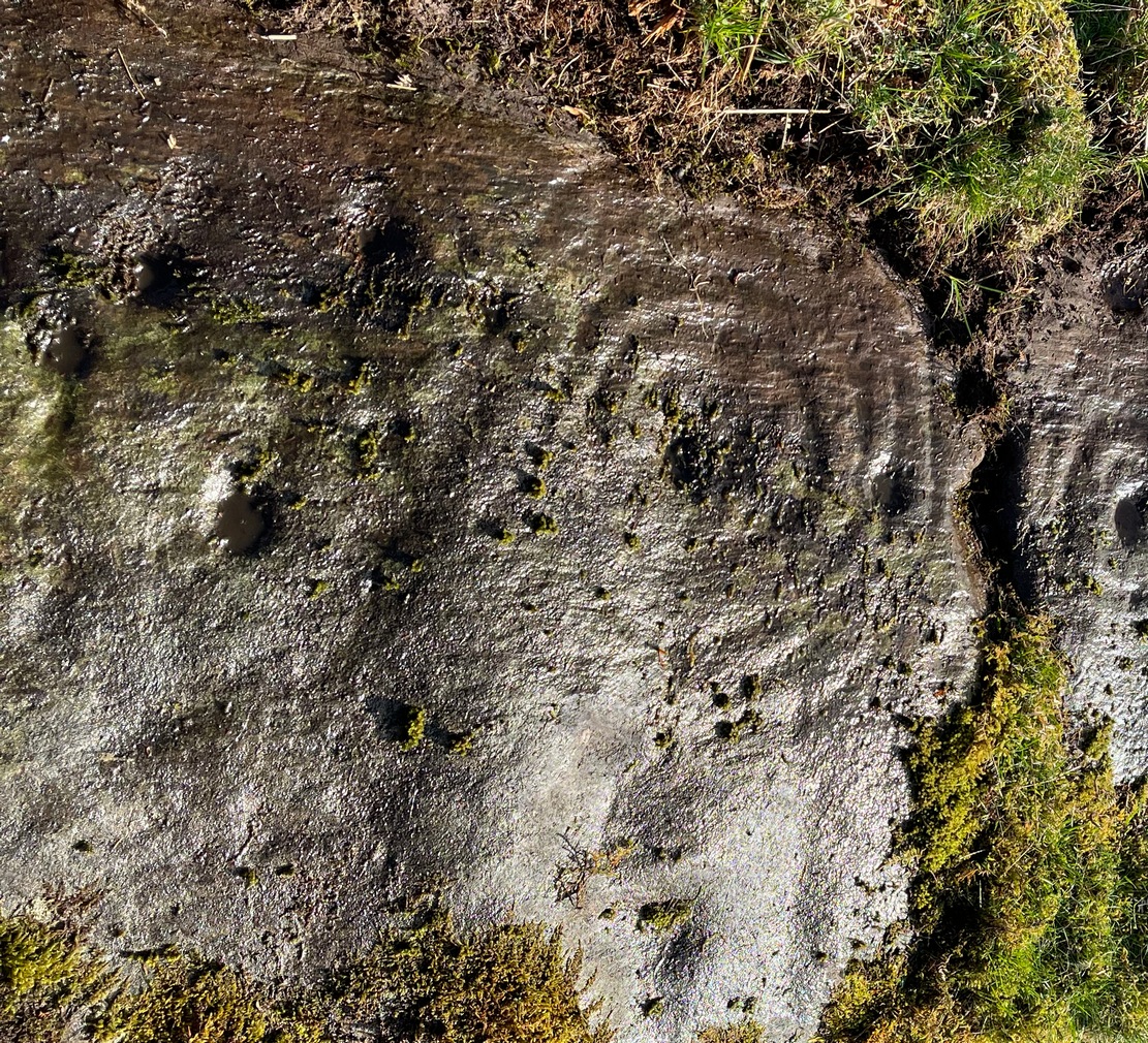
Section 2 is the most visually impressive of all the Blarnaboard (3) carvings: almost an evolutionary development of what we see on the first part. A 2-dimensional panorama shows off a distinct cup-and-ring close to the edge of the soil, and there’s a somewhat wonky incomplete cup with double-ring below it. A very clear cup-mark to the right of this has another faint incomplete double-ring round it—but this is hard to see. The same cannot be said of the cup with seven concentric rings surrounding it! (the outer two of these are incomplete) As I walked round and round this section, drooling somewhat, it became obvious that a number of well-defined cup-marks had been carved around the outer edges of the rings, deliberately creating an eighth ring comprised purely of cup-marks. It gave me the impression of it representing heavenly bodies revolving around the central Pole Star; but also of it defining the movement of the Moon through the heavens during a calendar year. (the astronomy of my youth still comes through at times!)
Section 3 carvingFaint double cup-and-ring
By comparison, the third and smallest section of Blarnaboard (3) almost pales into insignificance, possessing a mere cup-and-double-ring—and a very faint one at that. From a certain angle it looked like it possessed a third ring, but this was probably more to do with me wanting to see more than there is! Just below this double-ring, a single cup has what might have once been another incomplete ring round it—but we’d need the computer graphic students among you to suss that bit out! You can’t make it out on the photos here, sadly…
Section 4 carvingFaint double-arc, lower cup
The fourth section is the most visually unimpressive of the entire cluster and was probably carved much later than the rest. The poor little fella has just five single cup-marks, with a sixth at the top-corner or northeastern part with what seems to be a small carved double-arc, or partial lozenge, that was started and never finished.
A couple of other exposed sections of stone running a few more yards further down the same line have no carvings on them—but there may well be more to this petroglyph hiding beneath the turf, which covers quite a large area. I have no doubt that other unrecorded carvings exist in close by, but due to excessive forestry plantations all around here, they’ll either be covered over or will have been destroyed. Don’t let this put you off looking for others though!
Cup-and-five-ringsCup-and-seven rings
An interesting feature of this long line of stone is its potential alignment. When we were photographing the site, a local man came over and got chatting with us. He knew of the carving and had been here many times and told us that his wife had looked at this one and found it aligned with another cup-and-ring on the south-side of Blarnaboard farm and another one (officially unrecorded) even further along. I checked this when I got home and found that this long line of petroglyphs did indeed line up with the Blarnaboard farm carving, perfectly. Whether this was intentional and/or possesses an astronomical function, we might never know. The third carving along the line has yet to be located. I must emphasize however, that the relationship between earthfast petroglyphs and alignments is very rare and, where found, is little more than fortuitous. But when we find cup-markings on alignments of standing stones and other prehistoric monuments, the relationship seems to be much more intentional and would have had a specific mythic function.
If y’ follow the fence-line from this carving down to the small burn, on the other side is the much less impressive Blarnaboard (2) cup-marked stone.
Folklore
Prior to Lorna Main’s (1988) short note on this petroglyph, local people had long known about the carving. As late as the 20th century, people with fevers were brought to this stone in the early morning to be cured of the illness. The idea was that medicinal herbs were collected and placed in some of the cup-marks, which were used like a mortar and pestle to prepare the plants. This healing magick, spoken of by some of the old folk in Aberfoyle, was known to them as children, who’d been told of this by their elders and, of course, by the elders before them.
There is also a tradition that some of the stone that makes up the curious moondial (not sundial) that can be seen at the back of the church in Gartmore village nearly a mile to the southeast, originally came from here.
References:
Main, L., “Blarnaboard (Aberfoyle parish), Cup and Ring Marked Outcrop,” in Discovery & Excavation Scotland, 1988.
Acknowledgements:Huge thanks for use of the Ordnance Survey map in this site profile, reproduced with the kind permission of the National Library of Scotland.
Holy Well (destroyed): OS Grid Reference – TL 997 254
Archaeology & History
Near the centre of the ancient city could once be found the flowing waters of St. Helen’s Well. It was described many times in various legal and land documents from as early as 1331 CE onwards, in Colchester’s Oath Book. However, descriptions of the site itself and its curative abilities were not noted. It was simply associated with St Helen’s Chapel, whose original foundations date from the 12th century.
Folklore
One tradition told that it was St Helen herself who founded the chapel here. St Helen’s feast day is Agust 18.
References:
Benham, W. Gurney (trans.), The Oath Book; or, Red Parchment Book of Colchester, Essex County Standard: Colchester 1907.
Holy Well (lost): OS Grid Reference – SE 134 331 (approximation)
Archaeology & History
This site is both interesting and frustrating at the same time. Interesting inasmuch that as early as 1258 CE, “the Knights Hospitallers of St. John of Jerusalem in England, had in Allerton a manor called the manor of Crosley.” The Hospitallers, as some will know, were the immediate successors of the more famous Knights Templars. As their name suggests, their patron saint was St John, whose festival date was summer solstice and had his name given to many holy wells. But this one has left us with no name and its location has long since been lost. In J.H. Bell’s (1888) essay on the early medical history of the area he told that local people with certain afflictions, “were wont to resort to them to drink their waters for their supposed medicinal virtues: there was one between Cemetery Bridge and Crossley Hall”. But he doesn’t give its exact position. In John James’ (1841) classic History of Bradford he thinks that near the place where the local stream known as the Hebble, “there was undoubtedly in former times a Holy well,” but is unable to cite a location. No well is shown on the early maps between the old Hall and the cemetery and the only definitive reference to wells close by are in the early boundary perambulation record, which describe a Brock Well and a Cold Well. Perhaps the the most probable contender and location is cited in Harry Speight’s (aka Johnnie Gray) Pleasant Walks (1890) where, taking a route between Great Horton and Allerton, he told us to,
“go through fields on to Necropolis Road, opposite Scholemoor cemetery, turn down lane left outside cemetery, ½ mile, descending steps, cross beck (here used to be the Spa Beck public gardens, now removed higher up) and ascend, at second field, leaving the forward path and turn left, following beck with Crosley Hall and trees to right.”
The location of the said Spa Beck gardens is very close to where Mr Bell described the medicinal spring and is/was the most likely position of what James (1841) thought to be a long lost holy well. If we could get more information about the history of the Spa Well, we may be able to make more definitive statements about the place.
Standing Stone (destroyed): OS Grid Reference – NO 483 603(approximation)
Archaeology & History
In an area once teeming with megaliths, this is but one that lost its life in the 19th century. It would seem that the only reference of its existence—and demise—comes from the pen of the great regional historian Andrew Jervise (1853) who, in a description of the nearby holy well of St Ninian, in a field near Wellford,
“within the last half century there were two or three large rude boulders nearby, which were called Druidical stones.”
References:
Jervise, Andrew, The History and Traditions of the Land of the Lindsays in Angus and Mearns, Sutherland & Knox: Edinburgh 1853.
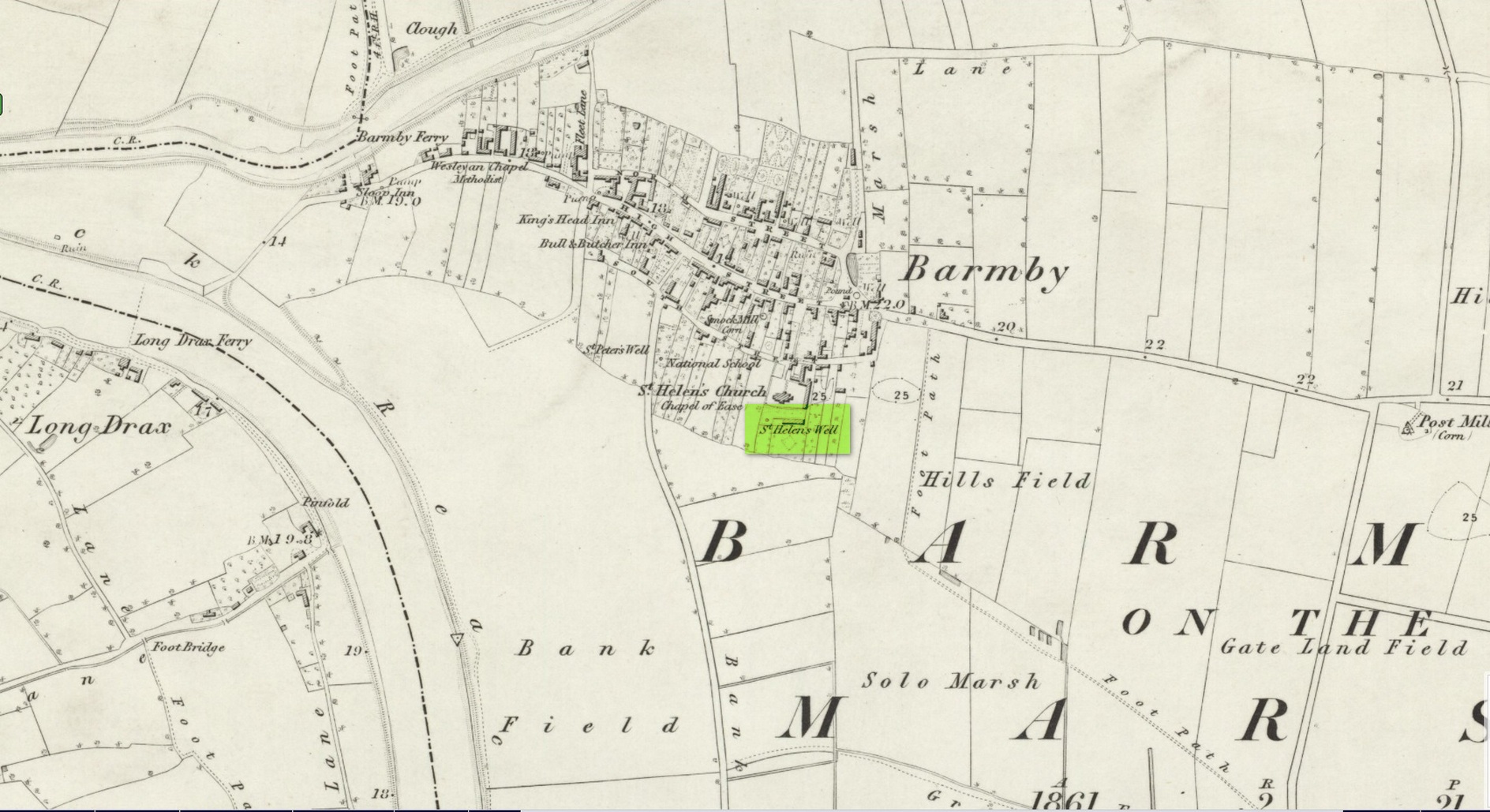
Holy Well (destroyed): OS Grid Reference – SE 6900 2841
Archaeology & History
Site shown on 1853 map
One of two holy wells in Barmby village which, like its compatriot St Peter’s Well, was destroyed sometime in the 19th century. Not good! It was located in the southwest section of the graveyard of St Helen’s Church and was apparently alive and running when the Ordnance Survey lads visited here in 1851 (as shown on their 1853 map). But when the site was revisited by them in 1905, it seems to have gone. However, as with the neighbouring St Peter’s Well, there are conflicting reports as to when it was destroyed, for although the Ordnance Survey lads spoke of it in the present tense when they went there, Thomas Allen (1831) told that “within the last six years (it has) been wantonly filled up.” Despite this, less than ten years later William White mentioned it in the present tense, also saying how it was “said to possess medicinal properties.” These healing qualities were, according to Allen, due to its iron-bearing or chalybeate nature, meaning that it would revive a weak and feeble constitution. Iron-bearing wells are damn good for such things!
As the years passed, St. Helen’s Well fell into folk memory. When William Smith (1923) surveyed the many holy wells in this part of the world he found how “old parishioners have said that as school-children they both drank of and washed in its water”, but little else.
References:
Allen, Thomas, A New and Complete History of the County of York – volume 2, I.T. Hinton: London 1831.
Gutch, E., Examples of Printed Folk-lore Concerning the East Riding of Yorkshire, Folk-Lore Society: London 1912.
Harte, Jeremy, English Holy Wells – volume 2, Heart of Albion press: Wymeswold 2008.
Smith, William, Ancient Springs and Streams of the East Riding of Yorkshire, A. Brown: Hull 1923.
White, William, History, Gazetteer and Directory of the East and North Ridings of Yorkshire, R. Leader: Sheffield 1840.
Holy Well (destroyed): OS Grid Reference – TQ 102 952
Archaeology & History
A long lost sacred site (not to be confused with the nearby Bright Well) that has given its name to the district of Holywell. It also gave its name to an early farmstead; and to the place-name of Holywellane recorded as far back 1485. It was also described as a “Holy Well” in a local vestry book in 1698. Nothing more seems to be known of the place.
References:
Gover, J.E.B., Mawer, Allen & Stenton, F.M., The Place-Names of Hertfordshire, Cambridge University Press 1938.
Harte, Jeremy, English Holy Wells – volume 2, Heart of Albion press: Wymeswold 2008.
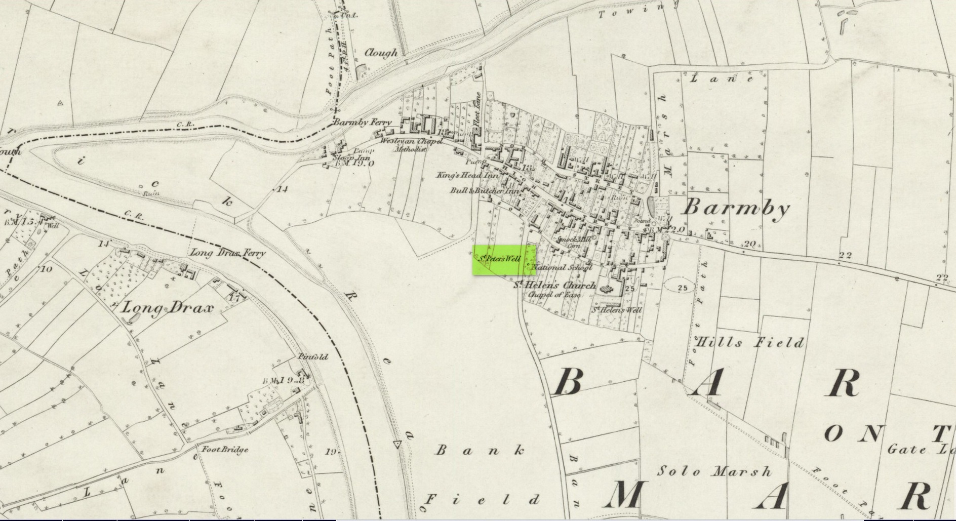
This holy well was one of two in the village of Barmby, neither of which seems to exist anymore — although, it has to be said, there are conflicting reports as to its demise from the word go. When it was first mentioned in Thomas Allen’s (1831) huge work on the history of Yorkshire he told us that,
“In this village are two extraordinary springs of sulphuric and chalybeate water, denominated St Peter’s and St Helen’s; the former possesses the rare virtue of curing scorbutic eruptions by external application. Both of these wells, within the last six years, have been wantonly filled up, and the site is only known to a few of the villagers.”
Their “extraordinary” waters however, were apparently found to be still flowing when the Ordnance Survey lads surveyed here in 1849, as they published it a few years later on the 1853 OS-map of the region, along with its nearby compatriot of St Helen.
Wet patch on 1907 mapSt Peters Well, Barmby 1853
Less than ten years earlier, Will White (1840) also spoke of St Peter’s Well, albeit briefly, telling that it “was said to possess medicinal properties”—but it seems that he never visited the site and was merely going on Mr Allen’s earlier description. Its exact whereabouts however, is somewhat of a curiosity. Although the Ordnance Survey lads mapped it as being SE 6885 2848 on the southwest side of the village, in William Smith’s (1923) survey of holy wells he gave us a very different location. “St Peter’s Well,” he wrote,
“is situated in an orchard about a hundred yards to the south-east of the church, and is reached by going through three fields. It is a pool about eight feet deep and fifteen in diameter, the spring now rising several yards from its original site. It flows clear and strong, and though attempts have been made to block it up, it always reappears. The water is soft and has never been known to freeze. It contains sulphur, as I can testify, having tasted the water. It is noted for curing scurvy and sore eyes, if applied externally, and half-a-century ago, people suffering from these ailments came long distances to apply the water as a remedy, and went away benefited. An eye-witness has said a man living far from Barmby, advised by his medical man, as a last resort visited the well and applied the water externally for the cure of scurvy, and so quickly did he lose the scales that fresh sheets for his bed were required each night…
“About a century ago, the owner of the orchard in which the well is situated had a son, a doctor, who commenced to practice in the district. The owner’s wife looked upon the spring as detrimental to the prospects of the son. So she said to her husband, “Tummus, we’ll hev that well filled oop. Foaks can cure thersens, an’ ther’ll be nowt fur poor Tummy ti dea.” Tummus was so convinced by his wife’s foresight that he did as she wished, and filled up the well.”
Naathen, on the very first OS-map of the village, the lads marked it at SE 6885 2848, as well as on subsequent surveys. This spot is 170 yards west of the village church wall. The location described by Smith has no “well” or spring marked on any maps, but, on the 25-inch scale map, 100 yards southeast of the the church walling we see marshland on the other side of a copse of trees in the very spot he told us about. Whether or not this was the actual spot, or whether the OS-lads had it right, we might never know. Field-name surveys may help; the existence and location of the orchard may help; other literary accounts might also be useful. But, one final query that may be important relates to Tom Allen’s (1831) words when he told us that “the site is only known to a few of the villagers.” By that, did he mean that the local folk kept its position quiet from outsiders? Even today, in our numerous inquiries with local people in the glens and mountains when seeking out lost or forgotten places, we still come across some olde local folk who are still quite hesitant, with that serious quizzical look in their eyes…
Folklore
St Peter’s day was celebrated on June 29. He was one of the so-called “major saints” due to him being one JC’s Apostles. His symbol was a key.
References:
Allen, Thomas, A New and Complete History of the County of York – volume 2, I.T. Hinton: London 1831.
Gutch, E., Examples of Printed Folk-lore Concerning the East Riding of Yorkshire, Folk-Lore Society: London 1912.
Harte, Jeremy, English Holy Wells – volume 2, Heart of Albion press: Wymeswold 2008.
Smith, William, Ancient Springs and Streams of the East Riding of Yorkshire, A. Brown: Hull 1923.
White, William, History, Gazetteer and Directory of the East and North Ridings of Yorkshire, R. Leader: Sheffield 1840.
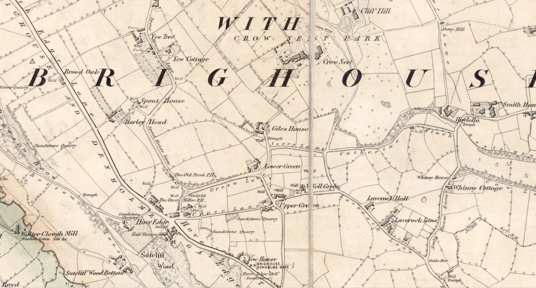
In times gone by there was a singular St.Giles’ Well in the old village of Lightcliffe, but the only reference we have of it is from one of James Parker’s works (1904) where, in his description of St. Giles’ House, he tells, “It derives its name from an ancient well, called ‘St. Giles’ Well,’ which once existed near to the house, and was dedicated to St. Giles”: an 8th century Greek prince who left everything to become a hermit. He lived on wild herbs and developed the ability to cure rheumatism (perhaps a curative aspect of the well), cripples and help beggars. He is the patron saint of woodlands and his symbol is the arrow gained after he healed a wounded doe shot by one (the mass of Robin Hood folklore in this area may have something to do with this symbolism). His date is September 1.
A.H. Smith (1963) cites the “local tradition that it is named from a well dedicated to St. Giles,” but thinks this attribution to be an unlikely one. As can be seen on the accompanying map, a great number of wells are in this area, none of them named, with one just below the said Giles House.
References:
Parker, James, Illustrated History from Hipperholme to Tong, Percy Lund: Bradford 1904.
Smith, A.H., The Place-Names of the West Riding of Yorkshire – volume 3, Cambridge University Press 1961.
Acknowledgements:Huge thanks for use of the Ordnance Survey map in this site profile, reproduced with the kind permission of the National Library of Scotland.
Standing Stone (destroyed): OS Grid Reference – NT 074 698
Archaeology & History
A few hundred yards west of the commemorative Wallace Stone monolith could once be seen a standing stone of considerable size. It was described by James Primrose (1898) in his description of the standing stones of the Strathbrock region; but even in his day, remains of it were fragmentary. He wrote:
“On Drumshoreland Moor, within the grounds of Pumpherston Oil Company, there is a stone, popularly styled Bucksides — its correct designation being Backsides — from its position at the backside of Pumpherston. This stone, a huge whinstone boulder about 12 feet long and 8 feet broad, was blasted in 1888, to make room for the site of a bench of retorts; a few fragments of the stone, however, yet remain by the roadside. The ancient name of this stone was Ballengeich — apparently the Gaelic for “the township towards the wind”, — as if a croft once stood here, near Pumpherston Mains, in an exposed and windy situation.”
A visit to the local history department of the local library might prove fruitful in giving us more information about this place—that’s assuming the filthy tory central government’s theft of taxpayer’s money doesn’t close it! (does that sound a bit harsh? 😁 )
Folklore
The same historian told of a “tradition…that round this stone in days gone by the Broxburn folks, along with their neighbours, used to assemble at Fair time, in the month of August, in order to witness their favourite sport of horse-racing; but whether there was any more ancient custom associated with it, we have never learned.”
References:
Primrose, James, Strathbrock; or, the History and Antiquities of the Parish of Uphall, Andrew Elliot: Edinburgh 1898.