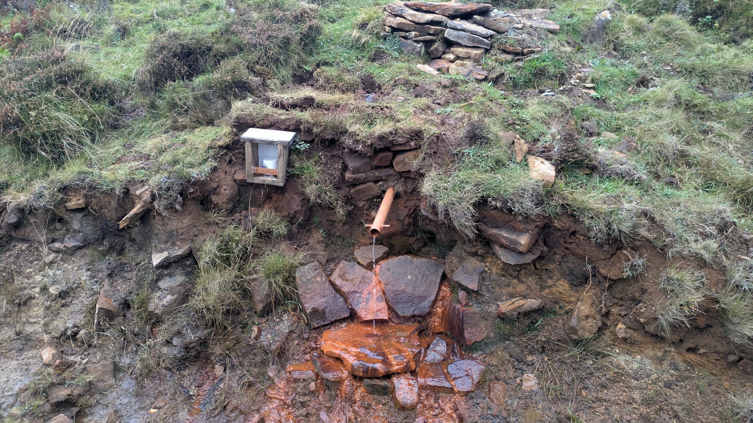
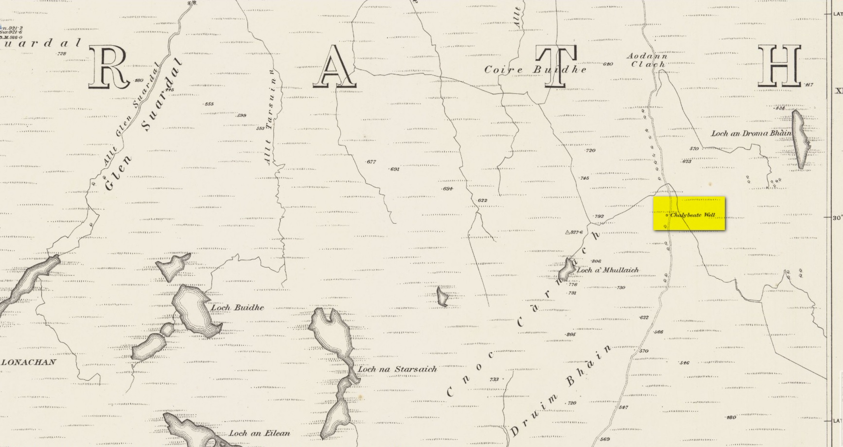
Highlighted on the earliest Ordnance Survey maps of the island, roughly halfway along the Broadford to Heaste road on the right (west) side you will come across the Tabar Ruadh (Gaelic for “Red Well”). For many generations at this point was a Chalybeate well where villagers would stop and drink in a pewter mug from outlet of cast iron pipe which connected to the stone well some nine feet from the road. It was a major stopping point for their horses and ponies to take a drink too.
This set up was functioning in the early 1980’s. At that time I talked to Heaste locals who remembered fishermen from their village taking bottles of this water to pregnant women in the village of Elgol. It was known then for it’s healing properties; this was the early 20th century. The pewter mug was stolen and with road widening and the pipe removed, the site was becoming increasingly overgrown and in danger of being lost for ever.
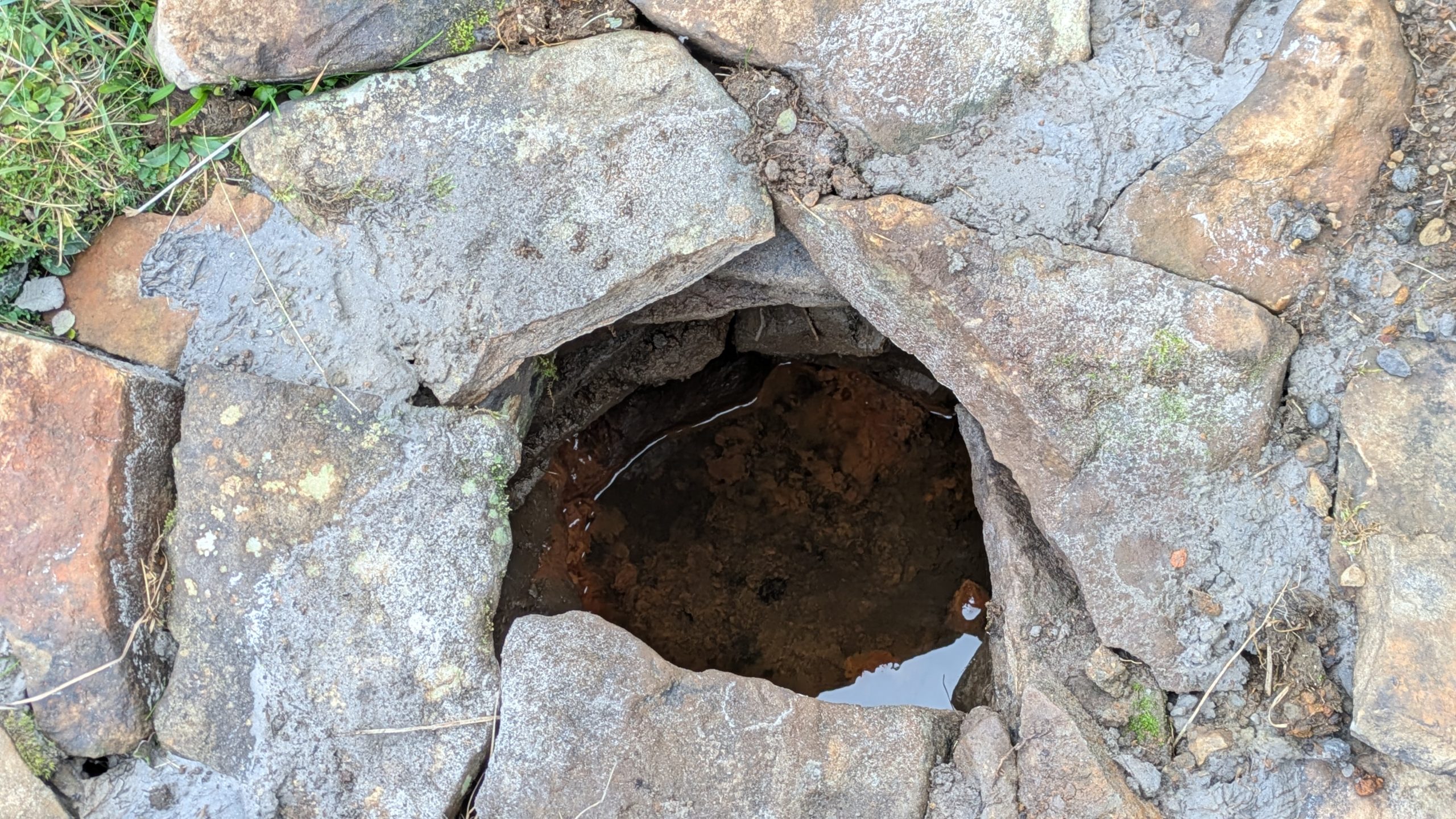
Site shown on 1881 mapWater under the well cover
For the last fifteen years I have been walking this road and had made it a determination to find this well. Success this summer! — and the hidden overgrown well was cleaned out a new steel pipe added. Chalybeate water now flows and a wooden box is at the roadside with a tin mug. On a wet roadside ditch this red water is very obvious where it joins the road.
Acknowledgements:Huge thanks for use of the Ordnance Survey map in this site profile, reproduced with the kind permission of the National Library of Scotland.
Holy Well (destroyed): OS Grid Reference – SE 6900 2841
Archaeology & History
Site shown on 1853 map
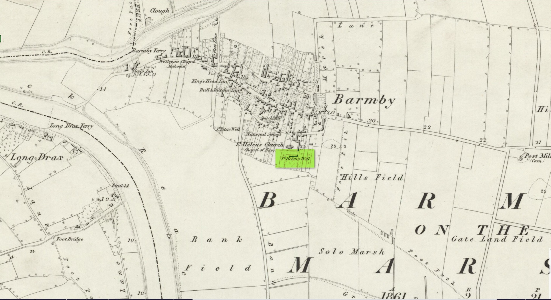
One of two holy wells in Barmby village which, like its compatriot St Peter’s Well, was destroyed sometime in the 19th century. Not good! It was located in the southwest section of the graveyard of St Helen’s Church and was apparently alive and running when the Ordnance Survey lads visited here in 1851 (as shown on their 1853 map). But when the site was revisited by them in 1905, it seems to have gone. However, as with the neighbouring St Peter’s Well, there are conflicting reports as to when it was destroyed, for although the Ordnance Survey lads spoke of it in the present tense when they went there, Thomas Allen (1831) told that “within the last six years (it has) been wantonly filled up.” Despite this, less than ten years later William White mentioned it in the present tense, also saying how it was “said to possess medicinal properties.” These healing qualities were, according to Allen, due to its iron-bearing or chalybeate nature, meaning that it would revive a weak and feeble constitution. Iron-bearing wells are damn good for such things!
As the years passed, St. Helen’s Well fell into folk memory. When William Smith (1923) surveyed the many holy wells in this part of the world he found how “old parishioners have said that as school-children they both drank of and washed in its water”, but little else.
References:
Allen, Thomas, A New and Complete History of the County of York – volume 2, I.T. Hinton: London 1831.
Gutch, E., Examples of Printed Folk-lore Concerning the East Riding of Yorkshire, Folk-Lore Society: London 1912.
Harte, Jeremy, English Holy Wells – volume 2, Heart of Albion press: Wymeswold 2008.
Smith, William, Ancient Springs and Streams of the East Riding of Yorkshire, A. Brown: Hull 1923.
White, William, History, Gazetteer and Directory of the East and North Ridings of Yorkshire, R. Leader: Sheffield 1840.
This holy well was one of two in the village of Barmby, neither of which seems to exist anymore — although, it has to be said, there are conflicting reports as to its demise from the word go. When it was first mentioned in Thomas Allen’s (1831) huge work on the history of Yorkshire he told us that,
“In this village are two extraordinary springs of sulphuric and chalybeate water, denominated St Peter’s and St Helen’s; the former possesses the rare virtue of curing scorbutic eruptions by external application. Both of these wells, within the last six years, have been wantonly filled up, and the site is only known to a few of the villagers.”
Their “extraordinary” waters however, were apparently found to be still flowing when the Ordnance Survey lads surveyed here in 1849, as they published it a few years later on the 1853 OS-map of the region, along with its nearby compatriot of St Helen.
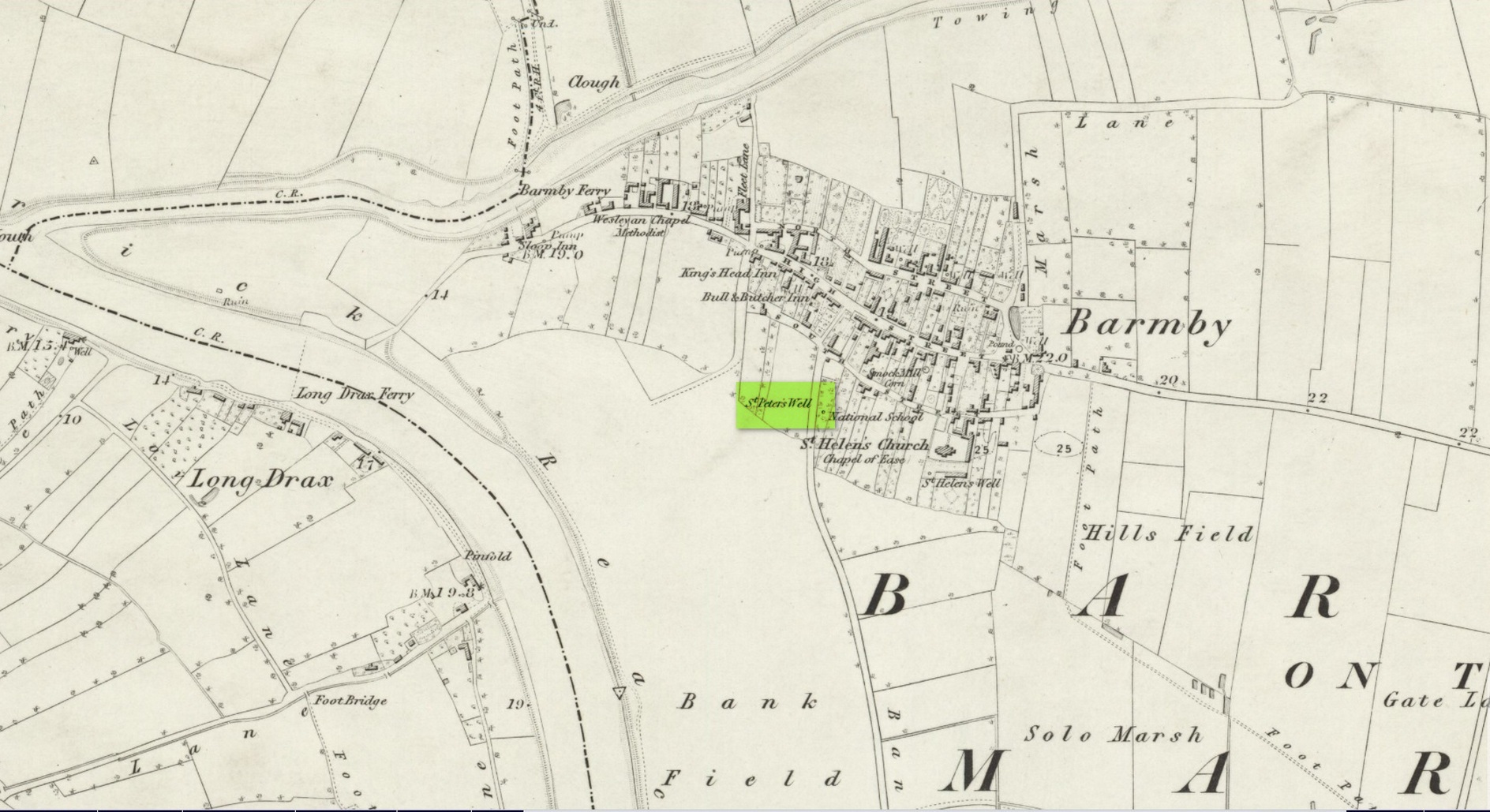
Wet patch on 1907 mapSt Peters Well, Barmby 1853
Less than ten years earlier, Will White (1840) also spoke of St Peter’s Well, albeit briefly, telling that it “was said to possess medicinal properties”—but it seems that he never visited the site and was merely going on Mr Allen’s earlier description. Its exact whereabouts however, is somewhat of a curiosity. Although the Ordnance Survey lads mapped it as being SE 6885 2848 on the southwest side of the village, in William Smith’s (1923) survey of holy wells he gave us a very different location. “St Peter’s Well,” he wrote,
“is situated in an orchard about a hundred yards to the south-east of the church, and is reached by going through three fields. It is a pool about eight feet deep and fifteen in diameter, the spring now rising several yards from its original site. It flows clear and strong, and though attempts have been made to block it up, it always reappears. The water is soft and has never been known to freeze. It contains sulphur, as I can testify, having tasted the water. It is noted for curing scurvy and sore eyes, if applied externally, and half-a-century ago, people suffering from these ailments came long distances to apply the water as a remedy, and went away benefited. An eye-witness has said a man living far from Barmby, advised by his medical man, as a last resort visited the well and applied the water externally for the cure of scurvy, and so quickly did he lose the scales that fresh sheets for his bed were required each night…
“About a century ago, the owner of the orchard in which the well is situated had a son, a doctor, who commenced to practice in the district. The owner’s wife looked upon the spring as detrimental to the prospects of the son. So she said to her husband, “Tummus, we’ll hev that well filled oop. Foaks can cure thersens, an’ ther’ll be nowt fur poor Tummy ti dea.” Tummus was so convinced by his wife’s foresight that he did as she wished, and filled up the well.”
Naathen, on the very first OS-map of the village, the lads marked it at SE 6885 2848, as well as on subsequent surveys. This spot is 170 yards west of the village church wall. The location described by Smith has no “well” or spring marked on any maps, but, on the 25-inch scale map, 100 yards southeast of the the church walling we see marshland on the other side of a copse of trees in the very spot he told us about. Whether or not this was the actual spot, or whether the OS-lads had it right, we might never know. Field-name surveys may help; the existence and location of the orchard may help; other literary accounts might also be useful. But, one final query that may be important relates to Tom Allen’s (1831) words when he told us that “the site is only known to a few of the villagers.” By that, did he mean that the local folk kept its position quiet from outsiders? Even today, in our numerous inquiries with local people in the glens and mountains when seeking out lost or forgotten places, we still come across some olde local folk who are still quite hesitant, with that serious quizzical look in their eyes…
Folklore
St Peter’s day was celebrated on June 29. He was one of the so-called “major saints” due to him being one JC’s Apostles. His symbol was a key.
References:
Allen, Thomas, A New and Complete History of the County of York – volume 2, I.T. Hinton: London 1831.
Gutch, E., Examples of Printed Folk-lore Concerning the East Riding of Yorkshire, Folk-Lore Society: London 1912.
Harte, Jeremy, English Holy Wells – volume 2, Heart of Albion press: Wymeswold 2008.
Smith, William, Ancient Springs and Streams of the East Riding of Yorkshire, A. Brown: Hull 1923.
White, William, History, Gazetteer and Directory of the East and North Ridings of Yorkshire, R. Leader: Sheffield 1840.
Healing Well (covered): OS Grid Reference – TQ 6000 3963
Archaeology & History
Shown on early OS maps as a chalybeate spring, the denuded remains of this site can still be seen in Dunorlan Park, between the tearoom and the lake, where the spring can be seen on the left beneath a large tree. It was first described in John Britton’s (1832) famous account of the area, who told us:
Site shown on 1872 map
“There is a spring, called Burnt House Spring, situated in a little dell, in a romantic spot to the right of the road leading from Tunbridge Wells to Pembury. It is a good chalybeate, and the iron is in a state of carbonate. This spring rises rapidly into a stone basin, placed in the centre of a circular excavation, about ten feet in diameter and six or eight feet deep, which is bricked round, and with the remains of stone steps leading down to the basin at the bottom. This spring, therefore, has clearly been, at some time, made use of as a medicinal water. It was accidentally discovered choked up with rubbish. The country about Tunbridge Wells abounds with springs of this character.”
The spring was cleaned up some time ago and its waters rise in a square stone-lined chamber—accessed by four stone steps—into a circular stone basin, before flowing down a short channel and into the drains. I’ve no idea whether or not the water is still drinkable.
References:
Britton, John, Descriptive Sketches of Tunbridge Wells and Calverley Estate, Longman: London 1832.
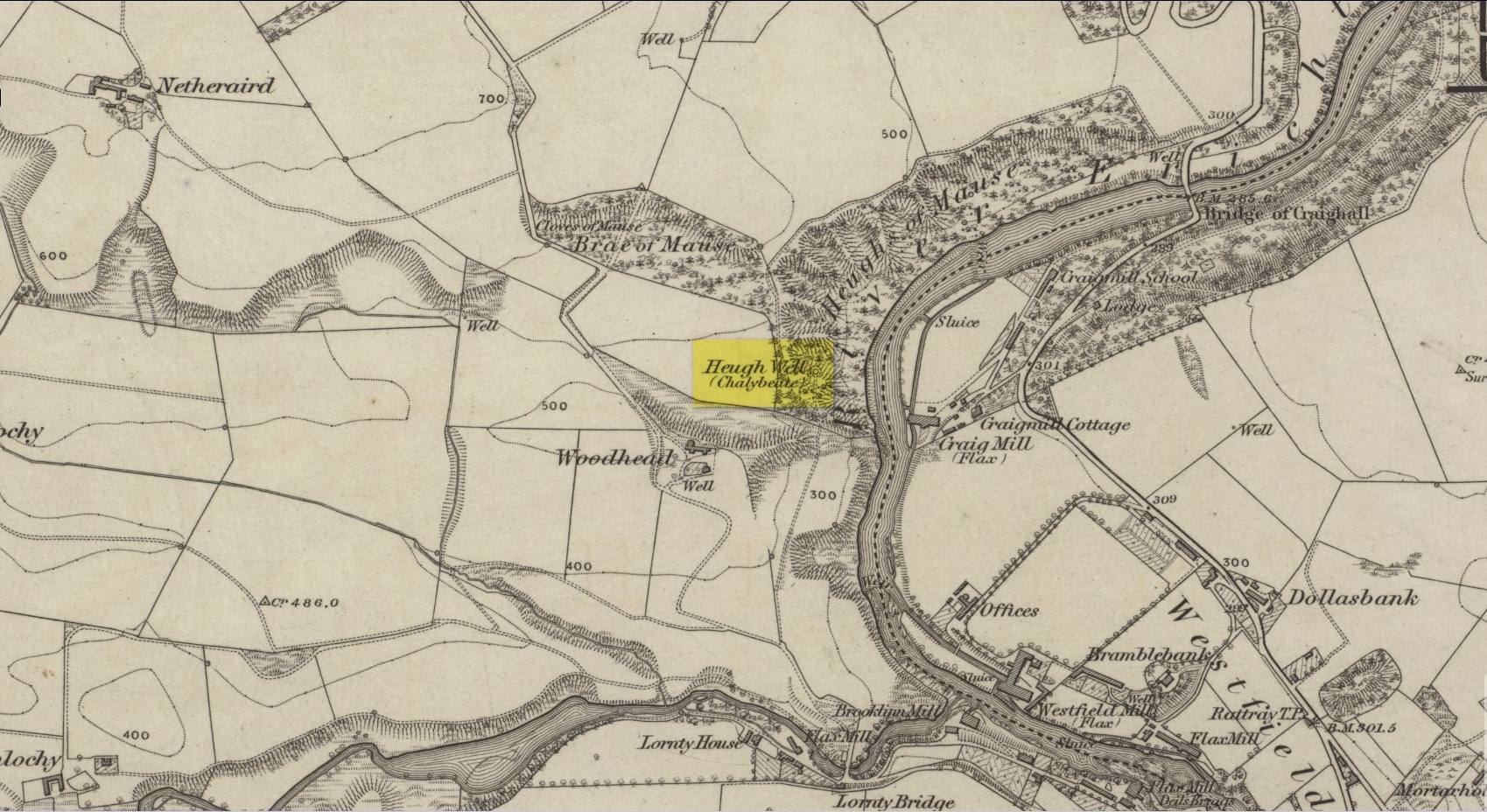
This little-known iron-bearing spring can still be found in the woodland known today as the Heugh of Mawse, a mile north of Blairgowrie. It was included in the Object Name Book of 1863, where they referred to an earlier account in the New Statistical Account, which told that,
“On the south end of it is a chalybeate spring much resorted to by the people of the locality. “There are one or two chalybeate springs in the parish; but they have never been chemically analyzed. There is one very fine spring called the “Heugh Well” It springs from the face of the “Heughs of Mause” (a mortar cliff of singular appearance; which descends abruptly into the bed of the river with an almost perpendicular declivity of about 200 feet) and judging from its colour, contains a considerable quantity of ferruginous matter. The use of its water has been found to be very beneficial in cutaneous eruptions, & affections of the Stomach.””
Heugh Well on 1867 map
Subsequently highlighted on the 1867 OS-map, a singular footpath led to the site and no further. It was mentioned by the regional historians J.G. McPherson (1885) and John MacDonald (1899), albeit briefly, where they respectively told that its waters were “formerly much resorted to by persons in the neighbourhood.” It possessed considerable medicinal properties which, according to tradition, were “found very beneficial for skin diseases and derangement of the stomach”! Doubtless such attributes will still be effective.