Holy Well (lost): OS Grid reference – SW 4025 3062
Archaeology & History
Just over a mile northwest of the superb Sancreed Well, we find documentary evidence from 1778 recording the field-name of Chapel Well Close here, although there seems to be no remaining spring or well and nothing is shown on the early OS-maps. Official records define it as a “medieval well” and speculate that it may have been associated with the nearby Boscence Chapel and possibly dedicated to St. Winwaloe.
References:
Anon., The Church and Parish of Sancreed in the County of Cornwall, Brewer: Sancreed c.1960.
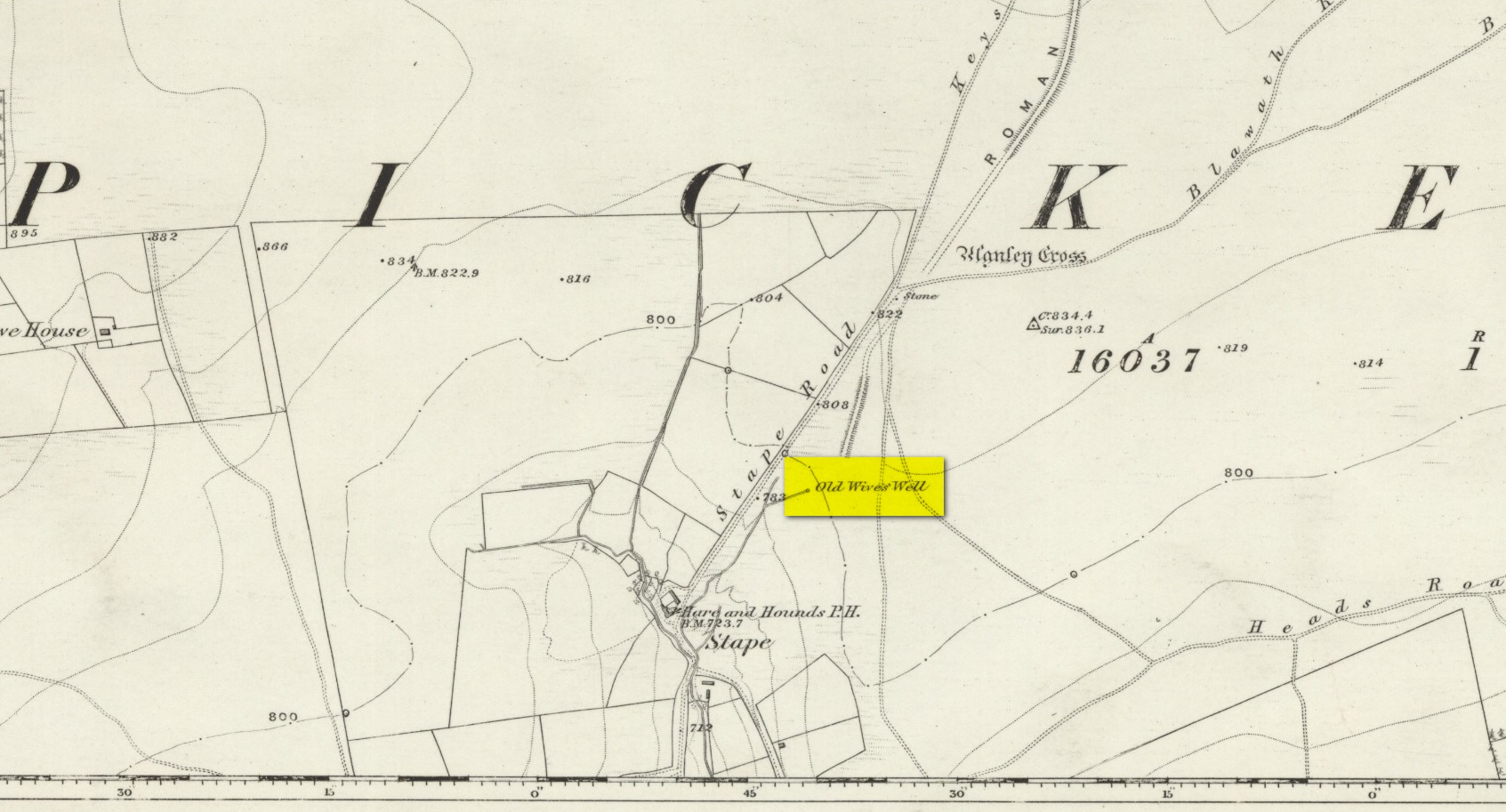
The history of the site is scanty to say the least. It first seems to have been recorded when the Ordnance Survey lads came here in the 1840s, although they left no record as to why the site was given such a dedication. It’s a decidedly pre-christian title as the name “old Wife” is usually indicative in northern counties as being related to the primal Earth deity of northern England and lowland Scotland (when we reach the Highlands and Ireland, She becomes known—amongst other names—as the cailleach). However, apart from its name we have no additional information. Neither the holy wells writer Edna Whelan (1989; 2001), nor hydrolatry researcher Graeme Chappell were been able to find anything about the place in their own researches. And so we must go on name alone…
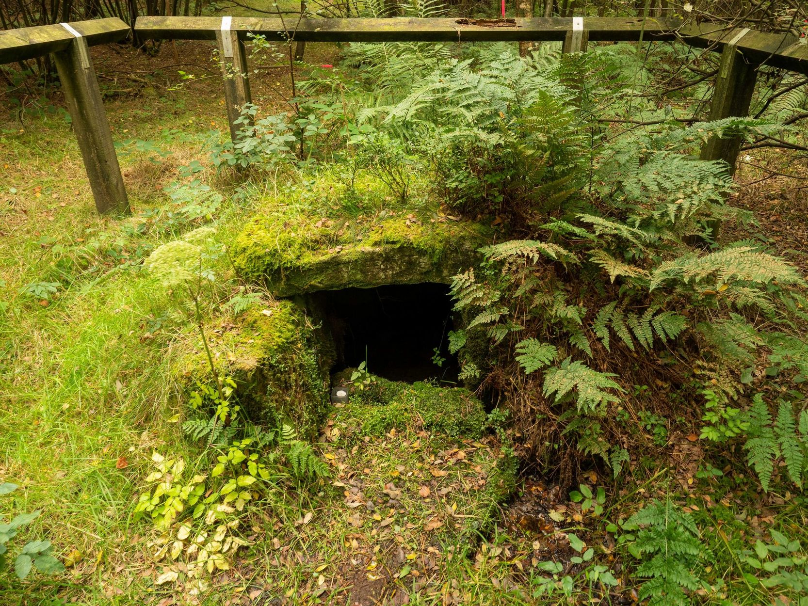
The waters bubble up into a small stone-lined chamber with the words Nattie Fontein carved into the lintel. This is something of a mystery in itself, for, as Edna Whelan (1989) told,
“it would be most unusual for the word fonten to be used for a spring in North Yorkshire: ‘keld’ is the local word. The rather roughly inscribed word may be a corruption of Fons Natalis, the name of a Celtic water nymph.”
Graeme Chappell (2000) meanwhile, noticed in a visit to the site in June 1999,
“that the N and A in “NATTIE” are carved in such a way that the word could be read as “MATTIE FONTEIN” perhaps meaning “Mother Fountain”. This might then be another reference to the Old Wife?”
He then goes on to note how,
“the latin word ‘natalis‘ meaning ‘birth’ and its link with the roman Festival ‘Dies Natalis Sol Invictus‘ (day of the birth of the unconquered sun) which took place on the 25th December. Natalis also gave rise to the welsh word ‘Nadolig‘ – meaning Christmas.”
This Yuletide element has an intriguing relationship with the name of the well; for to the west of Yorkshire’s borders into Cumbria there was annual gathering known as Old Wives’ Saturday that took place on the first Saturday after Christmas, or first Saturday of the New Year in a person’s house or inn, where a feast was had to bring in the New Year; but there is no known written lore of such a tradition here.
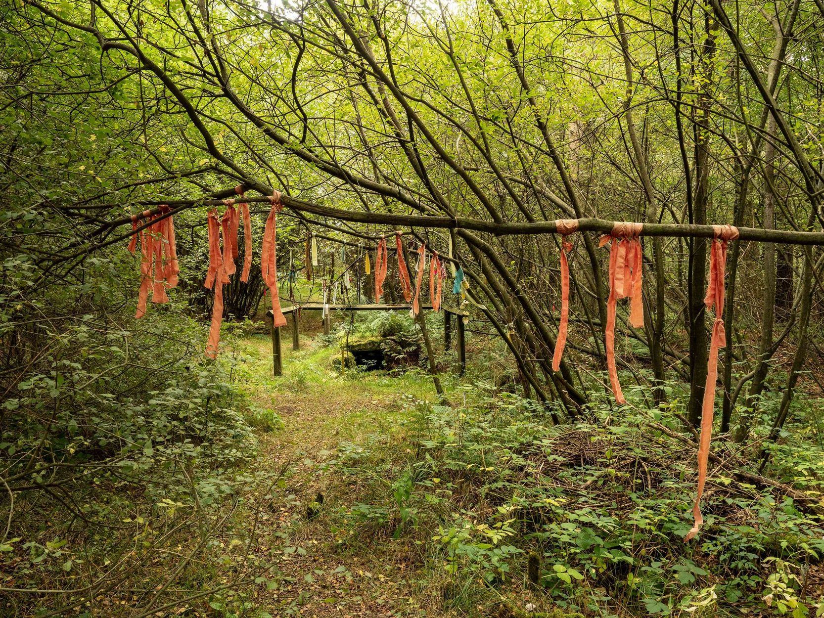
Nowadays the old tradition of hanging rags on the trees surrounding the well as offerings to the spirit of the place (known as memaws in parts of Yorkshire, and clooties in Scotland) has become a regular practice of those who hold such sites as sacred in their own way. Whelan mentioned seeing memaws here in the 1908s, but the Northern Antiquarian contributor Jon Barker told that, “The rags are a comparatively recent addition to the well, it is not a tradition there. When I used to go in the ’60s therewere no rags.”
On an even more curious note: very recently (from when this profile was written), the Northern Antiquarian contributor and photographer James Elkington visited Old Wives’ Well for the first time. It was a grey overcast day and when he arrived here, there was a woman ahead of him at the head of the well. I’ll let him tell the rest of it in his own words:
The Old Wives Well, Stape (James Elkington)Old Wives Well at Stape (James Elkington)
“In front of the well was a lady dressed in what looked like a white nighty, she had her back to me. There was a candle lit nearby, and her hands were in the water moving slowly about like she was washing something. She had long dark shoulder length hair. As I was about 25 feet away I was sure she wasn’t aware of me, and I thought it would make a good photograph. I quietly put my bag on the ground and got my camera out, and looked up and…she was gone! I couldn’t have taken my eye off her for more than 5 or 6 seconds. I looked all around and there was no sign of her. Even if she had legged it through the woods I would have seen her. I think it was then that I realized that I may have had ‘an encounter’. I quickly took three pics of the Well and got the hell out of there!”
He rang me once he had regained his senses in a somewhat emotional state and recounted over and over what had just happened. Whether this was a visual manifestation of the genius loci of the we can’t say. But such encounters are not unknown at numerous sacred water sites all over the world. We can only hazard a guess that this is what he was fortunate to encounter.
Just a few hundred yards north is the old Mauley or Malo Cross, which may or may not have had some mythic relationship with our Old Wives…
The first that I read of this place was in an article of the Scottish Ecclesiastical Society journal, on the parish history of Horndean. Standing originally at the edge of the ruined remains of the old churchyard, the author W.S. Moodie (1915), told that a long lost,
“grim relic of olden days is said to have existed here till fifty years ago. This was the Witches Stone—an upright pillar with a hole in it, to which the bodies of the poor unfortunates were fastened after they had been glede, while the faggots were piled around.”
A perusal in the Royal Commission inventory (1915) of the same year told that it had been moved several miles northeast to Paxton Cottage (NT 9279 5229) in the adjacent village. It was described as being,
“about 4 feet 6 inches in height above the ground, some 2 feet in breadth, tapering towards the upper end, and about 7 inches thick. Near the top are two perforations, not quite on the same level, about 2 inches in diameter at the surface on either side, constricted towards the Centre, and about 9 inches distant from centre to centre.”
Is this old stone still in existence…?
References:
Moodie, W. Steven, “Ladykirk, or the Kirk of Steill, Berwickshire,” in Transactions of the Scottish Ecclesiological Society, 4:3, Aberdeen 1915.
Royal Commission Ancient & Historical Monuments, Scotland, Inventory of Monuments and Constructions in the County of Berwick, HMSO: Edinburgh 1915.
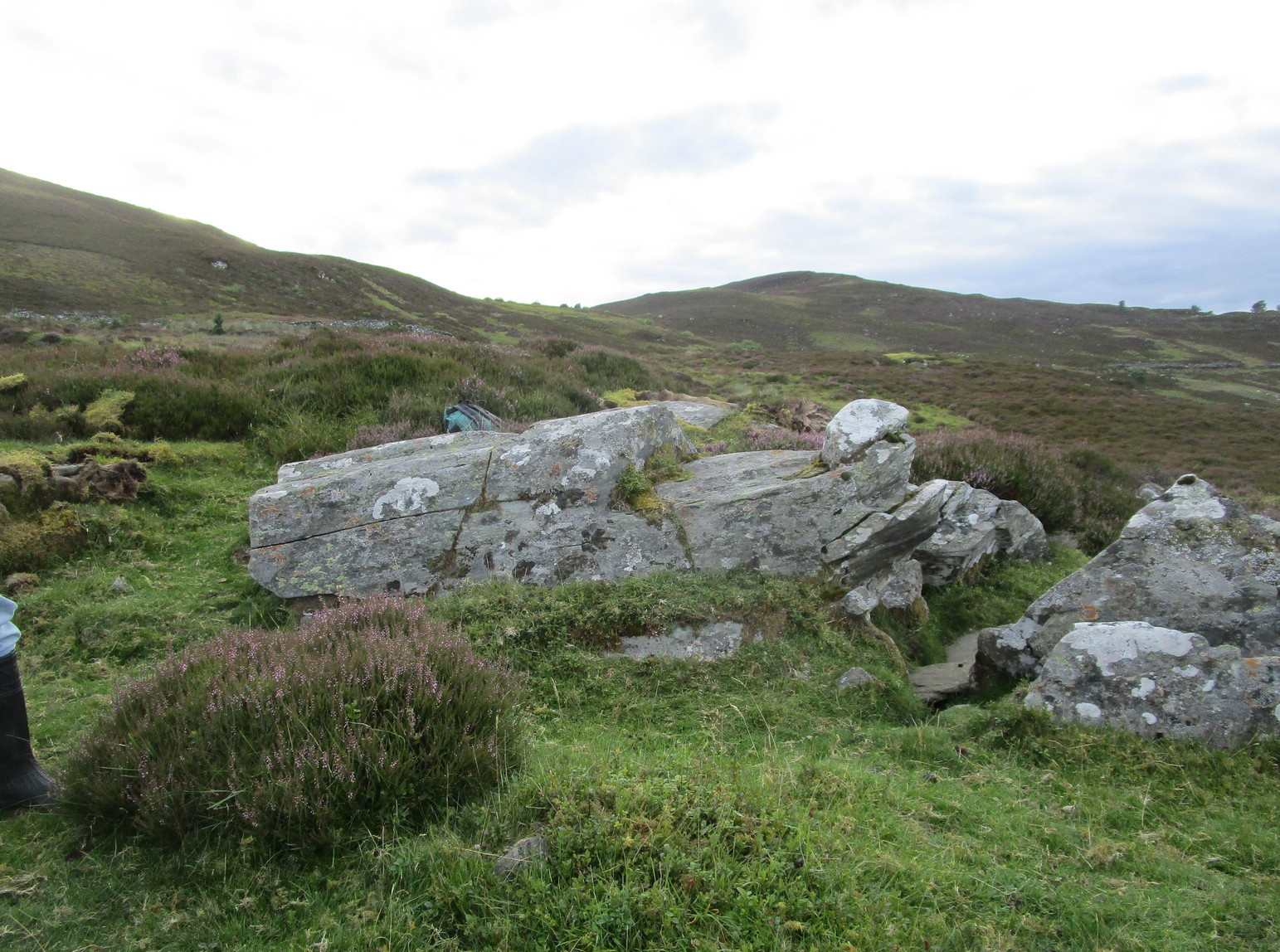
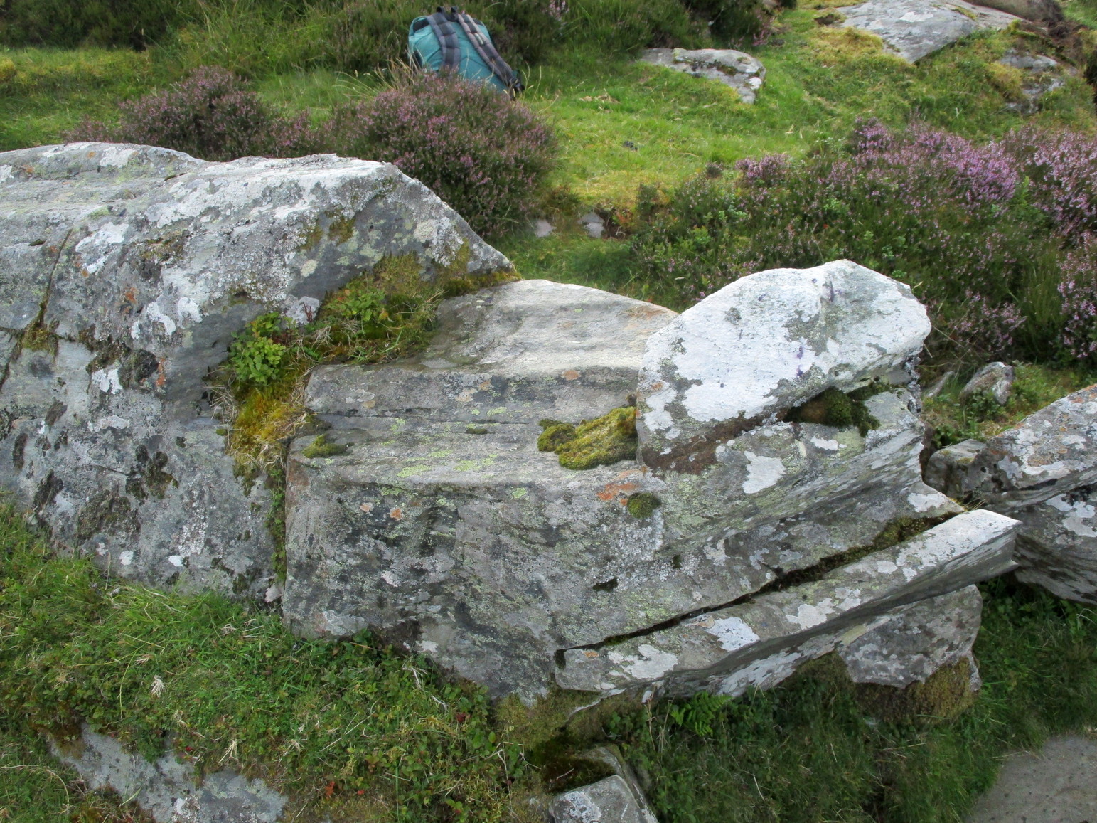
From Kenmore go east up the steep mountain road towards Glen Quaich, or if you’re coming from Amulree, go west along the same glen. After 2½ miles (4km) up the Kenmore route (nearly 9 miles on the Amulree route) you’ll reach a small lochan on your left (you’ve got a very small parking spot a coupla hundred yards before the loch). A gate and stile past the loch takes you east along a track into the moors. More than a mile on, the track splits, but you need to keep to the left and follow the track along the wall-side for another 400 yards or so, where you’ll see a small crag of rocks 100 yards down the slope on your right. Once here, the elongated rock with a “seat” that you can sit in is the stone in question.
Archaeology & History
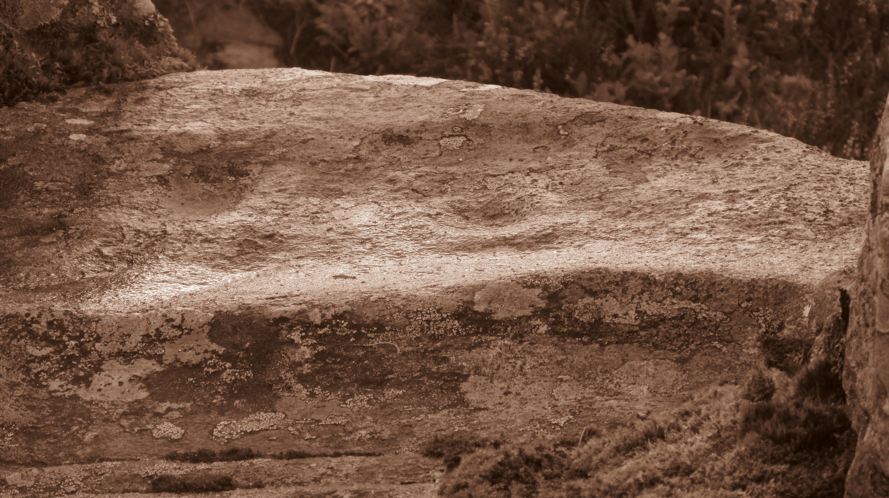
At first sight this stone doesn’t seem to have anything petroglyphic about it, and—as when we visited the other carvings in this Craig Hill cluster—the weather was grey and overcast, so it was difficult to discern anything at first. But as we walked round and round inspecting the Craig Hill cluster-5 carving, a glance at this adjacent stone seemed to indicate one or two cup-marks within the curious chair-like aspect of the rock, but we couldn’t initially work out whether they were simple geophysical elements or not.
Very faint cup-&-half ring near the centreClose-up of the C&R
So we poured water onto the stone in the hope that something might show up. And the more we walked round and round, bending down, looking from as many angles as possible, not only did we see what looked like several cups, but one of them had a half-ring that curved round what may or may not be a natural cupmark. You can see it pretty clearly in the attached photos. In other photos that we took, the faint cup-and-half-ring seems to plays its part in a line of three or four other cups; although in order to ascertain whether these elements are man-made or not, we could do with the help of a good geomorphologist.
Acknowledgements: Huge thanks to Prof Paul Hornby for use of his photos in this site profile; and to Myrna Hurley for getting us up there. Cheers doods. 😉
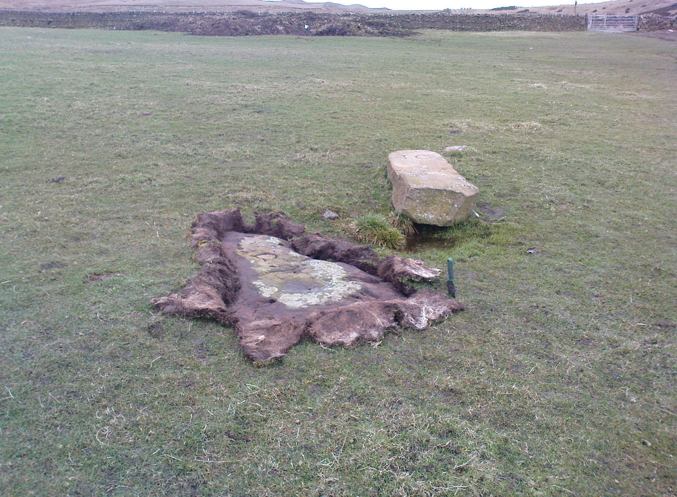
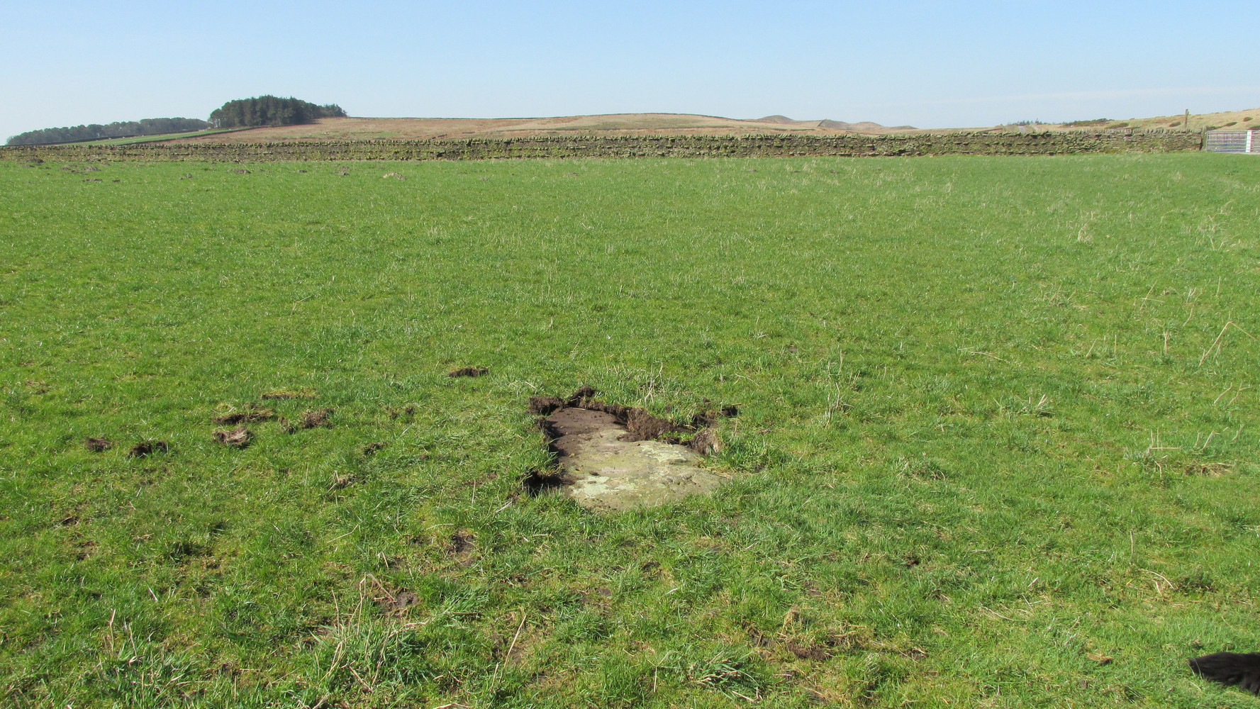
Probably the easiest way here is to take the well-trodden Dales High Way track westwards, under the bypass from Addingham, and along the old Roman Road. After 1.7 miles (2.7km) you’ll reach the Heights Lane country road. Stop here! Walk back on yourself along the track for maybe 50 yards and look in the field to your right (south) between 10-20 yards in the short grass and there, somewhere under your feet next to a modern stone, you’ll see peeking up at you (probably somewhat covered on the whole by the soil) a long flat stone. That’s what you’re looking for.
Archaeology & History
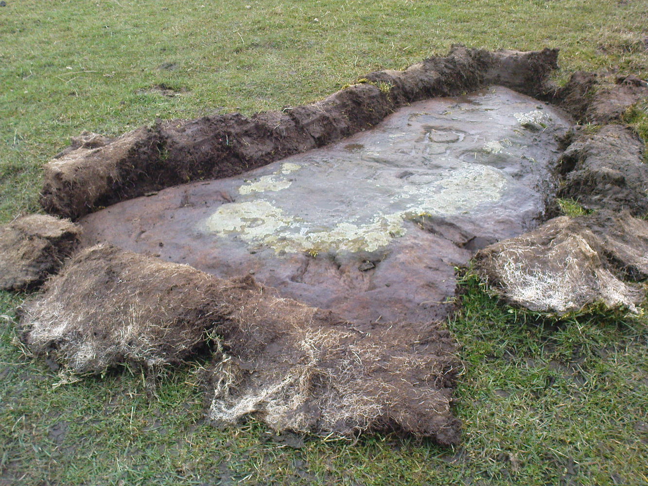
This old stone had been sought after by various groups and people for many years and I was fortunate to relocate it about thirty years ago, laid down and all-but-hidden beneath the grasses. The stone appears to have been buried nearly 100 years earlier, because when Harry Speight (1900) wrote about it in 1900 he described it as still upright. In more recent years, it seems that the farmer has put a replacement stone next to its position with the letters “JC” cut into it. You can see it in the above photo.
Thief Thorne uncoveredThief Thorne, looking W
First mentioned in the 16th century and included in boundary perambulation records of 1709, and again in 1781, someone during that period turned it into a milestone, etching the words “To Skipton 3 m. To Addingham 2 m.” It stood by the old Roman road, but its considerable erosion and shape is decidedly prehistoric. Nearly 6 feet long, it is now laid in the earth and almost completely covered over. A sure case for resurrection.
References:
Bennett, Paul, The Old Stones of Elmet, Capall Bann: Milverton 2001.
Speight, Harry, Upper Wharfedale, Elliott Stock: London 1900.
Chambered Cairn (destroyed): OS Grid Reference – H 277 998
Archaeology & History
Included in Eamon Cody’s (2002) magnum opus, this site has long since gone. It was highlighted on the 1845-47 OS-map of the area and the only subsequent information about it was written in the 1903 Ordnance Survey Name Book, where it was described as a “supposed Giant’s Grave” that was marked by a large spread of boulders.
Perhaps the only thing we can ascertain here is from the name Giant’s Grave. Invariably, giants are part and parcel of creation myths in early traditional societies. Such giants, as well as being huge mythical creatures, can also be the progenitor of tribes and communities, i.e., the person who laid the initial foundation of where the tribe came to live, usually an early queen, king or shaman figure. So, in the case of this Giant’s Grave, it was likely to have been known as the burial place of such a figure: mythical in importance as well as size.
References:
Cody, Eamon, Survey of the Megalithic Tombs of Ireland: Volume VI – County Donegal, Duchas: Dublin 2002.
On the northwest side of the Loch of Boardhouse can still be found a spring of water which was, in bygone times, the abode of the supernatural creature known as the troll or trow. The site is described in local place-name records and is located near the foot of a slope near Westerhouse, from where a small channel of water runs down into the Loch of Boardhouse about forty yards away. When it was last described in the 1960s, all folk memory of its heathen inhabitants had seemingly been forgotten and no folk-tales seem to have been recorded. Thankfully, the Well itself is still shown to exist on modern OS-maps.
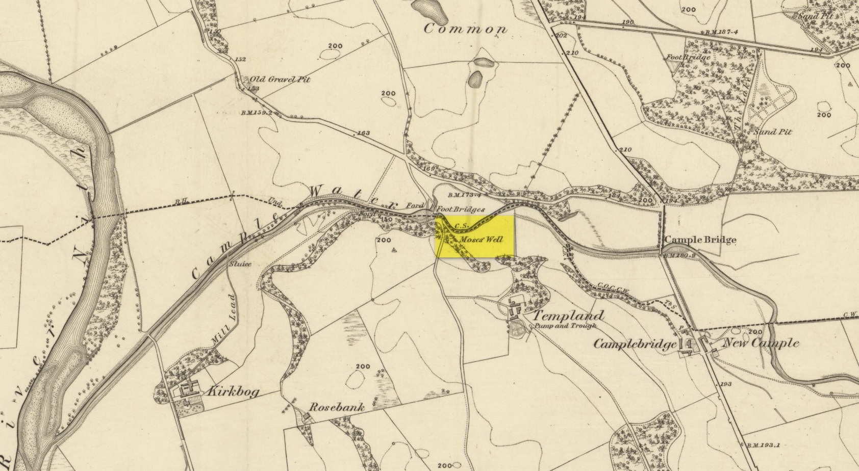
This little-known Biblical-sounding spring has apparently long since fallen back to Earth (perhaps there might be some local folk who could find out for certain). Shown on the 1861 Ordnance Survey map as being at the side of the wall in the small copse of trees—immediately east of kirk- place-names and a half-mile north of St Ninian’s Well—it was briefly described by T.C. Ramage (1876), who seemed to know nothing of its lore, merely telling us that,
“on Templand farm, close to the wooden bridge over the Cample, there is Moses’ Well, an unusual designation, but which some Knight Templar may have given in remembrance of his toils in Palestine.”
The Templar designation was deemed by Ramage to come from the name of the farm. However, a few years prior to this, the early Scottish place-name surveyors were traversing the area and found from local people how it derived “its name from a Tinker named Moses Marshall who with his family lived near it in a Camp during the time they had the small pox.” The Well was also included in the Morris survey (1982), but without comment. Another Moses Well can be found 44½ miles to the northeast, near Galashiels at NT 4046 4306.
Cross / Sacred Tree: OS Grid Reference – NN 581 012
Also Known as:
Law Tree
Archaeology & History
As a folklorist and antiquarian, I find this long lost site more than intriguing. Most ancient crosses are stone; but in early centuries many were made from wood which, obviously, have decayed down the years. But this cross, located on the northeast edge of the Lake of Menteith, was actually a tree: a hawthorn no less. This choice would have been made based on it being one of the few trees that are deemed sacred in both christian and indigenous lore. It was described—albeit briefly—in A.F. Hutchison’s (1899) excellent history book of the area:
“The cross of the burgh is said to have been the trunk of an old hawthorn tree, which stood by the lake side, opposite the manse of Port, and was known as ” the law tree.” Around this tree an annual fair was held in the month of September, and called after St. Michael.”
We’re obviously seeing here the traditional animistic veneration of trees by local people, with the incoming christian symbol being grafted onto it. Hawthorns were one of the potent protections against witchcraft and so the handshake between christian and pre-christian systems obviously worked here. Faerie-lore was also rampant at many places for many miles around this site.
References:
Hutchison, Andrew F., The Lake of Menteith – Its Islands and Vicinity, Eneas Mackay: Stirling 1899.
Cross (destroyed): OS Grid-Reference – SE 3224 4498
Archaeology & History
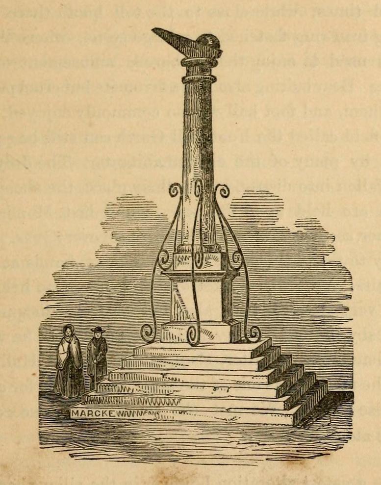
A Charter in the time of King John allowed for markets to be held in Harewood from 1209 CE onwards, “on the first day of July and the two following days, and also to hold one market there every week on the Monday.” But whether or not a market cross was erected that far back, we don’t quite know. Certainly, the edifice illustrated by John Jones (1859) in his standard work on Harewood didn’t date from such an early period! It stood close to the old road junction to Wetherby in old Harewood village, “a little below the intersection of the roads, and about fifty yards higher up than the market house.” Jones told us:
Harewood Cross (Jones 1859)
“It stood upon a large stone pedestal, and was approached by a quadrangular flight of seven steps, very broad, where the neighbouring farmers used to stand, and dispose of their butter, fowls, eggs, &c. It was re-erected, AD 1703, by John Boulter, Esq., and in the year 1804, when the road was lowered, it was taken down and destroyed. This is to be regretted, it might have been re-erected in another situation, if that was inconvenient, and would have been in the present day, not only an ornament to the village but a relic of the past, of which the villagers might have been justly proud. On the top of this cross there was a knur and spell, a game for which the village was celebrated in old times, while close to the toll booth there was a strong iron ring fastened to a large stone, where the villagers used to enjoy the barbarous amusement of bull baiting.”
References:
Bogg, Edmund, Lower Wharfeland, J. Sampson: York 1904.
Jones, John, The History and Antiquities of Harewood, Simpkin Marshall: London 1859.
Speight, Harry, Lower Wharfedale, Elliott Stock: London 1902.