Pretty easy really. From Arncliffe village, walk up the Monk’s Road footpath, heading for the rocky mass immediately south. Once you get onto the moor edge, veer straight up to your right and keep walking till you hit the rocks. Look around!
Archaeology & History
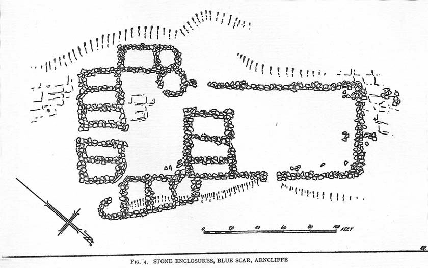
Drawing of main part of the settlement (Raistrick 1929)
Described by Miss D. Charlesworth at one of the annual meetings of the Archaeological Society in July 1968, this ‘settlement’ is found immediately south of Arncliffe village, literally 1000 feet up on the hillside and has a field system attached to it. When Charlesworth described this place, it had not been excavated, though her description of the place very much echoed those of Raistrick & Chapman (1929) nearly forty years earlier. She wrote:
“It faces north and east over the Skirfare valley, sheltered by the bulk of Parson’s Pulpit. The most interesting feature is the rectangular enclosure west of the sunken road. The walls are built of limestone some 5ft wide at the base and standing 2-3ft (tall). The huts are grouped round a courtyard at the south-eastern end and have a large stockyard attached to them. Of the 14 huts, only two are circular (those in the northwest corner), and one on the east side is approximately a circle. The remainder are rectangular, approximately 30 by 12ft.”
Although the sites is generally ascribed as Iron Age to Romano-British in date, it seems evident that these buildings were used in much later centuries — perhaps until late medieval periods. Other remains of similar size and stature can be found scattered on the hills near here (I’ll add them on TNA at sometime in the future).
References:
Charlesworth, D., ‘Iron Age Settlements and Field Systems,’ in Proceedings of the Archaeological Journal, 125: 1968.
Raistrick, Arthur & Chapman, S.E., ‘The Lynchet Groups of Upper Wharfedale, Yorkshire,’ in Antiquity, volume 3, 1929.
From Todmorden go east on the A646 for less than a mile and take the Cross Stone road on your left. Keep going all the way up till you hit the moorland edge road, where you’ll see the Great Rock (a massive boulder right by the roadside). Then go down Eastwood Lane, past the house where the lane swings right and here you’ll see a stile in the wall on the right (just after the next lane on your left). Walk along this path, over the stiles in the walling until you reach a wooden stile. The carving is hereby!
Archaeology & History
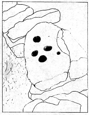
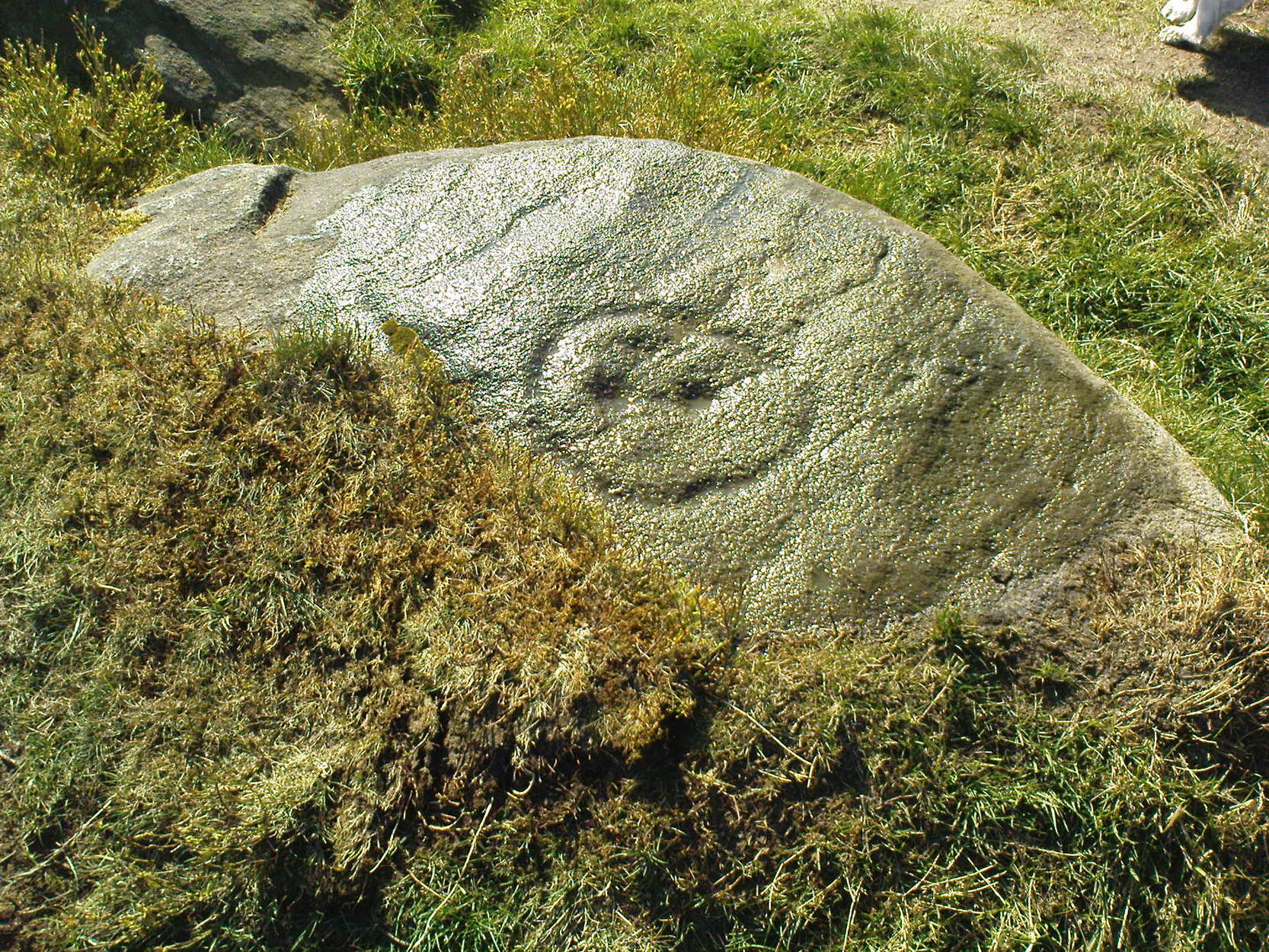
This carving was described just once by Mr J.A. Heginbottom (1979) as, “a small cup-marked boulder in a stile 100 metres east of Bent Head, Todmorden.” A small, innocuous stone used in the drystone walling, it gives the distinct impression of being one of the many ‘portable’ cup-marked stones typical of those found in prehistoric cairns and other tombs — but the record-books speak of no such remains here; and various ambles about in search of such a potential tomb have drawn a blank. Nevertheless, the cup-markings here are pretty obvious once you see ’em (assuming the daylight aint overcast, which can hide the carvings sometimes). About 2 feet long, about a foot wide and a foot high, this cup-marked portable is similar in size and form to the Nine Stones cup-marking, Derbyshire, recently found in walling very close to where an old tomb was recorded (though the Derbyshire one has only 2-3 cups). Certainly worth a look if you’re in the area.
References:
Heginbottom, J.A., The Prehistoric Rock Art of Upper Calderdale and the Surrounding Area, YAS: Leeds 1979.
Upon the heights of Baildon Hill, get to the Dobrudden Farm caravan site. 100 yards up the track leading from it (north), go into the tribbles of grassland immediately to your left. Look around!
Archaeology & History
This is only a small stone and takes some finding when the grasses are long. It’s found upon the once archaeologically rich High Plain with at least 17 cup-markings etched onto its surface. A single prehistoric tomb appears to have accompanied the rock and its cup-marks.
It was first described by Mr Baildon (1913) in his magnum opus; then later catalogued in Hedges (1986) survey, a couple of years after I did my first drawing of this stone.
References:
Baildon, W. Paley, Baildon and the Baildons – parts 1-15, Adelphi: London 1913-1926.
Bennett, Paul, Megalithic Ramblings between Ilkley and Baildon, unpublished: Shipley 1982.
Boughey, Keith & Vickerman, E.A., Prehistoric Rock Art of the West Riding, WYAS: Leeds 2003.
Hedges, John, The Carved Rocks on Rombald’s Moor, WYMCC: Wakefield 1986.
If you wanna find this, get onto the Low Plain north of the Dobrudden caravan park and its about 10 yards off the path running north from there, not too far from the other Baildon Hill carvings. Scramble about a bit & you’ll find it.
Archaeology & History
W.P. Baildon’s early sketch
Don’t ask me why, but I really like this carving. It’s one of the many I first saw on these moors when wandering about up here when I was 10-12 years old — and they had an effect on me. I call this one of the “primary design” stones, i.e., a number of CRs on this moor (and everywhere else for that matter) appears to have a central design feature. (I’ll point out the others as I post ’em) Some folk think it’s just the slant of the local rock-artist…I think it’s summat a bit different… Local astronomer Gordon Holmes (1997) found a similar pattern here and thought they may have represented star formations, but this is unlikely.
It was first described and illustrated by W. Paley Baildon (1913), way before Mr Jackson (1955) resurrected its attention for archaeologists.
References:
Baildon, W. Paley, Baildon and the Baildons (parts 1-15), St. Catherines: Adelphi 1913-26.
Boughey, K.J.S. & Vickerman, E.A., Prehistoric Rock Art of the West Riding, WYAS: Leeds 2003.
Hedges, John (ed.), The Carved Rocks of Rombald’s Moor, WYMCC: Wakefield 1986.
Holmes, Gordon, 2000 BC – A Neolithic Solstice Odyssey, SASRG 1997.
Jackson, Sidney, ‘Cup-and-Ring Boulders of Baildon Moor,’ in Cartwright Hall Archaeology Group Bulletin, 1:7, 1955.
South of Dobrudden caravan park, heading towards the wall, you’ll stumble across this old carving in the tribbly grass. Zigzag about and keep your eyes peeled!
Archaeology & History
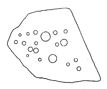
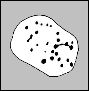
First described by W. Paley Baildon in his monumental 15-part study (1913) of the region, this carving was then later included in John Hedges (1986) survey as ‘Baildon stone 19.’ It was then catalogued as stone 146 in Boughey & Vickerman’s (2003) updated and expanded survey.
Modern drawing (after Hedges 1986)
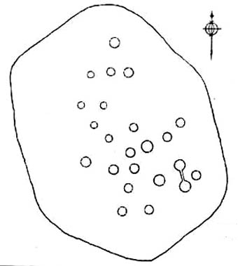
This carving was one of several in the Baildon Moor complex that was thought by local astronomer Gordon Holmes (1997) to possibly represent heavenly constellations, with Pleiades and Cassiopeia being primary contenders amidst the scattering of carved cups on this stone. This was something I explored in my own research on the possible nature of these carvings in the 1980s, but found that although it seemed a good idea, it was pretty unlikely (unfortunately!). The nature of this and other stones related to the other prehistoric remains where, in bygone days, many prehistoric cairns scattered this grassy moorland plain. The carving was more related to the cosmology of death and the psychogeography of spirit worlds: a factor understood at many other cup-and-rings across the country.
References:
Baildon, W. Paley, Baildon and the Baildons – parts 1-15, Adelphi: London 1913-1926.
Boughey, Keith & Vickerman, E.A., Prehistoric Rock Art of the West Riding, WYAS: Leeds 2003.
Cowling, Eric T., Rombald’s Way, William Walker: Otley 1946.
Hedges, John, The Carved Rocks on Rombald’s Moor, WYMCC: Wakefield 1986.
Holmes, Gordon, 2000 BC – A Neolithic Odyssey, SASRG: Baildon 1997.
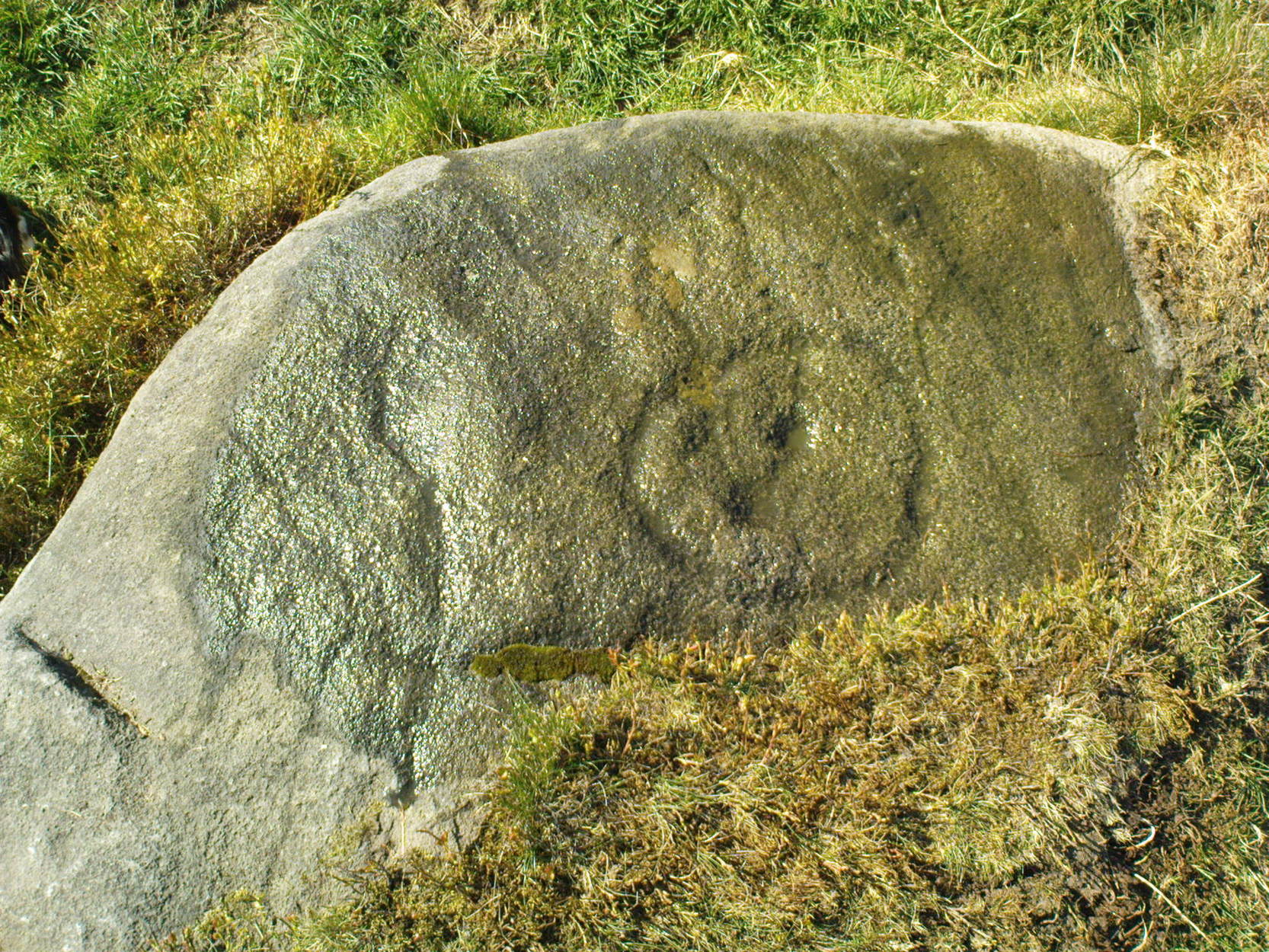
This lovely little stone is found on Shipley Glen. Walk a few hundred yards up past the Brackenhall circle until, on the right-hand side of the road, you reach the track which leads up the slope to Mitton Springs farmhouse. About 20 yards past the track, cross the road from and near to where the land drops down to the glen below and about 20 yards from the rowan tree, you’ll find this carving on one of the smaller low flat stones. Be patient and look around. You’re damn close!
Archaeology & History
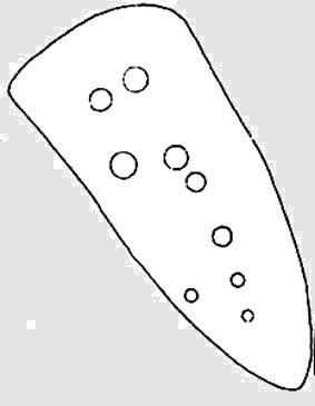
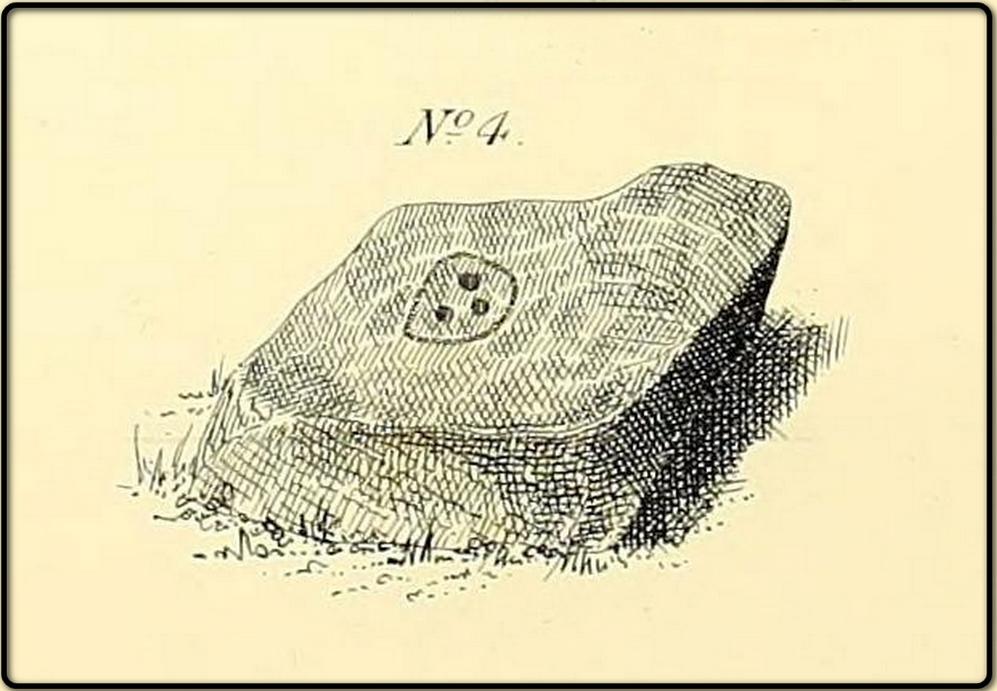
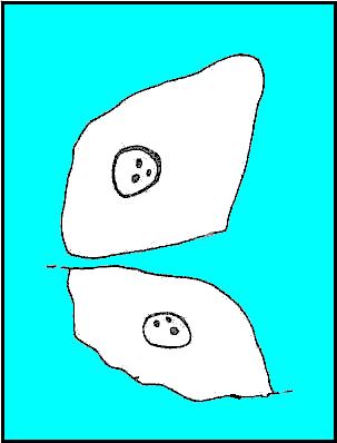
The carving first appears to have been described by the Bradford historian, William Glossop (1888), in his local survey of prehistoric remains here (see his drawing). It’s a cute little thing on a small stone, consisting of a simple large ‘enclosure’ ring with three archetypal cup-markings etched inside. Described by several other local writers since, no other archaeological remains have been found in relation to this carving, making any realistic academic assessment on its nature almost wholly impossible.
(after Hedges, 1968)
References:
Baildon, W. Paley, Baildon and the Baildons (parts 1-15), St. Catherines: Adelphi 1913-26.
Boughey, K.J.S. & Vickerman, E.A., Prehistoric Rock Art of the West Riding, WYAS: Leeds 2003.
Glossop, William, “Ancient British Remains on Baildon Moor,” in Bradford Antiquary No.1, 1888.
Hedges, John (ed.), The Carved Rocks of Rombald’s Moor, WYMCC: Wakefield 1986.
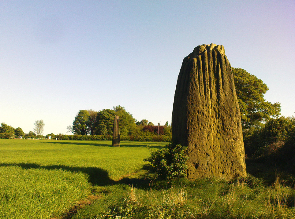
Dead easy to find! Turn off the A1(M) at the A6055 Boroughbridge road and head into town. Turn left after the Three Arrows Hotel, down Roecliffe Lane and the stones are a few hundred yards down, close to the motorway. The tallest is just off the road to the left, behind a gate (the owner of the adjacent house there is very pleasant), whilst the other two are across the road in the fields.
Archaeology & History
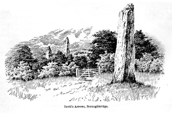
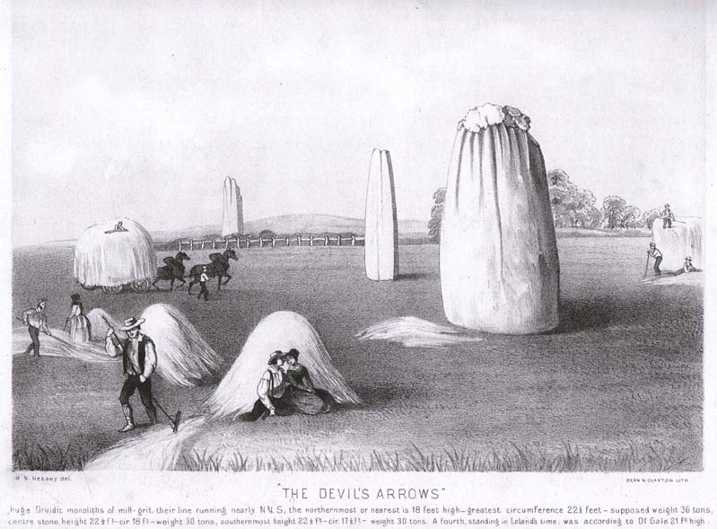
Devil’s Arrows (Percy Robinson, c.1895)
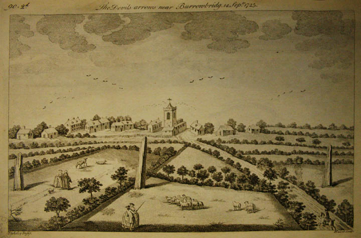
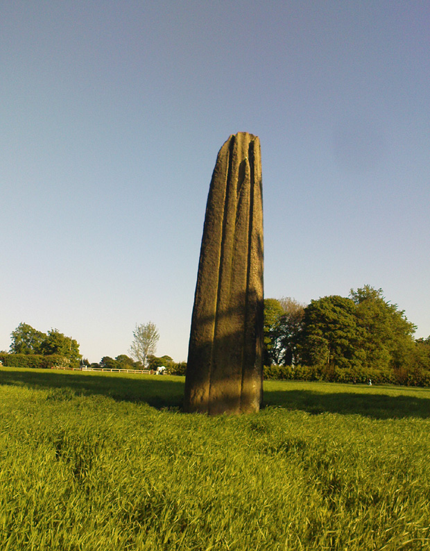
To many archaeo-megalithic and folklore fans, these huge standing stones need no introduction. These great heathen Arrows of the devil, today at least, are three gigantic standing stones, each one weighing several tons at least, standing in a rough straight line, nearly north-south. This is the greatest single stone-row anywhere in the British Isles.
Just how many standing stones originally stood here is difficult to say. We know from the records of early antiquarians and travellers that we had at least five Arrows here in centuries gone by; but one curious account, mentioned by the Yorkshire antiquarian Edmund Bogg (1895) more than a hundred years ago told:
“Peter Franck, a fisherman who travelled much about the world to enjoy his sport, came to Boroughbridge in 1694 and says he saw seven of these standing stones, Dr Stukeley mentions five, and John Leyland, in his travels, saw ‘four great stones wrought by man’s hands,’ but no inscription upon them. Camden, in 1592, saw four, but one of them at the time was thrown down, ‘for,’ says he, ‘the accursed love of gain.’ Part of this one is still to be seen, built into the Peggy Bridge which crosses the Tut on the entrance to the town, the top portion being preserved in the grounds of Aldborough Manor and this goes far to prove — and I have very carefully considered the question and examined the ground — that the original number of stones was far greater, and reached from the Yore, in equal distances to the Tudland of Leyland’s time, or the Staveley Beck of today. If this argument is correct, 2000 years ago there would be a line of at least 12 standing monoliths guarding the western approach to Isur Brigantium.”
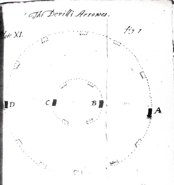
John Aubrey’s 1687 plan Devil Arrows Stone Circle
Will Stukeley’s 1776 image
Well y’ never know! But who was this Peter Franck chap from the 17th century? It would be good to find out more of what he said.
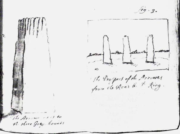
But this notion of there being a great many more stones here than the four or five that are accepted as standard, isn’t just to be found in the annals of some lost fisherman. The great Royalist antiquarian John Aubrey came here in September 1687 and, as illustrated here, saw the remaining three upright stones as remnants of a concentric ring of stones of obviously gigantic proportions. Following from a rough survey of the site and descriptions from local people, Aubrey placed the standing stones in their old line, of
“A. B. C. D., and I have drawn two imaginary circles in which it may be supposed that stones were placed, as at Avebury, Stonehenge, etc. Perhaps they might be more stones in each circle than I have fancied.”
Nearly two hundred years later, archaeologist John Ackerman (1847) echoed John Aubrey’s notion (or perhaps simply copied them) in his notion of the Devil’s Arrows once being part of a greater megalithic complex, saying,
“At Rudston and Boroughbridge, in Yorkshire, are supposed examples of maenhirs. Near the latter place there are four standing in a row, which are called by the country people the Devil’s Bolts; but, from their relative position, it is not unlikely that they are the remains of a large circle.”
Devil’s Arrows (from Smith’s ‘Reliquiae’)
The top 2 Arrows
As if to tempt further enquiry, or at least require suitable explanation, is the nearby field-name of ‘Kringelker,’ or Cringles Carr — last described in 1316 — and which means very simply a circle by the marsh, or circular marsh, or variants thereof. (Source: Yorkshire Deeds, volume 4,YAS: Leeds 1904)
But prior to John Aubrey’s speculations on the Arrows being part of a giant ring of stones, he related the earliest survey done here, by a local (unnamed) man on April 17, 1669, telling that:
John Aubrey’s 1687 sketch of the Arrows
“In Yorkshire near Burrough-brig on the west side of the Fosse-way, about a quarter of a mile, (in the Lordship of Alburgh) stand three pyramidish stones called the Devills Arrowes. The Arrow standing towards the south is seven yards and a half in height: the compasse of it five yards and a half. The middle Arrow seven yards and a half, in compass six yards. The Arrow towards the north in height five yards and a half, in compass seven yards. Here was another stone that stood in a straight line, at D, that was taken down and a bridge made of it.”
Other regal antiquarians and learned writers of the period came soon after. When William Camden (1695) visited the place at the end of the 16th century, he was equally impressed and described the place as follows:
“Not farre beneath there standeth by Ure a little towne called Burrowbridge, of the bridge that is made over the river: which is now built very high and faire of stone worke, but in King Edward the Second his time it seemeth to have beene of wood. For wee read that when the Nobles of England disquieted this king and troubled the state, Humfrey Bohun Earle of Hereford in his going over it was at a chinke thereof thrust through the body about his groine by a souldiour lying close under the bridge. Neere unto this bridge Westward wee saw in three divers little fields foure huge stones of pyramidall forme, but very rudely wrought, set as it were in a streight and direct line. The two Pyramides in the middest, whereof the one was lately pulled downe by some that hoped, though in vaine, to finde treasure, did almost touch one another. The uttermore stand not far off, yet almost in equall distance from these on both sides. Of these I have nothing else to say but that I am of opinion with some that they were monuments of victorie erected by the Romans hard by the high street that went this way. For I willingly overpasse the fables of the common people, who call them the Devills Bolts, which they shot at ancient cities and therewith overthrew them. Yet will not I passe over this, that very many, and those learned men, thinke they are not made of naturall stone in deed, but compounded of pure sand, lime, vitriol (whereof also they say there bee certaine small graines within), and some unctuous matter. Of such a kinde there were Rome cisterns, so firmely compact of very strong lime and sand, as Pliny writeth, that they seemed to be naturall stones.”
Another early antiquary, John Leland, also passed by here a few hundred years back and wrote the following after his visit:
“A little without this Towne on the west part of Watiling-Streate stadith 4 great maine stones wrought above in conum by Mannes hand. They be set in 3 several Feldes at this Tyme. The first is a 20 foote by estimation in higeth and an 18 foote in cumpace. The stone towards the ground is sumwhat square, and so up to the midle, and then wrought with certen rude boltells in conum. But the very toppe thereof is broken of a 3 or 4 footes. Other 2 of like shap stand in another feld a good But shot of: and the one of them is bigger then the other; and they stand within a 6 or 8 fote one of the other. The fourth standith in a several feld a good stone cast from the other, and is bigger and higher than any of the other 3. I esteme it to the waite of a 5 Waine Lodes or more.
Inscription could I none find yn these stones; and if there were it might be woren out; for they be sore woren and scalid with wether.
I take to be a trophaea a Romanis posita in the side of Watheling Streat, as yn a place most occupied in Yorneying ad so most yn sighte.”
Possible cup-marks on northernmost Arrow
Rock Art on the Devil’s Arrows
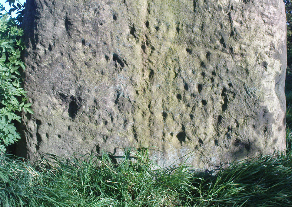
Although Leland told us he could find no inscriptions on the stones, he missed some which may be much older than the purely Roman marks his nose was seeking. Cup-and-ring stones — much in vogue nowadays thanks to the new, shamanically-inspired archaeo’s — aren’t etched here in anything like the styles expected of our Swastika Stone, or the Achnabreck carvings, but cup-markings seem to occur on the northernmost stone. Although a rather myopic bunch of earth-mystery people thought they were the first to discovered the cup-markings here in 2005, they were in fact first described way back in 1866, in Sir James Simpson’s precursory essay to his Archaic Sculpturings (1867), where he told:
“In England the most striking and magnificent group of monoliths that I have seen are the so called Devil’s Arrows at Borough-Bridge, in Yorkshire. Three only of these tall and enormous monoliths are now left, and stand in a line about a stone’s throw from each other. They are all pillars of a squarish shape, and said to bo formed of millstone grit. Two of them are above twenty-two feet in height, and the third measures eighteen feet. Each at its upper part is deeply and vertically guttered, apparently by long weathering and exposure ; and their lower portions show round, smooth, cup-like excavations upon some of their surfaces. The most northerly of these imposing monoliths is especially marked in this last way. Many, if not all, of these excavations, have probably been effected by the elements and weather; while some of them, which look more artificial, are of the same shape and form as those on the Kilmartin stones, etc. But unfortunately we have not here the presence of rings or circles around the cups to determine conclusively their artificial character.”
The central Arrow
Some of the cup-markings here are distinctly artificial; but as with these ancient non-linear designs in general, we are unable to ascertain any specific ‘meaning’ to them at this site, even in any mythic sense — as yet! (I’ll get some images of cup-markings next time I visit the Arrows, unless someone has some going spare!)
Folklore
Described by Bob Mortimer (1860) as a gathering place of the druids, who “met here to celebrate their great quarternal sacrifice”; not unsurprisingly there are a variety of other fascinating creation myths and folklore motifs raising their usual heads by these great stones. Mortimer told of more tales following his local society’s visit here at the end of the 1850s, saying:
“There lived a very pious old man (a Druid should we imagine) who was reckoned an excellent cultivator of the soil. However, during each season at the time his crops had come to maturity they were woefully pillaged by his surrounding neighbours; so that at this, he being provokingly grieved, the Devil appeared, telling the old man if he would only recant and throw away his holiness he should never more be disturbed in his mind, or have whatever he grew stolen or demolished. The old man, like Eve in the garden, yielded to temptation, and at once obeyed the impulse of Satan for the benefit of worldly gain. So when the old man’s crops were again being pillaged, the Devil threw from the infernal regions some ponderous arrows, which so frightened the plunderers by shaking the earth that never more was he harrassed in that way. Hence the name of the ‘Devil’s Arrows.'”
Another individual told me that it was believed by some that the stones sprung up one night in the very places they now occupy.”
Very close to the Arrows are antiquarian records of other sites which someone can hopefully throw more light on, as they may have had some relationship with the stones. Immediately west were (are?) the Penny Stones; plus a place called Bell’s Wife’s Field (Bel as a sun-god – though his wife may imply the moon). And just a few hundred yards east is the old Lady Well, mentioned elsewhere.
…to be continued…
References:
Ackerman, John Yonge, An Archaeological Index to the Remains of Antiquity of the Celtic, Romano-British and Anglo-Saxon Periods, J.R. Smith: London 1847.
The Stranger’s Guide; Being a Concise History & Description of Boroughbridge, John Mitchell: Boroughbridge 1846.
Bennett, Paul, The Devils Arrows, Heathen Earth: Keighley 2009.
Bogg, Edmund, From Eden Vale to the Plains of York, Goodall & Suddick: Leeds n.d. (c.1895)
Bogg, E., Richmondshire and the Vale of Mowbray (volume 1), Elliott Stock: London 1906.
Brayshaw,Thomas, ‘The Yorkshire Portions of Leland’s Itinerary,’ in YAJ 10, 1889.
Burl, Aubrey, ‘The Devil’s Arrows,’ in YAJ 63, 1991.
Burl, Aubrey, From Carnac to Callanish, Yale: New Haven & London 1993.
Camden, William, Britannia, or a Chorographical Description of Great Britain and Ireland, Edmund Gibson: London 1695.
Devereux, Paul & Thomson, Ian, The Ley Hunter’s Companion, Thames & Hudson: London 1979.
Elgee, F. & H.W., The Archaeology of Yorkshire, Methuen: London 1933.
Forrest, Bob & Behrend, Michael, ‘The Devil’s Arrows on Target,’ in The Ley Hunter,no.107, 1989.
Lawson-Tancred, Lady, A Guide Book to the Antiquities of Aldborough and Boroughbridge, J. Topham: Boroughbridge 1948.
Leadman, A.D.H., ‘The Devil’s Arrows,’ in The Antiquary, 1903.
Leland, J.J., The Itinerary of John Leland the Antiquary, Fletcher & Pote: Oxford 1770.
Lewis, A.L., ‘The Devil’s Arrows, Yorkshire,’ in Journal. Anthr. Institute, 8, 1878.
Longworth, Ian H., Regional Archaeologies: Yorkshire, Cory, Adams & Mackay: London 1965.
Lukis, W.C., ‘The Devil’s Arrows,’ in Proc. Soc. Antiquaries London, volume 7, 1877.
Lukis, W.C. (ed.), The Family Memoirs of the Rev. William Stukeley – volume 3, Surtees Society: Durham 1887.
Mee, Arthur, Yorkshire, West Riding, Hodder & Stoughton: London 1941.
Mortimer, Robert, ‘The Great Monoliths at Boroughbridge,’ in The Geologist journal, London 1860.
Phillips, Guy Ragland, Brigantia, RKP: London 1976.
Radley, J., ‘Prehistory of the Vale of York,’ in YAJ 1974.
Ross, Frederick, Legendary Yorkshire, William Andrews: Hull 1892.
Simpson, James Y., Archaic Sculpturings of Cups, Circles, etc., upon Stones and Rocks in Scotland, England and Other Countries, Edmonston and Douglas: Oxford 1867.
Smith, A.H., Place-Names of the West Riding of Yorkshire (volume 5), EPNS: Cambridge 1963.
Smith, Henry E., Reliquiae Isurianae, J.R. Smith: London 1852.
Somerville, Boyle, The Devil’s Arrows: Prehistoric Stone Monuments and their Orientation, B.A. Handbook, 1927.
Stukeley, William, Itinerarium Curiosum (volume 2), London 1776.
Thom, A.S. & Burl, Aubrey, Stone Rows and Standing Stones, BAR: Oxford 1990.
Turner, T.S., History of Aldborough and Boroughbridge, Arthur Hall: London 1853.
Tutin, John, ‘Theory about the Three Arrows,’ Yorkshire Life 3, 1954.
Walford, John. ‘An early description of the Devil’s Arrows, Boroughbridge, North Yorkshire,’ in Yorkshire Archaeological Journal, 79, 2007.
Wood, E.S., ‘The Grooves on the Devil’s Arrows, Boroughbridge,’ PPS 13, 1947.
This place is one of the first things you see when roving the northern edge of Ilkley Moor. Tis the small white house, perched on the hillside, which you can reach via the old track bending round to it on the west side, or the steep footpath which goes roughly straight uphill from the road, just above Ilkley Town centre, up (both) Wells Walk or Wells Road. If you go just a few hundred yards up these roads, as the road bends and the moor opens up ahead, you’ll see the white building above you. But if you’re truly useless at finding your way about, ask anyone of them there locals…
Archaeology & History
The White Wells, Ilkley Moor
The White Wells have been described by countless writers over the centuries and attested as one of the great healing wells of the region. It was, without doubt, one of the most important water supplies to the indigenous Britons living on the moors here. One of their settlement sites is above the cliffs behind the modern position of the wells — though archaeological work has yet to be undertaken been. Cup-and-ring marked stones scatter the edge of the ridge right above where the waters originally appeared (a few hundred yards further up the slope on the hillside, just below the trees); and the folk-memory of our ancestors living here is found in several adjacent sites known by ‘fairy’ place-names.
But today it looks nothing like it would have done when the ancient people of the moors drank these waters, nor even when the Romans came here. For the white building which today houses the well was built around 1760 by the local Squire Middleton and originally contained three plunge baths in which folk would take the ‘cold water cure.’ (These were looked after by William Butler and his wife and were typically used by the gentry of the period, who it seems didn’t mind too much having to walk up the hillside to bathe in the “mellifluent, diaphanous, luminous waters.”)
Carved ‘celtic’ head, from which the water now emerges
The water in the house (you can go in and have a look), which now empties into a plunge pool, pours gently from the open mouth of a ‘celtic head’ – thought by some modern pagans to be ancient, but in fact is barely 200 years old. The water at White Wells originally emerged from the Earth several hundred yards further up the slope, above the present position of the house, much closer to the moor edge near the bottom of the steep slope where the pine trees cling, amidst rocks, moss and lichen. Here is where the original waters were first borne.
Long held as being curative, the first detailed description of the place was in Thomas Short’s (1734) magnum opus, where he said:
“Ichley-spaw springs out of the middle of a mountain, a mile high, and consists chiefly of lime stone and freestone. The water is very clear, brisk and sparkling; has no taste, colour nor smell different from the common water, is of the same weight. Its bason and course are of no other dye than that of a common spring. About thirty-five years ago, there were a house and a bath built, about a furlong below the original spring, which spring was brought down in stone-pipes. The first spring, near the top of the hill was very weak and small; this, very large and strong; whereby there appears to be a large mixture of other springs with this; since which time, it has fallen much sort of its former great success. Twenty yard above the drinking well (over which is built a small house of a yard square on the inside) they have cut thro’ an original spring of common water. There are several old lime-kilns a little above this. The water is first whitish, then blackish purple with solution of silver; it’s very clear, and has a purplish pellicle, with solution of sublimate; it was first white, then clear in the middle, and a white mucus at the sides and bottom of the glass, with solution of Sugar of Lead; very clear, with Oil of Tartar; whitish, with Spirit of Hartshorn; and the same as common water, with all the other trials. Five pints of this liquor exhaled left seven grains of sediment, the salt whereof dissolved in distilled water, turned solution of silver purple; was white with Spirit of Hartshorn: therefore tho’ this water is of the greatest esteem and repute of any in the north of England, in the King’s Evil and other old ulcers; yet it derives these effects neither from its fixt nor volatile parts; but wholly from the coldness and purity of the element, its drying nature from the lime-stone it washes, tho’ a great part of it comes from blue clay.”
In 1830, one Thomas Shaw said of the place,
“The water is, perhaps, for its purity, tenuity and coldness, the best qualified to be of utility for relaxed and sedantry habits of any water in this part of the country. It has frequently been analysed, but the decomposition always proved that it contains no medicinal quality. In my opinion, it is its purity and softness only, which makes if more efficacious, by passing sooner and to the utmost and finest limits of the circulation than any water known.”
But although many cures were claimed of the waters here, as Kathleen Denbigh (1981) wrote:
“According to a 1977 analysis, it is simply a clear, colourless spring water of moderate hardness, organically pure and free from metallic contamination and coliform organisms.” — i.e., it’s good clean water!
When the place gained a reputation as a spa, it was frequented by such notaries as Charles Darwin, Frederick Delius and Prof. David Baldwin. But even before this, in 1709, Dr Richard Richardson of Bradford—a reputable naturalist but also with considerable interest in ancient and occult matters—wrote that the site “has done very remarkable cures in scrofulous cases by bathing and drinking of it.”
Folklore
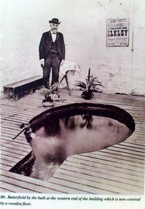
Old photo of Mr Butterfield, who saw fairies here
Popularly believed in local lore to have been a place held as sacred to the Romans, I’m of the opinion that the local ‘goddess’ Verbeia was resident here. A thought also mentioned by G.T. Oakley (1999) in his book on the subject.
Legend tells that the medicinal properties of the waters were first discovered hundreds of years ago when an old shepherd, walking over the moors, damaged his leg. Upon bathing it in the waters here, it soon healed.
In the Folklore Record of 1878 we find a fascinating tale about these waters, alleged to have happened to the old keeper of the place, told by a local man John Dobson, and which cannot go untold:
“William Butterfield…always opened the door first thing in the morning, and he did this without ever noticing anything out of the common until one beautiful, quiet, midsummer morning. As he ascended the brow of the hill he noticed rather particularly how the birds sang so sweetly, and cheerily, and vociferously, making the valley echo with the music of their voices. And in thinking it over afterwards he remembered noticing them, and considered this sign attributable to the after incident. As he drew near the wells he took out of his pocket the massive iron key, and placed it in the lock; but there was something “canny’ about it, and instead of the key lifting the lever it only turned round and round in the lock. He drew the key back to see that it was alright.and declared, “It was the same that he had on the previous night hung up behind his own door down at home.” Then he endeavored to push the door open, and no sooner did he push it slightly ajar than it was as quickly pushed back again. At last, with one supreme effort, he forced it perfectly open, and back it flew with a great bang! Then ‘whirr, whirr, whirr’, such a noise and sight! All over the water and dipping into it was a lot of little creatures, all dressed in green from head to foot, none of them more than eighteen inches high, and making a chatter and jabber thoroughly unintelligible. They seemed to be taking a bath, only they bathed with all their clothes on. Soon, however, one or two of them began to make off, bounding over the walls like squirrels. Finding they were all making ready for decamping, and wanting to have a word with them, he shouted at the top of his voice—indeed, he declared afterwards, he couldn’t find anything else to say or do—”Hallo there!” Then away the whole tribe went, helter skelter, toppling and tumbling, heads over heels, heels over heads, and all the while making a noise not unlike a disturbed nest of young partridges. The sight was so unusual that he declared he either couldn’t or daren’t attempt to rush after them. He stood as still and confounded, he said, as old Jeremiah Lister down there at Wheatley did, half a century previous, when a witch from Ilkley put an ash riddle upon the side of the River Wharfe, and sailed across in it to where he was standing.1 When the well had got quite clear of these strange beings he ran to the door and looked to see where they had fled, but nothing was to be seen. He ran back into the bath to see if they had left anything behind; but there was nothing; the water lay still and clear as he had left it on the previous night. He thought they might perhaps have left some of their clothing behind in their haste, but he could find none, and so he gave up looking, and commenced his usual routine of preparing the baths; not, however, without trotting to the door once or twice to see if they might be coming back; but he saw them no more.”
Along with sightings of ‘little people’, ghosts have been seen at the White Wells. It is thought that the strange apparition which presented itself to a householder here in 1982—the ghostly figure of a young girl, weeping at the water’s edge—was that of little Ann Harper who, in August 1793, at the age of nine, drowned in the well when bathing.
Earthlight (UFO) phenomena have also been reported here over the years—the most dramatic of which was alleged to have taken place at the top of the slope above the original source of the wells in 1989, when a police officer reported and photographed a “little green man” on the geological prominence just behind the wells. He went on to narrate a typical UFO ‘abduction’ event, but much of this was psychogenic and the mythic undertones echo precisely the medieval lore of abduction by faerie.
The Fortean researcher David Barclay found in his dowsing investigations here that there were spiral patterns all round the place. “At first these were in no order,” he wrote, “but through a period of over twenty visits to the place, I established markers which indicated the spiralling patterns of the energy” within the Earth immediately adjacent to the White Wells. These spirals were nearly always in a clockwise direction. In further studies here, he and I came to know a Mrs Elsie Hill, who had done some quite striking automatic drawings of the place. “In her pictures,” he wrote, “appear a prominence of spiral-forms and faerie creatures which, she believes, inhabit White Wells.”
Hmmmm…..
…to be continued…
References:
Bennett, Paul, The White Wells, Ilkley Moor, Heathen Earth: Keighley 2009.
Bogg, Edmund, Upper Wharfeland, James Miles: Leeds 1904.
Collyer, Robert & Turner, J. Horsfall, Ilkley, Ancient and Modern, William Walker: Otley 1885.
Denbigh, Kathleen, A Hundred British Spas, Spa Publications: London 1981.
Granville, A.B., Spas of England, Henry Colburn: London 1841.
Oakley, G.T., Verbeia: The Goddess ofWharfedale, Rooted Media: Leeds 1999.
Shaw, Thomas, The History of Wharfedale, Otley 1830.
Short, Thomas, The Natural, Experimental and Medicinal History of the Mineral Waters of Derbyshire, Lincolnshire and Yorkshire, privately printed: London 1724.
Speight, Harry, Upper Wharfedale, Elliott Stock: London 1900.
Whelan, Edna and Taylor, Ian, Yorkshire Holy Wells and Sacred Springs, Northern Lights: York 1989.
Take the A658 road north out of Bradford, past Undercliffe, and downhill towards Greengates. When you meet with the large junction where Ravenscliffe Avenue turns to your right – stop! Immediately on the left-hand side of the road is where the old well used to appear.
Archaeology & History
Old map showing Eccleshill’s Holy Well
In times past this was one of the most renowned holy wells in the region (we have at least 200 in West Yorkshire). First recorded as a holy well in 1585, specialist writer Edna Whelan remembers the waters here running into a stone trough at the side of Harrogate Road when she was young.
In 1932, local historian W.E. Preston described, “the remains of what was once a fine grove of trees leading up the hillside from the road to its source,” implying ritual commemoration and a procession to the site. Today, this grove is still evidenced by the straight footpath across the main road, leading to the infamous Ravenscliffe estate.
In 1704 a court case was brought against some locals – Mr & Mrs Richard and Sarah White (and their daughter, Mary) – “for diverting the water from its ancient channel.”
In 1867 it was described in the Object Name Book:
“A considerable and well-known spring, it has the appearance of having been a bathing place. A bank has been thrown up on the east side, and a broken wall remains on the other sides. There is no tradition about it. It is likely to have been of some note…in the days of Romanism. Large trees are ranged on either side of the approach to it, forming a grove.”
Up till 1978, Andrea Smith (n.d.) reported the well to still be “protected by local tradition,” but this is no longer possible. Yorkshire Water don’t particularly give a damn about its preservation (water is money folks!) and today it’s covered by a man-hole in the garden.
References:
Preston, William E., ‘Notes on the Early History of the Manor of Eccleshill,’ in Bradford Antiquary, 5, 1912.
Preston, William E., ‘Some Local Holy Wells,’ in Bradford Antiquary, June 1932.
Smith, Andrea, ‘Holy Wells Around Leeds, Bradford & Pontefract,’ in Wakefield Historical Journal 9, 1982.
Whelan, Edna & Taylor, Ian, Yorkshire Holy Wells and Sacred Springs, Northern Lights: Pocklington 1989.
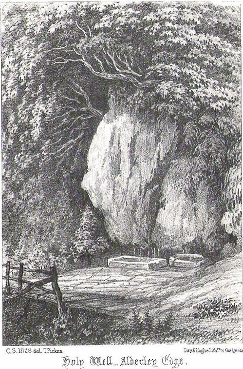
In Roeder & Graves’ (1906) analysis of the neolithic remains surrounding this geological arena, they told there to have been “at least nine wells at different parts of the Edge” — this and the Wizard Well being the ones of greater local renown. Flints and the remains of neolithic man were found all round here. Obviously the water from this well here would have been of primal use.
Folklore
In 1843, Robert Bakewell told how the waters from this famed well, “are said to be a cure for barrenness.” As well as this he reported how a large boulder fell from the Holy Well Rocks above it around 1740, and “a woman and a cow are said to have been buried under it.” But a lengthier description came from Roeder & Graves’ archaeological essay, where they told how both the Wizard Well and this site, “were in ancient times connected with well worship.” They continued:
“Their healing powers were considered to be unfailing: the barren, the blind, the lame, and bodily-afflicted constantly made their way thither; maidens whispered their vows and prayers over them, their lovers and their future lives being their theme. Crooked silver coins were dropped into the well, but these have been cleared out long ago. At present time the devotees are satisfied, in their economical habit, to offer mere pins and hairpins; the custom is not yet dead, for some of the immersed pins are still quite corroded and bright. Some of the sex deposit the pins in their straight and original form, others bend them only at right angle, and as many again seem to consider the charm alone to act effectively when carefully and conscientiously doubled-up. Maidens of a more superficial cast just the slightest twist to the object. To judge from the state of corrosion and the old-fashioned, thick globular heads, some of these pins must have been in the well for at least sixty years… There are occasionally to be seen also a few white pebbles in the two wells.”
References:
Bakewell, Robert, Alderley Edge and its Neighbourhood, J. Swinnerton: Macclesfield 1843.
Roeder, C. & Graves, F.S., ‘Recent Archaeological Discoveries at Alderley Edge,’ in Trans. Lancs & Cheshire Antiq. Soc., 1906.