Brimham Rocks Circle, Summerbridge, North Yorkshire

Stone Circle:  OS Grid Reference – SE 2056 6507

Archaeology & History

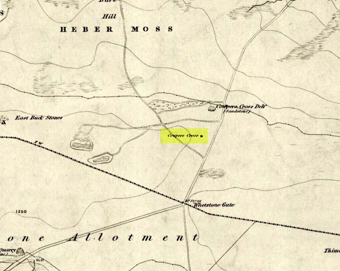
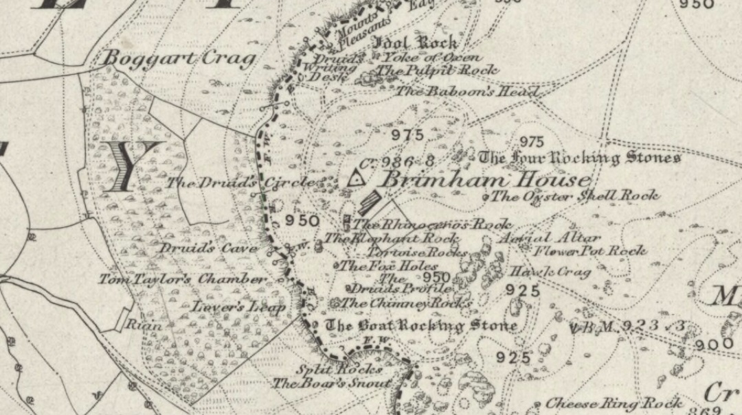
Druid's Circle on 1854 map
Druid’s Circle on 1854 map

A site that was illustrated by the early Ordnance Survey lads between the haunted Boggart Crag and Brimham Rocks to the south, I haven’t thoroughly explored this area so don’t know if anything at all remains of what was described.  It may or may not have been an early folly.  The earliest reference to this missing circle comes from Mr Hayman Rooke’s (1787) essay on the Brimham Rocks complex in Archaeologia journal.  Described in context with other prehistoric remains in the locale, Mr Rooke said,

“About a quarter of a mile further to the west (of Brimham Rocks) is a Druid circle, with a vallum of earth and stones, thirty feet diameter. It is exactly of the same construction as those on Stanton Moor, in the Peak of Derbyshire. There are likewise several small tumuli. Thirteen of them are ranged in a kind of circle, the largest not above eighteen feet in diameter. They are formed of earth and large stones. Two of these I opened; towards the bottom the effects of fire appeared on the stones; and ashes were scattered about, but there were no urns to be found.”

This description was echoed a few years later by Ely Hargrove (1809) and reiterated by Godfrey Higgins (1829) in his work on the Druids, but neither authors added anything new (strongly implying they never actually saw this ‘circle’).  The last description I’ve found of the site is in Mr Speight’s (1906) survey — which gives the reality of the site considerably more credence!  He told us:

“About 80 yards west of the Cannon Rock is a large tumulus, and about 300 yards still further is a Druid’s Circle, thirty feet in diameter, mentioned by Hargrove in 1809.”

But that’s it!  Nowt else!  It would seem from Hooke’s initial writing, that we are perhaps looking at a lost cairn circle in this locale, but until someone finds it we will never know for sure.

Intriguingly, there are a number of other prehistoric remains not far from this seemingly lost ‘circle’.  There’s a large standing stone not far away on Standing Stone Hill a half-mile south (kinda gives the game away really, dunnit!?) which I first saw as a kid; some cup-and-ring stones nearby; and the seemingly lost tumuli of Graffa Plain, southeast of Brimham Rocks, showing that prehistoric folk were up to the usual tricks nearby.  But the ‘circle’ is seemingly lost.  Is there anyone out there who knows anything more about yet another one of Yorkshire’s lost stone circles?  More information about the circle or the tombs would be very welcome!

References:

  1. Hargrove, Ely, The History of the Castle, Town and Forest of Knaresborough, Hargrove & Sons: Knaresborough 1809.
  2. Higgins, Godfrey, The Celtic Druids, R. Hunter: London 1829.
  3. Rooke, Hayman, “Some Account of the Brimham Rocks in Yorkshire,” in Archaeologia journal, volume 8, 1787.
  4. Speight, Harry, Upper Nidderdale, with the Forest of Knaresborough, Elliot Stock: London 1906.

© Paul Bennett, The Northern Antiquarian


Bride Stone, Farnley Moor, North Yorkshire

Standing Stone:  OS Grid Reference – SE 1991 4932

Getting Here

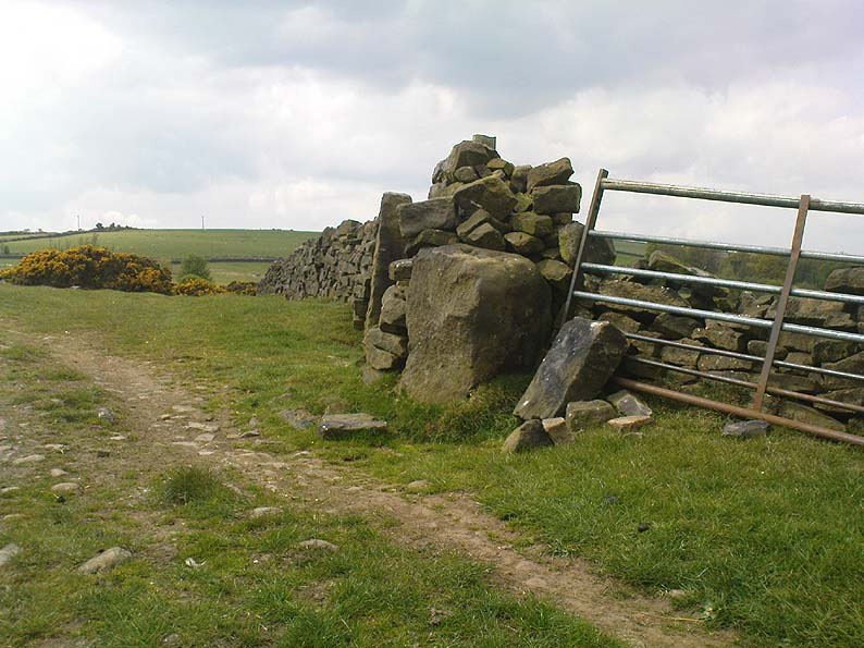
From Otley go north straight over the river and upwards into the countryside for nearly two miles (past the TV mast on the right).  As you reach near the top of the hill, there’s a turn to your right.  Go on here for a hundred yards or so, then walk along the footpath to your right.  After a few hundred yards, keep your eyes out for the stone just through the gate, in the walling on your left.

Archaeology & History

Although we see named on the 1853 Ordnance Survey map the respective place-names of Bride Cross House and Bride Cross Allotment, the first literary reference to any site here as a standing stone appears to be Eric Cowling (1946) who, when commenting on the pagan tradition and folklore of ancient sites, told that

“The name of Bride Cross Farm, Dob Park, is very significant, for at the meeting place of several tracks to the south-east is a squat standing stone built into a wall and marked as a boundary stone, which was probably Brides Cross.”

Bride Stone, Farnley Moor
Boundary markers on top

Although I’d read about this place as a kid, it was Graeme Chappell who first brought me here some twenty years back, in one of our many exploratory forays into the prehistory of this area.  It’s a nice fat squat standing stone, similar in stature to the more famous Bull Stone near Otley Chevin, a few miles to the south — though our Bride Stone here is about half as high.  Only about three-feet tall, it stands by the gate at the wall-side about 200 yards down the footpath from the Dob Park Lodge road and does seems to have been used as a boundary marker, as the letters “F.F.” are carved deeply on top of the upright (possibly denoting the Fawkes family of Farnley).

Cowling’s assertion that this old stone accounts for the ‘Bride Cross’ place-name is probably right, as the site is roughly midway between the respective place-names of the House and Allotment.  There is an old field-name of Crosse Close in the vicinity, from 1692, but I haven’t located it.  If such a cross ever existed nearby (most likely, it’s gotta be said), it’s obviously the relic which left the place-names — though the standing stone was certainly here first!  As yet, we’ve found no references to this place before 1853…which can’t be right…

Folklore

Seems to be a petrification legend in here somewhere. Although the short tale doesn’t say as much, it is supposed to have got its name through “the murder of a bride, rejected by a suitor, on her return from a wedding.”  Indeed, I’d go so far as to say ‘fertility’ as well!

Eric Cowling (1946) really stuck his neck out and reckoned sacrifices occurred here in the not too distant past. This may relate to the nearby Haddock Stones, a few hundred yards south, thought to derive its name from a cairn and ‘altar stones.’

References:

  1. Bennett, Paul, The Old Stones of Elmet, Capall Bann: Milverton 2001.
  2. Cowling, E.T., Rombald’s Way, William Walker: Otley 1946.
  3. Phillips, Guy Ragland, Brigantia — A Mysteriography, RKP: London 1976.
  4. Smith, A.H., The Place-Names of the West Riding of Yorkshire – volume 5, Cambridge University Press 1961.

© Paul Bennett, The Northern Antiquarian

Brackenhall Circle, Baildon Moor, West Yorkshire

Enclosure:  OS Grid Reference – SE 1305 3908

Also Known as:

  1. Brackenhall Ring
  2. Catstones Ring
  3. Soldier’s Trench

Getting Here

To get here, ask all and sundry where Shipley Glen is and, once there, head to the Brackenhall Countryside Centre. It’s less than 100 yards past it, right on the roadside (a coupla nice birches sit in its edge).

Archaeology & History

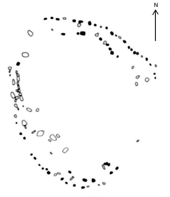
Lay-out of the Catstone's Ring (North is an approximation)
Lay-out of Catstone’s Ring

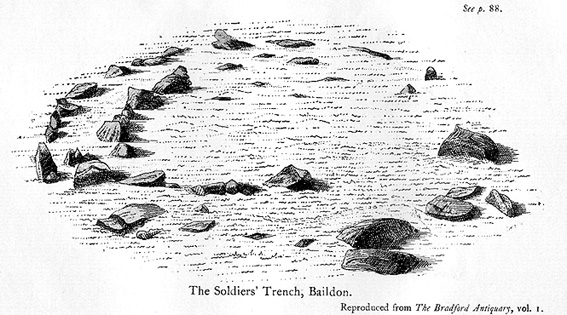
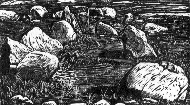
Described by many local writers over the years and marked on modern OS-maps as ‘The Soldier’s Trench,’ this curious double-ring of stones has long been somewhat of an archaeological anomaly.  The archaeologist John Barnatt thought it to be “almost certainly an enclosure, of indeterminate age”; and similarly so by Faull and Moorhouse (1981), who described it as a settlement or enclosure.  It has previously been classified as a ‘stone circle’ by archaeologists, and although I’ve added it to the listing of such sites here on TNA, I do so as a historical tradition, as the site aint a true megalithic ring.  Although we don’t know exactly what it was used for, we’re better using the term ‘enclosure’ for it.

The first description of the place was by J.N.M. Colls (1846).  When the pseudonymous Johnnie Gray (a.k.a. Harry Speight) got here he wrote:

“It comprises portion of an earthwork (which was perfect a few years ago), raised between two concentric circles, whose grater circumference is 137 yards, and diameter 57 yards north to south, and 39 yards east to west… There are unmistakable evidences about it of immense fires.”

Earliest known image (Glossop 1882)

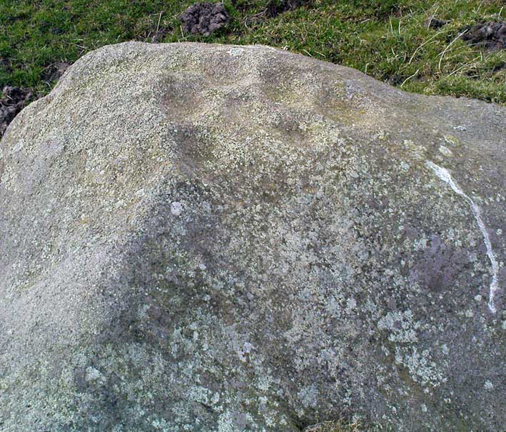
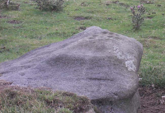
At least two of the stones in this double-ringed complex have cup-markings etched on them; though Boughey and Vickerman (2003) report a third such carving, but doubt its authenticity.  They may be right.

Folklore

The other name for this site, the Soldier’s Trench, comes from an old tale which relates to the place being used as a camp by a group of soldier’s the night before they went into battle.

Drawing by John la Page (1951)

The site stands right next to a prominent geological fault (as any visitor clearly sees!).  It’s likely that this cleft in the Earth is one of the causative factors in the creation of numerous UFO phenomena that have been reported hereabouts through the years.  One large spherical object with a very slight ‘tail’ to the rear, travelled slowly over this site in the 1980s and was watched for several minutes slowly following the geological ridge up and round Baildon Hill to the north, fading back to Earth and eventually out of sight.

References:

  1. Baildon, W. Paley, Baildon and the Baildons – parts 1-15, Adelphi Press: London 1913-1926.
  2. Bennett, Paul, The Old Stones of Elmet, Capall Bann: Milverton 2001.
  3. Boughey, Keith & Vickerman, E.A., Prehistoric Rock Art of the West Riding, WYAS 2003.
  4. Colls, J.N.M., ‘Letter upon some Early Remains Discovered in Yorkshire,’ in Archaeologia 31, 1846.
  5. Faull, M.L. & Moorhouse, S.A. (eds.), West Yorkshire: An Archaeological Survey to AD 1500 – 4 volumes, WYMCC: Wakefield 1981.
  6. Glossop, William, ‘Ancient British Remains on Baildon Moor,’ in Bradford Antiquary, 1882.
  7. Gray, Johnnie, Through Airedale from Goole to Malham, Elliott Stock: London 1891.
  8. Hedges, John (ed.), The Carved Rocks on Rombald’s Moor, WYMCC: Wakefield 1986.
  9. la Page, John, The Story of Baildon, Byles: Bradford 1951.

© Paul Bennett, The Northern Antiquarian

Blue Scar Settlement, Arncliffe, North Yorkshire

Settlement:  OS Grid Reference – SD 9319 7102

Getting Here

Pretty easy really.  From Arncliffe village, walk up the Monk’s Road footpath, heading for the rocky mass immediately south.  Once you get onto the moor edge, veer straight up to your right and keep walking till you hit the rocks.  Look around!

Archaeology & History

Drawing of main part of the settlement (Raistrick 1929)

Described by Miss D. Charlesworth at one of the annual meetings of the Archaeological Society in July 1968, this ‘settlement’ is found immediately south of Arncliffe village, literally 1000 feet up on the hillside and has a field system attached to it.  When Charlesworth described this place, it had not been excavated, though her description of the place very much echoed those of Raistrick & Chapman (1929) nearly forty years earlier.  She wrote:

“It faces north and east over the Skirfare valley, sheltered by the bulk of Parson’s Pulpit. The most interesting feature is the rectangular enclosure west of the sunken road. The walls are built of limestone some 5ft wide at the base and standing 2-3ft (tall). The huts are grouped round a courtyard at the south-eastern end and have a large stockyard attached to them. Of the 14 huts, only two are circular (those in the northwest corner), and one on the east side is approximately a circle. The remainder are rectangular, approximately 30 by 12ft.”

Although the sites is generally ascribed as Iron Age to Romano-British in date, it seems evident that these buildings were used in much later centuries — perhaps until late medieval periods.  Other remains of similar size and stature can be found scattered on the hills near here (I’ll add them on TNA at sometime in the future).

References:

  1. Charlesworth, D., ‘Iron Age Settlements and Field Systems,’ in Proceedings of the Archaeological Journal, 125: 1968.
  2. Raistrick, Arthur & Chapman, S.E., ‘The Lynchet Groups of Upper Wharfedale, Yorkshire,’ in Antiquity, volume 3, 1929.

© Paul Bennett, The Northern Antiquarian

Bent Head, Todmorden, West Yorkshire

Cup-Marked Stone:  OS Grid Reference – SD 9602 2587

Also Known as:

  1. Upper Eastwood Carving

Getting Here

Bent Head cup-marking

From Todmorden go east on the A646 for less than a mile and take the Cross Stone road on your left.  Keep going all the way up till you hit the moorland edge road, where you’ll see the Great Rock (a massive boulder right by the roadside). Then go down Eastwood Lane, past the house where the lane swings right and here you’ll see a stile in the wall on the right (just after the next lane on your left).  Walk along this path, over the stiles in the walling until you reach a wooden stile. The carving is hereby!

Archaeology & History

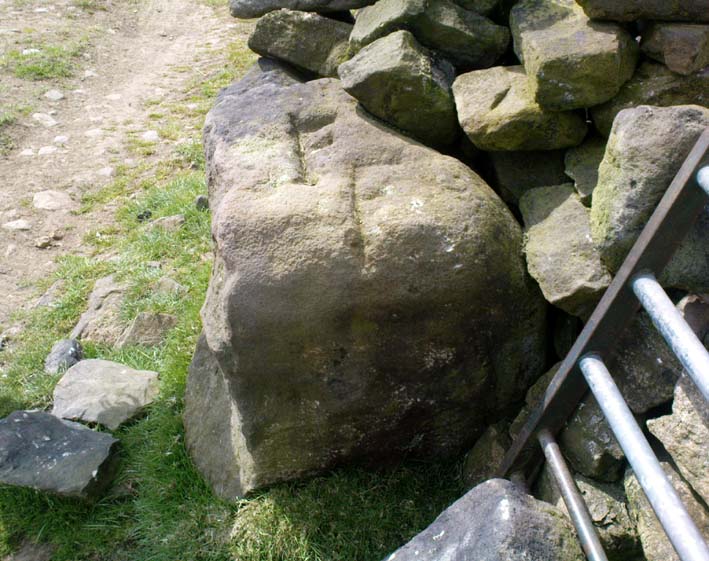
This carving was described just once by Mr J.A. Heginbottom (1979) as, “a small cup-marked boulder in a stile 100 metres east of Bent Head, Todmorden.” A small, innocuous stone used in the drystone walling, it gives the distinct impression of being one of the many ‘portable’ cup-marked stones typical of those found in prehistoric cairns and other tombs — but the record-books speak of no such remains here; and various ambles about in search of such a potential tomb have drawn a blank. Nevertheless, the cup-markings here are pretty obvious once you see ’em (assuming the daylight aint overcast, which can hide the carvings sometimes).  About 2 feet long, about a foot wide and a foot high, this cup-marked portable is similar in size and form to the Nine Stones cup-marking, Derbyshire, recently found in walling very close to where an old tomb was recorded (though the Derbyshire one has only 2-3 cups).  Certainly worth a look if you’re in the area.

References:

  1. Heginbottom, J.A., The Prehistoric Rock Art of Upper Calderdale and the Surrounding Area, YAS: Leeds 1979.

© Paul Bennett, The Northern Antiquarian

Baildon Moor (171), West Yorkshire

Cup-Marked Stone:  OS Grid Reference – SE 13842 40268

Also Known as:

  1. Carving no.37 (Hedges)

Getting Here

W.P. Baildon’s sketch

Upon the heights of Baildon Hill, get to the Dobrudden Farm caravan site. 100 yards up the track leading from it (north), go into the tribbles of grassland immediately to your left.  Look around!

Archaeology & History

This is only a small stone and takes some finding when the grasses are long.  It’s found upon the once archaeologically rich High Plain with at least 17 cup-markings etched onto its surface.  A single prehistoric tomb appears to have accompanied the rock and its cup-marks.

It was first described by Mr Baildon (1913) in his magnum opus; then later catalogued in Hedges (1986) survey, a couple of years after I did my first drawing of this stone.

References:

  1. Baildon, W. Paley, Baildon and the Baildons – parts 1-15, Adelphi: London 1913-1926.
  2. Bennett, Paul, Megalithic Ramblings between Ilkley and Baildon, unpublished: Shipley 1982.
  3. Boughey, Keith & Vickerman, E.A., Prehistoric Rock Art of the West Riding, WYAS: Leeds 2003.
  4. Hedges, John, The Carved Rocks on Rombald’s Moor, WYMCC: Wakefield 1986.

© Paul Bennett, The Northern Antiquarian


Baildon Moor (152), West Yorkshire

Cup-Marked Stone:  OS Grid Reference – SE 13743 40161

Also Known as:

  1. Carving no.24 (Hedges)

Getting Here

If you wanna find this, get onto the Low Plain north of the Dobrudden caravan park and its about 10 yards off the path running north from there, not too far from the other Baildon Hill carvings.  Scramble about a bit & you’ll find it.

Archaeology & History

W.P. Baildon’s early sketch

Don’t ask me why, but I really like this carving. It’s one of the many I first saw on these moors when wandering about up here when I was 10-12 years old — and they had an effect on me.  I call this one of the “primary design” stones, i.e., a number of CRs on this moor (and everywhere else for that matter) appears to have a central design feature. (I’ll point out the others as I post ’em) Some folk think it’s just the slant of the local rock-artist…I think it’s summat a bit different…  Local astronomer Gordon Holmes (1997) found a similar pattern here and thought they may have represented star formations, but this is unlikely.

It was first described and illustrated by W. Paley Baildon (1913), way before Mr Jackson (1955) resurrected its attention for archaeologists.

References:

  1. Baildon, W. Paley, Baildon and the Baildons (parts 1-15), St. Catherines: Adelphi 1913-26.
  2. Boughey, K.J.S. & Vickerman, E.A., Prehistoric Rock Art of the West Riding, WYAS: Leeds 2003.
  3. Hedges, John (ed.), The Carved Rocks of Rombald’s Moor, WYMCC: Wakefield 1986.
  4. Holmes, Gordon, 2000 BC – A Neolithic Solstice Odyssey, SASRG 1997.
  5. Jackson, Sidney, ‘Cup-and-Ring Boulders of Baildon Moor,’ in Cartwright Hall Archaeology Group Bulletin, 1:7, 1955.

© Paul Bennett, The Northern Antiquarian


Baildon Moor (146), West Yorkshire

Cup-Marked Stone:  OS Grid Reference – SE 13666 39756

Also Known as:

  1. Carving no.19 (Hedges)
  2. Carving no.146 (Boughey & Vickerman)

Getting Here

South of Dobrudden caravan park, heading towards the wall, you’ll stumble across this old carving in the tribbly grass. Zigzag about and keep your eyes peeled!

First known drawing (W.P. Baildon 1913)

Archaeology & History

First described by W. Paley Baildon in his monumental 15-part study (1913) of the region, this carving was then later included in John Hedges (1986) survey as ‘Baildon stone 19.’  It was then catalogued as stone 146 in Boughey & Vickerman’s (2003) updated and expanded survey.

Modern drawing (after Hedges 1986)

This carving was one of several in the Baildon Moor complex that was thought by local astronomer Gordon Holmes (1997) to possibly represent heavenly constellations, with Pleiades and Cassiopeia being primary contenders amidst the scattering of carved cups on this stone.  This was something I explored in my own research on the possible nature of these carvings in the 1980s, but found that although it seemed a good idea, it was pretty unlikely (unfortunately!).  The nature of this and other stones related to the other prehistoric remains where, in bygone days, many prehistoric cairns scattered this grassy moorland plain.  The carving was more related to the cosmology of death and the psychogeography of spirit worlds: a factor understood at many other cup-and-rings across the country.

References:

  1. Baildon, W. Paley, Baildon and the Baildons – parts 1-15, Adelphi: London 1913-1926.
  2. Boughey, Keith & Vickerman, E.A., Prehistoric Rock Art of the West Riding, WYAS: Leeds 2003.
  3. Cowling, Eric T., Rombald’s Way, William Walker: Otley 1946.
  4. Hedges, John, The Carved Rocks on Rombald’s Moor, WYMCC: Wakefield 1986.
  5. Holmes, Gordon, 2000 BC – A Neolithic Odyssey, SASRG: Baildon 1997.

© Paul Bennett, The Northern Antiquarian

Mitton Springs, Baildon Moor, West Yorkshire

Cup-and-Ring Stone:  OS Grid Reference – SE 12897 39490

Also Known as:

  1. Carving no.4 (Hedges)
  2. Carving no.121 (Boughey & Vickerman)

Getting Here

Glossop’s 1888 sketch

This lovely little stone is found on Shipley Glen.  Walk a few hundred yards up past the Brackenhall circle until, on the right-hand side of the road, you reach the track which leads up the slope to Mitton Springs farmhouse.  About 20 yards past the track, cross the road from and near to where the land drops down to the glen below and about 20 yards from the rowan tree, you’ll find this carving on one of the smaller low flat stones.  Be patient and look around.  You’re damn close!

Archaeology & History

The carving first appears to have been described by the Bradford historian, William Glossop (1888), in his local survey of prehistoric remains here (see his drawing).  It’s a cute little thing on a small stone, consisting of a simple large ‘enclosure’ ring with three archetypal cup-markings etched inside.  Described by several other local writers since, no other archaeological remains have been found in relation to this carving, making any realistic academic assessment on its nature almost wholly impossible.

References:

  1. Baildon, W. Paley, Baildon and the Baildons (parts 1-15), St. Catherines: Adelphi 1913-26.
  2. Boughey, K.J.S. & Vickerman, E.A., Prehistoric Rock Art of the West Riding, WYAS: Leeds 2003.
  3. Glossop, William, “Ancient British Remains on Baildon Moor,” in Bradford Antiquary No.1, 1888.
  4. Hedges, John (ed.), The Carved Rocks of Rombald’s Moor, WYMCC: Wakefield 1986.

© Paul Bennett, The Northern Antiquarian

Devil’s Arrows, Boroughbridge, North Yorkshire

Standing Stones:  OS Grid References – SE 3909 6653

Also known as:

  1. The Devil’s Bolts
  2. The Three Greyhounds
  3. The Three Sisters

Getting Here

Dead easy to find!  Turn off the A1(M) at the A6055 Boroughbridge road and head into town. Turn left after the Three Arrows Hotel, down Roecliffe Lane and the stones are a few hundred yards down, close to the motorway. The tallest is just off the road to the left, behind a gate (the owner of the adjacent house there is very pleasant), whilst the other two are across the road in the fields.

Archaeology & History

Devil's Arrows (Percy Robinson, c.1895)
Devil’s Arrows (Percy Robinson, c.1895)

To many archaeo-megalithic and folklore fans, these huge standing stones need no introduction.  These great heathen Arrows of the devil, today at least, are three gigantic standing stones, each one weighing several tons at least, standing in a rough straight line, nearly north-south.  This is the greatest single stone-row anywhere in the British Isles.

Just how many standing stones originally stood here is difficult to say.  We know from the records of early antiquarians and travellers that we had at least five Arrows here in centuries gone by; but one curious account, mentioned by the Yorkshire antiquarian Edmund Bogg (1895) more than a hundred years ago told:

“Peter Franck, a fisherman who travelled much about the world to enjoy his sport, came to Boroughbridge in 1694 and says he saw seven of these standing stones, Dr Stukeley mentions five, and John Leyland, in his travels, saw ‘four great stones wrought by man’s hands,’ but no inscription upon them. Camden, in 1592, saw four, but one of them at the time was thrown down, ‘for,’ says he, ‘the accursed love of gain.’ Part of this one is still to be seen, built into the Peggy Bridge which crosses the Tut on the entrance to the town, the top portion being preserved in the grounds of Aldborough Manor and this goes far to prove — and I have very carefully considered the question and examined the ground — that the original number of stones was far greater, and reached from the Yore, in equal distances to the Tudland of Leyland’s time, or the Staveley Beck of today. If this argument is correct, 2000 years ago there would be a line of at least 12 standing monoliths guarding the western approach to Isur Brigantium.”

John Aubrey's 1687 plan Devil Arrows Stone Circle
John Aubrey’s 1687 plan Devil Arrows Stone Circle

Will Stukeley’s 1776 image

Well y’ never know! But who was this Peter Franck chap from the 17th century? It would be good to find out more of what he said.

But this notion of there being a great many more stones here than the four or five that are accepted as standard, isn’t just to be found in the annals of some lost fisherman. The great Royalist antiquarian John Aubrey came here in September 1687 and, as illustrated here, saw the remaining three upright stones as remnants of a concentric ring of stones of obviously gigantic proportions. Following from a rough survey of the site and descriptions from local people, Aubrey placed the standing stones in their old line, of

“A. B. C. D., and I have drawn two imaginary circles in which it may be supposed that stones were placed, as at Avebury, Stonehenge, etc.  Perhaps they might be more stones in each circle than I have fancied.”

Nearly two hundred years later, archaeologist John Ackerman (1847) echoed John Aubrey’s notion (or perhaps simply copied them) in his notion of the Devil’s Arrows once being part of a greater megalithic complex, saying,

“At Rudston and Boroughbridge, in Yorkshire, are supposed examples of maenhirs. Near the latter place there are four standing in a row, which are called by the country people the Devil’s Bolts; but, from their relative position, it is not unlikely that they are the remains of a large circle.”

Devil’s Arrows (from Smith’s ‘Reliquiae’)

The top 2 Arrows

As if to tempt further enquiry, or at least require suitable explanation, is the nearby field-name of ‘Kringelker,’ or Cringles Carr — last described in 1316 — and which means very simply a circle by the marsh, or circular marsh, or variants thereof.  (Source: Yorkshire Deeds, volume 4,YAS: Leeds 1904)

But prior to John Aubrey’s speculations on the Arrows being part of a giant ring of stones, he related the earliest survey done here, by  a local (unnamed) man on April 17, 1669, telling that:

John Aubrey's 1687 sketch of the Arrows
John Aubrey’s 1687 sketch of the Arrows

“In Yorkshire near Burrough-brig on the west side of the Fosse-way, about a quarter of a mile, (in the Lordship of Alburgh) stand three pyramidish stones called the Devills Arrowes.  The Arrow standing towards the south is seven yards and a half in height: the compasse of it five yards and a half.  The middle Arrow seven yards and a half, in compass six yards.  The Arrow towards the north in height five yards and a half, in compass seven yards.  Here was another stone that stood in a straight line, at D, that was taken down and a bridge made of it.”

Other regal antiquarians and learned writers of the period came soon after. When William Camden (1695) visited the place at the end of the 16th century, he was equally impressed and described the place as follows:

“Not farre beneath there standeth by Ure a little towne called Burrowbridge, of the bridge that is made over the river: which is now built very high and faire of stone worke, but in King Edward the Second his time it seemeth to have beene of wood. For wee read that when the Nobles of England disquieted this king and troubled the state, Humfrey Bohun Earle of Hereford in his going over it was at a chinke thereof thrust through the body about his groine by a souldiour lying close under the bridge. Neere unto this bridge Westward wee saw in three divers little fields foure huge stones of pyramidall forme, but very rudely wrought, set as it were in a streight and direct line. The two Pyramides in the middest, whereof the one was lately pulled downe by some that hoped, though in vaine, to finde treasure, did almost touch one another. The uttermore stand not far off, yet almost in equall distance from these on both sides. Of these I have nothing else to say but that I am of opinion with some that they were monuments of victorie erected by the Romans hard by the high street that went this way. For I willingly overpasse the fables of the common people, who call them the Devills Bolts, which they shot at ancient cities and therewith overthrew them. Yet will not I passe over this, that very many, and those learned men, thinke they are not made of naturall stone in deed, but compounded of pure sand, lime, vitriol (whereof also they say there bee certaine small graines within), and some unctuous matter. Of such a kinde there were Rome cisterns, so firmely compact of very strong lime and sand, as Pliny writeth, that they seemed to be naturall stones.”

Another early antiquary, John Leland, also passed by here a few hundred years back and wrote the following after his visit:

“A little without this Towne on the west part of Watiling-Streate stadith 4 great maine stones wrought above in conum by Mannes hand.  They be set in 3 several Feldes at this Tyme.  The first is a 20 foote by estimation in higeth and an 18 foote in cumpace. The stone towards the ground is sumwhat square, and so up to the midle, and then wrought with certen rude boltells in conum. But the very toppe thereof is broken of a 3 or 4 footes. Other 2 of like shap stand in another feld a good But shot of: and the one of them is bigger then the other; and they stand within a 6 or 8 fote one of the other.  The fourth standith in a several feld a good stone cast from the other, and is bigger and higher than any of the other 3. I esteme it to the waite of a 5 Waine Lodes or more.

Inscription could I none find yn these stones; and if there were it might be woren out; for they be sore woren and scalid with wether.

I take to be a trophaea a Romanis posita in the side of Watheling Streat, as yn a place most occupied in Yorneying ad so most yn sighte.”

Possible cup-marks on northernmost Arrow

Rock Art on the Devil’s Arrows

Although Leland told us he could find no inscriptions on the stones, he missed some which may be much older than the purely Roman marks his nose was seeking.  Cup-and-ring stones — much in vogue nowadays thanks to the new, shamanically-inspired archaeo’s — aren’t etched here in anything like the styles expected of our Swastika Stone, or the Achnabreck carvings, but cup-markings seem to occur on the northernmost stone.  Although a rather myopic bunch of earth-mystery people thought they were the first to discovered the cup-markings here in 2005, they were in fact first described way back in 1866, in Sir James Simpson’s precursory essay to his Archaic Sculpturings (1867), where he told:

“In England the most striking and magnificent group of monoliths that I have seen are the so called Devil’s Arrows at Borough-Bridge, in Yorkshire. Three only of these tall and enormous monoliths are now left, and stand in a line about a stone’s throw from each other. They are all pillars of a squarish shape, and said to bo formed of millstone grit. Two of them are above twenty-two feet in height, and the third measures eighteen feet. Each at its upper part is deeply and vertically guttered, apparently by long weathering and exposure ; and their lower portions show round, smooth, cup-like excavations upon some of their surfaces. The most northerly of these imposing monoliths is especially marked in this last way. Many, if not all, of these excavations, have probably been effected by the elements and weather; while some of them, which look more artificial, are of the same shape and form as those on the Kilmartin stones, etc.  But unfortunately we have not here the presence of rings or circles around the cups to determine conclusively their artificial character.”

The central Arrow

Some of the cup-markings here are distinctly artificial; but as with these ancient non-linear designs in general, we are unable to ascertain any specific ‘meaning’ to them at this site, even in any mythic sense — as yet! (I’ll get some images of cup-markings next time I visit the Arrows, unless someone has some going spare!)

Folklore

Described by Bob Mortimer (1860) as a gathering place of the druids, who “met here to celebrate their great quarternal sacrifice”; not unsurprisingly there are a variety of other fascinating creation myths and folklore motifs raising their usual heads by these great stones.  Mortimer told of more tales following his local society’s visit here at the end of the 1850s, saying:

“There lived a very pious old man (a Druid should we imagine) who was reckoned an excellent cultivator of the soil. However, during each season at the time his crops had come to maturity they were woefully pillaged by his surrounding neighbours; so that at this, he being provokingly grieved, the Devil appeared, telling the old man if he would only recant and throw away his holiness he should never more be disturbed in his mind, or have whatever he grew stolen or demolished. The old man, like Eve in the garden, yielded to temptation, and at once obeyed the impulse of Satan for the benefit of worldly gain. So when the old man’s crops were again being pillaged, the Devil threw from the infernal regions some ponderous arrows, which so frightened the plunderers by shaking the earth that never more was he harrassed in that way. Hence the name of the ‘Devil’s Arrows.'”

Another individual told me that it was believed by some that the stones sprung up one night in the very places they now occupy.”

Very close to the Arrows are antiquarian records of other sites which someone can hopefully throw more light on, as they may have had some relationship with the stones.  Immediately west were (are?) the Penny Stones; plus a place called Bell’s Wife’s Field (Bel as a sun-god – though his wife may imply the moon). And just a few hundred yards east is the old Lady Well, mentioned elsewhere.

…to be continued…

References:

  1. Ackerman, John Yonge, An Archaeological Index to the Remains of Antiquity of the Celtic, Romano-British and Anglo-Saxon Periods, J.R. Smith: London 1847.
  2. The Stranger’s Guide; Being a Concise History & Description of Boroughbridge, John Mitchell: Boroughbridge 1846.
  3. Anonymous, Yorkshire Legends, Dalesman: Clapham 1969.
  4. Aubrey, John, Monumenta Britannica, Little Brown & Co: Boston 1982.
  5. Beck, Howard, Yorkshire’s Roots, Sigma: Wilmslow 1996.
  6. Bennett, Paul, The Devils Arrows, Heathen Earth: Keighley 2009.
  7. Bogg, Edmund, From Eden Vale to the Plains of York, Goodall & Suddick: Leeds n.d. (c.1895)
  8. Bogg, E., Richmondshire and the Vale of Mowbray (volume 1), Elliott Stock: London 1906.
  9. Brayshaw,Thomas, ‘The Yorkshire Portions of Leland’s Itinerary,’ in YAJ 10, 1889.
  10. Burl, Aubrey, ‘The Devil’s Arrows,’ in YAJ 63, 1991.
  11. Burl, Aubrey, From Carnac to Callanish, Yale: New Haven & London 1993.
  12. Camden, William, Britannia, or a Chorographical Description of Great Britain and Ireland, Edmund Gibson: London 1695.
  13. Devereux, Paul & Thomson, Ian, The Ley Hunter’s Companion, Thames & Hudson: London 1979.
  14. Elgee, F. & H.W., The Archaeology of Yorkshire, Methuen: London 1933.
  15. Forrest, Bob & Behrend, Michael, ‘The Devil’s Arrows on Target,’ in The Ley Hunter,no.107, 1989.
  16. Lawson-Tancred, Lady, A Guide Book to the Antiquities of Aldborough and Boroughbridge, J. Topham: Boroughbridge 1948.
  17. Leadman, A.D.H., ‘The Devil’s Arrows,’ in The Antiquary, 1903.
  18. Leland, J.J., The Itinerary of John Leland the Antiquary, Fletcher & Pote: Oxford 1770.
  19. Lewis, A.L., ‘The Devil’s Arrows, Yorkshire,’ in Journal. Anthr. Institute, 8, 1878.
  20. Longworth, Ian H., Regional Archaeologies: Yorkshire, Cory, Adams & Mackay: London 1965.
  21. Lukis, W.C., ‘The Devil’s Arrows,’ in Proc. Soc. Antiquaries London, volume 7, 1877.
  22. Lukis, W.C. (ed.), The Family Memoirs of the Rev. William Stukeley – volume 3, Surtees Society: Durham 1887.
  23. Mee, Arthur, Yorkshire, West Riding, Hodder & Stoughton: London 1941.
  24. Mortimer, Robert, ‘The Great Monoliths at Boroughbridge,’ in The Geologist journal, London 1860.
  25. Phillips, Guy Ragland, Brigantia, RKP: London 1976.
  26. Radley, J., ‘Prehistory of the Vale of York,’ in YAJ 1974.
  27. Ross, Frederick, Legendary Yorkshire, William Andrews: Hull 1892.
  28. Simpson, James Y., Archaic Sculpturings of Cups, Circles, etc., upon Stones and Rocks in Scotland, England and Other Countries, Edmonston and Douglas: Oxford 1867.
  29. Smith, A.H., Place-Names of the West Riding of Yorkshire (volume 5), EPNS: Cambridge 1963.
  30. Smith, Henry E., Reliquiae Isurianae, J.R. Smith: London 1852.
  31. Somerville, Boyle, The Devil’s Arrows: Prehistoric Stone Monuments and their Orientation, B.A. Handbook, 1927.
  32. Stukeley, William, Itinerarium Curiosum (volume 2), London 1776.
  33. Thom, A.S. & Burl, Aubrey, Stone Rows and Standing Stones, BAR: Oxford 1990.
  34. Turner, T.S., History of Aldborough and Boroughbridge, Arthur Hall: London 1853.
  35. Tutin, John, ‘Theory about the Three Arrows,’ Yorkshire Life 3, 1954.
  36. Walford, John. ‘An early description of the Devil’s Arrows, Boroughbridge, North Yorkshire,’ in Yorkshire Archaeological Journal, 79, 2007.
  37. Wood, E.S., ‘The Grooves on the Devil’s Arrows, Boroughbridge,’ PPS 13, 1947.

© Paul Bennett, The Northern Antiquarian