High Sleets, Hawkswick, North Yorkshire

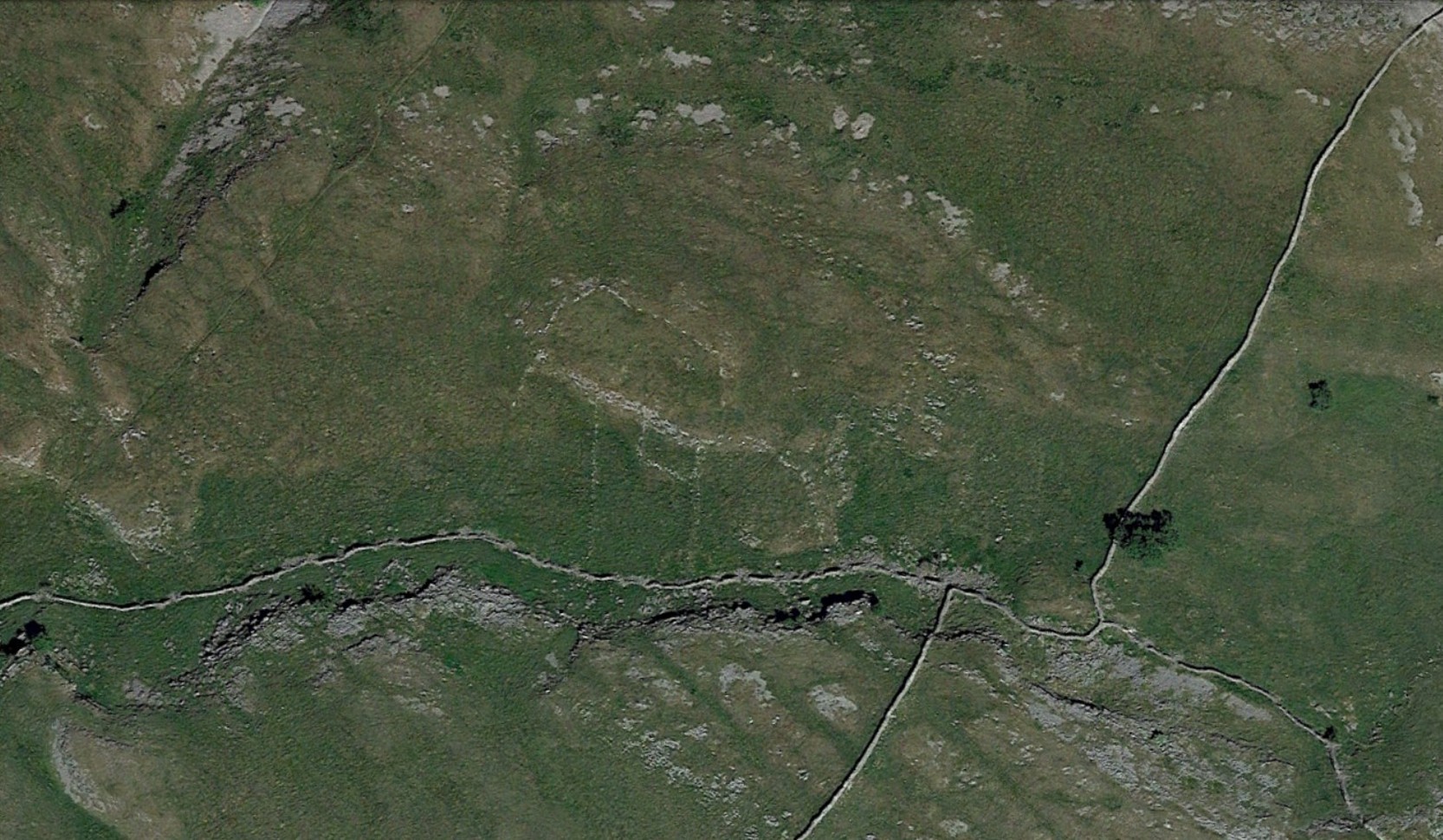
Enclosure:  OS Grid Reference – SD 95415 69019

Getting Here

Enclosure walls beneath the long crags

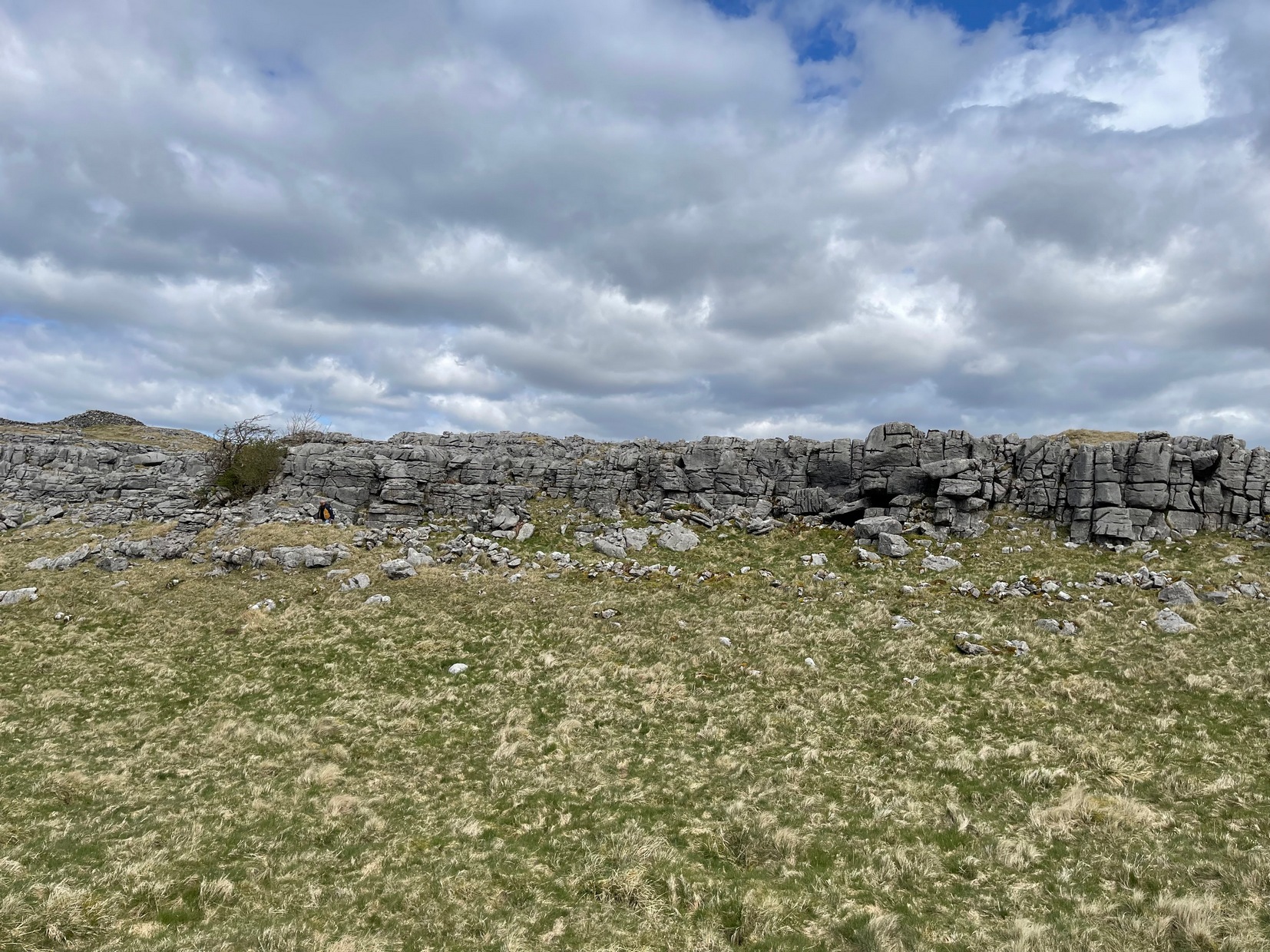
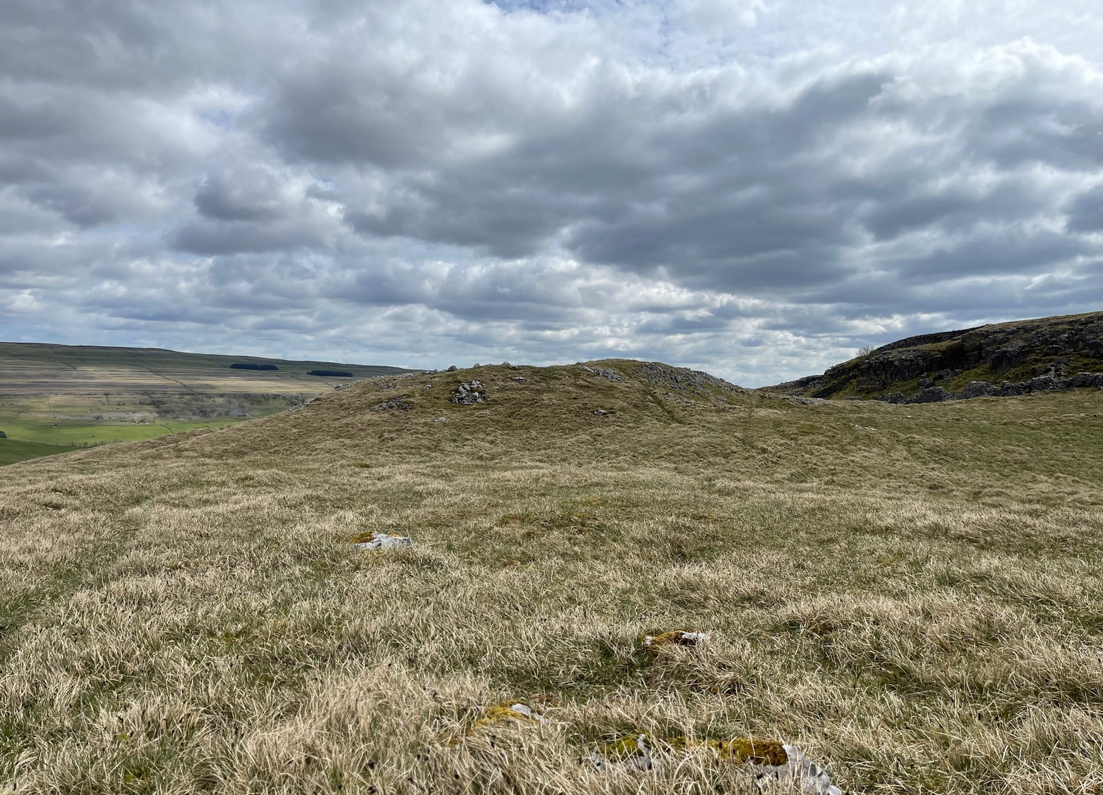
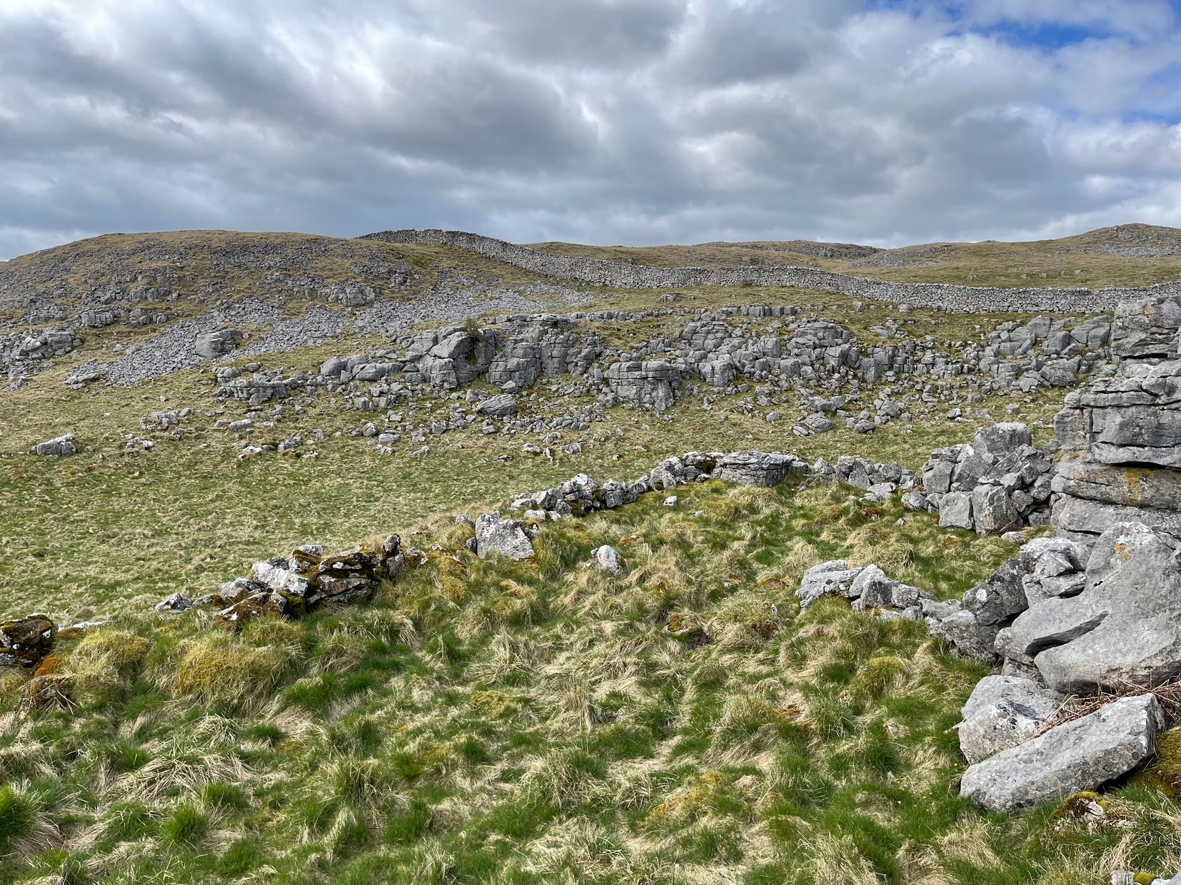
Going along the B6160 road from Grassington to Kettlewell and taking the little road to Arncliffe on your left just a few hundred yards past Kilnsey Crags, after ¾ of a mile keep your eyes peeled for the small parking spot on the left-side of the road, with the steep rocky stream that leads up to the Sleet Gill Cave. Walk up this steep slope, following the same directions to reach the Sleets Gill Top enclosure. From here you’ll notice a large gap in the rocky crags about 200 yards WSW that you can walk through. On the other side of this gap, along a small footpath about another 200 yards along you’ll reach a large ovoid rock.  Just before this, on your right, is a long rocky rise with distinct drystone walling below it.  That’s the spot!

Archaeology & History

Walled section, looking S

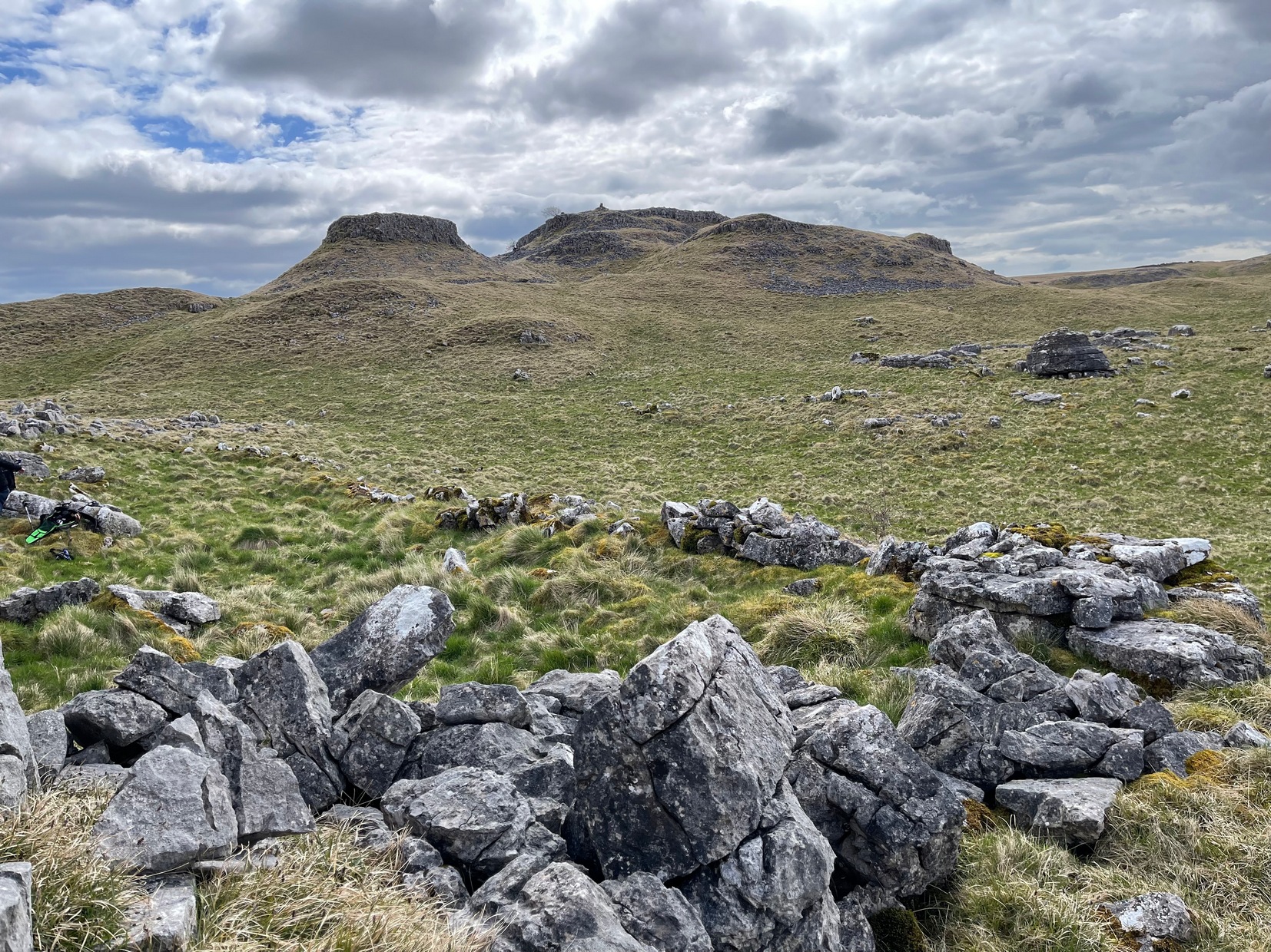
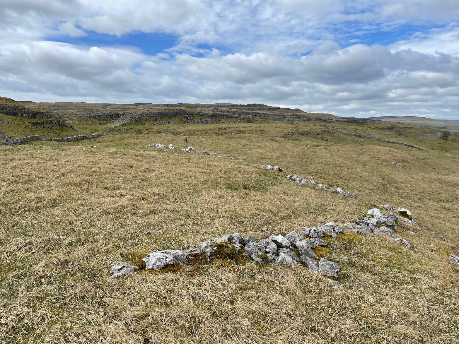
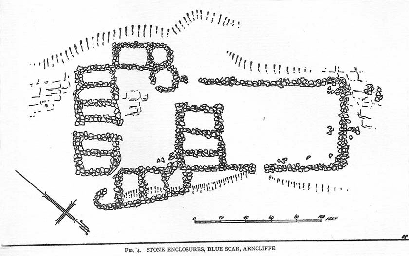
Encircling a slightly sloping area of ground that stretches out beneath a long line of limestone crags is this notable walled enclosure running almost the full length of the rocky ridge.  Measuring 40 yards (36m) in length by 10 yards (9m) across at its greatest width, this elongated rectangular enclosure has all attributes of being Iron Age in origin, much like many others in this area.  However, in comparison with the others close by, this is a pretty small construction and—if used for human habitation, as is likely—would have housed only two or three families.

Western end of enclosure

Within the enclosure itself, near its  western end, we find an internal line of walling that creates a single room: enough for a single family, or perhaps even where animals were kept.  Only an excavation would tell us for sure.

Curious stone ‘cupboard’

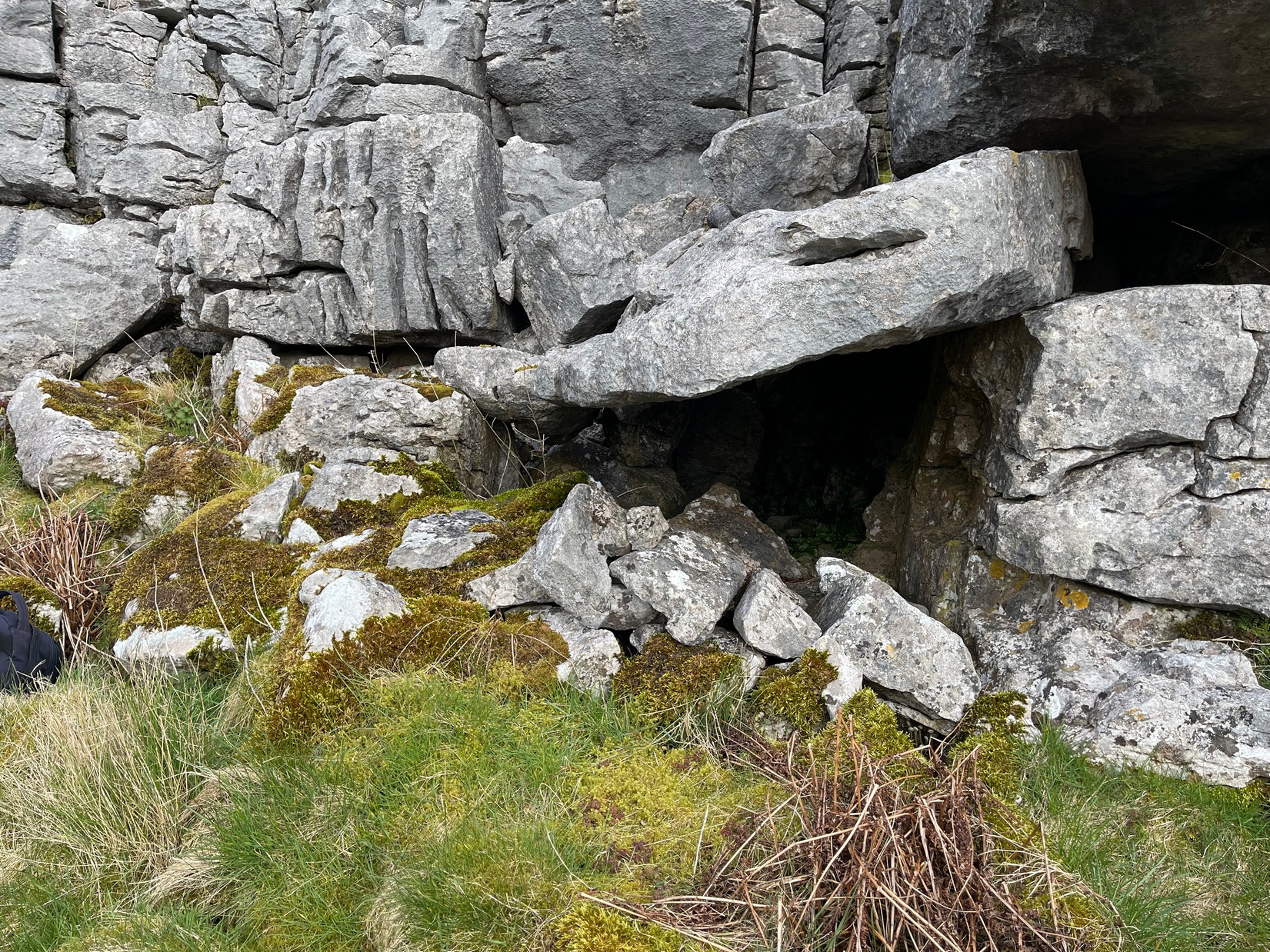
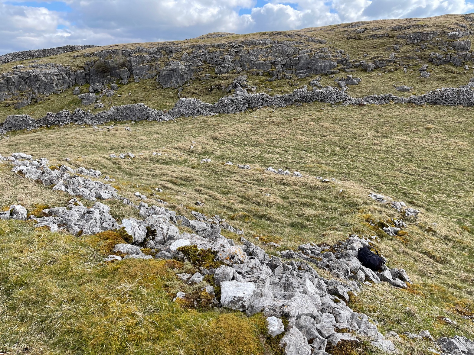
One notable interesting feature exists roughly halfway along the enclosure, up against the crag itself: here is small man-made stone “cupboard” of sorts, akin to some modern pantry.  You’ll get an idea of it in the photo.  At first I wondered if this would have been a sleeping space, but, unless it was where a shaman liked to encase him/herself inside a domestic household cave (highly improbable), it would have served a simple pragmatic function. Make up your own mind.

I liked this place. It’s surrounded by crags on almost all sides with some ancient spirit-infested rocky hills very close by, giving it a beautiful ambience.  Immediately below the enclosure is what looks to be a large dried-up pool, which was probably well stocked with fish.  A perfect living environment.  Check it out!

References:

  1. Raistrick, Arthur, Prehistoric Yorkshire, Dalesman: Clapham 1964.

© Paul BennettThe Northern Antiquarian

Sleets Gill Top, Hawkswick, North Yorkshire

Enclosure:  OS Grid Reference – SD 95735 69145

Getting Here

Sleets Gill enclosure hillock

Go up the B6160 road from Grassington to Kettlewell and just a few hundred yards past the famous Kilnsey Crags, take the little road to Arncliffe on your left.  After ¾ of a mile, keep your eyes peeled for the small parking spot on the left-side of the road, with the steep rocky stream that leads up to the Sleet Gill Cave. Walk up to the cave, then keep going up the same steep slope to the wall/fence above. You can get over the wooden fence and keep following the wall until it just about levels out nearly 200 yards up.  From here, walk 100 yards to your right where the land rises up and you’re at the edge of the walled enclosure.  Look around.

Archaeology & History

Walled section, looking W

On top of a small rise in the land is this large, roughly rectangular walled enclosure measuring about 55 yards across at its longest axis (roughly WNW to ESE) and averaging 24 yards wide.  The walling is pretty low down and, in some areas (mainly on its eastern edges) almost disappears beneath the vegetation—but you can still make it out – just!  The southernmost edge of the enclosure is built upon a the edge of a natural rocky outcrop (typical of many enclosure and settlement sites in this neck o’ the woods) and when you stand on this section you see a very distinct rectangular enclosure, sloping down from here.  This would likely have been where animals were kept as it makes no sense as a human living quarter due it being on a slope.  But below this, where the land levels out, another low line of ancient walling reaches towards the high modern walls.  This is one of three lines of ancient walling running, roughly parallel to the more modern walls (which themselves may have an Iron Age origin) from the main enclosure.

Aerial view of site

The entire structure is Iron Age in origin, but the site would have been in continual use throughout the Romano-British period and possibly even into early medieval centuries (though only an excavation would confirm that).  Its basic architecture is replicated in the many other prehistoric settlements that still exist on the hills all round here (there are dozens of them).  You’ll see this clearly when you visit the High Sleets enclosure less than 400 yards southwest from here.

References:

  1. Raistrick, Arthur, Prehistoric Yorkshire, Dalesman: Clapham 1964.

© Paul BennettThe Northern Antiquarian

Blue Scar Settlement, Arncliffe, North Yorkshire

Settlement:  OS Grid Reference – SD 9319 7102

Getting Here

Pretty easy really.  From Arncliffe village, walk up the Monk’s Road footpath, heading for the rocky mass immediately south.  Once you get onto the moor edge, veer straight up to your right and keep walking till you hit the rocks.  Look around!

Archaeology & History

Drawing of main part of the settlement (Raistrick 1929)

Described by Miss D. Charlesworth at one of the annual meetings of the Archaeological Society in July 1968, this ‘settlement’ is found immediately south of Arncliffe village, literally 1000 feet up on the hillside and has a field system attached to it.  When Charlesworth described this place, it had not been excavated, though her description of the place very much echoed those of Raistrick & Chapman (1929) nearly forty years earlier.  She wrote:

“It faces north and east over the Skirfare valley, sheltered by the bulk of Parson’s Pulpit. The most interesting feature is the rectangular enclosure west of the sunken road. The walls are built of limestone some 5ft wide at the base and standing 2-3ft (tall). The huts are grouped round a courtyard at the south-eastern end and have a large stockyard attached to them. Of the 14 huts, only two are circular (those in the northwest corner), and one on the east side is approximately a circle. The remainder are rectangular, approximately 30 by 12ft.”

Although the sites is generally ascribed as Iron Age to Romano-British in date, it seems evident that these buildings were used in much later centuries — perhaps until late medieval periods.  Other remains of similar size and stature can be found scattered on the hills near here (I’ll add them on TNA at sometime in the future).

References:

  1. Charlesworth, D., ‘Iron Age Settlements and Field Systems,’ in Proceedings of the Archaeological Journal, 125: 1968.
  2. Raistrick, Arthur & Chapman, S.E., ‘The Lynchet Groups of Upper Wharfedale, Yorkshire,’ in Antiquity, volume 3, 1929.

© Paul Bennett, The Northern Antiquarian