Crow Well enclosure, Denton Moor, North Yorkshire

Settlement:  OS grid reference – SE 1417 5199

Getting Here

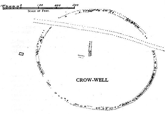
Crow Well settlement (Cowling 1946)

Using the OS-map as a guide, from Denton village head up the road northwest, past Moorside Farm and onto the moor.  Before you reach the rise of Lippersley Pike you’ll reach the Crow Well itself (completely covered over by Yorkshire Water’s handiwork, stopping anyone from drinking the previously fresh waters here).  In the middle of nowhere, just above the completely ruined well, is the old shooter’s cottage and from here, Eric Cowling (1946) told us to look in the heather immediately east. When Richard Stroud and I ventured here a few years back (2.8.5) we couldn’t find a thing — though a vaguely reminiscent structure seemed possible 300 yards away.

Archaeology & History

If the heather’s deep, you’ll have little chance of seeing the site as Eric Cowling (1946) obviously did!  He described and illustrated this place — so was fortunate enough to have ventured here following the heather-burning.

The site is not a stone circle, but what Cowling thought to be an Iron Age settlement: ellipsoid in shape and nearly 400 feet across; it’s obviously an  impressive archaeological site when visible (akin to the Snowden Carr settlement a couple of miles east).  In all probability the site is much earlier than Iron Age.

An aerial image of the site indicates its size to be very close to Cowling’s initial measurements.  The ‘settlement’ is quite huge, with the walling or defining edges being between 4 and 6 yards across in places, with double-walled sections akin to that found at the Brackenhall circle on Shipley Glen, just over 8 miles (13km) to the south.  However, it’s probably much older than its Brackenhall compatriot.  Its maximum diameters measure 130.5 yards (119.3m) roughly east-west and 98.5 yards (90m) roughly north-south, with an external circumference of about 345 yards (315m).  This is a big fella!  Near its centre is a well-defined ring, or ellipse, measuring approximately 20 yards (18.3m) north-south and 18 yards (17.5m) east-west.

It’s difficult to say what this might be without a site analysis, and we need the heather burning back at this site to enable a good inspection of the place!  We may be looking at Denton Moor’s equivalent of the Woofa Bank Enclosure just over 4 miles (6.5km) to the south, above Ilkley, with its host of cup-and-rings and surrounding cairns.  A good inspection of this site is long long overdue…

Hereabouts Cowling also found other remains dating from the neolithic period, including walling, cairns, hut circles and cup-and-ring stones.  He thought that “the name Crow-well appears to be the modern equivalent of ‘the circle of the well'” — and although I doubted this in my Old Stones of Elmet, I have since come to realise the truth of his words!

References:

  1. Bennett, Paul, The Old Stones of Elmet, Capall Bann: Milverton 2001.
  2. Cowling, Eric T., Rombald’s Way: A Prehistory of Mid-Wharfedale, William Walker: Otley 1946.

© Paul Bennett, The Northern Antiquarian

Crow Hill Circle, Midgley Moor, West Yorkshire

Ring Cairn: OS grid reference – SE 026 271

Getting There

Best approached by taking the same direction to the unexcavated Foster Clough ‘enclosure.’ From here, walk towards the walling about 100 yards to your east. Follow it along on the moorside for another 100 yards then follow the small sheep-path up the angle of the slope onto the moor itself. Once you’re at the top and on the level, it’s right ahead of you! If the heather’s deep though, you might as well give up before y’ start! (honest – I went there a while back for a night’s sleep & couldn’t find the damn thing!) But if you’ve made the effort getting here, wander 200 yards towards Crow Hill and keep yer eye out for the large heather-clad tumulus.

Archaeology & History

This site was rediscovered in October 1995, when I was bimbling about on the southern side of Crow Hill. It was one of those good periods, when the heather had been extensively burnt back, so enabling a better examination of the moors for any potential prehistoric remains. I unknowingly walked right into the middle of this small ring of stones with a fella called John Billingsley, who seemed quite unaware of what I was getting excited about until I pointed out to him exactly what we were standing in the middle of! (he couldn’t see what was under his nose, which was a bit weird considering he edits an earth-mystery mag) But I wouldn’t have even been looking for this site, were it not for what happened just a few days earlier…

I was on one of my many ambles across the moortops, which to many people watching would seem like some seemingly aimless, lost soul – an apt description at times! – wandering across the hills (those who know me well, have long called such seemingly aimless treks, Barmy Bennett Expeditions!). It was a lovely day: a shallow snow-cover lay across the moors and as the wind brushed across the earth and up, Her wisps of breath were freezing. But I was well-wrapped and sat, upon occasion, behind the small rock outcrops I was checking for cup-and-rings for shelter when needed. But as the day fell on and the sun touched the western hills, I had to turn for home as the cold was strengthening. Being on the moors at night, in this sort of weather, is never a good idea unless you’ve got your gear with you — and this day I hadn’t. So I set off back for home in Hebden Bridge, in that dreamy sort of state which the hills elicit after a day’s ambling. The colours of Earth and Sky were crisp in the bracing air and as I headed for the footpath towards the old stone known as Churn Milk Joan, I gazed at Crow Hill a half-mile or so away…

Without warning, it came like a thunderbolt up through my dreaming mind: ‘There’s a stone circle over there!‘ came the words. And though the words were quiet and simple, their effect was anything but! I focused quickly – very quickly! My mind staggered out of the dreaming and into the ego state, trying quick to rationalise what had just emerged from my unconscious. An adrenalin rush hit me and amidst the snow-filled hills I started to bound, gazelle-like, across the wibbling moors, straight towards Crow Hill. But then I stopped!

“Wait… She’s nearly dark,” I said to myself. “You’ve no food and there’s gonna be no no light. Come back in a day or two and you’ll have all the time you need to explore.”

And so I wandered back in the dark to the warmth of fire and home and waited a few days, for the Earth to drink Her snow, and hope that the curious intuition — as it had been on numerous other occasions — proved fruitful. And so it did…

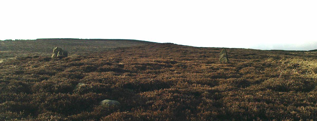
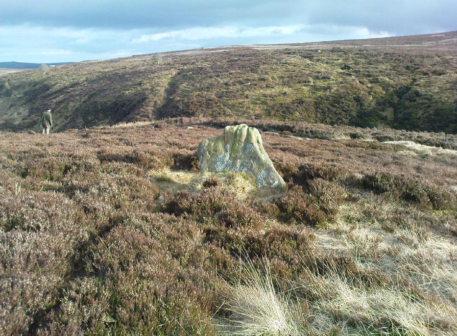
If you can find the place (almost impossible when the heather’s in full growth), you’ll see that this ‘cairn circle’ is little more than 32 feet across, with the tallest stone in the ring little more than 2 feet tall. A curious small squared circle of loose stones exists in the south side of the ring and a raised embankment surrounds the site. Scatterings of small, football-sized stones are found both in, out and at the edge of the circle. (Please note – to those of you who wanna cross-reference – that the photos alleging to show this site on The Megalithic Portal are not of the right place.)

Close by are other neolithic remains, including extensive walling, 2 or 3 other small standing stones and a large tumulus which one rather myopic hobbyist (Mike Haigh) reckoned – in a poor attempt at sarcasm – might be the burial tomb of a successful local farmer.  Hmmmm…..

The site was later described in an article by the same Mike Haigh (in Billingsley’s Aspects of Calderdale) as being discovered by John Billingsley himself, which wasn’t just a mistake but a rather huge lie.  John was there with me when I found it, as he knows full well.  But it seems here we have an example of people who like to try give themselves credit for discovering things that they did not do.*  Even sillier, Mr Billingsley then moaned when I described the site (in my Old Stones of Elmet) without mentioning his name! But in all honesty, if that’s the disreputable way in which they go about their business, what do they expect in return!? (What’s worse is that the site was first described in an article in his own Northern Earth Mysteries mag in 1995, which I co-authored, and then when I asked if he could point out the error and correct it, he ignored the request in just the same way politicians do.  Pure bloody ignorance no less.  But then, he is one of those incoming Southern-types – y’ know the sort…)

This aside: the entire region hereabouts requires considerable archaeological attention as we have here the remains of either a neolithic settlement, or graveyard, or both!

* see the note at the bottom of the ‘About TNA‘ page on such issues.

References:

  1. Abraham, John Harris, Hidden Prehistory around the North West, Kindle 2012.
  2. Bennett, Paul, The Old Stones of Elmet, Capall Bann: Milverton 2001.
  3. Billingsley, J. & Bennett, P., ‘Recent Fieldwork on Midgley Moor,’ in NEM, 65, 1995.

© Paul Bennett, The Northern Antiquarian

Crosley Wood, Gilstead, Bingley, West Yorkshire

Enclosure / Settlement:  OS Grid Reference – SE 1186 3859

Getting Here

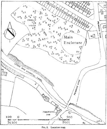
Along the main Aire Valley road (A650) between Cottingley and Bingley, turn right by Beckfoot Grammar School and wander along and up the winding road, over the canal bridge where the Fisherman’s pub is on Primrose Lane.  On the slope above you amidst the scatter of trees on the left-hand side of the road is this Romano-British site (the map below should help).  Check it out!

Archaeology & History

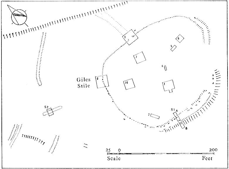
Excavated in the 1960s by the archaeologist P. Mayes, this little-known but reasonably well-preserved enclosure-cum-settlement comprises of a large oval of stone walling, double in places, about 200 feet across at its widest point.

Crosley Wood ground plan (YAJ 42, 1967)
Crosley Woods map (YAJ 42, 1967)

Thought to have been constructed sometime between the Iron Age and Romano-British period, for some reason one of the stones on the western edge has long been given the name of the ‘Giles Stone’ or Stile — though nobody knows for certain why.  It’s about three-feet tall with a smaller upright by its side.  Any other remains that might once have been here were destroyed by the housing estate that sits above here.  When Mr Mayes (1967) and his associates did their work here, cutting across sections of the walling, he told:

“The best preserved section of wall was amongst the trees on the lines of the south wall of the enclosure and included the boulders of both the inner and the outer faces of the wall.  A trench 6ft by 38ft was laid out at right angles to it.  The turf was removed showing the boulders of the wall with the smaller stone filling between them.  On either side of the wall was a relatively small quantity of loosely tumbled stones, the angle of rest of which suggested the wall as their source of origin… Careful examination of the wall filling failed to show any sign of post settings.”

Mr Mayes said that it was “doubtful whether the Crosley Wood site, dated by one pot to the late 3rd or early 4th century AD, was ever conceived of as an occupation site.”  In reference to his excavations he continued, “Certainly no evidence of settled living was found” here, concluding:

“It seems probable that the main enclosure at Crosley Wood served as a cattle pound; its defensive potential being invalidated by the scarp to the north, whilst the short stretches of external walling are all that remains of a rectilinear field system for arable or pastoral farming.”

References:

  1. Mayes, P., ‘Excavations at Crosley Wood, Bingley,’ in Yorkshire Archaeology Journal, volume 42, 1967.

© Paul Bennett, The Northern Antiquarian
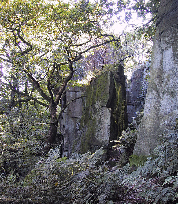

Cowper’s Cross, Ilkley Moor, West Yorkshire

Cross:  OS Grid reference – SE 10223 45609

Also Known as:

  1. Cawper’s Cross

Getting Here

Site shown on 1851 map

From Ilkley town, head up the road as if you’re going to White Wells but keep following the moorland road up towards Whetstone Gate and the TV masts on the very tops (you’ll have to walk the last half-mile).  Shortly before you get them, you can’t miss this relic by the track-side on your right-hand side.

Archaeology & History

Possibly a christianised monolith, erected here in an attempt to divert local people away from the impressive Badger Stone where they may have held springtime gatherings.  There used to be an old monolith laid on the ground a few yards away from the cross, which may have stood upright before the cross was erected. Also on the south-facing side of the cross were four cup-markings, indicating great age.  These may also have been added when the cross was erected. (We know this occurred at other sites in the region, e.g., Churn Milk Joan, Midgley Moor, where such cup-marks were added sometime in the 15th or 16th century.)  However, thanks to some idiotic halfwits in more recent years going up here and vandalizing Cowper’s Cross, the prehistoric cup-markings that were on this relic have been destroyed.  The upright shaft of the cross that’s here now is a re-worked gatepost that replaced the old shaft with its authentic ‘pagan’ carvings.

1920s postcard of Cowper's Cross
1920s postcard of the Cross

But it’s had other bits of bad luck through the years.  The site was struck by lightning many years back, splitting the stone in half, but has since been rebuilt and stands adjacent to its original position, right next to the old Roman road that crosses Ilkley Moor.  Historian Allan Butterfield suggested this site to have originally been an old boundary markstone, christianised many centuries ago.  The name ‘Cowper’ derives from the local Ilkley family of Cawper.

Those of you interested in the early christian history of these moors should also have a look at the little-known Black Knoll Cross, less than a mile south of here in the middle of Morton Moor.

Folklore

Folklore relates that markets were held at this old stone cross many years ago. This gives added weight to the idea that the nearby cup-and-ring marked Badger Stone, where markets were probably held around the time of the equinoxes, was the original site for such gatherings.  Note that another site, the Reva Hill Cross, on the eastern side of this moor, has much the same history.

References:

  1. Bennett, Paul, The Old Stones of Elmet, Capall Bann: Chieveley 2001.
  2. Cowling, E.T., Rombald’s Way, William Walker: Otley 1946.

© Paul Bennett, The Northern Antiquarian 


Cob Stone Field, Keighley, West Yorkshire

Cup-Marked Stone:  OS Grid Reference – SE 00549 40888

Also Known as:

  1. Carving no.1 (Boughey & Vickerman)

Getting Here

Cob Stone with cup-marks on top
Cob Stone its cup-marks

Go through Laycock village and take the left turn along the lovely, hidden country lane towards Slippery Ford (called Todley Hall Road) until you get near the end of this beautiful wooded valley (called Newsholme Dean). Just by Grey Stones Hill, on your left, is a track heading down to a large farm building with numerous rocks and boulders in the fields either side of you.  Stop! – and look in the field on the right.

Archaeology & History

Cluster of cup-marks on top
Cluster of cup-marks

This particular stone is in the field to the right of the track, over the wall, right near the top of the field.  Described for the first time in Boughey & Vickerman’s (2003) survey where they describe “at least eight cups” on the rock; and it’s listed on the MAGIC Map survey as having 6 cups — which are the ones you can plainly see on the very top edge of the stone. What may be three other faint ones can be discerned on the sloping sides of the rock.

Cob Stone Field carving

Another ‘possible’ cup-marked stone can be seen lower down the field, past the large Cob Stone.  There is also another cup-marked stone in the adjacent field at SE 00610 40841 (listed as stone no.2 in Boughey & Vickerman, 2003) with apparently 17 cups on the large rock there, but this can be difficult to see unless lighting conditions are just right.

References:

  1. Boughey, Keith & Vickerman, E.A., Prehistoric Rock Art of the West Riding, West Yorkshire Archaeology Service 2003.

© Paul Bennett, The Northern Antiquarian
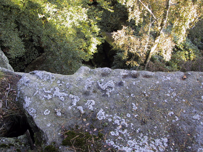

Cleatop, Settle, North Yorkshire

Stone Circle (destroyed):  OS grid-reference – SD 821 613

Also known as:

  1. Druid’s Hill Circle
  2. Druid’s Circle

Archaeology & History

Speight's 1895 map - showing position of circle
Speight’s 1895 map – showing position of circle

Not included in any previous archaeological surveys of megalithic rings, this circle of stones was apparently visible from quite a distance away, sitting on the hillside where now there is woodland.  It was described by the great Yorkshire historian Harry Speight (1892, 1895), though today it seems that all remains of it have vanished.

An early description of it came after an excursion to the site by local antiquarians, who told that “at Cleatop, about a mile to the south of Settle, are the remains of an ancient stone circle.” (Horsfall-Turner 1888) A few years later, Mr Speight gave us more details of the place, saying:

“A little above Cleatop Farm (near Rathmell)…is Cleatop Wood.  Cleatop derives its name from the A.S. cleof, a rocky aclivity; Latin clivus, a bank or slope. Near the northeast side of the wood there was once a very noticeable Druid’s Circle, about 60 feet in diameter; indeed, Mr Thomas Brayshaw of Settle, informs me that within the memory of persons still living, it was so regular and well-defined that one or two gaps caused by the removal of stones could be easily distinguished. The eminence at the rear of the site has, from time immemorial, been known as Druid’s Hill.”

Some years later, that very same local historian Tom Brayshaw (1932) wrote:

“The Ordnance map marks, on the steep slope to the north of Cleatop Wood, ‘site of Stone Circle’.  It needs a very keen eye to identify the few stumps that remain today, and it is deplorable that this most interesting monument, after enduring for so many centuries, has been destroyed during the last eighty years.  In 1847 a description of the circle, as it then was, was sent to Captain Yolland of the Ordnance Survey.

“”I suppose the circle of stones in Cleatop High Park to be aboriginal British or Druidical remains from the following appearances: the circle is complete and the large stones are set on end, some of them several tons weight.  The stones are twelve in number now standing, beside several others that seem to be rolled a short distance, as it is placed on the ascent of a steep hill and commands a beautiful and extensive prospect (more so than any given point of the same altitude in the vicinity).  The circle is 36 feet in diameter.”

“A few stones were still standing in 1883.  The hill above long bore the name Druids Hill.  The Enclosure Acts passed towards the end of the 18th century greatly increased the number of drystone walls in the parish, and it is probable that many old stone monuments were destroyed in making them and in their subsequent repair”.

We have no references of burials or other excavations here to give us any idea of whether human remains had ever been found.  It’s an intriguing place in the landscape though…and worthy of further explorations…

References:

  1. Brayshaw, Thomas, A History of the Ancient Parish of Giggleswick, Halton & Co.: London 1932.
  2. Horsfall-Turner, J. (ed.), ‘Antiquarian Excursion to Giggleswick and Settle,’ in Yorkshire Folklore Journal, vol.1, T. Harrison: Bingley 1888.
  3. Speight, Harry, The Craven and Northwest Yorkshire Highlands, Elliott Stock: London 1892.
  4. Speight, Harry, Tramps and Drives in the Craven Highlands, Elliot Stock: London 1895.

© Paul Bennett, The Northern Antiquarian
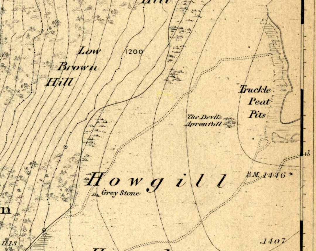

Castleberg, Nesfield, North Yorkshire

Hillfort:  OS Grid Reference – SE 0925 4947

Getting Here

Two main ways to get here.  Hmmmm….on second thoughts, one main way.  My preferred route would be from Addingham (east-side) where the foot-bridge crosses the Wharfe.  Walk up the path and, eventually, onto the tidgy road and bear left till you hit the trees.  On the right-hand side of the road you’ll see the trees covering the crop near the edge of the river. …Otherwise, come from Ilkley, cross the river, take the first left, on a few hundred yards and left again on Nesfield Road.  From here, keep walking about a mile and when you hit the village, you need to look into the field behind the first farmhouse on your left.

Archaeology & History

You’ll see the more visible embankments on the western edge of these old earthworks. But unless you’re a real archaeomaniac into depleted field remains, this might not tickle your neurons too much. However, it’s a gorgeous little hamlet is Nesfield – and I think that alone makes it worthy of a visit!

Cowling's 1946 plan
Cowling’s 1946 plan

Described variously over the years as an enclosure, a hillfort, a camp, a settlement – aswell as being ascribed to periods from the medieval, Roman, Iron Age and Bronze, the consensus opinion at the moment edges to it being late Bronze- to early Iron Age in origin.

The fortifications themselves seem to have been first mentioned by T.D. Whitaker in 1812, who said the following:

“Castleberg is in a commanding position, on the brink of a steep slope washed by the Wharfe, about two miles above Ilkley. This post is naturally strong, as the ground declines rapidly in every other direction. But it has been fortified on the more accessible sides by a deep trench, enclosing several acres of ground, of an irregular quadrangular form. At a small distance within the enclosure, an urn with ashes was lately found, but what seems to evince beyond a doubt, the Castleberg was a Roman work, is the discovery of a massy key of copper, nearly two feet in length, which,” he thought, “had probably been the key of the gates.”

This ‘key’ that Whitaker mentioned (if memory serves me right) has been lost and therefore its nature/function lost aswell.  E.T. Cowling (1946) thought the key “may refer to a bronze article of a size which must belong to the Late Bronze Age, when the metal became more plentiful”; thinking it perhaps to be part of a sword.  Twouldst be good to find this artifact and know for certain. Cowling also posited that the urn found here was of Bronze Age origin – an opinion echoed by later archaeologists.

The great Harry Speight (1900) meanwhile, told that the hamlet itself was locally called Castleberg and told us a bit more of the details of the finds, saying:

“I am disposed to think it was a winter-station of the old Britons of Howber, and afterwards of the Teutonic settlers.  An urn containing ashes has been found on the site, and Mr James Pickard, who has long occupied the adjoining farm, tells me he has excavated several parts of it and found human bones, but no relics.  This premises Anglo-Saxon interments and the urn late British…”

References:

  1. Cowling, E.T. Rombald’s Way, William Walker: Otley 1946.
  2. Howson, William, An Illustrated Guide to the Curiosities of Craven, Whittaker: Settle 1850.
  3. Keighley, J.J., ‘The Prehistoric Period,’ in Faull & Moorhouse’s, West Yorkshire, An Archaeological Guide, vol.1, Wakefield 1981.
  4. Speight, Harry, Upper Wharfedale, Elliott Stock: London 1900.
  5. Whitaker, T.D., History and Antiquities of the Deanery of Craven, J. Nichols: London 1812.

© Paul Bennett, The Northern Antiquarian
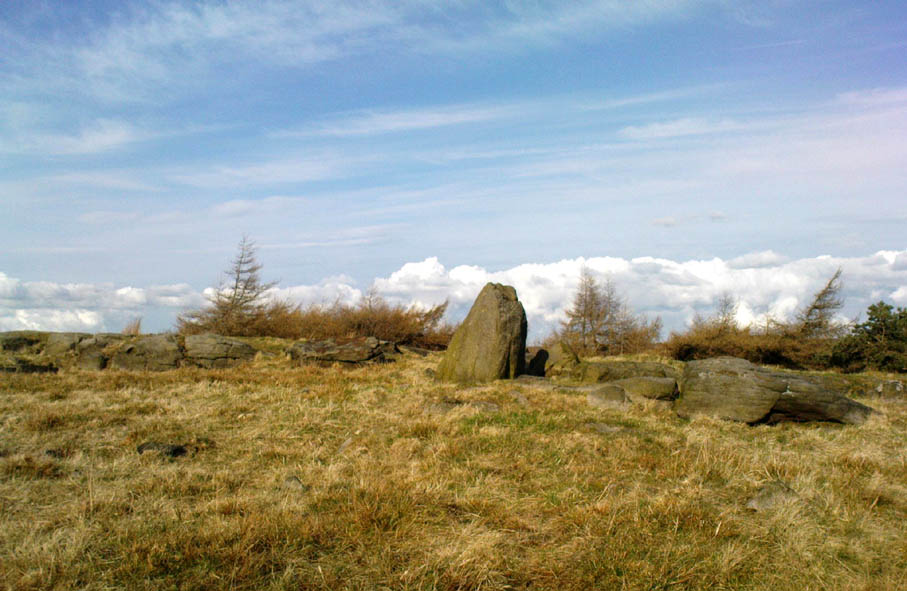

Calverley Woods (12), Leeds, West Yorkshire

Cup-Marked Stone:  OS Grid Reference – SE 2006 3790

Also Known as

  1. Carving no.12 (Boughey & Vickerman)

Getting Here

Lost Cup-Marked Stone, Calverley Woods

Troublesome really, as it’s got lost somewhere amidst the undergrowth.  From the valley bottom at Apperley Bridge, take the road-then-track which goes up thru the Calverley Cutting (as locals call it), turning left along the dirt-track just as the track begins to slope uphill.  Go past the detached house in the edge of the trees and shortly past there is a small footpath taking you into the trees on your left,  Walk down and along here, near the bottom of the tree-line above the walling.  If you find it, let us know!

Archaeology & History

Included in Boughey & Vickerman’s (2003) survey as ‘stone 12’ – it was first described by Sidney Jackson in 1954, who later gave us a map and drawing of the stone.  I looked for it several times x-number of years back, but never found it (though was led astray a little by the profusion of Amanitas in the locale!).  Comprising at least 18 cup-markings on a generally flat rock surface, to this day the carving remains unfound, though is probably under the herbage hereabouts.  The same fate seems to have befallen the West Woods 1 and West Woods 2 carvings in another part of the same woods.  Does anyone know what’s become of them?

References:

  1. Bennett, Paul, “The Undiscovered Old Stones of Calverley Woods,” in Earth no.2, 1986.
  2. Boughey, Keith & Vickerman, E.A., Prehistoric Rock Art of the West Riding, West Yorkshire Archaeology Service 2003.
  3. Jackson, Sidney (ed.), ‘Calverley Wood Cup-Marked Rock,’ in Bradford Cartwright Hall Archaeology Group Bulletin, 1:1, 1954.
  4. Jackson, Sidney (ed.), ‘Cup-Marked Boulder in Calverley Wood,’ in Bradford Cartwright Hall Archaeology Group Bulletin, 1:7, 1955.
  5. Jackson, Sidney (ed.), ‘Cup-and-Ring Boulders near Calverley,’ in Bradford Cartwright Hall Archaeology Group Bulletin, 1:16, 1956.

© Paul Bennett, The Northern Antiquarian 

Busky Dike Druidical Altar, Fewston, North Yorkshire

Legendary Rocks (destroyed):  OS Grid Reference – SE 187 545

Archaeology & History

The original position and nature of this site was difficult to ascertain and left us wondering whether the place was once a monolith, stone circle or legendary rock outcrop, as seemed that there were no remains left of the place.  Aswell as that, the only reference we had that describing this place is from William Grainge’s History of Knaresborough (1871), where he wrote:

“At Busky Dike, a place between Cragg Hall and Fewston, according to the report of tradition, there once existed a Druidical altar; and that same venerable authority declares that the same place is the haunt of a Bharguest; and many of the country people yet tremble as they pass that place in the dark, for fear they should meet that strange and terrible beast.”

The latter remark would indicate that something decidely pre-christian was once of renown here.  But it seems that an old rock outcrop was the place in question here, found in the now wooded area on the south side of the Busky Dike Road, just northwest a half-mile outside of Fewston itself.  It would be good to hear more about this place…if anyone knows owt…

References:

  1. Grainge, William, The History of Harrogate and the Forest of Knaresborough, 1871.
  2. Grainge, William, The History and Topography of Little Timble, Great Timble and the Hamlet of Snowden, William Walker: Otley 1895.

© Paul BennettThe Northern Antiquarian


Brink Ends Cairn, Dovestones Moor, Wycoller, Lancashire

Cairn:  OS Grid Reference – SD 96138 42296

Getting Here

Best way to get up here is to start from the old hall and haunted bridge at Wycoller. From here walk upstream, on the footpath on the south side. It wibbles about following the waters for a half-mile until the moors open up when you reach an old stile, past which is another bridge over the stream. Walk past this (keep on the same side) for another 50 yards, then walk up the hillside where, if the vegetation is low, you can just see a decent-sized collection of rocks. This is the old cairn.

Archaeology & History

I don’t think the site is in the Lancashire archaeological register, but it’s described in John Bentley’s fine local history work, Portrait of Wycoller from 1975. He told that,

“a suspected Bronze Age burial mound at Brink Ends in Wycoller was excavated by Stanley Cookson in 1971 and 1972. Although no interment was discovered, the remains of a fire was found in the centre of the mound with half-burnt twigs and coal.”

Brink Ends Cairn, Wycoller

It’s not unlike some of the giant cairns on Ilkley Moor and elsewhere, though not as big, nor as high, being only about 22-24 feet across. Some of the stones have evidently been taken for use in the local walling, and the ‘cairn’ is in a pretty abject state. It’s a bittova odd spot to be honest. Not 100% sure what to make of it – though flints, arrowheads and similar implements have been found on the moors here close by. Bentley (1975) also told how “Stanley Cookson had strong suspicions that an Iron Age settlement existed in this area, but only time and further exploration will tell.” A sentiment I tend to agree with. And on our first and only visit here — during one helluvan awesome downpour all day — what seemed like an Iron Age hut circle was noted a few hundred yards to the south; though we got so saturated that day that we decided to turn for home soon after looking at this cairn.

Cookson and Hindle (1985) later described this site as a “middle Bronze Age burial cairn of 1400 to 900 BC, adding:

“The 34ft diameter inner circle was excavated during 1956-58 disclosing flints, a hearth with an abundance of charcoal, and four pieces of coal on a round, heavily burnt stone.”

More visits to these moors to check for other archaeological sites are needed in the near future to see what else might be on these unexplored moors.

References:

  1. Bentley, John, Portrait of Wycoller, Nelson Local History Society 1975.
  2. Cookson, Stanley & Hindle, Herbert, Wycoller Country Park, H.Hindle: Colne 1985.

© Paul Bennett, The Northern Antiquarian