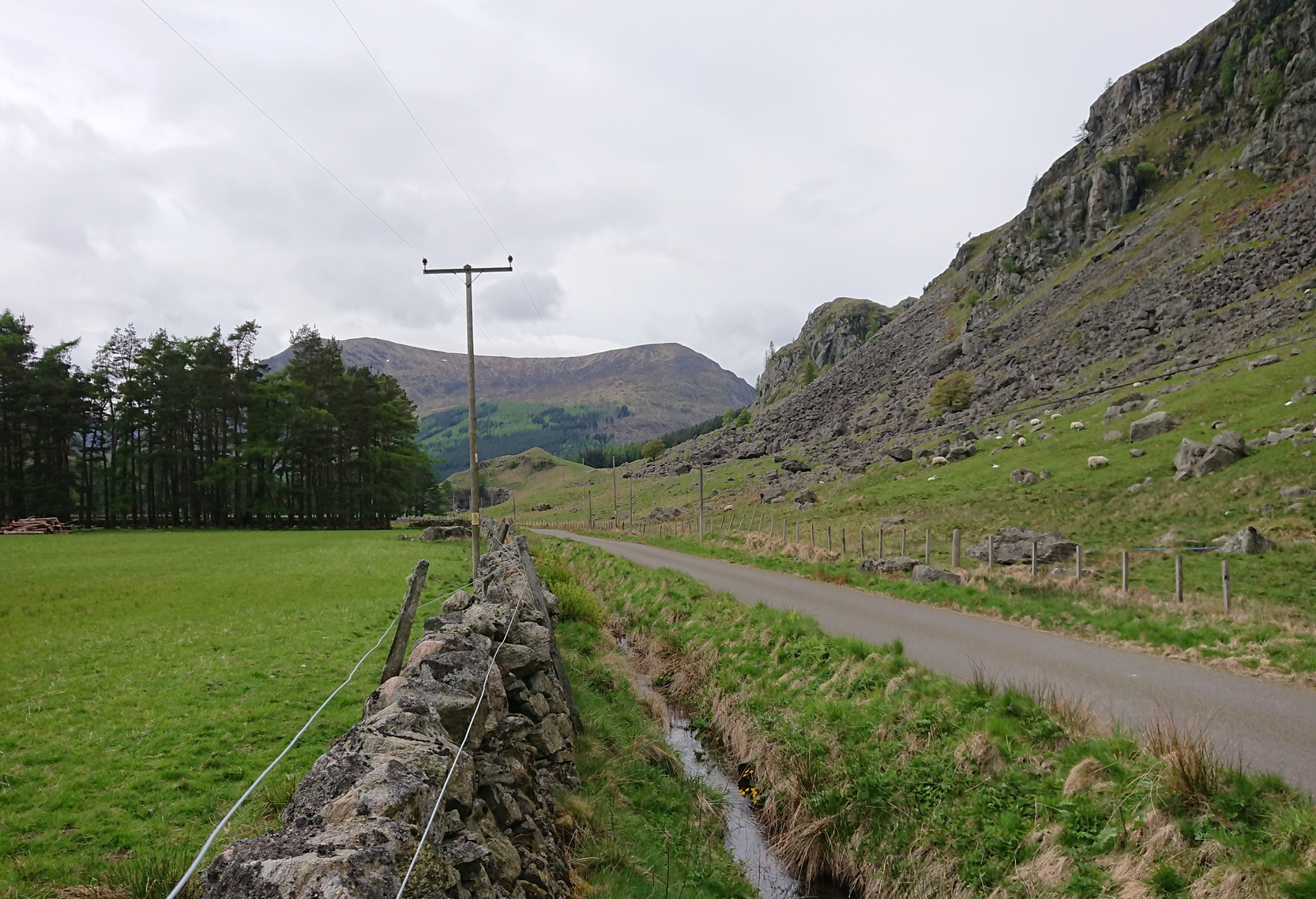
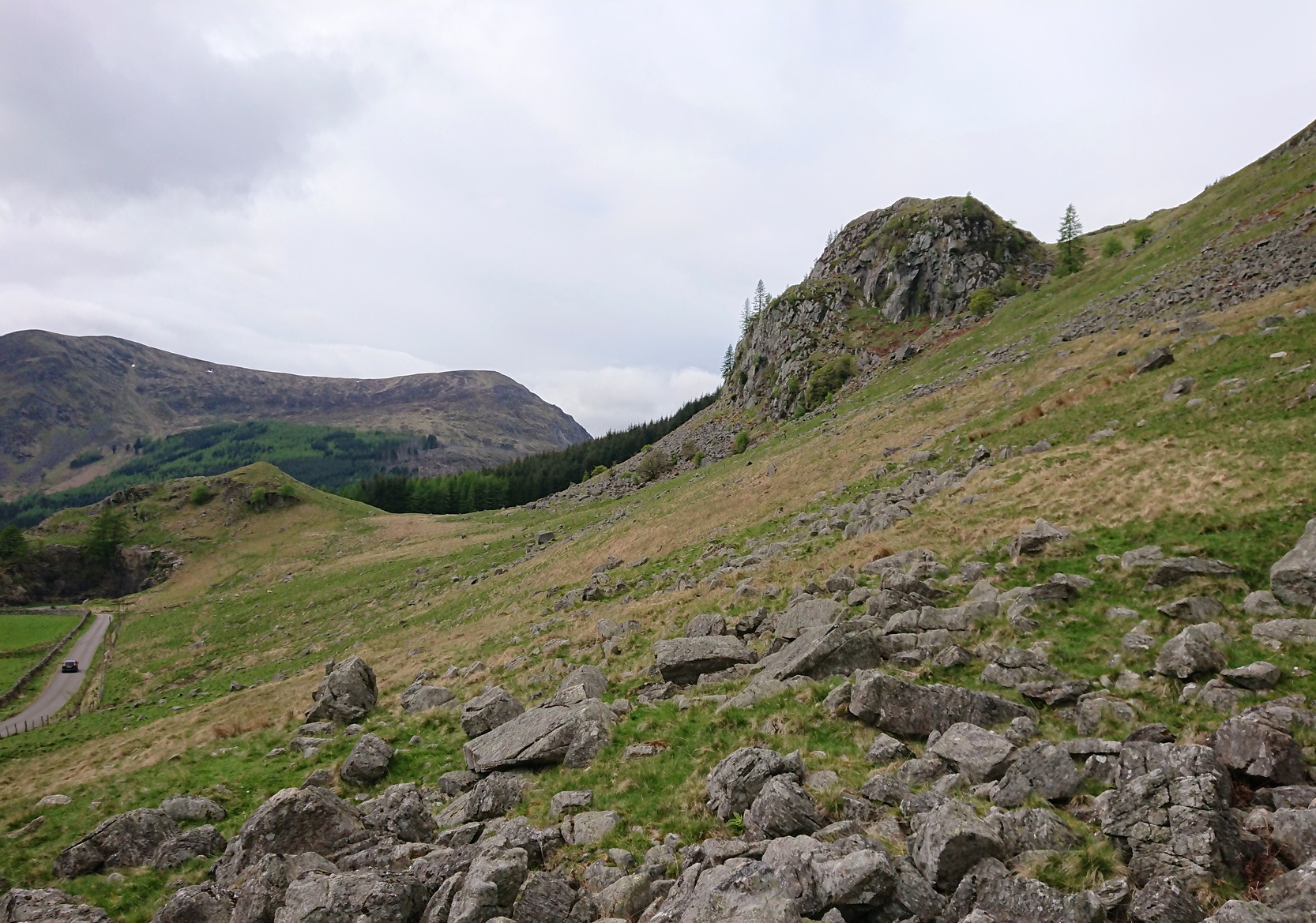
From Kirriemuir town centre up the B956 Kinnordy Road, turn left where it goes along the B955 road for several miles towards Cortachy. Keep going on the B955 for a few more miles into Glen Clova, past the Caddam stone and eventually, after going over the bridge into Clova village, you turn left and go up towards the mountains. Nearly 3 miles along you see the very conspicuous and impressive rising crag, like a small volcano on the right-hand side of the road, which is Dun Mor. Walk up the steep climb round to the back of it – and you’re in the middle of the old ruins…
Archaeology & History
Highlighted on the 1865 OS map of the region, Dun Mor is Gaelic for a “large or great fort” – and such it is! Those of you with a nose for these sorts o’ things will no doubt take to the remains pretty quickly. Its position in the landscape is a bit of a gem! On its north-side— invisible to anyone in the glen below—an overgrown arc of walling some 3 feet high and about 70 yards long bends towards the crag of rocks on each side, with a notable “dip” or entrance about 8 feet wide in the middle of it. The walling itself averages about 4 yards wide all along its arc.
The crag of Dun Mor
It’s quite impressive once you get a good feel of the place and envisage it as it once was. The sheltered fortress within the rise of Nature’s crags is about 100 yards across and would be ample space for several families to live in when it was first built, in those mythic times of so so long ago. It was probably constructed in the Iron Age, although several ruined rectangular stone structures inside it are thought to be mediaeval shelters; and even in those more recent times, the people here would have regularly heard the howl of the wolves, whose names are kept in the hills above as reminders of a world not too long past….
The only real way to get here is via Kirriemuir. Head north to the hamlet of Cortachy and past it, as you enter Glen Clova, where the road splits make sure you bear to the left-hand (western) side. Nearly 5½ miles along, keep your eyes peeled on your right where you can’t really miss it. The stone’s less than 100 yards into the field. …It may perhaps be a bit easier if you take the eastern road of the glen all the way to Clova village. Turn right from there, over the small river bridge and as it curves to go back down the glen, a half-mile along you pass Caddam house. Keep going for another 500 yards and you’ll notice it in the field.
Archaeology & History
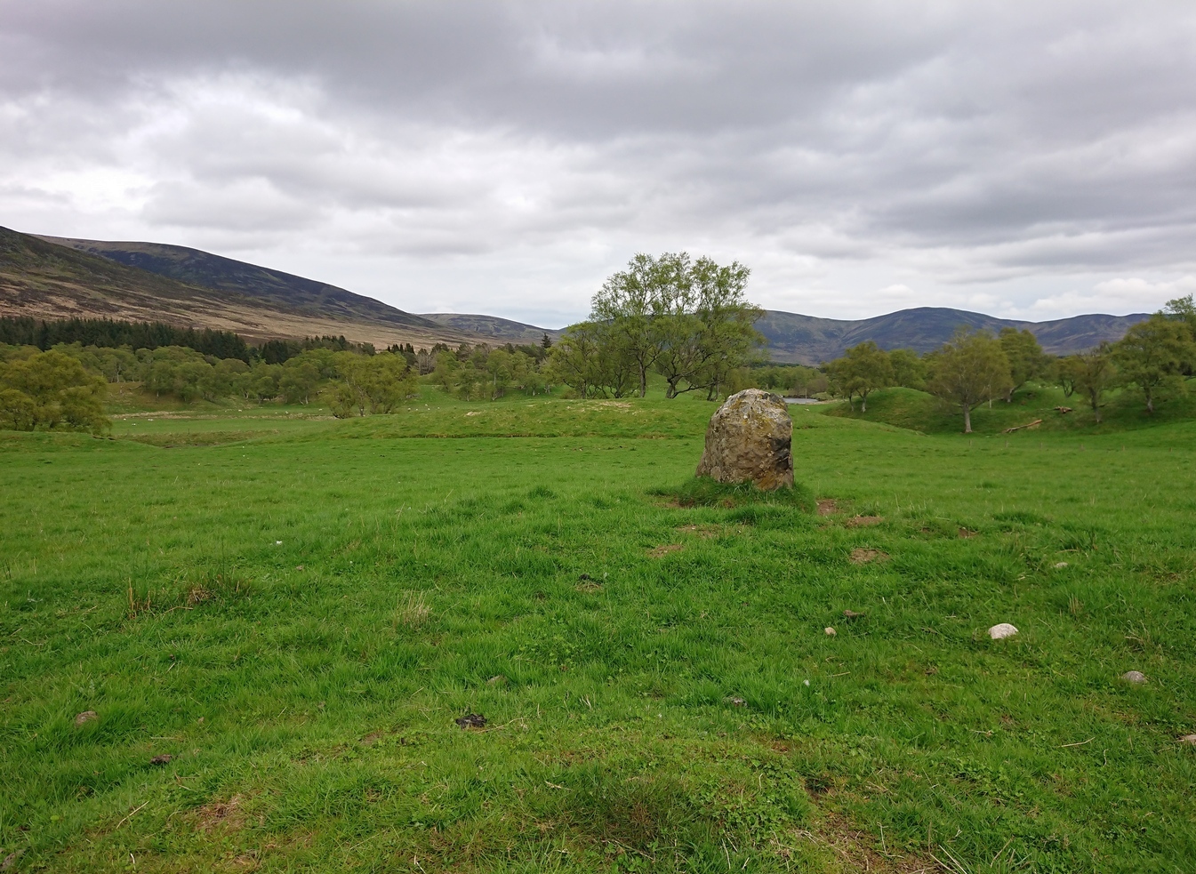
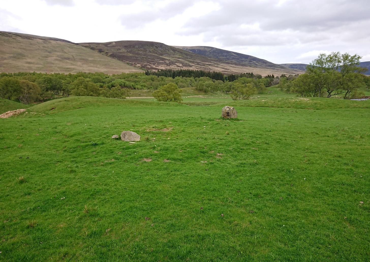
Stone and its hut circle
Not to be confused with the ruined stone circle of the same name 10 miles to the south, this small standing stone—only some three feet in height—is at the eastern edge of a small overgrown hut circle measuring some 3 yards by 4 yards across. You can just make out the overgrown low walling in the second photo (right). The stone probably had some architectural relationship with the hut circle, but without an excavation we can’t know for certain what that relationship might have been. A settlement of much larger hut circles can be found on the other side of the river, near Rottal, two miles southeast of here.
Cup-Marked Stone (lost): OS Grid Reference – NO 0617 2328
Archaeology & History
Site shown on 1933 map
First highlighted on the 1933 OS-map of the area, it was located alongside the old fence-line hereby, but no subsequent description of the carving has been made since then. A small boulder and a number of other stones can be found along the line of fencing, but none seem to be possessed of petroglyphs and apart from it being shown on the old maps, I can find no reference or description of it. It may have been destroyed. Some researchers have wondered if the carving was mistakenly marked at this spot by surveyors who confused it with another one more than 500 yards to the southeast (and described by Fred Coles in 1903), but this would seem an unlikely error to have been made. Whilst this was described as a simple “cup-marked stone”, its neighbour at West Lamberkine (2) was a distinct and more complex cup-and-ring design.
References:
Coles, Fred, “Notices of …(4) of Some Hitherto Undescribed Cup-and-ring-marked Stones…” in Proceedings Society Antiquaries Scotland, volume 37, 1903.
Acknowledgements:Many thanks for use of the Ordnance Survey map in this site profile, reproduced with the kind permission of the National Library of Scotland.
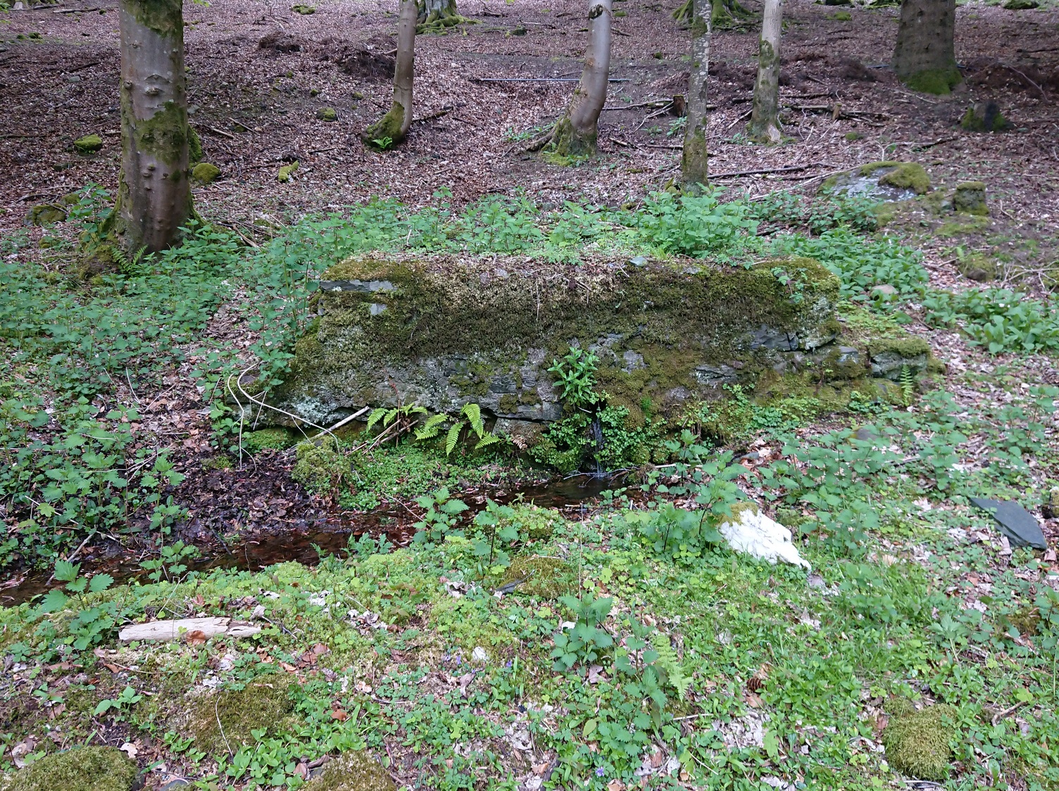
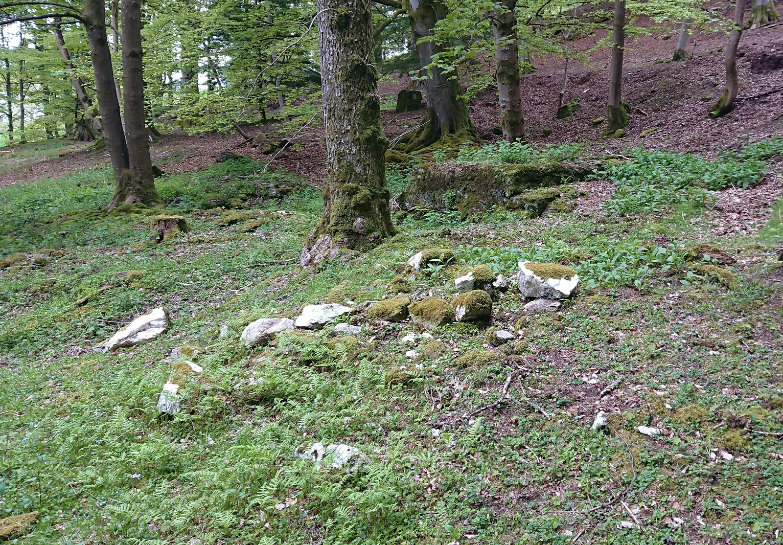
A long long way to go for a single little spring! From Kirriemuir town centre go up the B956 Kinnordy Road, going straight across at the crossroads up the countryside lane towards Lednathie (signposted 8 miles): dead straight, long-and-winding, up-and-over…. Stick to this single road, all along, ignoring all turn-off junctions until, once reaching the hamlet of Easter Lednathie, stay awake for the turn up to Glenprosen, 2 miles along, over the bridge. Turn left and a few hundred yards along go over the next little bridge until you reach the “Private Road” sign, then walk up the track past Katy’s Cottage. ¾-mile along just before Balnaboth, keep your eyes peeled to the left for a splatter of quartz rocks with a spring of water thereby. At long long last, you’ve reached your destination!
Archaeology & History
A “splatter of quartz rocks”
Miles to the winding north of Kirriemuir, in the depth of the olde mountains, this clear spring of iron-bearing water (still fresh and drinkable) was, earlier in the 20th century, covered over by someone-or-other and surrounded by straight slabs of stone. The waters were maintained however, by the builders who cut a small hole into the moss-embolded rock allowing this pure water to still run freely for all to use…
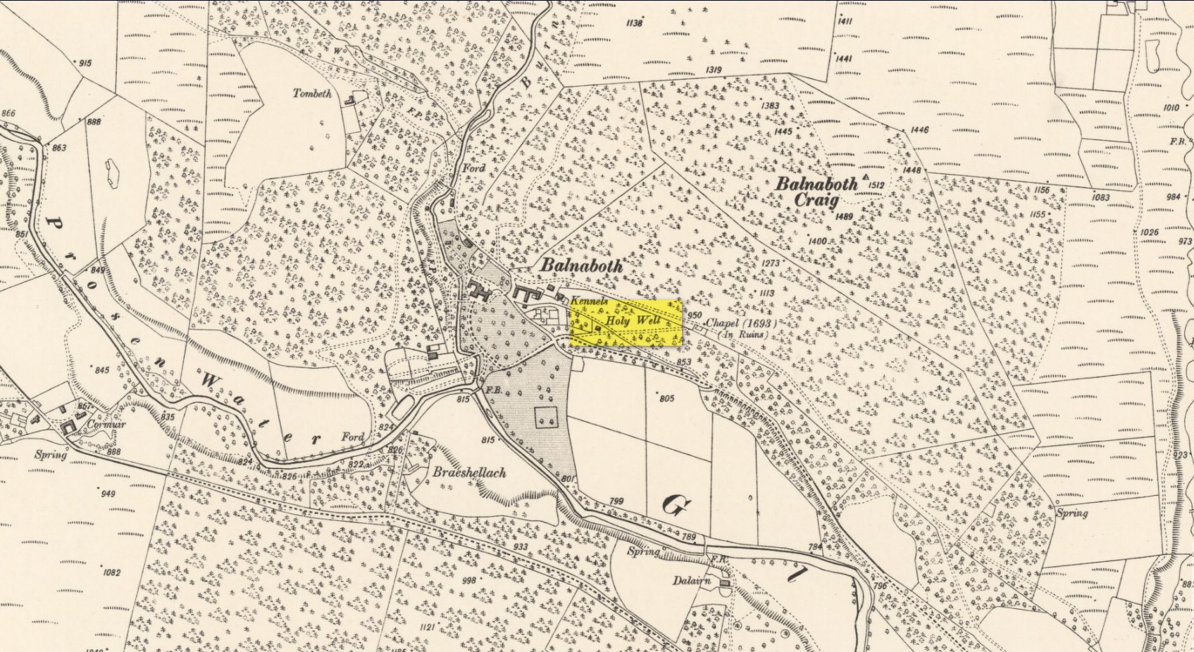
Shown on the early OS-maps, its sacrality or holy association would seem to be lost from the tongues of the older folk, most of whom seem long gone from this beautiful glen-to-nowhere. The only remaining religious connection we might have relating to the place comes from the ruined 17th century chapel less than 250 yards away to the west on the slope above the track, from where a singular stone-lined footpath runs dead straight to the well.
Site shown on 1900 OS-map
But another important feature found here is the large scatter of quartz rocks a few yards away from the water source. They are in disarray but would seem to have once been built around the spring where it first emerged from beneath the ground, then being cast aside to their present positions when the more modern stone structure was built above it. We can’t prove this with any certainty, but there are a number of other holy wells with this quartz-defining feature elsewhere in Scotland: the St Mary’s Well at Callander and Beltane Well of Kenmore to name just two.
References:
Robertson, D.O., Long-Ago Legends of Clova, W.P. Nimmo: Edinburgh 1872.
Acknowledgements:Huge thanks for use of the Ordnance Survey map in this site profile, reproduced with the kind permission of the National Library of Scotland.
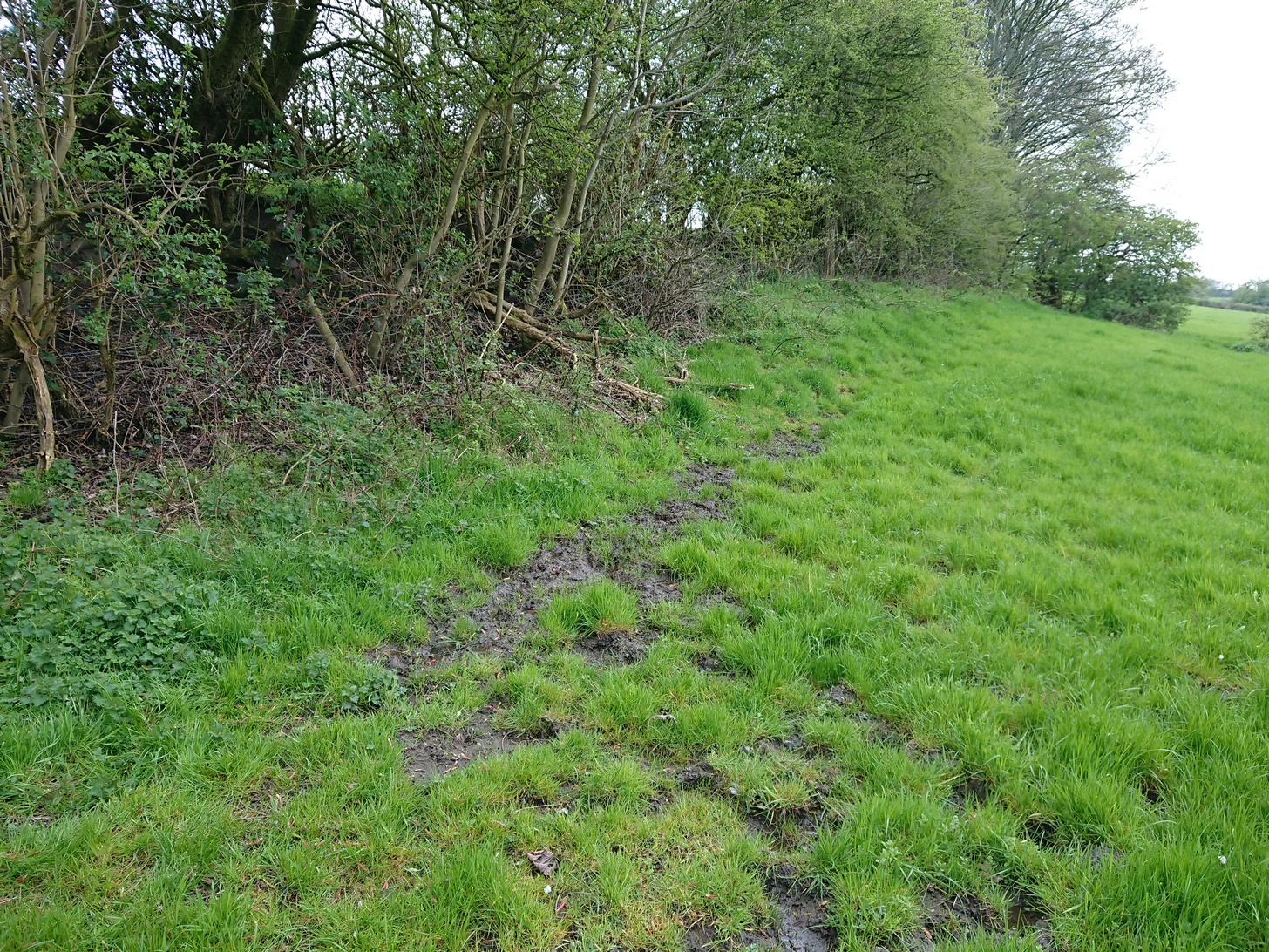
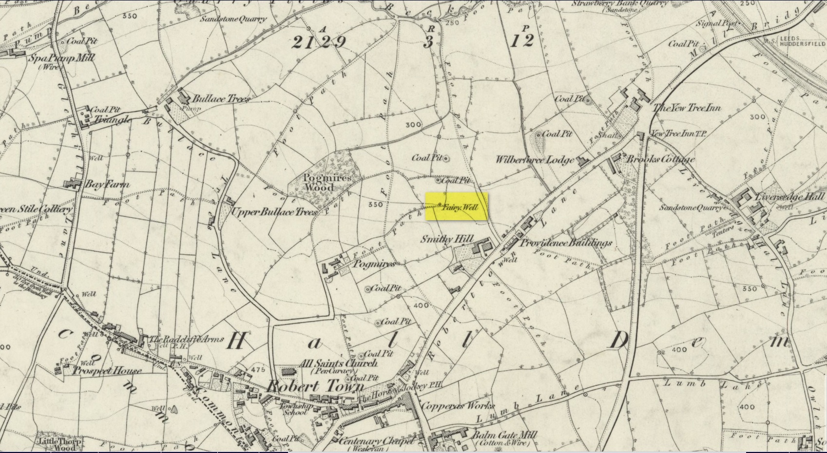
Best approached from Heckmondwike/Liversedge and going up Roberttown Road where, just past the Spen Valley High School parking spot, an almost dead straight footpath takes you down (northwest) into the woods. Walk down here for about 100 yards and then go left over the stile into the small copse of trees. Once you come out the trees at the other side, walk up the slope in the field that you’re now in. As you approach the line of trees at the top, you’ll notice the ground gets very boggy. Look carefully under the trees and you’ll notice an embedded flat stone protruding out and a somewhat trivial trickle of water into the grass at the front. That’s it!
Archaeology & History
Site on the 1854 OS-map
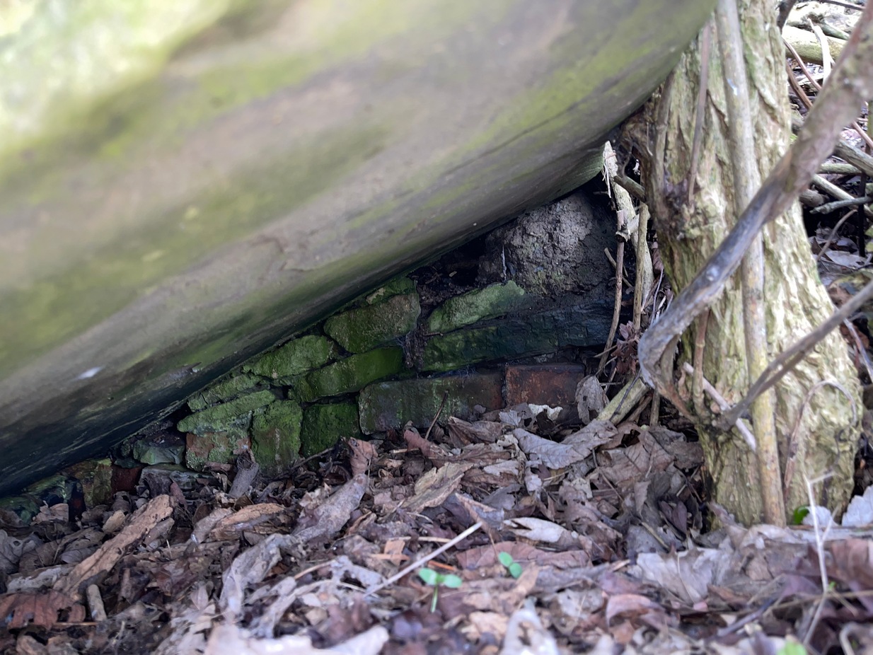
Highlighted on the 1854 Ordnance survey map of the area, this is a somewhat ruinous site which has seen better days. Even after good downpours it’s not very obvious and, in truth, could do with being cleaned-up, cleared out, and brought back into the old life it once had. If you look carefully beneath the roots of the covering tree, you’ll notice a decent-sized flat worked stone sticking out at the bottom of the sycamore and below this, at the back, almost covered in earth, you can make out some brick walling at the rear. It takes some finding! This is evidently the remains of a small protective well-house, now in total ruin.
Old cover of the well
When we visited the place a few weeks ago, there seemed to be no water inside. Instead, the water emerges into a small bog just below the tree-line a few yards away from the covering slab from whence it originally flowed.
Folklore
Obviously the abode of fairy folk in bygone days, all trace of the folklore and habits of them seems to have been lost long ago….
Acknowledgements: Huge thanks to mi old mate Gary Ferner for helping us uncover the source of the waters, which was almost completely covered in soil.
Holy Well (destroyed): OS Grid Reference – SE 2997 5561
Also Known as:
St. George’s Spa
Archaeology & History
About 50 yards away from the Royal Promenade on the east-side of Parliament Street, there used to flow the healing waters of an old holy well, that later became one of Harrogate’s many spa wells. It was first recognized as a medicinal spring about 1792 when Thomas Garnett (1794) uncovered it beneath the overgrowth of vegetation surrounding the spring-head. In doing so, it became evident that at some time in the past it had been used by local people as,
“a wall was discovered round the spring, but whether this had been built with an idea of its being a medicinal water, or with an intention of collecting water for cattle, I cannot determine.”
Chalybeate (iron-bearing) in nature, the waters were analyzed by Adam Hunter (1830) in the 1820s and, although possessed of soluble iron, had less than its medicinal compatriots nearby, meaning that its fortifying qualities weren’t quite as good. He told us how,
“it had been known (by locals) for many years, but at no time much used internally; it had acquired some celebrity however as a wash for sore eyes, for which purpose it was well adapted. As chalybeate water has long been a favourite popular remedy for a wash in various weaknesses, and chronic affections of the eyes, it is proper to state that (the nearby) John’s Well, the Tewit Spa, or the succeeding one at Starbeck, are the only three chalybeates which can at present be recommended for that purpose.”
A few years after Hunter had been here, the well was destroyed “by the making of a highway drain.” (Jennings 1981)
Folklore
St George (saint’s day – April 23) was one of the christian dragon-killers. There is no known tradition of the saint or festivities that may once have occured here.
References:
Garnett, Thomas, A Treatise on the Mineral Waters of Harrogate, Thomas Gill: Leeds 1794.
Hunter, Adam, The Waters of Harrogate and its Vicinity, Langdale: Harrogate 1830.
Jennings, Bernard, A History of the Wells and Springs of Harrogate, Interprint: Harrogate 1981.
Very little is now known about this sacred site that was once found “a few hundred yards east from the New Church at Low Harrogate.” (Hunter 1830) Even most of travellers and medical experts who wrote about the numerous Harrogate wells in the 18th and 19th century bypassed its quietude; and by the time Mr Hunter wrote about it in his great descriptive catalogue, its healing or medicinal qualities had been forgotten.
He told that “the spirit in the water…or that with which it is infused, has long been most actively engaged in adding real or fancied comforts to the (Harrogate) Fair, and is now in much more general use” than the two other holy wells in the town. It was, he said, “the best water for making tea and more extensively used for that purpose than any in the neighborhood of Harrogate.” It would also appear to have been built over at some time in the not-too-distant past…
Folklore
St Ann (saint’s day – July 26) was a giant in early christian and Islamic myths. An apocryphal figure, She was the Great Mother of the mother of Christ—the Virgin Mary—and was Herself a Virgin until, in Her old age, after seeing a bird feeding a chick, decided She wanted a child and so eventually gave birth to Mary. An old woman giving birth when the Springtime appears (when birds and other animals become fertile) is the same motif found in the lore of the Cailleach in Ireland and Scotland (and parts of northern England). Pre-christian lore at this old well would seem evident here.
References:
Hunter, Adam, The Waters of Harrogate and its Vicinity, Langdale: Harrogate 1830.
Healing Well (covered): OS Grid Reference – TQ 6000 3963
Archaeology & History
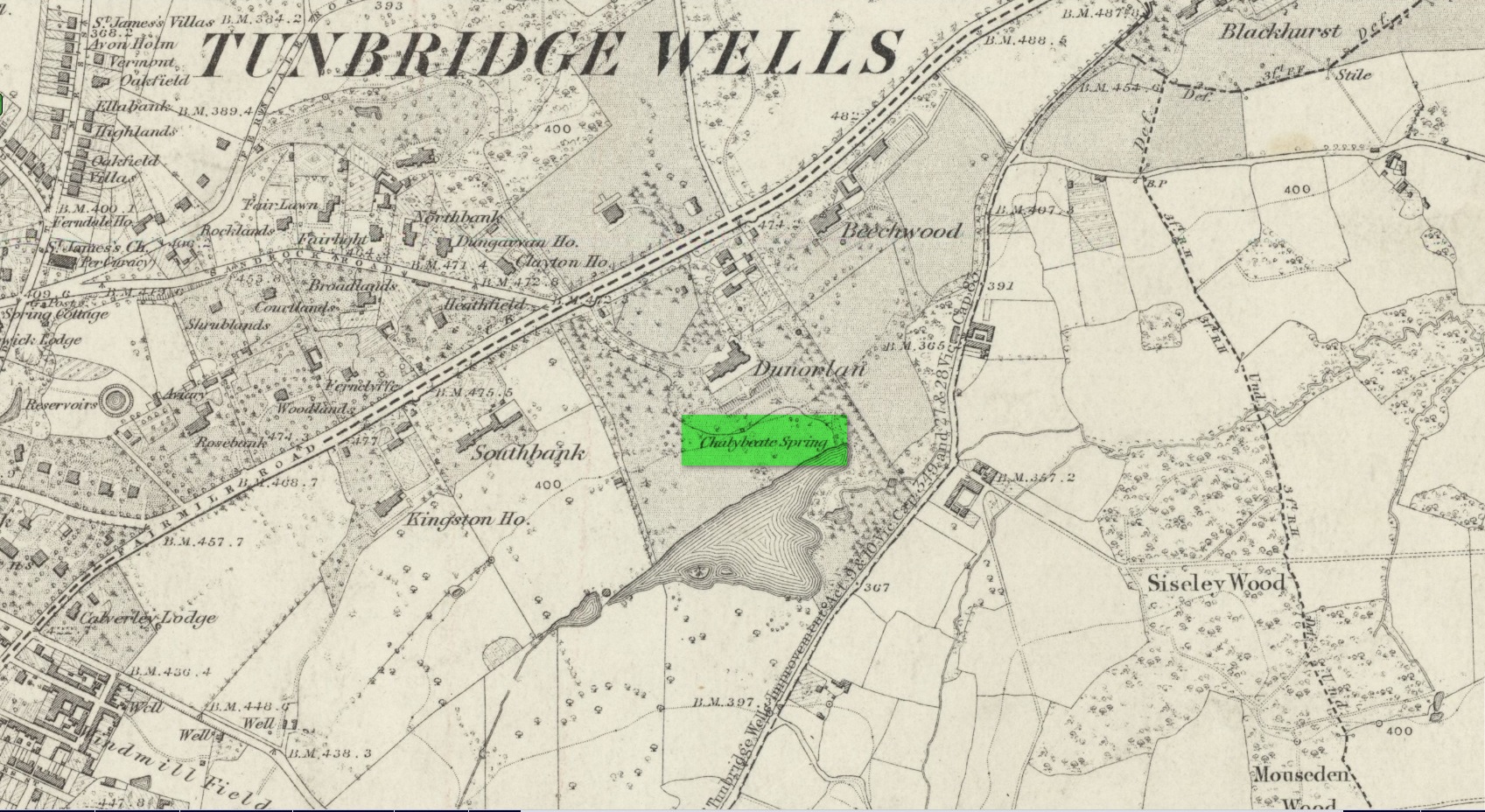
Shown on early OS maps as a chalybeate spring, the denuded remains of this site can still be seen in Dunorlan Park, between the tearoom and the lake, where the spring can be seen on the left beneath a large tree. It was first described in John Britton’s (1832) famous account of the area, who told us:
Site shown on 1872 map
“There is a spring, called Burnt House Spring, situated in a little dell, in a romantic spot to the right of the road leading from Tunbridge Wells to Pembury. It is a good chalybeate, and the iron is in a state of carbonate. This spring rises rapidly into a stone basin, placed in the centre of a circular excavation, about ten feet in diameter and six or eight feet deep, which is bricked round, and with the remains of stone steps leading down to the basin at the bottom. This spring, therefore, has clearly been, at some time, made use of as a medicinal water. It was accidentally discovered choked up with rubbish. The country about Tunbridge Wells abounds with springs of this character.”
The spring was cleaned up some time ago and its waters rise in a square stone-lined chamber—accessed by four stone steps—into a circular stone basin, before flowing down a short channel and into the drains. I’ve no idea whether or not the water is still drinkable.
References:
Britton, John, Descriptive Sketches of Tunbridge Wells and Calverley Estate, Longman: London 1832.
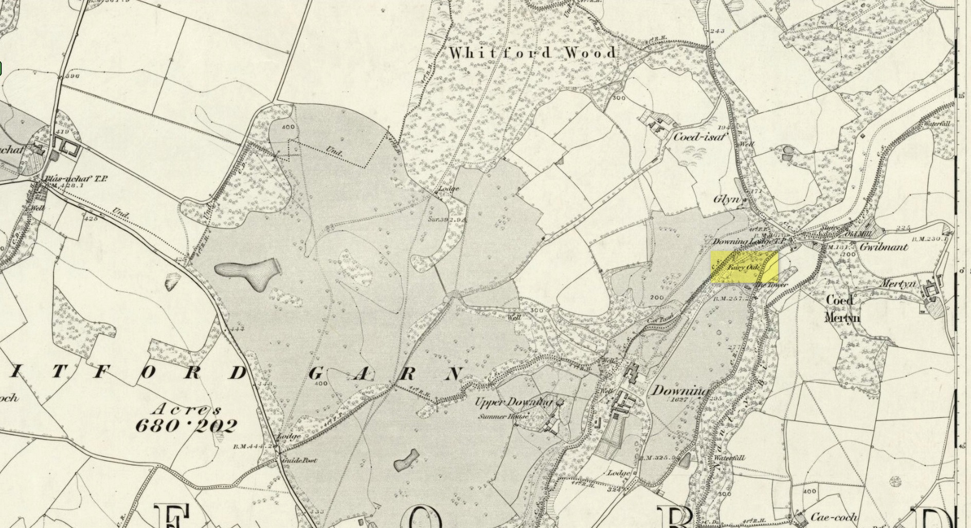
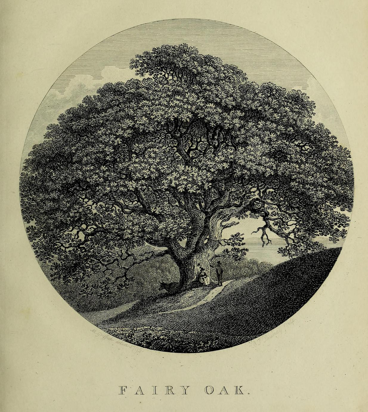
Highlighted on the earliest Ordnance Survey map of the region in 1878 and described much earlier by Thomas Pennant (1796)—almost as legendary as the fairies themselves in some parts—this ancient tree was obviously a place of great repute in the mythic history of the people in previous centuries. Animistic relationships with the landscape were still deeply embedded in the daily lives of our peasant communities all across the country when Pennant wrote about this place. In his antiquarian history of the area he described the great mansion of Downing Hall and in its grounds the ruins of Molandina Abbey. “Above this,” he wrote,
Fairy Oak on the 1878 mapPennant’s 1796 drawing
“is a spreading oak of great antiquity, size, and extent of branches: it has got the name of the Fairy Oak. In this very century a poor cottager, who lived near the spot, had a child who grew uncommonly peevish; the parents attributed this to the fairy, and imagined that it was a changeling. They took the child, put it in a cradle, and left it all night beneath the tree, in hopes that the tylwydd têg, or fairy family, or the fairy folk, would restore their own before morning. When morning came they found the child perfectly quiet, so went away with it, quite confirmed in their belief.”
Nearby, and in the same grounds of the mansion, Pennant told there to be an even older and greater oak tree that “has in it furrows so deep, and of aspect so uncommonly venerable, as to render its shade as worthy of the solemn rites of the Druids.”
References:
Pennant, Thomas, The History of the Parishes of Whiteford and Holywell, B. & J. White: London 1796.
The best/easiest way to approach this and the Rivock carvings as a whole is to reach the Silsden Road that curves round the southern edge of Rombalds Moor (whether it’s via East Morton, Riddlesden, Keighley or Silsden) and keep your eyes peeled for the singular large windmill. About 200 yards east of this is a small parking spot, big enough for a half-dozen vehicles. From here walk 450 yards east along the road till you hit the dirt-track/footpath up towards the moor. Follow the track up for about 400 yards and you’ll see the crags a half-mile ahead of you. Get up there to the Wondjina Stone and follow the walling east for about 175 yards where you’ll see a track-cum-clearing in the woods. Walk along and the first large stone on your left is what you’re after.
Archaeology & History
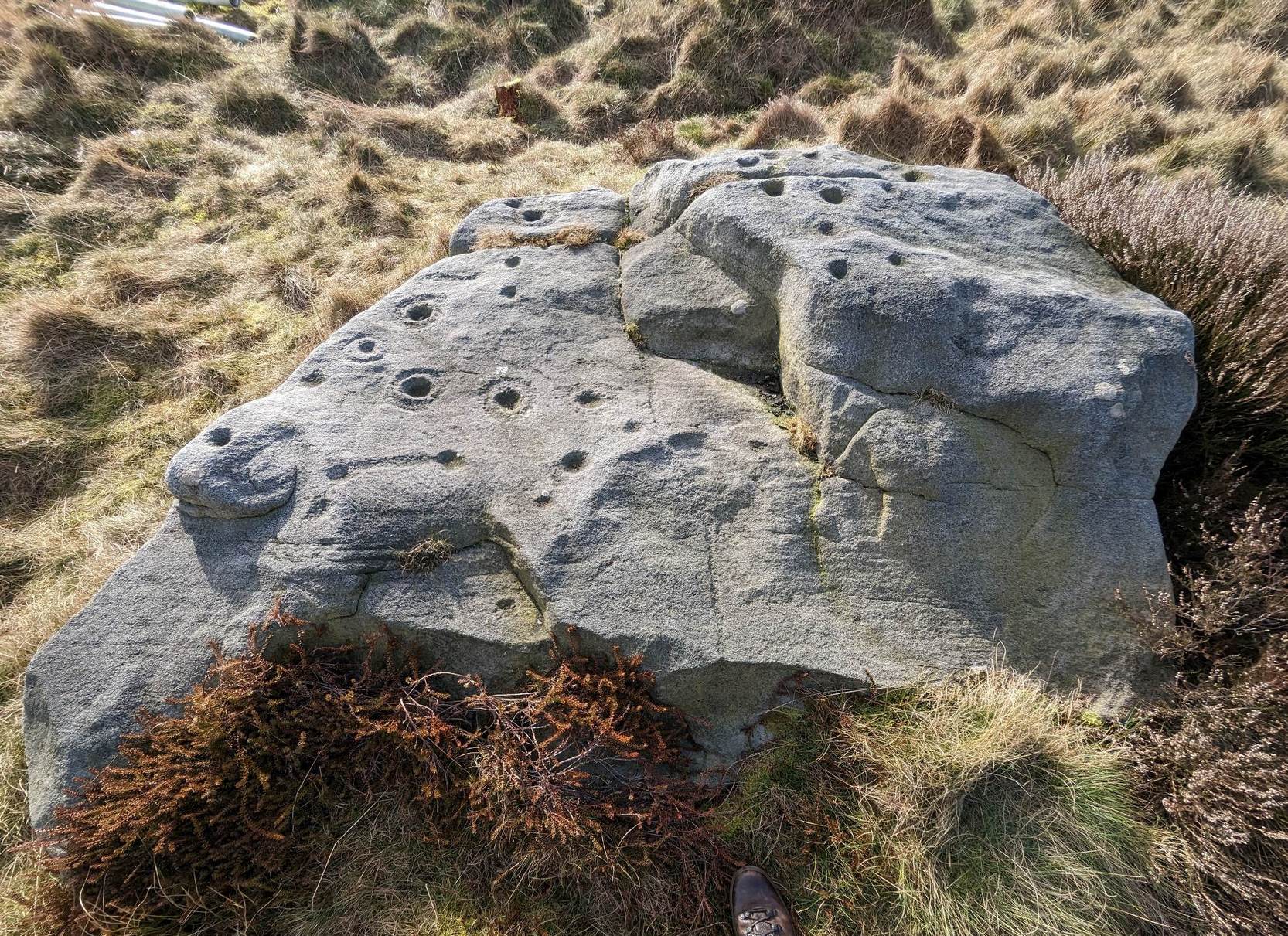
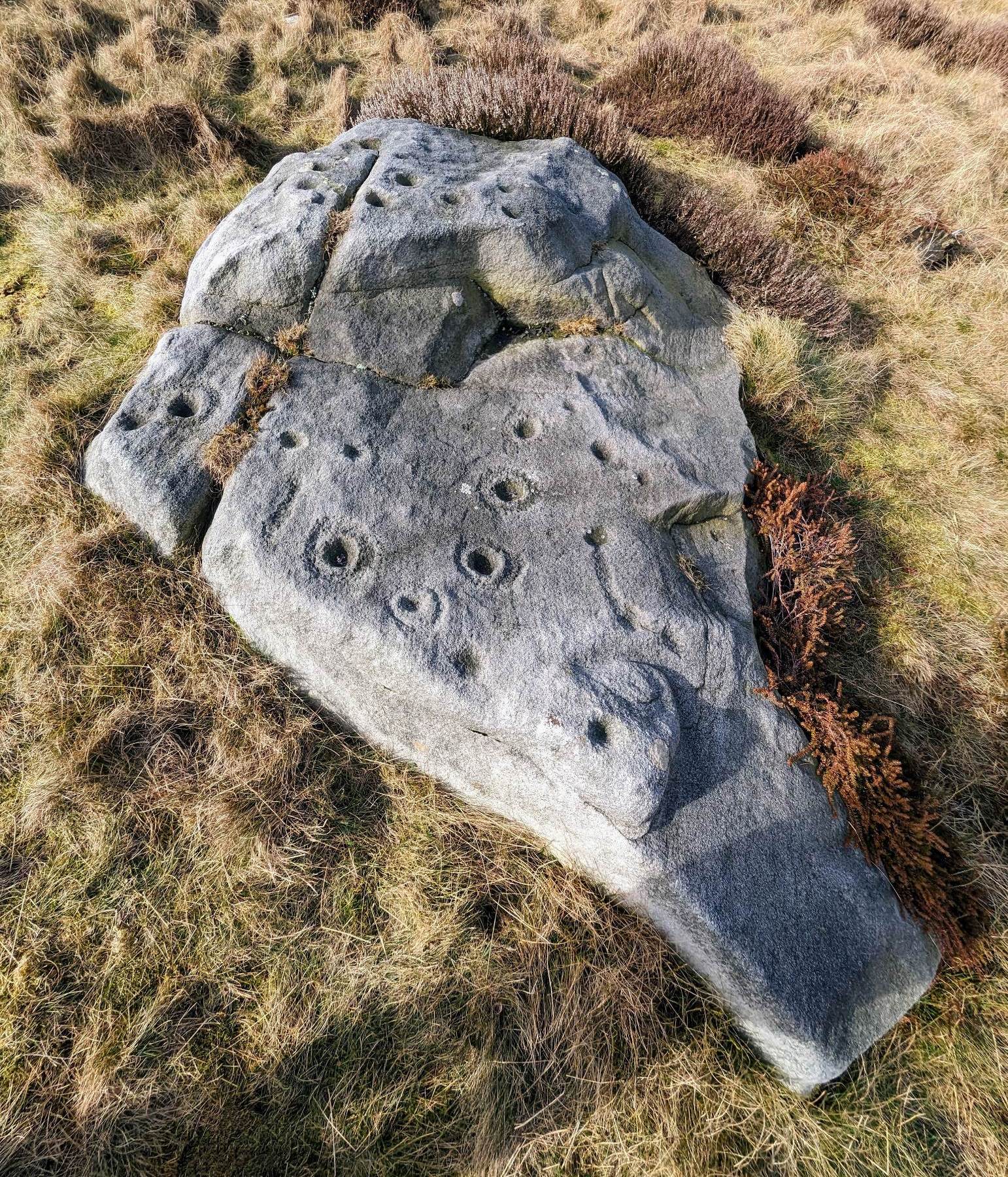
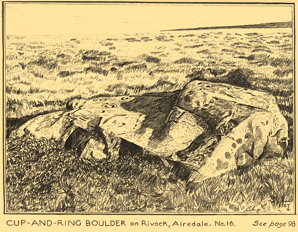
I first visited this carving in my teenage years in the 1970s, before the intrusive so-called “private” forest covered this landscape and when its petroglyphic compatriots were easier to find. Thankfully this one’s still pretty accessible and possesses a damn good clear design. It was rediscovered in the 1960s by Stuart Feather and his gang, zigzagging their way across the open moors, pulling back the heather to see what they might find. His description of it told how the stone,
“has two roughly level areas, one 18ins and the other 2 feet above ground level. Both (levels) have several well-preserved cup-and-ring markings on them. There are eight single cup-and-rings and 18 cups, two of the latter being joined by a clear channel seven inches long and 1½ inches wide. Nearly all the markings are unusually well preserved and the pocking marks are very clear.”
Note the line running down
He also had “the impression that all the markings on this stone and possibly one other similar stone in the Rivock area have been carved by the same hand, as all the symbols are nearly identical in in type, size and execution.” (this other carving he’s referring to seems to be one about 170 yards to the north, where occasionally “offerings” have been found)
The design from E-W
When John Hedges (1986) and his team checked the stone out he could only make out “seven cups with single rings, twenty two other cups”; whilst the ever descriptive Boughey & Vickerman (2003) saw “twenty-nine cups, eight with single rings.” Eight cup-and-rings is what most people see when the light’s right. There’s also a long, bent carved line on the lower level of the rock, running from near the middle of the stone out to the very edge. It seems to be man-made (although I may be wrong) – and I draw attention to it as this same feature exists on at least three of the other large and very ornamental cup-and-rings hereby within 300 yards of each other – and on these other carvings the long “line” is definitely artificial. Tis an intriguing characteristic…
Stuart Feather’s old sketch
When visiting this petroglyph you’ll notice how some of the carved elements on top of the stone are more eroded than those on the lower section. This is due to the fact that the lower section was only revealed by Feather and his team in the mid-20th century, after it had been covered in soil for countless centuries. As a result you can still see the peck-marks left by the implements that were used to make the carving, perhaps 5000 years ago!
The name of the stone was inspired by a local lady who saw an astronomical function in the design (I quite like it as well). Examples of petroglyphs representing myths of heavenly bodies have been described first-hand in some tribal cultures and, nowadays, even a number of archaeologists are making allusions about potential celestial features in some carvings in the British Isles. That doesn’t mean to say that it’s correct, but the idea’s far from unreasonable…
Anyhow – check this one out when you’re next up here. You’ll like it!
References:
Bennett, Paul, “The Prehistoric Rock Art and Megalithic Remains of Rivock & District (parts 1 & 2),” in Earth, 3-4, 1986.
Boughey, Keith & Vickerman, E.A., Prehistoric Rock Art of the West Riding, WYAS 2003.
Deacon, Vivien, The Rock Art Landscapes of Rombalds Moor, West Yorkshire, ArchaeoPress: Oxford 2020.
Feather, Stuart, “Mid-Wharfedale Cup-and-Ring Markings – no.16 – Rivock,” in Cartwright Hall Archaeology Group Bulletin, volume 8, no.10, 1963.
Hedges, John (ed.), The Carved Rocks on Rombalds Moor, WYMCC: Wakefield 1986.
Morris, Ronald W.B., “The Prehistoric Rock Art of Great Britain: A Survey of All Sites Bearing Motifs more Complex than Simple Cup-marks,” in Proceedings of the Prehistoric Society, volume 55, 1989.
Acknowledgments: Huge thanks to Collette Walsh for use of her photos.