Along Halifax Road (A649), get to the Shears Inn and then take the footpath at the back of the pub that runs down the side of the fields and alongside the allotments. Less than 150 yards down, just through the stile into the edge of the field on your left, you’ll see the side-edge of a large flat stone in the grasses. Check it out!
Archaeology & History
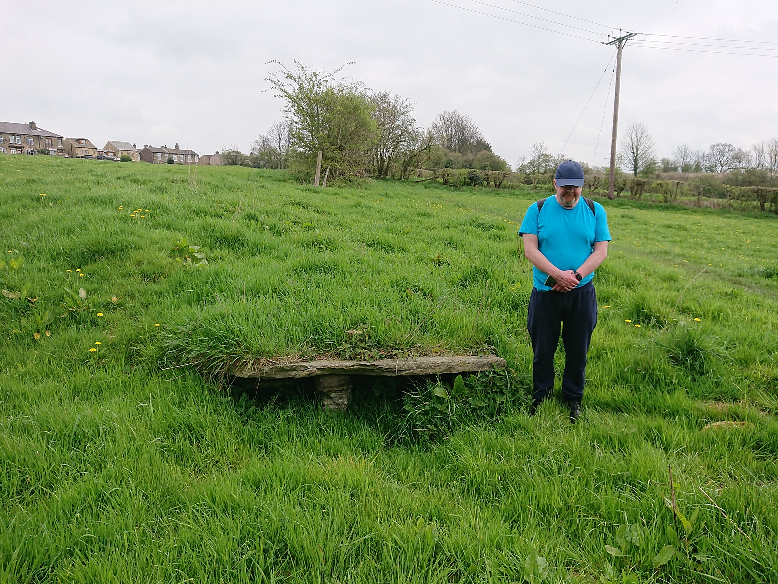
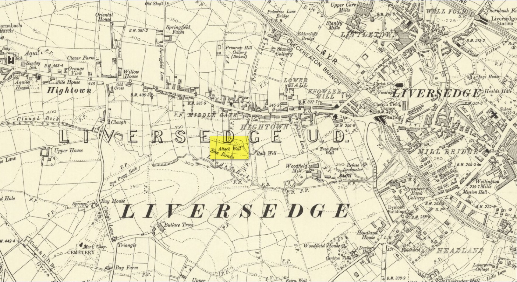
Along with the Attack Well and Tree Root Well, this was one of three springs close to each other that gave local villagers their water supply in bygone times. When we visited here at the height of a long warm spell in the summer of 2023, there was still was a small amount of clear water trickling beneath the long flat slab of stone — although it was somewhat clogged-up with vegetation. It wouldn’t take much work to completely clean this out and use the fresh drinking water once again.
The well gained its name from its position in the land, with balk, being “a portion of a field left unploughed”, or “a strip of ground left untilled” and variants thereof.
References:
Wright, Joseph, The English Dialect Dictionary – volume 1, Henry Frowde: London 1898.
Acknowledgements: Huge thanks to the great Gary Ferner, for use of his photo and the day’s venture!
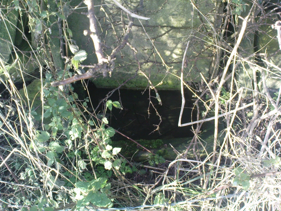
Located down the slope behind Shears Inn on Halifax Road (A649), past the stone-lined Balk Well, then round the other side of the allotments up where the footpath cuts to your right, the waters from this site can barely be found in the now large mass of brambles that make it virtually inaccessible to reach. When Gary Ferner and I visited here, it seemed that a very small pool of water existed in the hollow beneath the prickly vegetative covering—but even I didn’t struggle to get through it all and so we don’t know if the waters are still running as once they were. It was obviously one of the wells that fed local people in earlier times, but I can find no historical references to the site apart from its showing on the 1908 Ordnance Survey map.
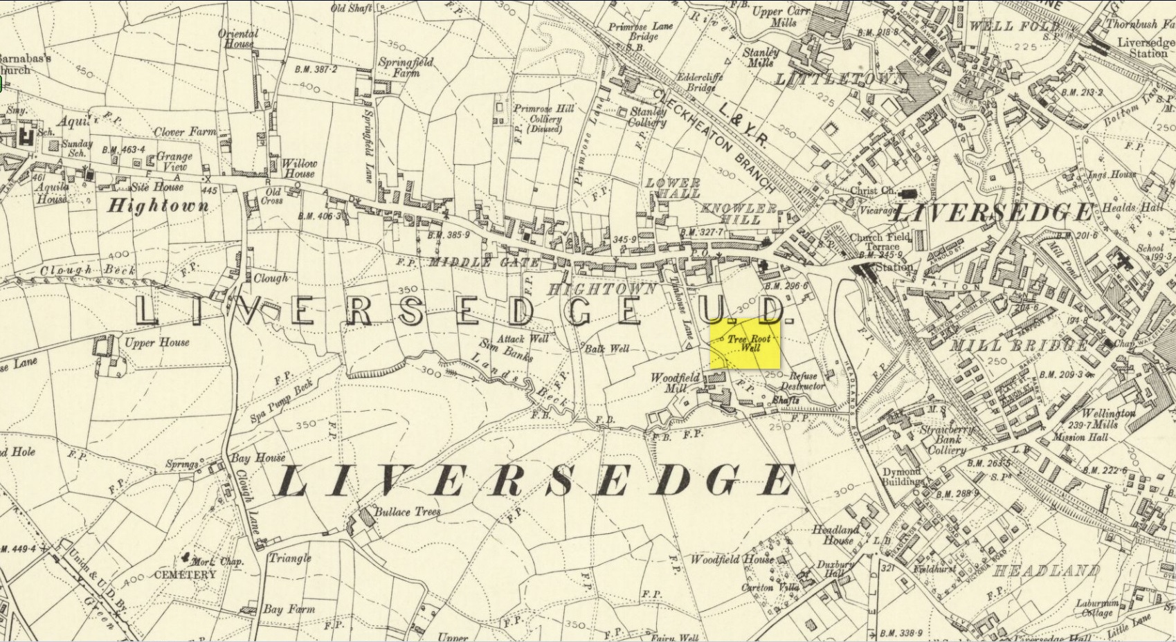
Along with the nearby Attack Well and Balk Well, this was one of three water supplies for the people of Middle Gate between Hightown and Liversdge in the 19th century. Found near the bottom of the old track known as Tanhouse Lane, its waters emerged at the base of some Victorian walling that’s built into the hillside, above which are the decayed remains of what seems to be an old hawthorn tree, whose roots obviously reached down to the stone trough, giving the place its name. Its waters have long since dried up and fallen back to Earth. Although it is shown on the 1908 OS-map of the region, I can find no virtues ascribed to the well nor any local history notes.
Acknowledgements: Huge thanks to the great Gary Ferner, for help in locating the site and the day’s venture!
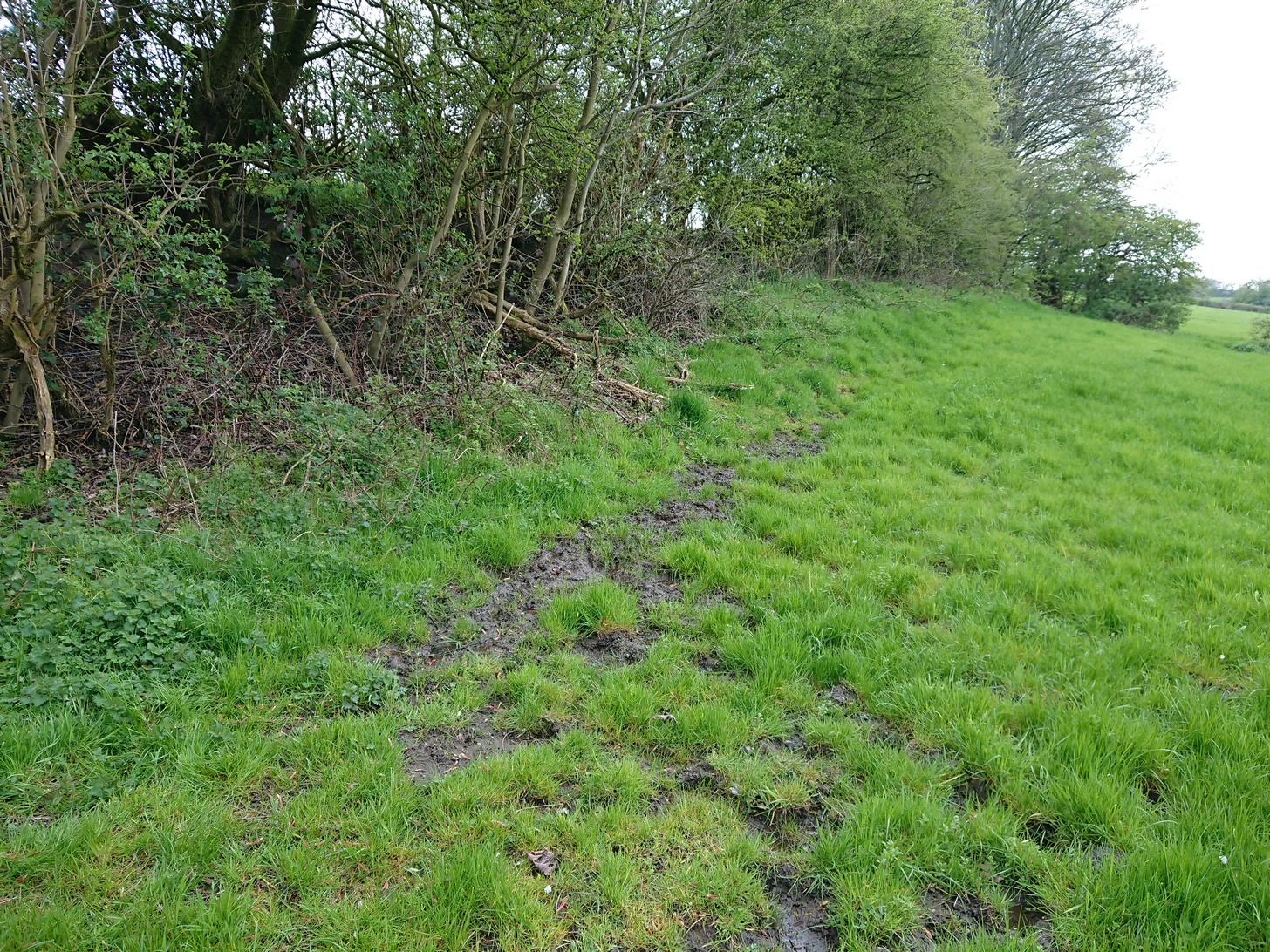
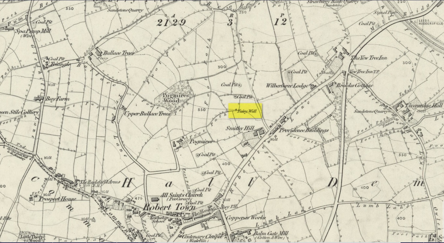
Best approached from Heckmondwike/Liversedge and going up Roberttown Road where, just past the Spen Valley High School parking spot, an almost dead straight footpath takes you down (northwest) into the woods. Walk down here for about 100 yards and then go left over the stile into the small copse of trees. Once you come out the trees at the other side, walk up the slope in the field that you’re now in. As you approach the line of trees at the top, you’ll notice the ground gets very boggy. Look carefully under the trees and you’ll notice an embedded flat stone protruding out and a somewhat trivial trickle of water into the grass at the front. That’s it!
Archaeology & History
Site on the 1854 OS-map
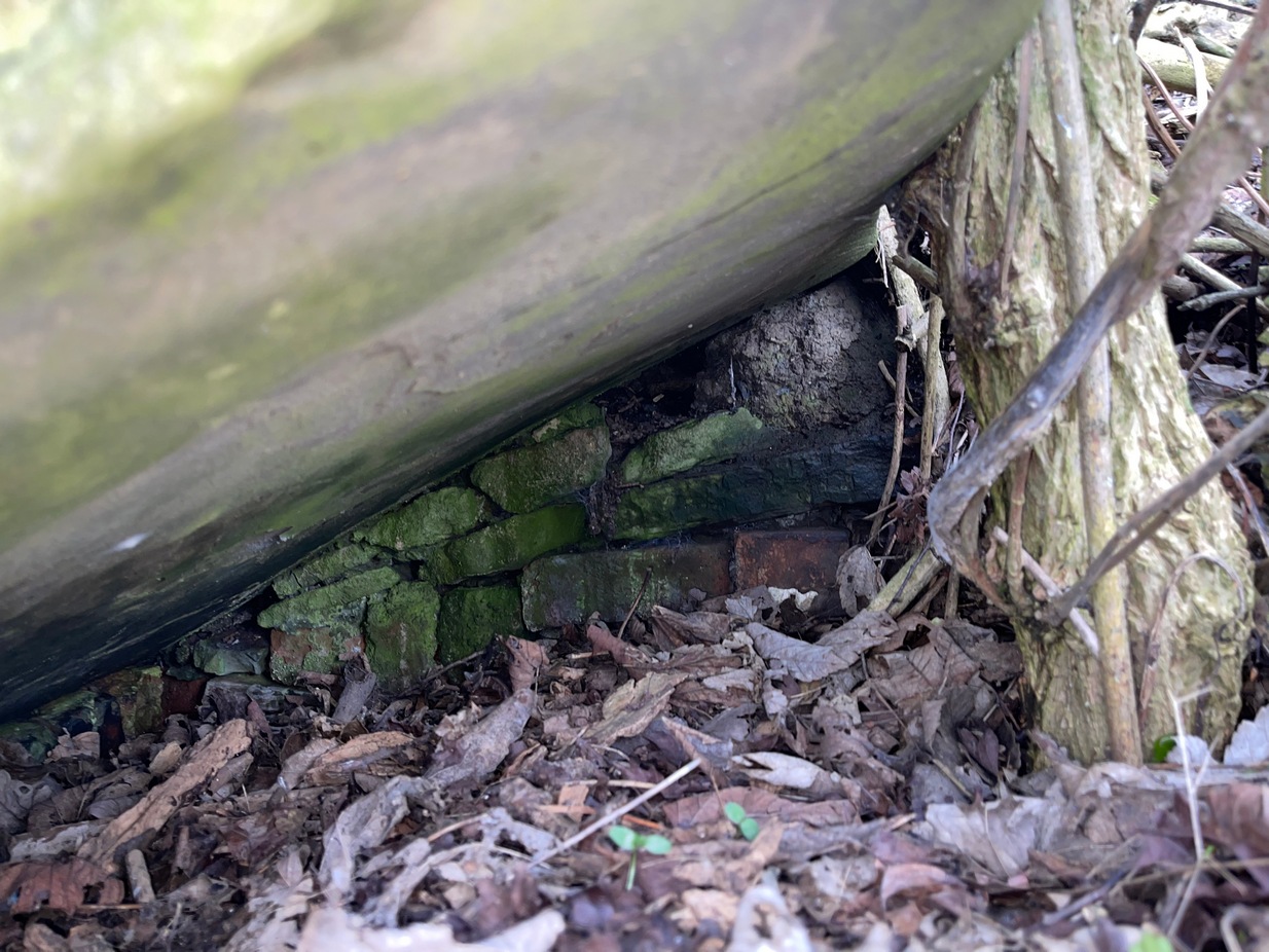
Highlighted on the 1854 Ordnance survey map of the area, this is a somewhat ruinous site which has seen better days. Even after good downpours it’s not very obvious and, in truth, could do with being cleaned-up, cleared out, and brought back into the old life it once had. If you look carefully beneath the roots of the covering tree, you’ll notice a decent-sized flat worked stone sticking out at the bottom of the sycamore and below this, at the back, almost covered in earth, you can make out some brick walling at the rear. It takes some finding! This is evidently the remains of a small protective well-house, now in total ruin.
Old cover of the well
When we visited the place a few weeks ago, there seemed to be no water inside. Instead, the water emerges into a small bog just below the tree-line a few yards away from the covering slab from whence it originally flowed.
Folklore
Obviously the abode of fairy folk in bygone days, all trace of the folklore and habits of them seems to have been lost long ago….
Acknowledgements: Huge thanks to mi old mate Gary Ferner for helping us uncover the source of the waters, which was almost completely covered in soil.
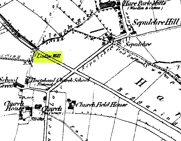
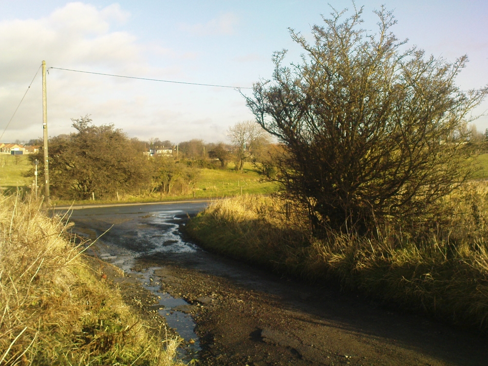
This can take a little bitta finding if you don’t know the area. So it’s best starting from Hartshead church, right on top of the hill here. From whichever direction you’re taking to reach Hartshead, ask a local when you get close and they’ll direct you there. From here, walk out of the churchyard and turn left. Walk barely 50 yards and turn left again along Lady Well Lane. Past the old houses and bear right where it becomes a dirt-track. This then turns left, then again right and – with the fields on either side of you – note the single hawthorn tree ahead of you by the walling. Go into the field at the back of the hawthorn and look under its shady bough. Tis there, I assure you!
Archaeology & History
The holy well is beneath this hawthorn tree
Emerging at the edge of the field beneath an old hawthorn tree at the side of the track running to the adjacent church, the waters from here are clean and fresh—though the stone trough into which it flows is constantly clogged up and the ground around it very boggy. The well has given its name to Lady Well Lane, which leads to the 12th century St. Peter’s Church, with its own ancient and legendary history. The well is thought to derive its name from ‘Our Lady’, the Virgin Mary, indicating it would have had considerable importance in the religious traditions of the christians who named it, but moreso the original animistic traditions of normal local people who would have used it for much longer…
Close by this old stone trough appears to be another one, covered by moss and the encroaching field. Whatever medicinal properties the waters may once have had, have long since been forgotten. Around Lady Well is a healthy abundance of flora: elder, chickweed, nettle, clover, bramble, dandelion, sow thistle, dock and shamanic species.
Folklore
The overgrown Lady Well
Marion Pobjoy (1972), like her predecessors, suggested that this was one of many sites in Calderdale used by St. Paulinus to perform baptisms. Local folklore tells that Robin Hood stopped here to drink the waters—but then we find an abundance of the pagan outlaw’s activities all round here. The nearby church of St.Peter is aligned to the equinoxes and may well be an indication of when pre-christian celebrations occurred here. The yew tree in churchyard was where Robin Hood was supposed to have taken wood to fashion one of his bows. Modern folklore also ascribes the well to be along a ley line.
References:
Heginbottom, J.A., ‘Early Christian Sites in Calderdale,’ in Proc. Halifax Ant. Soc., 1988.
Pobjoy, Harold N. & Marion, The Story of the Ancient Parish of Hartshead-cum-Clifton, Riding 1972.