Lour Fort, Drumelzier, Peeblesshire

Cup-Marked Stone (lost): OS Grid Reference – NT 179 356

Archaeology & History

In Sir George Douglas’ (1899) brief sketch of prehistoric remains in Peeeblesshire, he described coming across a petroglyph somewhere near the top of the Iron Age hillfort east of Stobo Castle, near Drumelzier (King Arthur country).  He told that,

“on a flat stone lying on the slope of the fort at Lour, are two “cups,” measuring 2¾ inches in diameter and an inch in depth, and exhibiting perfect symmetry in their form and position on the stone: they have been thought to be genuine examples of “rock-markings”.”

The carving hasn’t been seen since and it’s presumed that vegetation has covered the stone. (the grid-reference for this site is an approximation)

References:

  1. Douglas, Sir George, A History of the Border Counties: Roxburgh, Selkirk, Peebles, W. Blackwood: Edinburgh 1899.

© Paul BennettThe Northern Antiquarian

Soonhope, Peebles, Peeblesshire

Cup-and-Ring Stone (lost): OS Grid Reference – NT 269 419

Also Known as:

  1. Kittlegairy Burn

Archaeology & History

Fred Coles’ 1898 sketch

An apparently isolated cup-and-ring stone was found on the hills north of Peebles at the end of the 19th century by the renowned Scottish megalith explorer, Fred Coles. (1899)  He was having a look at some of the hillforts in the area and—as some of us tend to do—he began meandering off-track, down streams, through bogs and as a result came across the carving that’s illustrated here.  It’s subsequently become “lost” in the hills, but it shouldn’t be too difficult to locate, as the description he gave of its whereabouts is a pretty good one.  He told us:

“A very little over one mile and a quarter up the valley, measuring from the road at Kerfield Cottage, a tiny rivulet called Kittlegairy Burn trickles down from the SE into the main stream.  On the hill to its east, and about 450 feet higher, are the remains of a fort, one of a series of three crowning prominent heights along this side of the valley.  Down the main stream from Kittlegairy Burn is a large ruined sheep-shelter called Soonhope.  Nearly midway between these two points a deep curve has been hollowed out of the E. bank; and, at the foot of this rather high gravel bank, half immersed in the stream, lies the block of stone with the cup-and ring-marks.  They were discovered, 14th September 1896, by my daughter, Helen, on crossing the stream; and we at once proceeded to make a measured drawing, a reproduction of which is given here….  The depth of the rings in proportion to their width is the one most noticeable feature; next, the extreme thinness of the intervening ‘neck’; but, on a minute and careful examination of the nature of the stone itself, taking into consideration that its angularity and sharpness of edge and the absence of moss or even of confervoid growths on its surfaces went against the possibility of its being truly waterworn.”

The rock had obviously fallen from its original position above the burn.  Today, the entire area where this stone exists has been covered by a huge forestry plantation, but if any rock art fanatics from the Peebles area get bored one day and have nothing to do…..

References:

  1. Coles, Fred, “Notices of the Discovery of a Cist and Urns at Juniper Green, and of a Cist at the Cunninghar, Tillicoultry, and of some Undescribed Cup-marked Stones’, in Proceedings Society Antiquaries, Scotland, volume 33, 1899.
  2. Morris, Ronald W.B., “The Cup-and-Ring and Similar Early Sculptures of Scotland; Part 2 – The Rest of Scotland except Kintyre,” in Transactions of the Ancient Monuments Society, volume 16, 1969.
  3. Morris, Ronald W.B., “The cup-and-ring marks and similar sculptures of Scotland: a survey of the southern Counties – part 2,” in Proceedings of the Society of Antiquaries, Scotland, volume 100, 1969.
  4. Morris, Ronald W.B., The Prehistoric Rock Art of Southern Scotland, BAR: Oxford 1981.

© Paul BennettThe Northern Antiquarian

Harelawside, Grantshouse, Berwickshire

Cup-and-Ring Stone (removed): OS Grid Reference – NT 807 659

Archaeology & History

A carving that no longer exists in its place of origin, but can now be seen in the National Museum of Antiquities in Edinburgh.  It was discovered by a Mr James Craw (1931), who gave us the following account of his find:

“In 1910 my attention was attracted by some markings on a boulder on the top of a field wall, ¼-mile NNW of Grant’s House church and at an elevation of some 550 feet above sea level.  The stone was a rounded and somewhat flattened slab of greenstone, measuring 22 inches by 17 inches by 4 inches… It bore a small cup ½-inch in diameter, surrounded by two rings of shallow incision, the outer being 3 inches in diameter.  From the cup a duct, partly natural, led across the stone, and another cup, without rings, had also a short duct.  Adjacent to these markings was a curious grid design of shallow lines, a series of parallel lines ¼-inch apart, being crossed at right angles by lines 2½ inches apart.”

1930 photo of the carving

Across a section of the stone there may also be a curving pecked line which Craw didn’t appear to notice.  The parallel lines would appear to have quite separate origins, with those running below the cup-and-ring seeming to be ancient, whereas the others have the appearance of being cut with metal tools and seem much more like modern scarring.

Shortly after finding the stone, Mr Craw took the petroglyph to the National Museum in Edinburgh, where he was told that they didn’t think it “as being of early workmanship, the cups and rings being of much smaller proportions than the typical markings of the Bronze Age and the grid design having no known parallel.”  They were wrong on both accounts of course, although I for one still remained unconvinced by one set of parallel lines that run along to the edge of the stone.  That said, there are similar carvings of parallel lines at the impressive Traprain Law 15 miles northwest of here, so I may be wrong.

The wall in which this carving was found was obviously not its place of origin.  It most likely came from one of the cairns that was reported by J. Hardy to have been destroyed in this field in 1882.

References:

  1. Craw, James H., “An Inscribed Boulder from Grants House,” in History of Berwickshire Naturalists Club, volume 27, 1931.
  2. Edwards, Arthur J.H., “Rock Sculpturings on Traprain Law,” in Proceedings Society of Antiquaries, Scotland, volume 69, 1935.
  3. Morris, Ronald W.B., “The Cup-and-Ring and Similar Early Sculptures of Scotland; Part 2 – The Rest of Scotland except Kintyre,” in Transactions of the Ancient Monuments Society, volume 16, 1969.
  4. Morris, Ronald W.B., “The cup-and-ring marks and similar sculptures of Scotland: a survey of the southern Counties – part 2,” in Proceedings of the Society of Antiquaries, Scotland, volume 100, 1969.
  5. Morris, Ronald W.B., The Prehistoric Rock Art of Southern Scotland, BAR: Oxford 1981.

© Paul BennettThe Northern Antiquarian

Dun Mor, Glen Clova, Angus

Hillfort:  OS Grid Reference – NO 2900 7600

Getting Here

Crag of Dun Mor, centre-right

From Kirriemuir town centre up the B956 Kinnordy Road, turn left where it goes along the B955 road for several miles towards Cortachy.  Keep going on the B955 for a few more miles into Glen Clova, past the Caddam stone and eventually, after going over the bridge into Clova village, you turn left and go up towards the mountains.  Nearly 3 miles along you see the very conspicuous and impressive rising crag, like a small volcano on the right-hand side of the road, which is Dun Mor.  Walk up the steep climb round to the back of it – and you’re in the middle of the old ruins…

Archaeology & History

Highlighted on the 1865 OS map of the region, Dun Mor is Gaelic for a “large or great fort” – and such it is!  Those of you with a nose for these sorts o’ things will no doubt take to the remains pretty quickly.  Its position in the landscape is a bit of a gem!  On its north-side— invisibile to anyone in the glen below—an overgrown arc of walling some 3 feet high and about 70 yards long bends towards the crag of rocks on each side, with a notable “dip” or entrance about 8 feet wide in the middle of it.  The walling itself averages about 4 yards wide all along its arc.

The crag of Dun Mor

It’s quite impressive once you get a good feel of the place and envisage it as it once was.  The sheltered fortress within the rise of Nature’s crags is about 100 yards across and would be ample space for several families to live in when it was first built, in those mythic times of so so long ago.  It was probably constructed in the Iron Age, although several ruined rectangular stone structures inside it are thought to be medieval shelters; and even in those more recent times, the people here would have regularly heard the howl of the wolves, whose names are kept in the hills above as reminders of a world not too long past….

© Paul BennettThe Northern Antiquarian

Folly Top, Barden Moor, North Yorkshire

Ring Cairn:  OS Grid Reference – SE 03536 59756

Getting Here

Folly Top ring, looking E

It’s easier to explain how to get here if you’re coming from the Burnsall-side of the B6160 road that leads to Bolton Abbey.  A half-mile out of Burnsall village you a small woodland with a small parking spot.  From here, a footpath runs up the steep hill above the parking spot.  It zigzags a little and you eventually come out on the south-side of the trees where it meets some tall walling.  Follow this walling further uphill for more than 600 yards (past more woodland) until the land starts to level out.  Hereby, go thru an opening in the wall and less than 100 yards away (west) amidst the overgrown heather, you’ll see what you’re looking for.

Archaeology & History

A large but peculiar site resting on a moorland plateau on the eastern edges of the mighty Barden Moor.  Peculiar inasmuch as it’s completely isolated from any other monument of the same age and type anywhere on these huge moors.  A few miles east, on the moors around Appletreewick, Thruscross and Beamsley we have a plethora of prehistoric sites—but up here on Barden Moor there’s apparently nowt else!  I find that hard to believe….

Inner rubble walling
Rubble walling, looking N

Listed on official websites as being a ring cairn, it’s difficult without a detailed excavation of the site (there hasn’t been one) so say that’s what it is.  But we’ll stick with it for the time being.  My initial impression of the site was that it was a crude form of a collapsed Scottish dun: impressive large circular monuments—buildings if you like—with very well-built large stone walls, usually several yards thick, a little bit like the Scottish brochs (mighty things indeed!).  This thing at Folly Top isn’t quite as impressive, but it’s like a collapsed version of a dun.

Arc of western walling

The site consists of large ring of raised collapsed rubble walling, more than a yard high in places, and about three yards thick all the way round, measuring roughly 21 yards (N-S) by 19 yards (E-W) from outer wall to outer wall.  There are “entrances” on the east and west sides; but there seemed to be little of any note in the middle of the ring, although the site was somewhat overgrown on our visit here.  Outside of the ring there was also nothing of any note.  It’s a pretty isolated monument which seems to have more of an Iron Age look about it than the Bronze Age—but until there’s an excavation, we’ll not know for sure.

It’s well worth checking out—and from here, walk onto the huge moorland above you to the west….

Acknowledgements:  Huge thanks to the Crazy-gang of Sarah, Helen and James for their awesome assistance on our venture up here.  A damn good day indeed!  Cheers doods. 🙂

© Paul BennettThe Northern Antiquarian

Dun Osdale, Dunvegan, Skye

Broch:  OS Grid Reference – NG 24162 46424

Also Known as:

  1. Canmore ID 10832

Getting Here

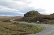
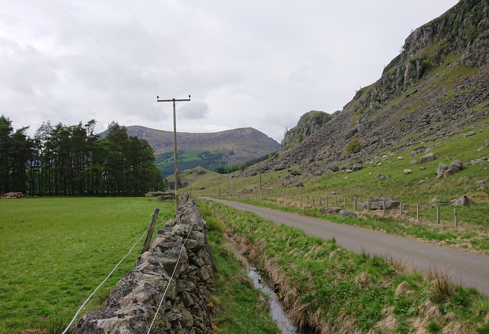
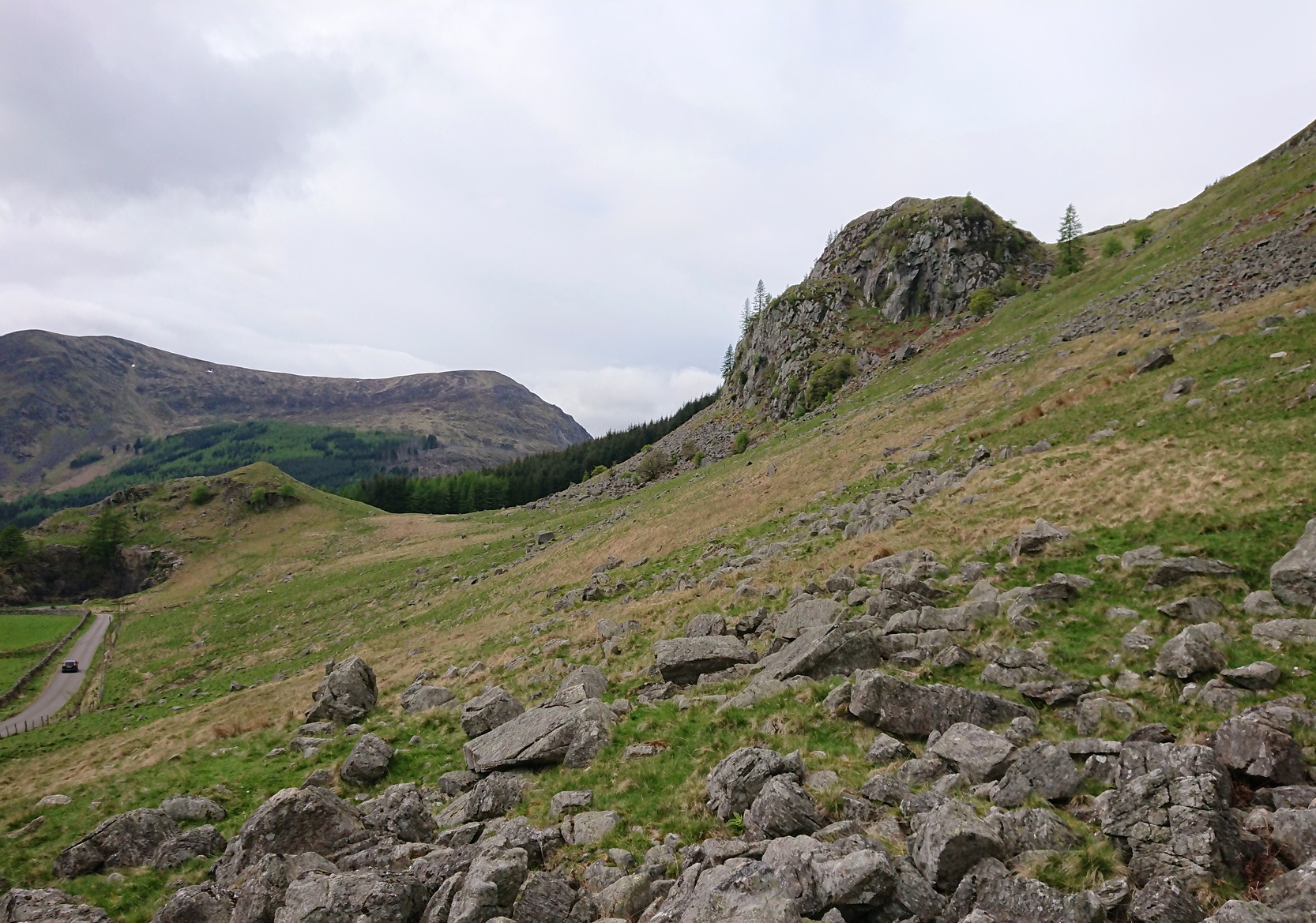
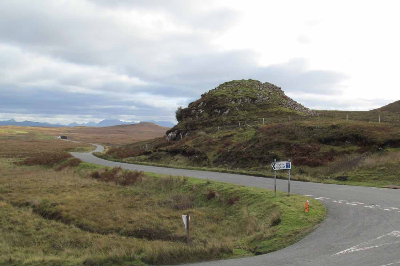
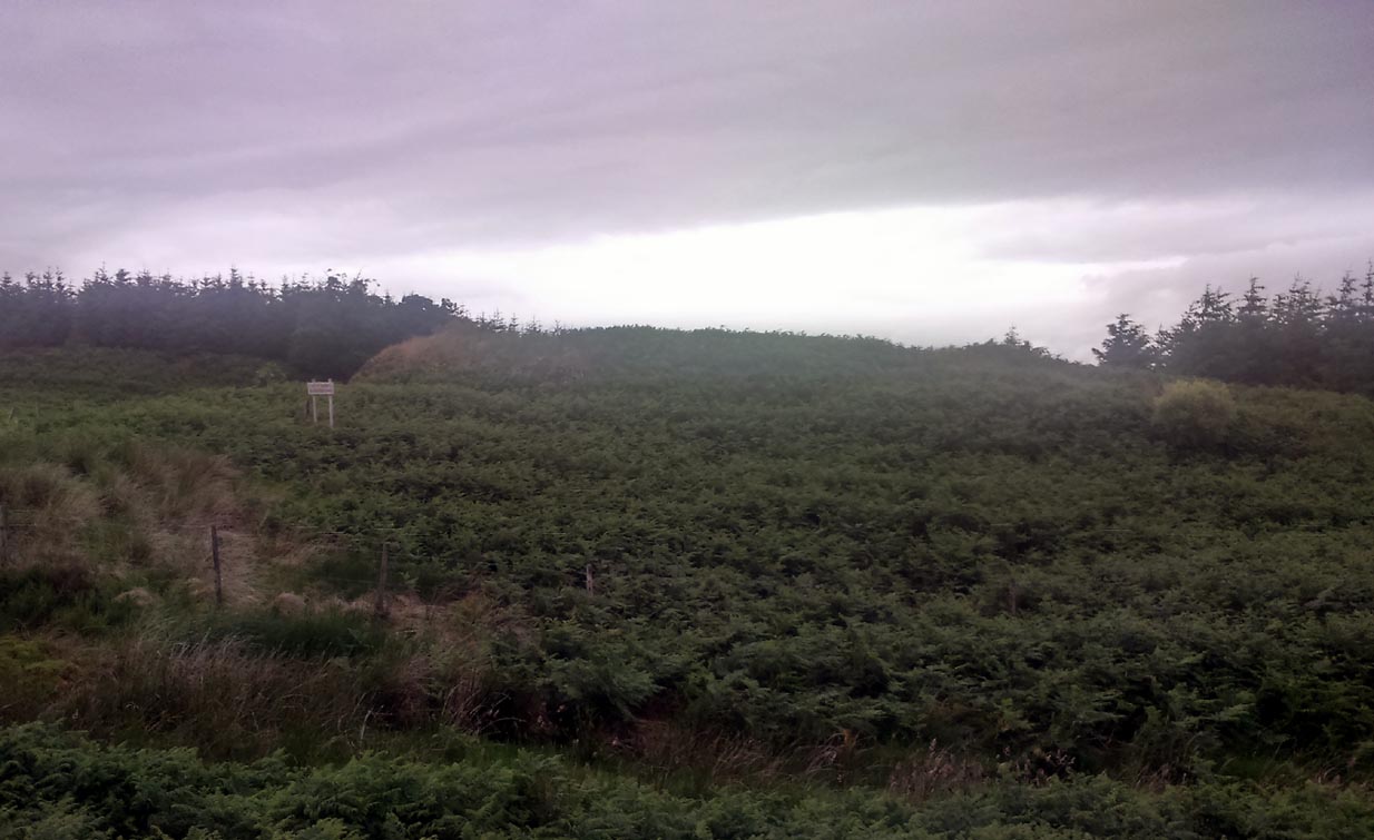
Dun Osdale, by the roadside

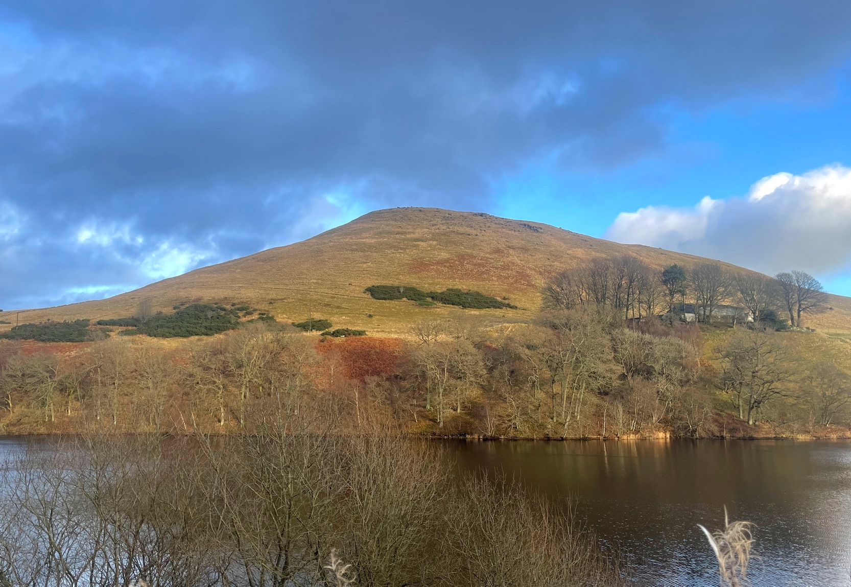
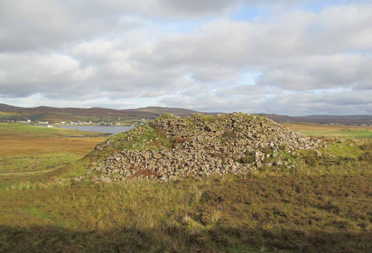
From the A863 Dunvegan road, a mile south of the village turn onto the B884 road at Lonmore, making sure you veer right after a few hundred yards and head towards Glendale.  About a mile along, on the left-hand side of the road, note the small rocky crag that begins to grow just above the roadside.  At the end of this crag you’ll see a huge pile of rocks, seemingly tumbling down, just by a small T-junction to Uiginish.  You can’t really miss it.

Archaeology & History

Listed as one of the duns, or fortified prehistoric structures in Skye by the old writer J.A. MacCulloch (1905), the rediscovery of this broch was, said A.A. MacGregor (1930), one that “became historical only within living memory.”  I find that hard to believe!  The Gaelic speakers hereby merely kept their tongues still when asked, as was common in days of olde—and it was a faerie abode….

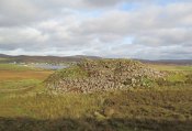
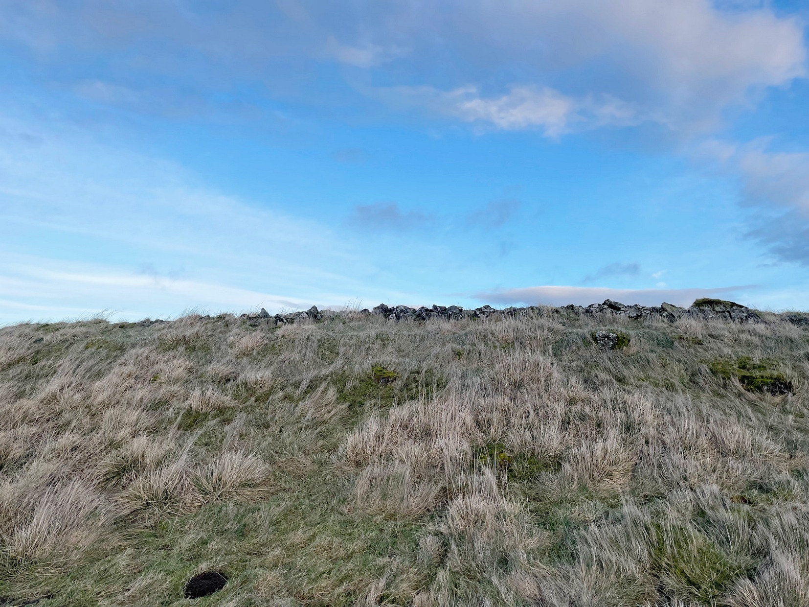
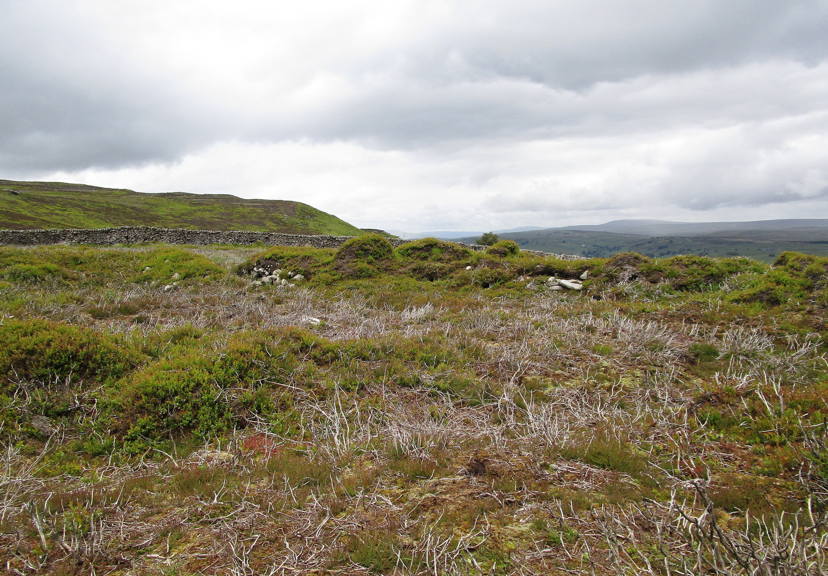
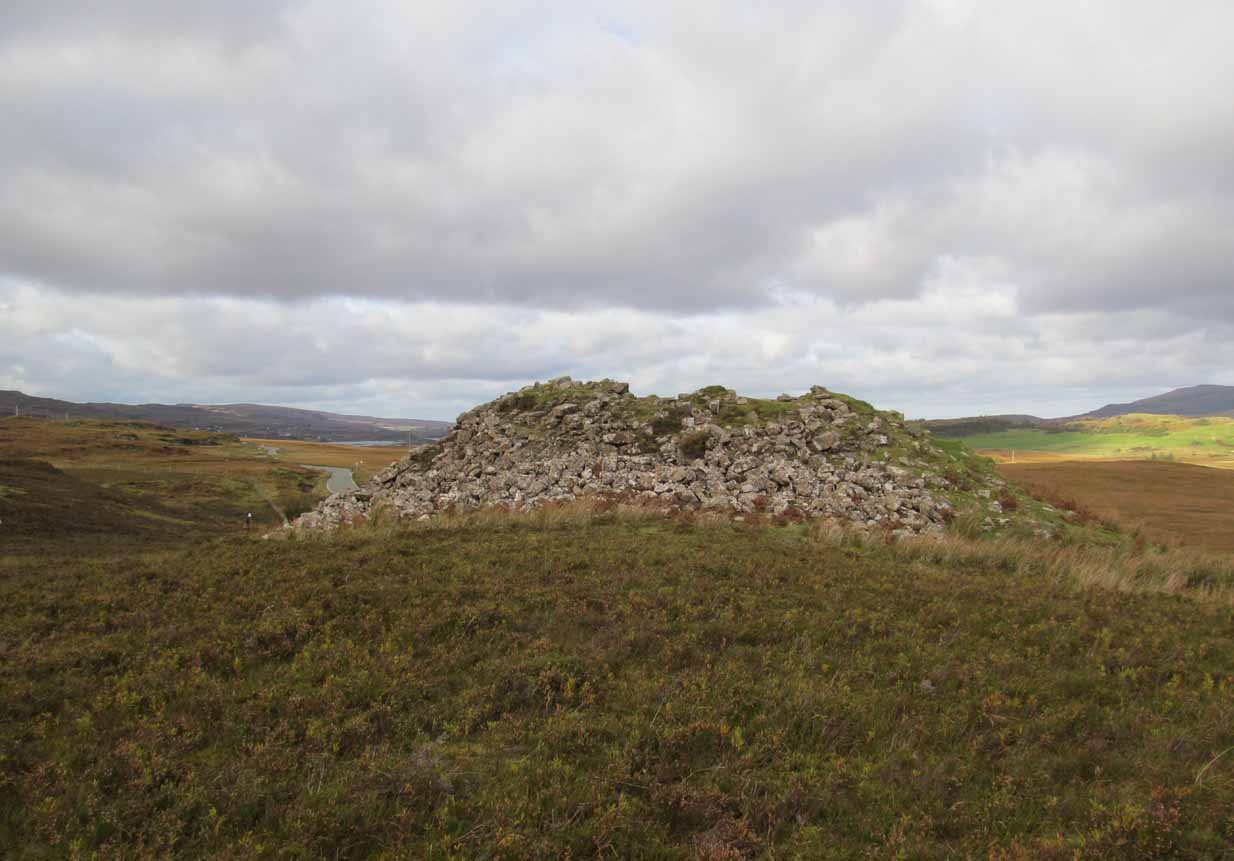
Looking at the SW walling

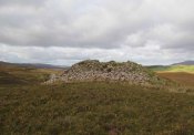
Looking at the SE walls

Once you go through the gate below the broch, the large boggy area you have to circumnavigate is the overflow from an ancient well, known as Tobar na Maor, where Anne Ross said, “tradition that the stewards of three adjacent properties met there.”  This well was covered by an ancient Pictish stone (now in Dunvegan Castle), which may originally have been associated with the broch just above it.  When I visited the site with Aisha and Her clan, we passed the overgrown well and walked straight up to the broch.

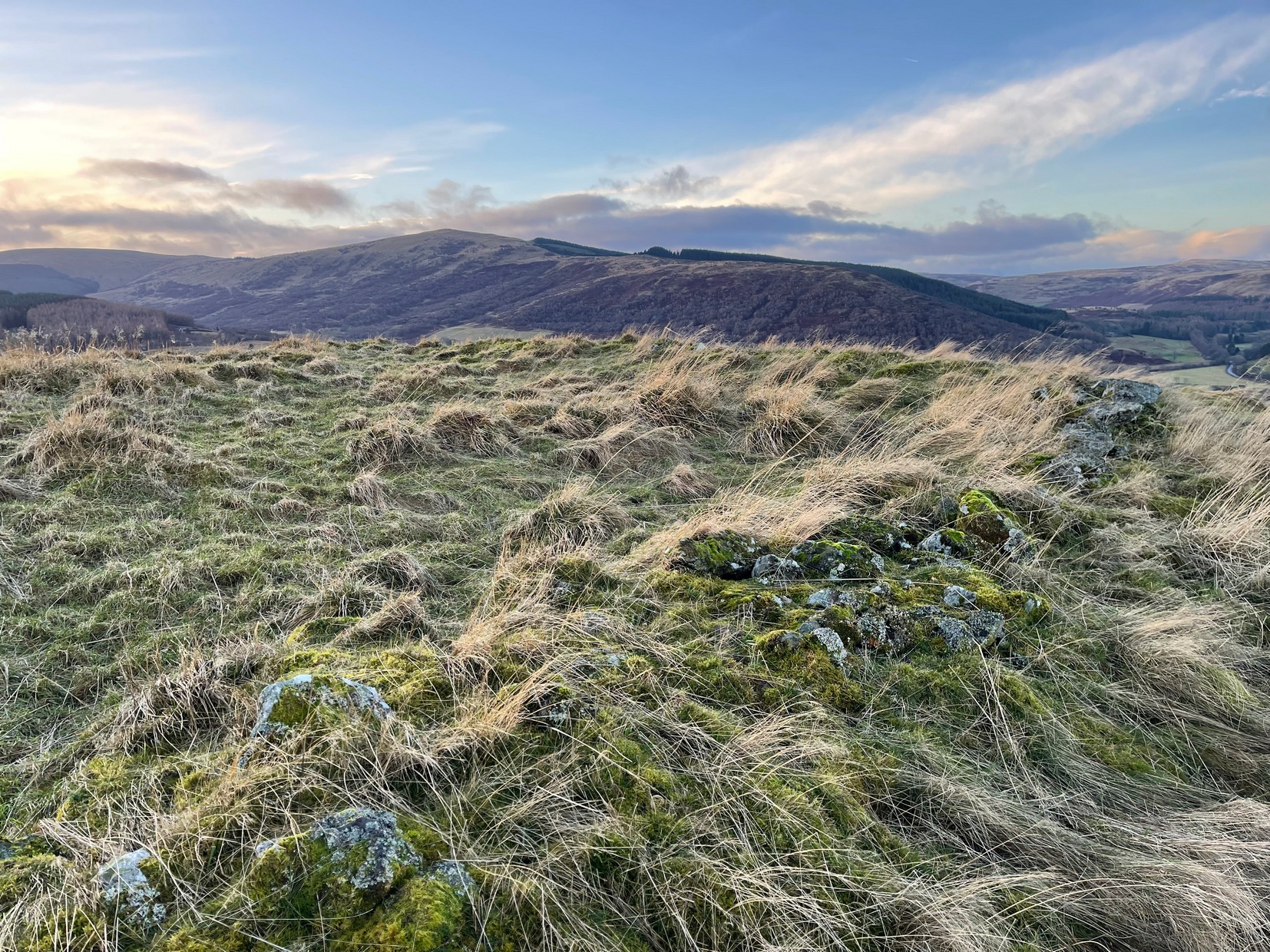
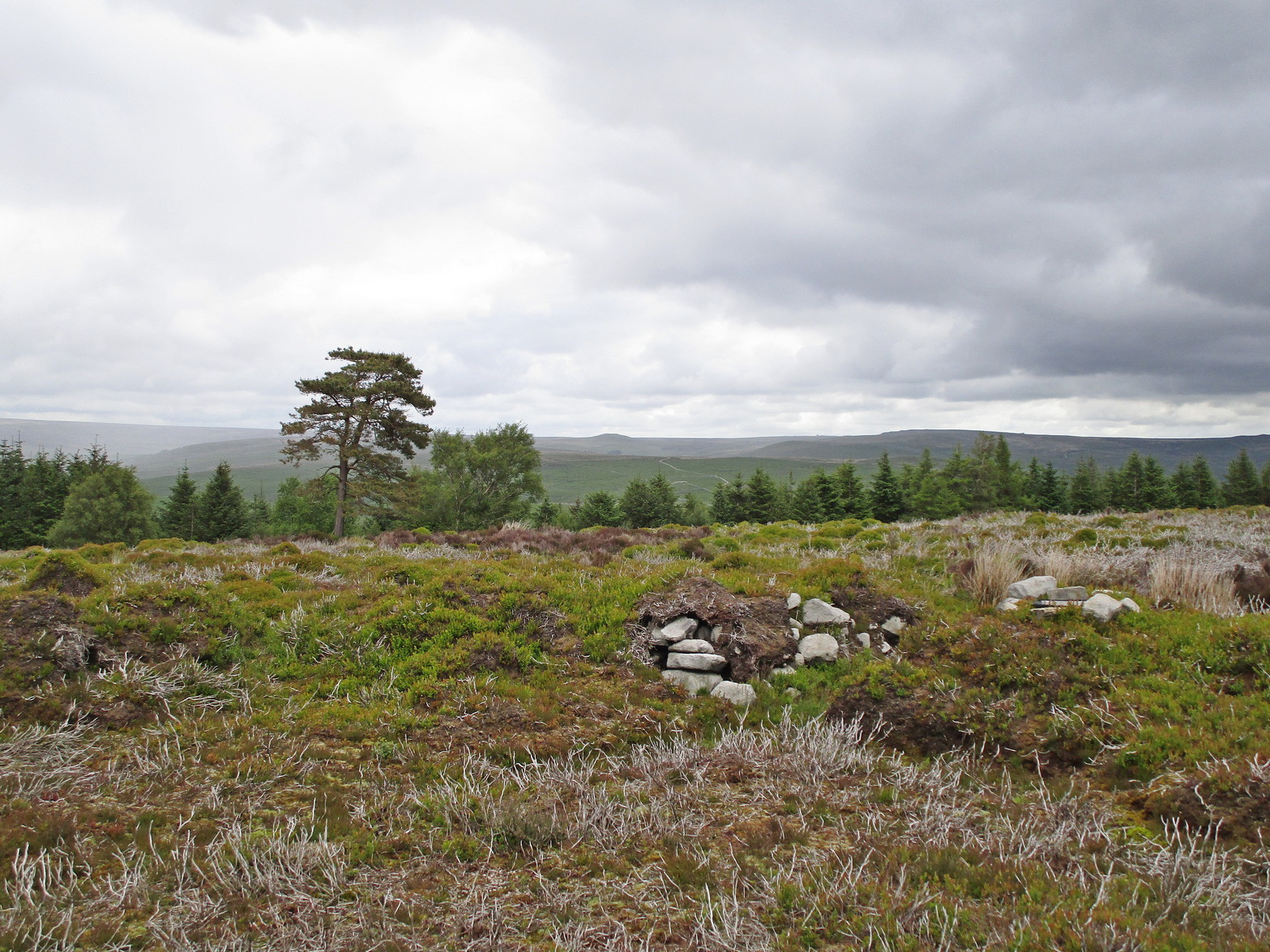
Despite being ruinous it is still most impressive.  The massive walling on its southwestern side is still intact in places; but you don’t get a real impression of the work that went into building these structures until you’re on top.  The walls themselves are so thick and well-built that you puzzle over the energy required to build so massive a monument.  And Scotland has masses of them!

Aisha in the broch

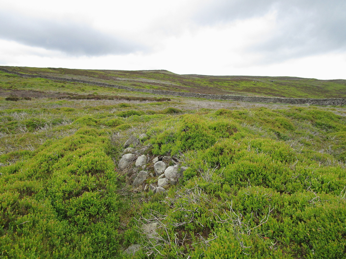
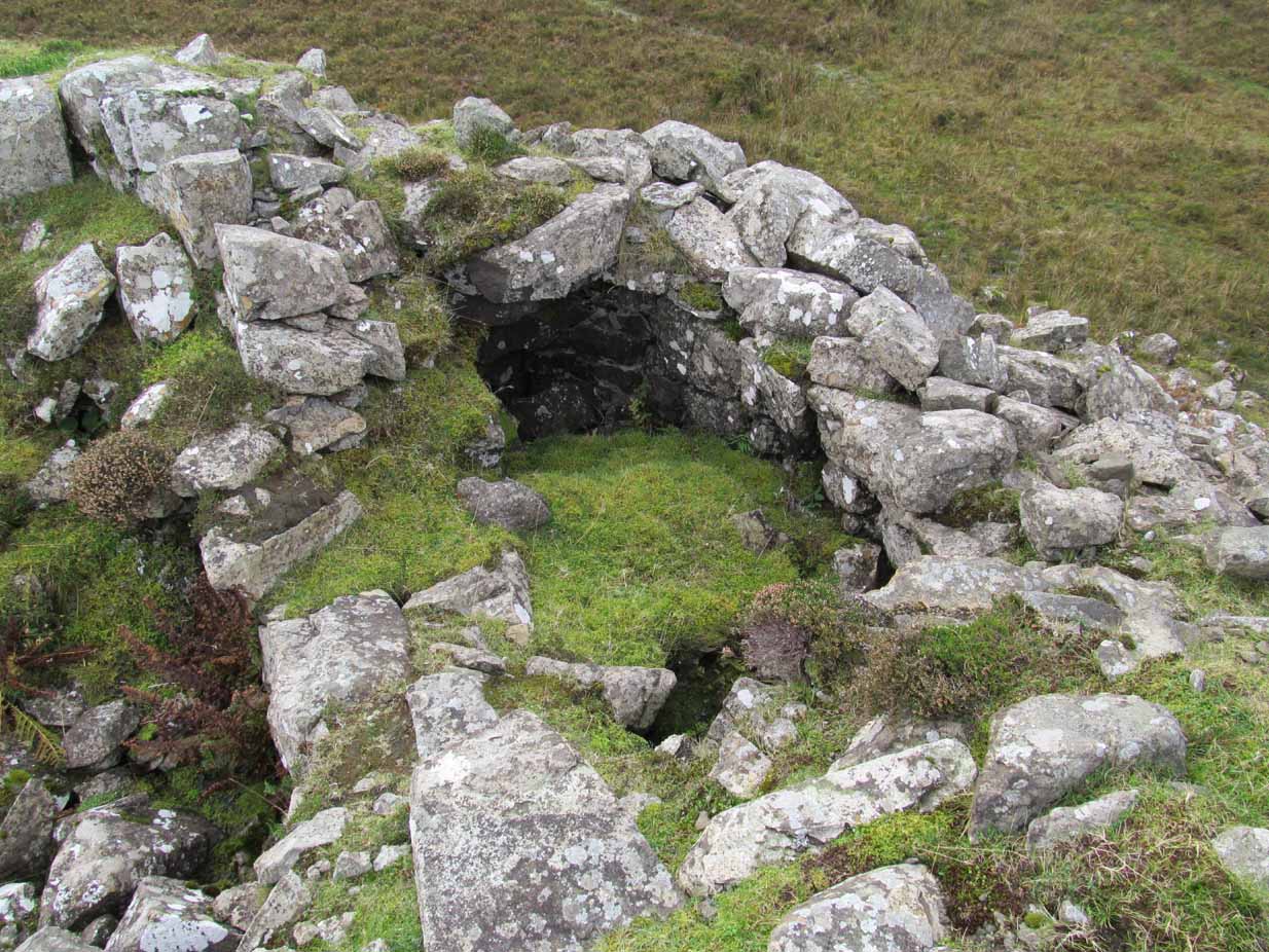
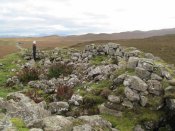
Small internal chamber

The site was surveyed briefly when the Ordnance Survey lads came here in 1877, subsequently highlighting it on the first OS-map of the area.  But it didn’t receive any archaeocentric assessment until the Royal Commission (1928) lads explored the area some fifty years later.  In their outstanding Inventory of the region they described Dun Osdale in considerable detail, although kept their description purely architectural in nature, betraying any real sense of meaning and history which local folk must have told them.  They wrote:

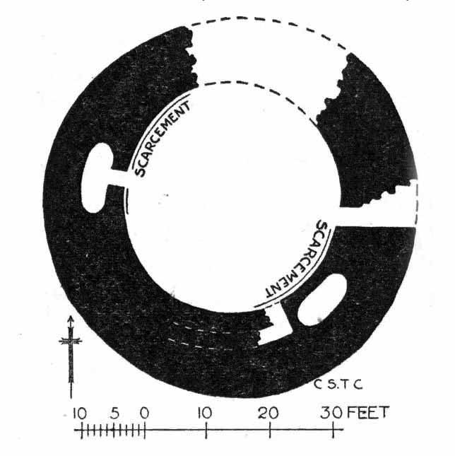
“The outer face of the wall of the broch for a great part is reduced to the lower courses, but on the west-southwest a section still maintains a height of about 7 feet; on the south-side, although hidden by fallen stones, it is about 4 to 5 feet high, and on the northeast there is a very short section 3 feet in height.  The stones are of considerable size and laid in regular courses.  In the interior a mass of tumbled stone obscures the most of the inner face of the wall, but on the south and northwest it stands about 8 feet above the debris.  The broch is circular with an internal diameter of 35 feet to 35 feet 6 inches, and the wall thickens from 10 feet on the north to 13 feet 7 inches on the south. The entrance, which is one the east, is badly broken down, but near the inside has a width of 3 feet 2 inches, and appears to have been 2 feet 10 inches on the outside; it has run straight through the wall without checks.  In the thickness of the wall to the south of the entrance is an oval chamber measuring 10 feet long by 4 feet 9 inches broad above the debris with which it is half-filled.  The roof has fallen in, but the internal corbelling of the walls is well displayed.  The fallen stones no doubt still cover the entrance, which has probably been from the interior.  Within the western arc of the wall, nearly opposite the main doorway, is another oval cell 12 feet in length and 4 feet 6 inches in breadth over debris, with a doorway 2 feet 9 inches wide; its outer and inner walls are 5 feet 9 inches, and 2 feet 6 inches respectively.  The roof od this chamber has also collapsed, but from the masonry which remains in position it must have been over 6 feet in height.  Immediately to the west of the cell near the entrance are exposed the left jamb of a door and a short length of a gallery 3 feet 6 inches wide in the thickness of the southern wall, which probably contained the stairs, as traces of a gallery at a higher level than the oval chambers are seen here, the inner wall being about 3 feet and the outer 8 feet thick. Parts of a scarcement 9 inches wide can be detected on the northwestern and southeastern arcs.”

Dun Osdale plan (RCAHMS 1928)

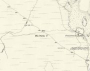
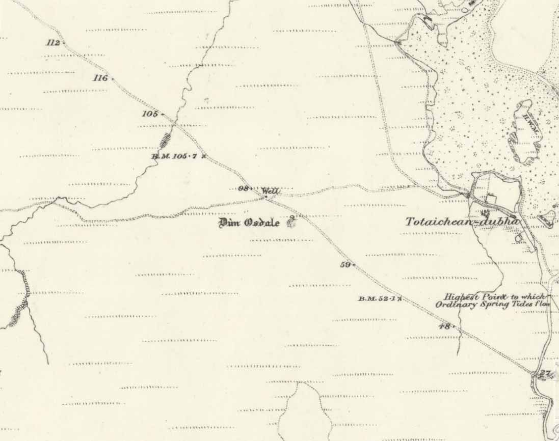
Dun Osdale on 1881 map

Measurements and architectural tedium aside, the broch is worthwhile for anyone interested in our ancient mythic past, not least because of its position in the landscape and its visual relationship with other sites of the same period nearby.  As well as that, there are unrecorded ancient sites still hiding in these olde moors…

Folklore

Tradition tells that Dun Osdale was used as a watch-tower by the tribal folk—which seems quite credible.  But the original inhabitants of Duirinish, the sith or fairy folk, were also said to live here.  It’s one of several places in Duirinish where the legendary Fairy Cup of Dunvegan was said to have come from.  Otta Swire (1961) told its tale:

“One midsummer night a MacLeod, searching for strayed cattle, stayed late on the moor.  In the moonlight he saw the door of Dun Osdale open and the little people come out, a long train of them, and began to dance on the green grass knoll nearby.  Fascinated, he watched, forgetting everything but the wonderful dance. Suddenly he sneezed.  The spell was broke.  The dance stopped.  MacLeod sprang up to fly, but the fairies were upon him and he was dragged, willy-nilly, into the dun.  Inside, as soon as his eyes grew accustomed to that strange green light associated with fairyland, he beheld a pleasing sight.  A great banquet was spread on a large table carved from a single tree: on it were vessels of gold and silver, many of them set with jewels or chased in strange designs.  His fairy ‘hosts’ led him to the table, poured wine into one of the beautiful cups and, giving it to him, invited him to toast their chief.  Now this man’s mother was a witch, so he knew well that if he ate or drank in the dun he was in the Daoine Sithe’s power for ever.  He lifted the cup and appeared to drink the required toast, but in fact skilfully let the wine run down inside his coat.  As soon as his neighbours saw the cup was half empty, they ceased to bother about him but went off on their own affairs or to attend the banquet.  Thereafter MacLeod watched for a chance of escape and, when one offered, slipped quietly through the door of the dun and away, carrying the cup with him.

“The fairies soon realised what had happened and started in pursuit, but he was already across the Osdale river and in safety.  He hurried home, told his mother the story, and showed her the cup.  Being a wise woman she realised the peril in which he undoubtedly stood and at once put her most powerful spell upon him to protect him from the arts of the Daoine Sithe, warning him seriously never to leave the house for a moment without getting the spell renewed.  But she forgot to put a protecting spell upon the cup also.  The fairies soon discovered the exact state of affairs and immediately laid their own spell upon the cup, a spell so powerful that all who saw the cup or even heard of it, were seized with an overmastering desire to possess it, even if such possession involved the murder of the holder.

“For a year, all went well and thanks to his mother’s care the young man went unharmed.  Then he grew careless and one day ventured out without the protecting spell.  A one-time friend, bewitched by the cup, had been awaiting just such a chance and immediately murdered him and went off with the prize.  The fairies, their revenge achieved, took no further interest in the matter, but MacLeod of MacLeod did.  The boy’s mother hurried to him with her story, and he at once gave orders that the murderer be found and brought to justice.  He was duly hanged and the trouble-making cup, now free of enchantment, passed into the possession of the chief and can still be seen in (Dunvegan) castle.”

References:

  1. Donaldson-Blyth, Ian, In Search of Prehistoric Skye, Thistle: Insch 1995.
  2. MacCulloch, J.A.,  The Misty Isle of Skye, Oliphant, Anderson & Ferrier: Edinburgh 1905.
  3. MacGregor, Alasdair Alpin, Over the Sea to Skye, Chambers: Edinburgh 1930.
  4. Royal Commission on Ancient & Historical Monuments of Scotland, Inventory of Monuments and Constructions in the Outer Hebrides, Skye and the Small Isles, HMSO: Edinburgh 1928.
  5. Swire, Otta F., Skye: The Island its Legends, Blackie & Sons: Glasgow 1961.

Acknowledgements:  Eternally grateful to the awesome Aisha Domleo and Her little clan for getting us to this ancient haven on Skye’s endless domain of natural beauty.  Without Her, this would not have been written.  Also, accreditation of early OS-map usage, reproduced with the permission of the National Library of Scotland.

© Paul BennettThe Northern Antiquarian


Castle Craig, Tillicoultry, Clackmannanshire

‘Fort’ (destroyed):  OS Grid Reference – NS 9116 9769

Also Known as:

  1. Canmore ID 48294

Archaeology & History

This ancient fort could once be seen in the ancient woodlands on the western side of the Mill Glen, above the village, going into the Ochils—but it was completely destroyed, as usual, by the Industrialists when they quarried the entire structure out of existence.  It was a big thing too, by all accounts.  When Stewart Cruden (1964) saw it, shortly before its final demise, it was still impressive to look at.  He told that the fort consisted of a deep rock-cut ditch with a stone wall on the inside and the remains of a stony rampart on the outside.  Although damaged it still measured 300 feet across.  Its interior contained an almost precise circular enclosure, more than eighty feet across inside the remains of a large stone wall some twelve feet thick.

Nearly a hundred years earlier, Miss Christian MacLagan (1875) told it to be much bigger!  Not only did she report how locals remembered a stone roof on top, but it possessed three concentric circular walls, thirty-five apart, with the central area eighty feet in diameter—much as Cruden later reported.  However, even in MacLagan’s day, she told how many of the stones from the fort were being used to construct sheepfolds.  This destruction was being lamented by the local historian William Gibson (1883), who wrote:

“On the west side of the burn, and overtopping the village, stands the beautiful Castle Craig, wooded to the top, and on which stood, in ancient times, a round Pictish fortress, the traces of which can still be distinctly seen. This craig is, I think, one of the most picturesque objects on the Alva estate, and it is a very great pity that it should be so disfigured by the extensive quarrying operations that are being at present carried on at it.”

On the top of the quarry edges can still be found old walled remains crumbling at the edge of the huge cliffs, but these are unlikely to have been attached to the ancient fortress, and may just be the fragmentary memories of the sheepfolds built from the old fort.

Folklore

Tradition told that this was one of the old forts of the Picts who lived in the Ochils.  If it was a fort, then the Pictish tradition is probably true.  Old lore also told that some of the stones from the fort were used in the construction of Stirling Castle, 7.8 miles (12.6km) to the west.

References:

  1. Corbett, L., et al., The Ochil Hills, Forth Naturalist & Historian 1994.
  2. Cruden, Stewart H., “Castle Craig, Tillicoultry,” in Discovery & Excavation Scotland, 1964.
  3. Feacham, Richard, Guide to Prehistoric Scotland, Batsford: London 1977.
  4. Gibson, William, Reminiscences of Dollar, Tillicoultry and other Districts Adjoining the Ochils, Andrew Elliot 1883.
  5. Maclagan, Christian, The Hill Forts, Stone Circles and other Structural Remains of Ancient Scotland, Edinburgh 1875.
  6. Royal Commission on the Ancient & Historical Monuments, Scotland, Inventory of Monuments and Constructions in the Counties of Fife, Kinross and Clackmannan, HMSO: Edinburgh 1933.
  7. Royal Commission on the Ancient & Historical Monuments, Scotland, The Archaeological Sites and Monuments of Clackmannan District and Falkirk District, Society of Antiquaries of Scotland 1978.
  8. Watson, Angus, The Ochils: Placenames, History, Tradition, PKDC: Perth 1995.

© Paul BennettThe Northern Antiquarian


Castlehill Wood, St Ninians, Stirling, Stirlingshire

Dun:  OS Grid Reference – NS 75074 90902

Also Known as: 

  1. Canmore ID 46233
  2. Castlehill Wood

Getting Here

In ghostly mist and bracken

Take the Gateside Road from St Ninians or Polmaise Road out of Torbrex across the M9, heading out west onto the southern moors of Touch Hills, passing the Wallstale dun in the trees and then the Castlehill dun just off the road.  Keep going uphill for just over half-a-mile, keeping your eyes peeled on the right for where the MOD lads play some of their war-games.  Walk along the track here, following the line of the woods, until it gets to the spot where it doubles back on itself.  Just here, about 30 yards in front of you, a rounded walled knoll gives the game away!

Archaeology & History

Artists impression of the reconstructed site (PSAS 1959)

An impressive-looking site, not too far off the moorland road, it is one of more than half a dozen hillforts and duns found to the west of Stirling, all of them relatively close to each other—showing that a lot of human activity was going on here in the Iron Age and, probably, much earlier.  Looking like a cross between a broch and a traditional hillfort, the site is best visited in the Winter and Spring months before the bracken starts to encroach and cover it.

Officially rediscovered in 1952 and excavated three years later, it was thought to have been built in the 1st century AD and used for a few hundred years thereafter.  As you walk up to the eastern edge of the monument, a large entrance, 4½ wide, allows you into the large open space within.  From here, and walking around both the inner and outer walls, you get an idea of the huge amount of work it must have taken to build this structure.  The walls alone which constitute the main of Castlewood Dun are, on average, 16 feet thick!  The Royal Commission report for the area (summarizing the archaeological work of F.W. Feacham in the ’50s) gives the basic architectural features of the place:

“The dun is oval in plan…and measures 75ft from NE to SW, transversely within a drystone wall 16ft thick.  The faces of the wall are composed of large, angular blocks, and the core of boulders, small rubble and earth.  The entrance in the E arc, is provided with door-checks.  Within these, the passage measures 4ft 6in in width, and outside them 3ft 9in.  A few paving-stones were laid to level the rough rock surface of the passage-floor.  Traces of what might have been the bottom step of a stair, rising up the inner face of the wall, were found at a point 8ft N of the entrance.  The dun had no mural stair or galleries, but two sets of mural chambers were located, one in the W and the other in the S acr of the wall.  The former consisted of an entrance-passage, 6ft in length, which varied in width from 2ft at the outer to 3ft at the inner end, where it opened into a circular chamber 4ft in diameter.  From either side of the passage a narrow duct or flue, about 19ft in length and 1ft 6in in width, led off obliquely through the core of the wall to debouch into the interior of the dun.  The construction in the S arc consisted of a similar passage, one flue and a smaller chamber.  Ash and a clinker of very light weight were found in the form of deposits in both passages and all the flues. …The excavator suggested they might have been corn-drying installations.”

Groundplan of site (PSAS 1959)
Entrance details (PSAS 1959)

Apart from a small piece of Roman glass, quern fragments, anvils stones and a pot lid, the excavators found very little inside the dun—not even any hearths.  The walling on the southwest and western edges was built onto a small cliff, making access slightly difficult from that side.

From the site itself, views are excellent, particularly in an arc through the north, east and southeast, with the western skylines being only a short distance away.  This enabled relatively easy tribal communication with people at the other brochs, duns and forts in the area, across an otherwise large but difficult landscape in prehistoric times.  A few hundred yards to the northeast, on the other side of the recently planted tree-farm (forestry plantation), a large D-shaped structure—possibly Iron Age, possibly medieval— is accompanied by lines of ancient walling running down the slopes.

References:

  1. Feachem, R W., “Castlehill Wood Dun, Stirlingshire“, in Proceedings Society Antiquaries, Scotland, volume 90, 1959.
  2. Feachem, R W., “Castlehill Wood, Polmaise”, in Discovery & Excavation Scotland, 1955.
  3. MacKie, E W. “English Migrants and Scottish Brochs’, in Glasgow Archaeological Journal, volume 2, 1971.
  4. Royal Commission on the Ancient & Historical Monuments Scotland, Stirling – volume 1, HMSO: Edinburgh 1963.
  5. Royal Commission Ancient & Historical Monuments, Scotland, Archaeological Sites and Monuments of Stirling District, Central Region, Edinburgh 1979.

© Paul Bennett, The Northern Antiquarian 


Auchensalt, Thornhill, Stirlingshire

Broch:  OS Grid Reference – NN 6533 0099

Also Known as:

  1. Canmore ID 24398
  2. Easter Borland
  3. Keir

Getting Here

Auchinsalt broch, looking south

Take the A873 from Thornhill to Aberfoyle, and literally 1 mile west of Thornhill turn right up the track up and past Easter Borland farm (as if you’re heading up to Auchensalt).  250 yards past the farm, a large field opens up.  Walk 100 yards east along the side of the wall towards the trees and follow the tree-line upstream 250 yards (don’t go into the lovely little glen) until, on your right, you’ll see a reasonably large area of grassland that rises up, with a steep-ish slope down to the burn below.  This is the remains of the broch.

Archaeology & History

Shown as a ‘Keir’ on the 1866 OS-map, this is an old Scottish dialect word, barely used at all nowadays (folk need to start using it again!) which meant “an ancient fortification” or “rude forts”.  The word is mentioned in early Statistical Accounts in 1795 and in the Second Account of 1845 the “Kiers at Auchinsalt” are mentioned specifically, albeit in passing….

Auchinsalt ‘Keir’ on 1866 map

When we visited the site yesterday, very little could be seen due mainly to the summer vegetation covering the area.  A very small section of open walling was noted on its western side, and beneath the undergrowth a roughly oval structure was in evidence on the rise between the edge of the field and the drop into the small glen below.  Something obviously man-made lies beneath the grasses, but in the last 100 years or so there has been debate as to whether it was a fort, a dun or a broch.  The consensus at the mo, tells Euan Mackie (2007), is that it’s a broch!

Auchinsalt broch, looking east

Measuring some 25 yards across, the walling that makes up the broch was between 4-6 feet wide all round, and about 2 feet high.  There seemed to be aggregates of large scattered stones inside and outside the main oval feature.  If there was an entrance, it seemed to be at the western side, but I wasn’t sure about this. In truth, unless you’re a hardcore broch fanatic, you’d be truly disappointed with the dilapidated state of this monument.  Much better ones can be seen just a few miles away…

References:

  1. Chrystal, William, The Kingdom of Kippen, Munro & Jamieson: Stirling 1903.
  2. Grant, William (ed.), The Scottish National Dictionary – volume 5, SNDA: Edinburgh 1960.
  3. MacKie, Euan W., The Roundhouses, Brochs and Wheelhouses of Atlantic Scotland c.700 BC-AD 500, BAR: Oxford 2007.
  4. McCulloch, Stuart J., Thornhill and its Environs, Munro Trust: Perth 1995.

Acknowledgements:  Huge thanks to Paul Hornby for getting us here. Cheers matey!

© Paul Bennett, The Northern Antiquarian


Caisteal Nan Coin Dubh, Craobh Haven, Argyll

Dun:  OS Grid Reference – NM 8000 0763

Also Known as:

  1. Canmore ID 22744

Archaeology & History

Caisteal Nan Coin Dubh (after RCAHMS 1988)

Up above the roadside leading down the gorgeous Craobh Haven road, we not only find remains of a previously unrecorded standing stone, but we see this little-known overgrown fort that has been described as a “galleried dun” by the Royal Commission (1988) lads.  Known in folk tradition as the “castle of the black dogs” and an important place in the great legends of the Finns, in archaeological terms the Royal Commission described the site as:

“Oval in plan, the dun measures about 13m by 10m within a wall which varies from 3m to 4m in thickness.  Considerable stretches of the outer face survive and on the N it rises to a height of 1.7m in ten rough courses; the inner face is less well preserved, but a long stretch is visible on the NW.  There are traces of a gallery within the thickness of the wall on the NW; it was entered through a narrow passage, the S-side wall of which it stands to a height of 0.4m in three courses.  A second break in the line of the inner face, 2.5m to the NE, is either another entrance to the gallery or the entrance to a second chamber.  Depressions in the thickness of the wall on the S may indicate the presence of yet another intramural feature.  The entrance to the dun lies on the WSW; it measures about 1m in width at the outer end, 1.8m at the inner end, and is checked for a door 1m from the exterior.  On the NE there is a short stretch of facing at right-angles to the line of the wall, and this may be a straight-joint similar to that at Castle Dounie…or one side of a postern gate. In the interior there are the remains of at least two animal-pens and a modern rectilinear cairn. There is no trace of the midden-deposit noted by Campbell & Sandemann to the W of the dun, and the cairns and stretches of field-walling on the N flank of the ridge are of relatively recent date.”

Folklore

Close to a little-known cailleach site, this ruined fortress was one of the many places which the illustrious historian and folklorist Archibald Campbell told about in his awesome series of Waifs and Strays of Celtic Tradition (1889).  The tale of the fort was known to local people as “The Fight between Bran and Foir and is as follows:

“The black dog, Foir, was the brother of Bran, the far-famed hound of Fionn. Foir was taken early from his dam, and was afterwards nurtured by a band of fair women, who acted as his nurses. He grew up into a handsome hound, which had no equal, in the chase or in fight, in the distant North. His owner, Eubhan Oisein, the black-haired, red-cheeked, fair-skinned young Prince of Innis Torc (Orkney ?) was proud, as well he might be, of his unrivalled hound. Having no further victories to win in the North, his master determined to try him against the strongest dogs in the packs of the Feinne.

“He left home, descended by Lochawe, and entered Craignish through Glen Doan. Before his arrival, the Fienne, after spending the day in the chase, encamped for the night in the upper end of Craignish. Next day Fionn arose before sunrise, and saw a young man, wrapped in a red mantle and leading a black dog, approaching towards him at a rapid pace. The stranger soon drew near, and at once declared his object in coming. He wanted a dog-fight, and so impatient was he to have it, and so restless by reason of his impatience, that he suffered not his shadow to dwell a moment on one spot.

“Fifty of the best hounds of the Feinne were slipped at last, but the black dog killed them all one by one. A second and then a third fifty were uncoupled, but the strange dog disposed of them as easily as he did of the first.

“Fionn now saw that all the dogs of the Feinne were in serious danger of being annihilated, and therefore he turned round and cast an angry look on his own great dog Bran. In a moment Bran’s hair stood on end, his eyes darted fire, and he leaped the full length of his golden chain in his eagerness for the fight. But something else besides the casting of an angry look was still to be done to rouse the fierce hound’s temper to its highest pitch.

“He was placed nose to nose with his rival, and then his golden chain was unclasped. The two hounds, brothers by blood, but now champions on opposite sides, at once closed in deadly fight; but for an adequate description of the struggle between them the reader must consult the bards. See the “Lay of the Black Dog”, in Islay’s Leabhar na Feinne, the McCallum’s Ancient Poetry, etc.

“The contest lasted from morning to evening, and victory remained, almost to the close, uncertain; but in the end Bran vanquished Foir, and, by killing the latter, amply revenged the death of the three fifties. The Feinne buried their own dogs, and the stranger, with a sore heart, laid his black hound in the narrow clay bed.

“This great dog-fight, so celebrated in Gaelic lore, is said to have been fought at Lergychony, in Craignish. It is further said that the place was called Learg-a-choinnimh, or the “Plateau of Meeting”, because it was there the two hounds met in fight. There are, of course, many other places in the Highlands which claim the honour of being the scene of this legendary contest.”

References:

  1. Campbell, Archibald, Waifs and Strays of Celtic Tradition – volume 1, David Nutt: London 1889.
  2. Royal Commission on the Ancient & Historical Monuments of Scotland, Argyll – Volume 6: Mid-Argyll and Cowal, HMSO: Edinburgh 1988.

© Paul Bennett, The Northern Antiquarian