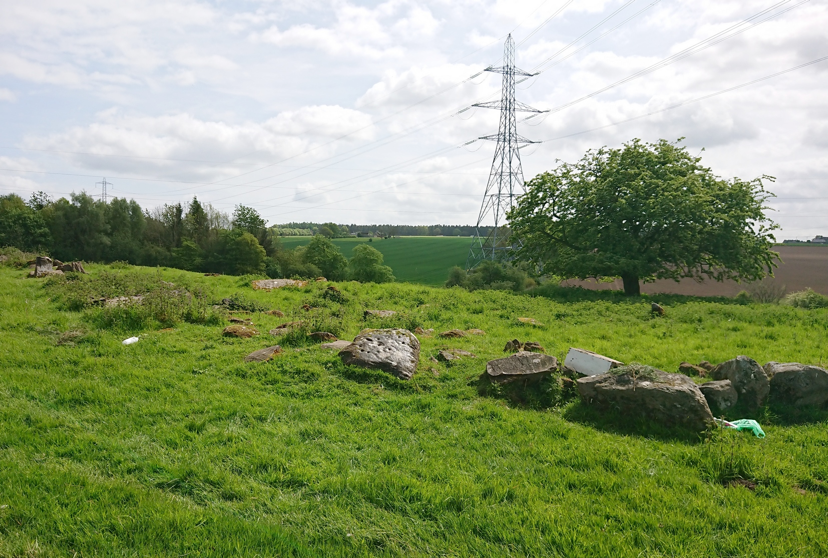
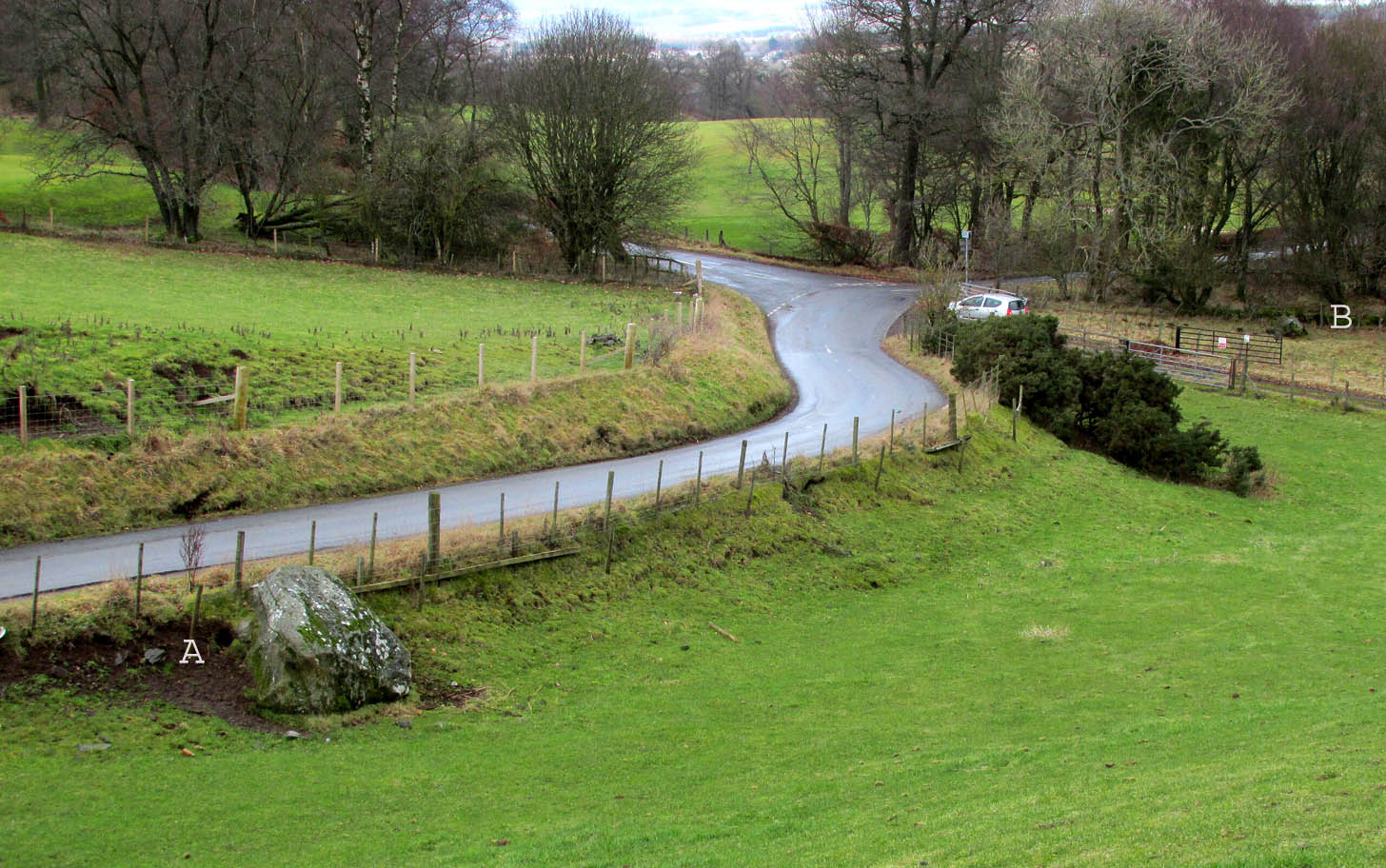
Go west out of Perth city centre, along Longcauseway which runs straight into Jeanfield Road, then (keep your eyes peeled) turn left and go along Burghmuir Road to the end where, at the roundabout, go straight across. 100 yards along, a dead straight path starts on the left-side of the road. Walk 400 yards along here, cross the road, keep straight on the path (called Old Gallows Road) into the trees and a half-mile on you reach a large pylon on your right; but walk to your immediate left here and after 25 yards go through the gate on your left. In this field, 100 yards to the south you’ll see a tree inside a large low stone enclosure. You need to find the stone that’s the most northerly one in this enclosure walling.
Archaeology & History
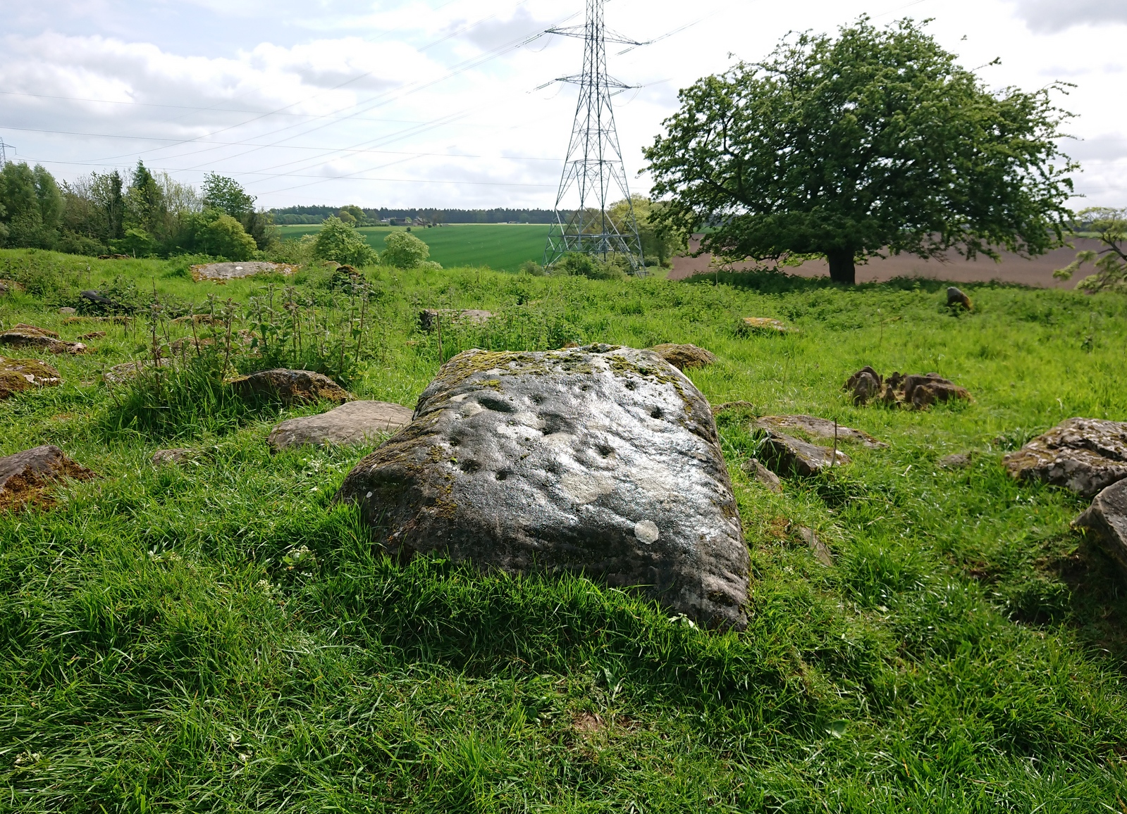
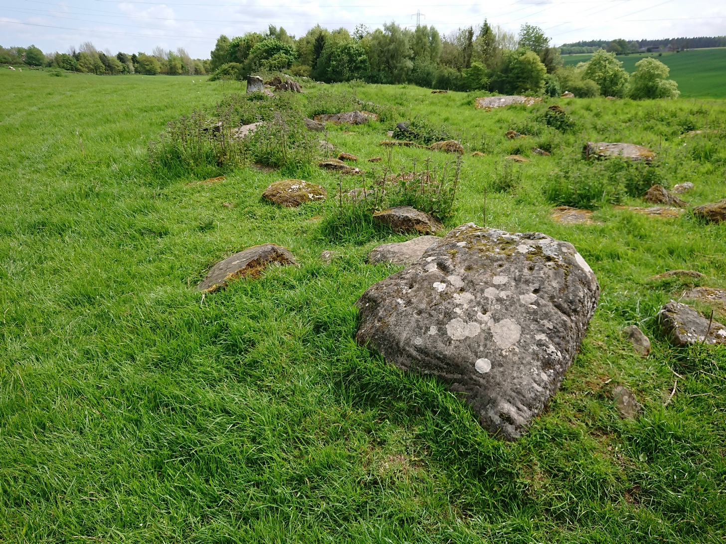
It’s debatable as to whether or not this carving is in its original position as it’s located within the outer walling of an enclosure, deemed by Fred Coles (1903) to have been a large garden, yet which has all the hallmarks of being much earlier structure, possibly even Iron Age. Either way, the cup-and-ring that we see today on the northernmost edge of this old walling, would seem to have been moved into the position it presently occupies.
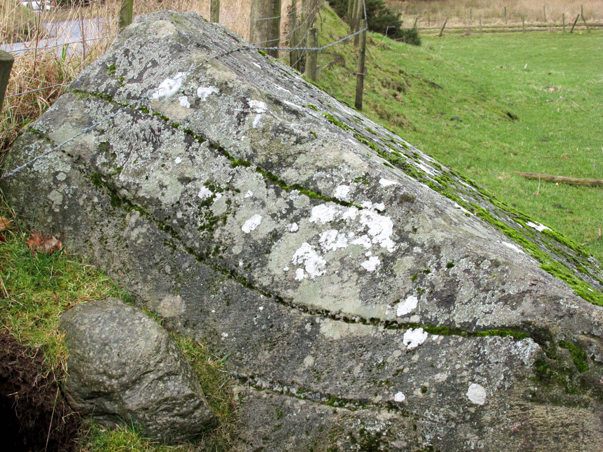
Close-up of the carvingPosition in line of walling
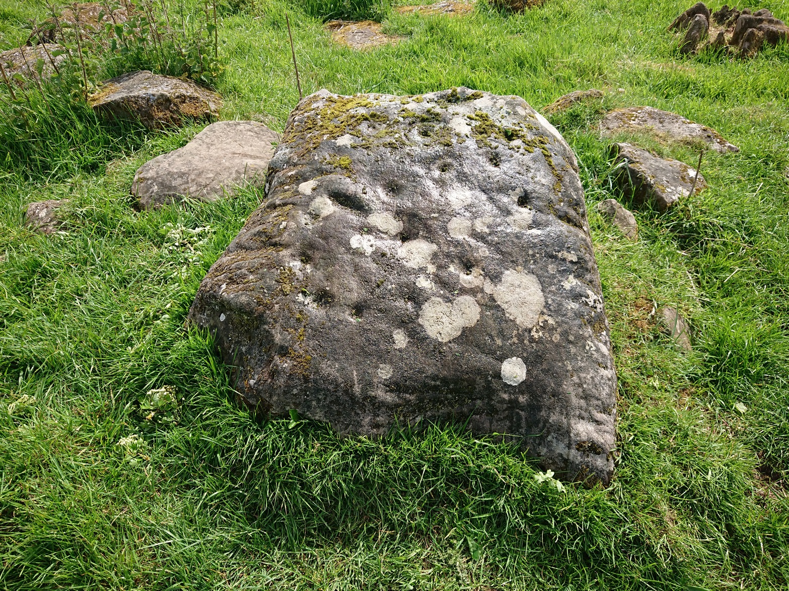
There’s another oddity about it too, as one (or more) of the cup-markings have been incised and worked upon in much more recent centuries, as evidenced by a small thin almost pencil-like cut into the centre of one of them, perhaps with the intention of smashing the stone to pieces. A geologist or stonemason could perhaps look at this and let us know what they think. Thankfully the stone and the carved design remains intact!
It was described by the great Fred Coles (1903) in a summary essay of numerous antiquities both here and further afield. He told us:
Coles (1903) sketchClose-up of the design
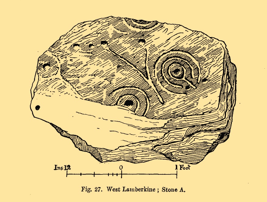
“The cup-and ring-marked stone here was first brought to my notice by Mr David Smith in the summer of 1900. He then reported that the stone appeared to be one of a large number forming a rough circle in a plantation on the west of this farm. On reaching the house, I was fortunate in meeting Mr Douglas the tenant, who at once conducted me to the westmost field and showed me the stone. It is a squarish and not very thick block of ‘bastard whinstone,’ uneven, weathered, and moss-grown. It measures 2 feet 10 inches by 2 feet 8 inches. As far as examination in the gloom of the clump of trees allowed, I believe I am correct in recording…the seven single cups and the two surrounded by rings as all the definitely artificial marks now visible on this stone. The stone at present lies prone upon the curved alignment of many stones which have been set on edge, enclosing an area roughly oval, and measuring in round numbers about 210 feet nearly east and west by 90 or 100 feet north and south.”
There are in fact a few more cups with rings than what Coles described, but they’re difficult to make out. At least five have rings, possibly six of them. If you happen to visit this carving when the daylight is being nice, see if you can catch us a good photo or two and stick ’em on our Facebook group.
References:
Coles, Fred, “Notices of…some Hitherto Undescribed Cup-and-ring-marked Stones,” in Proceedings Society Antiquaries Scotland, volume 37, 1903.
Acknowledgements:Many thanks for use of the Ordnance Survey map in this site profile, reproduced with the kind permission of the National Library of Scotland.
Cup-and-Ring Stone (lost): OS Grid Reference – NO 0654 2296
Archaeology & History
All trace of this carving seems to have gone. It was first recorded by the great Fred Coles (1903) who found it within a small group of stones, but no one has seen it since. Unless it’s been shifted into one of the nearby walls, it may have been destroyed. Coles told us it could be found,
Cole’s 1903 sketch of the carvingStone ‘A’ is the culprit
“at a point 333 yards east of the farm-steadings, where two hedges meet at right angles. Four stones…lie close together. They appear to be all of bastard whinstone. The middle stone, B, has its longer axis ESE and WNW. It is only 3in inches thick. The stones D and C are each 6 inches thick. No marks are to be seen on any of these. But on A is the very distinct sculpturing shown in the illustration…unfortunately not complete, owing to the flaking off of large strips of the weathered lower portion of the slab. There is a strong suggestion of a cist-cover in the shape and size of this stone, which the close proximity of the two other squarer and thinner stones helps to enforce. Though these stones have been known to the tenant for over thirty years, this is, I believe, the first record made of their position and features.”
The records at Canmore have suggested that this lost carving and the missing petroglyph of West Lamberkine (1) nearby are one and the same. This is unlikely. West Lamberkine (1) was described simply as a cup-marked stone, whereas this stone possessed clear identifiable cups and rings. It would be difficult to make such an elementary mistake.
Cup-Marked Stone (lost): OS Grid Reference – NO 0617 2328
Archaeology & History
Site shown on 1933 map
First highlighted on the 1933 OS-map of the area, it was located alongside the old fence-line hereby, but no subsequent description of the carving has been made since then. A small boulder and a number of other stones can be found along the line of fencing, but none seem to be possessed of petroglyphs and apart from it being shown on the old maps, I can find no reference or description of it. It may have been destroyed. Some researchers have wondered if the carving was mistakenly marked at this spot by surveyors who confused it with another one more than 500 yards to the southeast (and described by Fred Coles in 1903), but this would seem an unlikely error to have been made. Whilst this was described as a simple “cup-marked stone”, its neighbour at West Lamberkine (2) was a distinct and more complex cup-and-ring design.
References:
Coles, Fred, “Notices of …(4) of Some Hitherto Undescribed Cup-and-ring-marked Stones…” in Proceedings Society Antiquaries Scotland, volume 37, 1903.
Acknowledgements:Many thanks for use of the Ordnance Survey map in this site profile, reproduced with the kind permission of the National Library of Scotland.
Travelling north from Perth on the A94, take the right turning for Murrayshall just before entering Scone, then take the first right and continue up to the road junction, and park up at the trackway opposite. You’ll see the big stone in the field to the right, up against the road embankment; and the small stone is in the paddock to the left of the trackway at the edge of the trees.
Archaeology & History
Two large glacial erratics which have acquired mythic status and picked up a Christian triumphalist message on the way.
Folklore
In Lawrence Melville’s (1939) excellent local history work, he thankfully put to pen an all-but-forgotten tale of oral tradition:
“Where the road from the Muir of Durdie leaves Kilspindie parish, a grass grown road leads north to Boglebee….. A few yards from the highway lie two large stones, said to have been flung from the Giant’s Hill in Collace parish – the flat topped eminence lying due north from the stones, about two or three miles away, better known as “Macbeth’s Hill”, or “Dunsinane Hill”.
The ‘string’ marks of legendThe smaller stone with its ‘string’ marks
“When the church dedicated to St John in Perth was being built and its tower began to appear, a witch living in Collace was enraged to see this proof of the approach of Christianity and determined to destroy it. She had a son, a giant (after whom the hill receives one of its names), whom she sent to the top of the hill, giving him two huge stones with which to destroy the rising church.
“By her incantations she had supernatural power and knew that when Christianity came her power would be destroyed. She gave him her mutch from her head to be used as sling and in it the giant put the two huge stones. Whirling it around his head, he aimed them in a line with the tower, but, just as he let them fly, the string of his mother’s cap broke and the stones only went the length of Boglebee. The marks on the stones are said to be the marks of the witch’s mutch strings.”
Another view of the larger stone
A familiar folkloric message is remembered the length of Britain: a giant, a devil or other supernatural being throwing stones that either spill out of an apron or otherwise miss their mark. And in this case an unsubtle message to anyone trying to take on the might of the church. But what was the original story of these stones as told by the old time oral storytellers before Christian missionaries stalked the land?
If the string hadn’t broken and the stones had followed their original trajectory they would have fallen south of St John’s Kirk, but it was the thought that counted….
Reference:
Melville, Lawrence, The Fair Land of Gowrie, William Culross: Coupar Angus, 1939.
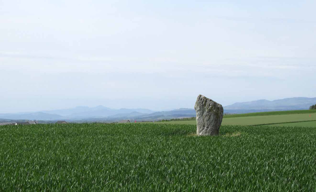
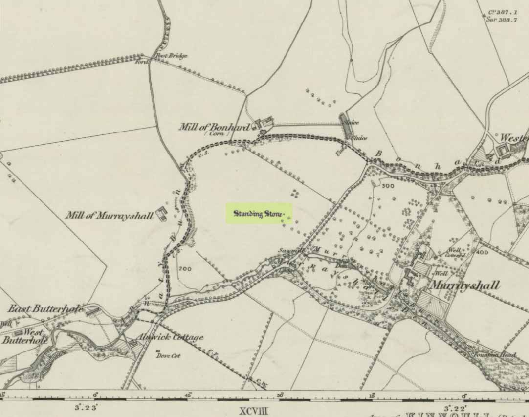
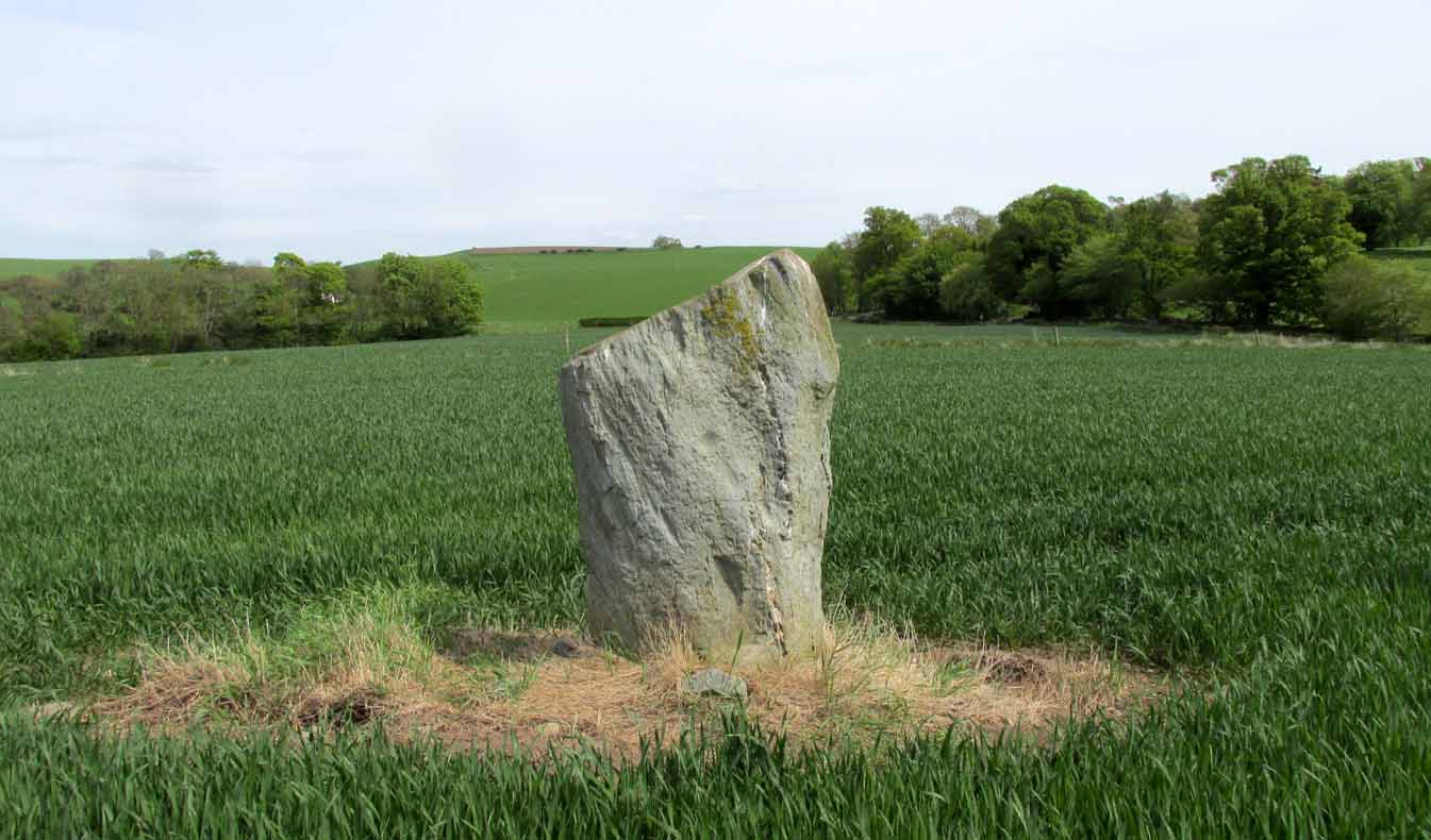
On the main road (A94) through Scone, go east along either Murrayshall Road or Bonhard Road for a short distance until you go out of the town and into the countryside. About ⅓-mile (0.5km) along the country lane, go left at the road junction; and just another ¼-mile on, notice the field-gate on your left. As you’ll see, the standing stone is just over 100 yards away in that field.
Archaeology & History
Murrayshall on 1867 map
In a region littered with megaliths, this fine upright single stone stands, quite deliberately, at a point in the field where you have excellent 360° views, which to the north looks way into the orgasm of the Scottish mountains. History and tradition seem to tell it has always been a loner, without companions, but no archaeological excavation has taken place here to my knowledge; and the apparent proximity of some type of prehistoric ring-ditch 30 yards away may be related to the stone. But we don’t for sure…
Close-up of cupmark
North-face with cupmark
Despite being shown on the first OS-map of the region in 1867 and despite being a large monolith more than 6 feet tall, very little seems to have been said of it. It was included in Swarbrick’s (2012) poorly arranged survey; and the Royal Commission (1994) merely listed it, without comment, other than to say “it bears no markings.” Yet when Paul Hornby and I visited the place recently, a large single cup-mark is plain to see on the north-face of the stone.
Although the stone is alone in this field, once you start exploring the hills a short distance to the south and the farmed fields heading north and east, masses of prehistoric sites begin to appear. It’s well worth checking out!
References:
Royal Commission on the Ancient & Historical Monuments of Scotland, South-East Perth: An Archaeological Landscape, HMSO: Edinburgh 1994.
Swarbrick, Olaf, A Gazetteer of Prehistoric Standing Stones in Great Britain, BAR: Oxford 2012.
Acknowledgements: Huge thanks as always to Paul Hornby for getting us to this site. Plus, accreditation of early OS-map usage is reproduced with the permission of the National Library of Scotland.