Holy Well, Glen Prosen, Angus

Holy Well:  OS Grid Reference – NO 3172 6681
Getting Here

Glenprosen Holy Well

A long long way for a single little spring, go from Kirriemuir town centre up the B956 Kinnordy Road, going straight across at the crossroads up the countryside lane towards Lednathie (signposted 8 miles): dead straight, long-and-winding, up-and-over…. Stick to this single road, all along, ignoring all turn-off junctions until, once reaching the hamlet of Easter Lednathie, stay awake for the turn up to Glenprosen, 2 miles along, over the bridge. Turn left until and a few hundred yards along go over the next little bridge until you reach the “Private Road” sign, then walk up the track past Katy’s Cottage.  ¾-mile along just before Balnaboth, keep your eyes peeled for a splatter of quartz rocks with a spring of water thereby.  At long long last, you’ve reached your destination!

Archaeology & History
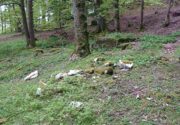
A “splatter of quartz rocks”

Miles to the winding north of Kirriemuir, in the depth of the olde mountains, this clear spring of iron-bearing water (still fresh and drinkable) was, earlier in the 20th century, covered over by someone-or-other and surrounded by straight slabs of stone.  The waters were maintained however, by the builders who cut a small hole into the moss-embolded rock allowing this pure water to still run freely for all to use…

Shown on the early OS-maps, its sacrality or holy association would seem to be lost from the tongues of the older folk, most of whom seem long gone from this beautiful glen-to-nowhere.  The only remaining religious connection we might have relating to the place comes from the ruined 17th century chapel less than 250 yards away to the west on the slope above the track, from where a singular stone-lined footpath runs dead straight to the well.

Site shown on 1900 OS-map

But another important feature found here is the large scatter of quartz rocks a few yards away from the water source.  They are in disarray but would seem to have once been built around the spring where it first emerged from beneath the ground, then being cast aside to their present positions when the more modern stone structure was built above it.  We can’t prove this with any certainty, but there are a number of other holy wells with this quartz-defining feature elsewhere in Scotland: the St Mary’s Well at Callander and Beltane Well of Kenmore to name just two.

References:

  1. Robertson, D.O., Long-Ago Legends of Clova, Edinburgh 1872.

Acknowledgements:  Huge thanks for use of the Ordnance Survey map in this site profile, reproduced with the kind permission of the National Library of Scotland

© Paul BennettThe Northern Antiquarian

St. Ninian’s Well, Blairgowrie, Perthshire

Holy Well (destroyed):  OS Grid Reference – NO 180 452

Archaeology & History

The Well Meadow in the middle of Blairgowrie was once the place where the 5th century Apostle of the Southern Picts, or St Ninian, baptised local folk into the so-called “new faith”.  It’s long since gone.  The local historian John MacDonald (1899) told that it was located opposite the buildings on the north-side of the square, adding:

“St Ninian, one of the earliest Christian Celtic missionaries, on his tour through Scotland, pitched his camp where the Wellmeadow now is, and quenched his thirst at an old well or spring which ever afterwards bore the name of “St Ninian’s Well,” until it was covered in and the water led into the town drains.”

Old Ninian’s saint’s day is September 16.

References:

  1. MacDonald, John A.R., The History of Blairgowrie, Advertiser Office: Blairgowrie 1899.

© Paul BennettThe Northern Antiquarian

Small Wells, Louth, Lincolnshire

Sacred Wells (destroyed):  OS Grid Reference – TF 32603 87555

Also Known as:

  1. Little Wells

Archaeology & History

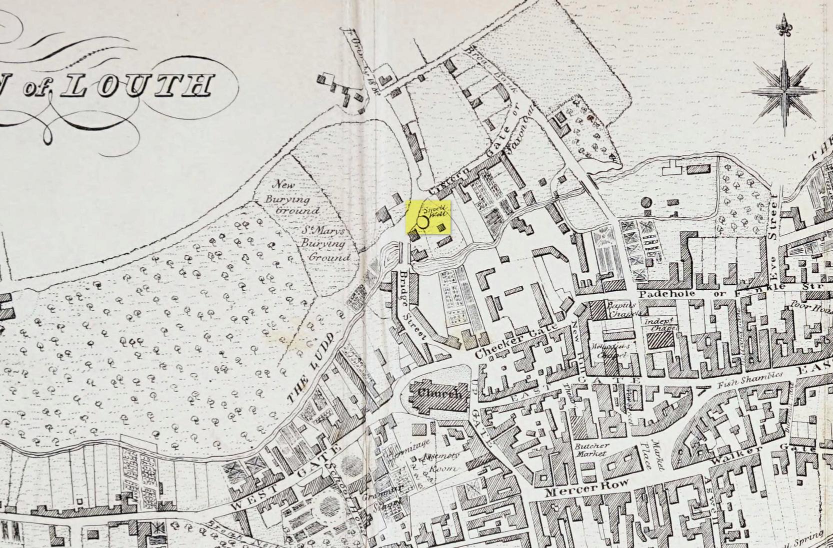
Small Well on 1834 map

Of the three wells in old Louth around which local ceremonies occurred, the Small Wells were apparently the least impressive.  Its ritualised compatriots south of the River Lud in St. Helen’s Well and the Ash Well (the Aswell in modern Louth place-names) were reportedly the much better water supplies in bygone times.  The site was highlighted on a map of the town in Robert Bayley’s (1834) history of the area, showing it as a small pool just below the Cistern Gate road; but when the Ordnance Survey lads came here later in the 19th century it had already gone.

It’s category here as a “sacred” well is due to it being annually decorated with garlands of flowers, commonly known today as well-dressing.  Such wells tend to be places of pre-christian rites, attended by local people at dawn usually at Beltane or at Midsummer (St John’s Eve); but I’ve been unable to find out which was the sacred day when the waters here were honoured.  All that we have left to tell us of the rites is from old township notes that said how,

““The small wells,” a cluster of little springs on the north of the town, shared in the honours of green boughs and popular huzzahs” the traditions held at the wells of St. Helen and Aswell a half-mile to the south.

A brief 16th century account told of a local man being paid for the adornment of the Small Wells: one “Henery Forman received for dressing small wells for a yeare – xiid” – or 12 pennies in old money.  Not bad at all in them days!

References:

  1. Bayley, Robert S., Notitiae Ludae; or Notices of Louth, W. Edwards 1834.

© Paul BennettThe Northern Antiquarian 

Cross Well, Dundee, Angus

Healing Well (destroyed):  OS Grid Reference – NO 4032 3025

Archaeology & History

This old water supply had no direct ‘holy’ nature, despite its proximity to the cathedral, the old market cross and St Clement’s Well some fifty yards away!  Most odd.  A much more mundane story lies behind this long lost water source.  The Dundee historian William Kidd (1901) told us,

“When the public wells were erected, about the year 1749, to supply the town with water from the Lady-well reservoir at foot of Hilltown, one was placed on the High Street, on the east side of the Cross, and was called the Cross Well.”

It didn’t have too long a life either—much like the old Market Cross, for,

“In the year 1777 that quaint structure was demolished.  The platform and octagonal tower were carted away as rubbish, the least decayed stones being selected to be used in other buildings.  The stone shaft, also, was preserved, and placed beside the Old Steeple. With the demolition of the Cross, the Cross Well was cleared away from the High Street, but, as water was an essential to the people, the well was re-erected behind the Town House in St. Clement’s Lane.  In that situation it remained for nearly one hundred years, when, being rendered unnecessary by the introduction of the Lintrathen water supply, it was also demolished, along with the old buildings in the Vault and St. Clement’s Lane, to make room for the additions to the Town House.”

References:

  1. Colville, A., Dundee Delineated, A. Colville: Dundee 1822.
  2. Kidd, William, Dundee Market Crosses and Tolbooths, W. Kidd: Dundee 1901.

© Paul BennettThe Northern Antiquarian

Barley Cross, Richmond, North Yorkshire

Cross (destroyed):  OS Grid Reference – NZ 1709 0085

Archaeology & History

This was one of at least four old stone crosses that used to exist in Richmond.  It was accompanied by other functional edifices nearby known as the Oat Cross and Wheat Cross.  Like its companions, the Barley Cross is thought to have been the site where this grain was traded.  An early reference to it is Chris Clarkson’s (1814) survey, where he told us that not far from the old Market Cross,

“was formerly another, which went by the name of Barley Cross, perhaps so named from that sort of corn being sold there: it was a lofty Pillar of one large stone upon a small flight of steps with a cross at the top: rings were fastened to it, where criminals were punished by whipping: it is not long since it was taken down.”

Barley Cross (centre left) on 1724 town plan

Similar punishments were also administered to people at the original old Market Cross.  The grand masters of of Yorkshire history, Edmund Bogg (1908) and Harry Speight (1897) also mentioned this antiquity, but added nothing more.

The cross was highlighted on a 1724 plan of Richmond, just below the larger Market Cross.  In 1780 the local council ordered it to be demolished and, at a later date, large weighing scales were erected on the spot next to where it had stood, on the south-west side of the Trinity Church in the market square.

References:

  1. Bogg, Edmund, Richmondshire, James Miles: Leeds 1908.
  2. Clarkson, Christopher, The History of Richmond, T. Bowman: Richmond 1814.
  3. Home, Gordon, Yorkshire Dales and Fells, A. & C. Black: London 1906.
  4. Speight, Harry, Romantic Richmondshire, Elliot Stock: London 1897.

© Paul BennettThe Northern Antiquarian