Enclosure: OS Grid Reference – NC 69843 61228
Also Known as:
- Bail Margait
- Margaret’s Town

Baile Mhargaite 1 enclosure, looking NW
Take the A836 road west out of Bettyhill, down the road and cross the river on the tiny bridge. From here, go over the gate on the right-hand side of the road and follow the edge of the river towards the sea. Crossing the large extensive sands, you’ll reach a large sand and gravel rise ahead of you. Once on top of this natural feature, walk NNE for 550 yards (0.5km) until you reach one of many extensive sandy expanses in the grasses (and pass tons of archaeological remains as you walk!). You’ll get there!
Archaeology & History
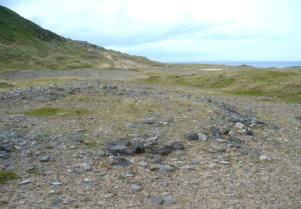
Arc of south, west & north walling
On this naturally raised sand-and-gravel platform at the edge of this beautiful sandy coastline in the far north of Scotland, walking in search of this particular enclosure, you’ll meander past a whole host of prehistoric sites and remains – some of which are plain to see, others hiding almost just above ground level, barely visible. But if you’re an antiquarian or historian, this plateau is a minefield of forgotten history!
The site is shown on the 1878 Ordnance Survey map of the region as a “hut circle”, which it may well have been—but this is a large hut circle and was more probably a place where a large family would easily have lived. When I visited the place the other week, there were no internal features visible. It is a large ring of stones made up of thousands of small rocks whose walls are low and scattered, barely a foot above present ground-level in places, and barely two-feet at the very highest. It has been greatly ruined or robbed of other architectural elements and an excavation is in order. My initial evaluation is that this structure is at least Iron Age in origin. In Angus Mackay’s (1906) venture here in the early 1900s, he suggested that this and the other “circular rings” were “cattle folds.”
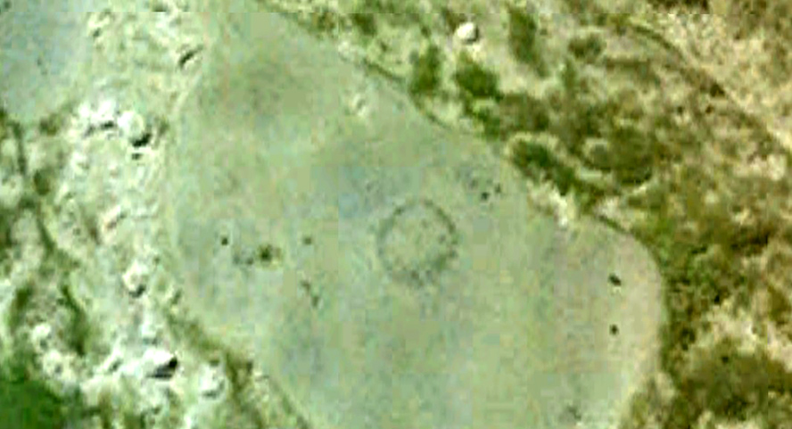
Aerial view, looking straight down

Looking down from the broch above
The enclosure measures, from outer-edge to outer-edge of the walling, 16.5 yards (15.1m) east-west by 18 yards (16.5m) north-south, and has a circumference of roughly 52.5 yards (4mm); although an accurate measure of its circumference is hampered by the scatter of spoilage from the collapsed walls stretching outwards. Only the western walled section remains in reasonably good condition.
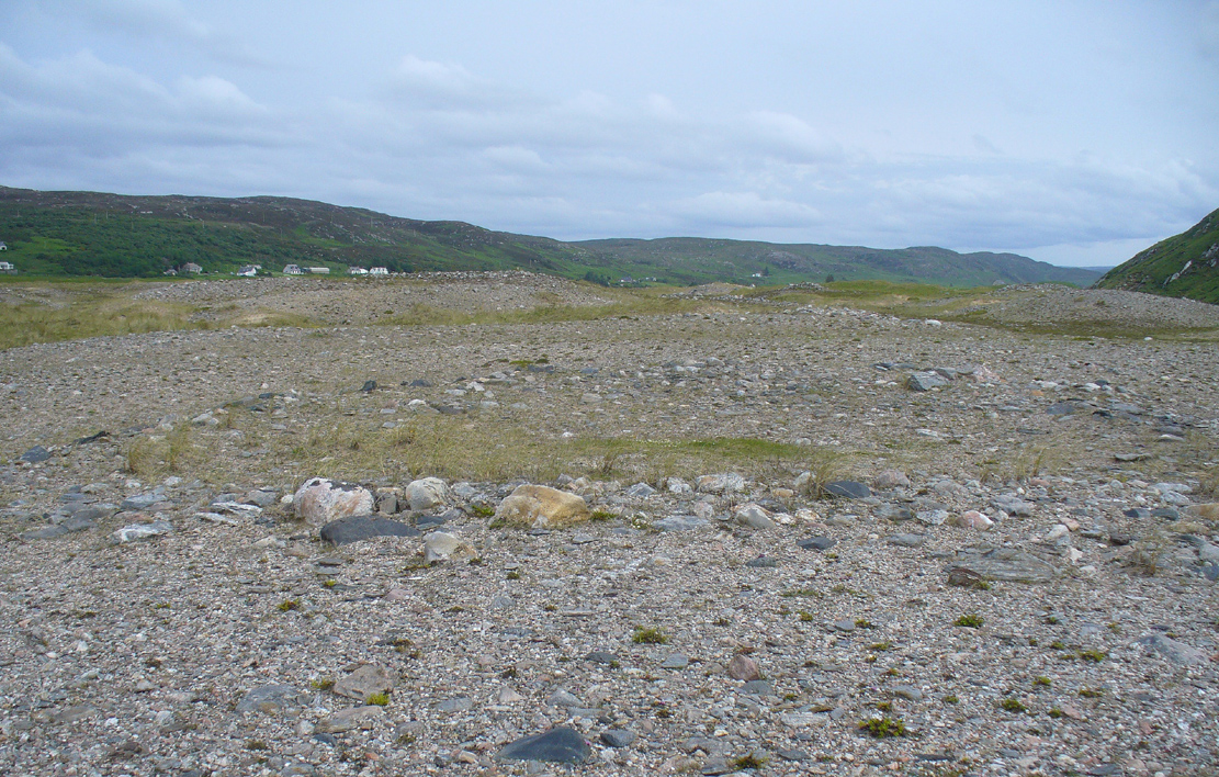
Looking south, thru the enclosure
Close by are many cairns, some of which are prehistoric. A chambered cairn on the same ridge less than 200 yards away, with another enclosure of the same type yards away, clearly shows that people have lived and used this raised section of land for thousands of years. We know that people were still living here at the end of the 18th century which—for me at least—begs the question: what ancient traditions, customs and lore did these people know about, which may have dated back into truly ancient history? …And then the english Clearances destroyed them…
References:
- Mackay, Angus, “Notes on a Slab with Incised Crescentic Design, Stone Mould for Casting Bronze Spear-Heads, a Cup-Marked Stone, Holy Water Stoup, and other Antiquities in Strathnaver, Sutherlandshire,” in Proceedings of the Society Antiquaries, Scotland, volume 40, 1906.
- Royal Commission on Ancient & Historical Monuments, Scotland, Second report and inventory of monuments and constructions in the county of Sutherland. HMSO: Edinburgh 1911.
© Paul Bennett, The Northern Antiquarian