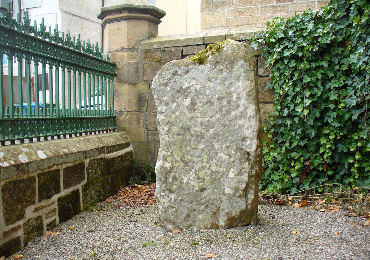
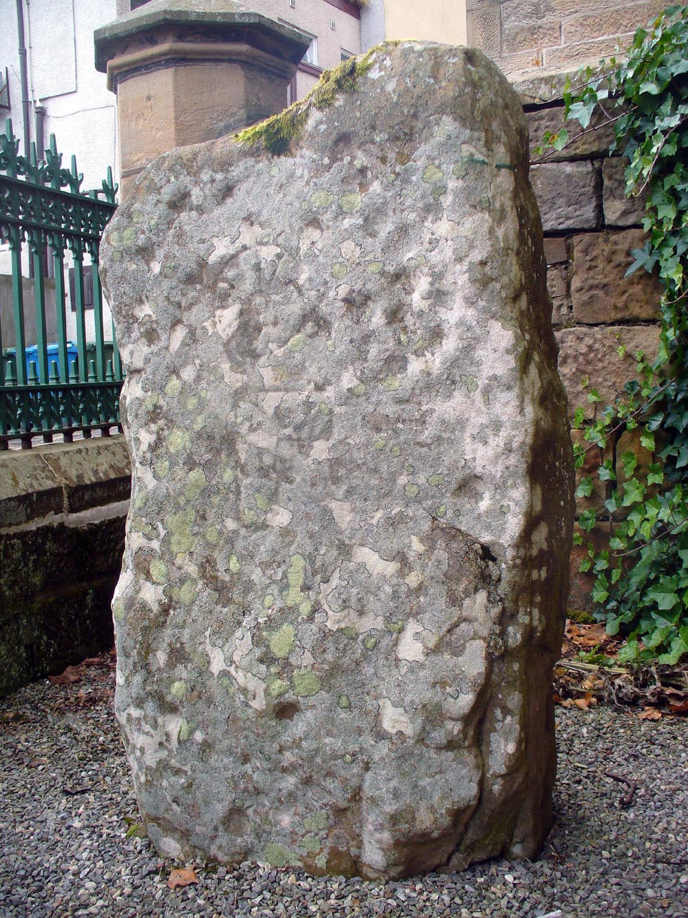
The stone is no longer in its original position (a few miles away), but can now be found if you visit the Tain & District Museum, just off Tower Street, in towards St Duthus’ Church. The stone is upright around the side of the adjacent buildings. It’s probably easier to access if you walk down Castle Brae, keeping your eyes peeled to your left. Otherwise, just ask the helpful people at the Museum and they’ll point you to the spot.
Archaeology & History
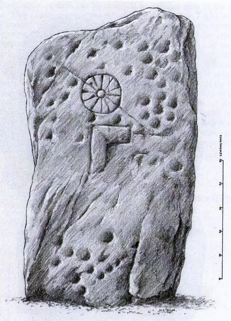
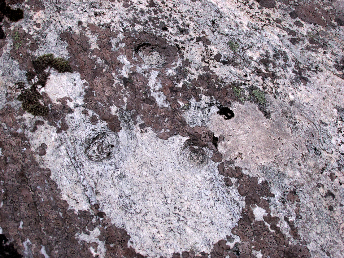
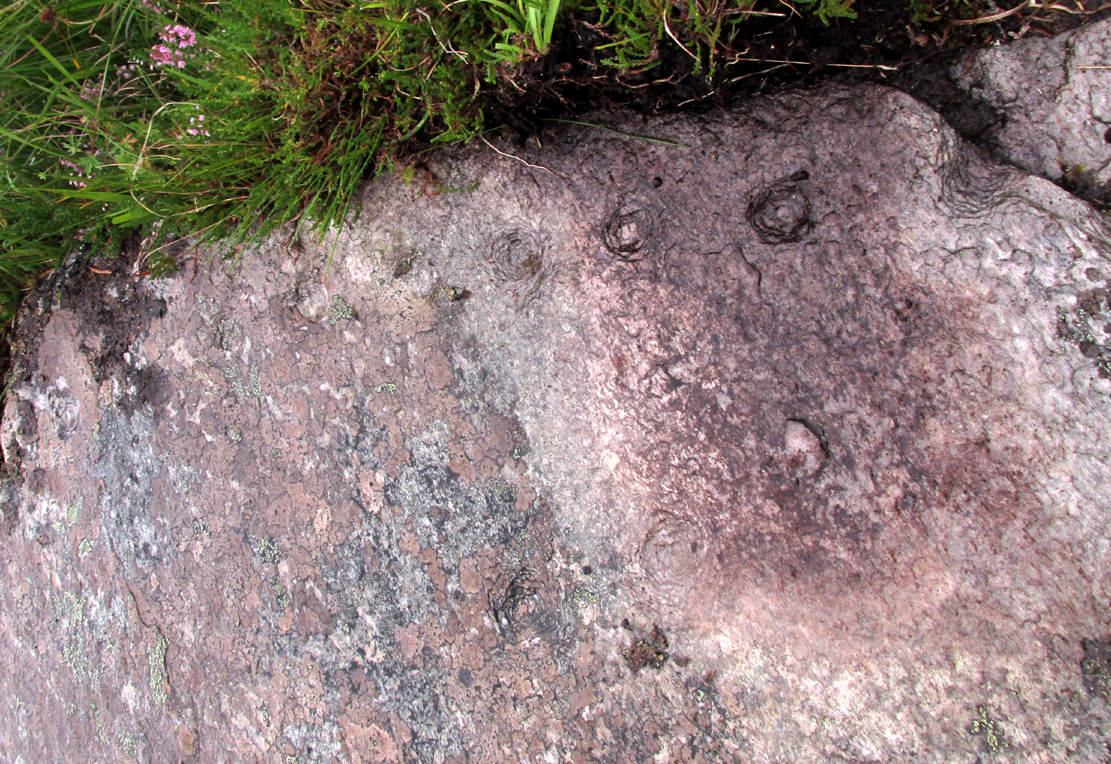
An intriguing stone with what may be a long and fascinating history behind it… It was only rediscovered in the 1960s, when the farmer at Ardjachie (2½ miles northwest of Tain town centre) came across it in one of his fields. It’s not large or notable in any way, other than it possessing a couple of really peculiar symbols etched amongst a mass of otherwise standard neolithic and Bronze Age cup-marks. These other symbols are (as seen in Mark Taylor’s drawing, right) a very distinct ‘spoked wheel’ and what looks like a right-angled ‘tool’ or set-square of some sort. These symbols have brought with them notions from academics who are claim it has Pictish provenance. However, we must be very cautious of this idea….
The first written account of the stone was by Ellis Macnamara (1971) who gave a detailed description of the carving:
Ardjachie Carving (after Mark Taylor 2004)
“Boulder found on Ardjachie Farm, now in Tain Museum. The boulder, of probably local old red sandstone, is uncut and very irregular in shape but has two principal faces; the maximum length is 1.7m; maximum width is 0.65m and on the maximum thickness is some 0.35m. The carvings are all on one face, which is much weathered; the opposing face is conspicuously less smooth so that it is possible that this stone was never set upright. The weathered face is covered with at least 30 ill-defined cup markings scattered over nearly the whole surface, though grouped towards one end; the average diameter of these cup markings is about 3 to 4cm, depth about 1.5cm. There are several indistinct lines among the cup markings and there is among the thickest cluster of cup markings a symbol like a ‘wheel’, with the outer ‘rim’ drawn as a fairly perfect circle, with a diameter at the outer edge of some 17cm. The ‘wheel’ has twelve ‘spokes’ and a single inner circle, or ‘hub’, with a diameter at the outer edges of about 4 or 5cm.”
Subsequent to Macnamara’s description, it’s been suggested that there are cup markings on both sides of the stone; but the ones on the other side are a little less certain. The stone itself almost typifies the cup-marked cist covers we find scattered all over the country—yet no burial or other structure was noted upon its discovery in the fields. It’s an oddity on various levels…
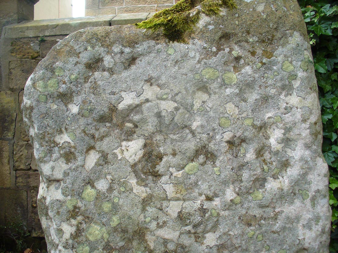
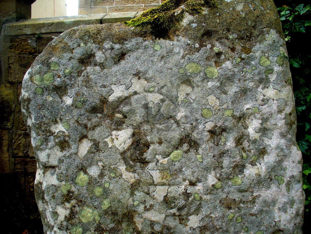
Close-up of spoked-wheelClose-up of spoked-wheel
The spoked-wheel symbol and, moreso, the right-angled element, have led some to speculate that the symbol was carved in Pictish times; but there are problems with this on two levels at least. The cup-marks we know are neolithic or Bronze Age in origin, and their design always inclines to abstract non-linear forms, screwing egocentric analysis. But the ‘spoked wheel’ is more linear in nature. But as acclaimed petroglyph researchers from George Coffey (1912) to Martin Brennan (1983) show, this spoked wheel occurs in neolithic Ireland; and the identical symbol occurs in prehistoric carvings at Petit Mont in France (Twohig 1981), at Cairnbaan in Argyll (Royal Commission 2008) and there’s even a partial spoked-ring on the Badger Stone on Ilkley Moor! We have no need to jump into Pictish times to account for its origin and unless we have direct archaeological evidence to prove this, the academic Pictish association must be treated with a pinch of salt. It is nevertheless scarce amongst neolithic and Bronze Age carvings in Britain. Maarten van Hoek (1990) suggested it to be a variant on the ‘rosette’ design, also neolithic in origin. On the whole the symbol is interpreted as being the sun—which it may well be.
If you look carefully at the images above you can see, to the right of the ‘wheel’, a cup-marking surrounded by a ring of six-cups. It is possible that this may be an older variant of the spiked-wheel solar symbol. All speculation of course. The other peculiar element here is the curious right-angled design, below the ‘sun’. This symbol in particular is quite different from the early cup-marks and may have been carved at a much later date. In which case, this raises the potential for a continuity of tradition here… which mightjust bring in the Picts!
A bittova closer look
But the general problem with a Pictish assignment is that of the Picts themselves. If we ascribe the current anglocentric belief that the Picts only existed between the 3rd and 9th centuries (because we only have written records of them during that period), we are assuming the rather naive philosophy that anything before written history did not exist: a sort of blind-man’s Schrodinger’s Cat ideology, only really accepted by pseudo-historians. But if the Picts didhave something to do with this carving, we may indeed be talking about a continuity of tradition from the ancient past into the written period. Such an idea would be no problem in developed tribal cultures with an animistic cosmology—and that’s assuming that this stone was deemed as ‘special’ in some form or another to the local people. But all these are uncertainty principles in themselves and we may never know for sure…
There are no adjacent monuments to where Ardjachie’s stone came from, and apart from a scatter of flints found a hundred yards or so closer to the beach, other archaeological remains are down to a minimal. Its isolation is peculiar. There are however, a number of springs of water a few hundred yards away, just across the main A9 road, two of which have left their old names with us as the Cambuscurrie Well and the Fuaran nan Slainte, or fountain/spring of Healing (the modern Glenmorangie whisky gets it waters hereby!). Although we must be careful not to assign every example of prehistoric rock art with the same material, the mythic association between petroglyphs and water cannot be understated, and although such an association at Ardjachie is conjectural, it cannot go unnoticed.
References:
Brennan, Martin, The Stars and the Stones: Ancient Art and Astronomy in Ireland, Thames & Hudson: London 1983.
Coffey, George, New Grange and other Incised Tumuli in Ireland, Hodges Figgis: Dublin 1912.
McHardy, Stuart, A New History of the Picts, Luath: Edinburgh 2012.
Mack, Alastair, Symbols and Pictures: The Pictish Legacy in Stone, Pinkfoot Press: Brechin 2007.
Macnamara, Ellen, “Tain, Ardjachie Farm: Cup Markings and Incised Symbol”, inDiscovery & Excavation Scotland, 1971.
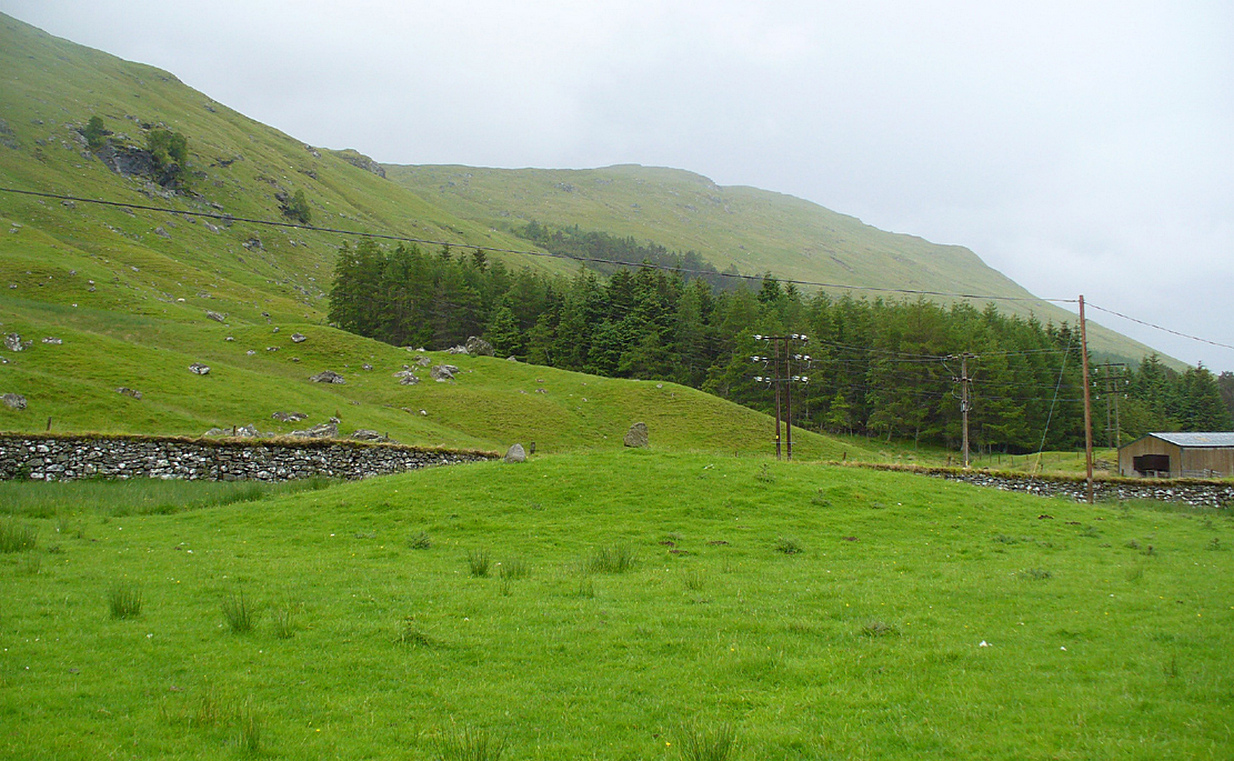
Whether you take the road west from Fortingall, or over the heights from Loch Tay, when you reach Meggernie Castle just keep going west for a few more miles. Keep going past the large Stronuich reservoir on your left and you’re getting close. Go past Caisteal Mhic Neill and the trees at Cashlie House for another 5-600 yards and where the track crosses the river Lyon, park up just past it. Ahead of you in the field on the left of the road, nearer the riverside, is where you need to look.
Archaeology & History
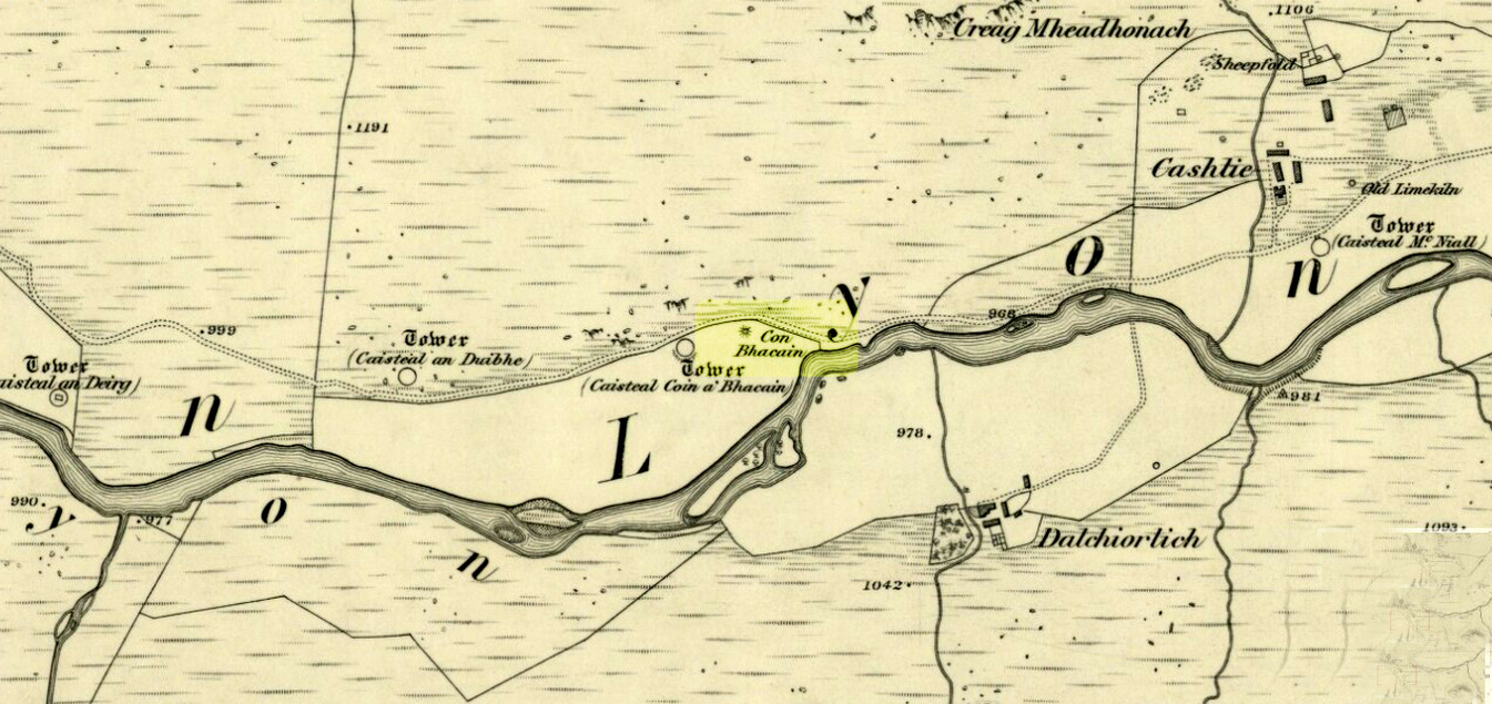
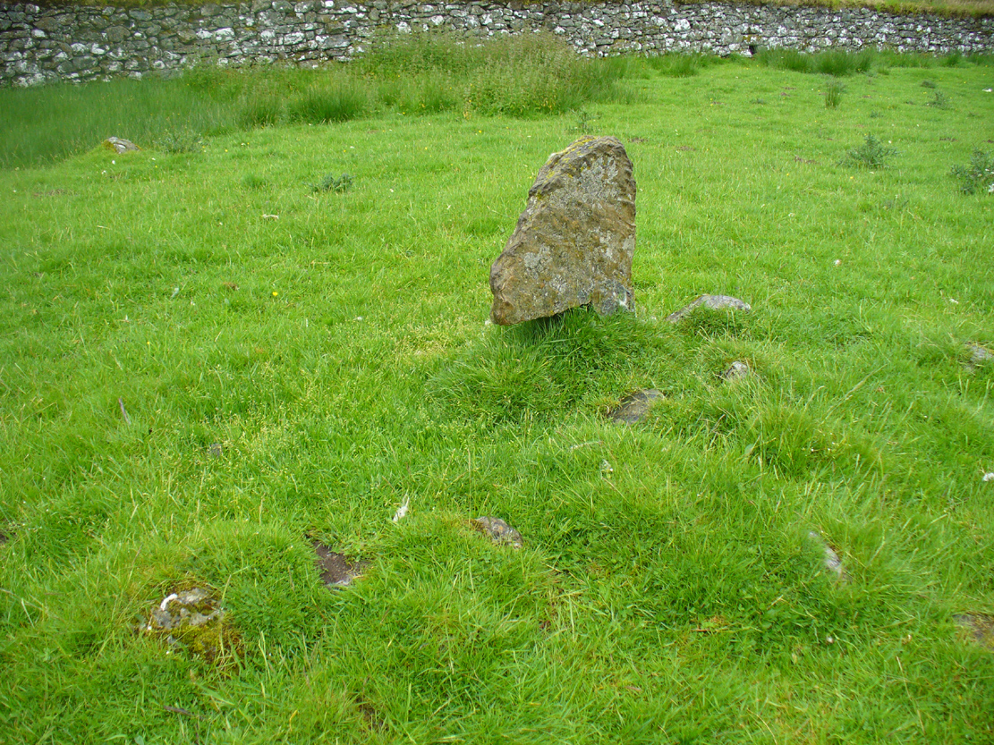
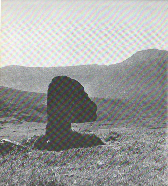
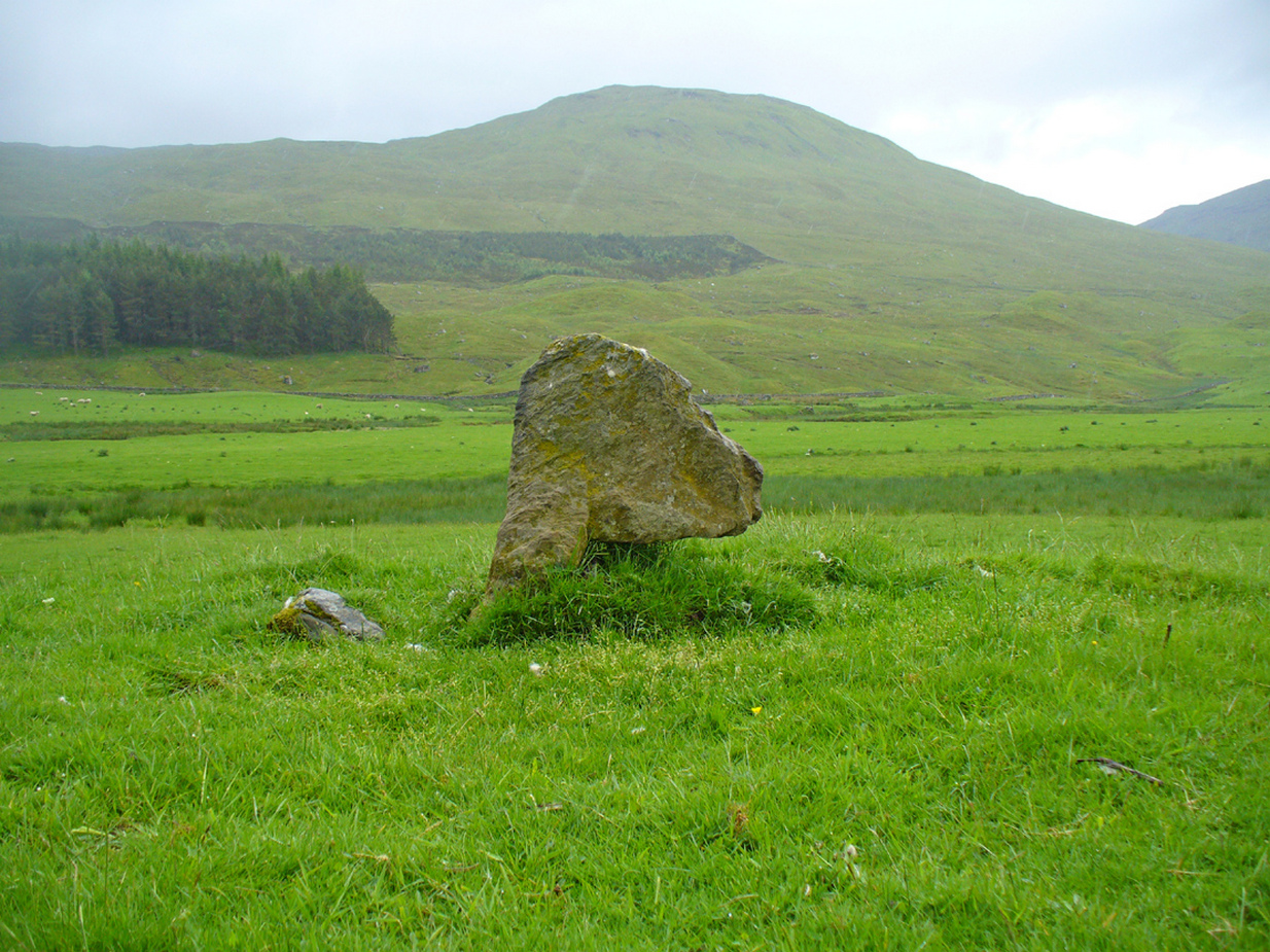
One of the most peculiar and unique sites in the British Isles is this remote small upright stone, known locally as The Bhacain. Standing upon a small mound in the field immediately east of one of Finn’s legendary ‘forts’ (a dun or a broch) called Caisteal Cona Bhacain, this curious monolith, less than two feet tall, has a thin upright stem with a much enlarged rounded end to it. Some might even ascribe it as phallic—although local traditions of the stone relate it as a truth-sayer of a young girl’s virginity!
The Bhacain on 1867 mapMound of The Bhacain
Its position on top of the small mound is intriguing, giving it the impression of being atop of a tumulus; and there is also the scatter of small stones surrounding the upright just beneath the surface (as evidenced in one of the photos), making it possible that the stone is an ancient burial marker. If this is ever shown to be true, the likelihood is that the stone marks the grave of a hound, as the tradition of this spot implies. No excavation has ever occurred here, so the precise nature of the stone (and the mound) has yet to be ascertained; but knowing the longevity of some oral traditions in these Highland glens, the idea of it being the burial-place of a dog is anything but far-fetched.
If the stone is contemporaneous with the associated ‘duns’ close by, this would be a late standing stone, probably erected in the Iron Age. We can certainly see, quite plainly from the erosion on the stone, that this is not neolithic or Bronze Age in origin. A decent examination of the important sites hereby is long overdue…
Folklore
The Bhacain & its stony pile
The folklore and traditions attached to this site are numerous when you consider how small it is. Much of this relates to the fact that animistic cosmologies in the Highlands were retained until very recently, stretching way back. Accounts from the 19th and 20th centuries tell of people still frequenting this and other sites, at sunrise, or full moons, as such things were still very much integral parts of rural life. When the local historian Duncan Fraser (1973) wrote about The Bhacain in his fine work on this area, he told much about the traditions of the great warrior King Fionn and his activities hereby:
Duncan Fraser’s old photoThe Bhacain, looking S
“Another traditional link with the warrior King is the Bhacain, on a mound beside the road, far up the glen. Only a stone’s throw from one of the forts, it is about two feet high and shaped like the head of a dog. This is said to have been the stake to which the Fians tethered their staghounds with leather thongs, when they returned from the chase. And there were times, no doubt, when Fionn’s own dog, Bran was among them, with its yellow paws and its black flanks and its chain of pure gold. It was the best hunting dog that ever lived. And there was its brother, the dreaded Grey Hound, that used to roam on its own in the Great Glen, tearing its victims limb from limb, until it too abandoned its wildness and became one of the hounds of the Fians. They say that the dogs’ food was thrown to them from the top of Caisteal Coin-a-bhacain, the castle of the dog’s stake, upwards of seventy yards to the west. And any dog that failed to catch its supper was turned out of the pack.
“Time did not allow the Bhacain to become inanimate like other stones. Even in comparatively recent times it was still regarded with superstitious awe. A retired schoolmaster of Fortingall recorded eighty years ago that it was said to have a mysterious effect on those who crept under its head. And old folk in the glen will tell you that those who did so were girls. It had become the glen folk’s yardstick of virginity. In the late eighteenth century, when the girls returned from gathering the harvest in the ungodly Lowlands, under the stone they went. It was better than all your modern pills.”
In Hilary Wheater’s (1981) fine work on the history of the region, he told that “no youth was permitted into the fighting body of the Clan until he could lift the Bodach Stone onto the boulder beside it.” This tradition gave the Bhacain another name, the Testing Stone of the Fianna.
References:
Burke, Peter, Popular Culture in Early Modern Europe, Scolar Press: Aldershot 1994.
Fraser, Duncan, Highland Perthshire, Standard Press: Montrose 1973.
McKerracher, Archie, Perthshire in History and Legend, John Donald: Edinburgh 1988.
Stewart, Alexander, A Highland Parish; or, The History of Fortingall, Alex MacLaren: Glasgow 1928.
Wheater, Hilary, Aberfeldy to Glenlyon, Appin Publications: Aberfeldy 1981.
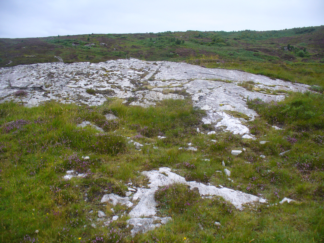
Along the A836 road between Durness and Tongue, take the minor road north to Melness. Keeping to the right all the way along, drive almost to the very end, shortly before which is a double right-hand bend uphill. Park here and walk back along the road, north, past the cottage of Dun Bhuidhe for about 100 yards until you see the large sloping rock face with the telegraph post sticking out of it. That’s the place!
Archaeology & History
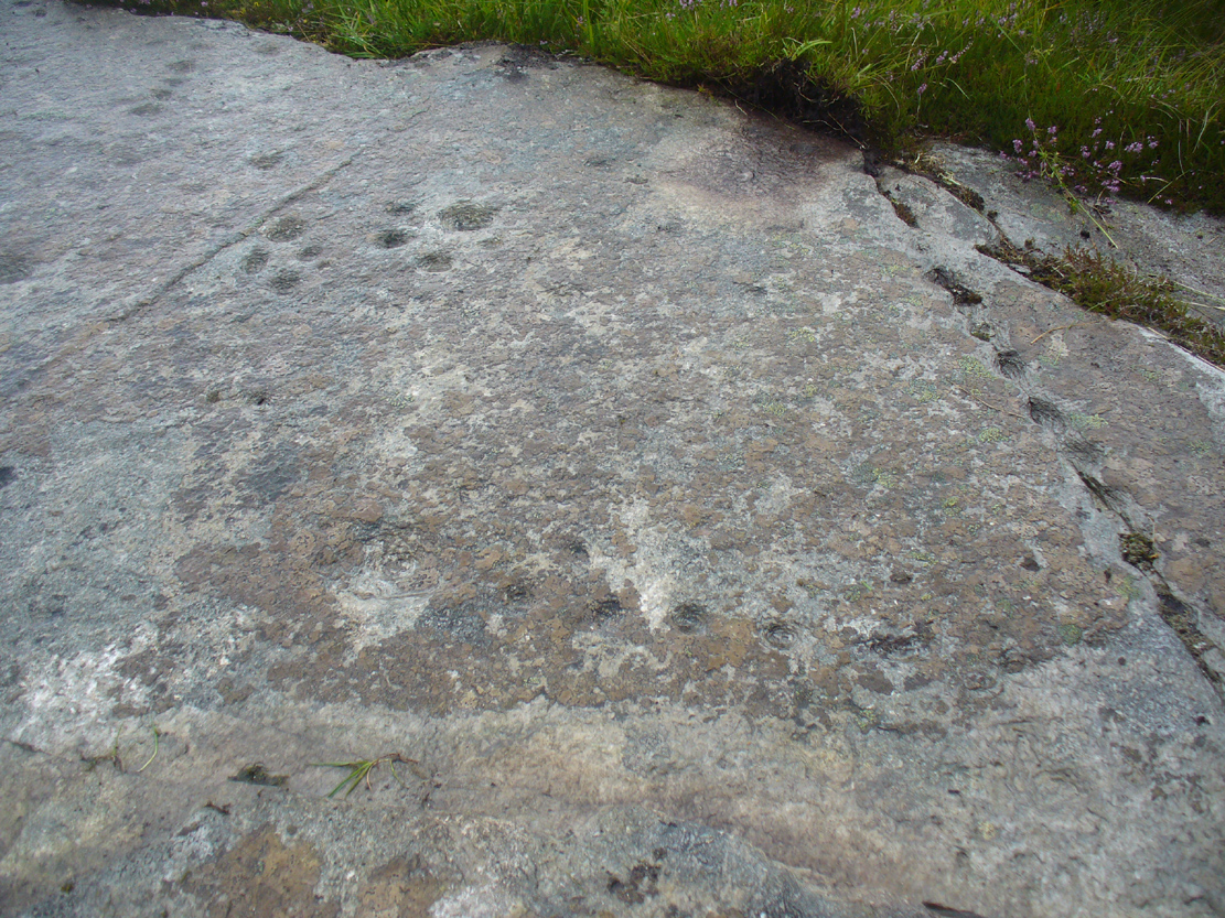
Not previously recorded, this cup-and-ring stone is right by the roadside up the far, lonely but beautiful glen west of Melness, which runs to a dead-end and into the heart of the silent moors high up in Sutherland’s remote landscape — and it’s a damn good one! It’s also the most northern example known of a Neolithic or Bronze Age petroglyph on the British mainland. The carving has been etched onto a large easterly sloping rock, fractured into several sections, with the decayed broch of Dun Bhuidhe rising to its immediate southwest. The setting alone is outstanding!
Sketch of the carving3 cups on the lower-east side
It was rediscovered on 25 August, 2015, after Prof Hornby and I had analysed the chambered tomb south of Dalvaid about half-a-mile away. In walking back to explore the aforementioned broch, I cut across the bottom of a nearby rock and found three distinct cup-markings etched near the bottom of its sloping face. Calling out to Prof Hornby, he retreated in his direction to the broch and came back to look at the top of this very large rock surface.
“There are some more cups on this section of the stone!” he called – and began to count them. “At least ten in this little section,” he said. There were indeed!
Carving, looking west
Carving, looking south
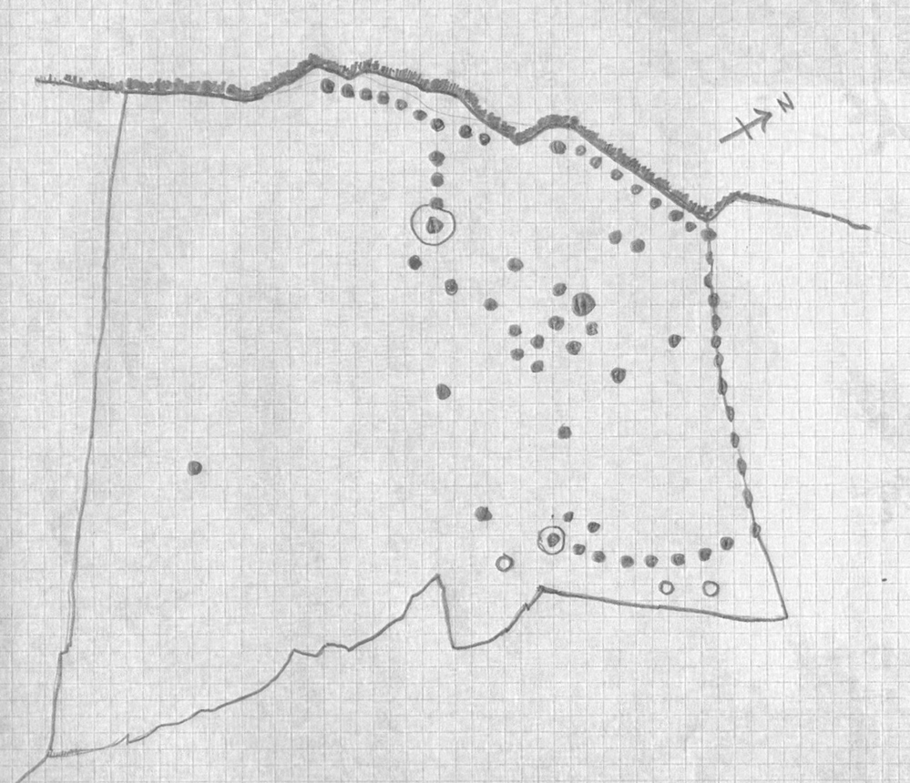
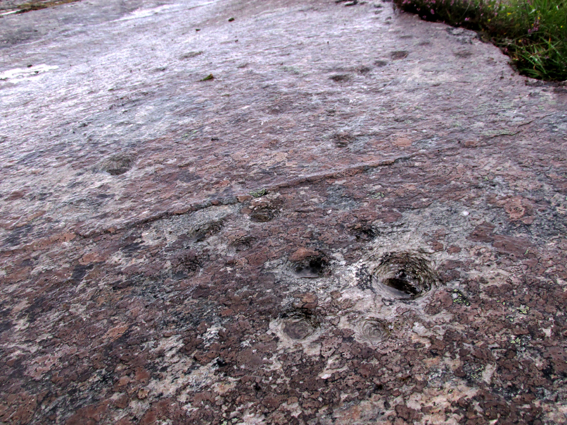
By the time we’d finished counting, drawing and assessing the design etched onto the rock surface, amongst at least two cup-and-ring elements we found at least 67 cup-markings, mainly carved onto the northwest portion of the stone. The first three that I’d seen were on the much lower eastern part and were etched in deliberate isolation from the primary design. However, of these three isolated cups, it looks as if one of them may have a spiral element curving out of it. This needs assessing in much better lighting conditions, because when we found it the skies were very grey and overcast, making an accurate survey very difficult (cup-marks on rocks can be hard to see unless daylight conditions are just right) – and, after a short while, the legendary Scottish midges appeared and began to feast on us, which stopped us in our work. The little buggers!
On a subsequent visit here with Sarah MacLean of Borgie in the summer of 2018, she found several more cup-marks beneath the lower arc shown in the above drawing (which I need to update, obviously).
Central features of the carving
Scatter of central cups
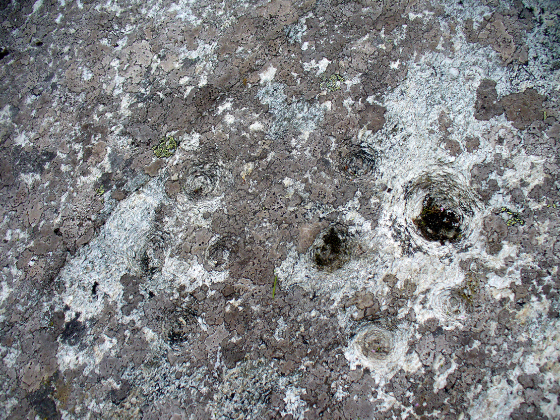
The most notable feature to this carving is the arrangement of the great majority of the cup markings. They were quite deliberately carved along the very top of the stone, close to its edge, in two contiguous lines of nine with a small gap separating them. At the northwestern end of this, a very notable feature occurs: a natural crack in the rock runs down the stone and, almost all the way down, we find a line of cups have been pecked onto the stone along the natural crack, with some of them near the top that are unfinished. These cup-marks are more elongated in form than the usual circular status; but this is due to them being etched into the cleft itself. From top to bottom there are 13 such cups. At the bottom of this line, another linear stretch of cups change direction and move back onto the main rock surface, just above another large long natural crack cutting across the rock. This gentle arc of cups (with two other possible cups beneath these) ends at a cup-and-ring, above which are two extra cups next to each other. Above these are a number of other cups of roughly similar size and depth, with a notably large one that gives the impression that the smaller cups around its edges are satellites to its larger parent body.
Line of cups on western edge
Row of cups etched into natural crack
Without any doubt there are other faint features that have been carved onto the stone, but due to the poor visibility factor at the time of its discovery we could not see anything other than the elements highlighted in the rough sketch. In looking through the many photos we took of this carving, there seem to be other faint lines, rings and cups within the overall design, but until we revisit the site (or someone else does!) such further features cannot be added to the drawing.
As the images of this petroglyph clearly shows, the primary feature defining it is the extensive line of continuous cup-markings running along the edges and enclosing a smaller number of internal cups. It’s an unusual element. Sequential line features such as these, defined by cups, are not common. My impression of this feature is that it was a pictorial representation of the horizons, inside which is played the story of….. something… But horizons they seem. Of course, this is a simplistic interpretation and is open to criticisms of any form. I care not! Much more importantly as far as I’m concerned is the fact that we’ve uncovered yet another unrecorded carving – and according to the official records, no such carvings exist here; but where one such carving exists, others are close by!
Watch this space…..
Acknowledgements: Considerable thanks must be given to Prof Paul Hornby, for use of his photos and without whose help this carving might never have been located. Cheers dood!