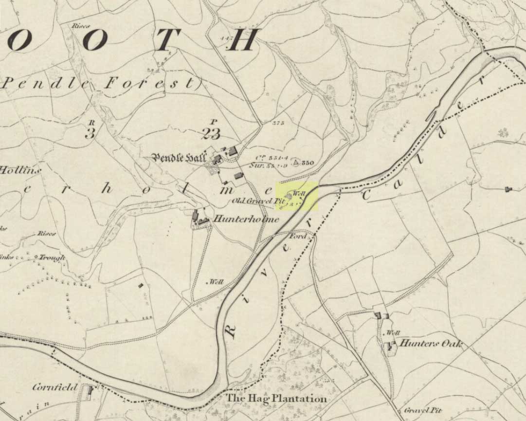
On the north-side of the River Calder, a short distance above the riverbank below Pendle Hall—as shown on the earliest OS-map of the area, but without a name—the local history writer, Joe Bates (1926), told us about this “spring of icy cold water”, which, in bygone years, “used to be called Robin Hood’s Well.” (Having moved out of the area, I’m not able to say whether this site is still visible. Can any local folk illuminate us on the matter?)
Folklore
Like many other sacred and healing wells across Britain, Bates (1926) said that the waters from Robin Hood’s Well,
“was at one time considered a specific for certain ailments of the eyes.”
References:
Bates, Joe, Rambles twixt Pendle and Holme, Nelson 1926.
Following a request to see if anyone could locate a lost standing stone in Fence (in the Forest of Pendle) not far from my home, I took up the challenge to locate this relic. One evening in July 2017, I decided to go take a look and having studied all maps I was fairly sure of its old position. Upon finding the deep ravine and the old field boundaries, I followed the line of old mature beech trees (perhaps 250-300 years old) that shroud the deep clough. Behind the biggest beech tree, but now some 10 feet down the slope, there I found the said standing stone, now recumbent and partly stuck into the earth due to its weight (approx 1.5 tonne).
Spurn Clough Stone, laid halfway down the slope
It appears to have either fallen on its own accord as the steep sides of clough are soft clays, unstable and eroding, or it has been pushed out of the way by a previous landowner. It is made of millstone grit and is likely a glacial erratic from off the top of the local fells; it is not of the same type of fine gain flaggy bedrock that exists in the river below. There are no more similar boulders within the clough other than a few small boulders in the bed of the stream. This stone is big: being about 4ft by 3ft and 5ft long that is visible, with considerably more into the banking.
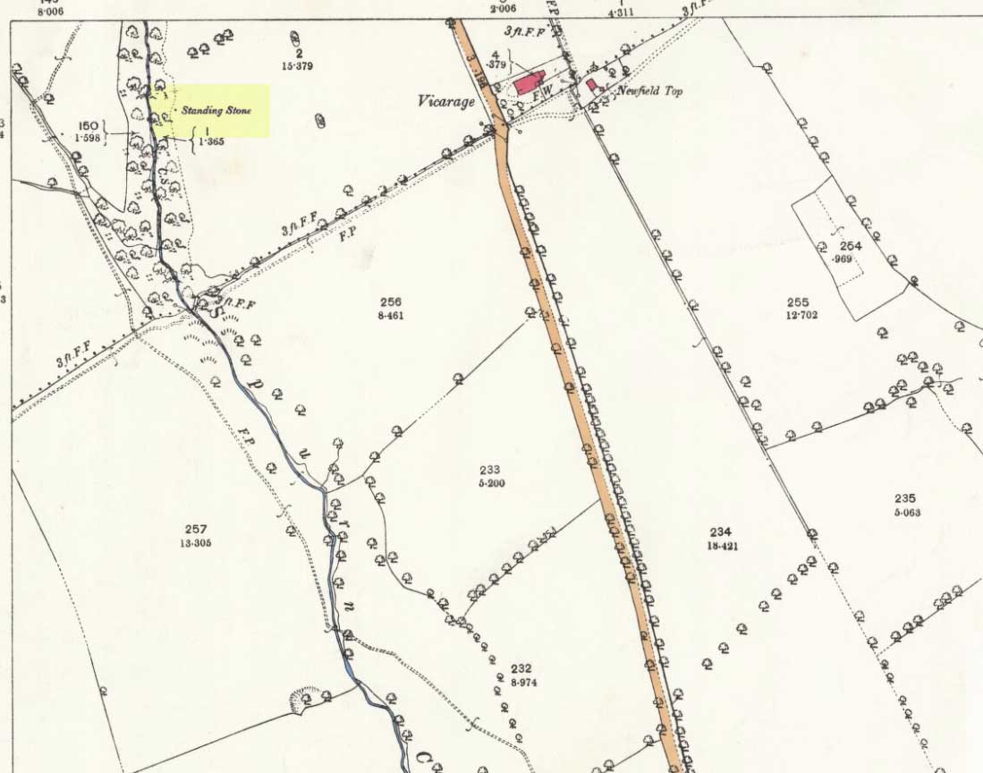
Exact position of the stone on the 1893 OS-map
I think it is worth approaching the local landowner to seek his approval to try and re-erect this standing stone in a position away from the crest of the ravine. It obviously was locally important and worthy of noting on the OS Map of 1848 and was not cut up and used as local walling stone, so it either was a boundary marker or held other folklore significance.
Research so far indicates no name is attached to the standing stone, but nearby is a ‘Hoarstones Lodge’ mentioned as a place for the Pendle witches to meet and the ravine and stream is called Spurn Clough, so I feel it apt to name it the Spurn Clough Standing Stone—unless I uncover another name used for the stone. It’s nice to locate a lost standing stone!
Now I throw open the question: should it be restored to its upright position and made safe from falling down the clough?