From Scotch Corner on the A1, head on the A66 and take the first right up to and straight thru Melsonby village at the crossroads and on for a few more miles till you hit the hamlet of Stanwick-St.-John. You’re now in the middle of the fortifications and earthworks! (check the map, right) Get to the nearby church of St. John’s and you’re on what once could have been a henge.
Archaeology & History
Although the Roman’s came here, the origins of this huge enclosure and settlement — between the hamlets of Eppleby and Stanwick St. John — are at least Iron Age. It’s very probable that this place has been used by people since at least the Bronze Age, if not earlier — but let’s keep to playing safe (for a change) and repeat what the professionals have found! Stanwick was recorded in Domesday as Stenwege and Steinwege, which A.H. Smith (1928) and later etymologists tell us means “stone walls,” which obviously relates “to some ancient rock entrenchments found in the township”, or the Stanwick Fortifications no less!
Sir Mortimer Wheeler’s (1954) account of the history and excavation of these huge ramparts found that it was a centre of some importance to the Brigantians. His view was that it was the rebel stronghold of the Brigantian figure called Venutius, ex-partner of the Queen Cartimandua. Archaeologists who did further work here in the 1980s concluded that it was one of Cartimandua’s “estates” — possibly even the original capital city of Brigantia.
The settlement was enlarged and fortified considerably upon the arrival of the Romans in the first century. Splitting them into three phases, the earliest Phase I area (Iron Age) covered 17-acres; Phase II was extended over 130 acres; and Phase 3 extended the enclosure over another 600 acres. A further extension of earthworks appears to have occurred, but Wheeler believed them to have been constructed at a much later period. To allow for a decent discourse on this huge site and its multiperiod settlement, I’m gonna quote extensively Mr Wheeler’s (1954) text on the site, who headed a team of archaeologists in the summers of 1951 and 1952 and explored various sections of this huge arena.
In the introduction to his work, Mortimer briefly mentioned the finding of some chariot burials found close by, though less certain is the exact spot where these important remains came from. He wrote:
“Of the three accounts, the earliest, dating from shortly after the discovery, states that the objects ‘were deposited together in a pit at a depth of about five feet within the entrenchment at Stanwick. Near by large iron hoops were found.’ Two years later MacLauchlan showed the find-spot on his map…as a little to the northeast of Lower Langdale, well outside the main Stanwick earthworks, and, in spite of variant accounts, his evidence may be regarded as authoritative.”
Nothing more is said of these finds throughout the book. Instead, Mortimer guides us through their dig, beginning with the structural sequence of the extensive earthworks that constitute Stanwick’s fortifications, from Phase 1 onwards, saying:
Plan showing 3-phase evolution of Stanwick earthworks from the Iron Age period at the top, to Phase 3 works in the 1st century AD (from Wheeler’s ‘Stanwick Fortifications’, 1954)
“Phase I. The nucleus of the whole system is a fortified enclosure, some 17 acres in extent, situated to the south of Stanwick Church and the Mary Wild beck, on and around a low hill known as ‘The Tofts’… The name ‘Tofts’ is defined by the Oxford Dictionary as “Site of a homestead”, or “An eminence, knoll or hillock in a flat region; esp. one suitable for the site of a house.” Appropriately the field is described by the farmer as a ‘dirty’ one; it produces an abundant crop of nettles which have to be cut twice a year and are a common sequel to ancient occupation. The enclosure is, or rather was, roughly triangular on plan, conforming approximately with the mild contours of the hill and to that extent meriting the exaggerated designation of ‘hill-fort.’ On the west its rampart and ditch are excellently preserved in a stretch of plantation known as ‘The Terrace’ or ‘The Duchess’s Walk’, where the single bank of unrevetted earthwork rises some 24ft above the ditch… The southern corner has been almost completely obliterated, but a part of it can be traced faintly in the walled garden southeast of the The Terrace. A stretch of the eastern side still stands up boldly beside the road from Stanwick Church to (the former) Stanwick Hall, but a large part of this side has been demolished for the making of the road, and some dumps of earth immediately east of Church Lodge may be a result of this process. The northern side approached but stopped short of the brook, and is marked by remains of a counterscarp bank… The main rampart was here thrown into the ditch anciently, doubtless when this portion of the work was included in and superseded by the work of Phase II. Near the northwestern corner was a stone-flanked entrance, now partially obscured by the northern end-wall of the Terrace plantation. The rampart was of earth, apparently without stone or timber revetment, the ditch was V-shaped save where, on the northern or lowest side, its completion in depth was stopped by water and the counterscarp bank already referred to was added as compensation.
“Phase II. Subsequently, at a moment which will be defined in the sequel as not later than AD 60, the hill-fort was supplemented by a new enclosure over 130 acres in extent, so designed as to outline the slight ridge north of the brook, to bend inward round the nearer foot of Henah Hill on the east, and farther west to cut off the northern end of the hill-fort, obviously in order to enclose the brook and its margin hereabouts. Southeast of Stanwick Church, the marshy course of the brook for a distance of over 300 yards was regarded as a sufficient obstacle, without rampart and ditch, though whether supplemented by a palisade is not known. As already indicated, that part of the Phase I earthwork which now lay inside the new enclosure was largely obliterated by filling its rampart into its ditch.
The enclosure constituting Phase II had an entrance near its western corner…where 50ft of the ditch, partially rock-cut, were cleared with notable results… There may have been another entrance under the present road-junction immediately east of the Stanwick vicarage, in the middle of the northern side, or less probably, at an existing gap 150 yards further to the southeast. The rampart was of earth, aligned initially at the back on a small marking-out trench and bank; in front it was revetted with a vertical drystone wall. The ditch was cut in the boulder-clay and partially in the underlying limestone…
Phase III. At a date which will be defined as about a dozen years later (c. AD 72), a similar though longer system, enclosing a further 600 acres, was added to Phase II. It impinges almost at a right angle upon, and implies the pre-existence of, Phase II on the east, and terminates upon the ditch of Phase II on the west. An entrance can be seen near the middle of the southern side, and less certainly a gap in Forcett Park may represent a second entrance in the western side. Further stretches of the mary Wild beck were included. The rampart, like that of Site A, incorporated a marking-out trench and bank at the rear, and was fronted with a vertical stone revetment.
Phase IV. To the southern side of Phase III was added at an unknown period an enclosure of some 100 acres, now subdivided by traces of a double earthwork extending southwards from a point east of the southern entrance of Phase III… This double earthwork however, is of an entirely different character from those already considered, and appears indeed to overlap the rampart of Phase III at a point where the latter had already been broken through. It is comparable with some of the double banks which constitute or are incorporated in the Scots Dike at Lower Langdale, farther east; and the Phase IV enclosure is in fact linked with the Scots Dike by a semi-obliterated ditch extending eastwards from its southeastern corner. Phase IV…may, as has been suspected, relate to the Anglo-Saxon period.”
References:
Smith, A.H., The Place-Names of the North Riding of Yorkshire, Cambridge University Press 1928.
Wheeler, Mortimer, ‘The Stanwick Excavations, 1951,’ in Antiquaries Journal, January 1952.
– The Stanwick Fortifications, North Riding of Yorkshire, OUP & Society of Antiquaries: London 1954.
Links: – Stanwick Iron Age Hillfort – For an extensive overview of the archaeology of this large site, you can do no better than this web-page.
Pretty easy to get to. Go south through the village for a half-mile until you reach the hall by the fire station, sat back on the left-hadn side of the road a few hundred yards past Loch a’ Mhuillinn. Stop here and walk up the slope behind the hall for a hundred yards or so. Walk about!
Archaeology & History
The OS-coordinate here is a loose one. It centres on the notable hillock of Torr Mor, around which are a number of hut circles (at NG 7097 4293; NG 7139 4303; NG 7087 4309; NG 7088 4310 and NG 7090 4320) which are each in a relatively good condition and are thought to date from at least the Iron Age. When I visited them, the bracken had encroached on all but one of them (the last in the list above), which was about 30 feet across.
North of here are several curious-looking heaps of stones which need closer examination when the vegetation has died away. At first glance they would seem to be cairns, i.e. tombs. No such prehistoric graveyard has been found anywhere on the peninsula as yet – but considering the existence of the settlements in the area at Sand, you’d think there’d be one somewhere!
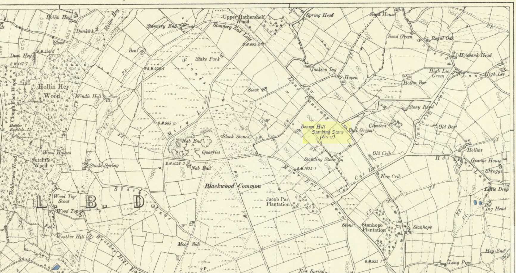
Standing Stone (destroyed): OS Grid Reference – SE 024 244
Archaeology & History
Standing stone on 1894 map
Also known as the Field House Standing Stone, this monolith seems to have gone. It was first described in local Minister’s Accounts of 1403, and then again in the Wakefield court-rolls of 1515. By the time John Watson (1775) wrote about the place there had been several other references describing this old “standyngstone”. It was still upright in 1852, but Ordnance Survey showed it as “Site of – ” at the beginning of the 20th century, and the stone had been moved a short distance away, further down from its original position to a spot at the side of the old trackway — but all trace of it has since vanished.
Folklore
This is thought to have been the standing stone which Robin Hood threw here, from the appropriately called Robin Hood’s Penny Stone at Wainstalls. The tale tells how he dug it out of the ground with a spade and threw it three-and-half miles across the valley until it landed here. Ooh, what a strong boy!
Pretty simple really. Go up the B6265 Skipton-Rylstone road for about 3 miles, past the Nettlehole Ridge woodland on your right. The next turn along to your right, up the track, is Scale House. Go past this until you get to Scale House Farm. The remains of the burial mound is in the field to your left, just before the farm. Knock on the door and ask!
Archaeology & History
This ‘tumulus’ (as it’s marked on the OS-map) was one of the many explored by the legendary reverend William Greenwell (1864) in the middle to latter-half of the 19th century. His description of the finds at Scale House were considerable; thankfully our old Yorkshire antiquarian Edmund Bogg (1904) shortened it and told us the following:
“The tumulus was 31 feet in diameter and about 7 feet high; it opened from the southeast; the soil immediately under the sod consisting of yellow clay to a considerable depth; then layers of blue clay… Exactly in the centre…at a depth of 7 feet, and on a level with the plane of the field, was found an oak coffin, formed out of a tree, split and hollowed-out, and placed due north and south, the head being placed to the south, as that as the larger part of the tree. After being exposed to the air for about 2 minutes, the bared coffin parted at the sides, and could not be moved except by detached pieces. The body had been wrapped in a cloth or shroud of texture resembling wool and coarsely-woven, of which there was a considerable quantity remaining; but the body itself was dissolved… The interment was considered to be that of an ancient Briton… The learned antiquary said it was the only instance (except the one at Gristhorpe, near Scarborough) where an interment in an oak tree hollowed out had a tumulus placed over it. It was more than 6 feet in length inside and about 7 feet 6 inches outside. The remains were carefully replaced and the mound restored to its former shape; a small leaden tablet being placed within, stating that it had been opened in AD 1864.”
Folklore
Jessica Lofthouse (1976) listed this as one of the places reputed to be an old fairy haunt, wherein “the folk of Scale House discovered a fairy kist or chest.”
References:
Bogg, Edmund, Higher Wharfeland, James Miles: Leeds 1904.
Greenwell, William, British Barrows, Clarendon Press: Oxford 1877.
Lofthouse, Jessica, North Country Folklore, Hale: London 1976.
Whether coming from Hebden Bridge or Oxenhope: at the very top of the long uphill road, at the very top where a small radio station sits by the roadside (the views from here are effing superb!) – stop! On the opposite side of the road from the radio station, get over the fence (I think there’s a gate nearby) and walk roughly westwards down the gently inclining grassland slope. Keep westward-ish for about 200 yards (if that) and you’re damn close!
Archaeology & History
Rediscovered in January 2002, this is a very curious stone, over a metre in height, isolated on the southern edge of Roms Hill, close to the folklore-sounding Halfpenny Hole Clough, near the very top of the hill between Hebden Bridge and Oxenhope. The base of the stone is almost wedged into a space between two rocks and its positioning here seems quite deliberate. It stands upon a small geological ridge in the ground that stretches for some distance, east and west, either side of here.
Roms Hill Stone in good fog!
Despite this, it seems unlikely to have an authentic prehistoric pedigree, but as there’s little else been said of the stone (apart from Dave Shepherd’s (2003) article on local megalithic remains, many of which are highly dubious as archaeological remains), it deserves a mention here. It’s not recorded in any of the old boundary records — unlike the upright boundary stone that can be found a few hundred yards northwest of here on the same moorland plain.
The land here has an etymological relationship with the Roms Law (or Grubstones) Circle on Rombald’s Moor, but as yet we can ascertain little more about this site. Well worth a visit — if only for the superb views it affords!
References:
Shepherd, David, “Prehistoric Activity in the Central Pennines,” in Transactions of the Halifax Antiquarian Society, volume 11 New Series, 2003.
Stone Circle (destroyed): OS Grid Reference – SD 664 655
Archaeology & History
I have found no archaeological references whatsoever to this site (though to be honest, the Lancashire archaeological fraternity are pretty poor when it comes to finding and recording sites). The place has its existence preserved in the aptly-named Ringstones Lane and the farmhouse, Ringstones.
Michala Potts found several records of the place in the 17th century, and the site is shown on the 1844 OS-map with the same name, but we have been unable to ascertain when/if any standing stones were here. The place may well have been a burial-site of some sort, as found at other Ringstone place-names in Lancashire. But we can clearly see on aerial imagery that there is a large, distinct, circular outline in the heavily ploughed fields about 100 yards north of the farm. There is what may be the remains of a second circle above this, but the outline is faint; but it appears that an enclosure of some sort, ovoid in shape and a couple of hundred feet across, was also evident in the same field where the more distinct circular outline is seen.
My favourite outline however, is a large linear mark on the ground stretching for several hundred yards running roughly north-south, starting in the field between Aikengill and Ringstones and going dead straight, bypassing the circle and crossing Ringstones Lane, where it seems to disappear and is no longer visible. The curious ‘ground line’ is roughly 100 feet across. Cursus anyone!?
Standing Stone (destroyed): OS Grid Reference – TM 052 809
Folklore
This slab of sandstone apparently used to stand upright in one of the fields of Oxfootstone Farm and on its surface is supposed to be the burnt impression of a cow’s hoof-print. Legend tells that there was a fairy cow which would come into the area when times of hardship occurred. During such periods she would freely give her milk to the people, but when the drought was over she stamped down on the stone upon which she stood, burning the imprint of her hoof onto it and magically vanished back from whence she came. A variation of the tale tells of a normal cow whose milk normally supplied the local villagers. But one night a drunken man (in another tale it is a witch) milked the cow dry through a sieve, until only blood came from her udders. At this point, the cow cried out in pain and kicked the stone so hard that she left the mark of her hoof-print on it.
Another tale tells that an ox got a large thorn stuck in its foot and rampaged through the local village, eventually stamping its hoof onto the stone so hard that it left the imprint of its foot here.
Now this might sound presumptious of me — but this tale has all the hallmarks of it being an old folk-remnant telling the origin of some cup-and-ring marked stone. We find a number of cup-and-rings with creation tales similar to this. Are there any local archaeologists or enthusiasts in Norfolk who might be able to locate any remains of this possible carved stone?
References:
Burgess, Michael W., The Standing Stones of Norfolk and Suffolk, ESNA 1: Lowestoft 1978.
Dutt, W.A., The Ancient Mark-Stones of East Anglia, Flood & Sons: Lowestoft, 1926.
Dead easy. Follow the Grassington-Pateley Bridge road (B6265) east and about 2 miles past Hebden village, the craggy hill rises to the left-hand side of the road, as you can see in the photo below. Simple!
Archaeology & History
Nursery Knott hill
When fellow rock-art freaks Graeme Chappell, Richard Stroud and I were exploring the cup-and-ring stones in the area just south of here a few years back, this hill kept calling out with some repeated awe. “There’s summat about that place,” were the remarks we kept saying – but we could never put our finger on it. (still haven’t if truth be had!). Between here and the awesome Simon’s Seat to the south, a whole panoply of neolithic and Bronze Age remains scatter the land — and if ritual landscape has any validity, this hill is undoubtedly enmeshed in the mythic framework of such a paradigm. But without any folklore I didn’t feel right to include it here…
At the northern or rear-end of this great outcrop (SE 082 640) is a scattering of many boulders, one of which in particular at Knot Head was explored by a Mr Gill in 1955 and found to have a number of Mesolithic worked flints all round it. Seems as if folk have been up to things round here for even longer than we first thought. Microlith or flint-hunters would probably do well on the moors up here!
Folklore
It’s the old pen of our Yorkshire topographer Edmund Bogg which brings the lost folktale of this place back to life – and it’s typical of aboriginal creation myths from elsewhere in the world. In his Higher Wharfeland he had this to say of old ‘Nursa Knott’, as it was locally known:
“The old legend is that the devil, for some reason anxious to fill up Dibb Gill,* was carrying these ponderous crags in his apron when, stumbling over Nursa Knott, the strings broke and the crags fell. Legend also says, should the crags be removed they will be carried by some invisible power back to their original position.”
He then reminds us of links with old Wade, plus the settlement of old Grim, a short distance to the north.
Across the road down the track running south to Skyreholme, Jessica Lofthouse ( 1976) told the tale of a ghostly horseman, seen by her great-grandfather no less! Suggesting he may have been ‘market merry’ (i.e., pissed!), she told how he “struck out at a spectral white horse at the Skyreholme three-land ends near Appletreewick – and his stick passed through it!”
References:
Bogg, E., Higher Wharfeland: The Dale of Romance, James Miles: Leeds 1904.
Lofthouse, Jessica, North Country Folklore, Hale: London 1976.
Walker, D., ‘A Site at Stump Cross, near Grassington, Yorkshire, and the Age of the Pennine Microlithic Industry,’ in Proceedings of the Prehistoric Society, 1956.
* Dibb Gill is nearly a mile due west of here – and Dibble’s Bridge which crosses the beck was also known as the Devil’s Bridge, with a few typical creation myths of its own attached.
There are several ways to get here, but I took the one from the road (B6265) walking up the track into Crookrise Woods. Unless you’ve got a decent OS-map with it marked on, this might take some finding to some folk as it’s tucked away on the northern edge of Crookrise Woods (which one Southerner bloke told us was private – though he was ‘allowed’ there!). It’s right on the rounded knoll at the top of the woods, beneath the prominent slopes which lead to the moor.
Archaeology & History
Our old mate and Yorkshire historian Arthur Raistrick seems to have been the first to describe this place in the Yorkshire Archaeological Register of 1964 – though the holy wells writer Edna Whelan told me she knew about the place many years back. Today hidden in woodland and mostly overgrown, Raistrick’s brief description of the place said:
“A small stone circle of six stones set symmetrically within a diameter of 26 feet. The stones vary in size from 21 to 58 inches. Surveyed 1963.”
The site has been badly affected by the erosion of time, forestry and god-knows what else. Scattered around are numerous small stones giving the impression that it may once have been a cairn-circle, more than a stone circle. Four of the six stones mentioned by Raistrick (1965) are visible, but none are impressive – and unless you’d read about the place first or found it in Mr Burl’s Stones Circles of Britain… (2000), you wouldn’t really give it the time of day.
Although sadly disappointing in its present status – completely surrounded by trees, with no view at all – it seems probable that it would have had some geomantic relationship with the hillfort-looking site of Rough Haw immediately west, and very probably the adjacent ritual site of Sharp Haw. It seems that the equinox sun would set between Rough Haw and the other small rounded hill above.
References:
Burl, Aubrey, The Stone Circles of Britain, Ireland and Brittany, Yale University Press 2000.
Park up at the Nick of Pendle and follow directions to the Devil’s Apronful of Stones, but about halfway along the path, bear to the right along a swerving footpath which eventually takes you to another guiding cairn. On the OS-maps there’s the Chartist’s Well 100 yards due west of this old overgrown tomb.
Archaeology & History
The much-overgrown Lower Apronful cairn
Seemingly excluded from all previous archaeological surveys, this is a very large structure indeed. Crowned with a small modern cairn on its top marking a small footpath crossing the site, this very large cairn-like structure is about four feet tall at the highest. I first came across it at the end of August, 2006, after going through some folklore records which then led to exploring the area in the hope that there might be some archaeological ruins in the region — and we weren’t to be disappointed!
Outline of extended monument
This giant cairn structure is larger than the denuded remains of the Devil’s Apronful cairn that can be seen a few hundred yards further uphill, but is almost entirely overgrown with grasses. It measures at least 31 yards (east-west) by 29 yards (north-south) and is just like an overgrown Little Skirtful of Stones on Burley Moor. Parts of its eastern side have been dislodged and the main rock structure is plainly visible where the vegetation has come away. A ringed embankment is also very clear, mainly on the north and eastern sides of this large structure (as one of the photos here shows), but on the whole it is overgrown and ruinous. It’s a brilliant spot though and sorely needs some proper archaeological attention. In the event that this site aint a prehistoric cairn, please lemme know so I can delete it from TNA.


")