Meg Dyke, Barkisland, West Yorkshire

Enclosure / Settlement:  OS Grid Reference – SE 0496 1747

Getting Here

Meg Dyke earthworks

If you’re coming via Ripponden, take the B6113 road uphill to Barkisland; but if from the Huddersfield direction, take the B6114 to Barkisland.  Once in the village, stick to the B6114 Saddleworth road going south.  After passing the unmissable Ringstone Edge reservoir (the Ringstone circle is on its far side) the Saddleworth road begins to straighten out and you hit the large quarry on your right.  But before the quarry entrance, keep your eyes peeled on your left for the minor Scammonden Road that slopes downhill.  50 yards down, a gate and stile allows you into the field on your left (north) where you’ll see the scruff of earthworks.  Y’ can’t really miss it

Archaeology & History

Watson’s 1775 plan

On the face of things, this is nowt much to look at unless you’re a prehistoric settlement freak!  It is however a very notable rectangular set of ditches and embankments, with the ditches averaging between 10-12 feet across and 3-4 feet deep in places; whilst the raised banks vary between 13-20 feet across.  The place was quarried into sometime at the end of the 19th century, casusing obvious damage, but its outer ramparts are still plain to see.  It’s been known about for quite a few centuries too.  Even before the Ordnance Survey lads had stuck it onto their brilliant mapping system, the great John Watson (1775) described these old ruins as,

“a piece of ground inclosed within deep ditches, on the side of the hill called Pikelow, one of which, to the west, is fifty-three yards long, full five yards wide, and about two yards deep; the opposite side to this cut by a wall and a road, but is very visible in the adjoining field, the plough not having yet been able to destroy it. The ditch to the south measures also fifty-three yards, but it is not so entire as the other. There is an opening at each corner of the western ditch which, if continued, would make the whole to be ninety-six (sic) yards each way. One of the sides towards the east is nearly levelled, the rest is in good preservation.”

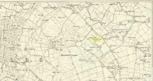
Meg Dyke on 1854 OS-map
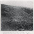
Petch’s 1933 photo

He thought the remains to be Roman—a sentiment echoed by local archaeologist James Petch in 1924.  More recently however, following a small excavation at the site by the Huddersfield Archaeology Group, Faull & Moorhouse (1981) suggested it to be Iron Age in nature—though with no hardcore evidence to confirm one way or the other.  When Arthur Longbotham (1933) assessed Meg Dyke in his short rare work, the Roman question was explored—and ditched.  Instead he thought that this settlement was “very likely the place of assemblage of all the warrior Brigantes from the surrounding hills and villages.”  I think it’s likely that this is pretty close to the mark.  My take on the place is a similar one, i.e., it’s either Iron Age or Romano-British in nature, simply due to its similarity with other remains from those periods: the Cowling’s enclosure on Askwith Moor being one such example.

References:

  1. Faull, M.L. & Moorhouse, S.A. (eds.), West Yorkshire: An Archaeological Guide to AD 1500 – volume 1, WYMCC: Wakefield 1981.
  2. Longbotham, Arthur T., Prehistoric Remains in Barkisland, Halifax 1933.
  3. Petch, James A., Early Man in the District of Huddersfield, Tolson Memorial Museum: Huddersfield 1924.
  4. Watson, John, The History and Antiquities of the Parish of Halifax, T. Lowndes: London 1775.

© Paul BennettThe Northern Antiquarian

Tower Hill, Warley, Halifax, West Yorkshire

Cairns (destroyed): OS Grid Reference – SE 053 261

Archaeology & History

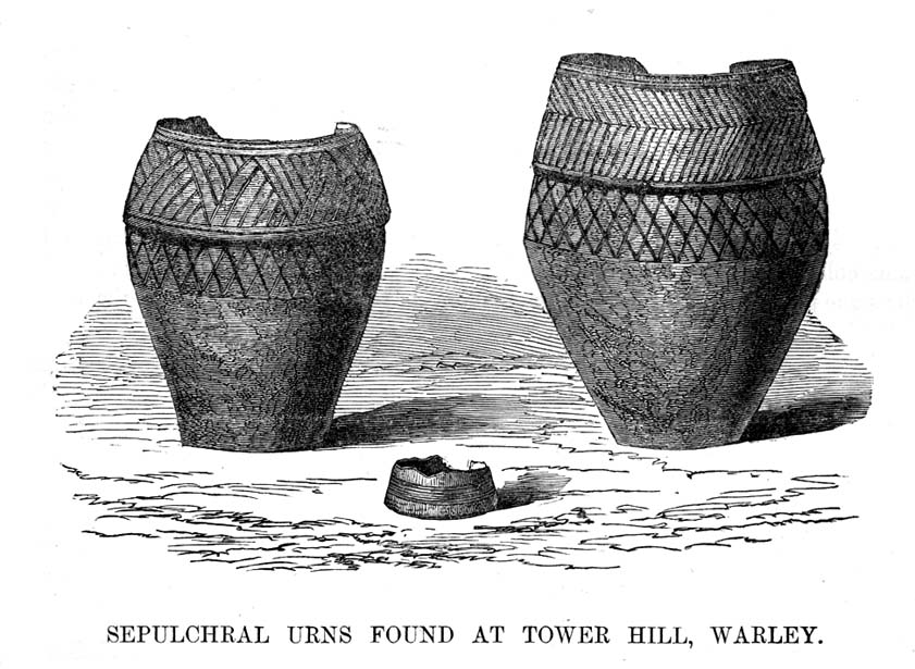
F.A. Leyland’s drawing of the urns

There’s really nowt to see around here nowadays (apart from a lovely view of the hills and the Calder valley), but it seems that not-too-long ago there were several burials in evidence upon this hill.  F.A. Leyland (1867) gives a quite detailed account of the urns and their discovery, which have been variously thought of as Roman, then Saxon, then prehistoric — with them finally ascribed as Bronze Age in Watson’s (1952) survey of the region.  Not too far away could once be found the legendary Robin Hood’s stone circle, which might have had some relationship with the burials here — though we’ll probably never know for sure!  Leyland’s (1869) lengthy notes of this site told:

“An interesting discovery was made in…recent times, of a number of cinerary urns in the township of Warley.  The site of the interments was at Tower Hill, a position on a line of military defences which extended from the entrenchments of Hunter’s Hill to Camp End in this township.  The urns were found in the process of quarrying for stone; but, owing to the nature of the operations, and the unlooked for discovery of such relics as these or the total absence of all knowledge of their value, by the people employed, many similar remains are known to have been demolished as worthless objects.

“On one occasion, however, an urn, bleached by the tempests of an entire winter, was observed to protrude half its own bulk from the stratum of soil in which it had been originally buried.

“The curiosity of the labourers was excited, and the relic was removed.  It was found to contain bones and ashes which the people, ever prone to the marvellous, held to be the remains of a child which had been destroyed by foul means and there buried.  This opinion was noised abroad, and the true nature of the interment explained.  We examined a fragment of this relic: it was rudely constructed of sun-burnt clay, and was grimed in the inside as if by the smouldering embers of the funeral pyre, and the smoking ashes of the dead, on their introduction to their narrow urn.

“This had been filled with these human exuviæ; and appeared to have been lined with moss mixed with fibres of plants which, after the urn had fallen in pieces, adhered firmly to its contents.  It was thirteen or fourteen inches high, and was no doubt made by the hand alone.  Within a few yards of this, another urn was found, containing bones and ashes, but so far decomposed as to preclude the possibility of its preservation: near the same place the smaller urn in our illustration was discovered buried in the dark soil peculiar to the locality; it was filled with calcined bones and ashes and, like the one found at Upleton—and in the possession of Dr Young of Whitby—had a small clay vessel placed within it, which is represented in our engraving.  The urn was, moreover, protected by a lid, resembling the inverted stand of an ordinary flower-pot: the relic measured six inches high.

“During the winter of 1848, a date subsequent to the above discoveries, there was a fall of earth from the same spot, into the quarry at Tower Hill; the soil, thus precipitated from the moor, impeded the operations of the labourers; and, on its removal, the larger urn of our illustration was brought to light.  This relic measured nine inches high and was twenty-two in circumference; but, in the rubbish, there were observed numerous fragments of other cinerary urns, and equally numerous relics of cremation.

“These discoveries lead one to one of two conclusions: either that Tower Hill was the field of some formidable engagement, in which numbers fell; or, that it was used as a place of frequent sepulture by the primitive inhabitants of the locality.  It is not at all improbable that these urns were the produce of some local pottery, if not made by the same hand, as the one described by Watson (1775), the patterns indented on the two upper compartments of the smaller vessel being of the same kind, and occupying the same positions as the one referred to.

“The larger urn, as will be observed, is divided like the others into three compartments, the upper one standing out in relief, but having a different kind of decoration resembling herring-bone masonry; while the smaller one of our illustration, and that of Watson, are furnished with a zigzag design.  But, although there is this slight variation in the upper moulding of the larger vessel, they all possess the lozenge-shaped decoration in their central compartments.”

We haven’t yet explored this site diligently and also know that if we have to await the slow hand of archaeology here we’d be waiting an aeon, but Tower Hill’s position in the landscape would tend to indicate the latter of Leyland’s earlier suggestions regarding the nature of the finds, i.e., the hill was a prehistoric graveyard, though of unknown size.

References:

  1. Leyland, F.A., The History and Antiquities of the Parish of Halifax, by the Reverend John Watson, M.A., R.Leyland: Halifax n.d. (c.1867)
  2. Roth, H. Ling, The Yorkshire Coiners, 1767-1783; and Notes on Old and Prehistoric Halifax, F.King: Halifax 1906.
  3. Watson, John, The History and Antiquities of the Parish of Halifax, T. Lowndes: London 1775.
  4. Watson, Geoffrey G., Early Man in the Halifax District, HSS: Halifax 1952.

© Paul Bennett, The Northern Antiquarian

Warley Edge, Halifax, West Yorkshire

Cup-and-Ring Stone (lost):  OS Grid Reference – SE 062 253

Archaeology & History

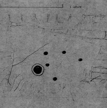
Warley Edge Cup-and-ring stone

A rare find in Calderdale, as it’s only one of a very small number of full cup-and-ring designs — though its exact whereabouts remains elusive.  From Heginbottom’s (1979) OS-reference, it’s close to a pretty built-up area, so may be destroyed.

He described it as a “large block with cup and ring markings, built into a dry stone wall,” 900ft above sea level. So where eactly is it…?

References:

  1. Heginbottom, J.A., The Prehistoric Rock Art of Upper Calderdale and the Surrounding Area, YAS: Leeds 1979.

© Paul Bennett, The Northern Antiquarian

Sowerby Lad, Mytholmroyd, West Yorkshire

Standing Stone (destroyed): OS Grid Reference – SE 024 244

Archaeology & History

Standing stone on 1894 map

Also known as the Field House Standing Stone, this monolith seems to have gone.  It was first described in local Minister’s Accounts of 1403, and then again in the Wakefield court-rolls of 1515.  By the time John Watson (1775) wrote about the place there had been several other references describing this old “standyngstone”. It was still upright in 1852, but Ordnance Survey showed it as “Site of – ” at the beginning of the 20th century, and the stone had been moved a short distance away, further down from its original position to a spot at the side of the old trackway — but all trace of it has since vanished.

Folklore

This is thought to have been the standing stone which Robin Hood threw here, from the appropriately called Robin Hood’s Penny Stone at Wainstalls. The tale tells how he dug it out of the ground with a spade and threw it three-and-half miles across the valley until it landed here. Ooh, what a strong boy!

References:

  1. Bennett, Paul, The Old Stones of Elmet, Capall Bann: Milverton 2001.
  2. Smith, A.H., The Place-Names of the West Riding of Yorkshire, volume 3, Cambridge University Press 1961.
  3. Watson, John, The History and Antiquities of the Parish of Halifax, T. Lowndes: London 1775.

© Paul Bennett, The Northern Antiquarian