Dunadd House, Kilmichael Glassary, Argyll

Standing Stone:  OS Grid Reference – NR 83865 93619

Also Known as:

  1. AR27 (Ruggles 1984)
  2. Canmore ID 39592

Getting Here

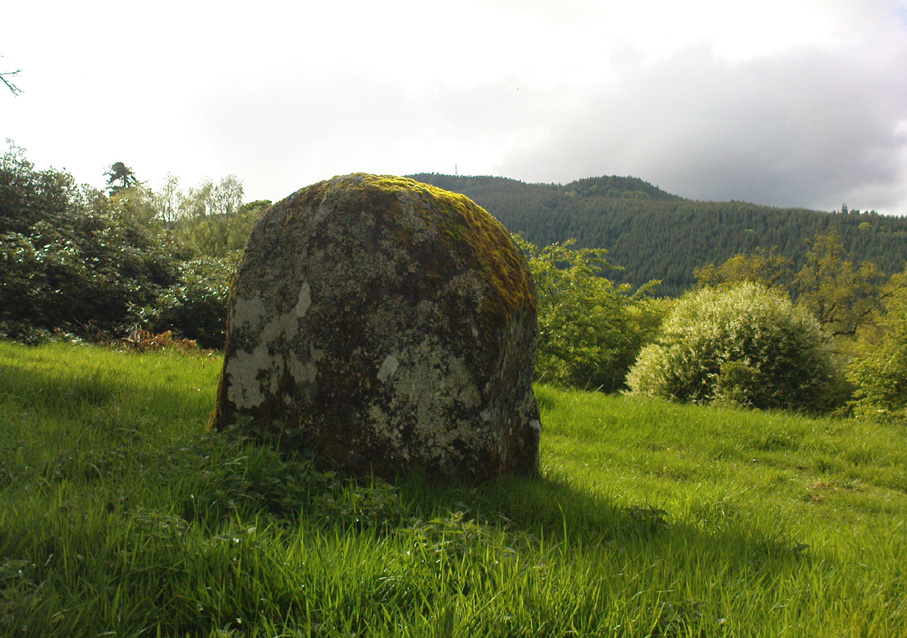
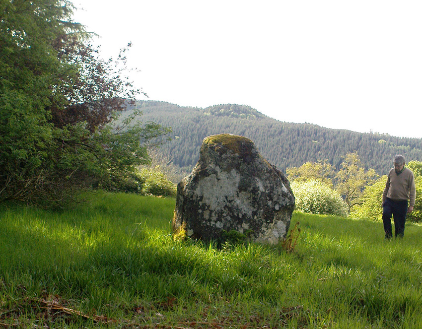
Standing stone below Dunadd

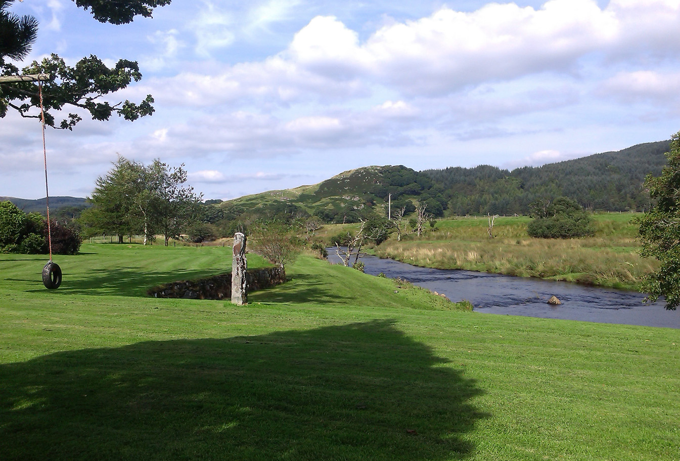
From Lochgilphead, take the A816 road north for several miles (towards the megalithic paradise of Kilmartin), keeping your eyes peeled for the road-signs saying “Dunadd.”  Turn left and park-up.  Instead of walking up the craggy fortress, follow the road-track to the house and, alongside the River Add, you’ll see the standing stone in the well-mown garden on your right.

Archaeology & History

As a monolith within the Kilmartin Valley complex, this is a slight, almost gentle standing stone, missed by most when they visit the other larger sites in Argyll’s Valley of the Kings.  Set upright close to the gentle winding River Add and only a few yards from the ancient ford that bridged the waters beneath the shadow of Dunadd’s regal fortress, the late great Alexander Thom (1971) wrote about it in his exploration of lunar alignments found at other nearby standing stones. This one however, was 3° out to have any astronomical validity.

Described only in passing by a number of writers, the greatest literary attention it has previously been afforded was by the Royal Commission lads (1988), whose notes on it were short:

“An irregularly-shaped block of stone, 1.35m high and 1.35m in girth at the base, is situated 25m S of Dunadd farmhouse, it is aligned NNW and SSE, and the top the SSE edge appear to have been broken off.”

…My first visit here was when I lived north of Kilmartin and each time I found the same ‘gentle’ feeling, in all different weathers: a most unusual phenomenon, as there tends to be changes in psychological states between rain, sunshine, frosts, dark night and mists.  But there was a consistency of subtlety; a regularity in genius loci—probably due to its proximity to the River Add, the lowland tranquility below the crags.  It’s a wonderful little place.  Well worth visiting if you go to Dunadd.

References:

  1. Campbell, Marion, Mid-Argyll: An Archaeological Guide, Dolphin Press: Glenrothes 1984.
  2. Lane, Alan & Campbell, Ewan, Dunadd: An Early Dalriadic Capital, Oxbow: Oxford 2000.
  3. Royal Commission on the Ancient & Historical Monuments of Scotland, Argyll – Volume 6: Mid-Argyll and Cowal, HMSO: Edinburgh 1988.
  4. Ruggles, Clive L.N., “A critical examination of the megalithic lunar observatories,” in Ruggles & Whittle, Astronomy and Society in Britain, BAR: Oxford 1981.
  5. Ruggles, Clive L.N., Megalithic Astronomy, BAR: Oxford 1984.
  6. Thom, Alexander, Megalithic Lunar Observatories, Clarendon: Oxford 1971.
  7. Thom, A., Thom, A.S. & Burl, Aubrey, Stone Rows and Standing Stones – volume 1, BAR: Oxford 1990.

© Paul Bennett, The Northern Antiquarian 


Gleneagles ‘B’, Blackford, Perthshire

Standing Stone:  OS Grid Reference – NN 92431 09804

Also Known as:

  1. Blackford
  2. Canmore ID 25924
  3. Loaninghead
  4. Peterhead Farm

Getting Here

19th century drawing of the old stone

Along the A9 dual carriageway between Blackford and Auchterarder, take the A823 road south, up Glen Eagles towards Pool of Muckhart and Dunfermline.  Less than 100 yards up the road, turn immediately right and park-up. On the overgrown grassy land on the right-hand side of the road, you’ll see this solid monolith calling for your attention.  You can’t really miss it!

Archaeology & History

Looking south, to the fairy-haunted Ben Shee

Described by archaeologists as a Class 1 Pictish Symbol Stone (and shown on OS maps as such), this is a fine solid standing stone more than 5 feet tall, with a lovely view up Gleneagles to the fairy mountain of Ben Shee beckoning in the distance.  Immediately north on the other side of the dual carriageway, the tree-lined mound 100 yards away is an ancient fort (which we’ll deal with in another entry); and of course we have the nearby companion of the Gleneagles A standing stone a coupla hundred yards west.  Whether or not this stone and its western companion ever had anything to do with the lost stone circle of Gleneagles, we might never know.

Close-up of the carved designs
Charles Calders drawing of the carvings

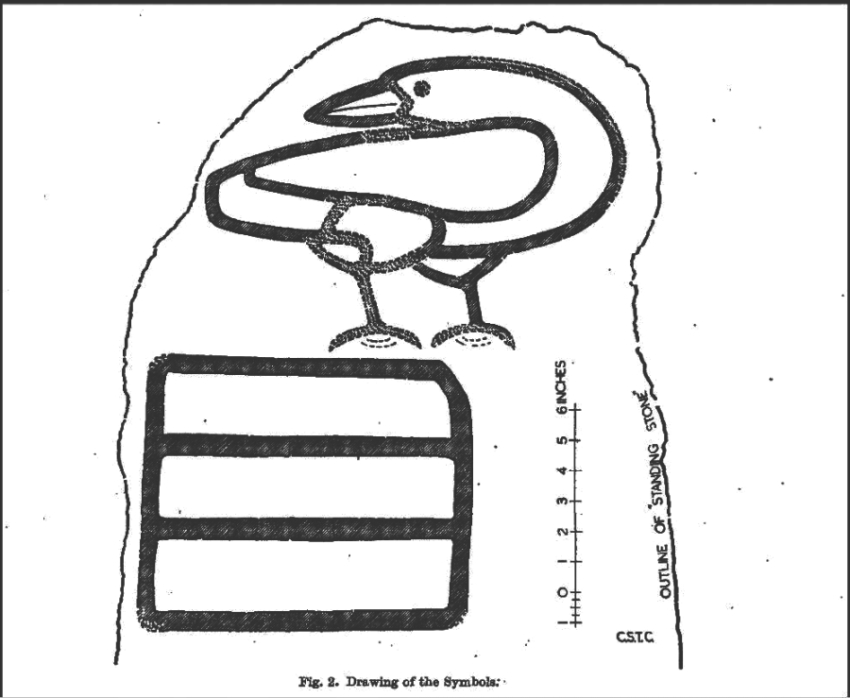
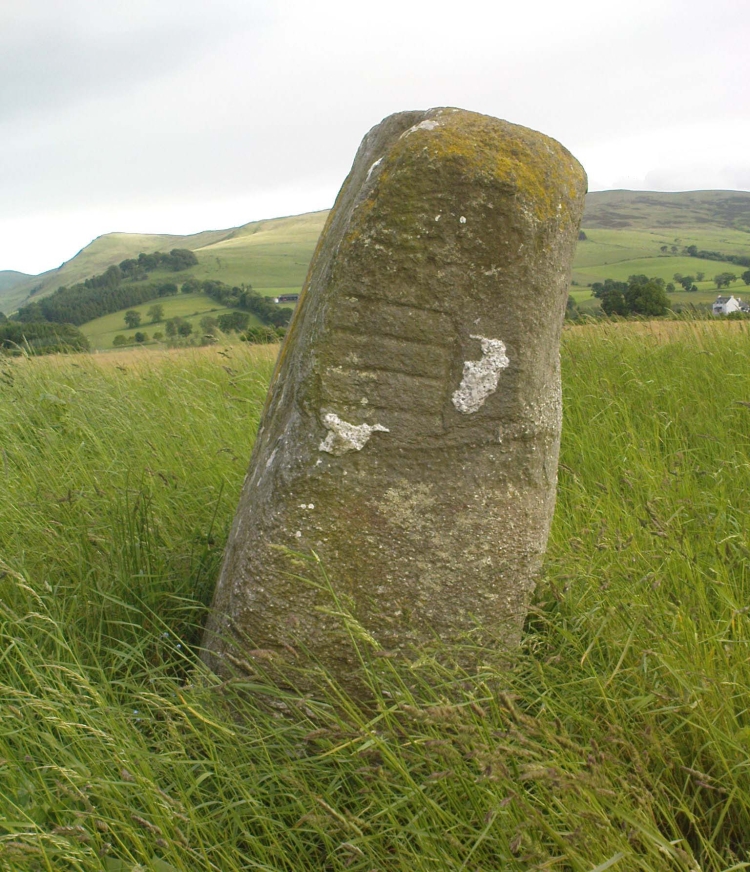
Although it seems consensus opinion that the standing stone here is prehistoric, the monolith was of some venerable importance to the Pictish people of the Ochils, who, according to the Royal Commission lads (1999) carved on this stone “the faint symbols of a goose and rectangle.”  The rectangle, however, is in fact a parallelogram—as the images here clearly show.  Archaeologist Richard Feachem (1977) thought the design was in fact “a double-sided comb.”  I have my doubts (a much smaller and probably more recent parallelogram design was recently identified on the upright face of the large Dunruchan D standing stone, about 10 miles WNW of here).  The ‘goose’ is carved above this geometric form and is much fainter, which may imply it was carved much earlier.  In Elizabeth Sutherland’s (1997) survey, she suggests the bird may be an eagle.  It is equally possible that it is a swan.

The earliest detaied account of this stone and its companion is in Mr Hutchison’s (1893) fine essay, where he wrote:

“On the south side of the road from Blackford to Auchterarder, about 150 yards west from Loaninghead where the line of the road is crossed by that from Gleneagles to Crieff, stands a fine stone of Highland grit.  It measures 4ft. 10in. in height above ground, 10ft. in girth at the base, and 6ft. 9in. in circumference at top.  It shows four sides of nearly equal measurement:— that facing north being 2ft 4in., south 2ft. 8in., west 2ft 5in., and east 3ft.  On the north is an incised figure in the form of an parallelogram, 10in. broad by 9in. high, divided into three equal portions by two horizontal lines.”

References:

  1. Calder, Charles S.T., “Notice of Two Standing Stones (one with Pictish Symbols) on the Lands of Peterhead Farm, near Gleneagles, Perthshire,” in Proceedings of the Society of Antiquaries, Scotland, volume 81, 1947.
  2. Feachem, Richard, Guide to Prehistoric Scotland, Batsford 1977.
  3. Finlayson, Andrew, The Stones of Strathearn, One Tree Island: Comrie 2010.
  4. Hutchison, A.F., “The Standing Stones of Stirling District,” in The Stirling Antiquary, volume 1, 1893.
  5. Royal Commission on the Ancient & Historical Monuments of Scotland, Pictish Symbol Stones: A Gazetteer, Edinburgh 1999.
  6. Sutherland, Elizabeth, A Guide to Pictish Stones, Birlinn: Edinburgh 1997.

© The Northern Antiquarian


Healey Stone Circles, Masham, North Yorkshire

Stone Circles (destroyed):  OS Grid Reference –  SE 170 810

Archaeology & History

I was hoping to get a Northern Antiquarian team to explore this arena before moving to Scotland, as I lived in hope that we might uncover some remains of an important cluster of megalithic rings in this quiet North Yorkshire area — but we didn’t manage to get here.  So this short profile is one based purely on texts.

A mile east of the standing stone and impressive cup-and-ring carvings of West Agra, was once to be found several stone circles — according to John Fisher (1865), who told us about them in his magnum opus on the history of the region.  Not to be confused with the giant Druid’s Temple a couple of miles south, Fisher was contextualizing them with the “huge circles of upright stones” which our great heathen ancestors built.  Although he made some mistakes trying to link the local place-names with these stone circles (a common pastime of Victorian writers), his remarks still make interesting reading. He told that,

“In this parish there are places which fully answer to this description, as well in situation and appearance, as in the names which they still bear. I refer more especially to Healey-Baals, Beldin Gill, and Baal Hill, which latter place is situate either upon or near to the range of hills known by the name of Healey-Baals.  The very name of Baal-Hill, without reference to its appearance or locality, indicates that the place is a hill dedicated to the worship of the heathen god Baal; and the name Healey-Baals, according to the interpretation which I put upon these words, is, if possible, still more conclusive of the matter. I take it that the name of Healey is derived from Heil, holy or sacred, and ley, land consisting of fallow-ground, pastures, or meadows. If, therefore, I am right in my interpretation of the name of Healey, then Healey-Baals means simply land sacred to Baal. This supposition is strengthened by the circumstance of circles of upright stones having recently existed near to the place, and from ancient relics which have been found within the parish, and at but a short distance from Healey and Healey-Baals, which are supposed to have been used in the mystical rites of the Druids or priests of Britain, for at least antiquaries can assign no other use to them…”

There are very few other references I can find that tell of these lost stone circles.  Edmund Bogg (1906) mentioned them briefly, saying that between Fearby and the hamlet of Healey a mile west, “there were formerly circles of upright stones and other relics suggestive of druidical origin.” But there’s little more.

In exploring the local field-names we find that three of them here carried the name “Standing Stones” – which seems to tell us where once we could find these old stones.  It may be possible that some of the stones were removed into the hedgerows at the sides of the fields.

Folklore

Fisher told of the local tradition of quarterly fire ceremonies close by, which he thought may have related to religious practices at the stone circles, telling:

“There are traditions, too, which have been handed down to us, to the effect that the heathen custom of making feasts and Baal-fires (which although unknown to the persons making them, were in truth so made in honour of Baal) have been continued until very recent times in this district — and especially in Nidderdale — the remembrance of which is transmitted to us in the annual feast which is still held at Healey.”

References:

  1. Bogg, Edmund, Richmondshire and the Vale of Mowbray, James Miles: Leeds 1906.
  2. Cunliffe-Lister, Susan, Days of Yore, privately printed: Bath 1978.
  3. Fisher, John, The History and Antiquities of Masham and Mashamshire, Simpkin Marshall: London 1865.
  4. Smith, A.H., The Place-Names of the North Riding of Yorkshire, Cambridge University Press 1928.

© Paul Bennett, The Northern Antiquarian


Newhall Bridge, Kenmore, Perthshire

Standing Stones:  OS Grid Reference – NN 7926 4668

Also Known as:

  1. Canmore ID 24910
  2. Newhall Stones
  3. Taymouth Standing Stones
Newhall Stones, Kenmore

Getting Here

Pretty easy to find.  At the eastern end of Loch Tay, go through the old village of Kenmore along the A827, towards Aberfeldy, for about a mile.  At least a mile past Kenmore, keep your eyes peeled for a small left turn which takes you back into the grounds of Taymouth Castle.  Go on this small road, pass the ornate walling, and you’ll see these two standing stones in front of you, before the trees, on the left.  If you reach the Croftmoraig Stone Circle, you’ve gone a few hundred yards past the turning.

Archaeology & History

Fred Coles’ drawing & lay-out

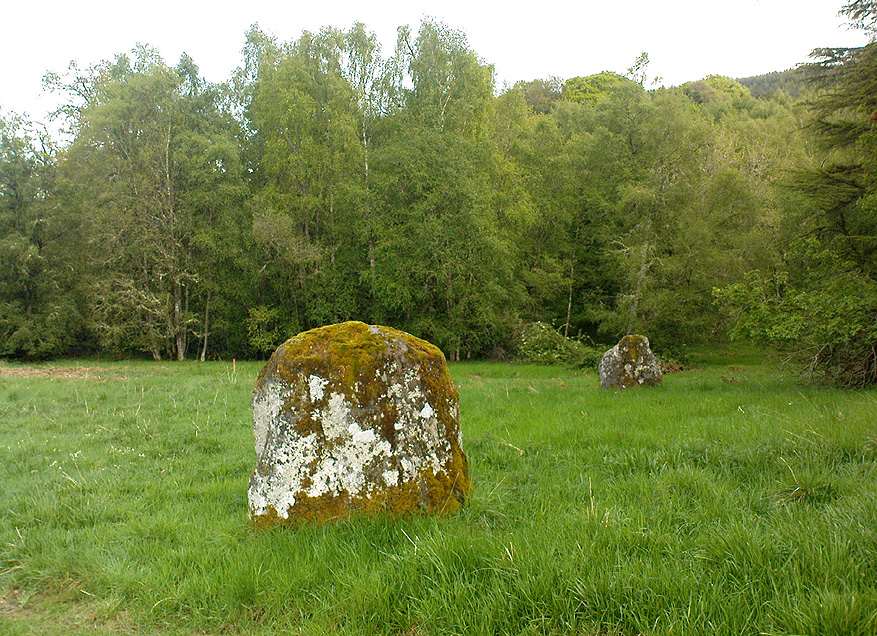
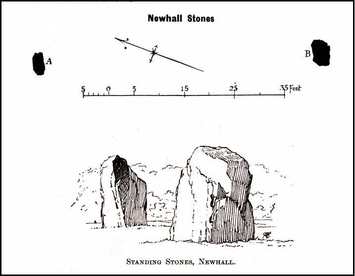
These fine-looking standing stones a mile northeast of Kenmore village, on the edge of the grounds of the superb Taymouth Castle, are worthy old monoliths, encrusted by the lichens of many centuries, resting within the long grass beside the track that runs to the castle.  But they have received little attention in archaeological terms.  When Fred Coles (1910) described them, he thought them to be the remains of a stone circle — an impression echoed by Margaret Stewart (1966) many years later (I got the same impression aswell), but no other stones have been found to substantiate this (although Mr Gillies’ folklore remnant is intriguing).  There is a notable rounded hillock immediately behind the two stones which may, or may not, have had other uprights surrounding it; though I can find no further data anywhere to substantiate such a thing.

In William Gillies’ (1938) historical survey of the area he related Mr Coles’ earlier findings of the two stones, telling us:

“There are two great standing stones just within the Principal Gate leading to Taymouth Castle.  The stone A (see plan) stands at a distance of 54 feet to the NNW of B — a somewhat greater diameter than is common among the Perthshire Circles.  These stones are almost equal in height — A is 4ft 9in, B is 4ft 7in — and they are both rugged blocks of a rough species of diorite.  Stone A measures round the base 10ft 8in, and stone B 14ft.”

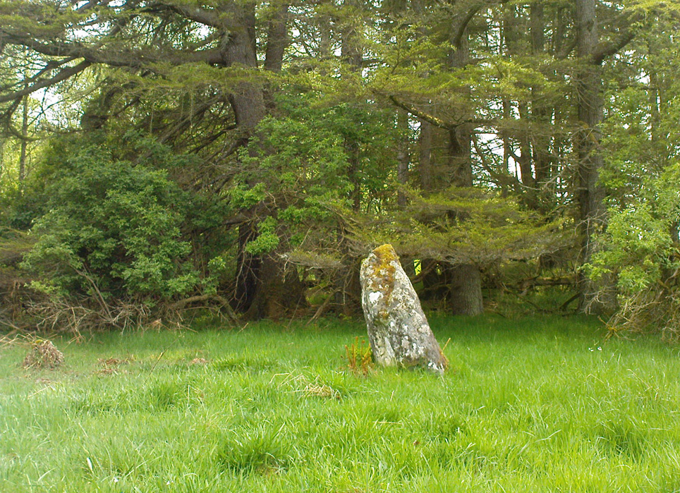
The western stone
The eastern stone

But it seems that little else has been found about the place.  It’s in a gorgeous setting (but, round here, everything’s in a gorgeous setting!) and must have related to other sites in the area, but it’s hard to contextualize the place on a single visit.  If you stand behind the two stones, the shape of their ‘heads’ fits very nicely onto the rounded hillock on the northwestern skyline — which seems to have later been used as a hillfort.  Whether this has any astronomical potential, I aint checked. (though Thom says nothing about them)

In geomantic terms both of these stones possess a distinct female flavour to them; the easternmost thinner of the two, particularly so.  But then I could just be talking bullshit!  I’d have loved to have spent more time with these two stones — bimbling, sitting, focussing, dreaming — as people of olde naturally did; but we were on the move and had other places to see.  Tis a delightful spot indeed…

(NOTE – This site was first given a grid reference of NN 801 477 in Margaret Stewart’s (1967) fine essay on the standing stones at nearby Lundin; and the grid-ref has since been reproduced in texts by Burl (1993), Thom (1990) and others.  Please note that this grid-ref is incorrect and is nearly a mile away from the actual position of the stones.)

Easternmost stone from another angle

Folklore

There is the possibility that this site once played a part in an important megalithic stone row.  Mr Gillies (1938) once again notes an old tradition told by local people which “says that at one time there was a paved way connecting the circle, of which these stones are the remains, with the great Croftmoraig circle.”  Very intriguing indeed…

References:

  1. Burl, Aubrey, From Carnac to Callanish, Yale University Press 1993.
  2. Coles, Fred, “Report on Stone Circles Surveyed in Perthshire,” in Proceedings of the Society of Antiquaries, Scotland, volume 44, 1910.
  3. Gillies, William A., In Famed Breadalbane, Munro Press: Perth 1938.
  4. Stewart, M.E.C., “The excavation of a setting of standing stones at Lundin Farm near Aberfeldy, Perthshire“, in Proceedings of the Society of Antiquaries, Scotland, volume 98, 1966.
  5. Thom, A., Thom, A.S. & Burl, Aubrey, Stone Rows and Standing Stones – 2 volumes, BAR: Oxford 1990.

© Paul Bennett, The Northern Antiquarian

Roms Hill, Wadsworth, Hebden Bridge, West Yorkshire

Standing Stone:  OS Grid Reference – SE 0080 3261

Getting Here

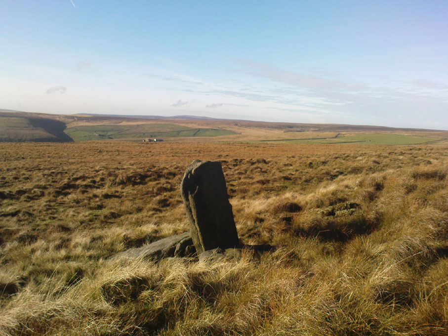
Roms Hill Stone

Whether coming from Hebden Bridge or Oxenhope: at the very top of the long uphill road, at the very top where a small radio station sits by the roadside (the views from here are effing superb!) – stop! On the opposite side of the road from the radio station, get over the fence (I think there’s a gate nearby) and walk roughly westwards down the gently inclining grassland slope.  Keep westward-ish for about 200 yards (if that) and you’re damn close!

Archaeology & History

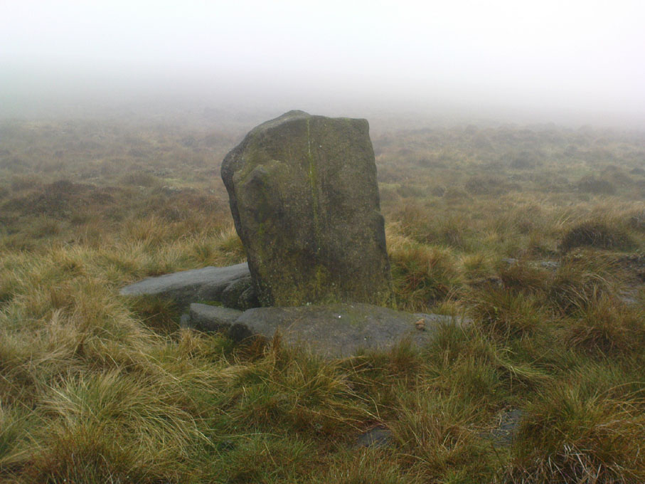
Rediscovered in January 2002, this is a very curious stone, over a metre in height, isolated on the southern edge of Roms Hill, close to the folklore-sounding Halfpenny Hole Clough, near the very top of the hill between Hebden Bridge and Oxenhope. The base of the stone is almost wedged into a space between two rocks and its positioning here seems quite deliberate.  It stands upon a small geological ridge in the ground that stretches for some distance, east and west, either side of here.

Roms Hill Stone in good fog!

Despite this, it seems unlikely to have an authentic prehistoric pedigree, but as there’s little else been said of the stone (apart from Dave Shepherd’s (2003) article on local megalithic remains, many of which are highly dubious as archaeological remains), it deserves a mention here.  It’s not recorded in any of the old boundary records — unlike the upright boundary stone that can be found a few hundred yards northwest of here on the same moorland plain.

The land here has an etymological relationship with the Roms Law (or Grubstones) Circle on Rombald’s Moor, but as yet we can ascertain little more about this site.  Well worth a visit — if only for the superb views it affords!

References:

  1. Shepherd, David, “Prehistoric Activity in the Central Pennines,” in Transactions of the Halifax Antiquarian Society, volume 11 New Series, 2003.

© Paul Bennett, The Northern Antiquarian