If you’re coming south out of Dunfermline, or north towards Dunfermline, make sure you go along the A823 Queensferry Road. About a mile short of the town centre you need to turn east along the B916 Aberdour Road. Nearly 1 mile along here, shortly past the Tesco supermarket, turn left along Tweeddale Drive. About 50 yards down here, turn left again along Walls Place. About 120 yards along you’ll find a small ginnel/path that runs between two rows of flats on the council estate. Walk down here for a short distance and the stone will magically appear on your right.
Archaeology & History
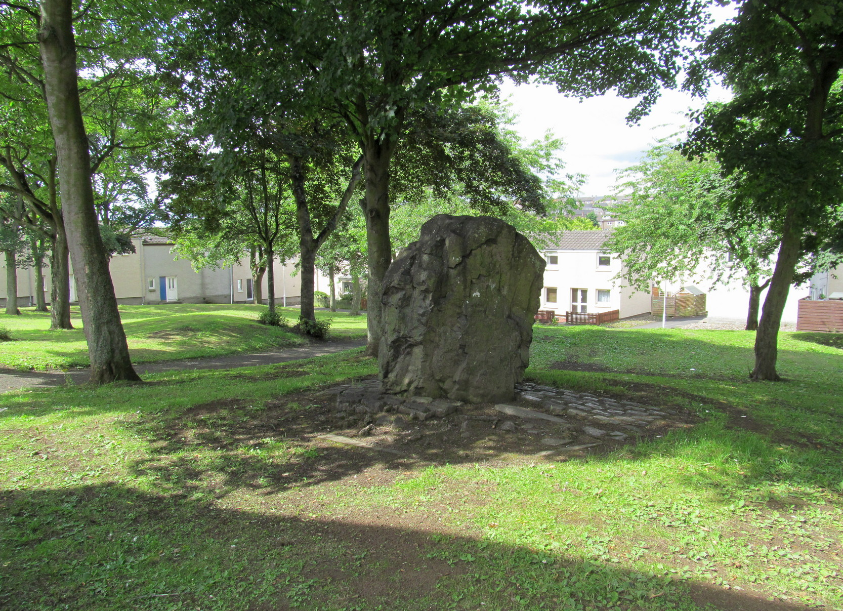
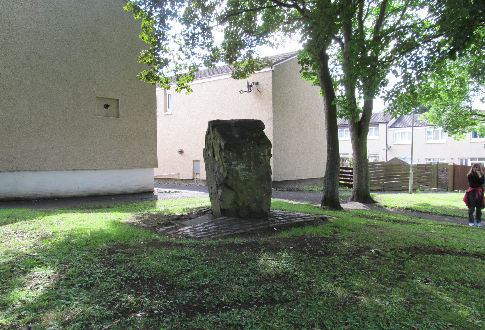
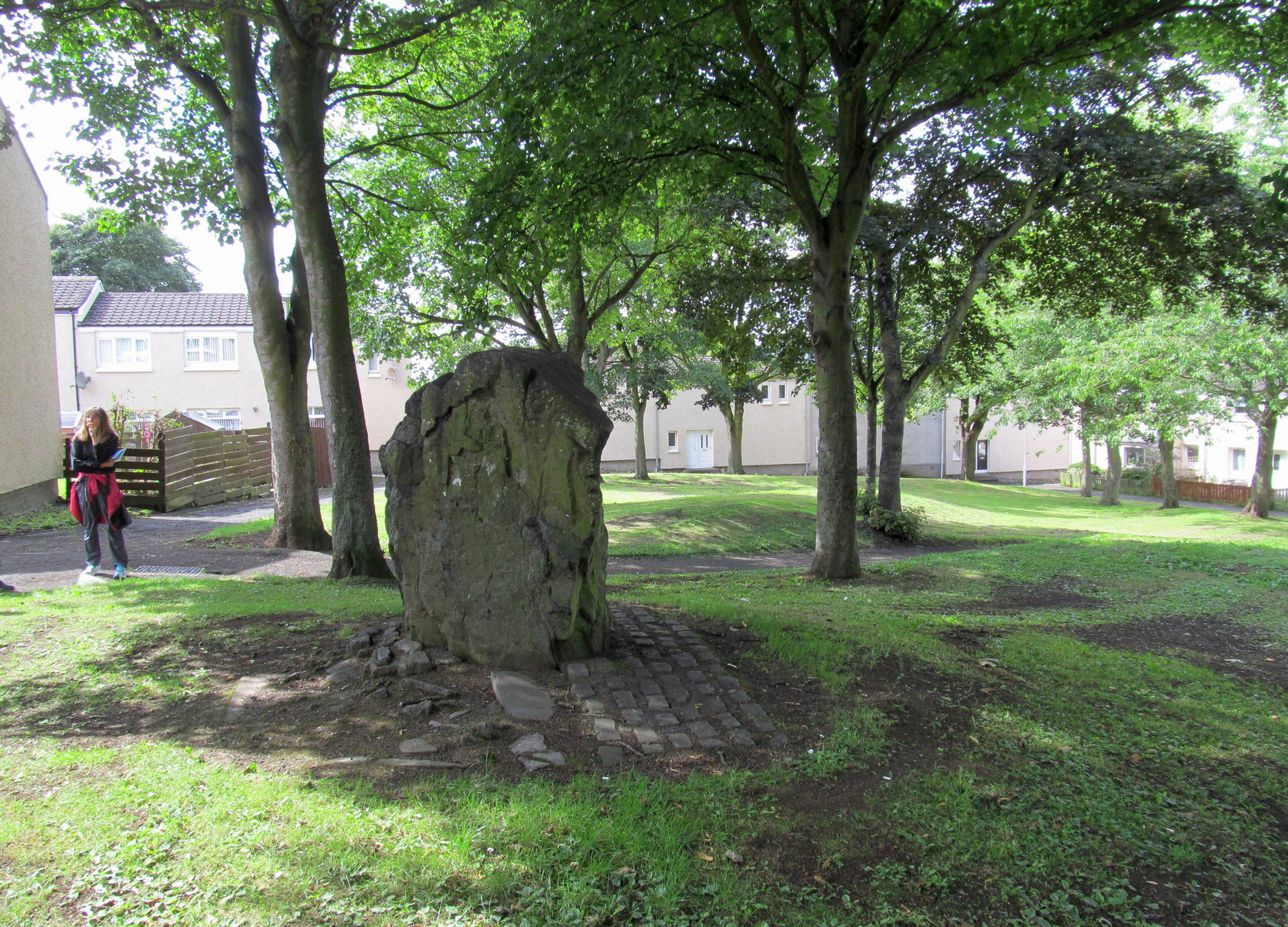
This is a bit of an odd one! Early accounts of the monolith are scarce and, on my first visit here, I was somewhat sceptical of its prehistoric provenance. To be honest, I still am. The erosion levels on the stone give the impression that it’s a much more recent erection (calm down… 😉 ), almost as if it was only quarried a century or two ago. Anyhow, that aside. It’s a nice bulky standing stone, nearly six feet tall and erected where the rising land levels out in the middle of the modern housing estate. It was included in the Royal Commission (1933) survey, who said of it:
Pitcorthie, looking SWPitcorthie, looking West
“About 200 yards north of the farm of Easter Pitcorthie, in a field adjoining the north side of the roadway from Dunfermline to Burntisland, stands a roughly rectangular block of sandstone, which presents the appearance of having been subjected to fire or heat. It is set with its main axis due north and south on the crest of slightly rising ground… There are some indications that it has been packed at the base, but what appears to be packing may be no more than a collection of loose stones which have accumulated round it during the years in which the surrounding area has been cultivated. It rises to a height of 5 feet 10 inches above the ground level, but shows no traces of any sculpturings. At 3 feet from the ground its girth if 11 feet 10 inches.”
It would be good if there were other prehistoric remains close by that could erode my slight scepticism about its age, but I think the nearest other Bronze Age monument is the cairn more than half-a-mile to the south-east.
References:
Royal Commission on the Ancient & Historical Monuments, Scotland, Inventory of Monuments and Constructions in the Counties of Fife, Kinross and Clackmannan, HMSO: Edinburgh 1933.
Swarbrick, Olaf, A Gazetteer of Prehistoric Standing Stones in Great Britain, BAR: Oxford 2012.
This little-known iron-bearing spring takes some finding! It’s all but lost beneath a mass of invasive rhododendrons that cover the slopes here (it needs to be severely cut back) and will only be found by the truly adventurous amongst you. In notes of this site by Ordnance Survey in 1854, they told that “there was formerly a fountain to protect the Spring, but the fountain has been allowed to go to ruin” and I could see no remnants here on my visit.
In a detailed and lengthy analysis of the spring water that was done by W. Robertson in 1829, the principal minerals in it were found to be iron, magnesia and lime, but the spring was said to have no medicinal renown locally.
Acknowledgements:Huge thanks for use of the Ordnance Survey map in this site profile, reproduced with the kind permission of the National Library of Scotland.
This little-known tree, said to have been planted in memory of Sir William Wallace’s mother, is long gone. The only notice I can find of it, is in the writings of Pete Chalmers (1844), who told us:
“There is a tradition that the mother of Sir William Wallace was buried in the old church-yard, on the spot where the present thorn-tree is growing, but how she came to die here history seems to be silent. It is added that her son wished afterwards to erect a monument to her memory, but being in pursuit of, or flight from, his enemies, had not time to do so, and, as a substitute, planted a thorn-tree.”
Much of what constitutes “the old church-yard” has long been covered by the new cathedral and so the precise location of this old thorn tree will never be known, which is a pity, for as Chalmers told,
“This tree had reached an immense size, and was seemingly of great age about 60 years ago (c.1784), when it was blown down by a storm and replaced by a stem from the old tree, now advanced to a considerable height and magnitude—the only living and remaining memorial of the filial affection of the Scottish Patriot.”
Due to a lack of writings from the viewpoint of Wallace and the Scottish people, we are only left with fragments regarding the why’s and wherefores of Wallace and his mum being in Dunfermline. Chalmers thought,
“Possibly the occasion of their being here is referred to in the following lines of the poet, an account of a pretended pilgrimage of Wallace and his mother to St Margaret’s shrine.”
He then cites a more assured account of Sir William being in the area, saying:
“It is recorded of this renowned person, that, on one occasion, in 1808, when he was surrounded by his enemies, he came from the fastnesses where he had taken refuge, to the Forest of Dunfermline, and by the mediation of his friends, proposed, on certain conditions, yiz., the assurance of safety in life, limbs, sad estate, to surrender himself. These conditions were indignantly refused by the haughty and infuriated Edward (the Tosser), who cursed him, by the fiend, for a traitor, and even set a price on his head. On hearing this, the Patriot ” betook himself again to the wilds and mountains, and subsisted on plunder.”
In Pete Chalmers (1844) historical brief about the long lost chapel and hospital of St. Leonard (and its associated holy well), mention is made of this long forgotten relic. Its memory was preserved in an old place-name, and was to be found less than half-a-mile southeast of St. Leonard’s sites on,
“the high part of the road, about a quarter of a mile to the south, the Spital-Crosshead, (named) from a pillar which, according to tradition, was erected there, decorated on the top by a St Andrew’s Cross, and removed probably towards the close of the 16th or 17th century.”
The cross is believed to have been erected in the 15th century.
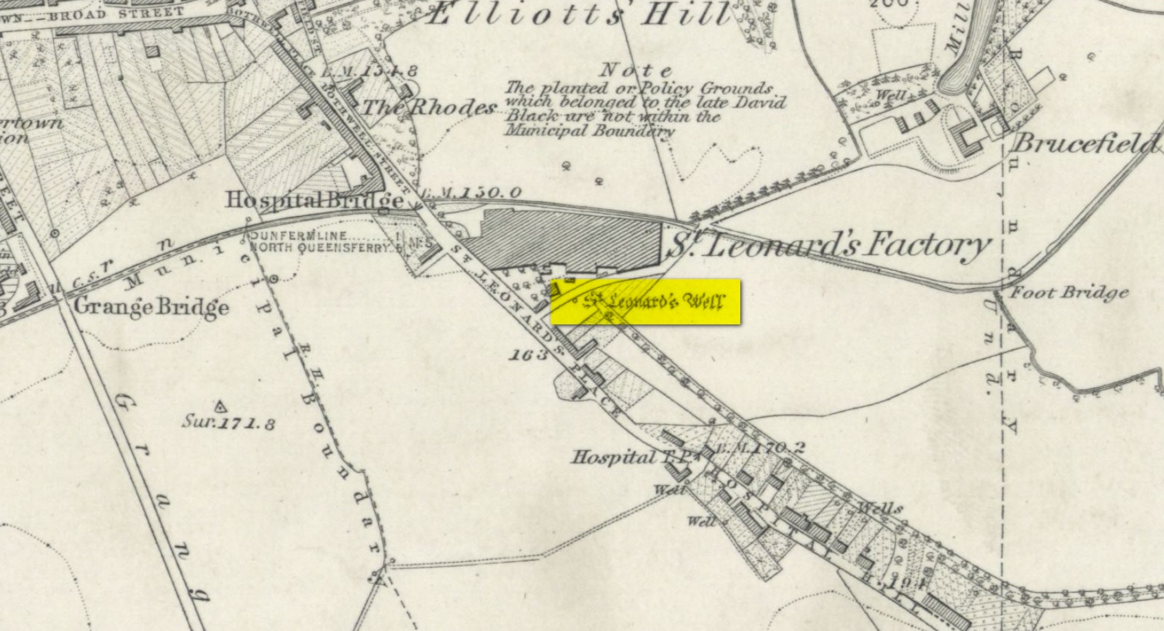
Holy Well (destroyed): OS Grid Reference – NT 0976 8666
Archaeology & History
Site shown on 1856 map
There seems to be very little information available about this holy well, lost long ago and now hidden beneath the foundations of a food superstore! It was found in close association with both a chapel and a hospital in St. Leonard’s name—both of which have also been destroyed. The water from here may have been used by the monks for patients in the hospital, but that’s purely speculative. St. Leonard was known to be connected with lepers, which may be something that the waters here were used to treat. But again, I’m speculating…
When the Ordnance Survey lads came here in 1853, the waters were still running and they subsequently added it to their map a few years later. The site was still visible when Erskine Beveridge (1917) came here, telling us briefly that,
“St. Leonard’s Well still remains a little to the south-east, and, though now built up, is recognisable.”
But a few years later it had been destroyed and its position was shown on the updated OS-map of 1926 as “Site of.” The old well had gone…
Simpkins, John Ewart, Examples of Printed Folk-lore Concerning Fife, with some Notes on Clackmannan and Kinross-shires, Sidgwick & Jackson: London 1914.
Walker, J. Russel, “‘Holy Wells’ in Scotland,” in Proceedings of the Society of Antiquaries of Scotland, vol.17 (New Series, volume 5), 1883.
Acknowledgements: Big thanks for use of the 1st edition OS-map in this site profile, Reproduced with the kind permission of the National Library of Scotland.
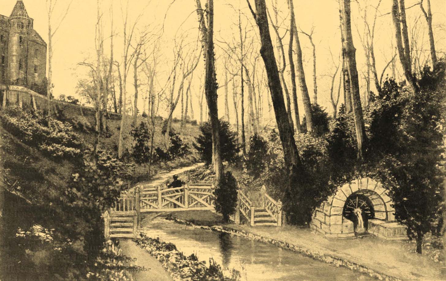
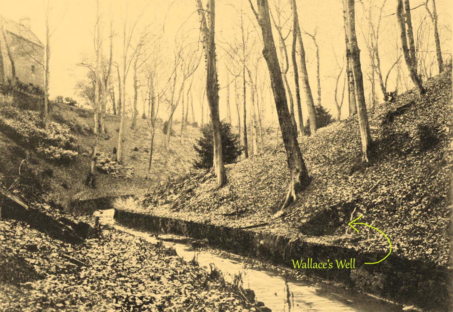
The ruins of this little-known site, dedicated to the legendary Sir William Wallace, can still be seen in the form of an overgrown stone ruin just off the footpath that runs through the Pittencrieff Glen out of the town centre. In earlier times the waters were evidently of some repute, as a Council meeting in May 1773 reported with some disdain the closure of the waters by a Mr Chalmers:
“This Day the Council considering that the entry from the Town to the Well of Spaw is now shut up by Mr. Chalmers, which was a particular privilege to ye Inhabitants of the Burgh, Do hereby appoint the Provost to intimate to Mr. Chalmers that the Town will not give up that privilege, and to require him to oppen an entry thereto as formerly.”
We don’t know whether the miserable Mr Chalmers gave access to the well, as there seem to be no Council meeting notes telling us the outcome. My guess would be that the local people got their way, hopefully at Chalmers expense! More than 70 years later, another Mr Chalmers (1844) wrote about the well in a more respectful light:
“On the north edge of the rivulet, a little below this bridge, at the foot of the Tower Hill, there is a famous well, named the Wallace Spa, or well of Spa, which was formerly much resorted to by the inhabitants of the town for its excellent water, but which has been long since disused. It is noticed here simply on account of the traditionary antiquity of its name, Sir William Wallace, it is said, having once, in the haste of a flight, drank a little of it, out of the palm of his hand.”
In spite of there being local folklore of William Wallace, the local historian Ebeneezer Henderson (1879), in his giant work on Dunfermline, thought there was a more prosaic origin to the well’s name. He told,
“This well is still in existence, about fifty yards south of the ruins of Malcolm Canmore’s Tower — Tower Hill. The water is reported as being “very cold at all times.” The water should be analysed. The well during the period of its being used was known as the “Spaw Well,” and the ” Well of Spaw,” and, by and by an easy, natural transition, ” Wallace Spa;” and thus the name of the well has sometime been connected with that of the great Scottish hero.”
The Well after 1900pre-1900 image
By the end of the 19th century, the well had become almost buried by earth and foliage, but was subsequently brought back to life following architectural improvements of the glen around the turn of the 20th century. In Patrick Geddes’ (1904) work he gives us “before and after” portraits (attached here) showing how it had been restored. He also mentioned “its tradition of medicinal value”, but could give no further information regardings the ailments it was reputed to cure…
References:
Chalmers, Peter, Historical and Statistical Account of Dunfermline, William Blackwood: Edinburgh 1844.
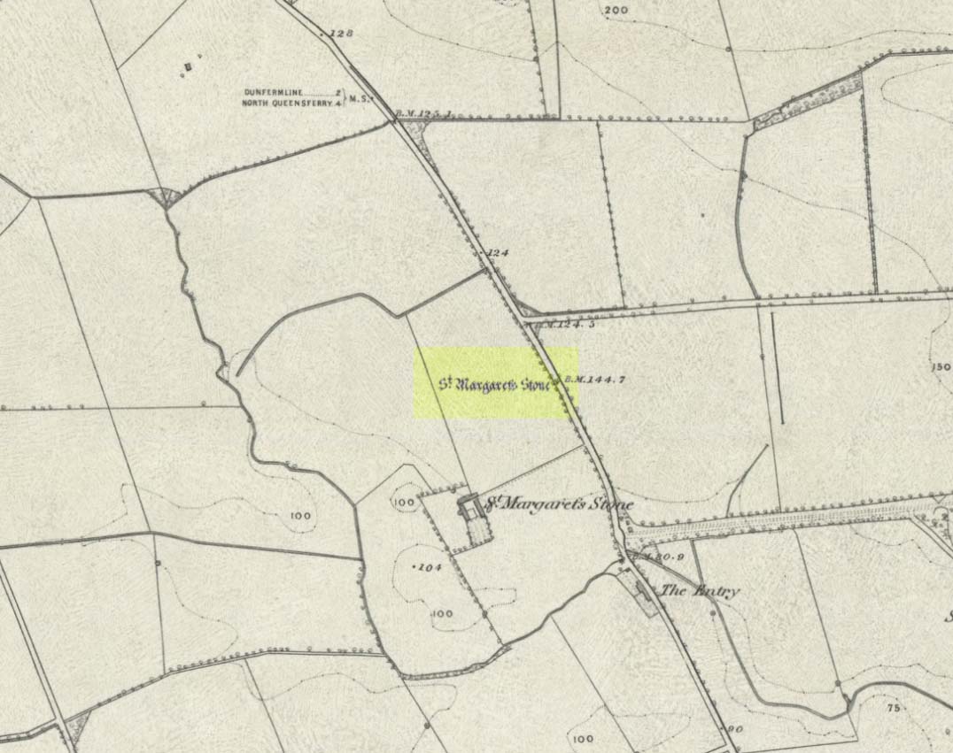
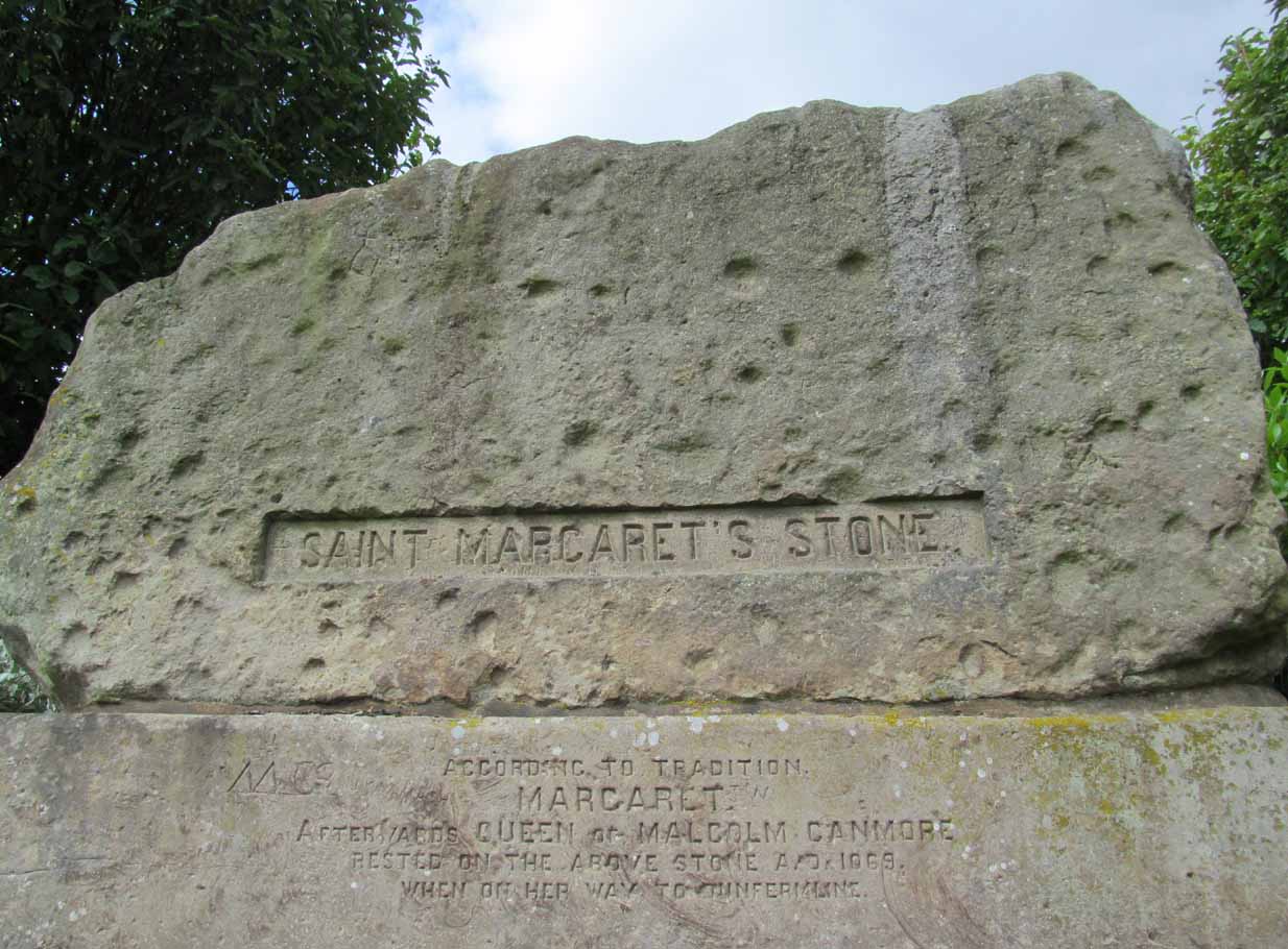
Take the A823 road out of Dunfermline south towards Rosyth. A half-mile before you hit the motorway roundabout, at the roundabout where Carnegie Avenue takes you east, turn west and park up along the road where the modern business park lives. 30-40 yards from the roundabout, set back on the pavement, you can’t really miss the huge flat slab of stone, covered in cup-markings, resting on a stone plinth with ‘St Margaret’s Stone’ stamped on it!
Archaeology & History
On the 1856 OS-map of this area, St Margaret’s Stone is shown at the roadside just above a farm of the same name, a short distance away from its present location. In October 1879, Alexander Stewart (1889) told us that funds were raised and steps taken to properly fix and preserve this ancient ‘resting-place’ of Queen Margaret on the Queensferry Road. It was quite a few years later before it was moved the few hundred yards further to its present location.
Cups on stone’s edge
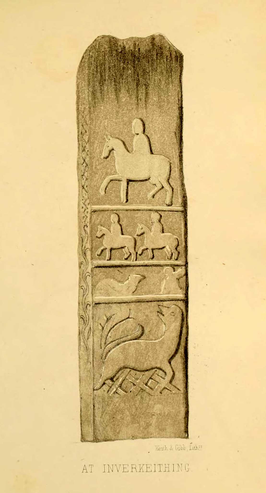
Early writers tell us that originally its position in the landscape was on the crest of one of the rises in the land between Dunfermline and the sea, making it visible for some considerable distance. This would seem to have been a deliberate placement. In my mind, and in accordance with the placement of many a prehistoric tomb, St Margaret’s Stone may originally have been part of a neolithic or Bronze age cairn, long since gone. The size and shape of the rock implies it too, with similarities here of the impressive cist or gravestone found inside the Netherlargie North cairn at Kilmartin. However, this wasn’t the thought of the prodigious Scottish historian, William Skene. He thought that St Margaret’s Stone originally stood upright, being a Pictish-style standing stone that was mentioned in the first Statistical Account of the area. The brilliant Scottish antiquarian, John Stuart (1856)—who gave us an illustration of the ‘standing stone’ in question—told us:
“It has been supposed by some that “St. Margaret’s Stone,” a block now lying on the side of the highway leading from Inverkeithing to Dunfermline, and about midway between these places, can be identified with the standing stone referred to in the Statistical Account. Mr Skene has noted below a sketch of St. Margaret’s Stone:- “The sculpture upon this stone has been lately chipped off in mere wantonness, so as to leave few traces of the subject recorded upon it.” He farther states that it formerly stood erect, and was called “The Standing Stone.” According to Mr. Skene’s measurement, St. Margaret’s stone is about nine feet and a half in length, one foot in thickness, and four feet broad at the widest end, and broken off to a narrow point at the other.”
The missing ‘standing stone’
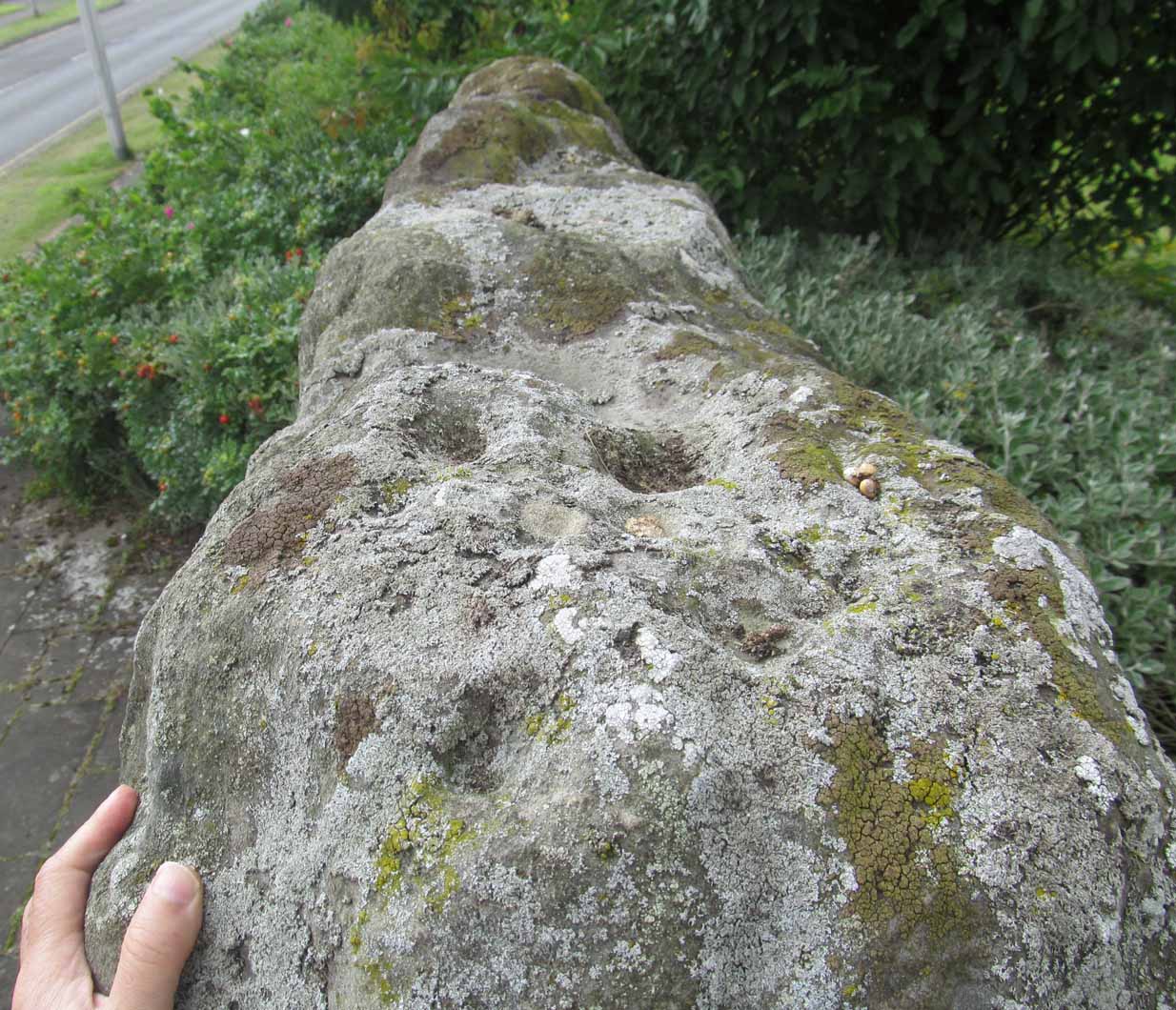
In this instance, Skene was confusing St Margaret’s Stone with the lost Pictish monolith (left) that used to exist nearby, which had carved horse figures and other memorial designs upon it and which he thought had faded away. Whereas the large slab we are looking at here, and which Skene visited and measured, is covered on one side by a gathering of prehistoric cup-markings—much earlier than any Pictish or early christian carvings. At first glance, it seems that some of these cups may well be natural, but it has to be said that some of them are distinctly man-made. And if we were to believe the archaeo-accounts of the stone, the cupmarks are only to found on one side of the stone. This is incorrect. As we can see here, a number of cupmarks run along the edge of the stone. We cannot say for sure whether all of them are artificial, but they certainly look like it! Also, on the other side of the flat surface, one or two single cups are visible. It would be good if we could get an artist to give us a detailed impression of the prehistoric carvings without the modern engraving of St Margaret’s Stone etching on the main face. (is there anybody out there!?)
The Royal Commission (1933) lads visited the stone in 1925 and, several years later in their write-up, told us simply:
“This stone…stands with its main axis due north and south and measures 8 feet 6 inches, by 4 feet 7 inches, by 1 foot 6 inches. On one side the entire surface is cup-marked, the markings varying in size from 1¼ inches to 3¼ inches and having an average depth of from ½ to ¾ inch.”
When the Scottish petroglyph writer and explorer, Ron Morris (1968) came to the site, he gave it an equally brief description, merely telling us:
“On standing stone (8 1/2 feet high, 4 1/2 feet wide), built in to roadside fence, over 80 cups, up to 4in in diam, 3/4in deep, some run together as rough dumbells.”
It’s well worth checking out!
Folklore
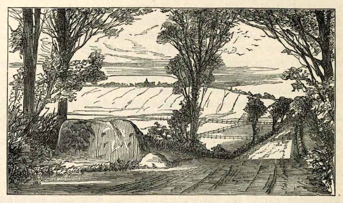
St Margarets Stone in 1825
When the Saxon Queen Margaret landed on the shores just west of Queensferry at Rosyth Castle (NT 1087 8200), legend reputes that she and her entourage made Her way north towards Dunfermline. Halfway along the ancient track She rested at this large stone which, thereafter, gained the name by which we know it today. It was said that Queen Margaret subsequently visited the stone on a regular basis for periods of solitude. The tale probably has some germ of true in it. Additional ingredients also told that,
“The large stone here is associated with St Margaret and was visited by women who hoped to conceive or sought a successful birth. The eight-foot high stone is said to mark the resting place of St Margaret when she journeyed between Queensferry and Dunfermline. Margaret had eight successful pregnancies and probably needed to rest quite a few times on her travels!”
The fertility aspects of the rock were not the only pre-christian virtues attached to it. We also find that oft-cited motif of rocks moving of their own accord: in this case, as J.B. MacKie (1905) told us, local people had always
“been told that the stone rose from its bed and whirled thrice round in the air every time it heard the cock at the adjoining farm crow.”
Cocks crowing are symbolic of sunrise, obviously, and this lore may simply represent a folk memory of the spirit in/of the stone being animated at that time of day. It’s a motif found at ancient sites all over the place!
Royal Commission Ancient & Historical Monuments of Scotland, Inventory of Monuments and Constructions in the Counties of Fife, Kinross, and Clackmannan. HMSO: Edinburgh 1933.
Rupert-Jone, John A., Rosyth, A. Romanes: Dunfermline 1917.
Stewart, Alexander, Reminiscences of Dunfermline and Neighbourhood, Scott Ferguson: Edinburgh 1889.
Legendary Stone (destroyed): OS Grid Reference – NT 058 865
Archaeology & History
Travelling along the old road between Crossford and towards Cairneyhill, on the right-hand (north) side, there was until recently a huge boulder, described by the folklorist J.E. Simpkins (1914),
“Its horizontal dimensions above ground are diagonally 18 feet by 21 feet; its vertical height above ground 5 feet… I estimate its weight at nearly 200 tons.”
The stone was proclaimed by 19th century geologists to be a glacial deposit from the upper region of the Forth (the nearest mountain region possessed of this type of stone); although our old petroglyph writer, Sir James Simpson, postulated the Witch’s Stone to be “of meteoric origin.”
But like oh so many old sites with heathen tales attached, the stone was destroyed by a local farmer on 7 February, 1972. The following interesting notes were made in a Crossford & Cairneyhill School log-book, describing its destruction:
“The local farmer blasted the “Witch’s Stone”, situated about 300m East of school at 2.30 this afternoon. Children vacated both buildings and sheltered at West End of main building. All windows were opened. Police informed that further operations of this nature will be carried out at weekend.”
A week later on February 14, all “remains of “Witch’s Stone” removed by blasting at 3pm today.”
On the other side of the road from our Witch’s Stone was another boulder, this time known as the Cadger’s Stone, said by Beveridge (1888) to have got its name,
“from the circumstance of its having formed a landmark for the ‘cadgers’, or itinerant merchants, who were wont to rest themselves and their ponies whilst they deposited for a short while their burdens on the stone.”
The earliest OS-map of the region in 1856 shows neither of these stones, but does highlight a Capel Stane, or Stone of the Horse, very close by.
Folklore
The stone was obviously of some traditional importance to local people in pre-christian times. David Beveridge (1888) described the position and creation myth of the Witch’s Stone as follows:
“On our right a singular-looking stone of blue limestone appears in a field, and is known as the Witch’s Stone, the popular legend being that a notable witch in this neighbourhood found it on the seashore, and that after she carried it some distance in her apron, the string of the latter broke, and the stone has since continued to lie in the place where it fell. “
A few years after this, the folklorist J.E. Simpkins (1914) wrote:
“The legend connected with this boulder is, that a witch wishing to bestow a valuable gift on the Pitfirrane family, resolved to present to them a cheese-press. With that view, she lifted this boulder and carried it some distance in her apron, but owing to its excessive weight the apron-strings broke and the stone fell to the ground, where it has remained ever since.”
If anyone knows anything more about this old stone, or has any old photos of the fella, please let us know!
References:
Beveridge, David, Between the Ochils and Forth, William Blackwood: Edinburgh 1888.
Simpkins, John Ewart, Examples of Printed Folk-lore Concerning Fife, with some Notes on Clackmannan and Kinross-shires, Sidgwick & Jackson: London 1914.