The low hill called Beadle Hill is located about half a mile north of Swinden Reservoir between Worsthorne and Haggate in the area called Extwistle. It is just a short distance south of Monk Hall and a little east of Monk Hall farm. The earthworks are a long rectangular feature on a low hill (more of a mound really).
The earthworks are more noticeable on the south and west sides but less so at the eastern and northern edges of the mound. They can’t be said to be in any way defensive. The thinking is that this was a Romano-British farmstead or settlement from the late 4th century AD and, not as often thought a Roman camp. The name Beadle is apparently from the Anglo-Saxon/Old English word ‘Beado‘ or ‘Beadlo‘, meaning ‘battle.’ So could the hill be the site of some long forgotten skirmish from the time when the Romans were leaving the north of England? Or could it refer to the legendary ‘Battle of Brunanburh’ which was fought close by in 937 AD? In that battle King Athelstan fought against, and defeated, the Danes and Scots who were moving south from Northumbria.
At the south side of Beadle Hill there is an ancient spring, and to the east is Twist Castle—a circular earthwork that could date from the same period as Beadle Hill. Also, there are a number of tumuli and cairns in this area though these are prehistoric in date, probably Neolithic or Bronze-Age. I do not know whether the site has been excavated. If it has, please let us know!
References:
Cockburn, John Henry, The Battle of Brunanburh and its Period, Elucidated by Place-Names, Sir W.C. Leng: Sheffield 1931.
Frost, Roger, A Lancashire Township – The History of Briercliffe-with-Extwistle, Rieve Edge Press: Briercliffe 1982.
Described in Walter Bennett’s (1946) magnum opus as a “stone circle” and repeated in Aubrey Burl’s (2000) magnum opus under the same category, the site here seems more likely to have been an old cairn circle, or perhaps even a simple tumulus — and a small one at that! It was first noted in June of 1842 when the antiquarian, Mr F.C. Spencer of Halifax, “had his attention called to a circle of stones in a field called Delph Hill Pasture by Jonas Lee, a Thursden farmer, and a somewhat noted character in his day” who knew the location very well. It didn’t take long for Mr Spencer to realise that this was “an ancient British barrow,” as he called it, and made plans to excavate the site soon after seeing it.
Following Spencer’s dig, a short account of the finds was made in the Gentleman’s Magazine, telling of the remains of this “small circle of stones” and the burials therein. The account said:
“The circle originally consisted of rock pillars (five of which remain) , standing about 18 inches above the surface, and being about 2 feet square. The diameter of the circle is about 5 yards. Mr Spencer directed an excavation to be made without delay, the result of which was the discovery of two very antique earthen urns, curiously marked, containing fragments of human bones, of small dimensions, mixed with charcoal and black mould. The tops of the vessels were covered with small flat slate-stones, but little larger than the urns, over which larger heavy stones were placed for their protection. The urns were found about 2 feet beneath the surface of the field, in the centre of the circle, embedded in soft clay, with many pieces of charcoal interspersed. About 300 yards from the barrow are the bold remains of a British circular camp…”
A few years later, Tattersall Wilkinson (1893) told that “three unglazed urns, with human remains and flint arrowheads” (my italics) were found at the locale. Curiously there has been some confusion as to the number of urns that were actually found at Delf Hill by different authors over the last 175 years (numbering between 1 and 3, depending on whose account you read!), but it would seem this has occurred due to the proximity of other tombs close by.
An excursion to Delf Hill a few years after Spencer’s first dig is described in an article by L. Clement (1874), where several members of a local history society reported that the mound here consisted of a “small circle of stones, seven in number, fourteen feet in diameter”, that probably surrounded the hillock. One of the stones had been knocked over and moved, so the group took it upon themselves to place the monolith back into what they thought was its original setting within the monument.
Tumulus (destroyed): OS Grid Reference – SD 866 309
Archaeology & History
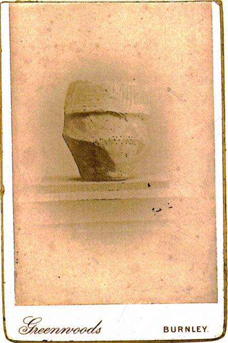
Cliviger Laithe urn
The grid reference given here is an approximation as we don’t have the exact position of the tomb that could once be seen in the fields immediately south of Cliviger Laithe farm — but it’s a pretty good approximation! Overlooking the once proud cairn of Cliviger Law some 800 yards below to the southeast, Geoffrey Watson (1952) told us the site was “on the summit of the hill…which tailed off near Barcroft Hall,” but this area of the fields have been dug and quarried away in recent years, leaving no trace of the original tumulus that stood here. It also appears that the discovery of the site was quite an accident, Mr Booth (1899) telling us how the urns that were unearthed here were located “while some men were engaged in digging there.” As a result of this, we have little by way of description of the burial mound itself, but thankfully the prehistoric vase which they unearthed was kept intact. Of this artifact Mr Booth told:
“The vase came into the possession of a Mr Roberts…who lived at the old hall near the church at Worsthorne… By the kind permission of Mr Roberts I had an opportunity of making an examination of the interesting object. The urn itself was of a similar character to those already found in our locality* and measured 14 inches in depth, about 8 inches across the mouth, and 36 inches in circumference at its widest part… The vase “bulged” out in the middle, as these cinerary urns invariably do, and from thence it tapered down to a base of about 3 or 4 inches in diameter. It was ornamented at the top by the usual deep collar of about 5 inches in depth, the upper and lower edges of which were ornamented (with) encircling lines… The vase contained a large quantity of calcined human bones. Dr Dean gave as his opinion that there were the remains of two if not three human bodies, one of which was the body of a child… Besides the bones, the vases contained a quantity of charcoal and ashes, and also a very friable bone pin.”
The tomb evidently made a good enough impression on the Lancashire historian J.F. Tattersall as he took to writing a poem about the place! It went:
In this lone cairn upon the mountain head,
On one far morning of the misty past,
The earliest wanderers o’er these moorlands cast
A kinsman’s ashes to their narrow bed.
Now we, by Nature’s kindly guidance led
By marvellous ways, through revolutions vast
Of Time, her latest children, not the last,
Gather again around the ancient dead.
References:
Bennett, Walter, The History of Burnley – volume 1, Burnley County Council 1946.
In days of olde this once proud tomb stood upright on the slopes below the more prominent Cliviger Laithe tumulus above. But, like many of the ancient ancestral tombs of this region, its days seem long gone. Although we’ve found what may be some traces of the outline of the cairn (further analysis required!), when the legendary Lancashire historian Thomas Dunham Whitaker (1872) wrote about the place, he was already writing about it in the past tense. He said briefly, that “this heap of stones was removed as materials for building a turnpike road” in 1763. The archaeologist Bernard Barnes (1982) told us that “a cist with an inhumation was found. In 1766 another tumulus was removed and an urn found. An axe-hammer is said to have been associated” here. The most lengthy description of this site can be found in Mr Booth’s (1899) short work where, in his summary of various prehistoric sites in this region, he told that,
“The first find recorded in this locality took place at Law House, near Mereclough, in the year 1763, when a mound was opened which covered a kistvaen, or stone cist, which, upon being opened, was found to contain a human skeleton. The information concerning this ancient burial is very meagre, and we have no information as to who were the discoverers of the mound. It may be noted that nearly 70 years before (in 1695) a number of Roman coins were found close to this barrow. The mound also contained a rude earthware vase filled with calcined bones.”
It’s unlikely that the earthworks by the walling hereby represent the denuded remnants of the monument in question, although the rise in the field here may be some remnant of the place, but without further excavation we might never know for sure. However, the recent discovery of what may be remnants of the cairn in an adjacent field requires further analysis. WATCH THIS SPACE – as they say!
References:
Barnes, B., Man and the Changing Landscape, University of Liverpool 1982.
Bennett, Walter, History of Burnley, volume 1, Burnley 1946.
Booth, Thomas, Ancient Grave Mounds on the Slopes of the Pennine Range, R. Chambers: Todmorden 1899.
Whitaker, T.D., History of the Original Parish of Whalley, London 1872.
Cross (destroyed): OS Grid Reference – c. SD 881 353
Archaeology & History
Not included in the magnum opus of Henry Taylor (1906), the exact position of this long lost site remains unknown, as even the investigative abilities of Clifford Byrne couldn’t track it down! It was erected in a region full of pre-christian remains and (at the time) living remnants of heathen folklore and practices between Worsthorne and Nelson. Mr Byrne (1974) described his search for the place, saying:
“This cross is of ancient origin and no part of it now remains as far as can be ascertained by investigation, although the memory of it certainly remains, for an elderly gentleman living in the cottages of Holt Hill, Briercliffe, said instantly on being asked about he cross that he had often heard it referred to by older people when he was a boy, although he could not say exactly where in the hamlet the monolith had stood. We are told that the cross is mentioned in a document in the year 1313 when Robert Briercliffe granted away the Sene intacks in the Holt Hill as it lay by Annot Cross on the south side. This implies that it stood on the south side of the road (between) Thursden and Haggate, which is an old road from Burnley to Halifax…”
This would give a rough grid reference for its position around SD 881 353, but nothing appears to be there. However, Byrne told of another intriguing bitta folklore a short distance away which may have had some relevance to the positioning of the cross.
“Down the road to Lane Bottoms, behind some bungalows, is a stone shaft in a depression in a meadow which we are told is an ancient standing stone. Whether this is so is not easy to ascertain for the stone has apparently been used as a gatepost at some time, and further gives indication of having been utilised as a cattle rubbing post.”
Below here we find the old place-name ‘Burwains,’ which clearly indicate a site of a prehistoric burial, though nothing remains of such a place — officially at least. Perhaps a couple of ventures in and around this area need to be done! One final note that Byrne made related to the title of this lost cross, saying:
“The name “Annot” may be of Saxon origin, for the Saxon word annet means solitude, and this would have certainly fitted the area in ages past.”
References:
Byrne, Clifford, A Survey of the Ancient Wayside Crosses in North-East Lancashire, unpublished report 1974.
Taylor, Henry, The Ancient Crosses and Holy Wells of Lancashire, Sherratt & Hughes: Manchester 1906.
Various ways to get here. From Worsthorne village, go east, up past the church, uphill following the dead straight path. After about 600 yards there’s a crossing in the footpath: go left here and walk another coupla hundred yards, over 2 walls, and after you’ve past the second wall you’ll notice the earthworks in the ground to your right. That’s it!
Archaeology & History
There’s nowt much to see here to be honest. It was included in Walter Bennett’s (1946) survey of ROMAN remains (oh dear) in the region — and his archaeological description of this place certainly seems to imply it was those doods (the Romans) who built this structure and not our neolithic ancestors. He wrote:
“Ringstones is a rectangular enclosure 50 yards square, surrounded by a mound or rampart 2 yards wide and one yard high, and an outer ditch two yards wide. Sepereated from the main enclosure by the ditch on the southeast side is another enclosure 18 yards square. Excavations made in 1925 gave the following information: a gateway, seven yards wide, was paved with boulder stones regularly laid on a gravel foundation, and on the south side of the gateway flat stones were sunk below the general floor level to act as a drain; a regular course of large stones flanked the gateway entrance on either side, and a foundation or irregular boulder stones was laid outside the gateway between the rampart and the ditch: inside the enclosure and 9 inches below the present grass surface., a floor had been made of gravel in some places and of flat stones or cobbles in others; the rampart was of earth and stones; a well-constructed road, 7 feet wide, ran from the earthwork in the direction of Bottin Farm, wich is situated on the Worsthorne-Roggerham road.”
There used to be a rough circle of stones on top of the site (probably giving the place its name), but these were apparently from the old remains of a lime-kiln from the 16th or 17th century — not prehistory. There is, therefore, a case that this site may not be prehistoric as archaeologists have classed it — and if the ground-plan above is anything to go by, you’d have to say it looks less than promising. More diggings are needed!
In the vicinity of the denuded ring-cairn and old tumulus of Wortshorne Hill, the Calderdale historian Mr J.A. Heginbottom (1979) described finding this simple cup-marked rock, a hundred yards or so northwest of the old circle. In my ambles here I was unable to locate it. The stone may have been reburied or destroyed. Prehistoric cup-marked carvings are (officially at least) rare things in Lancashire – and usually where you find one, others lurk close by. Do any local folk out there know anything more about this site?
References:
Heginbottom, J.A., The Prehistoric Rock Art of Upper Calderdale and the Surrounding Area, YAS: Leeds 1979.

")
