Sore Eye Well, Eldwick, West Yorkshire

Healing Well (destroyed):  OS Grid Reference – SE 1286 4007

Also Known as:

  1. Loadpit Well

Archaeology & History

Sore Eye Well on 1852 map

Descriptions of this site are few and far between, despite it having a meaningful name.  First recorded on the 1852 OS-map, in the folklore of our ancestors this was a well that local people frequented to wash their face and it was said that the waters would take away the ills of those suffering poor eyesight or other ocular problems.  Rags were left hanging over an old rowan tree as offerings to the spirit of the water, in return for curing the afflicted eyes.

When I first came looking for this as a boy, I was frustrated to encounter the water authority’s metal cover ruining the site completely, leaving nothing of the old well as it once was.  Around the metal-cover was evidence of a small rock enclave that would have defined the spring as it emerged from the earth—although it was barely noticeable.  The remnants of a small path just to the right of the main footpath that reaches up the hillside is apparent, leading to the well.  Below it were the remains of a large, water-worn flat rock, with other stones set to its sides, where the water used to flow and be collected, but today everything’s dried up and there’s little evidence of it ever being here.

References:

  1. Shepherd, V., Historic Wells in and Around Bradford, Heart of Albion: Wymeswold 1994.

© Paul BennettThe Northern Antiquarian

Dowley Gap, Bingley, West Yorkshire

Cist (destroyed):  OS Grid Reference – SE 1196 3824

Archaeology & History

The remains of a prehistoric tomb existed near the foot-bridge on the south-side of the canal at Dowley Gap, but was destroyed during the building of the sewage works there in 1951.  It was reported by a Mr Duncanson to Bradford’s Cartwright Hall archaeology group, who told how they accidentally uncovered it during construction work.  He told that “stone cist (was) about 3½ feet long and 1½ feet deep and was found on rising ground at the western end of the works where the storm water tanks are now situated.”

We obviously don’t know the age of the cist, but such grave monuments are most commonly Bronze Age.  The existence of the Crosley Wood Iron Age enclosure 4-500 yards NNW and the prehistoric circle 800 yards east are the nearest other known early period monuments.

References:

  1. Jackson, Sidney, “Stone Cist at Bingley,” in Cartwright Hall Archaeology Group Bulletin, 3:6, 1958.

© Paul BennettThe Northern Antiquarian

Pennythorn Hill, Baildon Moor, West Yorkshire

Tumulus (destroyed):  OS Grid Reference – SE 13922 40984

Archaeology & History

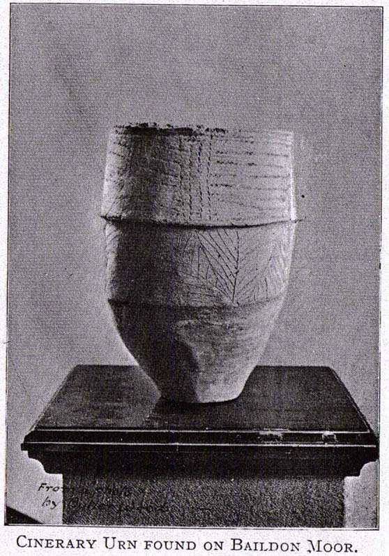
Pennythorn Hill urn
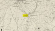
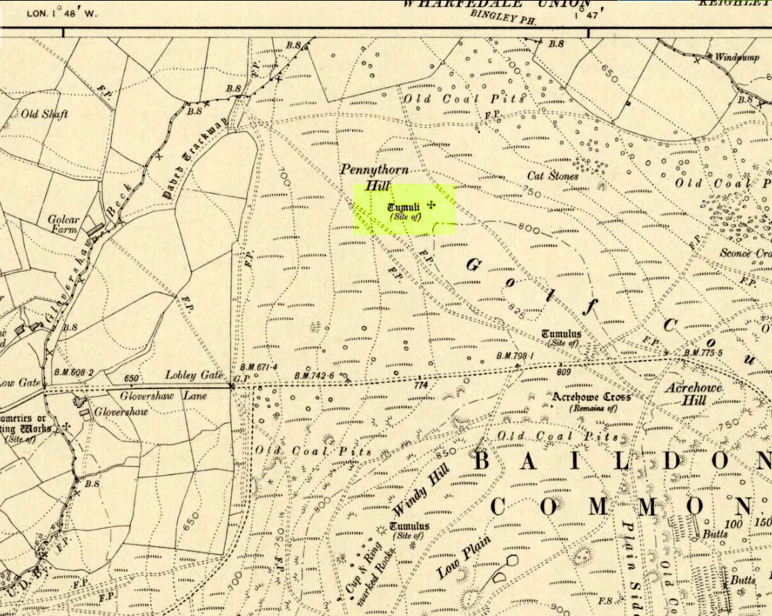
Site highlighted on 1909 OS-map
Site shown on 1909 OS-map

Highlighted on the 1909 OS-map of the area, on the top of the hill a short distance from the roadside, about 250 yards northwest of the Acrehowe Hill site (now at the edge of the golf course) could once  be seen another prehistoric burial mound.  The rediscovery of this tumulus was first announced briefly in the January 1905 edition of the Bradford Scientific Journal (issue no.3).  A few months later the local writer and historian William Preston (1905) wrote a more detailed article on the site, telling the following information:

“A discovery of considerable interest to local archaeologists was made early in December, 1904, on the summit of the spur of moorland on the northwest of Baildon Moor, known as Pennythorn Hill.

“A workman engaged in removing stones from an extension of the golf course, unearthed an ancient cinerary urn containing calcined human bones, a flake of flint which may have served the purpose of an arrow point, a bronze instrument, and a perforated piece of bone, unfortunately broken during calcination.  An examination of the site of the discovery revealed the remains of a tumulus, the upper part at some time removed, with a diameter as near as it was possible to tell, of about fifteen feet.  In point of construction it differed little from others which are to be found in the locality.  The vessel had been placed in an inverted position over the calcined bones, in a hole made in the sandy subsoil.  There was no indication of the urn having rested in a cist.

“The earth beneath the urn bore no evidences of fire, and it is likely that the funeral pyre on which the corpse was reduced to ashes was not erected on the spot.  It may be assumed from the association of the weapons named that the bones are those of a male person.

“The height of the urn is twelve and a half inches, it is eight and a quarter inches in diameter, and taper in the lowest third of its height to a base of about three inches in diameter.  In the course of its excavation it was broken by the workmen, but it has been excellently restored in the laboratory of the Hull Museum…

“The urn belongs to the early British type and its date is, probably, well before the Roman invasion of the island.  The general outline of the urn is very similar to that of some urns found by Canon Greenwell in the course of his exploration of the barrows of the north of England… The surface of the urn is divided into three zones.  The upper part of the vessel consists of a raised border, about four inches wide, decorated with horizontal and vertical lines alternately arranged, and produced by pressing a twisted thong up0n the clay of which it was composed… Beneath the border and upon the central part of the body, a different form of decoration has been carried out.  A zig-zag line scratched in the clay has been carried around the body, forming a number of triangular compartments, which were filled in with diagonal lines, giving he appearance of a herring-bone pattern.  The counterpart this design does not appear on any of the urns figured by Canon Greenwell in his records of digging in British barrows.”

References:

  1. Greenwell, William, British Barrows, Clarendon Press: Oxford 1877.
  2. Preston, William E., “The Discovery of a Cinerary Urn on Baildon Moor,” in Bradford Scientific Journal, no.4, April 1905.
  3. Wardell, James, Historical Notes of Ilkley, Rombald’s Moor, Baildon Common, and other Matters of the British and Roman Periods, Joseph Dodgson: Leeds 1869. (2nd edition 1881)

© Paul Bennett, The Northern Antiquarian 

Glovershaw Quarry Stone, Baildon Moor, West Yorkshire

Cup-Marked Stone:  OS Grid Reference – SE 13044 40093

Also Known as:

  1. Carving BM5 (Hedges)
  2. Carving no.122 (Boughey & Vickerman)

Getting Here

Follow the same directions as those to reach the small Central Design Stone up past the top-end of Shipley Glen.  You’ll notice the small disused quarry just a few yards away, and this partly-covered flat stone lies right at the very edge of the quarry itself.

Archaeology & History

Faint cups on CR-122
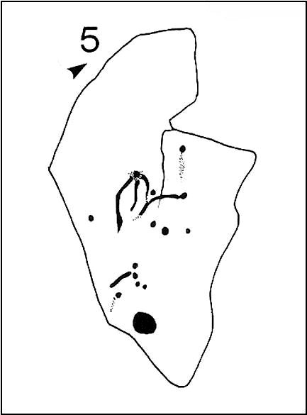
Plan of CR-122 (after Hedges)

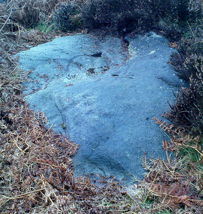
Unless you catch this stone in good light, many of the cups on this design are difficult to make out; but defocus for a bit and they’ll come to you.  Around 13 cups have been counted on this stone, with a couple of grooves: one of which descends just by the small arc (a common local feature on Baildon’s carvings), near the eastern side of the stone.  A larger basin below this, covered by earth, may or may not be natural.  Two of the cups here may have been carved sometime in the late 19th or early 20th century, probably around the time the quarrying was being done.

As is common in some parts of Britain, this carving (and others nearby) was found in association with a small cairn-field, much of which has long since gone.

It’s very probable that there were other petroglyphs close to this one, but which have subsequently been destroyed as a result of the quarrying operations here.

References:

  1. Baildon, W. Paley, Baildon and the Baildons – parts 1-15, Adelphi: London 1913-1926.
  2. Bennett, Paul, Megalithic Ramblings between Ilkley and Baildon, private manuscript: Shipley 1982.
  3. Boughey, Keith & Vickerman, E.A., Prehistoric Rock Art of the West Riding, WYAS: Leeds 2003.
  4. Jackson, Sidney, “Cup-Marked Boulder near the Glovershaw Footpath,” in Cartwright Hall Archaeology Group Bulletin, 2:17, 1957.
  5. Hedges, John, The Carved Rocks on Rombald’s Moor, WYMCC: Wakefield 1986.

© Paul Bennett, The Northern Antiquarian

Lower Glovershaw, Baildon Moor, West Yorkshire

Ring Cairn:  OS Grid Reference – SE 13201 40124

Getting Here

Easy to find if you go at the right time of year — very troublesome to find if you go at the wrong time!  Check the place out at the end of winter, beginning of Spring.  It’s at the top end of Shipley Glen, just past where the road bends round and goes uphill.  About 50 yards up, on the left side of the road walk into the grasslands for less than 100 yards.  Look around!

Archaeology & History

An intriguing site this one.  Intriguing as it wasn’t in the archaeological registers when I first came across it — and I’m really unsure whether it’s in there now.  It probably has, as John Barnatt came here with some earth-mystery folk in 1982!  But when I first visited this site in 1975 it seemed no one knew about it — and little has changed since then.

It is an enclosed ring of stones less than 30 feet across with an earth embankment separating it from what seems like a secondary ring on its outer edge, a foot or two away.  This didn’t appear to surround the complete ring and may have been damaged.  It had an appearance similar in size, shape and form to the Roms Law and Harden Moor sites, and thankfully in reasonable condition. I don’t think any excavation has yet been performed here though.

There are a number of other small standing stones on the outskirts of this ring that may have some relationship with the site, but we need excavation to prove one way or the other.  Several very well-preserved cup-marked stones are close by.

Folklore

Intriguing to those of you who are fascinated by alignments between sites, or ‘leys’, as an impressive lines runs through this site. Starting at the little known Hirst Woods Circle and terminating at the giant Great Skirtful of Stones cairn, once passing over the now destroyed Weecher circle and the Brackenhall Green ring on its way.

References:

  1. Bennett, Paul, The Old Stones of Elmet, Capall Bann: Chieveley 2001.

© Paul Bennett, The Northern Antiquarian

Crosley Wood, Gilstead, Bingley, West Yorkshire

Enclosure / Settlement:  OS Grid Reference – SE 1186 3859

Getting Here

Along the main Aire Valley road (A650) between Cottingley and Bingley, turn right by Beckfoot Grammar School and wander along and up the winding road, over the canal bridge where the Fisherman’s pub is on Primrose Lane.  On the slope above you amidst the scatter of trees on the left-hand side of the road is this Romano-British site (the map below should help).  Check it out!

Archaeology & History

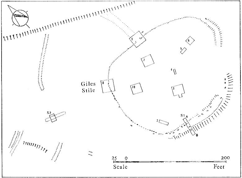
Excavated in the 1960s by the archaeologist P. Mayes, this little-known but reasonably well-preserved enclosure-cum-settlement comprises of a large oval of stone walling, double in places, about 200 feet across at its widest point.

Crosley Wood ground plan (YAJ 42, 1967)
Crosley Woods map (YAJ 42, 1967)

Thought to have been constructed sometime between the Iron Age and Romano-British period, for some reason one of the stones on the western edge has long been given the name of the ‘Giles Stone’ or Stile — though nobody knows for certain why.  It’s about three-feet tall with a smaller upright by its side.  Any other remains that might once have been here were destroyed by the housing estate that sits above here.  When Mr Mayes (1967) and his associates did their work here, cutting across sections of the walling, he told:

“The best preserved section of wall was amongst the trees on the lines of the south wall of the enclosure and included the boulders of both the inner and the outer faces of the wall.  A trench 6ft by 38ft was laid out at right angles to it.  The turf was removed showing the boulders of the wall with the smaller stone filling between them.  On either side of the wall was a relatively small quantity of loosely tumbled stones, the angle of rest of which suggested the wall as their source of origin… Careful examination of the wall filling failed to show any sign of post settings.”

Mr Mayes said that it was “doubtful whether the Crosley Wood site, dated by one pot to the late 3rd or early 4th century AD, was ever conceived of as an occupation site.”  In reference to his excavations he continued, “Certainly no evidence of settled living was found” here, concluding:

“It seems probable that the main enclosure at Crosley Wood served as a cattle pound; its defensive potential being invalidated by the scarp to the north, whilst the short stretches of external walling are all that remains of a rectilinear field system for arable or pastoral farming.”

References:

  1. Mayes, P., ‘Excavations at Crosley Wood, Bingley,’ in Yorkshire Archaeology Journal, volume 42, 1967.

© Paul Bennett, The Northern Antiquarian