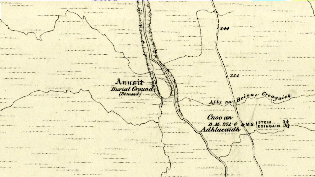
Otta Swire (1961) told how to find this place, thus: “The Waternish road turns off to the north at Fairy Bridge, whence it runs along the valley of the Bay river. On the left of the road, though at some little distance from it, where the river cleaves its way through a gorge to the sea, stands the mound which is now all that remains of the ‘Temple of Anaitis’ (so called).”
Archaeology & History
This is a curious place, full of archaeological potential if the folklore and history records are owt to go by, yet little of any substance remains to substantiate what may have been an important stone circle or other heathen site in earlier times. It seems to have been described first of all in the famous Hebridean journeys of Boswell and Johnson in the late 18th century. Amidst his insulting description of both the landscape and local people, on Friday 17th September 1773, James Boswell visited the site and told:
“The weather this day was rather better than any that we had since we came to Dunvegan. Mr M’Queen had often mentioned a curious piece of antiquity near this which he called a temple of the goddess Anaitis. Having often talked of going to see it, he and I set out after breakfast, attended by his servant, a fellow quite like a savage. I must observe here, that in Skye there seems to be much idleness; for men and boys follow you, as colts follow passengers upon a road. The usual figure of a Sky boy, is a lown with bare legs and feet, a dirty kilt, ragged coat and waistcoat, a bare head, and a stick in his hand, which, I suppose, is partly to help the lazy rogue to walk, partly to serve as a kind of a defensive weapon. We walked what is called two miles, but is probably four, from the castle, till we came to the sacred place. The country around is a black dreary moor on all sides, except to the sea-coast, towards which there is a view through a valley, and the farm of Bay shews some good land. The place itself is green ground, being well drained, by means of a deep glen on each side, in both of which there runs a rivulet with a good quantity of water, forming several cascades, which make a considerable appearance and sound. The first thing we came to was an earthen mound, or dyke, extending from the one precipice to the other. A little farther on, was a strong stone-wall, not high, but very thick, extending in the same manner. On the outside of it were the ruins of two houses, one on each side of the entry or gate to it. The wall is built all along of uncemented stones, but of so large a size as to make a very firm and durable rampart. It has been built all about the consecrated ground, except where the precipice is deep enough to form an enclosure of itself. The sacred spot contains more than two acres. There are within it the ruins of many houses, none of them large, a cairn, and many graves marked by clusters of stones. Mr M’Queen insisted that the ruin of a small building, standing east and west, was actually the temple of the goddess Anaitis, where her statue was kept, and from whence processions were made to wash it in one of the brooks. There is, it must be owned, a hollow road visible for a good way from the entrance; but Mr M’Queen, with the keen eye of an antiquary, traced it much farther than I could perceive it. There is not above a foot and a half in height of the walls now remaining; and the whole extent of the building was never, I imagine, greater than an ordinary Highland house. Mr M’Queen has collected a great deal of learning on the subject of the temple of Anaitis; and I had endeavoured, in my journal, to state such particulars as might give some idea of it, and of the surrounding scenery” —
But in all honesty it seems Mr Johnson was either too lazy to write about the place, or simply didn’t actually get there, in spite of what he alleged! But later that evening, Boswell dined with the same Mr MacQueen, who told him more of this site. In the typically pedantic tone of english supremacy (which still prevails in some idiots who visit these lands), he continued by saying:
“Mr Macqueen had laid stress on the name given to the place by the country people, Ainnit; and added, ” I knew not what to make of this piece of antiquity, till I met with the Anaitidis delubrum in Lydia, mentioned by Pausanias and the elder Pliny.” Dr. Johnson, with his usual acuteness, examined Mr Macqueen as to the meaning of the word Ainnit, in Erse, and it proved to be a water-place, or a place near water, “which,” said Mr. Macqueen, “agrees with all the descriptions of the temples of that goddess, which were situated near rivers, that there might be water to wash the statue.”
There ensued a discussion between Mr MacQueen and Samuel Johnson about the etymology of Anaitis, with one thinking it was of a goddess, and another that it represented an early christian site. To this day it is difficult to say what the word means with any certainty. In W.J. Watson’s (1993) fine work he tells us,
“Andoit, now annaid, has been already explained as a patron saint’s church, or a church that contains the relics of the founder. This is the meaning in Ireland and it is all we have to go upon. How far it is held with regard to Scotland is hard to say… They are often in places that are now, and must always have been, rather remote and out of the way. It is very rarely indeed that an Annat can be associated with any particular saint, nor have I met any traditions connected with them. But wherever there is an Annat there are traces of an ancient chapel or cemetery, or both; very often, too, the Annat adjoins a fine well or stream…”
The great Skye historian and folklorist Otta Swire (1961) also wrote about this mysterious site, mainly echoing what’s said above, but also adding:
“This name of Annait or Annat is found all over Scotland. It has been interpreted as meaning the ‘Water-place’ from Celtic ‘An’ = water, because many are near water. Others suggest ‘Ann’ = a circle (Celtic) and claim that most Annats are near standing stones. The most-favoured derivation seems to be from Ann, the Irish mother of the Gods, and those who hold this view claim that the Annats are always near a revered spot, where either a mother-church or the cell of a patron saint once stood. Probably Annat does, in fact, come from an older, pre-Celtic tongue, and belongs to an older people whose ancient worship it may well commemorate. The curious shape of the Waternish Temple of Anaitis and its survival make it seem likely that it was something of importance in its day, built with more than usual care and skill. Perhaps the Temple tradition is correct – but whose, if so, and to what gods? One cannot help wondering if cats played any part in its ritual, and if so, if any faint memory remains, for the nickname of the people of this wing was ‘Na Caits’ = The Cats, and not far off, by one of the tributary burns on the right of the roadway, there stands a small cairn, crowned by a long, sharp stone somewhat resembling a huge claw. This is the ‘Cats’ Cairn’.”
The Cats’ Cairn (NG271526) is said to mark the grave of a young boy from the 18th century, who was buried where he died and its story is told elsewhere on TNA. Another example of the Annait place-name can be found elsewhere on Skye at the megalithic site, Clach na h’annait.
References:
Boswell, James, The Journal of a Tour to the Hebrides with Samuel Johnson, National Illustrated Library: London 1899.
Swire, Otta F., Skye: The Island and its Legends, Blackie: Glasgow 1961.
Watson, W.J., The History of the Celtic Place-Names of Scotland, Birlinn: Edinburgh 1993.
Unless you’ve got your own boat, forget it! This one’s miles out on the isolated uninhabited island of Fladda-chuain about 5 miles off the northwest tip from Duntulm, Trotternish. I wouldn’t mind a coupla weeks alone on the isle though – if anyone can get me there!
Archaeology & History
The little rocky island itself was allegedly another of the many visiting places of St. Columba in his many ventures to sell his religion to the peasants and displace the druids, who were alleged to practice pre-christian rites here and deemed it as sacred. St. Columba’s chapel on this island was built to displace the heathen traditions.
Folklore
In Otta Swire’s (1961) excellent work on the folklore and history of the Isle of Skye, she wrote:
“In Duntulm Bay lies Tulm Island and beyond it, in clear weather, Fladdachuan, Fladda of the Ocean, can be seen. In olden times this was a sacred spot, held by many to be Tir-nan-Og, the Isle of Perpetual Youth, which lay in the west; here it is always summer and the sun never sets. The puffins recognized its sacred nature and never began any venture until they had circled the island three times sunwise; this they did also on arriving in Skye and before leaving it. It was held by some to be the reason why in Skye people used to turn three times sunwise before starting a new enterprise. The Druids held it in veneration and St. Columba caused a chapel to be built there. On its altar lay a black stone which some say was the original altar stone of the Druids and which was known as the Weeping Stone because it was always wet. Until fairly recently fishermen used to land on the island and pour three handfuls of seawater on the stone to procure favourable winds or to stop bad floods. The Weeping Stone no longer exists, or at least is no longer to be found where the altar once stood.”
I can’t find anything more about this place. Does anyone know owt more about it?
References:
Swire, Otta F., Skye: The Island and its Legends, Blackie & Son: Glasgow 1961.
From Hebden Bridge, take the Heptonstall road and go past the legendary Slack Bottom (no lies!), until a few hundred yards further on at Slack Top, take the Widdop road on the right. Amble the long and winding road for a mile – mebbe a bit more – until the valley on your right runs out of trees! (on the OS-map this is called Hebden Dale, but it’s generally known as Hardcastle Crags [after the name of the rock outcrop halfway up]). Just about here there’s a track to your left, by the rather desolate bus-stop! If you hit the wibbly hair-pin bend by the Blake Dean scout-hut, you’ve gone too far. Walk along the track for a coupla hundred yards and take the first opportunity you have to cross the deep dike on your immediate left. Then just walk along the edge of the stream itself until you reach the large rocks another few hundred yards along.
Archaeology & History
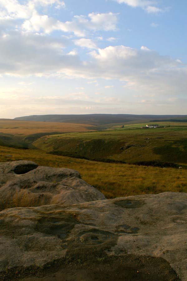
As Richard Stroud’s photo above shows, this is a beautiful spot — when the weather is good anyway! Much of the landscape around you is scattered with occult history and folklore: boggarts, witches, corpse routes, spirit animals, old stone crosses, standing stones and more! A damn good day out can be had in this area by any enthusiastic antiquarian or enquiring heathen.
Cups and faint rings
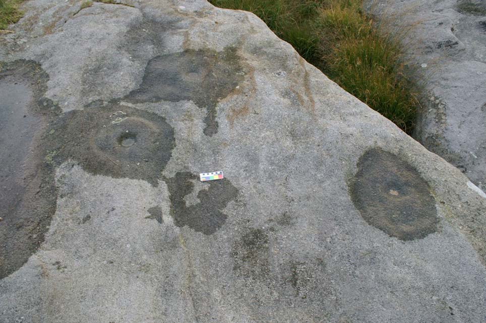
The carving we have here is an almost typical cup-and-ring stone, but it’s pretty isolated with no other ringed companions anywhere on these hills. It was first described in David Shepherd’s (2003) survey of prehistoric remains of the region — although I was initially a little cautious about the veracity of David’s findings, as some cup-marked stones in his survey are probably natural and some “standing stones” he cites nearby are simply natural earthfast rocks. But this particular carving seems man-made with large faint rings encircling at least one of the cup-marks, as you can see in Richard Stroud’s photo here. In Mr Shepherd’s survey, he said of this site:
“A prominent double boulder. On the top surface are two eroded cup marks by the south edge and one by the north edge. Two eroded cup marks with rings are on the northwest segment.”
References:
Shepherd, David, “Prehistoric Activity in the Central South Pennines,” in Transactions of the Halifax Antiquarian Society, new series, volume 11, 2003.
Acknowledgements: With thanks to Richard Stroud for use of his photos in this site profile.
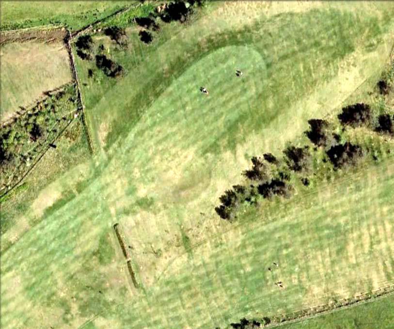
Aerial image showing faint outline of Blackheath circle
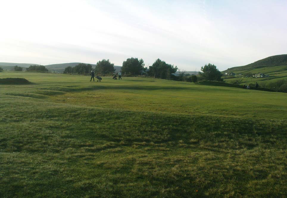
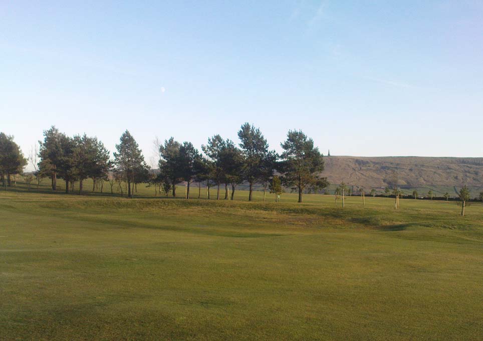
From Todmorden, take the road to Hebden Bridge (A646) less than half-mile outta town and just as road goes uphill, watch for the left turn up to Cross Stone. This is one helluva superb steep, winding road if you aint been up it before (which, somehow, I used to be able to cycle up without a break!). As you reach the hamlet of Cross Stone, bear uphill again (left) until you reach the top-end of the golf course, where you’ll see a footpath on your left that runs alongside the course. Walk on this until it reaches a stile. Walk up the wallside and onto the course itself – and there, in front of you, in the middle of the damn golf course, you’ll see the very denuded remains of a once fine prehistoric monument (it’s situation, quite frankly, is a disgrace – and any pagans or historians who feel similarly should complain to Calderdale Council about the lack of preservation here; as the more of us who do, the more they’ll have to pay attention and perhaps do something about it).
Archaeology & History
Very little can be seen of this once important site thanks to the important golf course built right on top of this once sacred site. Thankfully we have an extensive description of the place that was done by J. Lawson Russell (1906) from which this profile account — and every other account for that matter! — draws heavily upon. It was included in Aubrey Burl’s magnum opus (2000) as a stone circle, but this isn’t strictly correct and is more accurately a cairn circle or ring cairn monument.
Blackheath Circle’s shallow semicircular bankBlackheath circle, looking SE
It was thought in times past to have been a monument built by the Romans (hence the earlier title of ‘Roman Barrow’), but its origins were much earlier than those scruffy incomers! Its other local folk name, the “Frying Pan Circle” is, like its namesake at Morley, an etymological curiosity relating to the flat ground left in the wake of its shape: flat, circular, with raised edges surrounding it, not unlike a frying pan.
It was accurately described for the first time by Robert Law (1897), who later broadened his account of the site a year later in a paper he wrote for the Yorkshire Geological Society (1899) after an excavation here. Mr Law and others explored the centre of the ring where they believed it most probable to find remains of some form or another — and they weren’t to be disappointed! The following is taken directly from his lengthy article:
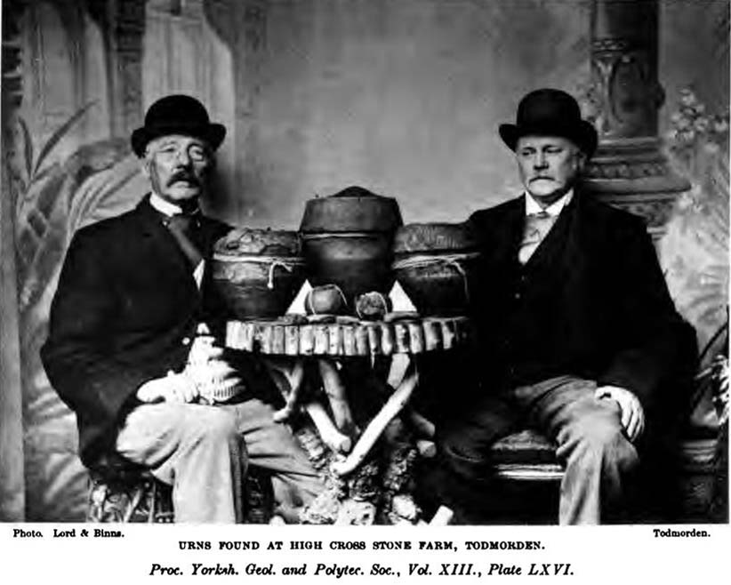
“On Thursday, July 7th of this year (1898), a very interesting and important archaeological discovery was made on a portion of land known as Higher Cross Stone Farm, belonging to Mr. Sutcliffe, of Todmorden. In a field on this farm, called Black Heath, a ring circle, made of earth, has long been known to exist, and has gone by the name of the “Frying Pan.” No history or tradition exists as to the origin of this circle, and various speculations have from time to time been indulged in by the residents. Some have called it a Roman Camp, others a fairy circle, others a circus ring, made to break in horses; but the excavations prove it to be a burial place of prehistoric times. Mr. Tattersall Wilkinson, of Burnley, a well-known archaeologist of considerable experience on ring circles, along with the writer of this article, came to the conclusion, on hearing of this circle, that it probably contained human remains, and an excavating party was organised to meet on the spot on the day above mentioned. This party met at the appointed time, and the plan of operations was to find the centre of the circle, by means of a tape, then to dig a circular trench about three feet from the centre, in which space it was thought the remains would lie. The ring was nearly a perfect circle. It was raised conspicuously above the ground. The rim of raised earth was about three feet wide, and the diameter of the whole circle was thirty yards. After the digging had been going on for a short time, burnt soil and charcoal were met with, and the top of an urn was exposed to view. The diggers then went to work with the greatest possible care, and very soon a beautiful urn was laid bare exactly in the centre of the ring. The urn was embedded in charcoal and calcined bones. It was ten inches high and nine inches at the top, tapering to about three inches wide at the bottom. There was a rim or collar in the upper part of the um about three inches deep, which stood out about one inch in relief from the lower part of it. The collar was ornamented, probably by a pointed stick, with the herring-bone pattern. The outer part of the um was plain. In clearing away the debris from the urn another one was discovered, different in pattern and less in size, but in a very perfect state of preservation.
“About two feet from this, on the opposite side of the central urn, another um was discovered and laid bare, by carefully digging round it with a trowel. This urn was also in a good state of preservation, and about the size of the second one, but differently ornamented. These smaller urns were the same shape as the larger central one, but the ornamentations were not so fine, and they were made of inferior clay. On the south side of the circle, about two feet from the centre, another urn was discovered, but it appeared to be insufficiently baked when manufactured, and had decomposed and crumbled into dust. From the inside of this urn a large quantity of calcined human bones and charcoal was dug up, but the bones were very fragmentary, and the sex of the person to whom the bones belonged could not be determined. Several portions of cranium, rib bones, and lower and upper leg bones were found among the debris.
“Within a few inches of this urn two small (so called) incense cups were found. One of them was very perfect and in an excellent state of preservation and was beautifully ornamented all over. These cups were about three inches in height and three and a half inches in diameter, but tapered a little at the bottom. Indications of three other urns were observed, but they were so much decomposed that little or nothing could be made of them. The others seemed to be arranged about the large central urn and about two feet apart. When the earth had been cleared away from the three perfect urns, and before they had been removed, several photographs were taken of them in situ. One of the smaller urns leaned a little to the south. Several pieces of flint and chert were dug out of the excavation. The urns and incense cups being removed were put into baskets and conveyed to Todmorden, where they were re-photographed and placed in the Free Library for their safe keeping.
“On July 13th, six days after the “find,” the urns were opened at the Co-operative Hall, Todmorden, before a very large gathering of scientific ladies and gentlemen drawn from the surrounding districts. Mr Tattersall Wilkinson, Dr. Crump of Burnley, and the author were entrusted with the opening of the urns.
“The largest one, which was of superior make to the other, was the first to be operated upon. The work was tedious and was done in the most careful way possible. Each operator commenced to pick out by means of a small pocket knife the substances deposited in the urns, and the material was closely examined as it fell out on the table. For the first half-hour or so nothing particular was found. The contents which had been so far dug out were portions of broken urns of a similar pattern to the urn that was being examined, but were not portions of it and must have been placed there as filling-in material. Along with these urn fragments there was some dark brown sand, which appeared to have been burnt, quantities of bituminous soil, small fragments of bones, and bits of charcoal. As the examining party dug deeper into the urn human bones became more numerous and in larger fragments and of a more determinable character, and this went on until the urn had been half emptied. The rest of the contents of the urn then showed signs of being almost entirely calcined bones, and bone after bone was picked out, examined, and laid on the table. Among these bones were fragments of various sizes: of cranium, portions of scapula, pelvic bones, femur, tibia and other bones of the legs. Besides these there were fragments of ribs and perfect toe bones.
“Presently a small cup was laid bare inside the urn, and a few pokes with the knife so far emptied it of its contents that an ancient relic could be seen which differed from any that had yet been found. A moment later a piece of metal was picked out of the cup resembling a spear head. It was about 2½ inches long and 1¼ inches wide at one end, and tapered to a point at the other. It was thin and flat and sharp at the sides and point. It contained a rivet at the two extremities and another one about half way up one side. A bronze pin was also found about the same time as this piece of metal, and on careful examination the metal and the pin were made out to be a bronze brooch, the pin having probably been detached in extracting it from the bones in the cup. Besides this brooch about a dozen beads of a necklace were found, which were chiefly of a rounded shape and about half an inch in diameter. Some of the beads seem to have been made of jet, and some of bone, and were more or less rudely carved. A bone pin was next brought to light. It was almost two inches in length and the eighth of an inch in diameter at one end, tapering towards a point at the other. It was cylindrical in form and slightly curved. The fact of all these ornaments having been carefully placed in the cup and buried with the urn point to the cup having been used as a utensil in which to preserve what was considered of great value. Several human teeth were also found in this cup.
“The opening of the two inferior urns proved that they contained nothing more than the sweepings up of the funeral pile which probably took place after the calcined bones had been placed in the more important urn.
“Since this discovery was made a beautifully-formed flint arrowhead of the leaf-shaped pattern has been found in the same hole from which the urns were dug. There have also been two or three more urns discovered within the same circle, but their contents have not yet been disclosed.”
Early 1899 photo of the Blackheath urnsBlackheath urns on display, c.1911
They had to wait a few more years before a more complete account described the contents of the “two or three more urns” at Blackheath’s circle. That duty fell to Mr J. Lawson Russell (1906), who, after further excavations, wrote the most detailed and complete account of the place.
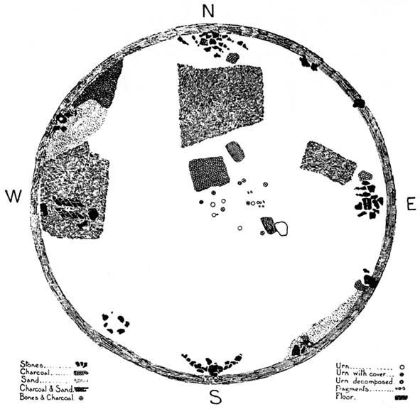
Following the successful discoveries in 1898, Messrs. Russell, Law, Wilkinson and others made a “further systematic examination of the whole circle”, which was then subsequently wrote up in Ling Roth’s Prehistoric Halifax. The following is a detailed account of that second dig:
“The first step in the systematic examination was the breaking up of the circle into quadrants. This we did by running deep trenches north, east, south and west. The turf was then removed and these quadrants dealt with seriatim. The diameter of the circle was as nearly as possible 100ft (30.5m), i.e. measuring from ridge to ridge, but the slight mound which marked the circumference sloped gently further into the general level of the field. Eight or nine deep furrows ran through the circle, from north to south, cutting the vallum up into segments and ploughing the enclosed area with their parallels. The method we followed was to trench till we came to soil which had never been disturbed. Generally about two spade grafts brought us to stiff glacial (?) clay. When we came upon an urn its position was carefully observed with reference to the centre and noted on a plan ; the earth was removed by trenching round the um, which was photographed in situ when sufficiently defined. The urns were not deeply placed, some of them being only six inches from the surface, none deeper than from 18in to 2ft (46 cm to 61 cm), and all of them without exception were set in the ground upright on their bases, not inverted. There was in the centre an urn, and this was surrounded at a radius of 2ft by a ring of deposits; two having urns, the others either having no urn at all or showing signs only of disintegrated pottery. At a distance of about 10 ft. from the centre another series of deposits was radially arranged, but all to the east side of the north to south centre line. It will be seen that, if we leave out of account the urn found in the vallum in the north-west quadrant, all the urns and deposits save one have been placed to the east of the north to south centre line.
“An extensive floor of charcoal, sometimes an inch to two inches in thickness, was defined to the north of the centre, and two deep pits were located about 16ft (4-9 m) from the centre, one in the north-east and one in the south-east quadrant. Close to that deep spot in the south-east quadrant we found a curiously baked surface which we attempted to photograph. A group of urns, one of which was a fine covered specimen, lay in line going due east from the centre ; and this group had placed all round it flat stones of no great size, set on edge, as if to protect the urns or mark them off from others.
“In the northern half of the circle and lying largely in the NE quadrant, was a considerable area showing a closely beaten, hard baked red floor, with pieces of charcoal speckled amongst the general red. Somewhat similar areas occurred at the west and at the east sides of the circle, that at the west being most marked, the whole floor in that quarter looking like disintegrated pottery closely trodden together.
“Lying NW by W, from the centre, we found in the vallum a large stone with an urn set right in its middle. Other stones lay near, as if they might have been set round this urn in kist fashion. All about this spot the ground seemed to be made up of shivers of sand stone and pounded sand. Over-lying this sand for a considerable area going northwards was a thick layer of charcoal. Curious cairns of stone had been placed just inside the vallum, and these, we soon discovered, accurately marked the cardinal points — N, E, S and W., the most curious of these cairns being that which lay exactly south. The stones here were in the form of a semi-circle, having an armchair -like arrangement in its middle, the back of the chair looking due south, i.e., by the sun at mid-day. In the turf over-lying this strange assemblage of stones a portion of the base of an urn was found, and there was abundance of charcoal at the westerly horn of the semi-circle. Many of the stones in the other cairns lay in groups of three pointing in one direction. Some of the groups looked as if they had been upright at one time and thrown down. At the western point the stones lay in an imbricated fashion, inclined at an angle of about 45°, placed in two rows, about 2½ft (76 cm) apart, five in one row, four in the other. A large flat stone lay near, and by it one which probably was the fifth of the second row. Between these rows of stones, and all around them, lay great quantities of what looked like partly baked clay or disintegrated pottery. In the southwest quadrant lay an incomplete ring of stones, which possibly marked an interment. This incompleteness is interesting and may have had some significance t Other large stones were found set into the vallum at more or less regular intervals. Some of these are still in situ, the further examination of the vallum having had to be abandoned. Close by all these stones charcoal was found, and the upper surface of one, at least, that in the SE quadrant, SE of centre, was blackened as if by fire.
“In removing the stones forming the four cairns I examined all of them for signs of markings, but none was seen except one deeply scored line drawn across the large flat stone in the cairn at the eastern point. This line may have been grooved into the stone by the over-passing plough, but I am rather of opinion that it was purposely graved there. What was the purpose of these cairns and large stones in the vallum? The fact of one large um having been found as already stated, on a stone in the vallum, while part of another urn was found near the southern cairn, suggests a probable explanation for some of these arrangements of stones. They may have been rude kists enclosing urns, or at least they may be regarded as stone-marked interments. The presence of charcoal close beside these stones may point to the performance of funeral rites.”
J.L. Russell’s 1906 ground-plan
Mr Russell then went into considerable details describing the urns, flints, carved bones and other objects recovered from the site (those who would like further info, find a copy of H.L. Roth’s Yorkshire Coiners for the full account). It was his opinion that the site was used primarily as a place for the dead. There was no evidence here of domestic activity or settlement of any kind. And particularly intriguing were the four cairns placed inside the circle: each one at the cardinal points north, south, east and west. This would indicate a ritual evocation of the airts, or spirits of the four directions, with obvious correlates in relation to spirits in the land of the dead. This was very obviously an important sacred site to the people who built this… Oh such a pity it’s now in the state it is…
One other point of intrigue here is: according to the archaeological records there are no other prehistoric sites nearby, nor any settlement remains that could account for the existence of this once important ritual site. That doesn’t make sense…
Folklore
Old lore told that this site was once the abode of the fairy folk. The old game of Knurr and Spell used to be played here; which is a game played with a wooden ball (the knurr) which is released by a spring from a small brass cup at the end of a tongue of steel (the spell). When the player touches the spring, the ball flies in the air and is struck with a bat. In J.L.Russell’s (1906) account of the excavations here, he reported finding several very old balls in the circle, indicating that Knurr and Spell or variants of this game had been played here for many centuries.
Even weirder was the UFO encounter here. In 1982, the landowner’s wife reported seeing an earthlight right next to the spot, as she looked from her bedroom window. The next thing she knew, she was laid outside prostrate on the ground right next to this ancient monument.
Holden, Joshua, A Short History of Todmorden, Manchester University Press 1912.
Law, Robert, “Evidences of Prehistoric Man on the Moorlands in and around the Parish of Halifax, in Halifax Naturalist, volume 2, April 1897.
Law, Robert, “The Discovery of Cinerary Urns at Todmorden,” in Halifax Naturalist, volume 3, August 1898.
Law, Robert, “On Recent Prehistoric Finds in the Neighbourhood of Todmorden,” in Proceedings of the Yorkshire Geological & Polytechnic Society, volume 13, 1899.
Roth, H. Ling, The Yorkshire Coiners, 1767-1783; and Notes on Old and Prehistoric Halifax, F.King: Halifax 1906.
Russell, J. Lawson, “The Blackheath Barrow,” in Ling Roth’s Yorkshire Coiners (Halifax 1906).
Watson, Geoffrey G., Early Man in the Halifax District, Halifax Scientific Society: Halifax 1952.
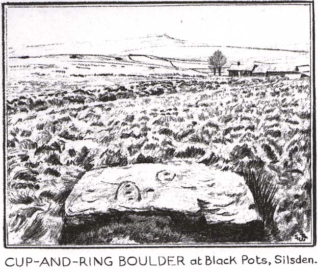
From Silsden, take the moorland road up to Brunthwaite (ask a local if you’re in doubt). As you get near the top of the moorland road, take the right turn (east) on the track past the Doubler Stones, until you reach the last cottage before the woodland called Black Pots. Go onto the moorland behind the cottage, walking north, crossing the stream and you’ll see a large boulder stuck on its own close by. That’s it!
Archaeology & History
Stuart Feather’s 1964 image
On another wander on these moors t’other day, we ventured to the Doubler Stones and whilst there I had a vague recollection of another decent-looking carving west of them, just above the hidden house at Black Pots, when I was a teenager. When I got home I rummaged through some of my old notebooks and found the drawing I made of it all those years ago. Tis a decent carving consisting of 3 distinct cups encircled, though not completely, in an elongated arc. A cup-and-ring is just above this, and Boughey & Vickerman (2003) highlight another couple of cups which I didn’t manage to see when I was there as a kid. Nor for that matter did Stuart Feather, who was the first person to write about it in the Cartwright Hall Archaeology Group Bulletin in 1964. Itis a good carving in a good spot, with excellent views to the south and west.
References:
Boughey, Keith & Vickerman, E.A., Prehistoric Rock Art of the West Riding, WYAS: Leeds 2003.
Feather, Stuart, “Mid-Wharfedale Cup-and-Ring Markings: no.24 – Black Pots, Silsden, near Keighley,” in Cartwright Hall Archaeology Group Bulletin, 9:7, 1964.
Hedges, John, The Carved Rocks on Rombald’s Moor, WYMCC: Wakefield 1986.
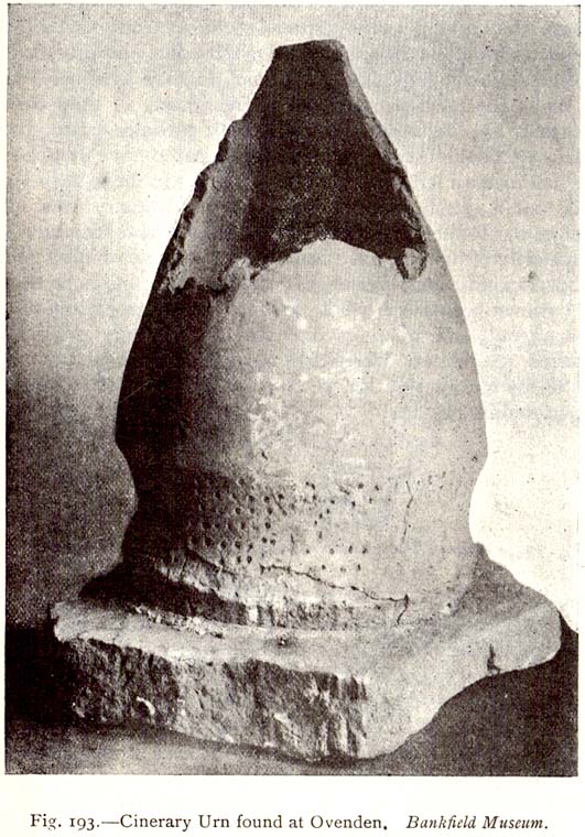
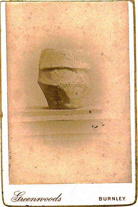
As with a number of prehistoric burials in the Halifax district, there is no longer any trace of the original site here. It was a place that I wrongly attributed as being a dolmen in my early survey on West Yorkshire’s megalithic remains (Bennett 1994) — but at least I got the prehistoric tomb part of it right! It was first found, quite accidentally, in February of 1877, when a grave-digger working in the grounds of the Mount Zion Chapel at Ovenden (as it was known in them days) hit upon a large stone beneath the earth he was digging. Thankfully the grave-digger was a conscientious chap and, instead of just digging up the obstruction, decided to inform others of his discovery. A temporary halt was made on his grave-digging and thereafter a careful dig was organized to explore what he’d found. Some years later an account of the discovery was reported in H. Ling Roth’s (1906) work on the history of Halifax, where he told:
“On digging about 2ft (61cm) below the surface of the ground, a slab of stone impeded the work, and on its removal, a square cavity, formed of four upright stones, was discovered, in which the urn had been placed bottom upwards (see old photo, PB), and the mausoleum filled with gravel… The urn had not been disturbed since its removal from its present site, but still remains on its original base: a rude stone which formed the floor of its ancient sepulchre. The urn measured when first discovered 19in (48cm) in height by 13in (32.5cm) in diameter at its orifice, but only 4in (10.2cm) at its base. Below its rim it has the usual curved division which is here ornamented with dots made with a pointed instrument when the clay was in a soft state.”
Mr Roth went on to tell how a Dr Dolan of Halifax examined the broken bones and contents within the urn and found them to be human. Intriguingly it seems there was some evidence of prehistoric dental practice from the remains! Dr Dolan told:
“There is unmistakable evidence on this point from some of the bones of the skull, particularly from the preserved portions of the petrous part of the temporal bone showing meatus auditorius, from the right malar bone, and from fragments of the flat bones of the cranium. The teeth offer confirmatory evidence. I have found several which had evidently been subjected to great heat, as they were completely calcined. But there was one which had been only partially burnt, the burnt part being quite black; and another, unburnt, which seems to have dropped from the jaw before the fire had reached it. One of the teeth seems to me to have been ‘stopped’, and this opens out a question whether the art of dentistry was known to the inhabitants before the Roman invasion. From the size and structure of the bones, I believe the majority of them to have belonged to a female of adult age. There are certain bones, particularly some phalanges, which seem to me to be those of a child. As we do not however possess the whole of the original contents of the urn — much having been extracted from it on its discovery — there may probably have been, when first interred, the relics of others than those we at present possess.”
The remains of the urn were eventually presented to the care of the Bankfield Museum by the Halifax antiquary, F.A. Leyland.
A definitive account of this little-known site was recently published by Raymond Varley (2021), and all interested readers can refer to his work here.
References:
Bennett, Paul, Circles, Standing Stones and Legendary Rocks of West Yorkshire, Heart of Albion Press: Loughborough 1994.
Leyland, F.A., The History and Antiquities of the Parish of Halifax, by the Reverend John Watson, M.A., R.Leyland: Halifax n.d. (c.1867)
Roth, H. Ling, The Yorkshire Coiners, 1767-1783; and Notes on Old and Prehistoric Halifax, F.King: Halifax 1906.
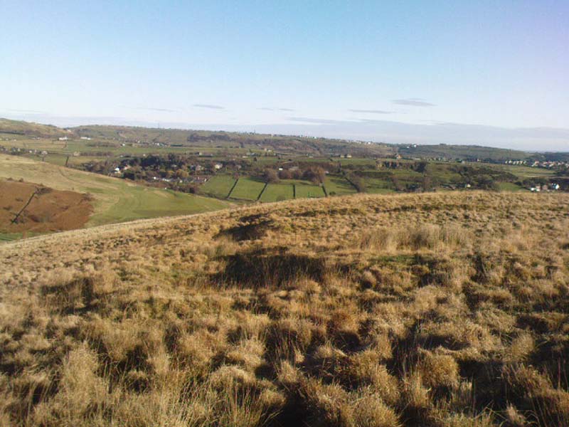
Troublesome to get to if you don’t know the area. You can get here rom Halifax, up through Highroad Well towards Wainstalls, keeping to the road that leads to the Oxenhope windmills. A short distance before the windmills, as the road levels out, keep your eye out on the right where the valley drops down (east) to the Halifax golf-course. If you’re coming from Oxenhope, walk up past the windmills at Nab End until the road starts going back downhill. As you look down and walk past the valley with the golf course in it, a footpath is on your left running diagonally over a field. Cross the stile and walk alongside the wall for about 200 yards until you reach a gate on your left. Go through this and walk along until you see the ditched earthworks that make up this little-known monument…
Archaeology & History
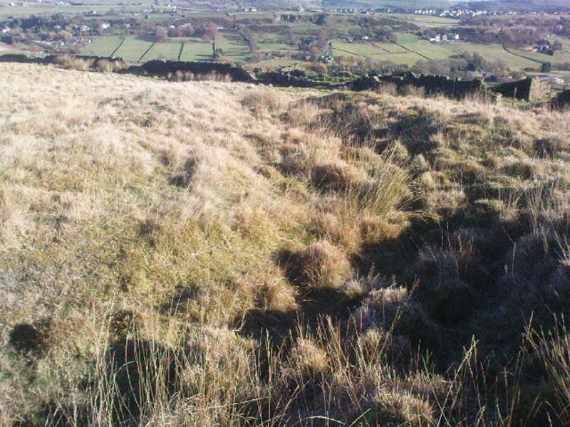
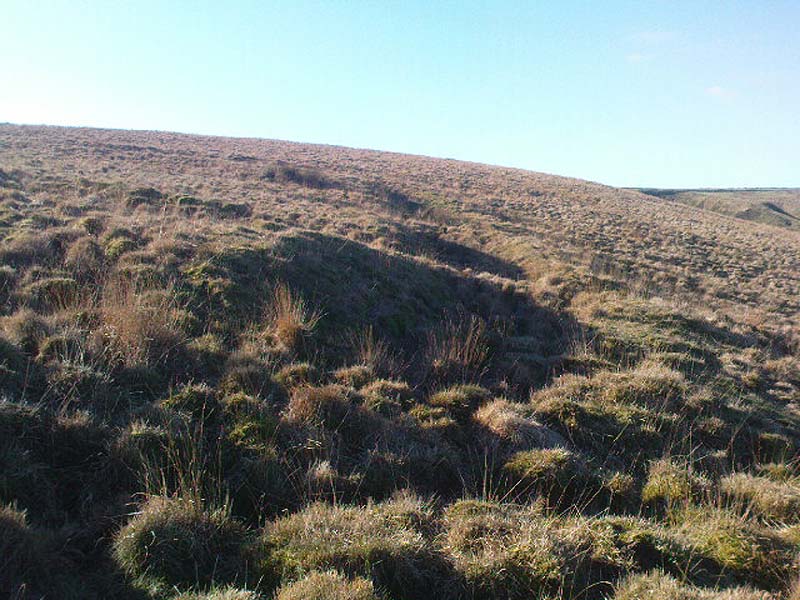
Not to be confused with the large circular enclosure that once crowned the nearby Hunter Hill, the nature and age of this large D-shaped earthwork has long been a source of speculation, with the majority of it centring around a Roman origin — and for good reason, it has to be said!
NW section of earthworksSouthern section of ditch
More than 280 yards (260m) in circumference, its north-south axis measures 82 yards (75m) at the greatest and 88 yards (81m) east-west. Its main feature is a decent ditch that averages 8-10 feet across round most of the D-shaped feature, and between 2-3 feet deep. It would obviously have been deeper than this when the ditches were first dug, but it’s now very overgrown across the entire site with Juncus grasses and tribbles (tussocks). A small internal ditch runs into the enclosure from the northern side. Its function is unknown. A small mound near the centre of the site has been posited by Calderdale archaeologists to be modern remains.
Carrs enclosure on 1852 map
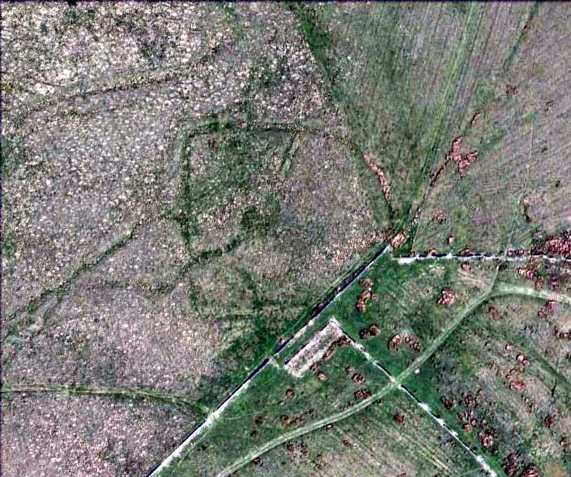
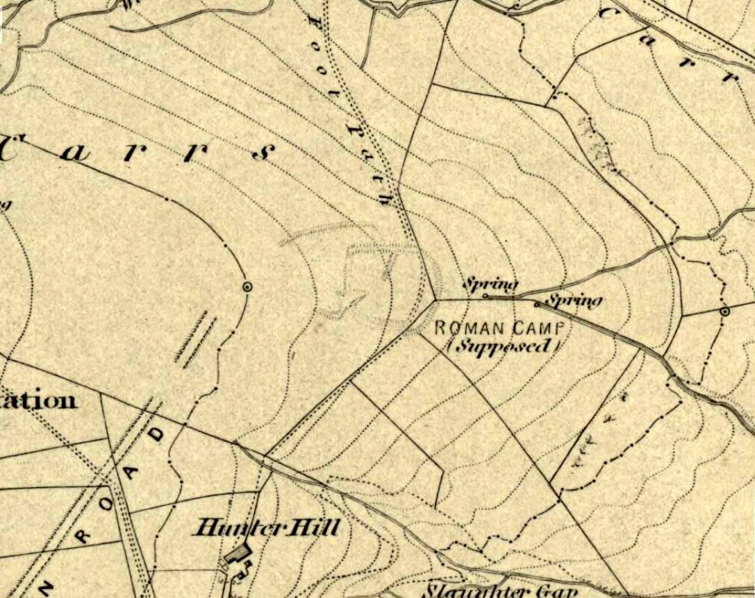
Although the main feature is the D-shaped earthwork, other features are apparent. For example, what looks like another man-made dyke cutting into the site on the southwestern side is in fact a natural stream channel. This natural feature may have been an integral part of the enclosure when it was first built. Above the northwestern edge of the ditch (as can be seen on the aerial photo) are other earthworks that run around the western edge of the main feature. This is probably what F.A. Leyland (1867) meant when he described there to be “the remains of several lines of intrenchments” here. Also coming into the southwestern side are what are thought to be the remains of a Roman Road. Early OS-maps (above) show the road running within yards of this enclosure — and it was this which, logically, led many earlier researchers to posit the notion that this site was in fact Roman. However, a dig here in 1951 recovered prehistoric pottery, which knocked the date back to the Iron Age.
Northern line of ditch
On the south and east sides, parts of the ditch and embankment have been removed by quarrying and farm-workings, with the walling on the eastern side completely ruining that part of the monument. A great number of flints have been found on the hills above here. I’m unable to give a more detailed exposition on the archaeological finds at this site as I don’t have a copy of Mr Varley’s (1997) essay that he wrote for the Transactions of the Hunter Archaeological Society, which apparently gives more info. When I manage to get a copy of the journal/essay, I’ll add the relevant data to this profile.
A note must also be made of another, previously unrecognized enclosure on the same hilltop a couple of hundred yards to the west from here. Very little trace of it is still visible at ground level, but the outline of the curvaceous quadrilateral ditch form can be seen from the air. It would appear from its form to be consistent with an Iron Age enclosure, though without further research this has to be proclaimed as hypothetical. No excavations are planned here in the near future.
Folklore
In F.A. Leyland’s (1867) superb commentary to Mr Watson’s History of Halifax, he told us:
“There is a well-preserved tradition amongst the inhabitants that a battle in which numbers fell was fought at a place called the Slaughters or Slaughter Gap, in the hollow between the Carrs and Hunter-hill. Fragments of gun-barrels and locks, with human bones, have been found about the place…”
But Leyland deemed the armoury finds here — that appeared to substantiate the folklore — were from a much later period in history than the enclosure. But I must draw attention to the remarkable Mixenden Finds, as they’ve become known: a collection of finely polished prehistoric axes and other stone remains a few hundred yards below The Carrs and which may relate to such folklore.
References:
Leyland, F.A., The History and Antiquities of the Parish of Halifax, by the Reverend John Watson, M.A., R.Leyland: Halifax n.d. (c.1867)
Varley, Raymond, “The Excavation of Castle Stead at Manywells Height, near Cullingworth, West Yorkshire,” in Transactions of the Hunter Archaeological Society, volume 19, 1997.
Varley, Raymond A., “Lost Neolithic and Bronze Age Finds from Mixenden, near Halifax, West Yorkshire,” in Yorkshire Archaeological Journal 70, 1998.
Described in Walter Bennett’s (1946) magnum opus as a “stone circle” and repeated in Aubrey Burl’s (2000) magnum opus under the same category, the site here seems more likely to have been an old cairn circle, or perhaps even a simple tumulus — and a small one at that! It was first noted in June of 1842 when the antiquarian, Mr F.C. Spencer of Halifax, “had his attention called to a circle of stones in a field called Delph Hill Pasture by Jonas Lee, a Thursden farmer, and a somewhat noted character in his day” who knew the location very well. It didn’t take long for Mr Spencer to realise that this was “an ancient British barrow,” as he called it, and made plans to excavate the site soon after seeing it.
Following Spencer’s dig, a short account of the finds was made in the Gentleman’s Magazine, telling of the remains of this “small circle of stones” and the burials therein. The account said:
“The circle originally consisted of rock pillars (five of which remain) , standing about 18 inches above the surface, and being about 2 feet square. The diameter of the circle is about 5 yards. Mr Spencer directed an excavation to be made without delay, the result of which was the discovery of two very antique earthen urns, curiously marked, containing fragments of human bones, of small dimensions, mixed with charcoal and black mould. The tops of the vessels were covered with small flat slate-stones, but little larger than the urns, over which larger heavy stones were placed for their protection. The urns were found about 2 feet beneath the surface of the field, in the centre of the circle, embedded in soft clay, with many pieces of charcoal interspersed. About 300 yards from the barrow are the bold remains of a British circular camp…”
A few years later, Tattersall Wilkinson (1893) told that “three unglazed urns, with human remains and flint arrowheads” (my italics) were found at the locale. Curiously there has been some confusion as to the number of urns that were actually found at Delf Hill by different authors over the last 175 years (numbering between 1 and 3, depending on whose account you read!), but it would seem this has occurred due to the proximity of other tombs close by.
An excursion to Delf Hill a few years after Spencer’s first dig is described in an article by L. Clement (1874), where several members of a local history society reported that the mound here consisted of a “small circle of stones, seven in number, fourteen feet in diameter”, that probably surrounded the hillock. One of the stones had been knocked over and moved, so the group took it upon themselves to place the monolith back into what they thought was its original setting within the monument.
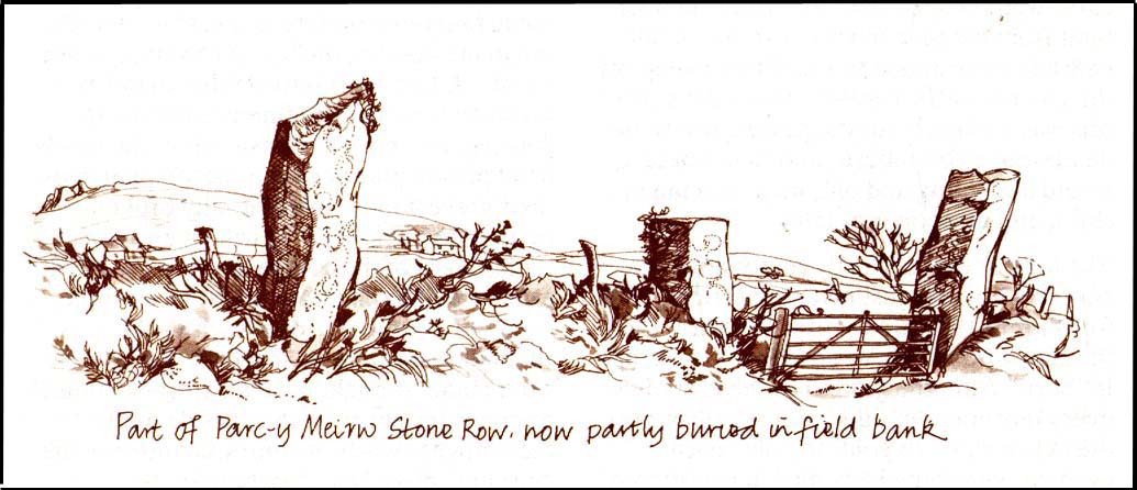
This is an impressive and well-known megalithic stone row, found just 4-5 miles inland from the coastal town of Fishguard. The drawing here is used courtesy of Elizabeth Haines, landscape artist, and gives a fine representation of the site as I’m sure you’d agree! Consisting of at least eight standing stones — four still upright and four laid down — aligning northwest to southeast, the tallest stone stands at the southerly end measuring 11 feet tall. The stone row is found in a region rich in prehistoric remains. Aubrey Burl (1993) said of the place:
“Four of the eight stones in this unusual row still stand, trapped in a field-wall, tow of them now gateposts. Thom suggested that the line, 131ft (40m) long, was laid out downhill towards the WNW and the minor northern moonset just north of Mount Leinster ninety-one miles away across the Irish Sea.”
Quite a distance! And perhaps because of this, Burl thought that the nature of this line of stones was more archaeological than astronomical, with its focal point being more likely up the slope to the ESE instead.
Folklore
There was once an adjacent chambered tomb here which, when it was “destroyed for a house in 1844 brought the owner no luck” (Thom, Thom & Burl 1990) – which is damn good to hear! There was a piece of folklore mentioned by E.L. Barnwell (1868) and other writers that the fields here marked the fall of three Welsh princes in the Battle of Mynydd Carn in 1084. In Roger Worsley’s (1988) fine tour of Pembrokeshire’s historical sites, he tells how these megaliths in the “field of the dead” are also haunted, saying:
“A local tale tells of Ladi Wen, a ghostly White Lady wandering about the fields at night, and who will kill anyone who ventures near; it was enough to keep villagers away from the site well into this century, though the stone row is over five thousand years old.”
References:
Barber, Chris & Williams, John Godfrey, The Ancient Stones of Wales, Blorenge: Abergavenny 1989.
Barnwell, E.L., “Alignments in Wales,” in Archaeologia Cambrensis, volume 14, 1868.
Burl, Aubrey, From Carnac to Callanish, Yale University Press 1993.
Thom, Alexander, Thom, A.S. & Burl, Aubrey, Stone Rows and Standing Stones, BAR 560: Oxford 1990.
Worsley, Roger, The Pembrokeshire Explorer, CCP: Abercastle 1988.
Tumulus (destroyed): OS Grid Reference – SE 094 242
Archaeology & History
Shaw Hill urn
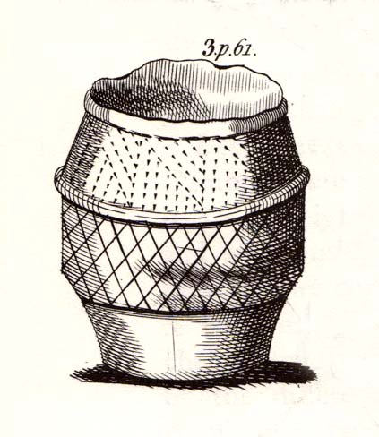
The remains here have long since succumbed to that self-righteous advance of industrial civilization. Even when the Halifax historian John Watson (1775) first described what had been here, the burial mound had gone; but thankfully he was fortunate in getting details regarding the whereabouts and contents of the remains. Three burial urns were found next to each other — presumably in the same tumulus — one of which was in a reasonably good state of preservation, as shown from the illustration which I reproduce here. We have no description of the burial mound, only of the urns, of which Mr Watson told us:
“It was found, with two others, at the gates, at the bottom of the walk near Shaw Hill, leading to the house in Skircoat, called Heath. They lay in a line, one yard deep and one yard asunder, with their mouths downwards. This contained calcined bones, and dust; the two others were broken in pieces. It is eight inches deep, stands upon a bottom of four inches diameter and, where there is no moulding, is from twenty-one inches, or thereabouts, to twenty-three inches in circumference.”
It was of similar size and design to burial urns found at Tower Hill a couple of miles west of Halifax. In Prof Watson’s (1952) work on the prehistoric sites of Calderdale, he assigned this burial mound and pottery to have been from the Bronze Age.
References:
Leyland, F.A., The History and Antiquities of the Parish of Halifax, by the Reverend John Watson, M.A., R.Leyland: Halifax n.d. (c.1867)
Roth, H. Ling, The Yorkshire Coiners, 1767-1783; and Notes on Old and Prehistoric Halifax, F.King: Halifax 1906.
Watson, John, The History and Antiquities of the Parish of Halifax, T. Lowndes: London 1775.
Watson, Geoffrey G., Early Man in the Halifax District, HSS: Halifax 1952.