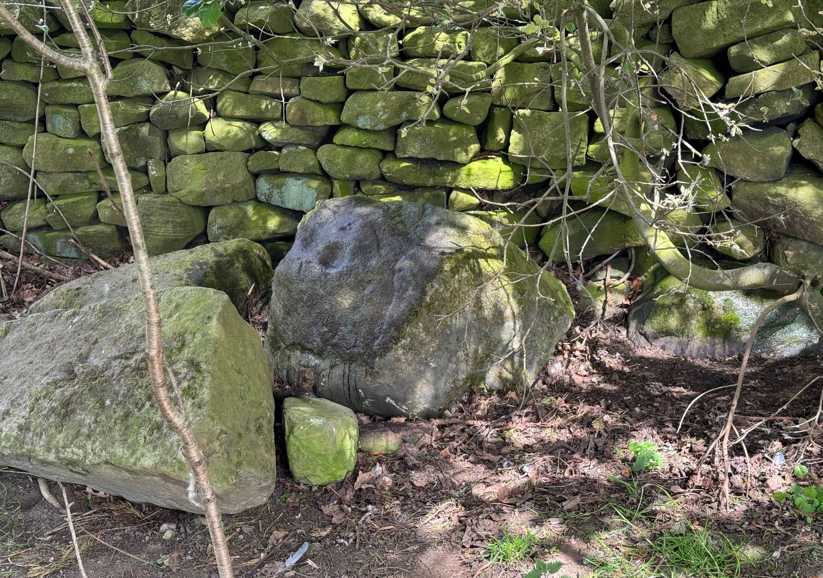
From Silsden, head up to Brunthwaite village and follow the same directions as if you’re going to see the Brunthwaite (1) cup-marked stone and, once there, look at the walling immediately behind it and you’ll see, at the base of the wall, peeking out is a small earthfast boulder. It’s about a yard away. You’ll find it.
Archaeology & History
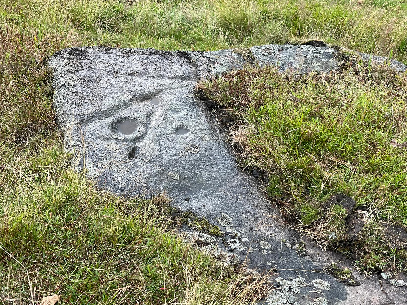
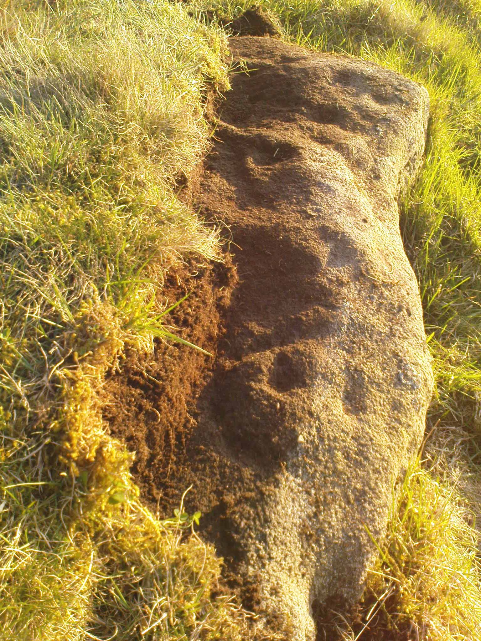
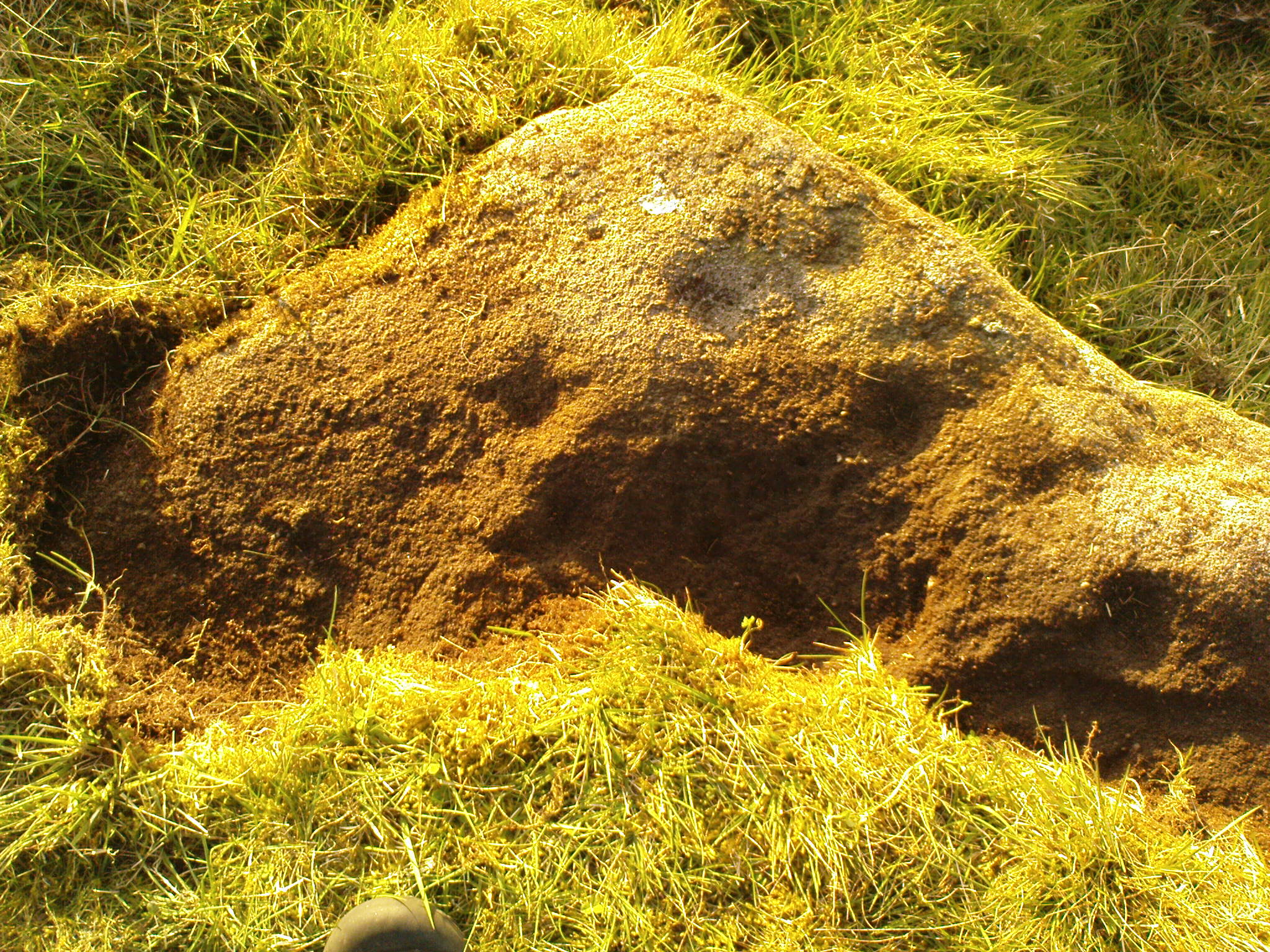
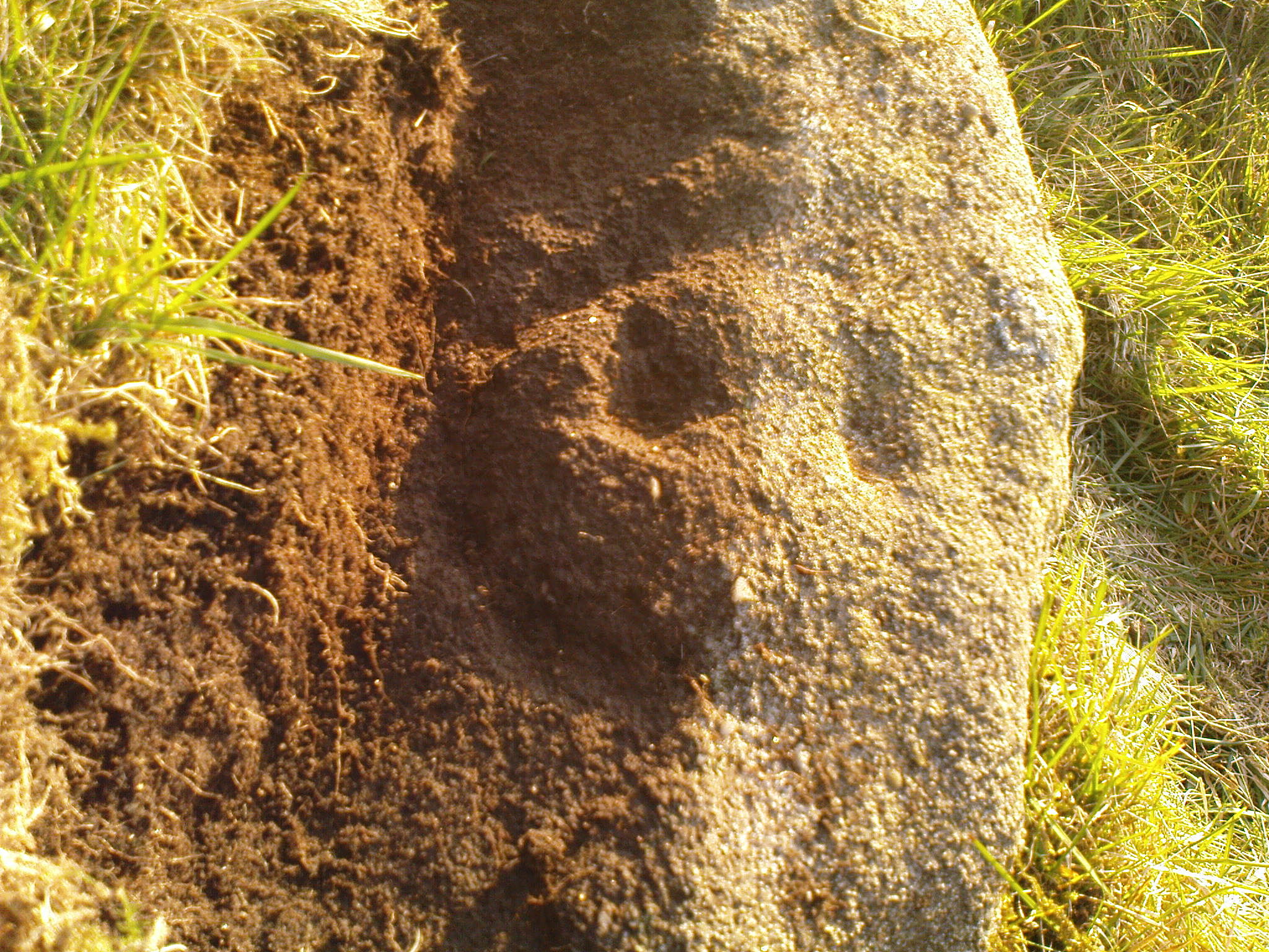
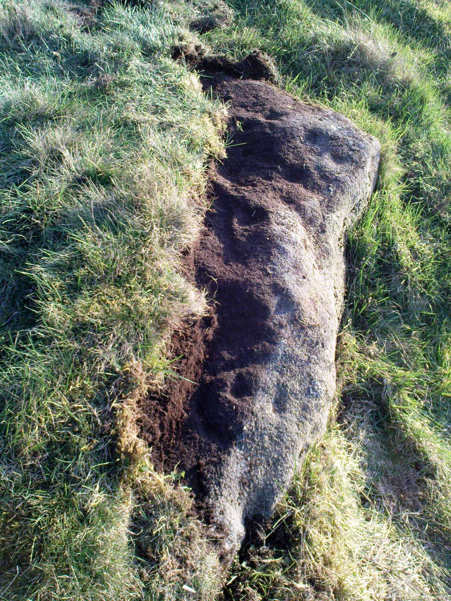
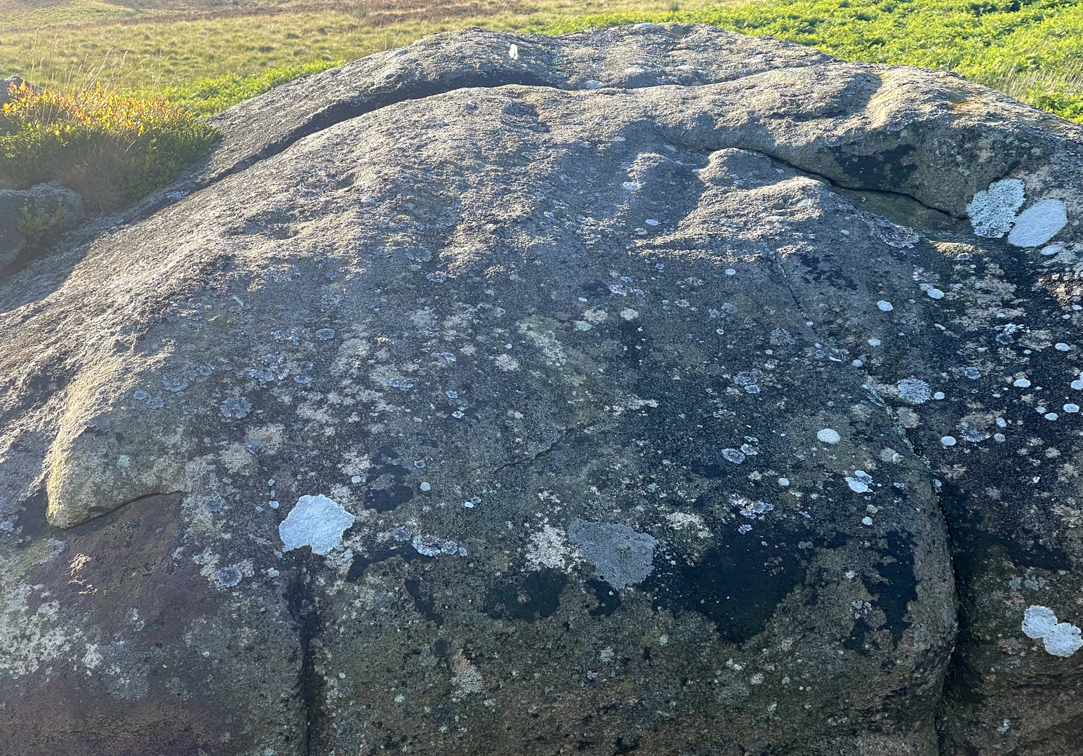
Sticking out from the edge of the walling at ground level is this low small cup-marked stone, rediscovered by rock art explorer Tom Cleland just a few weeks ago. It sits behind the cluster of rocks that were dumped here not too many years back. The carving comprises of at least three well-defined and quite deep cups, only two of which were initially visible until we cleared out a third one that had become filled with soil. It’s possible that there’s more of them on the stone, but we’d have to take the wall down to find that out!
The stone seems to be earthfast and may have remained in the same spot, untouched, since when it was first carved four or five thousand years ago—and certainly the depths of the cups suggest that its it’s been pretty much covered over for most of its life. The walling that’s been built on top of it is pretty recent by comparison; but it’s notable that its petroglyphic neighbour, the High Brunthwaite (3) carving, 175 yards to the east, is also an earthfast rock with the field-wall built on top of it.
Its somewhat minimalist appearance reminds me of several of the cup-marked petroglyphs at the top of Shipley Glen, six miles southeast of here, including the Baildon Moor (126) and (130) carvings…
Acknowledgements: Massive appreciation to Thomas Cleland for finding this carving and showing us it’s whereabouts.
As you’re going into Silsden up the A6034 road, over the canal bridge, turn right (east) and go up Howden Road for half-a-mile, then go left up Hawber Lane and after 250 yards veer right along Brunthwaite Lane. After nearly another half-mile, through gorgeous High Brunthwaite hamlet and just as the road bends round past the last of the gardens and houses, go through the gate into the field on your right. You’re needing to look at the walling here, which runs alongside the road, but on the field-side, barely 10 yards up. A cluster of rocks has been piled-up against the wall. The largest rounded broken one is the one you’re looking for.
Archaeology & History
Looking across the cups
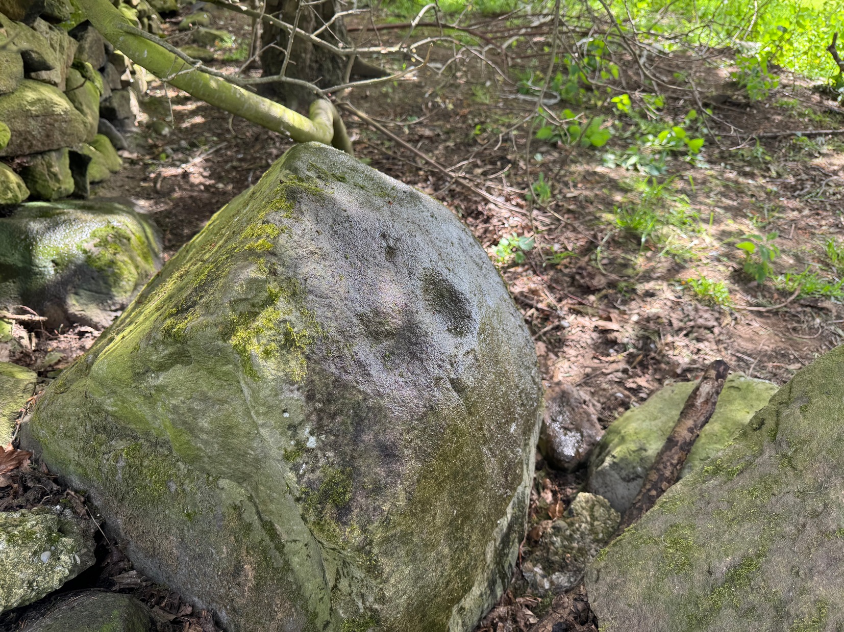
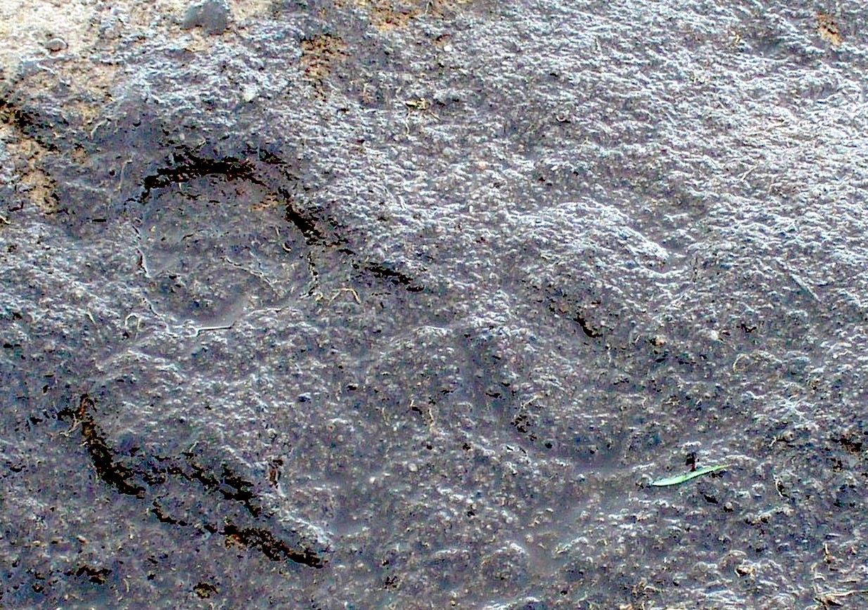
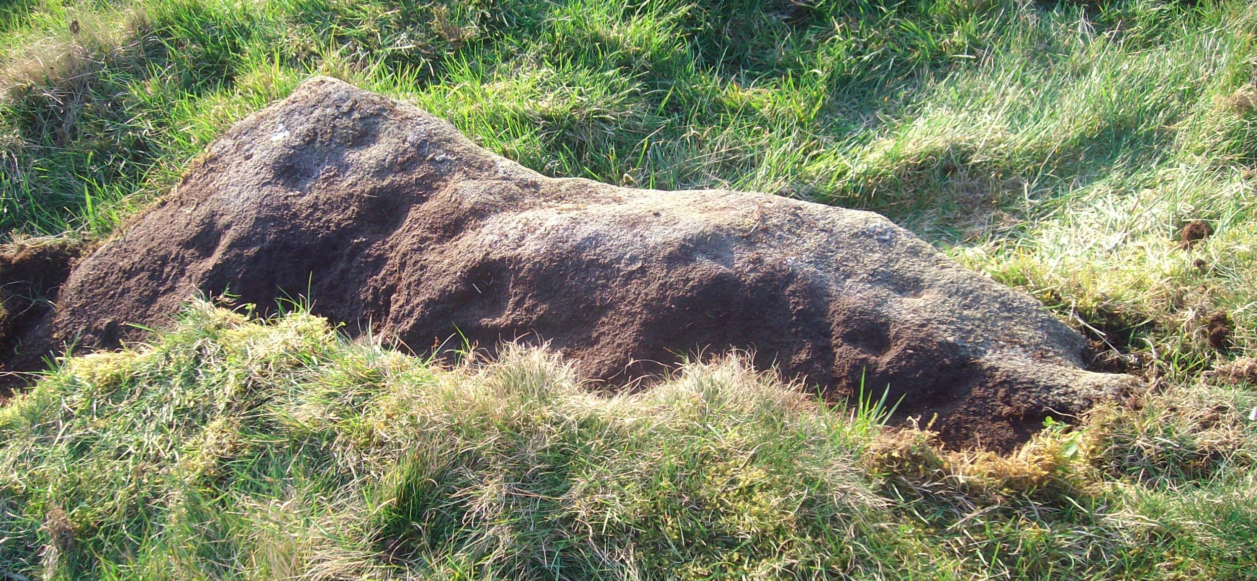
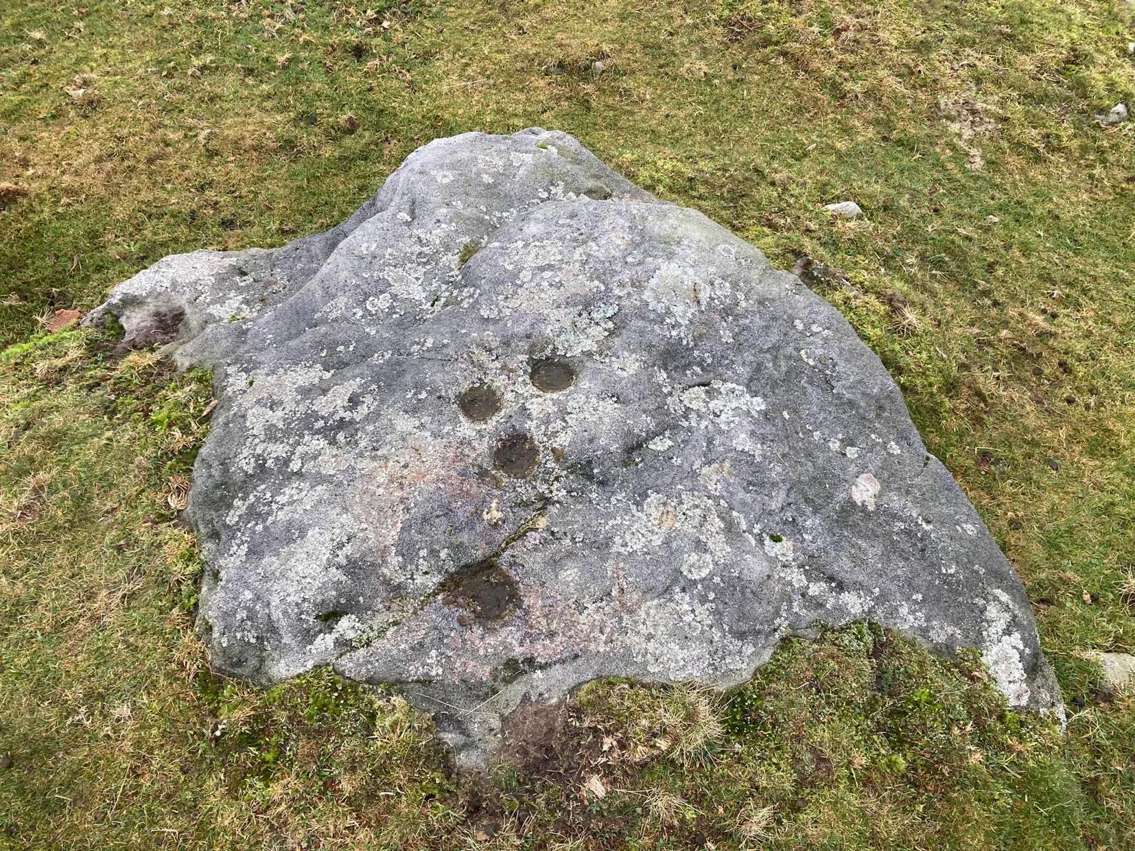
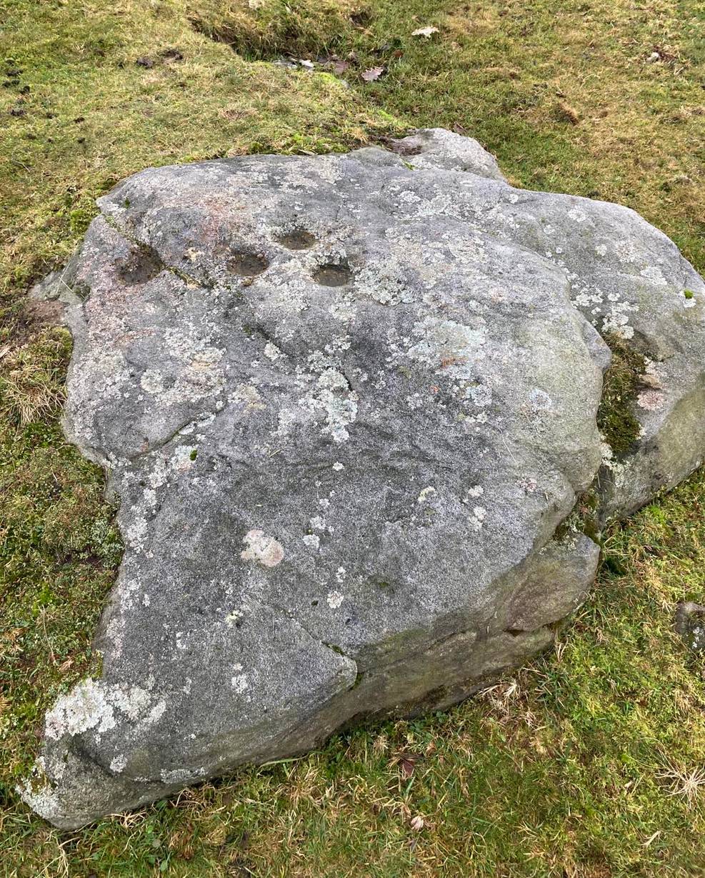
Discovered recently by the petroglyph explorer Thomas Cleland, this is one of two cup-marked stones in close attendance to each other. It’s nowt special to look at—unless you’re an ardent rock art buff!—as it consists of just two large well-formed cup-marks on its near-vertical face: the most distinct one being some two-inch across and a half-inch deep. The stone was obviously rolled here from very close by and just piled up against the wall and has been broken from a larger piece of rock, but we could see no other cup-marks on the others laid around it (although we couldn’t lift and turn the others over to see if there was anything on their undersides). The earthfast High Brunthwaite (2) cup-marked stone is just a yard away at the base of the wall.
Acknowledgements: Massive appreciation to Thomas Cleland for finding this carving and showing us it’s whereabouts.
In Steeton, walk up the High Street and after a hundred yards or so, turn right to go up to Quarry House (opposite Falcon Cliffe), up past Quarry Cottages to the end where it turns into a track. Follow the track for 200 yards, where it bends left, then immediately right go into the field, following the wall along for 450 yards where you’ll go through a gate to another rocky steep hill-slope. Walk up by the side of the walling here, at the edge of the trees and, once at the top, bear right and a few yards along keep your eyes peeled. You’re virtually on top of it!
Archaeology & History
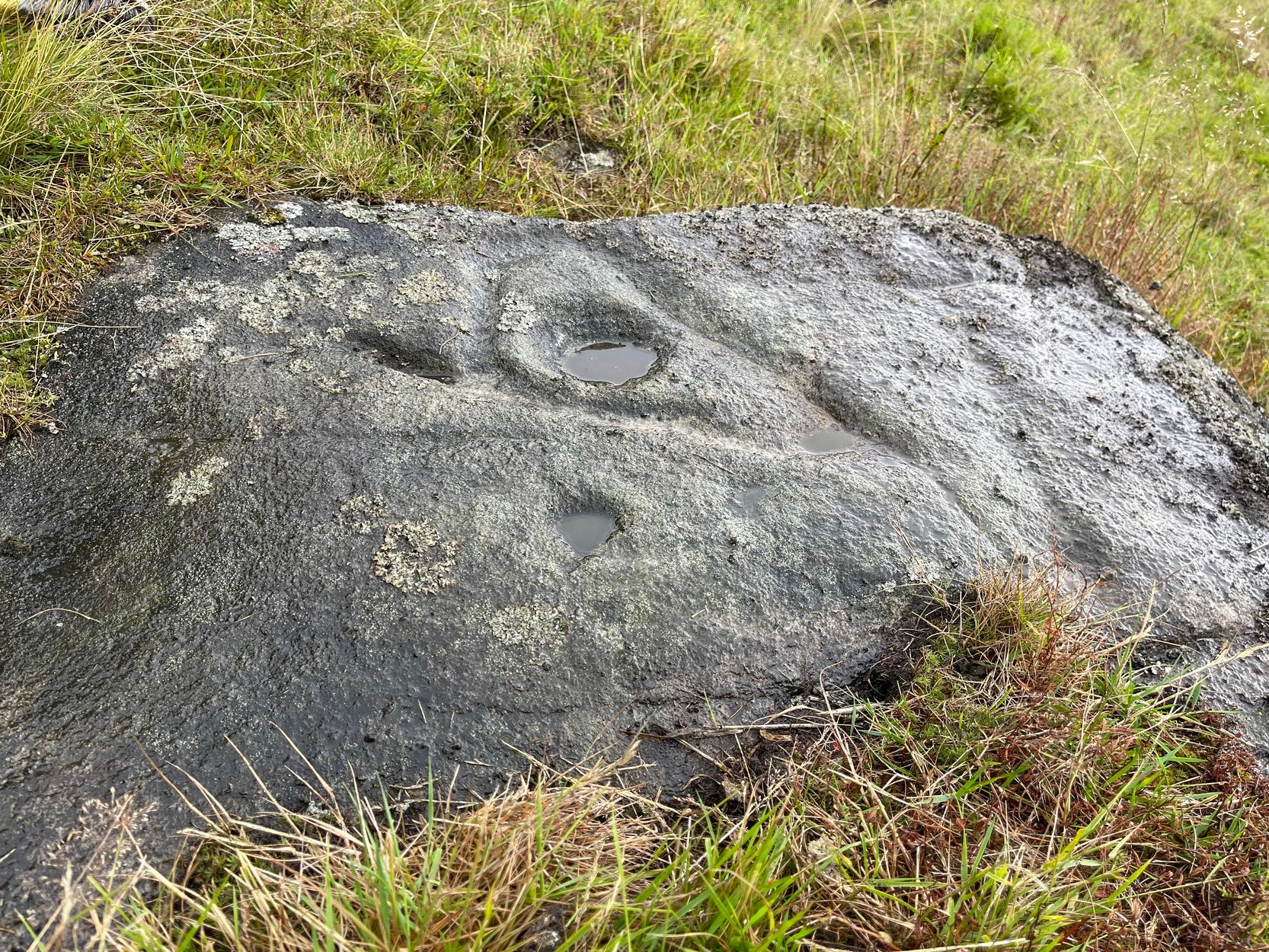
Not previously recorded, this is an unusual design: unusual in more ways than one. Firstly, it’s not entirely ‘ancient’; and secondly, the linearity in some of the carved lines around the cup-marks is unusual. It reminded me a little of the Hanging Stones above Ilkley, with its deeply cut lines, swerving around cup-marks, whose lack of ‘ancient’ guise is somewhat betrayed by the fact that Victorian quarry operations uncovered them—much like happened here…
It was first noticed in 2024 by Collette Walsh during a petroglyphic foray in the area. She noticed the distinct cup-marks on the rock surface, but then when she noticed a distinct quarrying mark, she dropped the idea that it was prehistoric. But this distinct quarry or stone-mason mark—executed sometime in the 19th century when the Industrialists were working here—shouldn’t take our attention away from the cup-marks; nor indeed all aspects of the other carved lines that swing round the edges of the deepest of the three cups, which is surrounded by a long curved triangle, some of which was carved into a natural crack, highlighting it more. The single outlying cup looked, from some angles when wet, that it may have had a partial ring around it—but we were unsure and it may have just been a trick of the light, along with our desire to see more than there actually is. Anyhow, it’s worth seeing. But we could do with a stonemason to check it out, enabling us a better assessment of which bits of this design are old and which are not-so-old.
Acknowledgements: To Collette Walsh for uncovering this design; and to Tom Cleland for showing me where it lives!
Along the B6265 old road between Keighley and Bingley, at Riddlesden go up Granby Lane, bending left into Banks Lane. About a mile up you’ll reach the moorland road. Turn left at the junction and nearly half-a-mile along there’s a layby on y’ right. From here walk along the footpath on the edge of the ridge, half-mile along bending slightly above Rough Holden Farm until, a coupla hundred yards on, you hit the dirt-track. There’s a long straight stretch of walling on your left: follow this for a few hundred yards, go through the gate and here walk on the other (left) side of the wall (if you’ve reach a derelict farm, you’ve gone too far). Some 60 yards or so down here, keep your eyes peeled on the long earthfast stone right near the walling. An alternative is to start at the steep hairpin bend up Holden Lane and follow the footpath into the woods. Walk along here (parallel with the stream below) for about 600 yards until you hit the bridge crossing the stream. Don’t cross over: instead double-back up the field on your right, go diagonally across and through the gate into the next field, and walk up along the walling to your right. 160 yards up, go through the gate and walk about 30 yards along the side of the walling again. Tis there!
Archaeology & History
Unveiling the Sunset Stone
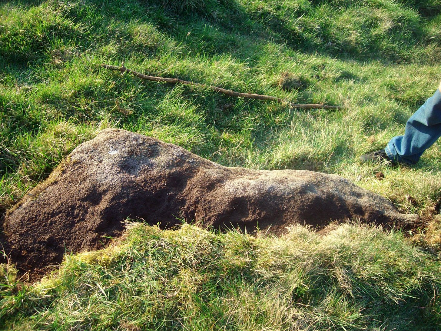
This is a fascinating carved stone on the western edge of Rombald’s Moor that I was fortunate to find in 2008. It’s found in association with two other cup-marked stones, north and south of it. I first noticed it when I was walking along the footpath by the side of the wall and saw that on a small exposed part of the rock a single cup-marking carved close to the vertical edge of the stone—and I’m glad that I stopped to give it more attention. The stone was very deeply embedded and the covering soil so tightly packed that I could only shift a small part of it—but the section that I managed to uncover and, importantly, the time of day when I did this, brought about an intriguing visage with subtle mythic overtones.
Carved arc on edgeEarly photo in low light
The carving was found near the end of the day just as the sun was setting and touching the far horizon. I noticed there was a cup-and-half-ring to the side of where I’d sat for a rest, near the northern edge of the stone, and the clear but soft light of the evening caught this element and almost brought it to life! As I gazed down at the half-ring, the sun highlighted it even more and I saw that some extended carved lines continued and dropped over the near vertical edge of the stone, becoming an unbroken elongated ‘ring’ that stretched twice the length of the half-ring on the flat surface. Not only that, but a faint cup-mark seemed to be inside this extended vertical ring and, as I saw this, a dreaming epiphany hit me that the symbolism behind this was a representation of the setting sun that I was watching at that very moment. It was quite beautiful and the carving seemed to come to life. The thought, nay feeling, that this part of the carving symbolized a setting sun not only slotted easily into a common animistic ingredient, but hit me as common sense too! However, as my ego and rational sense rose back to the fore (I had to get mi shit together and walk a few miles home before night fell), I saw that this impression may be a completely spurious one; but, as the rock-face inclines west, towards the setting sun, the name of Sunset Stone stuck. As I carefully fondled beneath the heavy overgrowth of vegetation covering the stone, I realised that I needed to come here again and uncover more of it, as additional cups and lines seemed to be reaching out from the mass of soil.
Cups near the S edgeClose-up of ring-edge
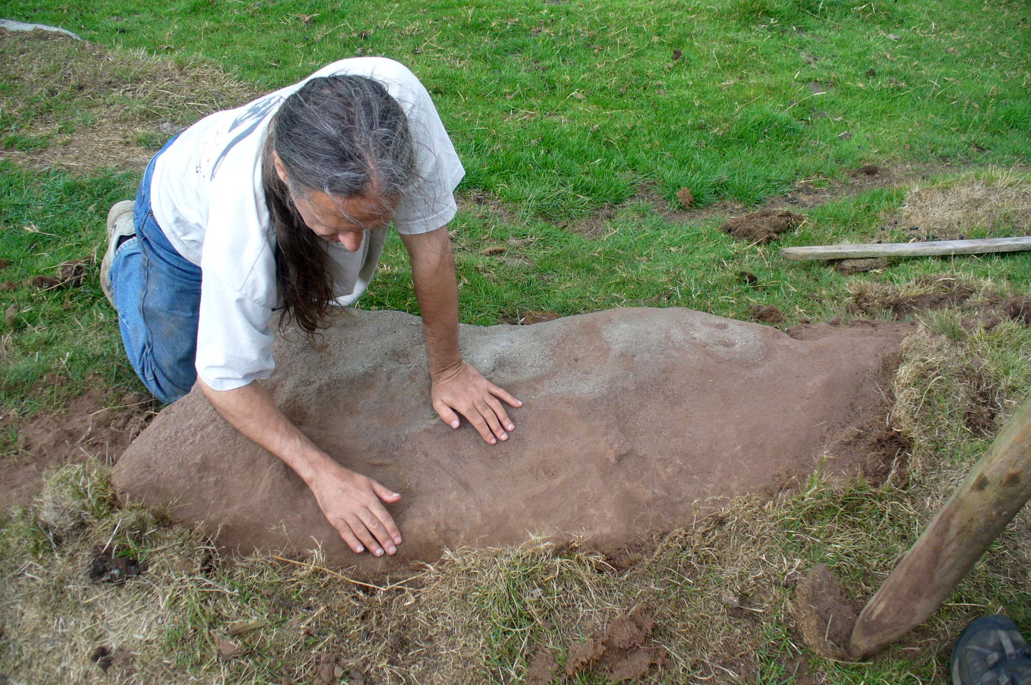
I returned to the stone a few times, but several years passed by before I revisited the site with the intention of uncovering more of the design in the company of Richard Hirst and Paul Hornby on August 4, 2013—and it took considerable effort to roll back the turf that covered the stone. But it was worth it! For it soon became obvious that much of the stone that was covered over had been unexposed for many centuries: as Richard pointed out, the edge of the rock was very smoothed by weathering, whilst the covered section of the stone that we were revealing was still quite rough and misshapen all across the surface, lacking weather and water erosion. Much of this design therefore, highlighted itself to us as it was when the mason first carved the stone. And it turned out to be a pretty curious design!
Faded photo of the carvingFaint proto-ring nr centre
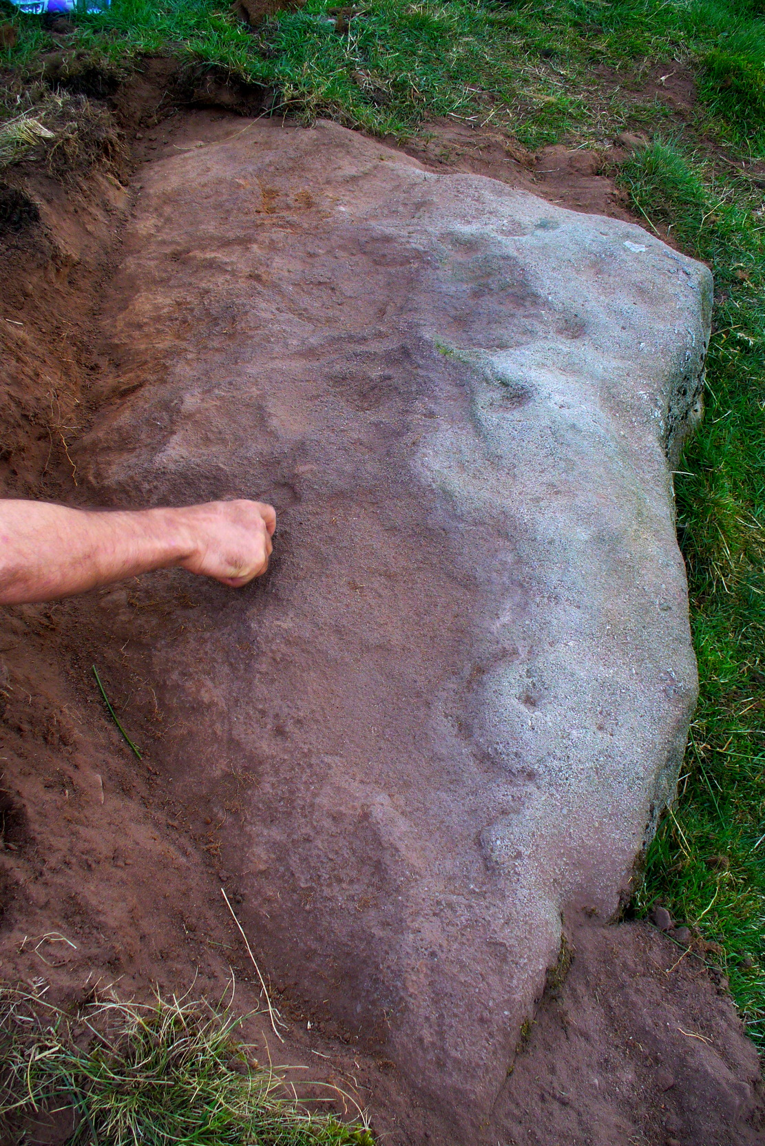
Our first impression was that the design comprised of two cup-and-rings near the middle of the rock, with another cup-and-drooping-ring near the northern edge of the stone, and between ten and twelve typical cup-markings, many on the western exposed side. But curiously near the middle were also a couple of rings whose edges had been defined, but the hollowed-out ‘cup’ in the middle remained uncut or unfinished, being a proto-ring, so to speak. Also, lines leading from these unfinished ‘cups’ were also pecked and laid out, but they were also unfinished. Some sections of the unfinished lines ran onto the western edge of the stone and were very faint, but they were undeniably there. Unfinished cups is an unusual feature for carvings on Rombald’s Moor.
Mr Hirst’s clearanceCups & curves on edge
But the most interesting element in the fainter, seemingly unfinished carved lines, was what may be a small spiral that started above the two faint cup-and-rings. This then continued in a sharp arc which doubled-back on itself. In the other direction, the lines curve round and go down to the vertical face of the rock, before bending back up onto the level surface again, then disappearing. The topmost cup-and-half-ring is also a curious feature. When you visit here you’ll see how this aspect of the design looks for all the world like a simply cup-and-half-ring near the edge of the stone. But, as I’ve already mentioned, closer examination shows that this “half-ring” has a larger oval body beneath it on the vertical face of the stone, very worn due to its exposure to the elements and very much in the shape of a bell—and within this large cup-and-ring ‘bell’ is a much fainter complete cup-and-ring, just below the topmost cup-marking. I know that I’ve already mentioned this, but I’m giving it added emphasis as it’s a unique design element for carvings on these moors.
Early photo of the carvingEdge of the carving
The Sunset Stone really requires more attention, when the daylight conditions are just right, so that all of these intriguing aspects can be highlighted with greater lucidity. There is also the potential that more carved ingredients remains hidden beneath the compacted soil.
What seems to be a more trivial single cup-marked stone can be seen roughly 20 yards to the north.
Acknowledgements: Massive thanks to Richard Hirst of Hebden Bridge, and Prof. Paul Hornby, for their help in bringing this carving to light.
From Steeton village, go up Mill Lane, turning right and then bending up the steep Barrows Lane for a half-mile or so, where in turns into Redcar Lane. There’s a row of old cottages on your left with a green lane track running into the fields at the back of them. Four fields along you’ll reach a long straight line of walling running uphill. Up here, above and past the long geological stretch of quarried rocks, the land levels out and two trees sit next to each other by walling. The carving’s beneath them.
Archaeology & History
Close-up of carving
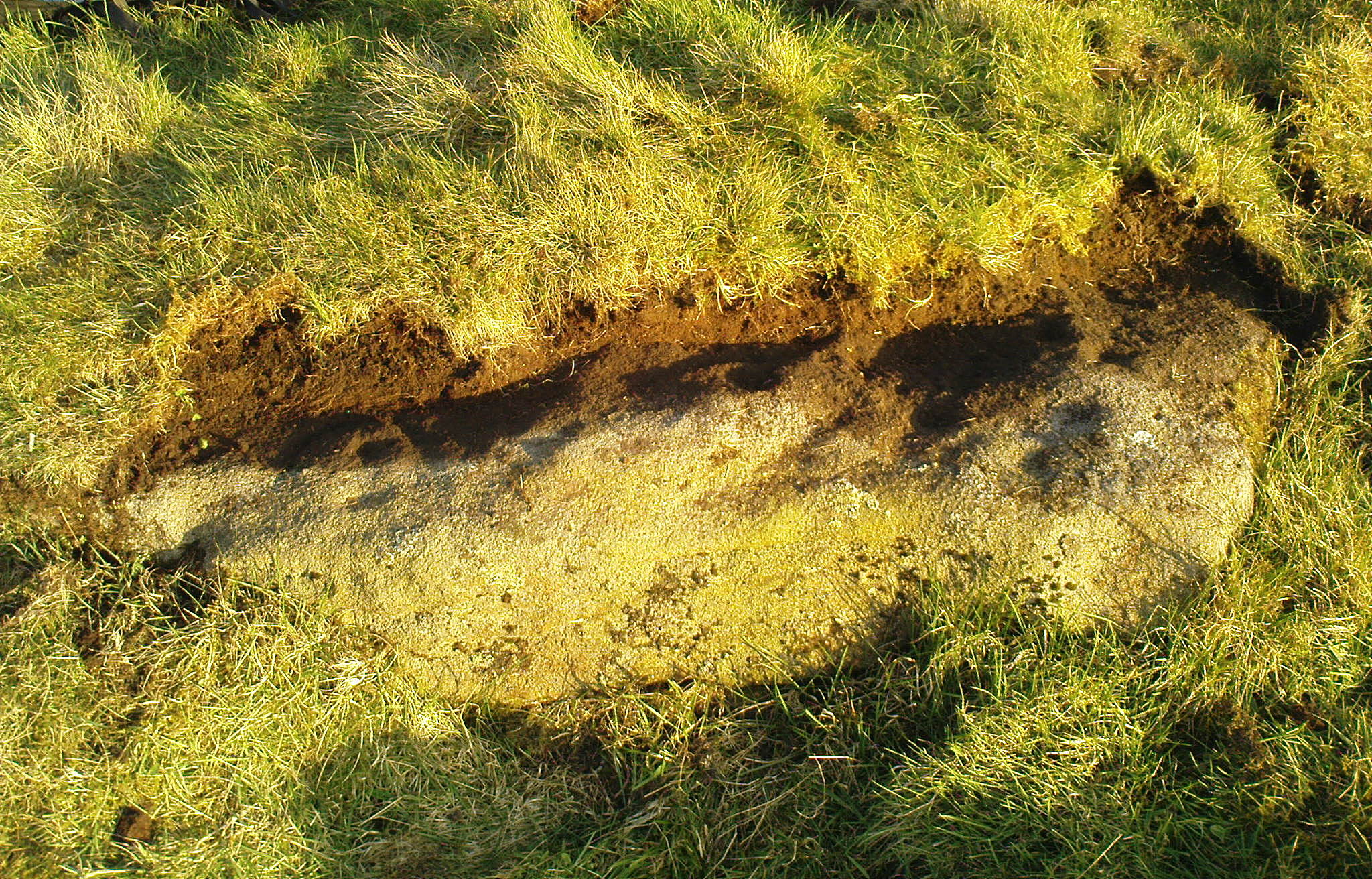
Rediscovered in the summer of 2024 by Thomas Cleland, a deeply worn cup-mark is the primary feature of this petroglyph on the topmost section of the stone, with the remains of a faint incomplete ring around one side of it. Three or four other smaller cup-marks can be seen close to the main one. There may be another cup-marked stone on an adjacent rock, with a lines running away from it, but we need to see that in better light or have one of the computer-tech doods to give it their attention to know for sure.
The easiest way to get reach here is via the Doubler Stones, which is usually approached either from the long and winding country lanes Silsden-side (you can’t drive all the way and there are hardly any parking spots en route), or from a long walk over the moors. Taking the latter route, probably the easiest is by starting at Whetstone Gate right on the moortop, on the Ilkley-Keighley road. From here, walk west along the footpath by the wallside for more than ½-mile until you reach the West Buckstones. From here, take the footpath NW (not SW) alongside the walling for literally one mile, where a notable angular skewing of three walls appears: keep to the left and walk alongside that wall for another ⅓-mile (0.5km) then climb over the wall and head straight for the small TV mast. The Giant’s Chair’s just below it.
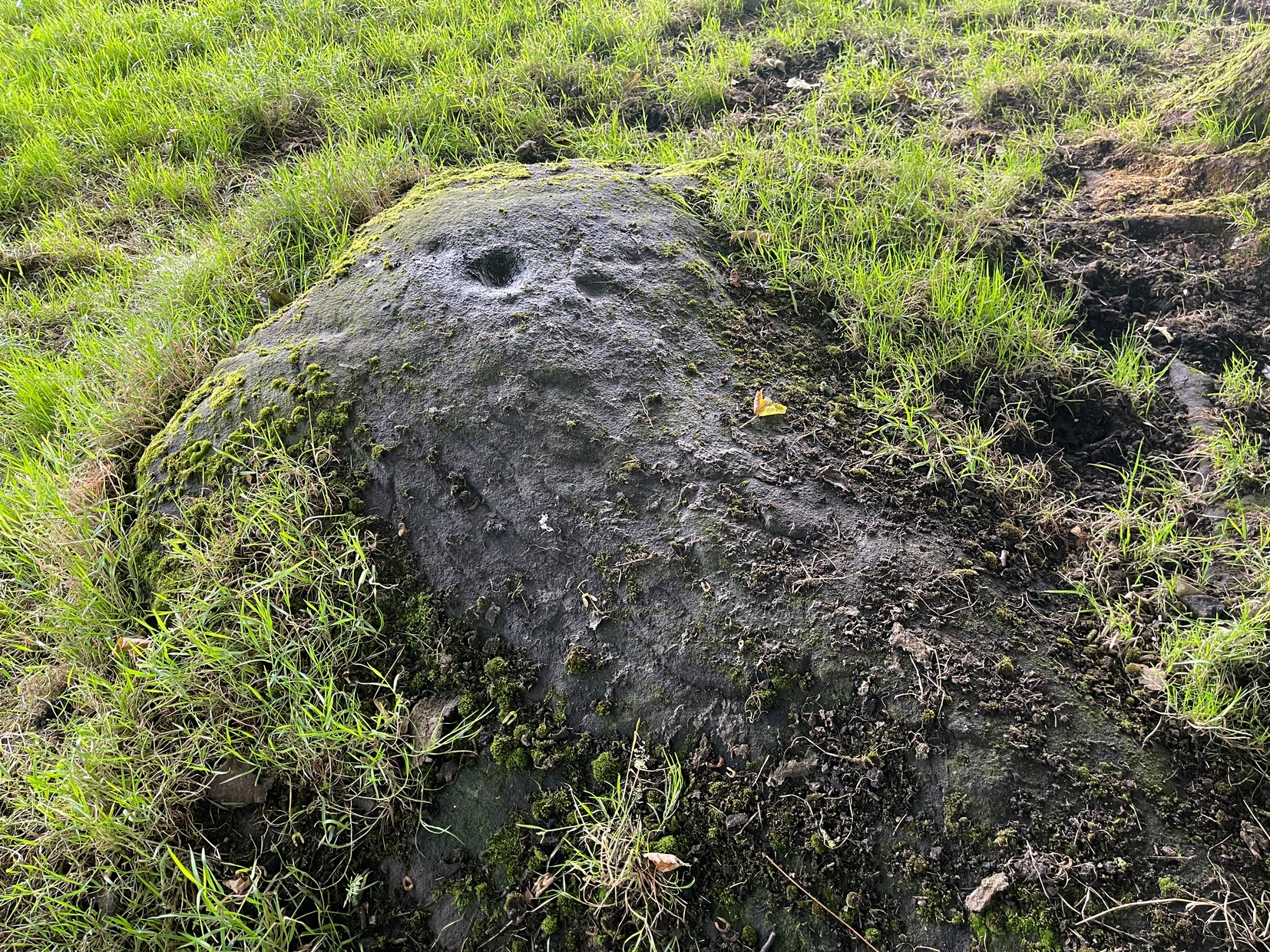
Some time in the mid- to late-1970s, on one of our early ventures to see the legendary Doubler Stones, this great rock outcrop of the Giant’s Chair also, understandably, drew our attention. And, as young fertile teenage lads, we all but flew up onto the top of this great rocky rise with relative ease. Now, nearly fifty years later, I’m unable to climb onto its top without ropes. (sigh….) It’s not easy. Anyhow, when we were on top of this rock as kids, a number of notable cup-markings stood out to us—in no distinct order, as I recall. But on the day of our clambering visit, She was grey and overcast; as She was on the two or three other visits we made to the stone, sitting on its top, fondling the cup-marks and eating our sarnies. All that I ever noticed were the cup-markings.
A few years after my early visits here, John Hedges (1986) wrote about this “very large high rock.” He mentioneed the cup-markings, obviously, but he also mentioned some things that we’d missed, saying that here are,
“Six large shallow worn cups, one with (a) partial ring and another with possible ring. One cup on SW end.”
Single cup-mark (?)One of the cup-and-rings (?), top-left
Sadly, I’ve never seen these rings and, these days, my ageing bones might not allow me back onto its surface to see them. (the expression, “sad bastard” comes to mind!) On a recent visit here with Sarah Walker of Silsden, neither of us could get our useless arses on top! (the photos taken here were done with me stood on top of an adjacent rock, hands held high, trying to get at least some elements of the carving—with a minor bit of success, I think) I take comfort in the fact that when Boughey & Vickerman (2003) subsequently added this carving in their enlarged inventory, that they never got to see them either, as they gave it the completely wrong grid-reference! And so, due to the ineptitude of us old folk, I await some younger and more competent explorers who can climb up on top and send us some good photos of the design, when weather and lighting conditions allow for good imagery. Are there any takers…?
References:
Boughey, Keith & Vickerman, E.A., Prehistoric Rock Art of the West Riding, WYAS: Wakefield 2003.
Deacon, Vivien, The Rock Art Landscapes of Rombalds Moor, West Yorkshire, ArchaeoPress: Oxford 2020.
Hedges, John (ed.), The Carved Rocks on Rombalds Moor, WYMCC: Wakefield 1986.
Acknowledgements: Big thanks to Sarah Walker for helping, albeit unsuccessfully, to scale this old rock to see the cup-and-rings on my last visit here. At least we tried…
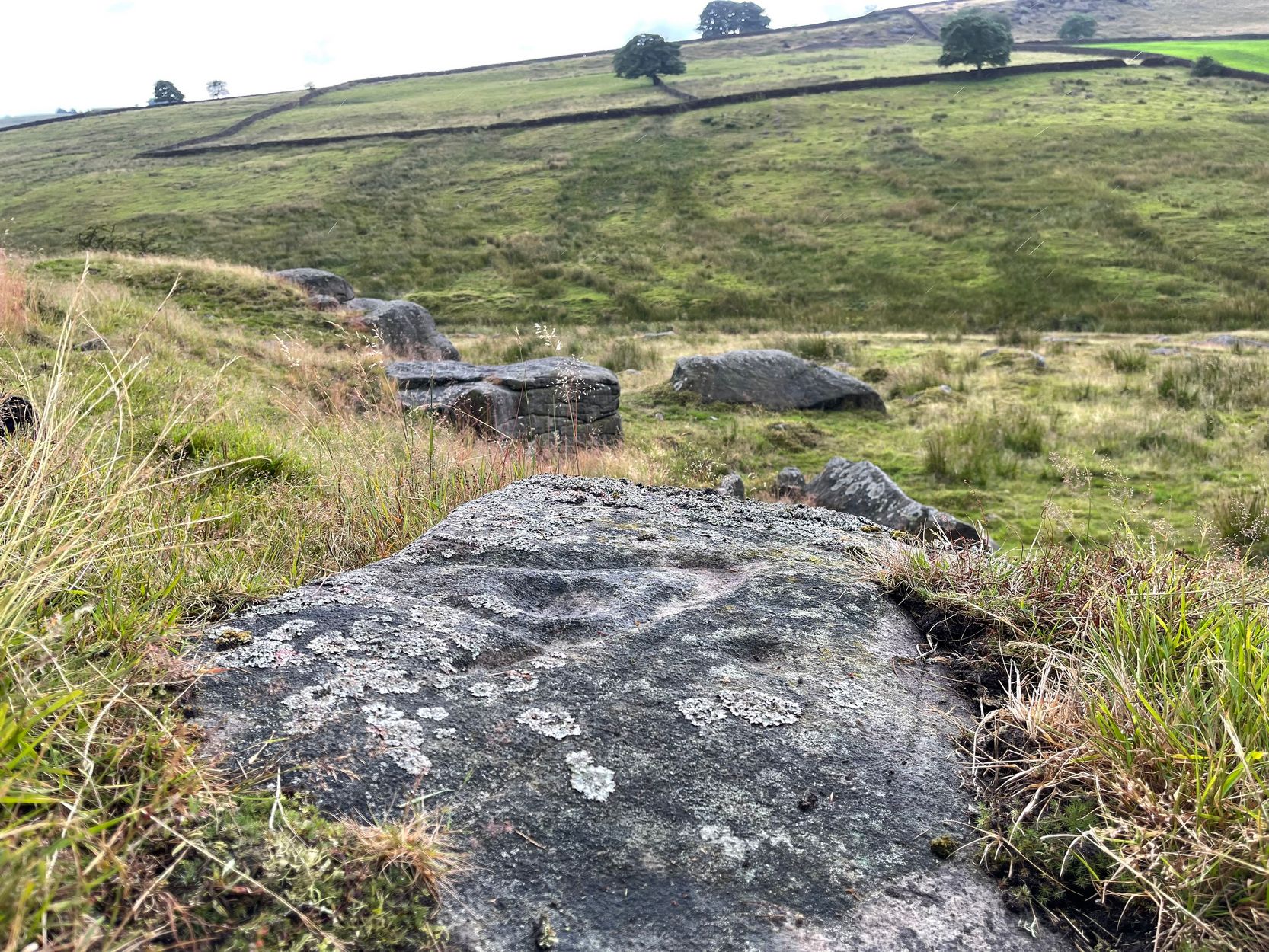
An intriguing find, made not too long ago by Jeff Wallbank of Silsden. Simplistic in design, it’s found on a small ridge of rocks adjacent to an old quarry (so there may have been other carvings here in times gone by), rising up immediately south of Haw Farm about 20 yards away, from where you can ask permission of the kind land-owner to have a look at the stone.
It’s pretty basic: consisting of a distinct triangle of three plain cup-marks on one side of a natural crack that runs across a section of the stone. Immediately adjacent and on the other side of this crack, is another singular cup. This appears to have a carved line running from it and possibly an elongated semi-circular element around the cup itself. It’s not too special when compared to the much more ornate petroglyphs further east, but is worth checking out if you’re walking in this gorgeous western edge of Rombalds Moor.
Acknowledgements: HUGE thanks to Sarah Walker, without whose help and permission to use her photos, this site profile could not have been written.
Cup-and-Ring Stone: OS Grid Reference – SE 0845 4529
Archaeology & History
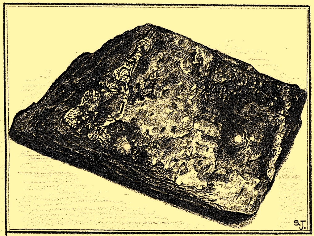
Discovered by Stuart Feather in the late 1950s, this was one of two carvings found very close to each other (see Bucking Hill 2) whose exact location are unknown (the grid-reference cited here is a reasonably accurate approximation). In his short article where he mentions the Bucking Hill 2 carving, he then told of,
Sid Jackson’s vague drawing of the carving
“the discovery a few yards away of a small stone bearing a cup-and-ring mark providing evidence for at least one other symbol from this small hill. This stone, only 14in long, 8in wide, and 6½in thick, has a cup 1¾in in diameter, ⅞in deep with a shallow channel 1½ long running from it.
“Round the cup, which is very symmetrical and has the pecking clearly defined, is part of a concentric channel which, if it were a complete circle, would have a diameter of 4in. The channel, which starts near to the small channel that runs from the cup, goes only halfway round the cup and is obviously unfinished. It is irregular in width and depth and in marked contrast to the workmanship of the cup.”
He then queries as to whether this small carved stone could have come off the larger cup-marked Bucking Hill (02) boulder close by. We may never know, but when we consider the lack of general erosion on this cup-and-ring (the pecking was still visible), it would obviously have remained upside-down in the peat for a few thousand years! There was an old cairn a short distance away on the top of Bucking Hill and it may have come from there. Anyhow, Mr Feather subsequently took this portable carving home with him and it’s subsequently been donated to the Ilkley Manor House Museum where it should be visible. (can someone send us a photo so we can add it to the site profile?)
References:
Boughey, Keith & Vickerman, E.A., Prehistoric Rock Art of the West Riding, WYAS 2003.
Feather, Stuart, “Mid-Wharfedale Cup-and-Ring Markings – Nos 21 and 22: Bucking Hill, High Moor, Rombald’s Moor,” in Bradford Cartwright Hall Archaeology Group Bulletin, 9:5, 1964.
Hedges, John (ed.), The Carved Rocks on Rombalds Moor, WYMCC: Wakefield 1986.
Cup-Marked Stone: OS Grid Reference – SE 0844 4529
Also Known as:
Carving no.87 (Boughey & Vickerman)
Carving no.217 (Hedges)
Archaeology & History
This was one of two carvings reported by Stuart Feather (1964) that were very close to each other (see Bucking Hill 3), both of which consisted of simplistic designs but which, he thought, may once have been part of the same rock. Its precise whereabouts are not known (the grid-ref is an approximation). He wrote:
“On the southern slopes of Bucking Hill, a fine gritstone rock 5ft 6in by 4ft 6in by 1ft 6in high, has a very clear cup-mark 2in in diameter and ½in deep carved 8in from the straight eastern edge of the rock.”
Feather thought that the edge of the rock had been cut and quarried for use in the boundary wall to the east. He may have been right.
References:
Boughey, Keith & Vickerman, E.A., Prehistoric Rock Art of the West Riding, WYAS 2003.
Feather, Stuart, “Mid-Wharfedale Cup-and-Ring Markings – Nos 21 and 22: Bucking Hill, High Moor, Rombald’s Moor,” in Bradford Cartwright Hall Archaeology Group Bulletin, 9:5, 1964.
Hedges, John (ed.), The Carved Rocks on Rombalds Moor, WYMCC: Wakefield 1986.
Cup-and-Ring Stone (lost): OS Grid Reference – SE 0828 4507
Also Known as:
Carving no.84 (Boughey & Vickerman)
Archaeology & History
Described by Boughey & Vickerman (2003) as being located somewhere “below Dirk Hill Sike” in the Rivock woods plantation, this is (or was) a “medium, upstanding rock lying NW-SE (with) one possible heavily weathered large cup-and-ring: cup 75mm diam. and ring 200mm diam.” However, the authors give no references to this site, nor images, or notes as to who rediscovered this stone. In their survey they also included one of the Bucking Hill carvings twice, giving the impression that there was more here than had previously been reported. These errors have subsequently been repeated elsewhere on-line. In saying this, there are a number of rocks scattered in this area which may have had carvings on them, but it’s been heavily forested and, recently, the trees have been felled and so many of them will have been damaged, turned over, or simply destroyed as a result of the forestry shennanigans.
References:
Boughey, Keith & Vickerman, E.A., Prehistoric Rock Art of the West Riding, WYAS 2003.
 The stone seems to be earthfast and may have remained in the same spot, untouched, since when it was first carved four or five thousand years ago—and certainly the depths of the cups suggest that its it’s been pretty much covered over for most of its life. The walling that’s been built on top of it is pretty recent by comparison; but it’s notable that its petroglyphic neighbour, the High Brunthwaite (3) carving, 175 yards to the east, is also an earthfast rock with the field-wall built on top of it.