Enclosure: OS Grid Reference – SE 0555 2993
Also Known as:
- Rough Carrs

Troublesome to get to if you don’t know the area. You can get here rom Halifax, up through Highroad Well towards Wainstalls, keeping to the road that leads to the Oxenhope windmills. A short distance before the windmills, as the road levels out, keep your eye out on the right where the valley drops down (east) to the Halifax golf-course. If you’re coming from Oxenhope, walk up past the windmills at Nab End until the road starts going back downhill. As you look down and walk past the valley with the golf course in it, a footpath is on your left running diagonally over a field. Cross the stile and walk alongside the wall for about 200 yards until you reach a gate on your left. Go through this and walk along until you see the ditched earthworks that make up this little-known monument…
Archaeology & History
Not to be confused with the large circular enclosure that once crowned the nearby Hunter Hill, the nature and age of this large D-shaped earthwork has long been a source of speculation, with the majority of it centring around a Roman origin — and for good reason, it has to be said!


More than 280 yards (260m) in circumference, its north-south axis measures 82 yards (75m) at the greatest and 88 yards (81m) east-west. Its main feature is a decent ditch that averages 8-10 feet across round most of the D-shaped feature, and between 2-3 feet deep. It would obviously have been deeper than this when the ditches were first dug, but it’s now very overgrown across the entire site with Juncus grasses and tribbles (tussocks). A small internal ditch runs into the enclosure from the northern side. Its function is unknown. A small mound near the centre of the site has been posited by Calderdale archaeologists to be modern remains.
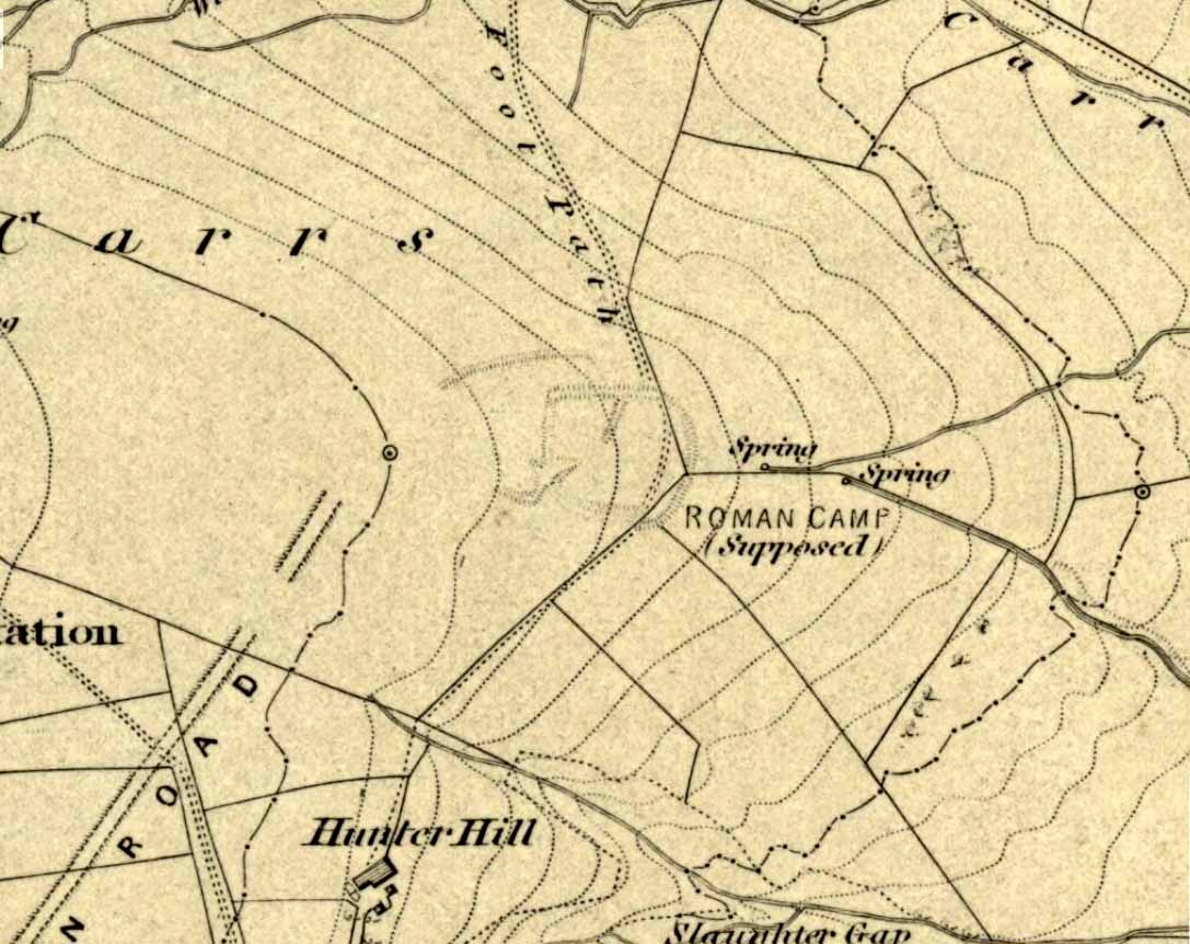
Although the main feature is the D-shaped earthwork, other features are apparent. For example, what looks like another man-made dyke cutting into the site on the southwestern side is in fact a natural stream channel. This natural feature may have been an integral part of the enclosure when it was first built. Above the northwestern edge of the ditch (as can be seen on the aerial photo) are other earthworks that run around the western edge of the main feature. This is probably what F.A. Leyland (1867) meant when he described there to be “the remains of several lines of intrenchments” here. Also coming into the southwestern side are what are thought to be the remains of a Roman Road. Early OS-maps (above) show the road running within yards of this enclosure — and it was this which, logically, led many earlier researchers to posit the notion that this site was in fact Roman. However, a dig here in 1951 recovered prehistoric pottery, which knocked the date back to the Iron Age.

On the south and east sides, parts of the ditch and embankment have been removed by quarrying and farm-workings, with the walling on the eastern side completely ruining that part of the monument. A great number of flints have been found on the hills above here. I’m unable to give a more detailed exposition on the archaeological finds at this site as I don’t have a copy of Mr Varley’s (1997) essay that he wrote for the Transactions of the Hunter Archaeological Society, which apparently gives more info. When I manage to get a copy of the journal/essay, I’ll add the relevant data to this profile.
A note must also be made of another, previously unrecognized enclosure on the same hilltop a couple of hundred yards to the west from here. Very little trace of it is still visible at ground level, but the outline of the curvaceous quadrilateral ditch form can be seen from the air. It would appear from its form to be consistent with an Iron Age enclosure, though without further research this has to be proclaimed as hypothetical. No excavations are planned here in the near future.
Folklore
In F.A. Leyland’s (1867) superb commentary to Mr Watson’s History of Halifax, he told us:
“There is a well-preserved tradition amongst the inhabitants that a battle in which numbers fell was fought at a place called the Slaughters or Slaughter Gap, in the hollow between the Carrs and Hunter-hill. Fragments of gun-barrels and locks, with human bones, have been found about the place…”
But Leyland deemed the armoury finds here — that appeared to substantiate the folklore — were from a much later period in history than the enclosure. But I must draw attention to the remarkable Mixenden Finds, as they’ve become known: a collection of finely polished prehistoric axes and other stone remains a few hundred yards below The Carrs and which may relate to such folklore.
References:
- Leyland, F.A., The History and Antiquities of the Parish of Halifax, by the Reverend John Watson, M.A., R.Leyland: Halifax n.d. (c.1867)
- Varley, Raymond, “The Excavation of Castle Stead at Manywells Height, near Cullingworth, West Yorkshire,” in Transactions of the Hunter Archaeological Society, volume 19, 1997.
- Varley, Raymond A., “Lost Neolithic and Bronze Age Finds from Mixenden, near Halifax, West Yorkshire,” in Yorkshire Archaeological Journal 70, 1998.
© Paul Bennett, The Northern Antiquarian