Knock Hill, Dunblane, Stirlingshire

Hillfort:  OS Grid Reference – NS 7825 9845

Also Known as:

  1. Canmore ID 45987
  2. Gallow Hill

Getting Here

The snow-covered old fort

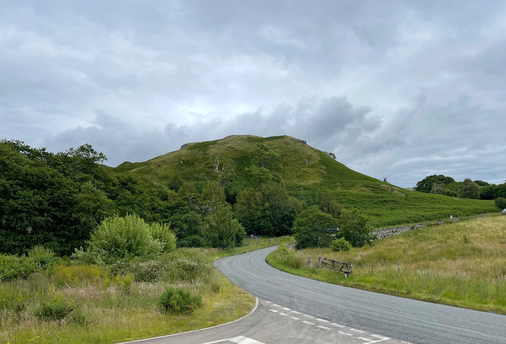
You can come here from either Dunblane to the north, or Bridge of Allan immediately south: either way you reach the site by going along the A9 road until you reach the Lecropt Church, a half-mile north of Bridge of Allan.  On the other side of the road is a somewhat battered wooden gate.  Go through here and up towards the tree-covered hill, following its edges to the right for a few hundred yards, until you come to another very large mound covered in trees.  That’s what you’re looking for!

Archaeology & History

Described on early OS-maps as a “Supposed Roman Camp,” this large fortified stone hillock has more recently been considered a creation of indigenous Scots.  Hemmed in and hidden on most sides, by the rises of Knock Hill to the west and Gallows Hill to the east, the only lines of visibility out of the fortress is along a northwest to southeast corridor, keeping the site quite secret to outsiders.  It would have been a fine place for a small community in ages not-so-long-ago, keeping the people hidden from the pestilent invasions of both Romans and english in bygone times.

The tree-clad fort, through blizzard

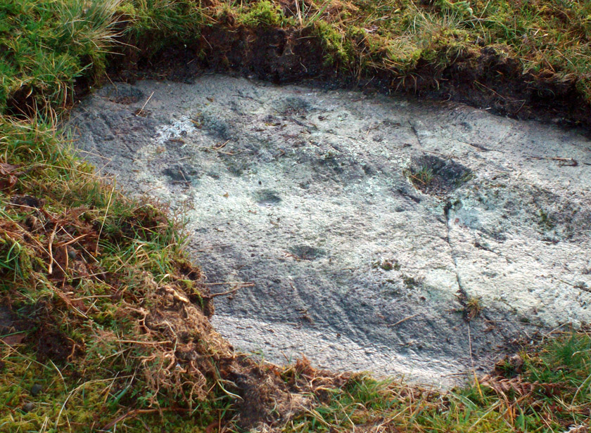
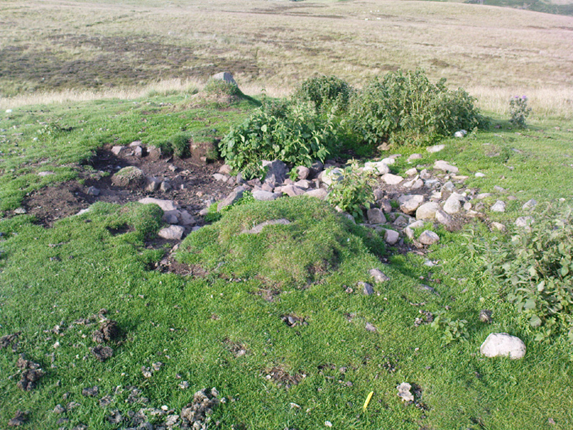
The large raised oval enclosure was walled around its sloping sides and edges, with remains of a walled embankment still visible running around the top of the slopes.  What may have been traces of hut circles were on top of the hillock until recent times, but these have been much reduced by some digging near the middle of the site.  It would appear that an ‘entrance’ was once visible on the southeastern side of the fort, but when we came here the other day, a lovely blizzard covered the place in snow, so this was difficult to see.

When the Royal Commission chaps came to visit the place in 1979, they didn’t really say much about the place, merely telling of its dimensions, saying:

“This fort measures 48m by 32m within the remains of a single rampart 4.5m thick and 1m high.”

I’m sure there must be much to be said of this lovely old site by local antiquarians, but I haven’t found much as yet.  But if you’re wanting a nice quiet spot to sit for a while on the outskirts of Stirling and Dunblane, I’d heartily recommend visiting this place.  Badgers and deer also seem to like the place!

References:

  1. Royal Commission on the Ancient & Historical Monuments of Scotland, Archaeological Sites and Monuments of Stirling District, Central Region, Society of Antiquaries of Scotland 1979.

© Paul Bennett, The Northern Antiquarian 


Duncroisk 6, Glen Lochay, Killin, Perthshire

Cup-Marked Stone:  OS Grid Reference – NN 53466 36485

Getting Here

Position of ‘Duncroisk 6’ cup-marked stone

Follow the same directions to reach the Duncroisk Crosses stone.  From here, look up the slope to your right and you’ll see the line of fencing running uphill.  Follow this until you reach the ruined remains of the old sheepfold building.  From here, look towards the tree-lined gorge of Duncroisk Burn, a few hundred yards west and walk towards it for about 50-60 yards.  There’s a group of three rocks hereby, two are large, but the carving’s on the smallest one in the middle.

Archaeology & History

This cup-marked stone was rediscovered as a result of the fine archaeological survey work by that Glasgow bunch of Certified Field Archaeologists, in their assessment of remains in and around Duncroisk Farm.  As well as mentioning — albeit briefly — the carvings of Duncroisk Farm and Duncroisk Crosses, Dugald MacInnes (2001) and his team came across another that hadn’t been recorded before.  Described in their survey as ‘feature 2’, he told,

“Some 20 metres downslope from the sheep fank and about 60 metres NW from it, there is a group of large boulders.  On the southeast sloping face of one of these there are three previously unrecorded cup-marks.  These are oriented vertically on a northeast to southwest alignment and are no more than 4cm apart.  They are all about 7cm in diameter and 2.5cm deep.”

The carved rock is a relatively small one sitting roughly in between two much larger rocks, both of which are easily visible from the Duncroisk Crosses stone less than 100 yards down the slope.  It’s probably only gonna be of interest to the rock-art purists among you and some may even question its veracity, particularly the bottom of the three cups, which gives the impression of being unfinished.  If you visit the site in summer and autumn it will be much harder to find, as it gets overgrown with bracken. (we did take a number of photos of this stone, but managed to somehow delete them all before saving to disk – so have gotta check it again when we next visit here)

References:

  1. MacInnes, Dugald, An Archaeological Field Survey of a Deserted Settlement at Duncroisk Farm, Glen Lochay, Association of Certified Field Archaeologists: Glasgow 2001.

© Paul Bennett, The Northern Antiquarian


Corrycharmaig (4), Glen Lochay, Killin, Perthshire

Cup-Marked Stone:  OS Grid Reference – NN 52768 35504

Getting Here

‘Corrycharmaig 4’ cup-marked stone

Follow the same directions to get to the Corrycharmaig 3 carving; and just a yard or two to the right of the far western edge of the rock, you’ll see another smaller slightly sloping rock, closer to the fencing, with faint cup-markings.  That’s the one! (note that the 10-figure grid reference given here might need adjusting slightly)

Archaeology & History

This small slightly sloping piece of exposed rock is on the western extremity of the Corrycharmaig cluster of carvings, but is a distinctly separate piece of rock from the Corrycharmaig 3 stone (though part of the same outcrop).  The stone itself has two sections to it, with a natural crack in the rock defining eastern and western section — both of which possess cup-marks.

The easternmost section of the stone has seven cup-marks, some of which were only recently uncovered.  A large single cup-mark sits near the middle of this portion of the rock; this is probably what Mr Cormack (1952) was talking about when he told that, “further west (of the Corrycharmaig 3 carving, PB) is one isolated larger cup of 4-inch diameter.”  On the western side of the stone, we find just two or three cup-marks, though one large cup-marking here would seem to be Nature’s handiwork.

It is highly likely that beneath the excessive vegetational growth around this carving and others along this ridge, other sections of prehistoric carvings remain to be found.

References:

  1. Cormack, E.A., “Cross-Markings and Cup-Markings at Duncroisk, Glen Lochay,” in Proceedings of the Society of Antiquaries, Scotland, volume 84, 1952.
  2. Morris, Ronald W.B., The Prehistoric Rock Art of Southern Scotland, BAR 86: Oxford 1981.
  3. Royal Commission on the Ancient & Historical Monuments of Scotland, Archaeological Sites and Monuments of Stirling District, Central Region, Society of Antiquaries of Scotland 1979.

© Paul Bennnett, The Northern Antiquarian


River Balgy, Shieldaig, Ross & Cromarty

Standing Stone:  OS Grid Reference – NG 849 533

Getting Here

Standing Stone nr Shieldaig

From Shieldaig, take the A896 road east to Torridon and Kinlochewe (a bloody superb part of Scotland – perhaps the best!) for a couple of miles, round the stunning bay of Ob Mheallaidh, till you reach the tiny hamlet of Balgie.  From here, walk upstream following the small River Balgie until you hit Loch Damh.  At the edge of the rugged and boggy flatland shortly before the loch itself, amble about in the rushes on your right (west).  You’ll find it!

Archaeology & History

This is a small but chunky standing stone was rediscovered by Dr J. Havelock Fidler in the 1980s.  Less than four-feet tall, it stands alone at the edge of the boggy landscape, with superb views all around (the hill in the background photo is An Ruadh-mheallan). There are other human remains scattered amidst the rocky landscape close by, including the remains of old buildings not far away, but this prehistoric monolith seems to be an isolated example.  However, the landscape here is so vast that it’s highly likely that other standing stones remain hidden in these ancient mythic hills…

References:

  1. Fidler, J. Havelock, Earth Energies, Aquarian: Wellingborough 1988.

© Paul Bennett, The Northern Antiquarian


Samson Stone, Callander, Perthshire

Legendary Rock:  OS Grid Reference – NN 60399 07820

Also Known as:

  1. Samson’s Putting Stone

Getting Here

Samson Stone on Bochastle Hill

Go west out of Callander on the A84 road and after a mile or so turn left at Kilmahog, down the A821.  After a few hundred yards, past the parking spot by the roadside, look up the small Bochastle Hill on your right and you’ll see a large singular boulder resting on top.  That’s it!

Archaeology & History

When I first wandered up to this giant rock, I was hoping there may have been cup-markings on its surface, but none could be found.  The stone is a glacial erratic.  The Iron Age hillfort of Dunmore is 370 yards (338m) to the southwest.

Folklore

Samson Stone, close-up

In Mr Rogers’ (1853) fine historical tour of the region, he notes the Samson Stone “on the summit of one of the eminences of Bochastle,” a couple of miles west of Callander, but wondered “how it came to occupy this remarkable position.”  If he’d have asked some of the old locals they may have told him what Rennie McOwan (1996) came across and described in his excellent work on the folklore of Scottish mountains.  For the Samson Stone was traditionally thrown here by one of the Fingalian giants in ancient times.  It was originally located upon Ben Ledi, nearly 3 miles northwest, and was one of several stones being thrown in a competition to see who was the strongest of the giants — and Samson was the name of the one who threw this huge rock.  Another version of the same legend tells that the stone was originally thrown from Ben Lawers, 21 miles (34km) to the north.

References:

  1. Bain, William, Around and about Callander, Callander & District Round Table n.d. (c.1978).
  2. McOwan, Rennie, Magic Mountains, Mainstream: Edinburgh 1996.
  3. Roger, Charles, A Week at Bridge of Allan, Adam & Charles Black: Edinburgh 1853.

© Paul Bennett, The Northern Antiquarian


Dun Toiseach, Ford, Kilmartin, Argyll

Dun:  OS Grid Reference – NM 8808 0476

Getting Here

The hill of Dun Toiseach

You can see the rocky hillock ‘pon which this old dun sits from the roadside – and can approach it by either climbing up the slope, or go round t’ back and approach it from t’ track. Either way, it’s easy to get to.

Archaeology & History

This old dun was rather ramshackled when I used to sit here, sometimes on my way home from working at the Inverliever Nursery, a bit further up the lochside — but it was a good spot to sit and daydream into Loch Awe and beyond…

Described as a vitrified fort, the structure is oval in shape.  Thought to have been constructed in the Iron Age, Dun Toiseach was originally about 50 feet across and its walls averaged 10 feet thick, with an entrance at its northeastern side.  The Royal Commission lads (1988) described it thus:

Dun Toiseach plan (after RCAHMS 1988)

“Situated on a prominent rocky knoll overlooking the S end of Loch Awe 250m ESE of Torran farmsteading, there is a severely ruined dun measuring about 16m by 13m within a wall which has been some 4m thick. Two stretches of outer facing-stones are visible, as well as a few possible stones of the inner face, but, particularly on the NE, the wall has been severely robbed and the core material scattered. The entrance lies on the NE, the innermost portion of the SE passage-wall and what may be a door-jamb on the opposite side still being visible.  The knoll has acted as a focus for recent field-walls, but there is no indication that it was additionally defended by outworks. A small modern cairn…surmounts the dun wall on the SE.”

References:

  1. Royal Commission on the Ancient & Historical Monuments of Scotland, Argyll – Volume 6: Mid-Argyll and Cowal, HMSO: Edinburgh 1988.

© Paul Bennett, The Northern Antiquarian


Pendreich (2), Bridge of Allan, Stirlingshire

Cairn:  OS Grid Reference – NS 8123 9938

Also Known as:

  1. Canmore ID 47119
  2. Sheriffmuir Road 1

Getting Here

Overgrown Pendreich 2 cairn (Pendreich 1 in background)

Take the same directions to get to the Pendreich 1 cairn.  Once on the hilltop, look across the moor a short distance to the north and you can just see this overgrown site a couple of hundred yards away.  From Pendreich 1 walk down the grassy slope and then up the gentle ahead of you, till it levels out a bit, keeping your eyes peeled for the change in vegetation and colour that gives the game away!

Archaeology & History

Like its companion cairns — Pendreich 1 & 3  — little has been said of the place.  Although much overgrown and visible as a small bumpy grassy mass, with the stones beneath the surface, it’s never been excavated as far as I’m aware.  It was referred to in the Scottish Royal Commission inventory for Stirlingshire (1963), site no.4, as ‘Mound, Sheriffmuir Road 1’, in which they wrote:

“Another possible Bronze Age cairn is situated on a low ridge, 200yd N of (Pendreich 1), and at a height of a little over 800ft OD.  It is a grass-covered, stony mound which measures 20ft in diameter and stands to a height of 9in above ground level.”

References:

  1. Royal Commission on the Ancient & Historical Monuments Scotland, Stirling – volume 1, HMSO: Edinburgh 1963.

© Paul Bennett, The Northern Antiquarian


Pendreich (1), Bridge of Allan, Stirlingshire

Cairn:  OS Grid Reference – NS 81244 99236

Also Known as:

  1. Canmore ID 47127

Getting Here

Pendreich-1 cairn, with Dumyat in the east

Up, round the back of Stirling University, between Bridge of Allan to Greenloaning, take the steep zigzaggy Sheriffmuir Road uphill, until it levels out beyond the main wooded area where the hills open up on either side of you.  There’s a little touristy parking spot further along the road, just below a small wooded bit.  Keep going on the road for another ¾-mile, until you reach a small scattered copse of trees on your left. At the top of this copse, walk onto the moor on your left (west), following the old walling for more than another 500 yards, where a scatter of old trees live by the wallside.  As this bends back downhill, note the rounded hill less than 100 yards above you (north).  Go to the top of it!

Archaeology & History

There are several cairns hereabouts; yet despite several visits here, we still haven’t got round to checking them all out, as other little-known archaeological remains keep catching our attention (old walled structures and a possible enclosure).  This is the most notable one of the bunch in the region — and easiest to find thanks to it being on top of the small hill where, many years ago indeed, was laid this small round rocky tomb of some long-dead chief, or granny, or someone!

There’s not been much written about this cairn, or its companions (Pendreich 2 & 3).  It was referred to in the Scottish Royal Commission inventory for Stirlingshire (1963) where it’s listed as site no.3 as ‘Cairn, Sheriffmuir Road’, but their description is scant.  They wrote:

“On a low ridge 800 yards WSW of spot-level 776 on the Sheriffmuir Road, and at a height of 800ft OD, there is a round cairn measuring 40ft in diameter and 2ft 8in maximum height.  For the most part it is covered with grass, but a shallow depression in the centre, which may have been caused by excavation, reveals a few boulders.”

Pendreich cairn, looking west
Exposed section of cairn

Indeed!  This cut into the centre of the cairn is somewhat larger than the 1963 description implies, as one of the images here shows.  But the grassy mound is pretty clear and there’s certainly something buried beneath here.

The views from here are excellent and gave the spirits the usual panoramic flights across the land, as at many other ancient tombs.  The great pyramidal hill of Dumyat rises to the east; and just a few hundred yards away to the north, we find the long laid-out standing stone of Pendreich Muir, whose mythic history has all-but been forgotten…

References:

  1. Royal Commission on the Ancient & Historical Monuments Scotland, Stirling – volume 1, HMSO: Edinburgh 1963.

© Paul Bennett, The Northern Antiquarian


Carlie Craig, Blairlogie, Stirlingshire

Legendary Rocks:  OS Grid Reference – NS 816 970

Also Known as:

  1. Carla Craig
  2. Carlin Craig
  3. Witches’ Craig

Getting Here

Carlie Craig is the tree- covered cliff, centre of photo

If you’re coming from Blairlogie, a half-mile west of the village, take the B998 road to the university, but turn right up the first road that runs uphill into the trees.  But if you’re coming from Stirling or Bridge of Allan, keep your eyes peeled for the barely visible B998 at the crossroads and go up the hill, and along, for a good mile, below the Uni, past the factory, then up the small road on your left.  Up this road go past the church another 100 yards and you’ll see the derelict ruins of Logie Kirk on your right.  Right above the ruin you’ll see the tree-lined cliff immediately behind.  This is the Carlie Craig!

Folklore

Carlie Craig on the 1862 map

The tree-covered Carlie Crags above the old ruined church and graveyard of Logie Kirk immediately below (thought to have been built in 1684) has long been associated with legends of old witches.  Deriving its name from ‘carlin’, a witch or old woman (cailleach), the Crags were traditionally the place of heathen rites (authentic ones, not your plastic pagan types).  In David Morris’ (1935) essay on the local township, he told the common story that “an elder in Logie Kirk was of the opinion that the Carla’ Craig…was haunted.”  At the end of the 19th century, Morris remembered a local lady known as ‘Ailie’, who was said by many old folk to be the traditional “witch of Logie.”

“Sickly children were brought to her for her blessing. Occasionally people came from as far as Stirling on this errand.  Her method of giving the blessing was to blow her breath on the child, and this was supposed to ward off evil.  It was also said that anyone buried in Logie Kirkyard on the first day of May, Hallowe’en, or other days of that kind, without her blessing, would not rest in his grave…”

Another legend told that,

“around 1720 witches were believed to rendezvous with the Evil One (i.e. the devil) who would appear in the form of a large black dog.”

A lengthier account of the belief in witchcraft and animistic pre-christian rites above the crags was told by Charles Rogers (1853):

“About the second decade of last century, there lived in the parish of Logie several ill-favoured old women, to whom the reputation of witchcraft was confidently attached.  They were believed to hold nocturnal dialogues and midnight revels with the Evil One, and Carlie Crag was regarded as one of their places of rendezvous. Satan, though he was believed to appear to them in various forms, was understood, in his interviews with the dreaded sisterhood, to appear most frequently in the aspect of a large shaggy dog, in which form it was alleged he had repeatedly been seen by the minister.  An elder of the kirk had been returning of an evening from a shooting excursion among the hills, with a trusty musket, which he had picked up some years before on the field of Sheriffmuir, and discovering on the top of Carlie an animal realizing the description of the Satanic mastiff, resolved to try upon it the effects of a shot. He knelt down cautiously near the foot of the crag, and after ejaculating a short prayer, and slipping into his musket a silver coin, fired with trembling heart but steady aim.  His victim, evidently shot dead, tumbled to the base, and the delighted and astonished elder lost no time in personally communicating to the minister the success of his wonderful adventure. Though not a little superstitious, the minister was somewhat sceptical as to the mysterious dog being really dead. He however agreed to accompany his elder next morning to the foot of the crag to inspect the carcase; but on reaching the spot, they found the remains of no shaggy dog or evil genius, but the lifeless form of the beautiful pet goat of a poor and aged woman, a much respected parishioner. The minister and elder both shed tears. The wicked dog still lived, the innocent goat had perished. The elder however took credit to himself for his good intentions and valorous intrepidity ; and the minister deemed it proper to improve the subject in his pulpit prelections on the following Sabbath. Discoursing on the subject of resistance to the Devil, he remarked, that the Evil One might assume numerous shapes and forms; that he went about as a roaring lion was declared in the Word, but he might take to himself various other aspects. He might even appear as a black colley dog.”  But whatever form he may assume,” added the minister, ” he cannot be overcome or destroyed by powder and shot. There is a gun, however, that will shoot him, and it is this — it is the Bible. Shoot him then, every one of you, with this gun, and he shall be shot.”

Whether the vicar’s biblical superstitions were adopted by local people—who were so much more used to the living animism of landscape and natural cycles—is questionable.  The crag is a fine site for ritual magick and its associative devil-lore probably derives from Pictish shamanistic practices, remains of which are evident across the Scottish hillls and northern England, where they survived for some considerable time…

References:

  1. Morris, David, B., “Causewayhead a Hundred Years Ago”, in Transactions of the Stirling Natural History and Archaeological Society, 1935.
  2. Roger, Charles, A Week at Bridge of Allan, Adam & Charles Black: Edinburgh 1853.
  3. Watson, Angus, The Ochils – Placenames, History, Tradition, Perth & Kinross District Libraries 1995.

© Paul Bennett, The Northern Antiquarian 


Witch’s Stone, Crossford, Dunfermline, Fife

Legendary Stone (destroyed):  OS Grid Reference – NT 058 865

Archaeology & History

Travelling along the old road between Crossford and towards Cairneyhill, on the right-hand (north) side, there was until recently a huge boulder, described by the folklorist J.E. Simpkins (1914),

“Its horizontal dimensions above ground are diagonally 18 feet by 21 feet; its vertical height above ground 5 feet…  I estimate its weight at nearly 200 tons.”

The stone was proclaimed by 19th century geologists to be a glacial deposit from the upper region of the Forth (the nearest mountain region possessed of this type of stone); although our old petroglyph writer, Sir James Simpson, postulated the Witch’s Stone to be “of meteoric origin.”

But like oh so many old sites with heathen tales attached, the stone was destroyed by a local farmer on 7 February, 1972.  The following interesting notes were made in a Crossford & Cairneyhill School log-book, describing its destruction:

“The local farmer blasted the “Witch’s Stone”, situated about 300m East of school at 2.30 this afternoon.  Children vacated both buildings and sheltered at West End of main building.  All windows were opened.  Police informed that further operations of this nature will be carried out at weekend.”

A week later on February 14, all “remains of “Witch’s Stone” removed by blasting at 3pm today.”

On the other side of the road from our Witch’s Stone was another boulder, this time known as the Cadger’s Stone, said by Beveridge (1888) to have got its name,

“from the circumstance of its having formed a landmark for the ‘cadgers’, or itinerant merchants, who were wont to rest themselves and their ponies whilst they deposited for a short while their burdens on the stone.”

The earliest OS-map of the region in 1856 shows neither of these stones, but does highlight a Capel Stane, or Stone of the Horse, very close by.

Folklore

The stone was obviously of some traditional importance to local people in pre-christian times.  David Beveridge (1888) described the position and creation myth of the Witch’s Stone as follows:

“On our right a singular-looking stone of blue limestone appears in a field, and is known as the Witch’s Stone, the popular legend being that a notable witch in this neighbourhood found it on the seashore, and that after she carried it some distance in her apron, the string of the latter broke, and the stone has since continued to lie in the place where it fell. “

A few years after this, the folklorist J.E. Simpkins (1914) wrote:

“The legend connected with this boulder is, that a witch wishing to bestow a valuable gift on the Pitfirrane family, resolved to present to them a cheese-press. With that view, she lifted this boulder and carried it some distance in her apron, but owing to its excessive weight the apron-strings broke and the stone fell to the ground, where it has remained ever since.”

If anyone knows anything more about this old stone, or has any old photos of the fella, please let us know!

References:

  1. Beveridge, David, Between the Ochils and Forth, William Blackwood: Edinburgh 1888.
  2. Simpkins, John Ewart, Examples of Printed Folk-lore Concerning Fife, with some Notes on Clackmannan and Kinross-shires, Sidgwick & Jackson: London 1914.

© Paul Bennett, The Northern Antiquarian