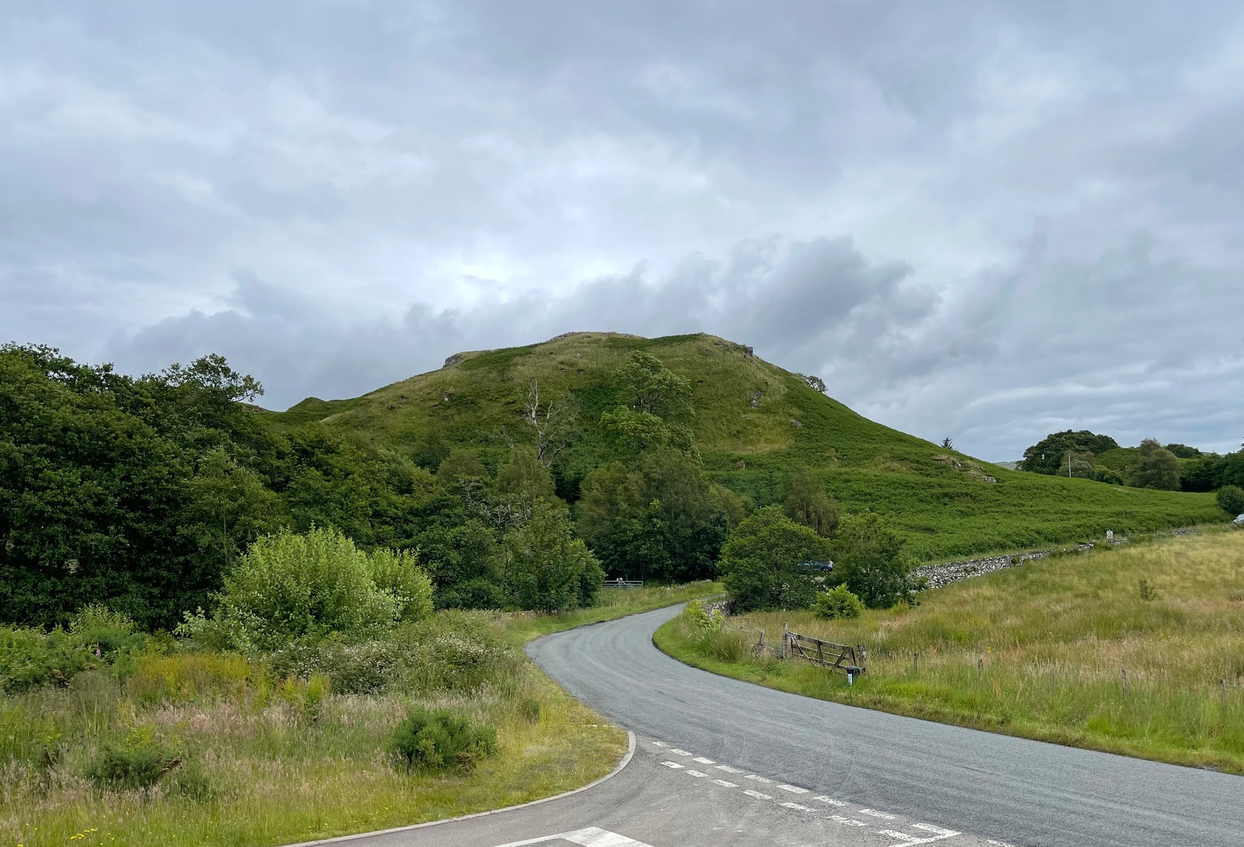
You can see the rocky hillock ‘pon which this old dun sits from the roadside – and can approach it by either climbing up the slope, or go round t’ back and approach it from t’ track. Either way, it’s easy to get to.
Archaeology & History
This old dun was rather ramshackled when I used to sit here, sometimes on my way home from working at the Inverliever Nursery, a bit further up the lochside — but it was a good spot to sit and daydream into Loch Awe and beyond…
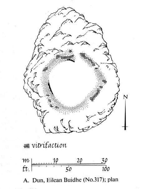
Described as a vitrified fort, the structure is oval in shape. Thought to have been constructed in the Iron Age, Dun Toiseach was originally about 50 feet across and its walls averaged 10 feet thick, with an entrance at its northeastern side. The Royal Commission lads (1988) described it thus:
Dun Toiseach plan (after RCAHMS 1988)
“Situated on a prominent rocky knoll overlooking the S end of Loch Awe 250m ESE of Torran farmsteading, there is a severely ruined dun measuring about 16m by 13m within a wall which has been some 4m thick. Two stretches of outer facing-stones are visible, as well as a few possible stones of the inner face, but, particularly on the NE, the wall has been severely robbed and the core material scattered. The entrance lies on the NE, the innermost portion of the SE passage-wall and what may be a door-jamb on the opposite side still being visible. The knoll has acted as a focus for recent field-walls, but there is no indication that it was additionally defended by outworks. A small modern cairn…surmounts the dun wall on the SE.”
References:
Royal Commission on the Ancient & Historical Monuments of Scotland, Argyll – Volume 6: Mid-Argyll and Cowal, HMSO: Edinburgh 1988.
This is a fine-looking monument amidst a fine piece of landscape! The site was constructed over various centuries, beginning in the Iron Age, with the earliest parts being the traces of walling on the outer edges. This first section of the fort “measures about 245m in length by a maximum of 50m in width internally,” and much of it can still be traced all along the full length and breath of the geological ridge upon which it sits. However, the timber-laced walls that stood all round the edges have, obviously, all but disintegrated. This earlier part of the fort, wrote Richard Feacham (1977),
“was superceded by a small subrectangular, now vitrified fort, about 170 feet long by 60 feet wide, and by a circular and probably vitrified dun measuring about 60 feet in diameter.”
View of the Dun (Smith 1885)Looking out from the dun
There was ample water supply for the people who may have lived on this ridged fortress, as there is still a fresh water spring on the southeast edge of the hill. And it seems pretty obvious that this fort was occupied for some considerable time into the Common Era, as material remains found amidst excavation work here at the end of the 19th century, “including metalwork of Roman date…suggests an occupation in the early first millenium AD.” (Harding 1997)
Folklore
The folklore and legends of this site (aswell as the surrounding district) are considerable, and for now I must refrain from writing all there is (it’d take me ages!). Needless to say, R. Angus Smith’s (1885) fine old history and folklore work is the source of much material. Smith told us that,
“There are many stories about it. It has been called the beginning of the kingdom of Scotland, the palace of a long race of kings; also the Halls of Selma, in which Fingal lived; the stately capital of of a Queen Hynde, having towers and halls and much civilization, with a christianity before Ireland; whilst it has also been considered to be that which the native name implies, simply the fort of the sons of Uisnach, who came from Ireland, and whose names are found all over the district, and who in the legend are reported to have come to a wild part of Alban.”
References:
Feacham, Richard, Guide to Prehistoric Scotland, Batsford: London 1977.
Harding, D.W., “Forts, Duns, Brochs and Crannogs,” in The Archaeology of Argyll (edited by Graham Ritchie[Edinburgh University Press 1997]).
Royal Commission on the Ancient & Historical Monuments, Scotland, Argyll- volume 2, HMSO: 1974.
Smith, R. Angus, Loch Etive and the Sons of Uisnach, Alexander Gardner: London & Paisley 1885.
")

")