Split Stone, Bridge of Allan, Stirlingshire

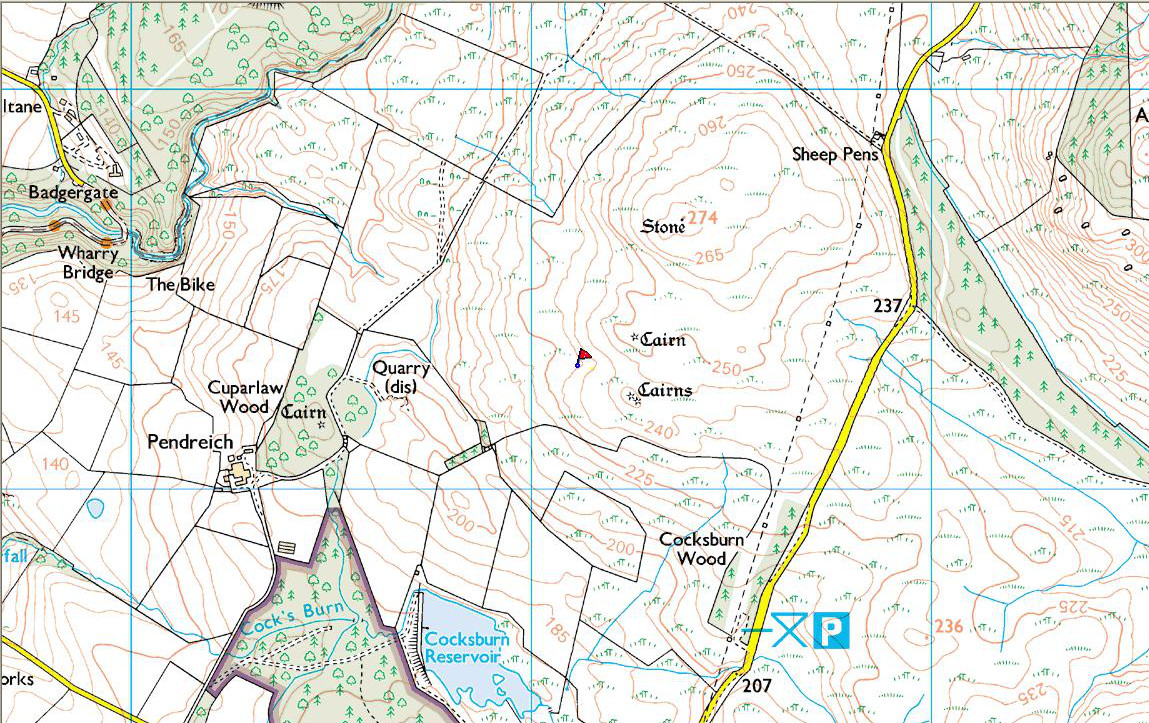
Split Stone mapStanding Stone: OS Grid Reference – NS 81116 99311

Getting Here

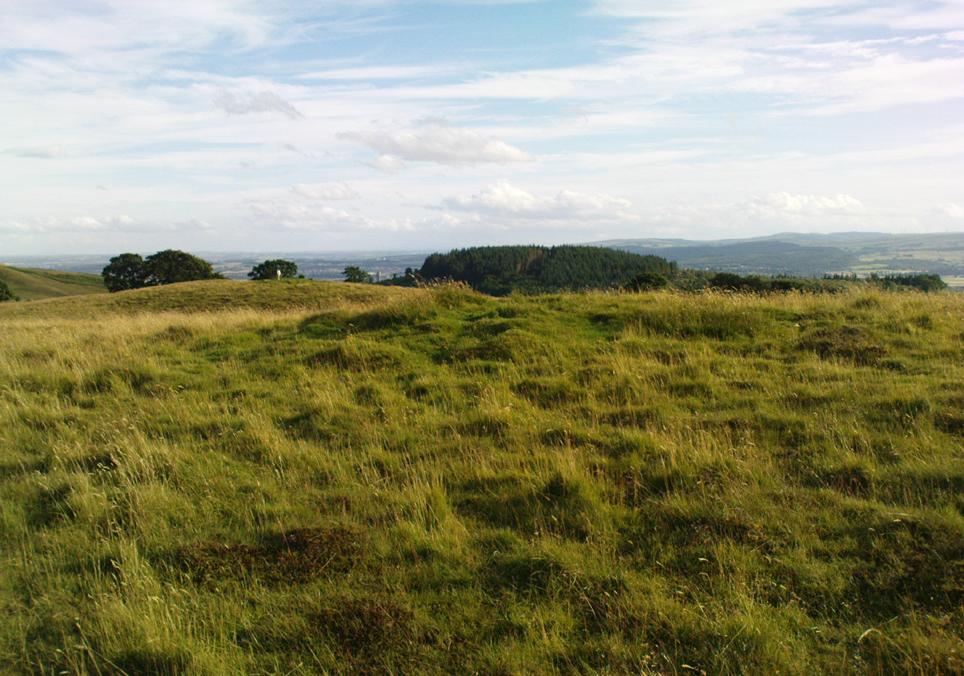
Take the same directions as if you’re gonna find the Pendreich Moor cairn up the hills behind and north of Stirling University (there are 2 very close to each other).  Once upon the cairned hill, walk dead straight WNW for 100 yards or so, or down the slope into the small valley, then westwards.  You’ll hit an overgrown length of very old walling.  Keep walking along here and, below it, you’ll find these stones laying down in the shallow grasses on the south-side of the all-but dried stream.  The large Cuparlaw Wood cairn is 0.4 miles west of here.

Archaeology & History
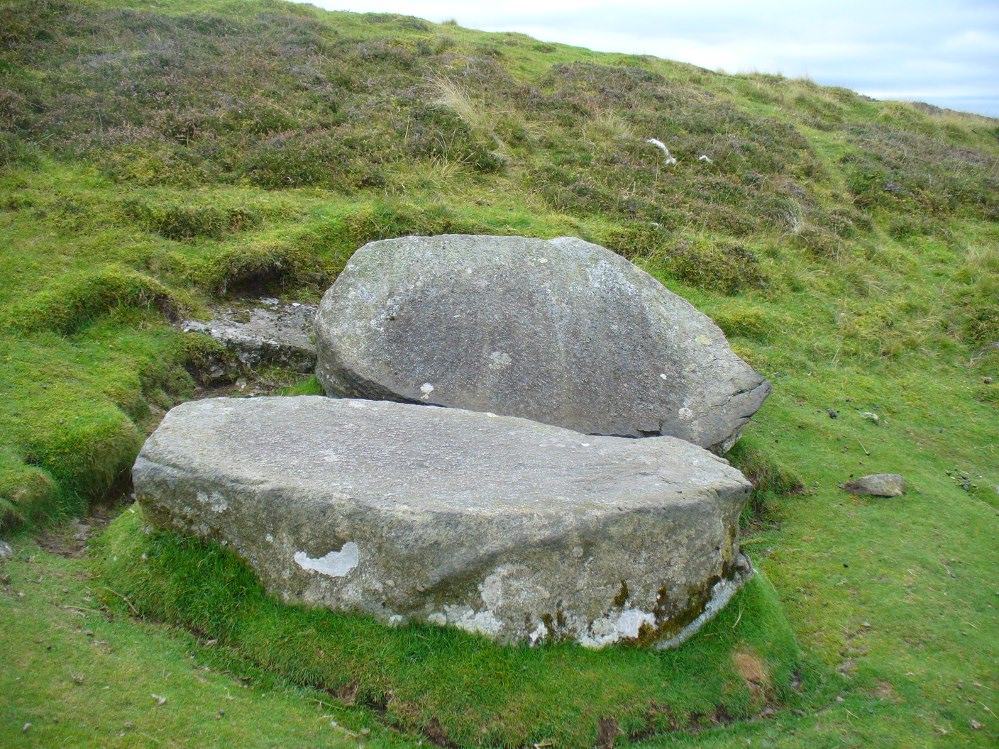
The Split Stone, Pendreich

This is something of an anomaly.  There is no previous written history about the place (that I can find) and archaeologists and historians on The Prehistoric Society and CBA forums can offer no other explanation when asked: is this a standing stone that, many centuries ago, was cut and prepared to be erected, but never made it into the intended monument? (wherever that might have been)  And so, I offer it onto TNA and ask the same of any readers, geologists or archaeo’s who might have an explanation for this curious, large split piece of stone, that lays silently on the western moorland edges of the Ochils, asking the same question.

When I first came across this site I was simply perplexed as to the why’s and wherefore’s of who had cut such a large rock into approximate halves.  I must have walked around it many times, puzzling what the purpose would have been of doing such a thing, and how long ago the ‘split’ had been performed.  About a year later I ventured up again and, when leaving to head back into Stirling, found no resolution to my puzzlement.  It had me truly stumped!

It wasn’t until I visited the prehistoric Witches’ Stone about 15 miles away near Monzie Castle last year, that one of those ‘eureka!’ events occurred.  The last thing on my mind was the curious split rock above Bridge of Allan.  Fellow antiquarian Paul Hornby and I were taking photos of the Witches’ Stone, when one of us remarked how unusually flat and smooth one face of this upright standing stone was – in fact, incredibly flat and smooth – and that’s when it hit me! As I walked round and round the Witches’ Stone, the similarity between this upright example and the one laid on the ground about 15 miles away got stronger and stronger.
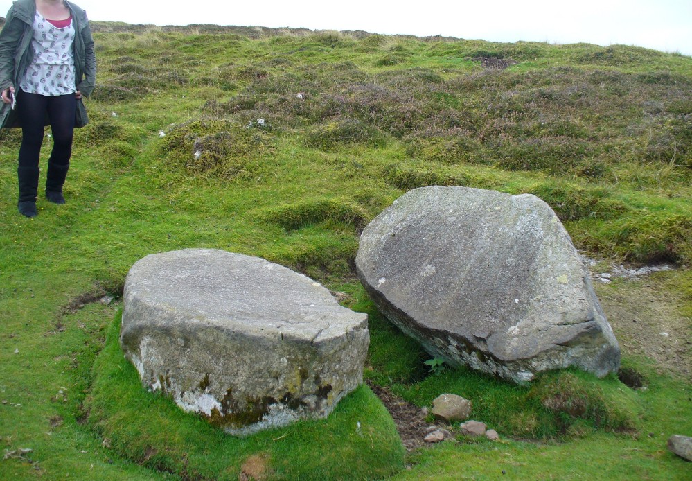
The Split Stone, looking east

A week or two later, archaeology student Lisa Samson and I went back to the Split Stone to have another look at it.  Without doubt, the appearance and size and type of rock were one and the same.  The only real difference between the Witches Stone and this Split Stone on the edge of Pendreich Moor, is that one stands upright and the other is laid down.

As you can see from the photos, we have a large rock, 5-6 feet long, which was, at some time many centuries ago, split almost straight down the middle, following a natural line of weakness or mineral deposit running through the stone.  In all probability this was a standing stone prepared and ready to be used in some neolithic or Bronze Age monument not too far way—but for some reason it never made the journey to its intended spot.

The age of this split rock needs assessing correctly by geologists.  Walking around the earthfast halves, it is difficult to see any recent evidence of mason marks that might help us determine when the rock was cut like this.  In looking at erosion marks on cut-and-dressed quarried stone from post-medieval periods, we find no equivalent scars on this Split Stone.  There is what may be faint evidence of some cuts into the stone at the top and side, but these are very debatable; and very probably it seems that the stone must have been cut a very long time ago, thousands of years back, in order to erode all obvious mason marks.  But it would be good to get a geologist to have a look and confirm or deny such things.

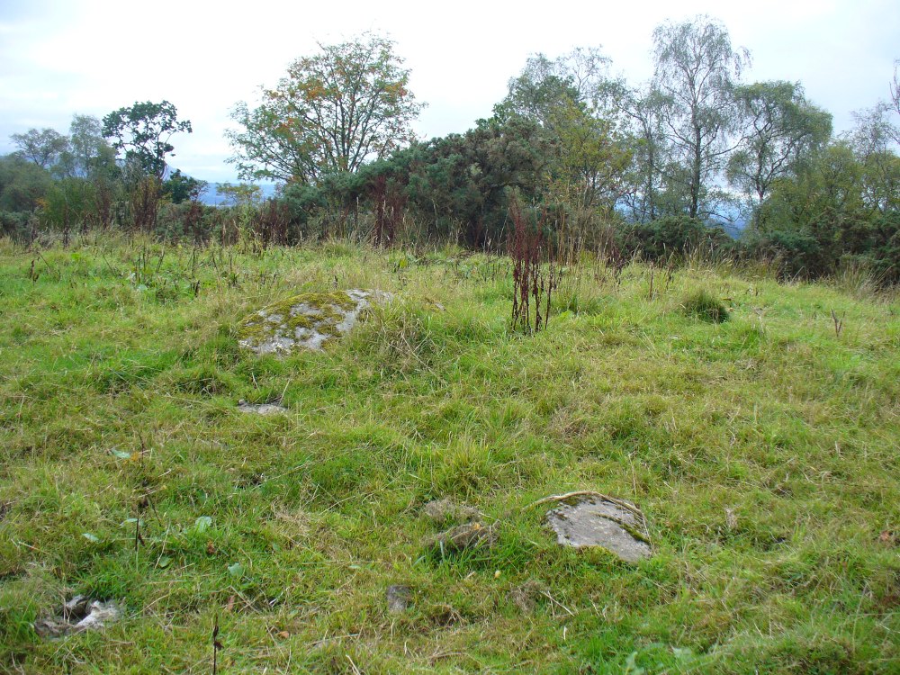
…And, as if this isn’t a mystery unto itself:  walk across the dried stream and go up the slope right in front of you immediately north.  There’s a small, almost level ridge you’ll reach after 30 yards up, before the hill then rises further.  If you notice, in the grasses and heather around you, there’s much more of the overgrown ‘walling’ here along this ridge—and some of it, with dips here and there and about three feet tall in places, is in a circle!  It’s man-made, it’s a ring of stones, you can see it on GoogleEarth pretty clearly, and it’s not in any official record books.

Watch this space!

© Paul Bennett, The Northern Antiquarian

Cuparlaw Wood, Bridge of Allan, Stirlingshire

Cairn:  OS Grid Reference – NS 8046 9916

Also Known as:

  1. Canmore ID 47128
  2. Pendreich

Getting Here

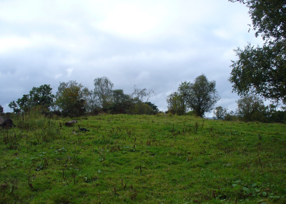
The rise of Cuparlaw cairn

From Bridge of Allan go down the main A9 road towards the University, but turn left up the Sheriffmuir road, 100 yards up turning right to keep you on track up the steep narrow dark lane, turning left at the next split in the road. Follow this for a mile or two all the way to the very end where the tell-tale signs of the unwelcoming english incomers of ‘Private’ now adorns the Pendreich farm buildings.  There’s a dirt-track veering uphill diagonally right from here. Go up here and as it bends slightly left, look into the open copse of trees to the highest point here less than 100 yards to you right. That’s it!

Archaeology & History

Lisa gives an idea of scale

The remains of this prehistoric tomb sits right on the very crown of the hill round the back of Pendreich, covered on its western edges by old gorse bushes.  Its eye speaks with the nearby sites of the Fairy Knowe to the south, the fallen standing stone of Pendreich Muir to the northeast, the associated cairns to the east, and the Pictish fortress of Dumyat behind them.  When I came up here for the first time last week with local archaeologist Lisa Samson, we found that the land upon which the cairn now lives is fertile with a variety of edible (Boletus, Amanita, etc) and sacred mushrooms (Panaeolina, Psilocybes, etc).  And, despite being told by locals and the archaeology record as a place where very little can be seen, I have to beg to differ.

Fallen stone at the cairn edge

The crowning cairn is of course much overgrown and has been dug into in earlier years, but just beneath the grassy surface you can feel and see much of the stone that constitutes this buried site.  The cairn itself rises a couple of feet beneath the grass and is clearly visible as you walk towards it.  At its edges there seems to be the fallen remains of a surrounding ring of stones.  Inside of this ring we can see and feel the overgrown rocky mass and open cists sleeping quietly, awaiting a more modern analysis to tell us of its ancient past.  When the site was visited by the Royal Commission lads in the 1960s, they went on to tell us the following about the place:

“This cairn is situated on the summit of a low knoll within a felled wood, 170 yards ENE of Pendreich farmhouse at a height of 600ft OD. It consists of a low, grass-covered mound which measures 40ft in diameter and stands to a maximum height of 1ft 6in.  The surface is disfigured by pits caused in 1926 when the cairn was opened and three cists were uncovered. Two of these contained no relics; in the third there were fragments of bones and a broken beaker, some sherds of which are preserved in the Smith Institute, Stirling.”

Although we find the scattered remains of old farm equipment lying round the edge of this tomb, it’s still a good site to visit and, I’d say, worthy of further archaeological attention.

References:

  1. Royal Commission on the Ancient & Historical Monuments Scotland, Stirling – 2 volumes, HMSO: Edinburgh 1963.
  2. Royal Commission on the Ancient & Historical Monuments of Scotland, Archaeological Sites and Monuments of Stirling District, Central Region, Society of Antiquaries of Scotland 1979.
  3. Watson, Angus, The Ochils – Placenames, History, Tradition, Perth & Kinross District Libraries 1995.

© Paul Bennett, The Northern Antiquarian

Pendreich (2), Bridge of Allan, Stirlingshire

Cairn:  OS Grid Reference – NS 8123 9938

Also Known as:

  1. Canmore ID 47119
  2. Sheriffmuir Road 1

Getting Here

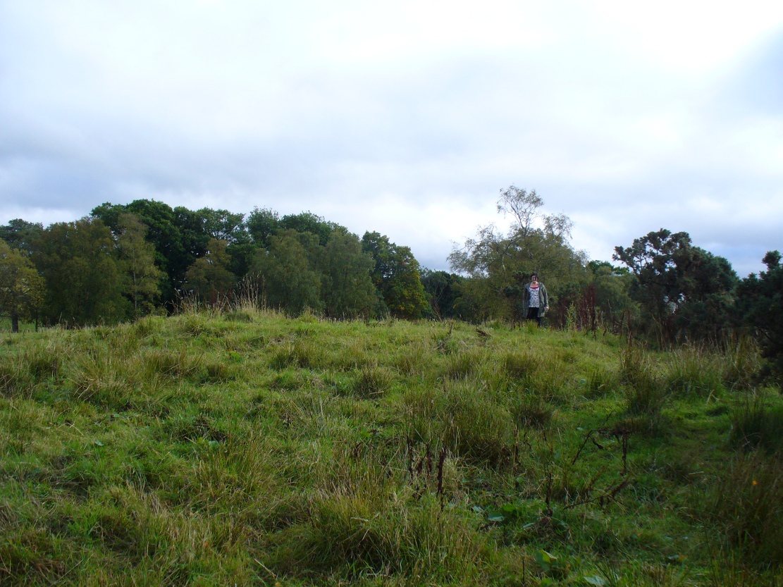
Overgrown Pendreich 2 cairn (Pendreich 1 in background)

Take the same directions to get to the Pendreich 1 cairn.  Once on the hilltop, look across the moor a short distance to the north and you can just see this overgrown site a couple of hundred yards away.  From Pendreich 1 walk down the grassy slope and then up the gentle ahead of you, till it levels out a bit, keeping your eyes peeled for the change in vegetation and colour that gives the game away!

Archaeology & History

Like its companion cairns — Pendreich 1 & 3  — little has been said of the place.  Although much overgrown and visible as a small bumpy grassy mass, with the stones beneath the surface, it’s never been excavated as far as I’m aware.  It was referred to in the Scottish Royal Commission inventory for Stirlingshire (1963), site no.4, as ‘Mound, Sheriffmuir Road 1’, in which they wrote:

“Another possible Bronze Age cairn is situated on a low ridge, 200yd N of (Pendreich 1), and at a height of a little over 800ft OD.  It is a grass-covered, stony mound which measures 20ft in diameter and stands to a height of 9in above ground level.”

References:

  1. Royal Commission on the Ancient & Historical Monuments Scotland, Stirling – volume 1, HMSO: Edinburgh 1963.

© Paul Bennett, The Northern Antiquarian