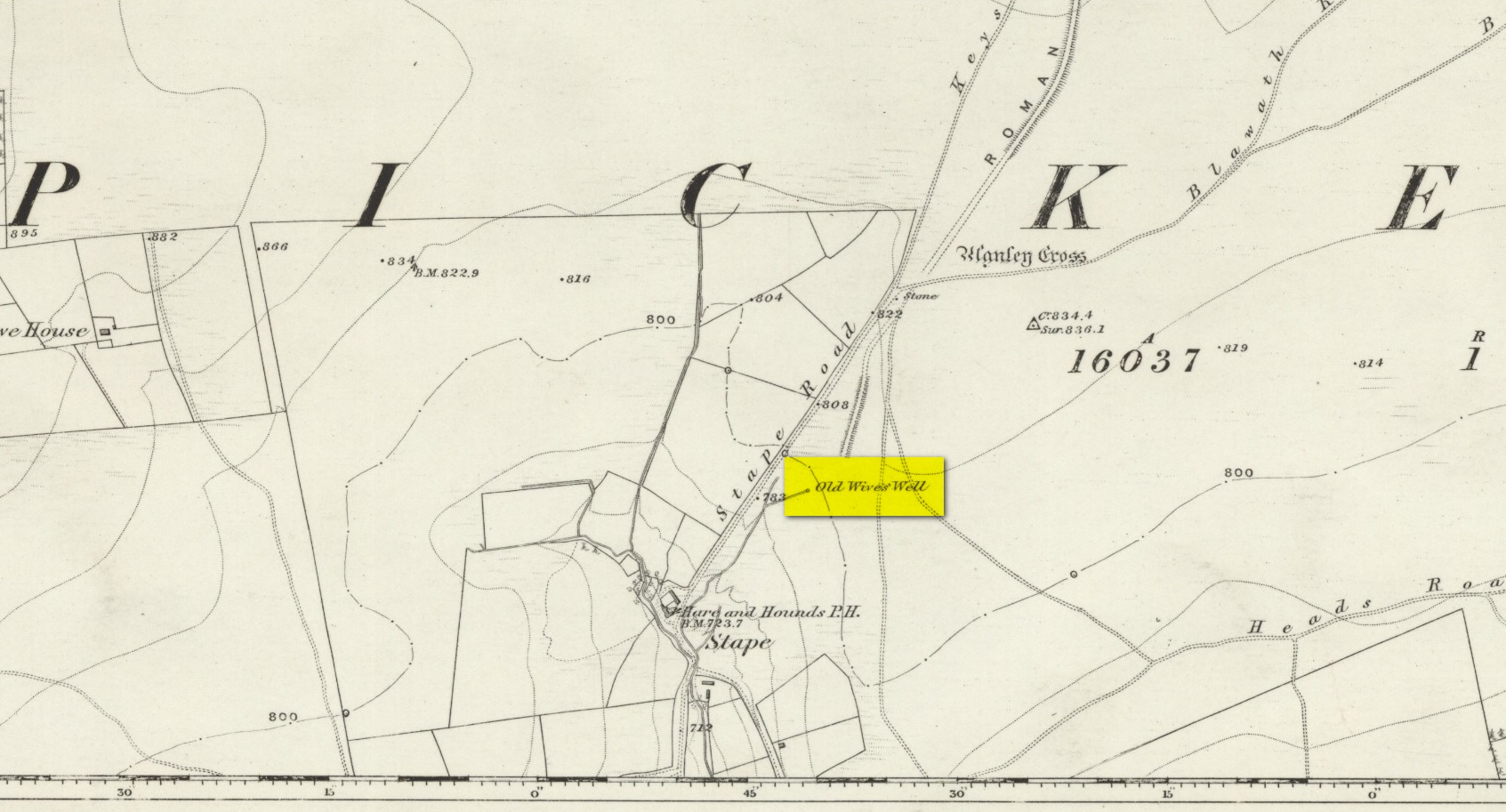
The history of the site is scanty to say the least. It first seems to have been recorded when the Ordnance Survey lads came here in the 1840s, although they left no record as to why the site was given such a dedication. It’s a decidedly pre-christian title as the name “old Wife” is usually indicative in northern counties as being related to the primal Earth deity of northern England and lowland Scotland (when we reach the Highlands and Ireland, She becomes known—amongst other names—as the cailleach). However, apart from its name we have no additional information. Neither the holy wells writer Edna Whelan (1989; 2001), nor hydrolatry researcher Graeme Chappell were been able to find anything about the place in their own researches. And so we must go on name alone…
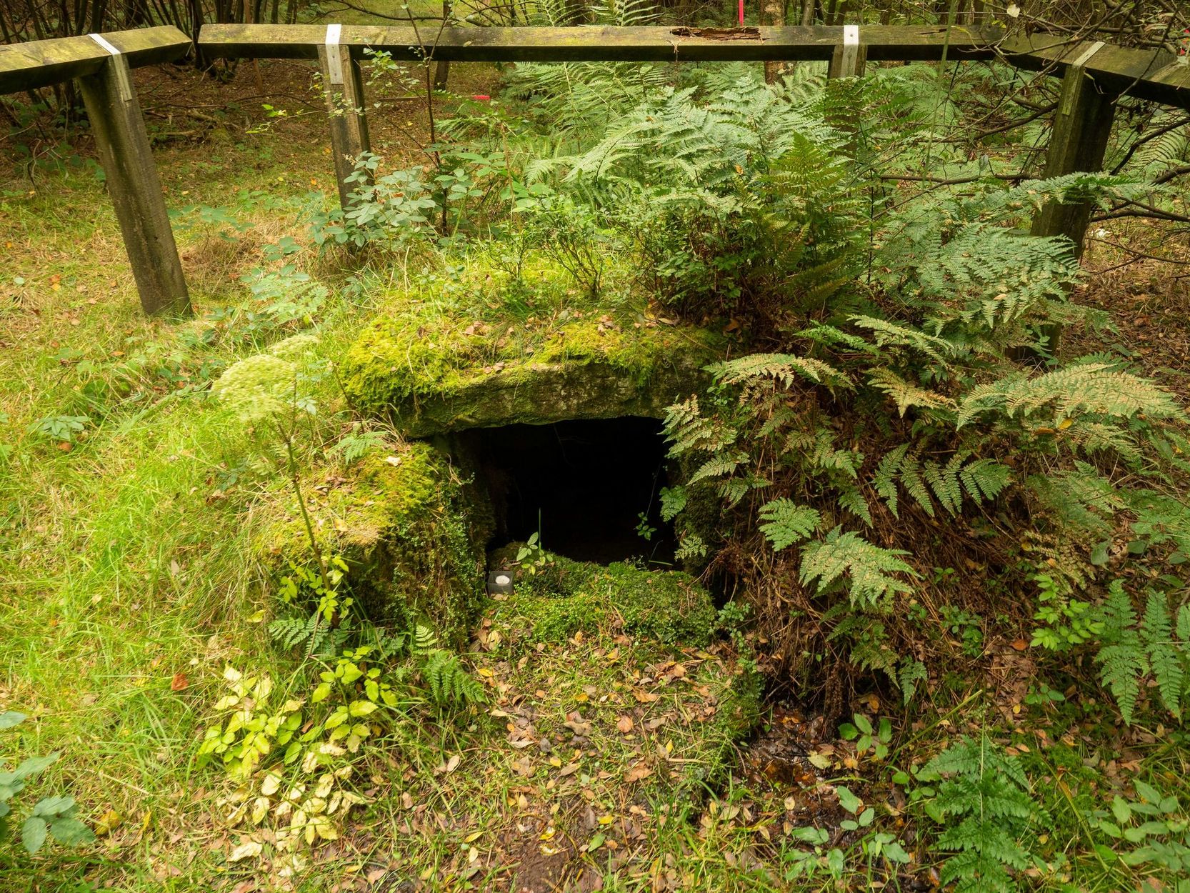
The waters bubble up into a small stone-lined chamber with the words Nattie Fontein carved into the lintel. This is something of a mystery in itself, for, as Edna Whelan (1989) told,
“it would be most unusual for the word fonten to be used for a spring in North Yorkshire: ‘keld’ is the local word. The rather roughly inscribed word may be a corruption of Fons Natalis, the name of a Celtic water nymph.”
Graeme Chappell (2000) meanwhile, noticed in a visit to the site in June 1999,
“that the N and A in “NATTIE” are carved in such a way that the word could be read as “MATTIE FONTEIN” perhaps meaning “Mother Fountain”. This might then be another reference to the Old Wife?”
He then goes on to note how,
“the latin word ‘natalis‘ meaning ‘birth’ and its link with the roman Festival ‘Dies Natalis Sol Invictus‘ (day of the birth of the unconquered sun) which took place on the 25th December. Natalis also gave rise to the welsh word ‘Nadolig‘ – meaning Christmas.”
This Yuletide element has an intriguing relationship with the name of the well; for to the west of Yorkshire’s borders into Cumbria there was annual gathering known as Old Wives’ Saturday that took place on the first Saturday after Christmas, or first Saturday of the New Year in a person’s house or inn, where a feast was had to bring in the New Year; but there is no known written lore of such a tradition here.
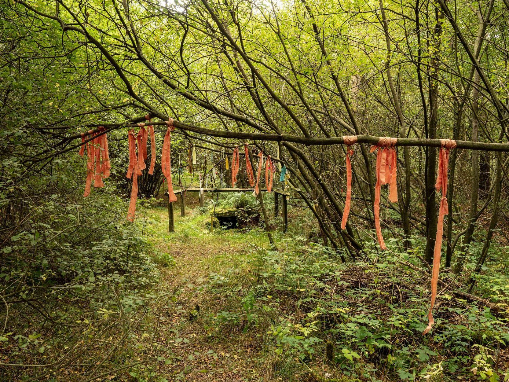
Nowadays the old tradition of hanging rags on the trees surrounding the well as offerings to the spirit of the place (known as memaws in parts of Yorkshire, and clooties in Scotland) has become a regular practice of those who hold such sites as sacred in their own way. Whelan mentioned seeing memaws here in the 1908s, but the Northern Antiquarian contributor Jon Barker told that, “The rags are a comparatively recent addition to the well, it is not a tradition there. When I used to go in the ’60s therewere no rags.”
On an even more curious note: very recently (from when this profile was written), the Northern Antiquarian contributor and photographer James Elkington visited Old Wives’ Well for the first time. It was a grey overcast day and when he arrived here, there was a woman ahead of him at the head of the well. I’ll let him tell the rest of it in his own words:
The Old Wives Well, Stape (James Elkington)Old Wives Well at Stape (James Elkington)
“In front of the well was a lady dressed in what looked like a white nighty, she had her back to me. There was a candle lit nearby, and her hands were in the water moving slowly about like she was washing something. She had long dark shoulder length hair. As I was about 25 feet away I was sure she wasn’t aware of me, and I thought it would make a good photograph. I quietly put my bag on the ground and got my camera out, and looked up and…she was gone! I couldn’t have taken my eye off her for more than 5 or 6 seconds. I looked all around and there was no sign of her. Even if she had legged it through the woods I would have seen her. I think it was then that I realized that I may have had ‘an encounter’. I quickly took three pics of the Well and got the hell out of there!”
He rang me once he had regained his senses in a somewhat emotional state and recounted over and over what had just happened. Whether this was a visual manifestation of the genius loci of the we can’t say. But such encounters are not unknown at numerous sacred water sites all over the world. We can only hazard a guess that this is what he was fortunate to encounter.
Just a few hundred yards north is the old Mauley or Malo Cross, which may or may not have had some mythic relationship with our Old Wives…
The first that I read of this place was in an article of the Scottish Ecclesiastical Society journal, on the parish history of Horndean. Standing originally at the edge of the ruined remains of the old churchyard, the author W.S. Moodie (1915), told that a long lost,
“grim relic of olden days is said to have existed here till fifty years ago. This was the Witches Stone—an upright pillar with a hole in it, to which the bodies of the poor unfortunates were fastened after they had been glede, while the faggots were piled around.”
A perusal in the Royal Commission inventory (1915) of the same year told that it had been moved several miles northeast to Paxton Cottage (NT 9279 5229) in the adjacent village. It was described as being,
“about 4 feet 6 inches in height above the ground, some 2 feet in breadth, tapering towards the upper end, and about 7 inches thick. Near the top are two perforations, not quite on the same level, about 2 inches in diameter at the surface on either side, constricted towards the Centre, and about 9 inches distant from centre to centre.”
Is this old stone still in existence…?
References:
Moodie, W. Steven, “Ladykirk, or the Kirk of Steill, Berwickshire,” in Transactions of the Scottish Ecclesiological Society, 4:3, Aberdeen 1915.
Royal Commission Ancient & Historical Monuments, Scotland, Inventory of Monuments and Constructions in the County of Berwick, HMSO: Edinburgh 1915.
Healing Well (destroyed): OS Grid reference – TQ 330 827
Also Known as:
Balsamick Well
Archaeology & History
In that typically rambling style beloved of early writers on medicinal springs, Timothy Byfield (1687) narrated the tale of uncovering this well in an almost alchemical discourse. It was located when digging out the cellar of a house near Charles Square in the 1680s. Upon investigation, the waters were found to possess a good quantity of sulphur and a small amount of iron, leading Byfield to proclaim it could cure a whole army of medical disorders, from cleaning out blockages in the alimentary canal, to treating kidney stones, scurvy, ulcers, headaches, migraines and more. If used correctly and in the right amount,
” There is,” he says, “no unwholesome glebe (concretion) or any dangerous mineral or metal (in them) that casts one unhappy ray into this healing fountain.” On the contrary, they set up ‘* such a pretty bustle or ferment in nature that makes gay a well-temper’d Healthy Body.”
In the early days when Spa Wells were in vogue, the Balsamic Well became a competitor to the nearby St Agnes le Clear Well, which is probably the reason why one doctor dissuaded the toffs of the time to avoid it!
The waters possessed a slight vinegar-esque flavour—hence the name. In John MacPherson’s (1871) work, he described it as a “chalybeate well” and despite it having that typical “bituminous scum on it, strange to say,” it yielded “a pleasant aromatic flavour.” The site has long since been covered over.
References:
Byfield, Timothy, A Short and Plain Account of the late-found Balsamick Wells at Hoxdon, London 1687.
Foord, Alfred Stanley, Springs, Streams and Spas of London: History and Association, T. Fisher Unwin: London 1910.
Hembry, Phyllis, The English Spa 1560-1815, Athlone Press: London 1990.
MacPherson, John, Our Baths and Wells, MacMillan: London 1871.
Sunderland, Septimus, Old London Spas, Baths and Wells, John Bale: London 1915.
Cross (destroyed): OS Grid reference – SD 5152 9280
Also Known as:
Cold Stone
Market Cross
Archaeology & History
Not to be confused with the carved cross fragments held in the local church, this old town cross has long since gone. It’s existence was recorded by the great Kendal historian Cornelius Nicholson (1861), but even in his day, this “obstruction” as he called it, was no longer standing. Known as the local Market Cross where all the wheeling and dealing took place—official ones, as well as the not-so-official works of local folks—it stood just off Stricklandgate,
“opposite the Covered Market, and was an obstruction in the street. There still remains a remnant of it in a stone at the corner, vulgarly called “cold stone,” where the charters and so forth were usually proclaimed. Cold stone is a corruption of “call stone;” an appendage common to most ancient towns, where all public matters were “called” prior to the “institution” of belman.”
This folk etymology of “cold” needs to kept in mind when we come across other stones of this name. …The earliest record of a market held at Kendal is from 1402, but written records of the Market Cross are scant until 1714. Such edifices tend to be architecturally ornate, but we have neither sketches nor descriptions of this lost site and must await the work of fellow researchers who may hopefully find out more.
References:
Nicholson, Cornelius, The Annals of Kendal, Whitaker & Co.: London 1861.
Smith, A.H., The Place-Names of Westmorland – volume 1, Cambridge University Press 1967.
Chambered Cairn (destroyed): OS Grid Reference – H 277 998
Archaeology & History
Included in Eamon Cody’s (2002) magnum opus, this site has long since gone. It was highlighted on the 1845-47 OS-map of the area and the only subsequent information about it was written in the 1903 Ordnance Survey Name Book, where it was described as a “supposed Giant’s Grave” that was marked by a large spread of boulders.
Perhaps the only thing we can ascertain here is from the name Giant’s Grave. Invariably, giants are part and parcel of creation myths in early traditional societies. Such giants, as well as being huge mythical creatures, can also be the progenitor of tribes and communities, i.e., the person who laid the initial foundation of where the tribe came to live, usually an early queen, king or shaman figure. So, in the case of this Giant’s Grave, it was likely to have been known as the burial place of such a figure: mythical in importance as well as size.
References:
Cody, Eamon, Survey of the Megalithic Tombs of Ireland: Volume VI – County Donegal, Duchas: Dublin 2002.
On the northwest side of the Loch of Boardhouse can still be found a spring of water which was, in bygone times, the abode of the supernatural creature known as the troll or trow. The site is described in local place-name records and is located near the foot of a slope near Westerhouse, from where a small channel of water runs down into the Loch of Boardhouse about forty yards away. When it was last described in the 1960s, all folk memory of its heathen inhabitants had seemingly been forgotten and no folk-tales seem to have been recorded. Thankfully, the Well itself is still shown to exist on modern OS-maps.
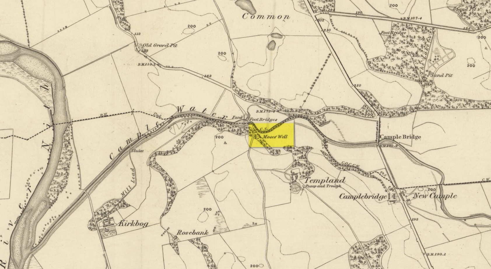
This little-known Biblical-sounding spring has apparently long since fallen back to Earth (perhaps there might be some local folk who could find out for certain). Shown on the 1861 Ordnance Survey map as being at the side of the wall in the small copse of trees—immediately east of kirk- place-names and a half-mile north of St Ninian’s Well—it was briefly described by T.C. Ramage (1876), who seemed to know nothing of its lore, merely telling us that,
“on Templand farm, close to the wooden bridge over the Cample, there is Moses’ Well, an unusual designation, but which some Knight Templar may have given in remembrance of his toils in Palestine.”
The Templar designation was deemed by Ramage to come from the name of the farm. However, a few years prior to this, the early Scottish place-name surveyors were traversing the area and found from local people how it derived “its name from a Tinker named Moses Marshall who with his family lived near it in a Camp during the time they had the small pox.” The Well was also included in the Morris survey (1982), but without comment. Another Moses Well can be found 44½ miles to the northeast, near Galashiels at NT 4046 4306.
Cross (destroyed): OS Grid-Reference – SE 3224 4498
Archaeology & History
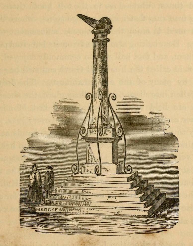
A Charter in the time of King John allowed for markets to be held in Harewood from 1209 CE onwards, “on the first day of July and the two following days, and also to hold one market there every week on the Monday.” But whether or not a market cross was erected that far back, we don’t quite know. Certainly, the edifice illustrated by John Jones (1859) in his standard work on Harewood didn’t date from such an early period! It stood close to the old road junction to Wetherby in old Harewood village, “a little below the intersection of the roads, and about fifty yards higher up than the market house.” Jones told us:
Harewood Cross (Jones 1859)
“It stood upon a large stone pedestal, and was approached by a quadrangular flight of seven steps, very broad, where the neighbouring farmers used to stand, and dispose of their butter, fowls, eggs, &c. It was re-erected, AD 1703, by John Boulter, Esq., and in the year 1804, when the road was lowered, it was taken down and destroyed. This is to be regretted, it might have been re-erected in another situation, if that was inconvenient, and would have been in the present day, not only an ornament to the village but a relic of the past, of which the villagers might have been justly proud. On the top of this cross there was a knur and spell, a game for which the village was celebrated in old times, while close to the toll booth there was a strong iron ring fastened to a large stone, where the villagers used to enjoy the barbarous amusement of bull baiting.”
References:
Bogg, Edmund, Lower Wharfeland, J. Sampson: York 1904.
Jones, John, The History and Antiquities of Harewood, Simpkin Marshall: London 1859.
Speight, Harry, Lower Wharfedale, Elliott Stock: London 1902.
Nothing has previously been written of this site. Its existence came to light during one of umpteen enquiries I’d made with a well-known and very respected local lady, born and bred in Killin (sadly, a dying breed), who is known as a fount of knowledge regarding the history of the area. We were talking about the ancient sites and folklore of the neighbourhood and, amidst being her usual helpful self she asked, “have you been to the Coin Tree? The place where we leave offerings to the spirit of the place?”
I hadn’t.
“No, I’ve never heard of the place.”
“We keep it quiet, ” she said, “for obvious reasons.”
I knew what she meant. The Fairy Tree at Aberfoyle is a case in point: littered with plastic pentagrams, children’s toys and so-called “offerings” of all kinds that have made it little more than a dumping ground for pseudo-pagans and new-age nuts that needs to be cleaned regularly by local folk.
Anyhow, our informant proceeded to give us directions to find the place, going out of the village, but asked that if we were to write about it, to keep its location quiet, “as the place is still used by us”—i.e., old locals. After a slow trek along one of the roads out of the village we saw nothing that stood out. Eventually we came across a fella relaxing in his garden and asked him if he knew anything about an old tree where offerings were made. He gave us that look that olde locals do, to work out whether you’re a tourist or not and, after telling him what we’d been told and who had told us —that seemed to do the trick!
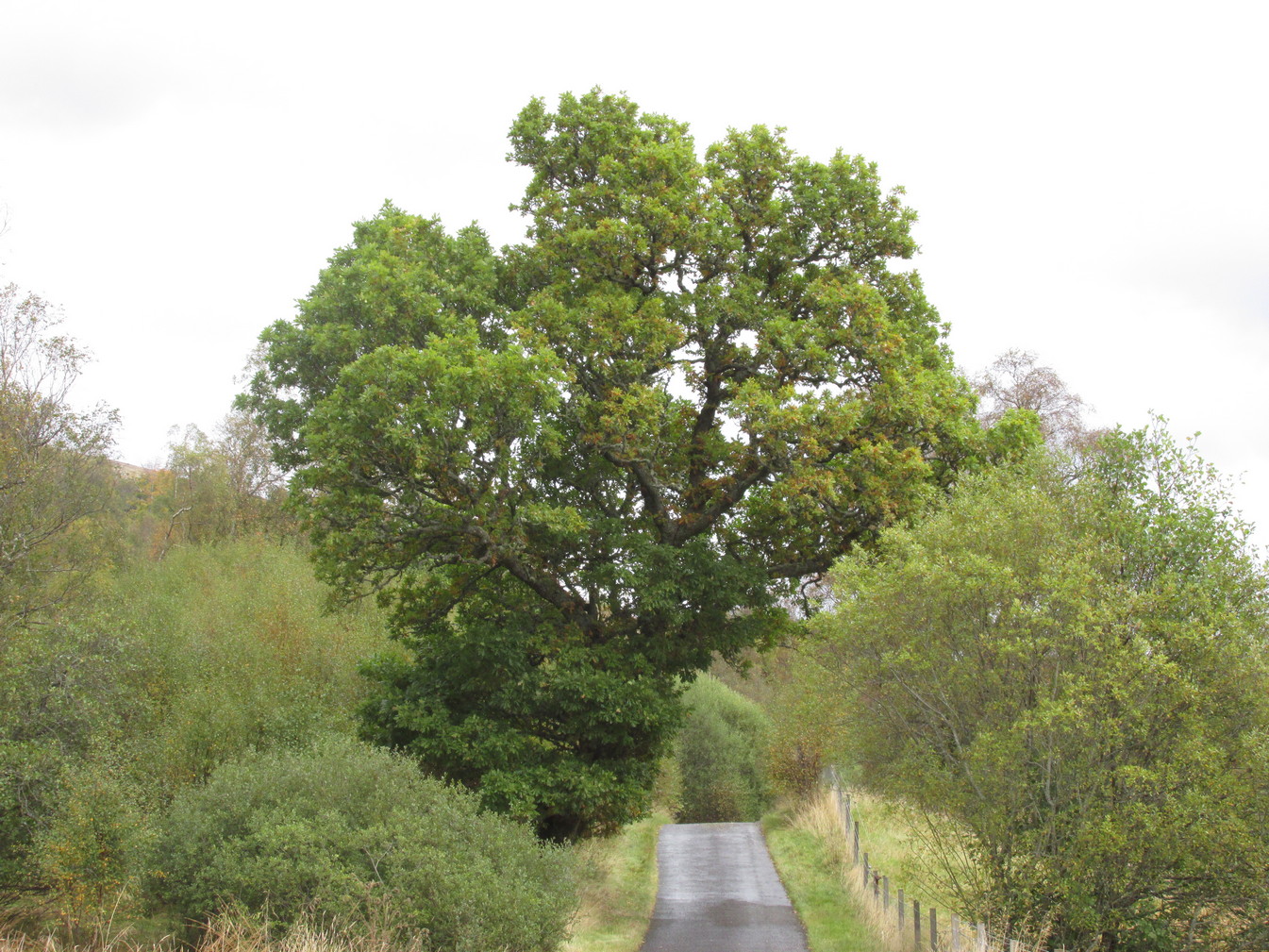
“You’d mean the Fairy Oak I s’ppose? Aye,” he said, “gerrin the car and I’ll drive y’ down to it.”
So we did. A short distance back along the road that we’d come down he stopped and walked along a to large oak tree beside the road. We’d walked straight past it—but in truth it’s not a conspicuous tree and unless you were shown where it was, you’d miss it as easily as we did (and I’m usually damn good at finding such things!). We thanked the fella for taking us to see it and he drove back home to leave us with out thoughts.
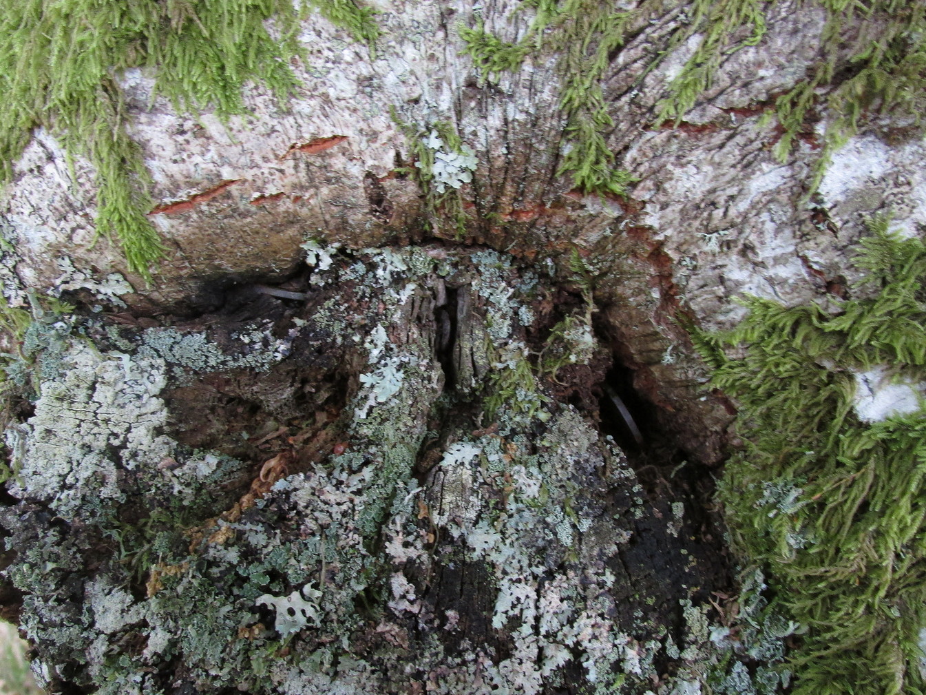
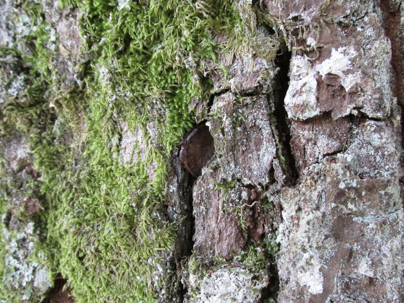
More coins as offeringsCoins for the little people
Embedded into the tree—some of them barely visible where the bark had grown over them—were clusters of old coins all around its trunk; some of them very old. These had been inserted into the tree as offerings in the hope that the little people, or the genius loci would bring aid to that which was asked of it.
In a field across the road there’s a large “fairy-mound” hillock, or tom as they’re known in the Gaelic landscape: one of Nature’s creations, but just the sort of place where many little people are said to live in many an old folk-tale. Some such mounds are old tumuli, but this aint one of them. It’s possible that it had some relationship with the tree where the fairy folk are said to reside but, if it did, our informants didn’t seem to know.
The important thing to recognise here is that in some of the small villages and hamlet in our mountains, practices and beliefs of a world long lost in suburbia are still alive here and there… But even these are dying out fast, as most incomers have no real attachment to the landscape that surrounds them. Simply put: they see themselves as apart from the landscape as opposed to being a part of it.
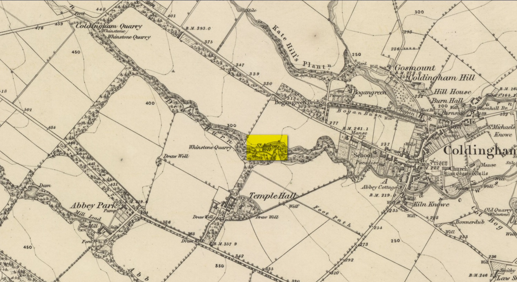
By the side of the stream known as St Andrew’s Burn, in the small wooded glen to the rear (west) of the Crosslaw Caravan Park (right by the side of the A1107 road), you can still find the flowing waters of this all-but-forgotten holy well that was dedicated to Scotland’s patron saint, god knows how long ago! The first description I’ve come across relating to the site is in William King’s (1858) early work on Coldingham Priory, where he told that,
“In a dean a little westward from the village, and on the border of the property of Bogangreen, is a spring of excellent water, called St Andrew’s Well, from which the monastery was supplied by leaden conduits, portions of which are occasionally turning up to view. These pipes are thick and well made.”
Fifty years later when Adam Thomson (1908) penned his magnum opus on Coldingham parish, the well was still in a good state of affairs. Hereby there grew much chamomile which, he thought, “the monks were wont to cultivate for the healing of the sick.”
Folklore
St Andrew’s feast day is November 30 and is known as Anermas.
References:
Hunter, William K., History of the Priory of Coldingham, Sutherland & Knox: Edinburgh 1858.