Duncroisk Enclosure, Glen Lochay, Killin, Perthshire

Enclosure:  OS Grid Reference – NN 5325 3607

Getting Here

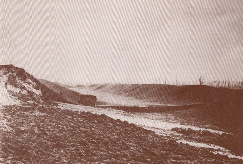
D. MacInnes’ ground plan

Take the single-track Glen Lochay road down past the Bridge of Lochay hotel at the edge of Killin, as if you’re gonna visit the superb cup-and-ring carvings opposite Stag Cottage (or Duncroisk 1).  Immediately past the garden of Stag Cottage is a small copse of trees and a couple of old wartime-looking buildings in the field above the roadside.  Go up past these buildings and onto the rise at the back.  You’re here.

Archaeology & History

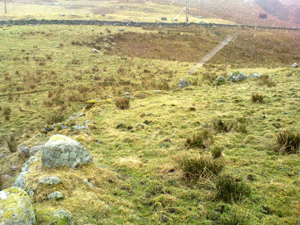
This is a fascinating site of multi-period historical usage, which Dugald MacInnes (2001) thinks may have its origins in the early Bronze Age or neolithic; but which I reckon was probably first used in the Iron Age.  Either way, we have here a large interesting well-preserved prehistoric stone enclosure, that has yet to be excavated.  I first came across it whilst gathering firewood from the adjacent copse and was quite puzzled by what seemed to be an extensive curved line of ancient walling running from its east to northeastern section, typical of prehistoric Iron Age walled structures common in northern England and beyond.  I must have paced back and forth along a 75 yard length of this section of walling a half-dozen times, wondering what the hell this place was.  And the more I looked at this section of the enclosure, the greater my conviction grew that this was constructed in prehistoric times.  And thereafter came the puzzle.
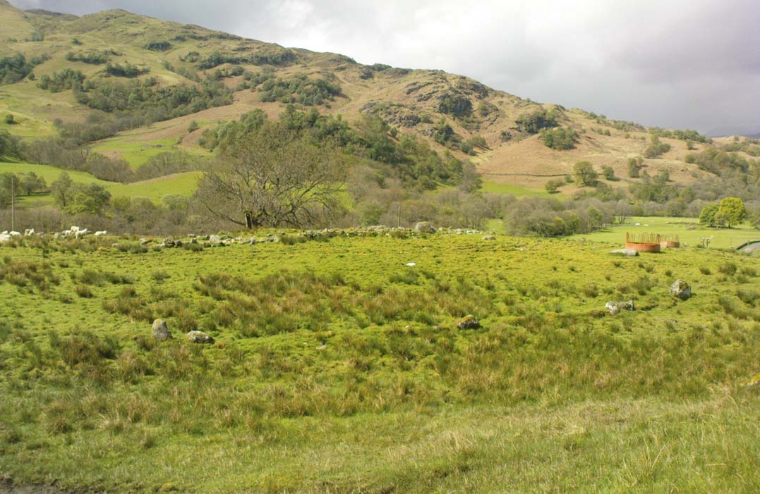
Looking down at the walled enclosure
NW section of walling

For along the southern walled section were a number of much more modern medieval and much later walled sections, including the remains of buildings that looked barely Victorian in age and nature.  The site was obviously being used presently by the local farmer for his cattle.  And so it became obvious that here was a large oval-shaped stone-walled enclosure or settlement that had been used over and over again through many centuries, with its origins seeming to be Iron Age in nature. Measuring approximately 195 yards (178m) in circumference, the structure has a maximum E-W diameter of 78 yards (71m) and N-S measurement of 44 yards (40m).

The mass of evidence for prehistoric activity is all round this hidden enclosure, with the fascinating clusters of cup-and-ring stones of Duncroisk and Corrycharmaig close by.  The small standing stones of Tirai 600 yards NW, and a similar prehistoric enclosure at Tullich ¾-mile NW show ample evidence of prehistoric man in this part of Glen Lochay.

Despite the size of the place, no literary reference of it occurs before MacInnes and his team came here.  His description is as follows:

“An oval enclosure, its boundaries formed principally from large water-worn boulders interspersed with drystone walling and in part by an earthen bank in the easternmost section, sits atop of a natural terrace about 155m OD.  The terrace slopes steeply to the west and south and cut into the western slope is a track, the course of which cannot be determined beyond the extent of the slope.  This track displays revetment in the form of stone coursing.

“The SW corner of the enclosure is angular rather than the rounded character of the other sections.  The W and SW sections are composed of coarsely constructed stonework in which large, 1m wide, often 1m high, water-worn boulders at two to three metre intervals, are interspersed with smaller boulders which form crude drystone coursing.

“The NE section is formed largely of large boulders, one of which is 1.5m in width and 1.2m high by 0.8m wide.  Sections of the northern part would appear to be robbed out, perhaps to construct the modern wall which lies about 25m to the north.  There are no remaining large boulders there, however, which could indicate their absence in the original construction of the enclosure.  The central section of the northern perimeter may be constructed of two outer skins of boulders, forming a wall about 0.9m wide, 0.4m high on its exterior, but reducing to 0.3m on its interior side.  Two sections could possibly be filled with a rubble core.

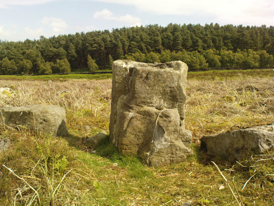
“The E section is formed by a low 0.3m high earthen grass-covered bank with occasional boulders.  This bank is about 0.2m high relative to the interior, but is about 0.5m to.0.8m high on its exterior side.  The NW side shows on the western side more evidence of double skin, rubble construction.  Close inspection of the stonework around the perimeter of the enclosure has revealed no evidence of shot-holes.  However a monolith situated in the NE has been split, but this would appear to be natural.  The interior of the enclosure is more or less level and grass-covered.  There is however, a slight drop in level in the western third of the interior.  This is defined by a linear slope which may be a lynchet.”
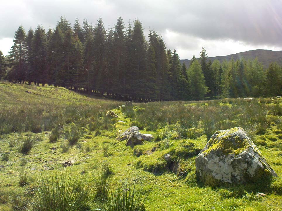
Northern section of enclosure
Upright stone in eastern wall

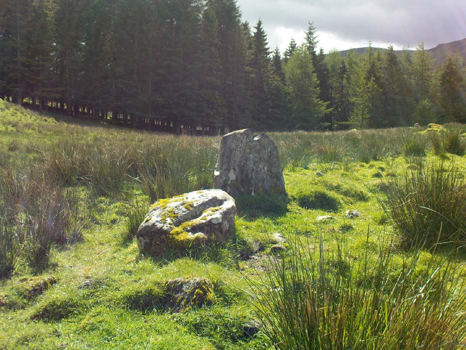
Northeast of the enclosure about 40 yards away is the normal drystone walling running along the sloping hillside.  But more intriguingly to archaeologists is the second line of much more ancient walling 76 yards (70m) further up the grassy slope, running at an angle across and uphill in a northwesterly direction.  This line of walling has a distinctly Iron Age flavour to it and is composed of some very large upright monoliths, almost Bronze Age in nature!  It continues into the next field for some 400 yards and onto Duncroisk Burn — the other side of which we find another line of ancient walling with an impressive cup-and-ring stone incorporated.

There’s tons more to be said of this region…

…to be continued…

References:

  1. MacInnes, Dugald, An Archaeological Field Survey of a Deserted Settlement at Duncroisk Farm, Glen Lochay, Association of Certified Field Archaeologists: Glasgow 2001.

© Paul Bennett, The Northern Antiquarian

Dun Toiseach, Ford, Kilmartin, Argyll

Dun:  OS Grid Reference – NM 8808 0476

Getting Here

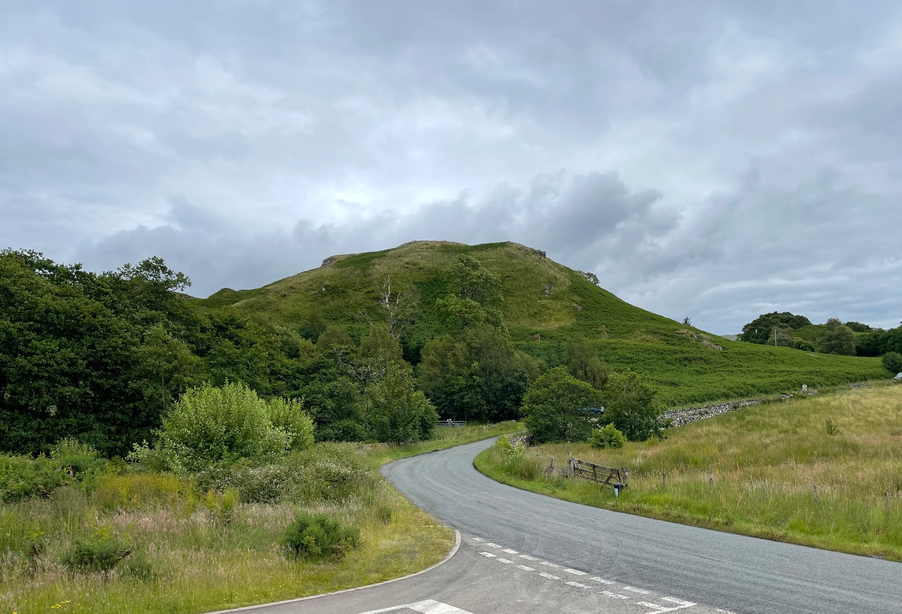
The hill of Dun Toiseach

You can see the rocky hillock ‘pon which this old dun sits from the roadside – and can approach it by either climbing up the slope, or go round t’ back and approach it from t’ track. Either way, it’s easy to get to.

Archaeology & History

This old dun was rather ramshackled when I used to sit here, sometimes on my way home from working at the Inverliever Nursery, a bit further up the lochside — but it was a good spot to sit and daydream into Loch Awe and beyond…

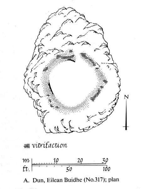
Described as a vitrified fort, the structure is oval in shape.  Thought to have been constructed in the Iron Age, Dun Toiseach was originally about 50 feet across and its walls averaged 10 feet thick, with an entrance at its northeastern side.  The Royal Commission lads (1988) described it thus:

Dun Toiseach plan (after RCAHMS 1988)

“Situated on a prominent rocky knoll overlooking the S end of Loch Awe 250m ESE of Torran farmsteading, there is a severely ruined dun measuring about 16m by 13m within a wall which has been some 4m thick. Two stretches of outer facing-stones are visible, as well as a few possible stones of the inner face, but, particularly on the NE, the wall has been severely robbed and the core material scattered. The entrance lies on the NE, the innermost portion of the SE passage-wall and what may be a door-jamb on the opposite side still being visible.  The knoll has acted as a focus for recent field-walls, but there is no indication that it was additionally defended by outworks. A small modern cairn…surmounts the dun wall on the SE.”

References:

  1. Royal Commission on the Ancient & Historical Monuments of Scotland, Argyll – Volume 6: Mid-Argyll and Cowal, HMSO: Edinburgh 1988.

© Paul Bennett, The Northern Antiquarian

Sheep Scar Enclosure, Giggleswick, North Yorkshire

Enclosure:  OS Grid Reference – SD 80648 66374

Getting Here

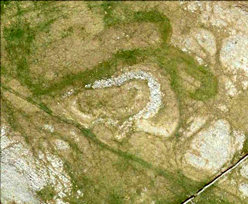
Aerial view of enclosure

To reach here, follow the same directions to get to the Apronful of Stones giant cairn.  Walk on the footpath past the cairn for about 200 yards until you reach a large gap where the old walling has collapsed.  Go through this and walk across the limestone rocks, towards the small rocky hillock rising up 100 hundred yards in front to your east (not the more rounded one to the north).  That’s it!

Archaeology & History

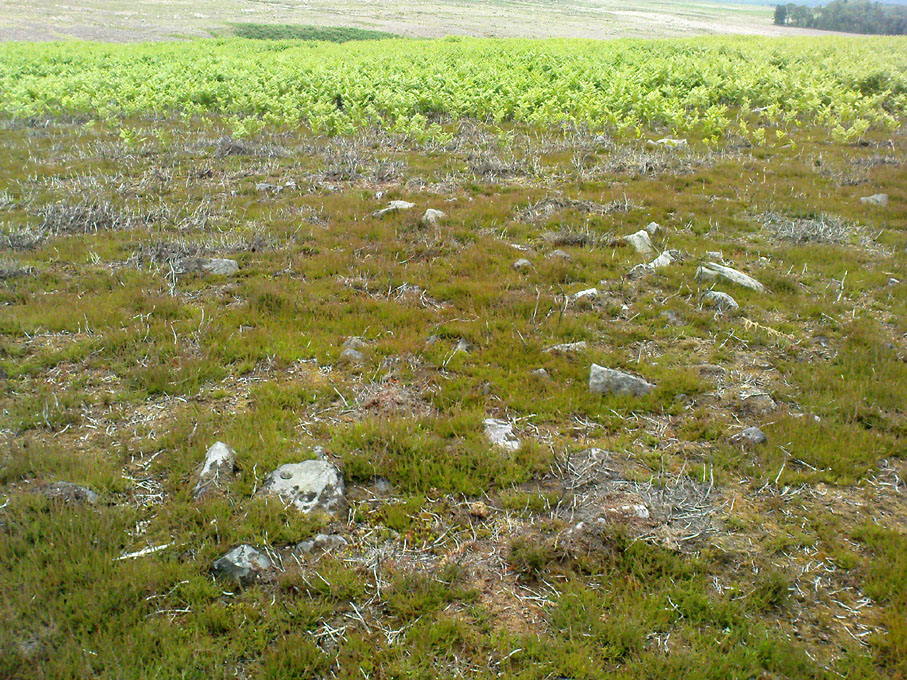
This is a most intriguing find, and one to which I can find no other literary reference (though I aint checked Brayshaw’s Giggleswick).  An undeniably large natural hillock has been modified and added to by people at some considerable time long ago and at some considerable effort!  Measuring more than 47 yards (43m) roughly east-west, and 21 yards (19m) north-south, the most definable man-made remains here is the length of elliptical walling on the southern and western edges.  The internal circumference of the enclosure measures roughly 113 yards (103m) all round the edges.  The northern and eastern sides of the hill would appear to be mainly natural, but seem to have been modified a little — not unlike the mass of settlements and enclosures a few miles to the east, like Torlery Edge, Lantern Holes and others around Malham Moor and district.

The site needs professional assessment: first to ascertain its period (which seems Iron Age on first impression, but could be much later), and second to ascertain its nature.  On the ridges close by we find a veritable mass of archaeological remains, ranging between Bronze Age to Medieval in nature.  The giant Apronful of Stones is only 172 yards (158m) south; the Sheep Scar cairn circle 156 yards (143m) northwest; and one of the remaining Sheep Scar cairns only 58 yards (53m) away.  And hopefully when we return to the place next week (fingers crossed!), we’ll be able to get some more photos of the walling you can see that define some edges of the site…

…to be continued…

References:

  1. Brayshaw, Thomas & Robinson, Ralph M., A History of the Ancient Parish of Giggleswick, Halton & Co.: London 1932.

© Paul Bennett, The Northern Antiquarian

Snowden Carr Carving (603), Askwith Moor, North Yorkshire

Cup-Marked Stone:  OS Grid Reference – SE 17993 51112

Getting Here

Snowden Carr carving 603

From Askwith village go up the Moor Lane and at the crossroads go straight across (Snowden Moor is across left).  Go down and along Snowden Carr Road until the road levels out and, watch carefully, about 500 yards on from the crossroads on your left you’ll see a small crag of rocks in the fields above.  Stop and go through the gate walking up the field and as you near the top you’ll see a gate across to your left that leads onto the moor.  Go through this and on the path which veers up to the right up to the Tree of Life Stone.  About 20 yards along, keep your eyes peeled just off-path, to the left, where a small rounded stone hides at the edge.

Archaeology & History

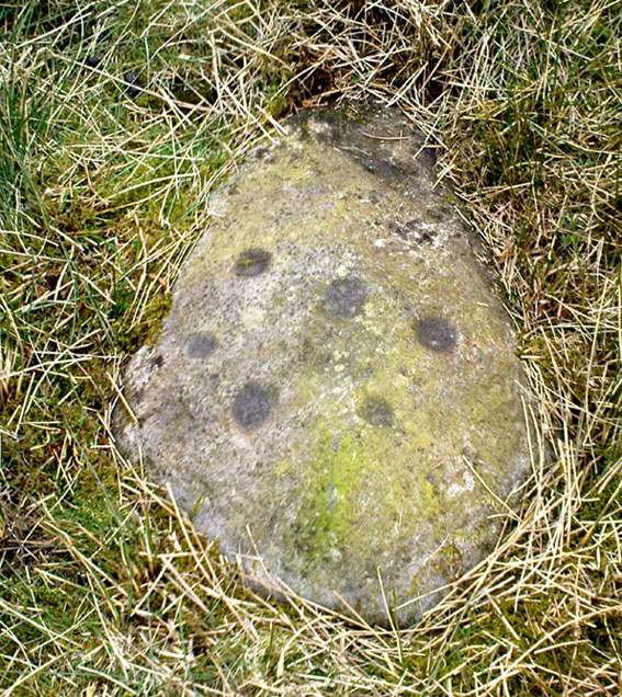
This was one of a number of cup-markings that Graeme Chappell and I came across in the early 1990s, though it didn’t receive any literary attention until included in Boughey & Vickerman’s (2003) survey.  It’s only a small fella, consisting of just six or seven cups on its upper rounded surface — though what may be a carved line runs round the southern side of the stone.  It seems to have been associated with a small cairn close by (a common feature on these moors) and adjacent prehistoric settlement walling.  In Boughey & Vickerman’s text, they gave the following notes:

“Small rock with rounded surface at ground level, near scattered cairn. Seven or eight cups, possible grooves at edge.”

Drawing of the stone (Boughey & Vickerman)

[You’ll notice in the photo above that the local phantom painter had been here again, artistically highlighting the cup-marks.  The photos we took were done earlier this year, when the paint (or whatever it is) was first noted.  It had not been painted-in the previous autumn.  But most notably is the fact that this carved stone has never previously appeared on the internet (until today) and the only other reference to it is in the standard Boughey & Vickerman text.  This would indicate that whoever it is that’s painting the carvings up and down mid-Wharfedale possesses a copy of that text, aswell as being relatively new to the subject of rock art.]

References:

  1. Boughey, Keith & Vickerman, E.A., Prehistoric Rock Art of the West Riding, WYAS 2003.

© Paul Bennett, The Northern Antiquarian

Green Plain, Blubberhouses Moor, North Yorkshire

Settlement:  OS Grid Reference – SE 1492 5378

Getting Here

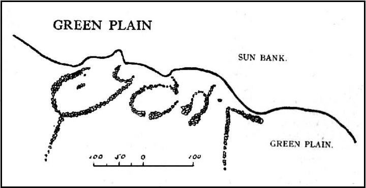
Cowling’s 1946 ground-plan of a portion of the settlement

From Blubberhouses church by the crossroads, walk up the slope (south) as if you’re going to Askwith, for 100 yards or so, taking the track and footpath past the Manor House and onto the moor.  Once you hit the moorland proper, take the footpath that bears left going down into heather and keep going till you hit the dead straight Roman Road path running west onto Blubberhouses Moor.  Go on here for nearly a mile until you hit the valley stream with its Eagle Stone down on your left.  Walk downstream, past the Eagle Stone, and cross over 100 yards down until you’re back on the level ground with the scatter of bracken and heather.  You’re here!

Archaeology & History

On the other side of the stream a short distance southeast of the large cup-marked Eagle Stone is a curious site, first described by Eric Cowling (1946) as “a series of enclosures of varying size and roughly circular shape” which he ascribed as a Bronze Age settlement.  Certainly we have a rather extensive scattered group of walled structures just as he described, but not all of the walling here seems typical of local Bronze Age constructions.  Cowling suggested the remains to be “useful for protection, herding and for shelter,” though admitted archaeological excavation would be the best way to ascertain their specific nature.  Such undertakings have yet to be done — and I wouldn’t hold your breath either.

Large section of walling
Walls of large circular structure

Although he described some of the walls here as nearly four-feet tall, when Graeme Chappell and I first ventured here in the winter of 1990, the walling wasn’t quite as high.  There are a number of individual tall stones sat in the walls that stand three-feet tall, with some that have been cut and dressed in more historic times.  Who did this and when is unknown.  However, if we visited this place when all the vegetation has been cut and burnt back at the end of winter and early months of Spring — a fact not lost on Cowling when he first found this place — we would gain a much clearer picture of things here.

Some sections of lower walling above the streamside appear to be prehistoric in nature, but many other parts of the walled structures across this flatland plain have a much later look and feel about them, illustrating that the site may have been used well into post-medieval periods.  This seems increasingly obvious where we find a number of the stones cut at sharp angles, with some having distinctive quarried grooves in them.  However, I can find no historical records to verify this at present.

Hut circle remains
Medieval cut upright stone?

If we walk up the slight slope westwards however (before bracken and heath grow) there are more distinct prehistoric remains in the form of typical hut circles with low walls emerging from deep peatlands — although even these have been cut in one or two places by metal tools.  My view of this little-known but large settlement arena is that we’re looking at a site initially built in the Bronze Age period, continuing to be used by local tribespeople throughout the Iron Age and, as the cut stones clearly show, was a village that was certainly made use of in the last millenium.  But until someone comes along here and gives the site the attention it deserves, we’re not gonna know…

On the southern fringe of the copious walled structures we also find a very curious medicinal chalybeate spring that may have been of some importance to those who once lived hereby.  A ‘standing stone’ and prehistoric cairn can also be seen close by.

References:

  1. Cowling, E.T., Rombald’s Way: A Prehistory of Mid-Wharfedale, William Walker: Otley 1946.

© Paul Bennett, The Northern Antiquarian


Snowden Carr (597), Askwith Moor, North Yorkshire

Cup-Marked Stone:  OS Grid Reference – SE 17965 51158

Getting Here

Find your way to the excellent Tree of Life cup-and-ring stone, then walk about 10-15 yards west.  It’s under your nose!

Archaeology & History

Single cup-marked stone

Another stone for the rock art purists amongst us: a singular cup-marking near the edge of the rock.  Although the photo here seems to show three cup-markings close to each other, only one of the three is in fact real.  The other two are simple geological creations.  But this fact seemed to go over the heads of some English Heritage archaeologists who reported to Boughey & Vickerman (2003) that this was a stone “with three cup markings” on it.  I’m not sure who trains EH rock-art enthusiasts, but they seem to have a tendency to mistake natural features with artificial cup-markings and their evaluations should be treated with considerable caution (you’ve gotta wonder who the students are that are teaching them).

The rock itself is found in close association with other prehistoric remains and may have been a part of enclosure walling.  Very close by are numerous well-preserved settlement remains, cairns and other cup-and-ring stones.

References:

  1. Boughey, Keith & Vickerman, E.A., Prehistoric Rock Art of the West Riding, WYAS: Wakefield 2003.

© Paul Bennett, The Northern Antiquarian

Fair Oak Circle, Whitewell, Lancashire

Settlement:  OS Grid Reference – SD 6474 4584

Getting Here

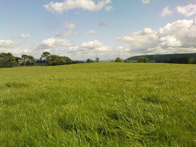
Fair Oak rise

From the village of Chipping, go along Talbot Street until it meets Green Lane and there, on the left, there runs a country lane roughly northwards.  Go along this and after about 1½ mile, watch out for the track of Quiet Lane on your left.  Go all the way up this track for nearly 1½ mile, till you reach its end.  Diagonally across to your right, note the stile into the field.  Go over this and, some 50 yards across the field, look to your south where the field rises to its small peak.  This is the site.

Archaeology & History

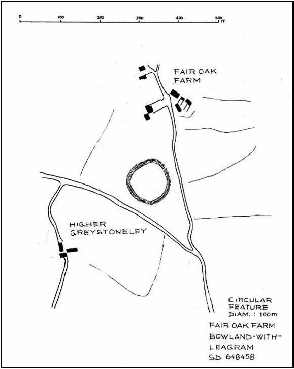
Fair Oak enclosure

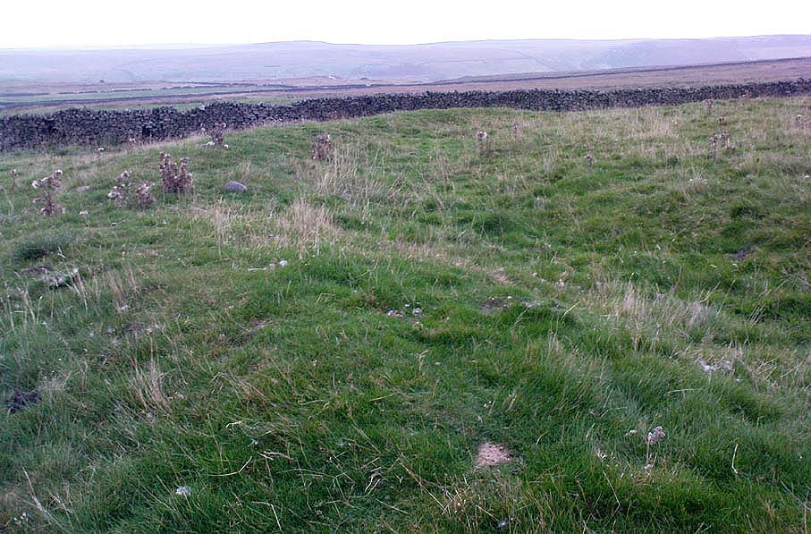
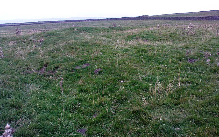
Although little can be seen of this site at ground level, aerial photography in the 1980s identified a large circular earthwork at Fair Oak Farm.  The circle has a surrounding ditch and bank enclosing a raised circular mound of approximately 100m in diameter.  It is thought that the feature may represent Bronze/Iron Age settlement in the area, and may possibly be a village site.   The site requires further survey.

Aerial photography has identified a number of possible settlement sites in the area between Dinkling Green and the River Hodder at Whitewell and in the area around Whitmore below Totridge Fell. The largest being that at Fair Oak.

Folklore

Jessica Lofthouse (1946) told of a number of places close by that were said by local people to be inhabited by faerie folk — Fair Oak itself being no exception.  Hinting of earlier heathen gatherings, she wrote:

“As for the farm of Fair Oak, where we take the path to Dinkling Green, nearby was the fairy oak, the scene of so much midsummer revelry.”

References:

  1. Dixon, John, The Forest of Bowland, Aussteiger Publications: Clitheroe 2004.
  2. Lofthouse, Jessica, Three Rivers, Robert Hale: London 1946.

© Paul Bennett & John Dixon, The Northern Antiquarian


Yarnbury Henge, Grassington, North Yorkshire

Henge:  OS Grid Reference – SE 01405 65413

Getting Here

Yarnbury henge from the air

In Grassington, go up the main street and keep going uphill, out of town.  You’re on Moor Road now and it keeps going northeast for about a mile, where the small copse of trees grows just before Yarnbury House.  However, on the other side of the road (right) two field before you reach the house, you’ll notice a slightly raised elevation in the field, close to the wall.  A footpath runs right past it, so you shouldn’t have too much trouble finding it!

Archaeology & History

This is a fine, roughly circular neolithic monument, sat not-quite-on-the-heights, but still possessing damn good views all round (except immediately west), begging the question, ‘what on earth are you and why were you built here?’  Answers to which, we don’t really know.  But ascertaining its geomantic nature wouldn’t be too difficult for local people who have spent years visiting the site.  John Dixon (1990) mentioned how, in the winter months,

“the sun falls behind Pendle (Hill) providing it with a sky-red backdrop.  In my own view the site is related to the presence of Pendle…and may have been the major factor in the location of the monument.”

He may be right!  It has been suggested by one archaeologist (King et al, 1995) that the site was “most probably a wood henge” with upright rings of wooden posts that were built onto the central platform — but until we get a full dig here, we’re not gonna know.

N-NE section of henge
SW section of the henge

Found close to an extensive amount of other prehistoric remains in the area (dating from the neolithic to Iron Age), this henge monument is notable for its size, as it’s only a little fella!  It’s like a mini-version of the Castle Dykes henge near Aysgarth, 14 miles to the north!  First mentioned as a ‘disc barrow’ in 1929, J. Barrett (1963) added the Yarnbury Henge to the archaeological registers 32 years later, citing it as a “circular platform 60-63 ft diameter, surrounded by a ditch 20ft wide (crest to crest) and an outer bank.”  A couple of years later D.P. Dymond (1965) described the henge in slightly more detail, telling:

“At Yarnbury, just over one mile north-east of Grassington there is an earthwork 116ft in diameter overall, consisting of a ditch with external bank.  On surface inspection the earthwork appeared to have the characteristics of a henge monument.  An excavation carried out in July 1964 , by an archaeological summer school based on Grantley Hall, proved this thesis.  There was no trace of an internal mound and the entrance to the southeast was obviously  original.  No traces were found of any sort of internal structure, and a square pit in the centre of the circle had been caused by an excavation earlier this century.  The ditch was rock-cut and the bank of simple dump construction.  No dating evidence was found… With its single entrance the Yarnbury henge falls into Atkinson’s Class 1.”

SW area of the henge

In recent years it seems that some damage has been done by digging into the east and southeastern sections of the henge.  Summat we hope doesn’t get any worse.  In the field on the other side of the road we found traces of prehistoric enclosure walling (along with a curious, large, almost cursiform shadow, 44 yards across and running 110 yards NE), typical of the extensive settlement remains found less than a mile away at Lea Green and High Close Pasture, Grassington.  It’s an impressive area, well worth checking out!

References:

  1. Barrett, J., “Grassington, W.R.,” in Yorkshire Archaeological Journal, part 161, 1963.
  2. Beck, Howard, Yorkshire’s Roots, Sigma: Wilmslow 1996.
  3. Dixon, John & Phillip, Journeys through Brigantia – volume 2: Walks in Ribblesdale, Malhamdale and Central Wharfedale, Aussteiger Publishing: Barnoldswick 1990.
  4. Dymond, D.P., “Grassington, W.R.,” in Yorkshire Archaeological Journal, part 163, 1965.
  5. Harding, A.F., Henge Monuments and Related Sites of Great Britain, BAR 175: Oxford 1987.
  6. Harding, Jan, The Henge Monuments of the British Isles, Tempus: Stroud 2003.
  7. King, Alan, et al, Early Grassington, Yorkshire Archaeological Society 1995.
  8. Wainwright, G.J., “A Review of Henge Monuments in the Light of Recent Research,” Proceedings of the Prehistoric Society, volume 35, 1969.

© Paul Bennett, The Northern Antiquarian
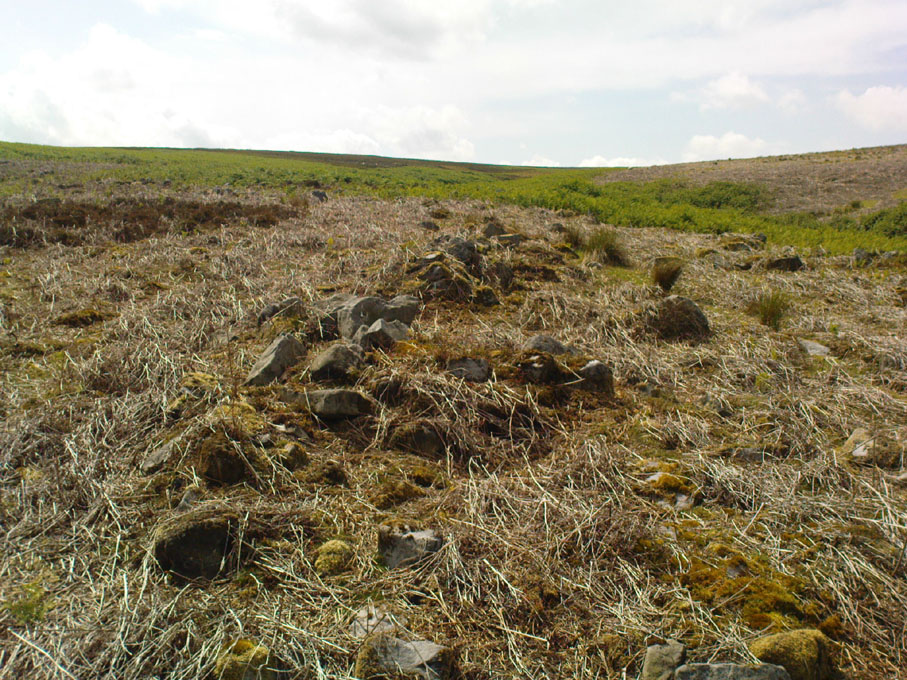

Castle Hill, Little Wittenham, Oxfordshire

Hillfort:  OS Grid Reference – SU 5696 9244

Also Known as:

  1. Sinodun Camp
  2. Wittenham Clumps

Getting Here

Either reach this from Dorchester’s Dyke Hills by crossing the bridge over the Thames at its southwestern side and walk thru the village and up the fields to the wooded rise on your left; or simply get take the road between Brightwell-cum-Sotwell to the delightful village of Little Wittenham and, on your right-hand side, notes the unmissable clump of trees and rise in the fields on your right.  That’s the place!

Archaeology & History

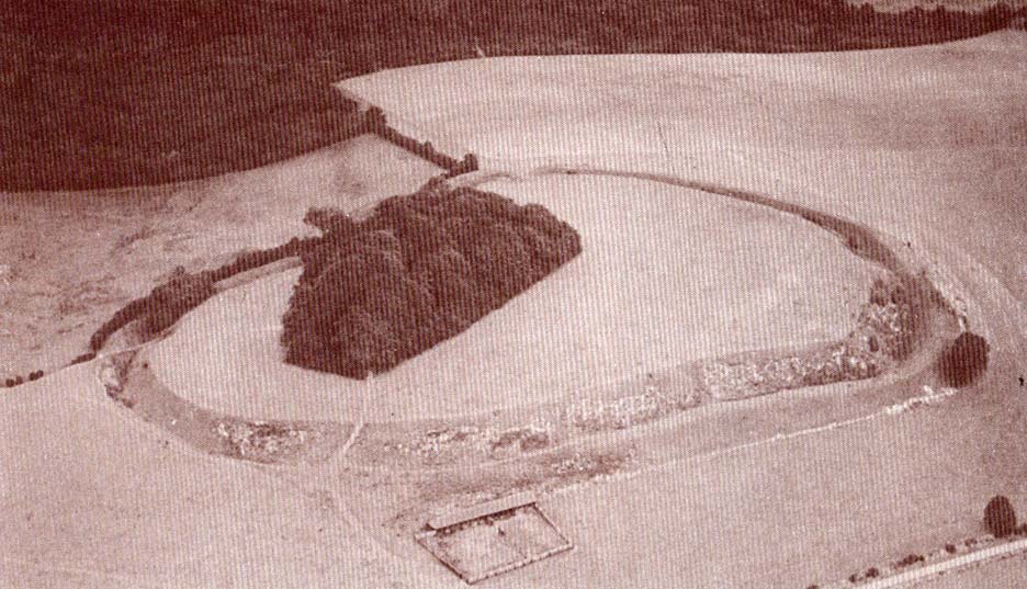
Major Allen’s 1932 photo

To be found on the southern side of the River Thames, across from the huge Dyke Hills camp, this prominent enclosed hillfort was thought to be a place where the tribal peoples of differing groups converged — the Dubonni, the Catuvellauni, and Atrebates peoples.  And to this day it remains impressive.  Long thought to have been merely the province of Iron Age settlers, in more recent years it has shown to have had a longer and richer history than academics previously dare write about.  In Jean Cook’s (1985) fine work on the archaeology of the region, she described the typical narrative Castle Hill elicited from professionals until only a few years back, saying:

“The hillfort on Wittenham Clumps covers approximately 4 hectares (c. 10 acres) and comprises a single ditch and rampart.  It commands superb views northwards up the Thames valley and to the south and west across the Vale of White Horse to the Berkshire Downs, where a series of similar hillforts follows the line of an ancient route — the Ridgeway.  The fort has never been excavated, although frequent past ploughings have produced Iron Age and early Saxon sherds as well as Romano-British pottery.  However, to the south of the hillfort…a well-stratified Iron Age settlement was found.  It seems probable on the basis of other excavated sites that the fort was permanently occupied.  It would have developed as  a regional administrative and political centre, with specialist craftsmen and traders and would have performed some of the same functions as a medieval market town.”

Although Cook’s latter remarks should be addressed with caution (market economics was far from the mythic perspectives of Iron Age people), this great site was of obvious importance.  But later excavations at the site in 2002-03 showed that the site had in fact been used by neolithic people and, around the tops, flints and other remains were found that took human activity here back into mesolithic times, with some finds dated around 6000 BC!  More surprisingly (to archaeologists anyway) was that Castle Hill continued to be used way into medieval times!

Thankfully much of this place is still pretty well-preserved and is well worth exploring to historians, pagans and walkers.

References:

  1. Cook, Jean, “Before the Roman Conquest,” in Dorchester through the Ages, Oxford University 1985.
  2. Cook, Jean & Rowley, Trevor (eds.), Dorchester through the Ages, Oxford University 1985.

Links:

  1. An Interim Summary Report on Excavations at Castle Hill, Wittenham Clumps

© Paul Bennett, The Northern Antiquarian
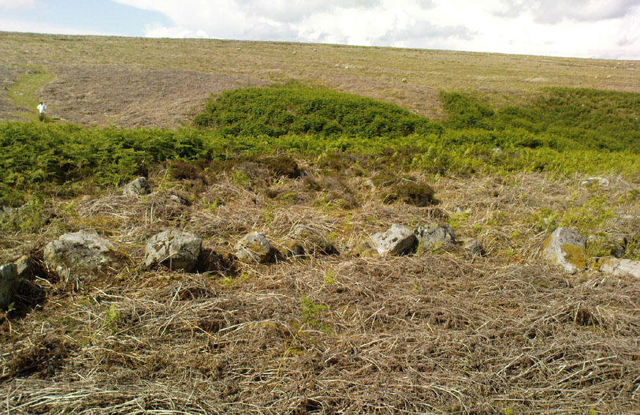

Dyke Hills, Dorchester, Oxfordshire

Settlement:  OS Grid Reference – SU 5735 9364

Also Known as:

  1. Dorchester Dykes
  2. Dorchester Fort

Getting Here

Easy to find.  From Dorchester town centre, take the road at the bottom of town where the church is and walk along to the end where a footpath takes you into the field.  Once here you’ll note a rise in the land at the end, stretching away to the west and the River Thames.  That’s your Dyke Hills!

Archaeology & History

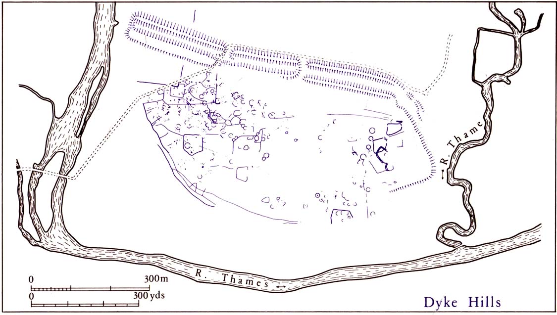
Plan of Dyke Hills (after Cook, 1985)

This site is another example of the considerable neglect shown to the prehistoric archaeological remains in and around the Dorchester region, despite Jean Cook (1985) describing the place as “a site of major local, regional and national importance.”  Which is a pity, as the site here was once huge and it seems that much could have been learned from here.  (you’ve gotta ask: do those doods who allegedly work for English Heritage care more for the ancient sites, or the money their organization gets?)

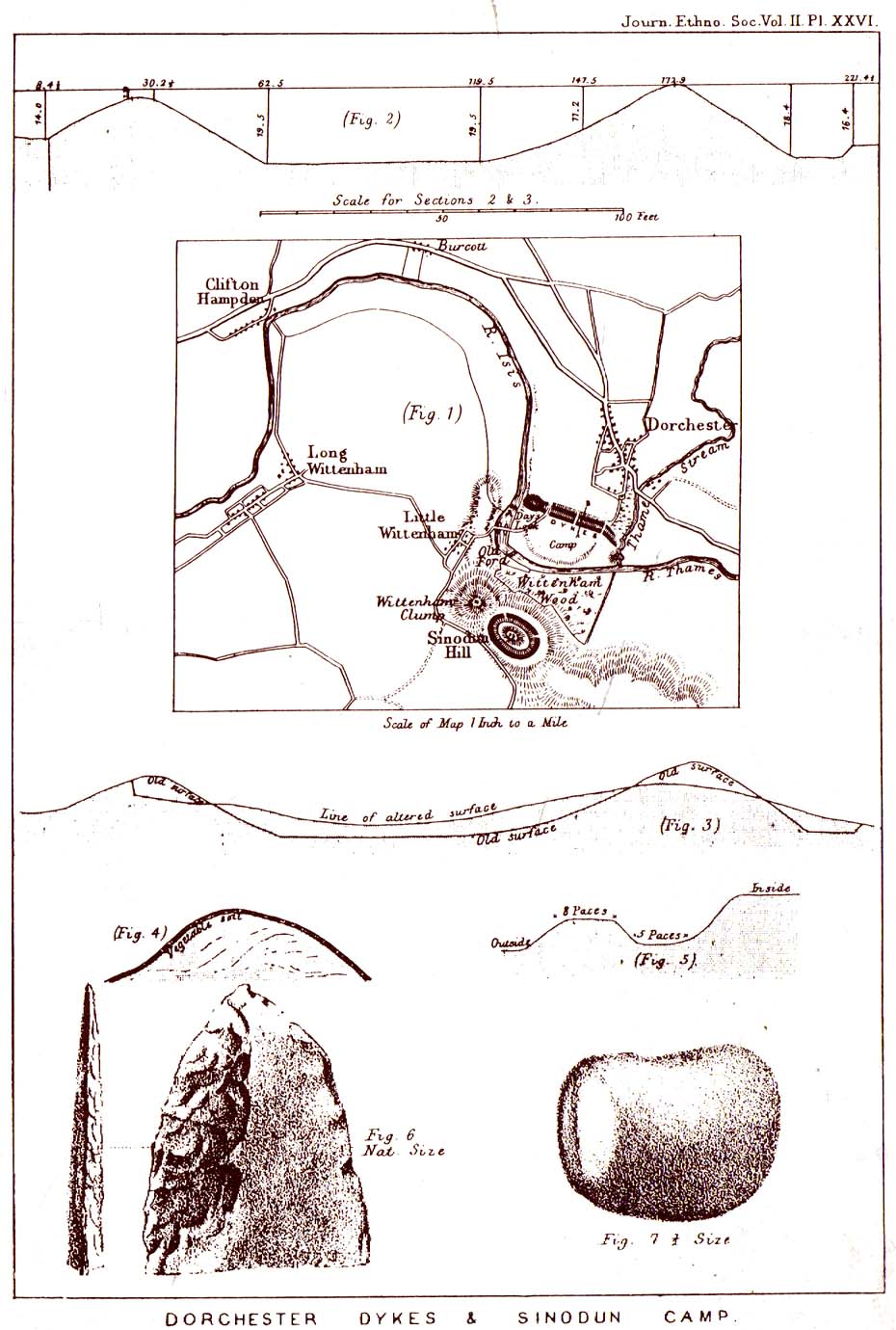
Lane-Fox’s 1870 survey

It would seem that the majority of the site was Iron Age in nature, with snifflings of Bronze Age remains scattered here and there. The primary position of the massive dykes and construction of internal domestic structures immediately below (south) of the dykes, was hemmed in on all sides by the surrounding River Thames and one of its tributaries, giving the place an excellent position in terms of food, plus shelter and protection from any intrusive tribes or hungry winter animals.

The first excavation at the huge dykes that define the northern edge of this ‘monument’ was done in 1870 by the renowned General Pitt-Rivers, then later Colonel Lane-Fox (at the time the Secretary of London’s Ethnological Society), as they were very concerned about the damage that was being inflicted upon the site, when the local landowner allowed sections of the banking to be “reduced for cultivation.”  An article in the Saturday Review magazine on July 2, 1870, told of these concerns and what was written — as Jean Cook so rightly tells — “has a depressingly modern ring to it”:

“…the fortress at Dorchester and the fortress on Sinodun (Castle Hill) are among the most speaking monuments of the earliest history of our island, and till lately they were among its most perfect monuments.  But it is a grievous truth that while we are writing, the dykes at Dorchester are being levelled.  Hitherto the neighbourhood ground has been grazed and the harmless sheep is no foe to history; but it has lately occurred to the owner of the ground hat a few shillings more of yearly profit might be gained by turning pasture land into arable; and to such a sordid motive as this these precious antiquities are at this very moment being sacrificed.  At least a third of the dyke has already been lowered, and will gradually be utterly destroyed beneath the yearly passage of ruin’s merciless plough share.  Such wanton destruction naturally aroused the indignation of men of taste and knowledge, especially in the neighbouring University.  A vigourous appeal to the owner to stay his hand was made by some of the most eminent Oxford residents, and an attempt was made to call public attention to the subject by describing the state of the case in various newspapers…”

Lane-Fox’s 1872 photo

But the digging into the dykes continued.  For some time at least — until Colonel Lane-Fox himself went to the see the landowner and “persuaded” him to stop what he was doing.  A method we should always keep in mind ourselves…

The modern state of the Dyke Hills is summarised once again in Jean Cook’s (1985) fine survey of the region, where she wrote:

“This great enclosure, known to archaeologists as an oppidum, covered 46 hectares (c. 114 acres) and as defended by a massive double bank and ditch to the north and to the east.  The southern and western boundaries have all but disappeared, but can be traced in lines of modern field boundaries beyond which the Thames forms a natural boundary.  The interior is (now) empty, but cropmarks reveal that it is full of enclosures, pits and circular houses aligned along a regular pattern of internal roads.  Although there has been no scientific excavation within Dyke Hills, ploughing of the site has produced one of the densest concentrations of Iron Age coins in Britain.”

It would appear that this site was of considerable importance for local tribes and would have been home to powerful chiefs and impressive-looking shamans!  The large Castle Hill site immediately across the river would have had obvious links to this once-omportant prehistoric settlement.

References:

  1. Cook, Jean, “Before the Roman Conquest,” in Dorchester through the Ages, Oxford University 1985.
  2. Cook, Jean & Rowley, Trevor (eds.), Dorchester through the Ages, Oxford University 1985.
  3. Williams, Geoffrey, The Iron Age Hillforts of England, Horace Books 1993.

 © Paul Bennett, The Northern Antiquarian