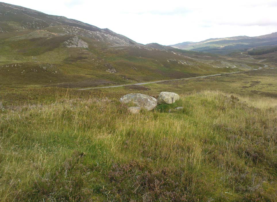
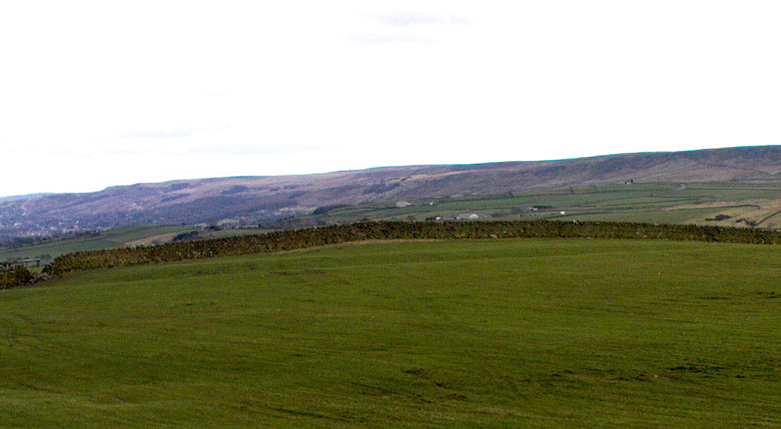
Along the A823 road from the Pool of Muckhart up to Glendevon, watch out for the small left turning opposite the car-parking spot by the Castlehill Reservoir a couple of miles up the road. Walk up this small road a mile or so to the Glenquey reservoir, taking the footpath on your right and making sure you walk along the north-side of the waters. You’ll eventually reach a small set of beautiful mossy green waterfalls (with the rounded fairy hill of Maiden Castle ahead of you). This is the Garchel Burn. Take steep the path up the side until it levels out a bit, heading for the small clump of stones on the near skyline a couple of hundred yards ahead. That’s it!
Archaeology & History
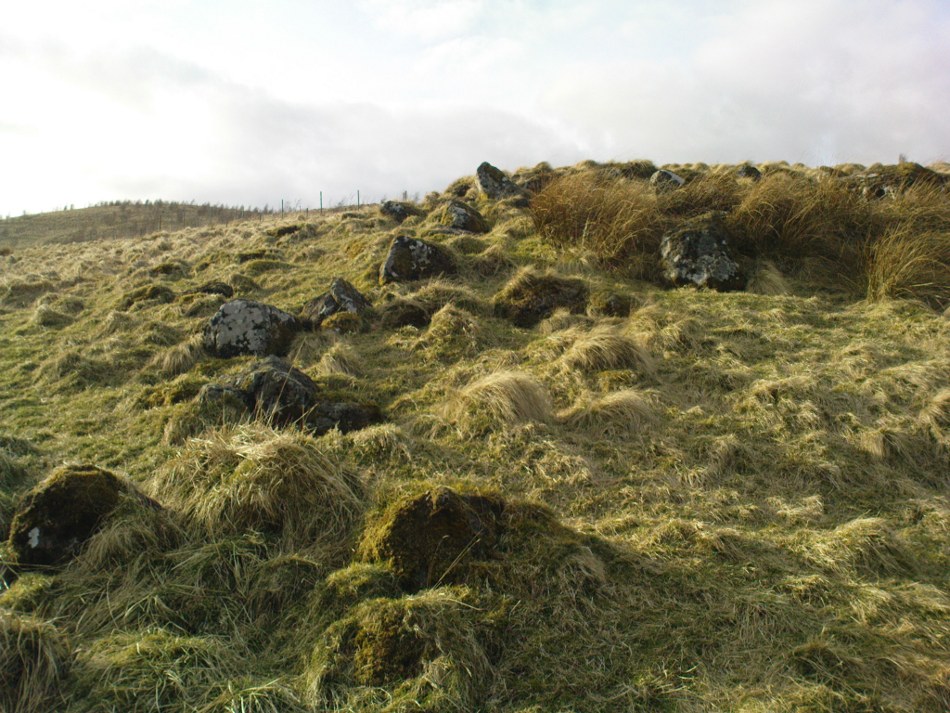
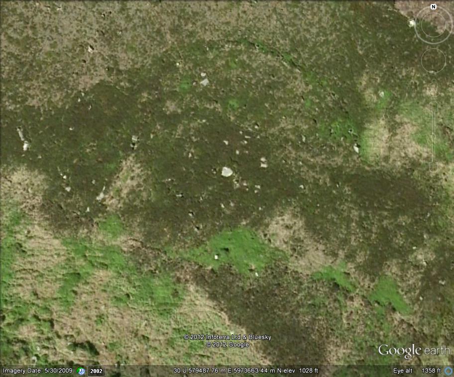
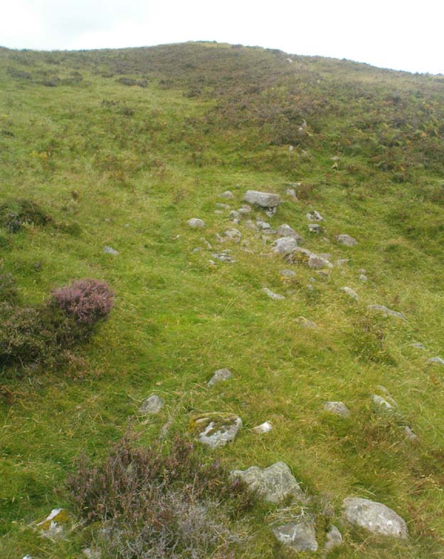
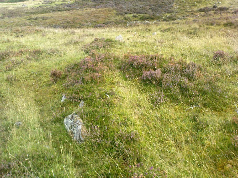
This is a curious little cluster of seemingly multi-period remains sitting on the edges above the gorgeous waters of the Garchel Burn. The Royal Commission Canmore report ascribes the scattered rocky cluster below the deer-fencing as the main hut circle – and the line of walling running slightly down the slope does have that traditional Iron Age look about it. But it’s yet to be excavated. The larger ring of stones constituting the main ‘circle’ is very much bogged-down, literally, amidst tussock and marshland, with an arc of stones running away from the circle and it’s obviously been made use of it by people in more recent times.
Small ‘hut circle’ to centre
Below the larger rock cluster is a lovely oval structure, built upon a slight rise overlooking the burn, with all the rocks in the structure overgrown with age and grasses. Tis a beautiful spot to sit and hear the silence of the waters around you. Aerial images show the outlines of other roughly circular remains in the same area, but none are yet excavated – and some are distinctly much later in period, medieval by the look of things and very probably used by farmers in more recent centuries. In all probability, there are more things to be found up here, hiding within the forests…
Follow the directions to reach the small Rivock East Carving just on the level of the small moorland. From here, walk less than 100 yards east, staying just on the edge of the moor, keeping your eyes peeled for the irregular shaped rocks running in lines roughly parallel with the footpath above the edge of the crags.
Archaeology & History
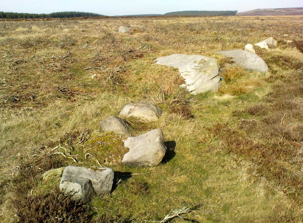
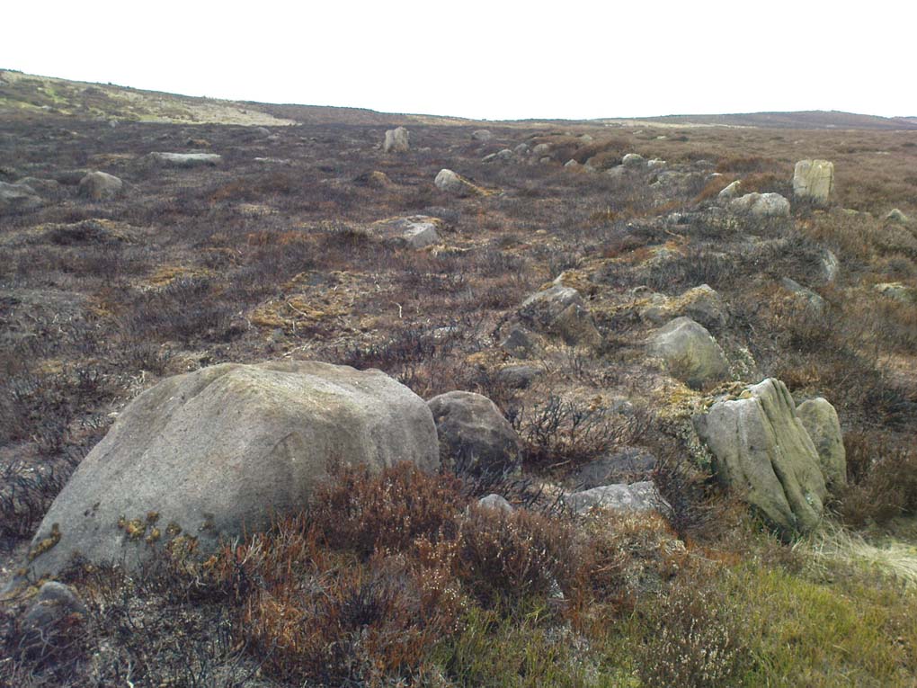
Recent explorations in and around the Rivock Edge area found, not only a number of undiscovered cup-and-ring stones, but the overgrown remains of an undoubted prehistoric enclosure on the ridge of moorland above the rock escarpment which has not previously been reported in archaeological surveys. Much of the time the area is covered in deep heather, but thanks to this small section of moor being burnt back a short while ago, the lines of walling that mark the enclosure are there for all to see. It’s obvious that some sections of the old walls have been removed in the not-too-distant past for use in more modern walling and, nearby, old quarries and farming have probably been responsible for other destructive elements.
Easternmost line of Rivock enclosure walling
This enclosure is of a rough, rounded, scalene triangular formation, with the main piece of extant walling running roughly northeast-southwest. The walling is typical of other settlements and enclosures in the region, probably Bronze Age in nature, Iron Age at the latest, with some natural earthfast boulders marking parts of the outline and many smaller pieces of rock and packing stones being added to build up the structure. The same layout is found at other nearby prehistoric enclosures at Crow Well, Dumpit Hill, Snowden Moor, Woofa Bank and many others.
Of the larger upright stones in the Rivock Enclosure, several of them stand about three feet high, with some of them having been knocked down. The longest line of walling, running roughly east-west, is less than 50 yards long; whilst the enclosure wall running roughly north-south on its eastern side is 30 yards long. Much of the walling along its northern side appears overgrown and sections of it are missing.
For a long time I puzzled as to whether there had been any settlements on this part of Rombald’s Moor, rich in cup-and-rings stones — and at last we find that there was at least one such site. Forays back and forth across the level ground all around here failed to locate any other similar enclosure remains; but it may be that some have been covered (or were destroyed) in the adjacent forestry plantation to the west. Further explorations by fellow antiquarians may prove worthwhile when the forest is cut down in the next few years.
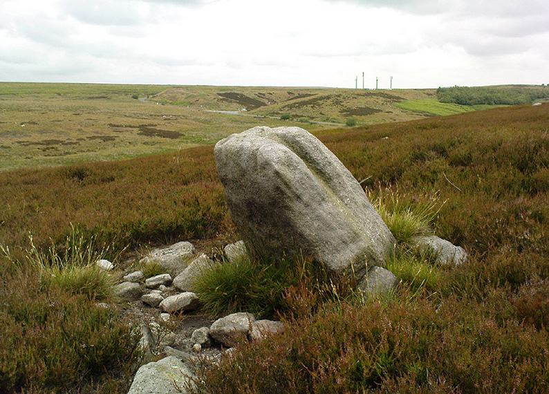
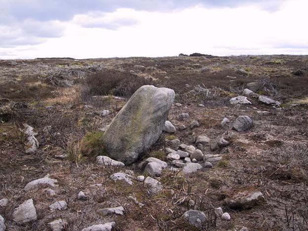
ON the A59 Harrogate to Skipton road, right on top where it crosses the barren moors, get to the parking spot right near where the road levels out at the highest point (2-300 yards past the turning to the derelict Dovestones Quarry). From here, go thru the gate onto the moor for about 100 yard. Then turn straight east (left) for another few hundred yards till y’ reach the spot marked as Gill Head Peat Moor on the OS-map. This small standing stone (right) is where you need to start – the other remains continue east of here.
Archaeology & History
Richard’s original photo, with walling clearly visible
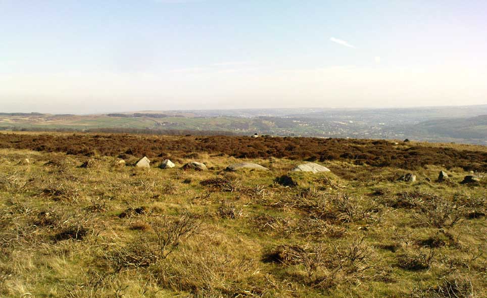
The discovery of this site began in April 2005, when rock art student Richard Stroud and I were exploring the moors here and he called our attention to what seemed like a singular upright standing stone, some 3 feet high, with a debatable cup-marking on top, standing amidst a scatter of smaller stones running north and south from here, implying that the stone may have been a part of some much denuded walling from our ancient past. But we weren’t sure—and simply noted its location (at SE 13378 54924) and carried on our way. But in revisiting this site after looking at some old archaeology papers, Paul Hornby and I chanced to find a lot more on the burnt heathland running east of here.
The upright stone found by Mr Stroud is certainly part of some ancient walling, but it is much denuded and falls back into the peat after only a short distance. A short distance west of this stone is a small cairn which seems of more recent origin; but due east, along the flat plain on the moorland itself, the burnt heathland showed a scattering of extensive human remains, comprising mainly of walling, hut circles and possible cairns—lots of it!
One issue we have to contend with on this moorland is the evidence of considerable peat-cutting in places, which was being done on a large scale into the Victorian period. Scatterings of medieval work are also found across this moor, in places directly interfering with little-known Bronze Age monuments in the middle of the remote uplands. There is no doubt that some of these medieval and later workings have destroyed some of the uncatalogued prehistoric archaeological remains on this moor. But thankfully, on the ridge running west to east along Gill Head to above the source of the Black Dike, scattered remains of human habitation and activity are still in evidence. The only problem with what we’ve found, is the date…
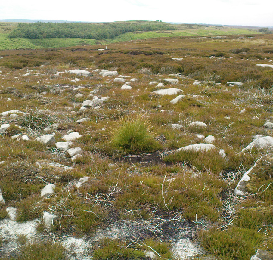
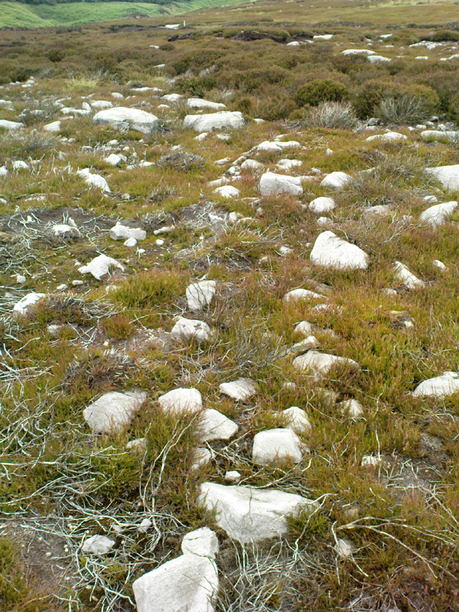
Two rows of straight walling, with stone scatter all roundAnother overgrown curve of walling
In 1960, Mr J. Davies first mentioned finding good evidence of flint-workings at a site close by; then described his discoveries in greater detail in the Yorkshire Archaeological Journal (1963) a few years later — but contended that the remains were of mesolithic origin. A few years earlier, Mr D. Walker described a similar mesolithic “microlith site” a bit further north at Stump Cross. Earlier still, Eric Cowling (1946) and others had made similar finds on these and adjacent moors. Yet all of them missed this scatter of habitation sites, perched near the edge of the ridge running east-west atop of the ridge above the A59 road. It’s quite extensive and, from the state of the walled remains, seems very early, probably neolithic in origin.
A number of small hut circles, 2-3 yards across, are scattered amidst the heather, with lines of walling—some straight, some not—broken here and there by people who came to gather their peat for fuel. The walling and hut circle remains are very low to the ground, having themselves been robbed for stone it would seem. The area initially appeared to be little more than a mass of stones scattered across the Earth (and much of it is), but amidst this are very clear lines of walls and circles, although they proved difficult to photograph because of the excessive growth of Calluna vulgaris.
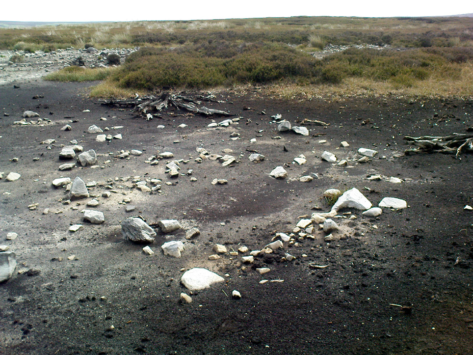
Curious man-made structure in dried peat-bog
A couple of hundred yards south there are remains of one of the many dried black peat-bogs—with one large section that has been tampered with by humans at some point in the ancient past. Over one section of it there has been built a small stone path, or possible fish-trap; plus elsewhere is a most curious rectangular walled structure (right) obviously made by people a long time ago. Also amidst this dried peat-bog are the truly ancient remains of prehistoric tree-roots emerging from the Earth, a few thousand years old at least – and perhaps the last remnants of the ancient forests that once covered these moors.
How far back in time do all these walled remains take us? Iron Age? Bronze Age? Or much much further…? Excavations anyone!?
References:
Cowling, Eric T., Rombald’s Way, William Walker: Otley 1946.
Davies, J., “A Mesolithic Workshop in Upper Wharfedale,” in Bradford’s Cartwright Hall Archaeology Group Bulletin, 5:1, 1960.
Davies, J., “A Mesolithic Site on Blubberhouses Moor, Wharfedale,” in Yorkshire Archaeological Journal, part 161 (volume 41), 1963.
Walker, D., “A Site at Stump Cross, near Grassington, Yorkshire, and the Age of the Pennine Microlith Industry,” in Proceedings of the Prehistoric Society, volume 22, 1956.
From Ilkley, take the Cowpasture Road up past Cow & Calf rocks, the hotel and along the moorside. A few hundred yards further, just before the next farm-building on your right, walk up the Rushy Beck path to the top. Crossing the stream at the top, now walk diagonally south-ish into the heather for some 200 yards, a short distance before the hillside begins to rise up again onto the next ridge. Remains of this ‘enclosure’ is all around you!
Archaeology & History
When the normal moorland vegetation covers this prehistoric site, you’d barely know there was anything here apart from various rocky rises and undulations in the ground and perhaps, if you were seeking out old stuff, what would seem to be lines of stone walls bending away onto the moor. But when the heaths have been burnt back, a whole new vista unfolds itself! You see before you a fantastic, well-preserved, unexcavated prehistoric enclosure, whose origins are probably neolithic, but whose history and use stretched through the Bronze Age and into the Iron Age—and it’s not alone! East, west and south of this particular enclosure, other prehistoric walled structures are found stretching all across the landscape hereby, structurally similar and also used over very long periods in prehistory. For antiquarians and historians alike, this is a truly impressive place indeed. In all honesty, the description I give here does not do the place justice!
Northwestern section of enclosure walling
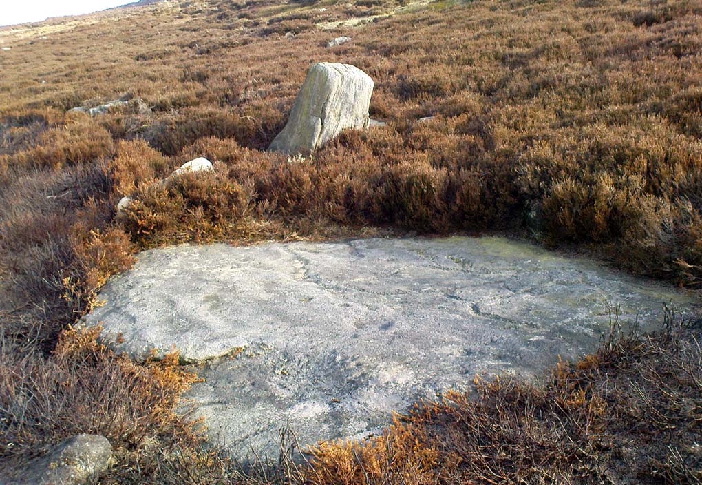
Things like ‘settlements’ and ‘enclosures’ are traditionally relegated by purist archaeologists to be little more than domestic or utilitarian sites: places where our ancestors kept cattle; or were used for defensive purposes; or lived for long periods of the year. Of course, these simple ideas are effective and true at some places; but here at Woofa Bank—in this particular enclosure—something more than just domestic activity was enacted, and over the period of many centuries by the look of things. We surmise this by the incidence of at least fifteen cup-and-ring stones being found within the enclosure itself; and at its very centre is a small standing stone, not previously recorded, that has perhaps five petroglyphs around it. The presence of such a large cluster of cup-and-ring stones close together within the enclosure would seem to suggest ritual activity.
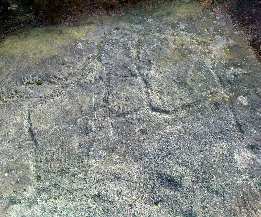
Carved rock & central stoneClose-up of, dancing anthropomorphic figure?
One of the carvings at the centre of the enclosure (listed in the Boughey & Vickerman survey as Carving 372) has been suggested to represent a dancing human figure (the image here shows the anthropomorphic element), which it may well be. The incidence of this central stone and its surrounding petroglyphs has important magico-religious implications, relating it as a site used for creation myth narratives and repetitions (transpersonal explorations at this site may prove worthwhile). The wider extended enclosure with more petroglyphs contained inside it, suggest that additional ritual performances were enacted here; these may have had something to do with the cluster of prehistoric tombs scattered on the moorland plain 100 yards to the west, but we might never know.
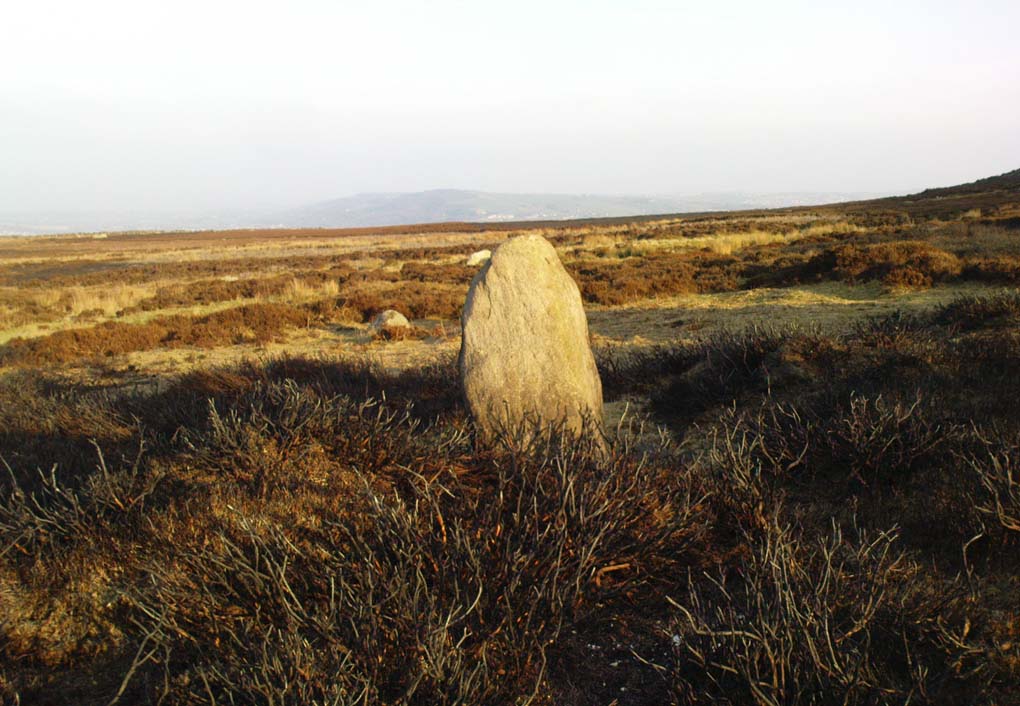
Easternmost standing stone
It seems that the walled enclosure itself was constructed around the earlier cup-and-ring stones, probably many centuries later—but we need excavations here to give us more precise details. Much of the enclosure walling itself has the hallmarks of being late Bronze Age to Iron Age, whilst we know that prehistoric rock art can date back into the neolithic period; and from this period Eric Cowling (1946) reported that, at Woofa Bank, “at the western end of the ridge,” just above this enclosure, a neolithic flint site existed.
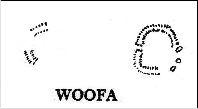
Cowling’s 1946 plan
Cowling (1946) himself was one of very few archaeologists to even mention this impressive site, in a section exploring the “Iron Age” sites along Green Crag Slack at the eastern end of Ilkley Moor. He wrote:
“At the other end of the site under the shadow of Woofa Bank and near the source of the Rushy Beck, is another D-shaped enclosure apparently unfinished. The plan is of a circle with a flattened side and does not exceed twenty-four yards across in any direction. Here the enclosing wall shows five or six courses at the lower end side and a simple entrance to the west.”
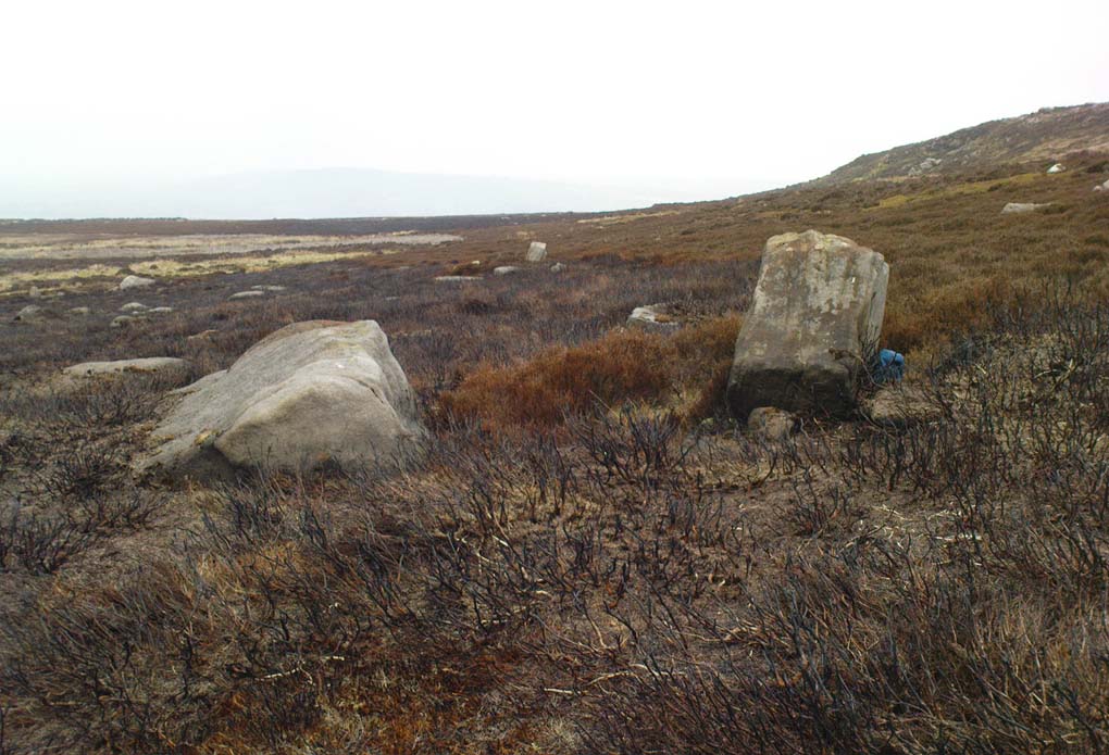
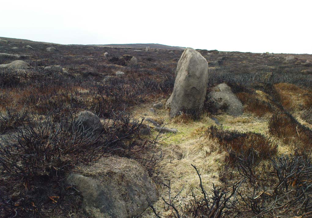
Western entrance to enclosureStone marking eastern entrance
Though Cowling’s measurements are way out! The enclosure itself is much larger than he describes. For the most part, three-quarters of it give the impression of it being a large oval shape, but the design and outline of the walling changes on its southeastern side and kinks inward, in an arc, to eventually meet the walling in the middle eastern section. Its entire circumference measures approximately 220 yards all the way round; it is 65 yards across east-west; and about 61 yards north-south. The average height of the main walling is between 2-3 feet tall, and is made up of many large rocks, some of them positioned upright as standing stones, all packed together with earth and countless thousands of smaller stones. The walling itself is between 2-3 yards wide in many places and has two main entrances: one near the middle of the western wall and the other almost opposite to the east. The eastern entrance is marked by a standing stone between 3-4 feet tall. No gaps are visible at all on the northern curved section of the enclosure. On the overgrown southern edges, not all of the walling is visible and much of it is overgrown. On the whole it’s still very much as Cowling found it, with the arc of walling in this part of the enclosure difficult to make out clearly. There is also another line of walling that runs off to the east, beyond the main enclosure itself.
Carved rock in western wall
The clearer, more visible western line of walling, running south of the entrance on that side, has a large singular cup-and-ring stone laid right along its axis (carving 366 in the Boughey & Vickerman [2003] survey), a short distance before the walling changes direction east-west and runs along the bottom of the slope.
Folklore
Tradition tells that the tribal people from this site were involved in a battle with the Romans along this moorland plain.
References:
Bennett, Paul, The Old Stones of Elmet, Capall Bann: Chieveley 2001.
Boughey, Keith & Vickerman, E.A., Prehistoric Rock Art of the West Riding, WYAS: Wakefield 2003.
Cowling, Eric T., Rombald’s Way, William Walker: Otley 1946.
Eliade, Mircea, Images and Symbols, Harvill Press: London 1961.
Hedges, John (ed.), The Carved Rocks on Rombalds Moor, WYMCC: Wakefield 1986.
Size, Nicholas, The Haunted Moor, William Walker: Otley 1934.
Although found within the parish of Fortingall many miles to the south, this site is much closer to Kinloch Rannoch, just a few miles northwest. From Kinloch Rannoch, take the south road, heading east for about 5 miles, till you go past the small Lochan an Daim on the left (north) of the road. As the moorland opens up ahead of you, about a half-mile further on, watch for the dirt-track running up onto the hills on your left. Cross the road from here, over the stream and bogs, onto the small hill ahead of you. You’re getting very close!
Archaeology & History
The Canmore entry for this site tells of just a large single hut circle being here, 13.5m by 12m across, but this is in fact part of a much larger enclosure system with extensive walls rising to heights of up to 3 feet in places and covering a very wide area indeed across the sloping grass-covered ridge above the streams on either side. The walling is typically Iron Age in structure and there are remains of other internal features that we gave only cursory attention to (other sites were calling out for us!).
This shows walling of another nearby enclosureAllt Leathan enclosure walling
What seem to be a cluster of several very overgrown cairns, roughly 20 feet across and 3 feet high, are evident on the south side of the enclosure walling. These need examining in greater detail. Also, on the eastern slope below the edge of the main walled enclosure, Paul Hornby found what seems to be a prehistoric standing stone, leaning to one side, which if completely upright would be about 5 feet tall. There are also the remains of at least two other large walled enclosures further onto the hillside, just before you start walking up the slopes to Schiehallion. They appear to be similar in nature and structure to this one at Allt Leathen, but I can find no account of them in any records.
Large arc of vegetation highlighting south section of wall
From Comrie town centre take the road south across Dalginross Bridge over the river, heading towards Braco, up the winding B827 road for 3 miles, past the tiny crossroads that would take you to the Craigneich standing stone, and past the farmhouse of Middleton as you go uphill. As you go round a bittova large bend in the road, take the next gate uphill, over the field and onto the moor. Follow the walling up a few hundred yards until it bends round and you see the Dunruchan monoliths ahead of you on the moor. From here, walk east into the heather, up a slight grade for 100 yards or more, keeping your eyes peeled for a large oval change in vegetation, covering a mass of small stones with several large ones at its NW sides. Your damn close!
Archaeology & History
I can find no previous reference to this large oval walled enclosure, either on the internet, PSAS or other local history texts, so assume for the time being that it is a new find (someone please lemme know if there’s owt written about it). But it’s existence here is not surprising, considering the presence of the giant standing stones of Dunruchan rise a few hundred yards to the east.
Sloping faint oval of vegetation across the centre of the photo outlines the main enclosure
The ‘enclosure’ is a large one and would seem to be prehistoric at first glance. I’d appreciate someone with greater local knowledge have a look at the place to see if they can contextualize it in relation to other local monuments of similar type. Paul Hornby and I approached it from the Duncruchan megaliths and, as the vegetation here was low, noted an overgrown rocky rise in the heather and moorland grasses. This turned out to be the northern line of walling and is nearly 3 feet high in places, though very overgrown. Typically comprising of many hundreds of small rounded stones and the occasional large ones, the walling took on an elliptical form – giving the impression of an early Iron Age to Bronze Age structure – roughly 79 yards in circumference, 29 yards across at its longer axis and 23 yards wide at the shortest. The average width of the walling itself was 2-3 yards all round the entire structure.
My initial impression was that this may have been a very large robbed-out cairn, and the presence of many small rocks scattering inside the enclosure didn’t help! But the more I walked round the site, the more it seemed obvious that this was a large enclosure, or possible settlement. Unfortunately the site has proved very difficult to photograph due to the excess of vegetation. Further visits are needed to this site by those more competent than I, to ascertain the real nature of these antiquarian remains…
Settlement (destroyed): OS Grid Reference – SE 309 336
Archaeology & History
Absolutely nothing is left of the large series of ancient earthworks that were reported to have existed near the very centre of Leeds by Ralph Thoresby, James Wardell and others in the 18th and 19th centuries. Although we do not know with certainty the age and nature of the site, it would seem very likely to have had a prehistoric provenance. However, this wasn’t the opinion of either Thoresby (1715) or Thomas Whitaker (1816). They both thought the remains were of Roman origin – but we must remind ourselves of the inaccuracies made, particularly by Whitaker, when it came to estimating the dates of early monuments (e.g., Whitaker’s assertions of the huge Counter Hill earthworks above Addingham). Sometime later, James Wardell (1853) thought the remains on Quarry Hill were distinctly pre-Roman; though reasoned that the invading force may have used the site at a later date. Wardell wrote:
“Traces of a prior occupation were, until recently, observable on the summit of Quarry-hill, along the western edge of which ran an earthwork of considerable length and magnitude, and of semi-circular form.”
We know little else of the place, sadly, but the shape of the site around the hilltop edges would seem to support the likelihood of an Iron or Bronze Age origin. Further information would, of course, be more helpful…
References:
Thoresby, Ralph, Ducatus Leodiensis, Maurice Atkins: London 1715.
Wardell, James, The Antiquities of the Borough of Leeds, Moxon & Walker: Leeds 1853.
Whitaker, Thomas D., Loidis and Elmete, T. Davison: Leeds 1816.
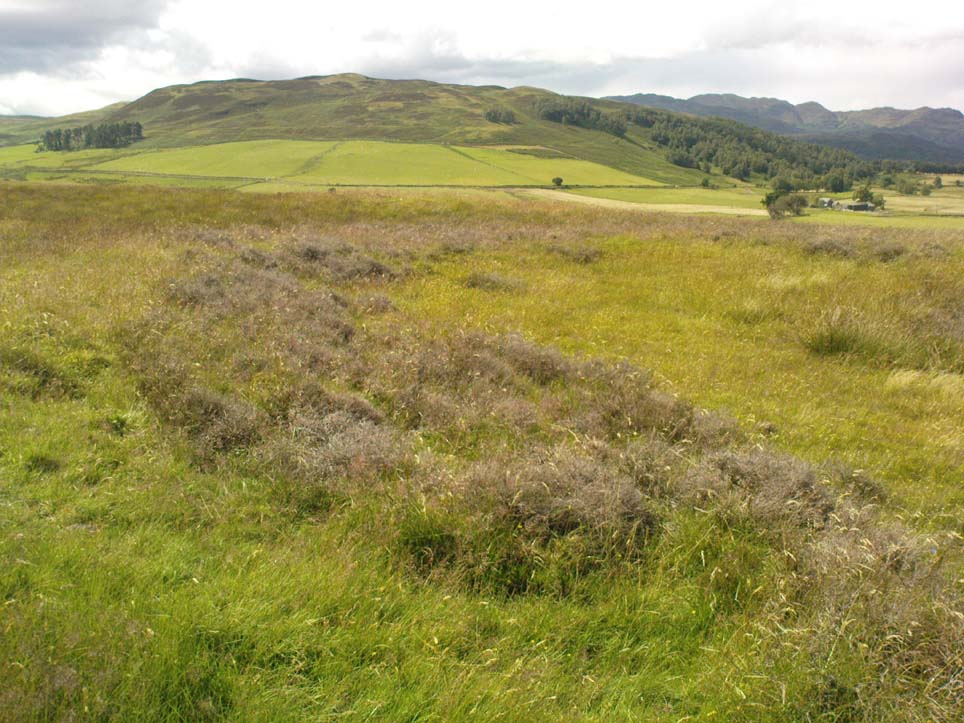
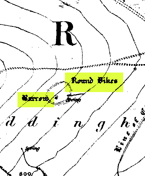
First highlighted on the 1850 Ordnance Survey map of western Addingham in the same year William Howson described it, this large oval embankment sits on the eastern side of Counter Hill, amidst its gigantic earthworks, with attending tumuli, cup-and-rings, buried standing stones and other enclosures, like one huge prehistoric family of ancient sites! The earthworks here are in slightly better condition than the nearby ones at Marchup, as we can still make out the ditch marking the site.
There have been many literary visitors to the Round Dikes and its cluster of sites. One of the early ones was by the renowned historians and antiquarians, Forrest & Grainge (1868) who, in the second part of their ‘rambles’ exploring the prehistoric sites on and around Rombald’s Moor in the 1860s, told us:
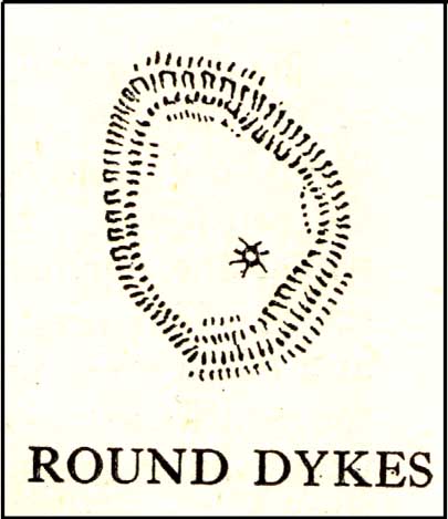
“The Camp—known locally as Round Dykes—is of an irregular oval shape, the longest axis measuring over all 300 feet, and the shorter 250 feet. The trench outside the vallum is about 15 feet wide, and 4 or 5 feet in depth. The area is level, showing no indications of buildings or works of any kind. A feeble spring of water rises at one corner. The trench is regular and even, and does not appear to have ever been used as a series of pit dwellings. This work commands a large and splendid view of Wharfedale…”
Although suggested by Thomas Whitaker (1878) in his magnum opus on the history of Craven, to have been constructed by the Romans—who laid a road nearby on top of another earlier trackway—the site is obviously prehistoric. But when the late great Harry Speight (1900) ventured over for a gander at the end of the 1890s, he too thought it might be Roman. Finding the place to be “thickly overgrown with ling,” it was still in very good condition he said, telling “how its outline is almost as perfect as when made seventeen or eighteen centuries ago.” He continued:
“The form bespeaks a rather late date, having the characteristic angles, which makes the ordinary streight-sided rectangle into an octogan, giving it the appearance superficially of a round or oval. Its dimensions are based on the most approved form of castramentation, the length being one-third greater than the breadth, namely sixty yards wide and eighty yards long. A watch-mound has been thrown up within the southwest angle, and the whole camp defended with a double rampart having an intervening ditch. There is an old and excellent spring of water on the east sie of the camp; the site having been well chosen, commanding as it does, a splendid view of the valley and Street as it runs towards Olicana.”
By the time Eric Cowling (1946) came and looked at these earthworks, the opinion had truly swayed to seeing Round Dikes as a prehistoric site and not Roman. Cowling placed it firmly in the Iron Age! His profile of the site told:
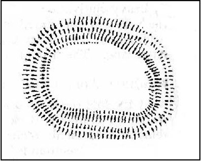
“On the Western slope of Counter Hill and with a wide view of Wharfedale to the east is a second enclosure with five sides. Three of these form the three sides of a square and the remaining two bend outwards to enclose a spring on the lower eastern side. This enclosure is one hundred feet across from east to west and in the opposite direction the greatest measurement is seventy-three feet. The ditch is fifteen feet wide and varies in depth from three to five feet and there appears to have been an entrance in the eastern angle. There is an unfinished look about the earthwork; the inner and outer banks vary in height and are not continuous. The position is badly sited for defence, being overlooked from the higher ground to the west. The site would be very suitable for excavation, for it has been untouched by cultivation and is undisturbed.”
E.T. Cowling’s plan
And as far as I’m aware, no such excavation has yet been done here; and as we all know the local archaeologist is pretty poor when it comes doing such things round here, so god only knows when the real explorers and scientists will ever get their teeth into the place! However, the writers and archaeology consultants John and Phillip Dixon told that “a limited survey of parts of Round Dykes defined nine hut circles or parts of circles and possible hearth sites” in the 1980s. And although they ascribe the large earthwork as being Iron Age, the tumulus which sits near the southern edge of the enclosure is ascribed as Bronze Age.
It’s likely that the internal tumulus (a separate profile of it is forthcoming) was of communal and religious importance at Round Dykes. There was probably ritual function here within the enclosure, though only at certain times, when and where the ancestral spirits in the tomb awoke or were required to help the living. The spring of water on the eastern side of the enclosure, above the tumulus, was obviously not just the main drinking supply for the people who stayed here, but would also have had ritual importance (water, forget not, is tantamount to blood in ancestral cosmologies, and not a ‘commodity’ as the half-witted retards in modern culture have profaned it in their shallow beliefs). In the Lands of the Dead, water is vital for gods, spirits and the sustenance of the underworlds. (Eliade 1979) You might not think that; judæochristians might not think that — but the worlds of experience are much wider and deeper than the failing beliefs of atheists and monotheists…
…to be continued…
References:
Bennett, Paul, The Old Stones of Elmet, Capall Bann: Milverton 2001.
Bennett, Paul, The Prehistoric Sites of Counter Hill, Addingham, forthcoming 2013.
Cowling, Eric T., Rombald’s Way, William Walker: Otley 1946.
Forrest, C. & Grainge, William, A Ramble on Rumbald’s Moor, among the Dwellings, Cairns and Circles of the Ancient Britons in the Spring of 1868: Part 2 – Counterhill and Castleberg, W.T. Lamb: Wakefield 1868.
Dixon, John & Phillip, Journeys through Brigantia – volume 1: Walks in Craven, Airedale and Wharfedale, Aussteiger Publications: Barnoldswick 1990.
Eliade, Mircea, A History of Religious Ideas – volume 1, Collins: London 1979.
Howson, William, An Illustrated Guide to the Curiosities of Craven, Whittaker: Settle 1850.
Speight, Harry, Upper Wharfedale, Elliott Stock: London 1900.
Whitaker, Thomas Dunham, The History and Antiquities of the Deanery of Craven in the County of York, (3rd edition) Joseph Dodgson: Leeds 1878.
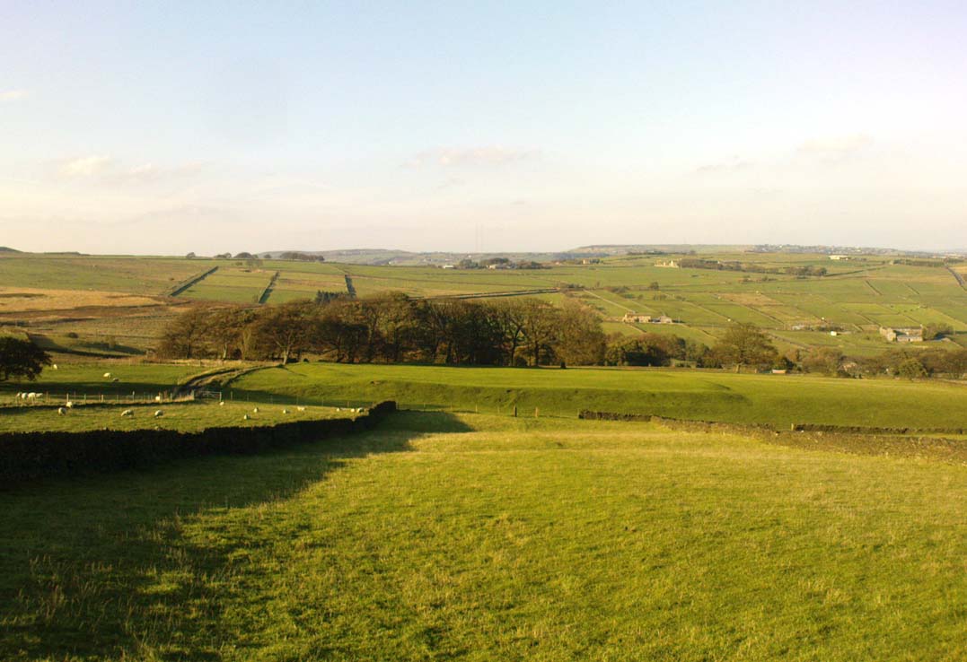
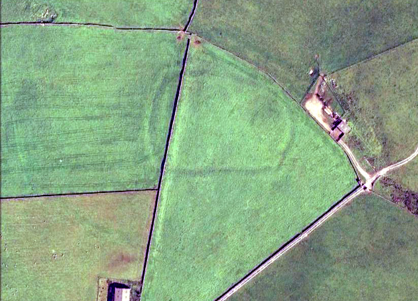
From the crossroads at the centre of Meltham, near the church, take the Wessenden Head Road up out of town for about a mile. Keep your eyes peeled to right (north) for the track leading downhill to Oldfield Hall or Farm. As you go down the track you’ll see a small cluster of hawthorns running along a small ridge 100 yards or so ahead, at the end of the field, with some line of embankment. This is on the right of the track and is the Oldfield enclosure!
Archaeology & History
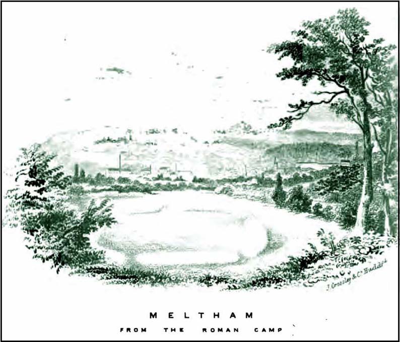
The remains of this large quadrangular settlement were first described as of ‘Roman’ origin in Mr Morehouse’s History of Kirkburton (1861), where he told that,
“In the…township of Meltham are the remains of a Roman encampment, on the moor below West Nab, a short distance to the left of the road which leads thence to the village…forming nearly a square of about four chains. When I visited the place about twenty years since, in company with the owner and other friends, the whole was very distinct and perfect. This piece of ground has since been brought into cultivation, yet the trenches are still visible. This encampment would appear only to have been made to supply some temporary emergency.”
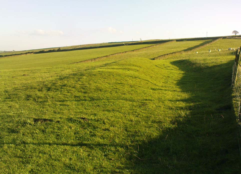
Joseph Hughes old drawing of the ‘Roman’ campWestern embankment & ditch
But Mr Morehouse’s speculation of its Roman origin and function are known to be untrue. The site is in fact of Iron Age origin and was probably in semi-permanent use for long periods between Spring and Autumn. But the ‘Roman’ nature of the site was echoed a few years later, albeit briefly, in Mr Hughes’ History of Meltham (1866), where he told that “querns or hand-mills for grinding corn were found” at the site.
In 1909, the Saddleworth antiquarian Ammon Wrigley excavated the site but found little that could enable a correct dating of the enclosure. It was explored again a few years later by Ian Richmond and then again by J.P. Toomey in the 1960s. Bernard Barnes (1982) summarised their respective findings, telling:
“Rampart of rubble and earth 7 feet wide faced with drystone walling; original height c.10 feet; V-shaped rock-cut ditch, 5½ feet deep and 6 feet wide, and a counterscarp bank similar to inner rampart with drystone revetment surviving to 4 courses. Northeast entrance had double timber gateway. Pre-rampart palisade trench on at least 2 sides of the enclosure with vertical posts 2 feet apart. Finds include 2 stone discs, rough out beehive quern, iron slag and very small fragments of pottery. Site dated to Iron Age.”
Another enclosure of similar period can be found a few hundred yards to the south.
Take the A6034 road between Addingham and Silsden and, at the very top of the hill between the two towns, at Cringles, take the small road of Cringles Lane north towards Draughton. Less than a mile on, veer to left and go along Bank Lane until you reach the track and footpath on your right that takes you to Moorock Hall. On the other side of the Hall, take the track on your left, along the wallside; and where the track turns left again, look into the field on the other side of the wall. You can see some of the ditch and embankment running across the field.
Archaeology & History
Found within the southwestern segment of the gigantic Counter Hill enclosure, near Woofa Bank, Eric Cowling (1946) described “an almost obliterated fortification” which has certainly seen better days — though you can make out the ditched earthwork pretty easily at ground level. When T.D. Whitaker visited this place sometime before 1812, he described it as a camp that “was found to contain numbers of rude (?!?) fireplaces constructed of stone and filled with ashes.” He also thought the enclosure was Roman in nature.
Western line of embankment
It’s a large site. Running around the outer edge of the embankment, this enclosure measures roughly 378 yards (345m) in circumference. It has diameters measuring, roughly east-west, 132 yards (121m); and north-south is 95 yards (87m). The ditch that defines the edges of the enclosure averages 6-7 yards across and is give or take a yard deep throughout — but this is not an accurate reflection of the real depth, as centuries of earth have collected and filled the ditch. An excavation is necessary to reveal the true depth of this. There also seems to have been additional features constructed inside the enclosure, but without an excavation we’ll never know what they are. Examples of cup-marked stones can be found nearby.
The Marchup Hill enclosure was described by the early antiquarian James Wardell (1869), who visited this and the other earthworks around Counter Hill. He told that this was,
“of oblong form, but broadest at the west end, and rather larger than the other. When the area of this camp was broken up, there were found some numbers of rude fireplaces constructed of stone and filled with ashes, and also a large perforated bead of jet.”
E.T. Cowling’s plan
Modern opinion places the construction of this enclosure within the Iron Age to Romano-British period, between 1000 BC to 300 AD. E.T. Cowling (1946) thought the Iron Age to be most likely, but it may indeed be earlier. His description of the site was as follows:
“At the foot of the southern slope of Counter Hill and close to the head waters of Marchup Beck is an almost obliterated fortification. These remains are roughly rectangular, but one side is bent to meet the other; the enclosure has rounded corners and has a ditch with the upcast at each side. The inner area is naturally above the level of the surrounding ground. In spite of heavy ploughing, the ditch on the western side still has a span of fifteen feet and a depth of five feet between the tops of the banks. Whitaker states that the camp “was found to contain numbers of rude fireplaces constructed of stone and filled with ashes.” These hearths appear to be the remains of cooking-holes such as are often found on Iron Age sites… Cup and ring markings are close at hand, but no flints have been found or trace of Mid-Bronze Age habitation. The enclosure is badly planned, the upcast on the western side would aid an attack rather than the defence.”
…to be continued…
References:
Cowling, Eric T., Rombald’s Way, William Walker: Otley 1946.
Wardell, James, Historical Notes of Ilkley, Rombald’s Moor, Baildon Common, and other Matters of the British and Roman Periods, Joseph Dodgson: Leeds 1869. (2nd edition 1881).
Whitaker, Thomas Dunham, The History and Antiquities of the Deanery of Craven in the County of York, (3rd edition) Joseph Dodgson: Leeds 1878.