Caratacus Stone, Winsford, Somerset

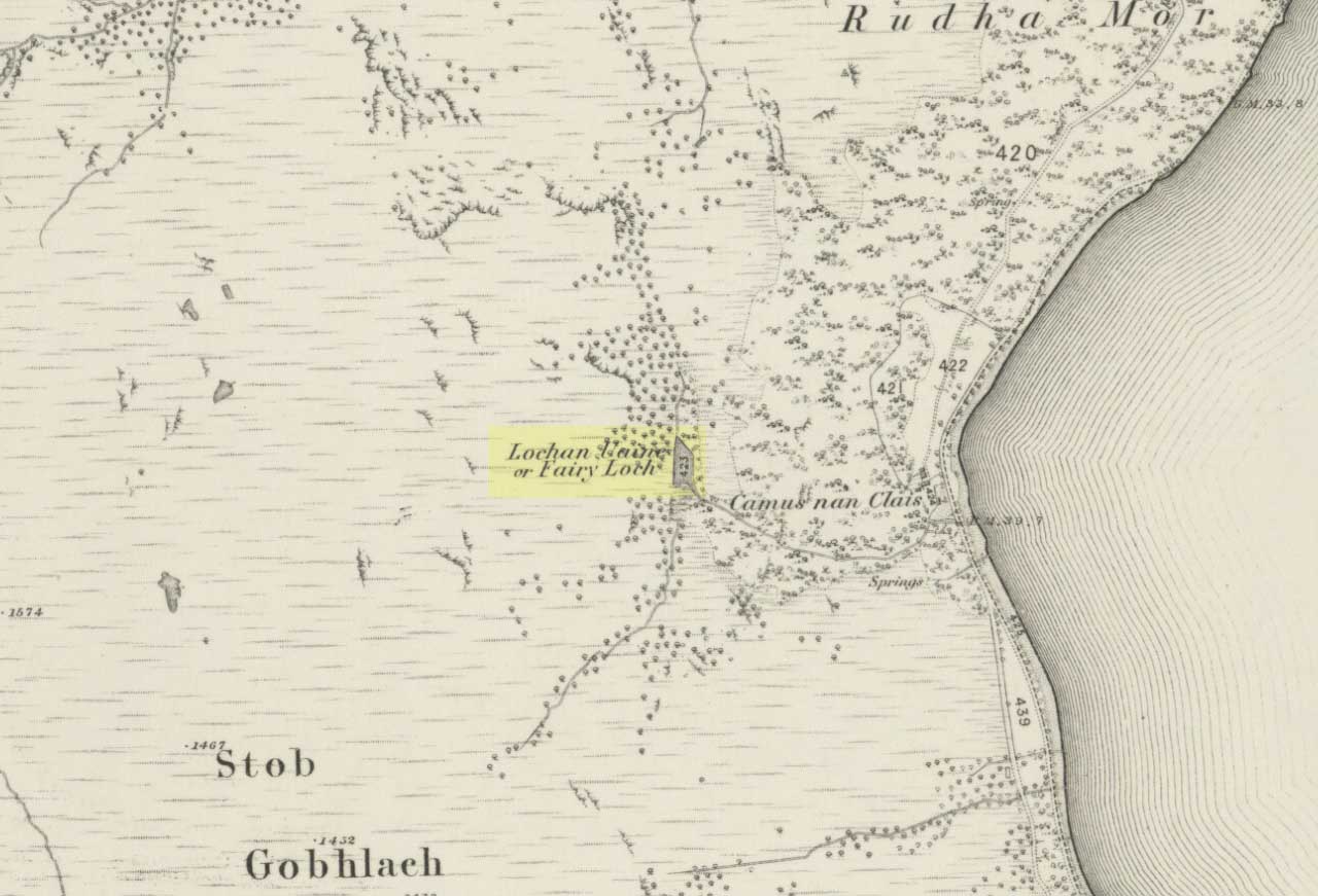
‘Standing Stone’:  OS Grid Reference – SS 8896 3355

Getting Here

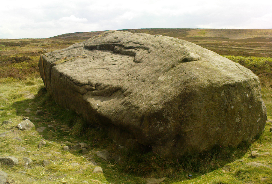
You can’t really miss this.  Take the road south from Winsford, up the steep hill onto the moors and before you reach the crossroads, look up across the slope on your left where you’ll see a small building on its own.  Go there!

Archaeology & History

A curious upright monolith more than five feet long (though some of this is embedded in the ground) with the words ‘CARAACI NEPVS’ carved on one side, is strangely closetted in a silly ‘house’ of its own on the moortops!  But the origins and history of the stone are contentious.  Some proclaim it as prehistoric, others Romano-British, and others as being from the Dark Ages.  In the 1960s and ’70s, archaeological tradition had its origins in the Romano-British period, and certainly the carved lettering on the sides of the stone seem to indicate a Roman provenance; but as the great Exmoor historian S.H. Burton (1974) told,

“It is possible that the stone was erected hundreds of years before it was inscribed, and the existence of an ancient trackway alongside, leading to the Barle, strengthens this possibility.  But, like most things about the Caratacus Stone, this is guesswork.”

We know it stood here in the 13th century as it was described in perambulation records of 1219 and 1279 AD; but it’s more than likely to be a monolith erected in the Dark Ages.  Grinsell (1970) however is a little more cautious, telling:

“The likelihood of the person in whose memeory this stone was raised claiming kinship with the Caratacus who was the arch-enemy of Rome, c. AD 45-50, has on more than one occasion been questioned.  It is, however, too tempting to be abandoned by the present writer.”

The carving on the stone was deciphered by the legendary Prof. John Rhys at the end of the 1800s, telling it to have been Carataci Nepos, the Kinsman of Caratacus (and variants thereof), who held out against the Romans in south Wales until AD 50.  The old Celtic writer, R.A.S. Macalister, thought the stone to have been dedicated to a local christian hero, St. Carantoc, but this notion has been generally dismissed.

Folklore

The old stone is said to be a site where buried treasure exists — though none has ever been found.  There is also an old tradition that “ghostly horses and waggons rumble towards the stone at midnight” — but this as likely relates to its proximity with the old crossroads a short distance away.

References:

  1. Burton, S.H., Exmoor, Hale: London 1974.
  2. Grinsell, L.V., The Archaeology of Exmoor, David & Charles: Newton Abbot 1970.
  3. Page, John Lloyd Warden, An Exploration of Exmoor and the Hill Country of West Somerset, Seeley 1890.
  4. Vowles, Alfred, History of the Caratacus Stone, privately printed 1939.

© Paul BennettThe Northern Antiquarian


Dun Bhuirg, Iona, Argyll

Hillfort:  OS Grid Reference – NM 2649 2462

Also known as:

  1. Canmore ID 21638
  2. Dun Cul Bhuirg

Getting Here

Take the road that cuts across the island, west, until you reach the stupid golf-course.  Walk across it, heading for the coast (not the building at Culbuirg), then follow the little footpath up until you reach the large rocky rise about 500 hundred yards north.  That’s it!

Folklore

Dun Bhuirg on 1881 map

Shown on the 1881 OS map of the region, the small remains of this Iron Age hillfort was said to be the place where St. Columba saw a rain-cloud which he predicted would bring a plague of ulcers to the people of Ireland. To prevent such a plague, Columba thence dispatched a monk called Silnan to Ireland, armed with some bread which he’d blessed. This bread was then dipped in consecrated water and given to those afflicted with the plague, who were thereafter cured.

Wee-ird……

Another tradition told that this old fort was once an important meeting place for the druids, though Geoff Holder (2007) writes that this is little more than a “spurious nineteenth century tradition” which he dismisses as without foundation. Though a short distance from here, he also told how one “Fiona MacLeod” (real name, William Sharp) one night watched the ghost of the Culdee, Oran, a couple of hundred yards away, “and so he never went that way again at night.”  In truth, traditions of druidism tend to be animistic traits: legends remembered from pre-christian days, and blanket dismissals of such folklore are themselves untrustworthy—especially on this Isle of the Druids.

References:

  1. Holder, Geoff,The Guide to Mysterious Iona and Staffa, Tempus: Stroud 2007.
  2. MacLeod, Fiona, Iona, Floris: Edinburgh 1982.

© Paul Bennett, The Northern Antiquarian


Barrow Well, Compton Martin, Somerset

Sacred Well:  OS Grid Reference – ST 537 573

Archaeology & History

This rather delapidated spring of water (there are actually two springs here) marks the western edge of the parish boundary, just on the south-side of the A368 road towards Ubley, on what Phil Quinn (1999) described as “a neglected triangle of shrubby ground.”  Its name derives from once being associated with a prehistoric tomb, or barrow, as the associated field-names of Barrows Orchard and Barrow Cross here indicates.  Sadly however, all remains of whatever tomb there once was appears to have gone.  Aerial imagery shows what may have been two or three barrows in the said field.

Folklore

A haunted site: the folklore here is akin to banshee-lore and similar mythic figures.  The fact that it marked the old boundary line between here and Ubley may have something to do with it.  Quinn (1999) says how,

“Local folklore states that the well was haunted by the ghost of a woman washing cabbages”!

But this vegetative lore is likely a mistranslation of a local dialect word.  Precisely what the spirit was supposedly ‘washing’ seems to have been lost in translation.

References:

  1. Quinn, Phil, The Holy Wells of Bath and Bristol Region, Logaston: Almeley 1999.

© Paul Bennett, The Northern Antiquarian


Jinny Well, Newchurch-in-Pendle, Lancashire

Sacred Well:  OS Grid Reference – SD 82377 39458

Getting Here

Easy to locate: it’s just by the roadside on the left-hand side of the road, Jinny Lane, coming out of the village, just after the last house where the field begins.

Archaeology & History

Nowt to write home about, as they say.  The waters here trickle from the earth into an old stone trough — but they don’t look too appetizing (even I didn’t have a drink, which is something of a rarity!).  Its the folktale accompanying this little site, giving a distinct hint of some heathen past, that I found intriguing.

Folklore

Here was once the spirit of a woman called Jinny – who gave her name to the road it’s on – that wandered betwixt the well and an old stone, once found further up the hillside (after a bitta digging, we found the remains of the old stone, previously an authentic monolith). It was said that if you wandered along the road on certain moonlit nights, her spirit would chase you. To make matters worse, the ghost was a headless one!

Jinny’s spirit originally resided, peacefully, in the broken old stone atop of the hill. At a certain time of the year, the spirit of the stone would venture downhill to drink from the waters here (much as we find at Rollright and other places). But one day a xtian priest came along and, because of its heathen association, broke the old stone in half and cursed the spirit which roamed between the sites. Thereafter, Jinny’s ghost wandered in torment, with her head hacked off, scaring people half to death when they saw her. And so, another priest was eventually called who, to the satisfaction of local people, eventually put Jinny’s ghost to rest, as they say. It seems to have been a successful ritual, as no-one has reporting seeing the headless ghost for many a long year.

References:

  1. Byrne, Clifford H., Newchurch-in-Pendle: Folklore, Fact and Fiction, Marsden Antiquarians: Nelson 1982.

© Paul Bennett, The Northern Antiquarian


Skyreholme Wall Stone, Appletreewick, North Yorkshire

Cup-and-Ring Stone:  OS Grid Reference – SE 0772 6231

Also Known as:

  1. Carving no.413 (Boughey & Vickerman)

Getting Here

Skyreholme Wall Carving
Skyreholme Wall Carving (after Boughey & Vickerman)

Various ways here, but for the sake of newcomers I’d say it was best following directions from Burnsall.  From here, take the Appletreewick road thru the village, past the left turn a few hundred yards along, and another 500 yards or so there’s a split in the road: take the one on your right!  Follow this up, keeping right (don’t turn into Perceval Hall, tempting though it may be!) and park-up where the road turns into a track.  Walk up the track, past the haunted junction, bearing left uphill up Black Hill Road until you reach the very peak of the track where, in the walling on your left, you’ll see this big boulder.  If you can’t see it, you’re bloody close!

Archaeology & History

This is at the very peak of Black Hill Road, with excellent views of Simon’s Seat climbing to the immediate south, the prominent and rounded Nursery Knot Hill immediately north, and grand views to peaks east and west. It is very likely this position had something to do with it being deemed worthy of relevance.  The rock itself defines a point along the old boundary line.

Skyreholme Wall Boundary carving

One peculiarity on this boulder is the deep cup-mark with a strange ‘lip’ to it, which has been mentioned by others in the past.  This is surrounded by at least five others cups — not dissimilar to some of the ‘rosary-designs’ of cup-and-rings further north.

The rock art student’s Boughey & Vickerman’s (2003) drawing of this design is pretty accurate — where they call it stone 413 — though it doesn’t actually give this carving the justice it deserves.  They also erroneously tell that some of the cups here are doubtful.

Check it out for y’self.  This is an excellent stone for cup-and-ring lovers! (with plenty of other sites scattered about all round here)

References:

  1. Boughey, Keith & Vickerman, E.A., Prehistoric Rock Art of the West Riding, WYAS 2003.

© Paul Bennett, The Northern Antiquarian


Fairy Loch, Arrochar, Argyll

Sacred Loch:  OS Grid Reference – NS 3384 9937

Also Known as:

  1. Lochan Uiane

Getting Here

Fairy Loch on 1865 map

To get here, go down the A82 about four-and-a-half miles south of Tarbet (along the Loch Lomond road). Near a burn coming down the hill is an old house, long in ruin, and near the side of this is an old path – more for deer than city-folk. Go up through the wooded hillside for about a half-mile (amble the trek and make it a nice hour’s walk to get into the place). I’d take the stream itself, as you get more into the nature of the place once you get up the slope: there’s more to see, feel and a healthy water supply en route.

Folklore

This is more of a ‘holy loch’ than a holy well — for obvious reasons.  Although it’s not much bigger than a large pond, it is little-known, but has long had the tradition of being an abode of the sith, or faerie-folk. There is, of course, a tendency to find prehistoric remains where the sith have their repute, but there seems little on official records nearby.

Tradition tells that the loch was actually formed in ancient times by locals damming the burn for water supply. Another tells the same in order that a mill could be fed with constant water – though no mill can be found. If this latter tradition is true however, the fairy creature here could have been a brownie – though they are generally more a lowland elemental. One of the reasons the place has been named after the little people is that when certain light falls on it, at the right time of day and year, green triangular shapes emerge from the water formed by deposits hidden beneath the surface (hence the original Gaelic name, Lochan Uaine, or the Green Loch).

Local historian Norman Douglas echoed the folktale described many years earlier by the great John Gregorson Campbell (1900), telling that,

“another story is that the local people would deposit their sheeps’ fleeces in the Fairy Loch overnight, wish for them to be dyed a certain colour, and overnight the fairies would carry out their wish.”

References:

  1. Campbell, John G., Superstitions of the Highlands and Islands of Scotland, James MacLehose: Glasgow 1900.
  2. Douglas, Norman, Arrochar, Reiver Press: Galashiels n.d. (c.1971)

© Paul Bennett, The Northern Antiquarian


Haystack Rock, Ilkley Moor, West Yorkshire

Cup-and-Ring Stone:  OS Grid Reference – SE 13027 46310

Also known as:

  1. Carving no.141 (Hedges 1986)
  2. Carving no.302 (Boughey & Vickerman 2003)
  3. Cottage Rock

Getting Here

The Haystack Rock
The Haystack Rock

Dead easy to find this one!  Get to the Cow & Calf Hotel and walk up the slope onto the moor ahead of you.  If you want a direction-pointer, head for the large, seemingly overhanging rocks which are the Pancake Stone, at the top of the ridge, but a few hundred yards to the right (west).  Once you reach the level on the moor proper, you’ll see this large haystack-shaped boulder close by.  That’s it!

Archaeology & History

This tends to be one of the spots I stop at when doing my tourist walks, to i) let folk get their breath back after ambling from the car park, via Hanging Stones and Map Stone; ii) to drink in the view, and, iii) to begin acquainting themselves with the landscape as it was when this stone was carved (over many decades, perhaps longer), and the animistic cosmology underlying people’s notions of their land.  It can be quite an education…

Haystack Rock, with crushed man underneath
Haystack Rock crushes local man
Fertility symbol, or Rorschach response?

The Haystack Rock was a very important boulder in the mythic landscape on this plain. It stands near the western end of the Green Crag Necropolis: a huge area of land on these moors where, quite simply, the people of these hills laid their dead.  Effectively, the Haystack Rock stands on the edge of Ilkley Moor’s “Land of the Dead”.*

Highlighting this quite firmly, we find that prehistoric walling ‘separates’ this great boulder from the other part of the Plain close to its east and southern sides (walling on its western side is as yet unproven).  It was a boulder that was specifically sectioned-off, away from any tombs.  All along this Plain are numerous small cairns, many with rock-art nearby, and certain parts of the Plain are split into sections by ancient walling (though a precise map of the walling, tombs and rock-art on this moorland ridge has yet to be done).

J.Romilly Allen's 1879 images
J.Romilly Allen’s 1879 images

As far as the textbooks are concerned, we find the first mention of this great carved boulder came from J. Romilly Allen at the end of the 1870s.  By 1900, a number of people had been here and written of its grandeur; but, as with cup-and-rings in general, its non-linear form and design elicited the usual notions of bewilderment, druids and puzzled ideas.  Much like today really!

Drawing of the central design (after Hedges, 1986)
Drawing of the central design (Hedges, 1986)

But this is a big and decent carving, with about 60 single cup-markings, 10 cup-and-rings, and various twizzly grooves and lines linking cups to others, and others going to seemingly nowhere.   Some of these lines, of course, may be weathering, or weathered channels emerging from once shorter lines.  We might never really know for sure what the original carving actually looked like.  On the north-facing side is what looks like a decidedly human figurine etched onto this great boulder, in good old cup-and-ring style. I’ve shown this to a few hundred people and they all seem to make the same remark: it’s a woman with her legs wide open — an early form of sheela-na-gig on Ilkley Moor no less! But whether this was intentional (many folk think so), or just us seeing something we want to see (men in particular!), we might never know.

Ancient cup-marks with vandal marks
More cup-and-rings with vandal marks

The black-and-white illustration above that shows what seems to be just about all elements of the carving in considerable detail, may well be accurate, but it’s nothing compared to seeing the carving first-hand.  When it comes to ancient rock-art, detailed drawings are one thing, but the real thing is altogether much much better!  Check it out and see for yourself…

Folklore

I’m not too sure what credibility we should give to Nicholas Size’s (1934) extravagant claims, but this was one of the sites he alleged to have seen visions of druidic rites and ghostly figures!

References:

  1. Allen, J. Romilly, ‘The Prehistoric Rock Sculptures of Ilkley,’ in Journal of the British Archaeological Association, 35, 1879.
  2. Bennett, Paul, The Old Stones of Elmet, Capall Bann: Chieveley 2001.
  3. Boughey, Keith & Vickerman, E.A., Prehistoric Rock art of the West Riding, WYAS: Wakefield 2003.
  4. Forrest,C. & Grainge, William, A Ramble on Rumbald’s Moor, part 3, Wakefield 1869.
  5. Hedges, John, The Carved Rocks on Rombalds Moor, WYMCC: Wakefield 1986.
  6. Size, Nicholas, The Haunted Moor, William Walker: Otley 1934.

* It’s gotta be pointed out that Ilkley Moor’s ‘Land of the Dead’ extends much further than just the Green Crag.  Much of the extended land above here to the south was an important area, where at some places rites of the dead were performed.  The supposed ‘settlement’ nearby (as well as the lesser known one on the moor west of here, on the moor above Ilkley Crags, near Cranshaw Thorn Hill) was likely to be a place where the dead were rested for a period.  But more about that in the section on the Green Crag Settlement…

© Paul Bennett, The Northern Antiquarian


Wycoller Bridge, Trawden, Lancashire

Cup-Marked Stones:  OS Grid Reference – SD 931 393

Getting Here

Easy enough to find once you’ve actually got to Wycoller.  By car, the only real way to get here is from Colne, through the village of Winewall, and along the Wycoller road, which runs to a dead end.  Once here, the old packhorse bridge with these cup-marks on it can’t be missed!

Archaeology & History

Wycoller Bridge's cup-marked stones (after Jackson, 1962)
Wycoller Bridge’s cup-marked stones (after Jackson, 1962)

A weird one this!  On the famous packhorse bridge close to the old hall, four of the stones have cup-markings etched onto them.  It seems that at least three of the carvings are archaic; with cups on one of the stones being somewhat deep and may actually be medieval.  But we simply don’t know….  A short article describing them was in the Bradford Cartwright Hall Archaeology Bulletin (1962) where they were equally as puzzled about them.  In 1979, J.A. Heginbottom described them in his survey on the prehistoric rock-art of upper Calderdale.  It’s possible that the stones on which the cups were carved might have been taken from a prehistoric tomb on the edge of the moor further up the valley from here.

Folklore

Just next to this bridge is another, much older one, known locally as the Clapper or Druid’s Bridge which perhaps has some bearing on the curious cup-markings.  Legend tells that this older construction was so called “because legend has it that it led to an amphitheatre where the druids held human sacrifices” – and the field just up from here (to the southwest) was known as the Dripping Stone Field.  Hmmmmm…..

References:

  1. Bentley, John, Portrait of Wycoller, Nelson Local History Society 1975.
  2. Heginbottom, J.A., The Prehistoric Rock Art of Upper Calderdale, unpublished report: 1979.
  3. Jackson, Sidney, ‘Cup-Marked Stones at Wycoller,’ in Cartwright Hall Archaeology Group Bulletin, October 1962.

© Paul Bennett, The Northern Antiquarian


Nursery Knot, Appletreewick Moor, North Yorkshire

Sacred Hill:  OS Grid Reference – SE 081 636

Also known as:

  1. Nursa Knott
  2. Nursery Hill

Getting Here

Dead easy.  Follow the Grassington-Pateley Bridge road (B6265) east and about 2 miles past Hebden village, the craggy hill rises to the left-hand side of the road, as you can see in the photo below.  Simple!

Archaeology & History

Nursery Knott hill
Nursery Knott hill

When fellow rock-art freaks Graeme Chappell, Richard Stroud and I were exploring the cup-and-ring stones in the area just south of here a few years back, this hill kept calling out with some repeated awe. “There’s summat about that place,” were the remarks we kept saying – but we could never put our finger on it. (still haven’t if truth be had!).  Between here and the awesome Simon’s Seat to the south, a whole panoply of neolithic and Bronze Age remains scatter the land — and if ritual landscape has any validity, this hill is undoubtedly enmeshed in the mythic framework of such a paradigm. But without any folklore I didn’t feel right to include it here…

At the northern or rear-end of this great outcrop (SE 082 640) is a scattering of many boulders, one of which in particular at Knot Head was explored by a Mr Gill in 1955 and found to have a number of Mesolithic worked flints all round it. Seems as if folk have been up to things round here for even longer than we first thought.  Microlith or flint-hunters would probably do well on the moors up here!

Folklore

It’s the old pen of our Yorkshire topographer Edmund Bogg which brings the lost folktale of this place back to life – and it’s typical of aboriginal creation myths from elsewhere in the world. In his Higher Wharfeland he had this to say of old ‘Nursa Knott’, as it was locally known:

“The old legend is that the devil, for some reason anxious to fill up Dibb Gill,* was carrying these ponderous crags in his apron when, stumbling over Nursa Knott, the strings broke and the crags fell. Legend also says, should the crags be removed they will be carried by some invisible power back to their original position.”

He then reminds us of links with old Wade, plus the settlement of old Grim, a short distance to the north.

Across the road down the track running south to Skyreholme, Jessica Lofthouse ( 1976) told the tale of a ghostly horseman, seen by her great-grandfather no less! Suggesting he may have been ‘market merry’ (i.e., pissed!), she told how he “struck out at a spectral white horse at the Skyreholme three-land ends near Appletreewick – and his stick passed through it!”

References:

  1. Bogg, E., Higher Wharfeland: The Dale of Romance, James Miles: Leeds 1904.
  2. Lofthouse, Jessica, North Country Folklore, Hale: London 1976.
  3. Walker, D., ‘A Site at Stump Cross, near Grassington, Yorkshire, and the Age of the Pennine Microlithic Industry,’ in Proceedings of the Prehistoric Society, 1956.

* Dibb Gill is nearly a mile due west of here – and Dibble’s Bridge which crosses the beck was also known as the Devil’s Bridge, with a few typical creation myths of its own attached.

© Paul Bennett, The Northern Antiquarian


Barrnacoilich, Ardmaddy Castle, Argyll

Standing Stone:  OS Grid Reference – NM 794 164

Getting here

This old stone is another one tucked away, but not too far south of Oban.  Take the Kilninver road and keep heading southwest, past Loch Seil.  Instead of following the road right, to Clachan and then onto Seil Island, bear left and towards Armaddy Castle.  Where the single-track road turns into the woodland towards the castle, the track keeps on into the rocky hills.  Keep going for about another 500 yards.  You’re nearly there!

Folklore

By the coast just north of Loch Melfort, near the hamlet of Degnish, is the grand old Armaddy Castle. On the other side of the trees from here, to the east, Scottish writer and folklorist A.A. MacGregor tells there to be an old standing stone. In his Ghost Book of 1955, he tells the tale of a local man called Donald MacDougal who, returning home after his day’s work at the castle, crossed over the old burn of Eas nan Caerdach where the standing stone can be found, just past the bend in the track.

On reaching it, Donald became aware of a strange light a short distance in front of him. Thinking at first it was the lamp of his co-worker making for the Home Farm, he walked past the stone – but it wasn’t until he got home himself and found he was alone that he questioned what on earth he’d seen! Upon asking other people in the neighbourhood, it was found that other locals had seen the same light, traversing the land from the old standing stone along the footpath to the farm.

References:

  1. MacGregor, Alasdair Alpin, The Ghost Book, Robert Hale: London 1955.

© Paul Bennett, The Northern Antiquarian