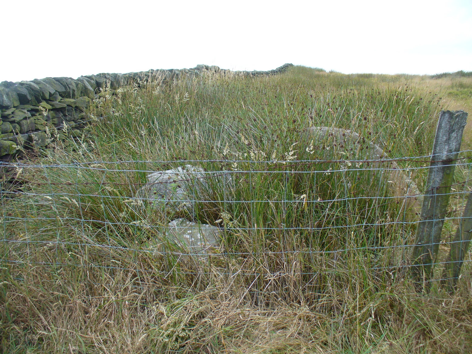
From the Cow & Calf car-park, walk towards and past the gigantic Calf rock, swerving round the fallen mass of rocks and into the trees at the back. Walk uphill to the Hanging Stones cup and ring stones, then keep heading—down the slope then back up the next one—west, for barely 100 yards until you’re on the level ground again, following the footpath alongside the heather. Barely 50 yards along, keep your eyes peeled in the heather for a low flat rock just a few yards in. Forage around and you’ll find it.
Archaeology & History
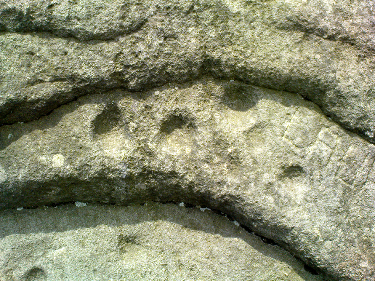
You’ll no doubt be seeing this carving after you’ve visited the impressive Hanging Stones petroglyphs 150 yards to the east. And you’ll probably be disappointed in its lack of visual grandeur when compared to its more ornate eastern neighbour. But the petroglyph fans among you should give it your attention.
Hedges 1986 sketchLooking to the SE
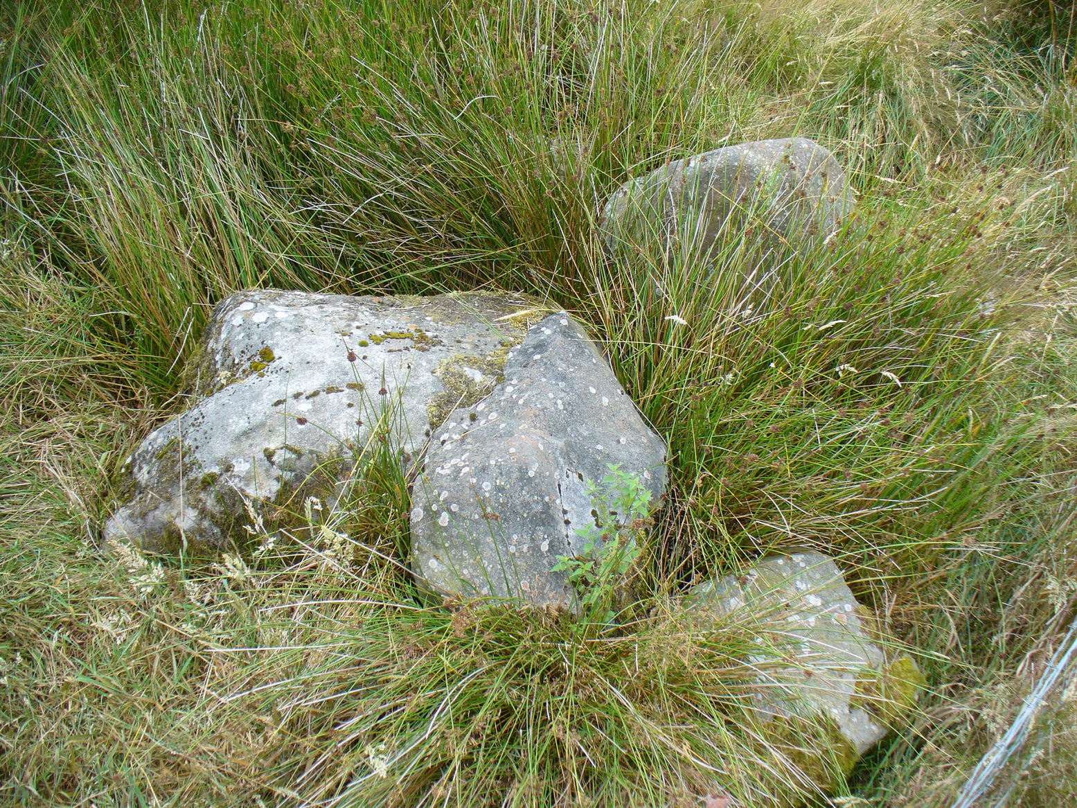
When the dawn or evening daylight cuts across the rock, the design looks much better than at sun high, perhaps telling us that the message of the stone coincided with those periods of the day. The gentle folds of the stone itself morph into the carving: evening and morning light cutting subtle shadowy folds across the rock, giving it an organic texture that our aboriginal ancestors told to be a vital essence of stone itself. The two small clusters of cup-marks upon this stone become greater than their basic design when brushed with the shadows and glows of a sunset. And when our aboriginal peoples painted them in ochre and other colours, an even greater mythos emerged—but sadly it is forgotten here….
When looked at with the simplistic eyes of the archaeo-mind, this and its compatriots are little more than a number of marks on lifeless rocks. This stone for example was described in John Hedges’ (1986) survey as being just “two groups of four and five cups and grooves”—nothing more—with naught but an echo in Boughey & Vickerman’s (2003) later work. The carving has neighbours even more basic in the heather close by…
References:
Boughey, Keith & Vickerman, E.A., Prehistoric Rock Art of the West Riding, WYAS: Wakefield 2003.
Hedges, John (ed.), The Carved Rocks on Rombalds Moor, WYMCC: Wakefield 1986.
Get to the Cow & Calf Rocks, go up across the car-park as if you’re gonna go up onto the moor and walk up the steep footpath uphill to the left of the crags. Once you get level with the crags, take the footpath bending left and walk along here for 110 yards, keeping your eyes peeled for the low smooth rock on the right of the footpath, just where another path meets it. You’ll find it.
Archaeology & History
Close-up, from above
This quiet little stone has seen better days. Nearly destroyed a few weeks ago when the Emmerdale Farm film-crew churned up sections of the moor right over the side of this carving—but thankfully it still remains intact (you or I would have been prosecuted for such damage).* The carving is a simple one in graphic terms, comprising simply of three cup-markings, all on the southern side of the rock. Close to several other petroglyphs (the Wray Stone is 78 yards north and several other more ornate carvings are close by), the carving was first described in the Hedges (1986) survey as a “small, low smooth grit rock sloping slightly NW to SE in crowberry, bilberry, grass and bracken. Three clear cups.” But it has to be said, one of them is fading fast. Let’s hope this humble little carving doesn’t fall prey to those who are gradually turning our moorlands into a park.
References:
Boughey, Keith & Vickerman, E.A., Prehistoric Rock Art of the West Riding, WYAS: Leeds 2003.
Hedges, John, The Carved Rocks on Rombald’s Moor, WYMCC: Wakefield 1986.
* As the footpaths on Ilkley Moor continue to be widened and paved by those who reckon they like these moors, it’s obvious that more prehistoric sites up here are going to get damaged. It’s difficult to see what the local archaeologist or Natural England are doing to ensure that these environmentally-damaging schemes don’t encroach on the mass of rich prehistoric sites on the moors, most of which have never been adequately assessed (the philosophy of “if we don’t know it’s there, it doesn’t matter if we destroy it” seems evident in some of those working for the local council). Before any work or structures are dug on Ilkley Moor, an archaeological assessment is, I believe, supposed to take place – but I think this ‘work’ consists merely of looking at their own limited records, without any detailed fieldwork being undertaken. As we know from research undertaken by rock art students at TNA, CSI and elsewhere, there are still many cup-and-ring stones, cairns and archaeological features constantly being discovered on these moors that are not in the record books.
Take the road from Ilkley town centre up towards the White Wells and keep following it along until it curves up and onto the moor itself and becomes a rocky dirt-track. Go up here, past the old quarries (left) until you hit the footpath which runs east (left) onto the flat level of the moorland. Follow this footpath along for literally half-a-mile, where a footpath runs up onto the tops of the moorland. Go up here for 100 yards and you’ll see a small standing stone by the right-hand side of the footpath; on the left, into the moorland about 20 yards away, this carving is to be found!
Archaeology & History
This is an excellent, archetypal cup-and-ring stone carving and is in a very good state of preservation. Found just a few yards away from the aptly-named Pitchfork Stone, the carving here on a large single stone mainly comprises of a double cup-and-ring. A couple of other possible outlying cup-marks can be seen: one just below the double-ring, and the other towards the top-end of the rock. It was first reported by Stuart Feather in the Bradford Archaeology Group’s journal in 1961, then listed in the surveys of Hedges (1986) and his followers.
Carving 257, looking NE
When Michala Potts, Dave Hazell and I we visited this carving the other day, some halfwit had been up here in the not-too-distant past and, as with some of the carvings on the moors north of Ilkley, had daubed some paint or oily resin onto the carvings themselves to specifically highlight aspects of the carved rock (not one part of the uncarved stone had anything on it). We aint quite sure exactly what the substance is that’s been daubed onto the carvings (it aint ordinary paint), but seems like an oil or industrial substance. And, whoever’s done this, obviously seems to have some knowledge of the rock art they’re painting over: they certainly have good grid-references and enjoy walking the hills. This aint just some idiot/s into vandalizing the carvings for the sake of it, nor the whim of some airy-fairy New-Ager. Whoever’s done this (and it’s been done on other cup-and-rings around this locale) have deliberately set out to locate and paint over specific carvings — a number of them off-path — with the intention it would seem to highlight them for photographic enhancement. So — whichever retard has done this, might I suggest that you keep your industrial waste where it belongs: in your own house you fucking moron! If anyone knows who is doing this to the carvings round here, please email me (anonymously if necessary) with all relevant info. Any such communications regarding this matter will be kept strictly confidential.
References:
Boughey, Keith & Vickerman, E.A., Prehistoric Rock Art of the West Riding, WYAS: Leeds 2003.
Hedges, John, The Carved Rocks on Rombald’s Moor, WYMCC: Wakefield 1986.
Head up to the Cow & Calf Rocks and walk to the large disused quarry round the back (west). You’ll notice a scattered copse of old pine trees on the edge where the hill slope drops back down towards Ilkley; and there, two raised hillocks (unquarried bits) rise up where the pine trees grow. The carvings are on the flat rocks atop of one of the two hillocks. If you’re walking up from Ilkley, once you’ve crossed the cattle-grid in the road and the moorland slope opens up above you, just walk uphill towards the copse of trees and watch out for the rock outcrop in the picture here.
Archaeology & History
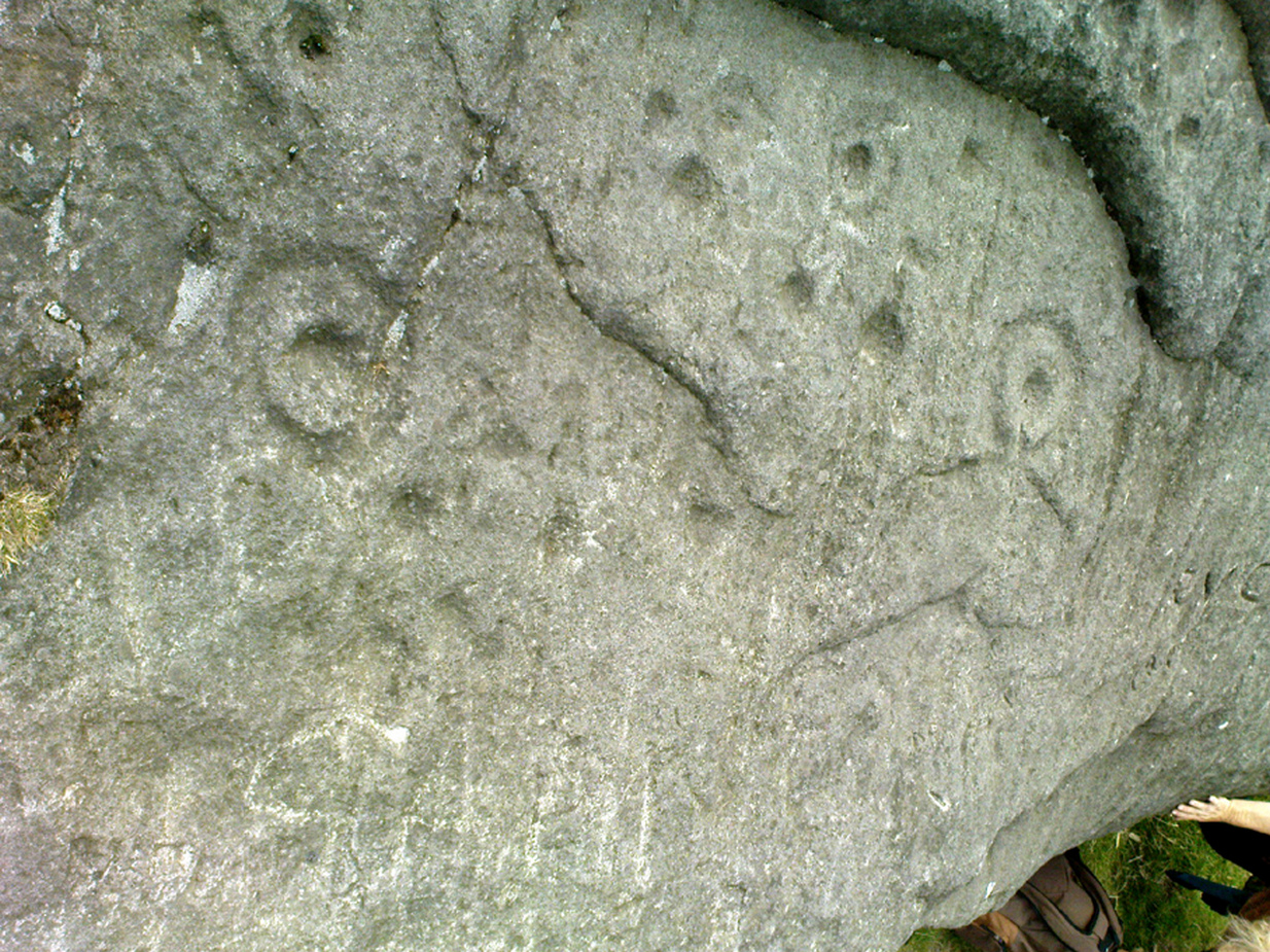
Very well-known to locals, folklorists and archaeologists alike, the remains of these old glyphs have caught the attention of artists, historians and Forteans alike for the images and tales surrounding them. It was obvious that in times past, that the carved remains that we see today would have extended considerably further, but the quarrying destroyed much of it. Indeed, we’re lucky to have this small section of carved rock still intact!
The rocks were first described as the Hanging Stones in the local parish records of 1645, and their name probably derives from the old-english word hangra, meaning ‘a wood on a steep hill-side,’ which is very apt here. The first known description of the site as possessing cup-and-rings appears to have been in a small article in the local Leeds Mercury newspaper in 1871. Several years later J. Romilly Allen (1879) wrote a lengthier descripton of the site:
“The crags from which these masses have been detached are known by the name of hanging stones, and at their eastern extremity is a large quarry. Between this quarry and the overhanging edge of the cliff a portion of the horizontal surface of the rock was some years ago bared of turf, thereby disclosing the group of cup and ring sculptures shown on the accompanying drawing. It will be seen that the design consists of twenty-five cups of various sizes, from 1 to 3 inches in diameter. Seven of the cups are surrounded by incomplete rings, many of them being connected by an irregular arrangement of grooves. The pattern and execution are of such a rude nature as almost to suggest the idea of the whole having been left in an unfinished state. The sides of the grooves are not by any means smooth, and would seem to have been produced by a process of vertical punching, rather than by means of a tool held sideways.”
Allen and other archaeologists from this period saw some considerable relevance in the position of this and the many other cup-and-rings along this geological ridge, telling:
“The views obtained from all points over Wharfedale are exceedingly grand, and this fact should not be lost sight of in studying remains that may have been connected with religious observances, of which Nature worship formed a part.”
J. Romilly Allen’s 1879 drawing of the carvingsWater-assisted double-ring on eastern rock
A common sense point that seemed long-lost to many archaeologists, adrift as they went in their measurements of lithics and samples of data charts for quite a number of years. In recent years however, this animistic simplicity has awakened again and they’ve brought this attribute back into their vogue. Let’s hope they don’t lose sight of it again!
There are tons of other archaeological references to this fine set of carvings, but none add anything significant to anyone’s understanding of the nature of the designs. We must turn to psychoanthropology, comparative religion and folklore if we want to even begin making any realistic ‘sense’ (if that’s the right word!) of this and other cup-and-rings. Curiously, the nature of this and other carvings is a remit archaeology has yet to correctly engage itself in.
Hanging Stones with “21st century informal unauthorised carvings”
On a very worrying note, we need to draw attention to what amounts to the local Ilkley Parish Council officially sanctioning vandalism on the Hanging Stones, other prehistoric carvings and uncarved rocks across Ilkley Moor. As we can see on a couple of photos here, recent vandalism has been enacted on this supposedly protected monument. Certain ‘officials’ occasionally get their headlines in the local Press acting as if they’re concerned about the welfare of the ancient monuments up here, but in all honesty, some of them really don’t give a damn. The recent vandalism on this stone and others has now been officially recognised as an acceptable “tradition” and a form of — get this! — “twentieth / twenty-first century informal unauthorised carving” and has been deemed acceptable by Ilkley Parish Council as a means to validate more unwanted carving on the moorland “in the name of art”! Of course, their way of looking at this has been worth quite a lot of money to a small group of already wealthy people. But with Tom Lonsdale and Ilkley Council validating or redesignated ‘vandalism’ as “twenty-first century informal unauthorised carvings”, this legitimizes and encourages others to follow in their shallow-minded ignorant footpath, enabling others with little more than a pretentious ‘care’ for both environment and monuments to add their own form of ‘art’ on cup-and-ring carvings, or other rocks on the moors.
Hanging Stones with more “21st century informal unauthorised carvings”
You can see in some recent vandalism — sorry, traditional “twentieth / twenty-first century informal unauthorised carving” — at the top-right of the Hanging Stones photo to the side, a very ornate ‘Celtic’-style addition, akin to the quality carved by well-known stone-mason Pip Hall who, coincidentally, has now been granted a lot of money to “officially” carve her own work on another stone further down the valley from here. With Miss Hall, Mr Lonsdale, poet Simon Armitage and Ilkley Parish Council each playing their individual part in encouraging what is ostensibly vandalism…errr…sorry – I keep getting it wrong – I mean traditional “twentieth / twenty-first century informal unauthorised carving” on the Hanging Stones monument and other cup-and-ring stones on the moor, we can perhaps expect a growth industry in this field…..especially if you’re wanting to make more money for yourself in the name of art or poetry. And if you apply to Rachel Feldberg of the Ilkley Arts Festival, you may get good money for your work… Seriously! (this is no joke either)
Please contact Ilkley Parish Council and other relevant authorities and express your dismay at their lack of insight and concern for the knock-on effects of their decisions on this matter. Other plans to infringe even further onto Ilkley Moor are in the business pipeline…
Folklore
Just underneath the carved overhanging rocks (walk off the knoll to the bottom of the rocks, facing the town), is a small recess or sheltered cavity which, told Harry Speight (1900),has
“From time immemorial (been) known as ‘Fairies’ Kirk’, and traditions of it having been tenanted by those tiny sprites, the fairies, still exist among old people in the neighbourhood.”
Tradition goes on to tell that when the Saxons arrived here, they were wont to build a christian church by the Hanging Stones, but the little people strongly resented this and fought hard against the invading forces. As the Saxons started building the edifice of the new religion, during the night the fairy folk took down the stones and moved them into the valley below. In the morning when the Saxons found this had happened, they carried the stones back up to begin building again; but each night, the fairy folk emerged and again took the stones to the valley bottom again. Eventually, after much hardship, the Saxon folk gave up the idea of building on the Fairie’s Kirk, as it was known, and the church that still remains in Ilkley centre was decided as an easier place to build their edifice.
Traditions such as this (of fairies moving stones back to whence they came, or away from ancient archaeological sites) are found throughout Britain and appear to be simple representations of the indigenous peasant hill-folk who strongly objected to their own sacred sites (rocks, trees, wells, etc) being supplanted by the invading religious force.
In more recent years the observation of curious light phenomena over these rocks have been seen, both over here and the Cow & Calf Rocks…
References:
Allen, J.R., ‘The Prehistoric Rock Sculptures of Ilkley,’ in Journal of the British Archaeological Association, vol.35, 1879.
Bennett, Paul, The Old Stones of Elmet, Capall Bann: Milveton 2001.
Bogg, Edmund, Higher Wharfeland, James Miles: Leeds 1904.
Collyer, Robert & Turner, J. Horsfall, Ilkley: Ancient and Modern, William Walker: Otley 1885.
Gelling, Margaret, Place-Names in the Landscape, Phoenix: London 2000.
Hedges, John (ed.), The Carved Rocks of Rombald’s Moor, WYMCC: Wakefield 1986.
Leeds Mercury, ‘Prehistoric Remains at Ilkley’, 20 April, 1871.
Michell, John, The Earth Spirit: Its Ways, Shrines and Mysteries, Thames & Hudson: London 1975.
Size Nicholas, The Haunted Moor, William Walker: Otley 1934.
Smith, A.H., English Place-Name Elements – volume 1, Cambridge University Press 1956.
Speight, Harry, Upper Wharfedale, Elliott Stock: London 1900.
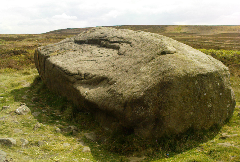
Dead easy to find this one! Get to the Cow & Calf Hotel and walk up the slope onto the moor ahead of you. If you want a direction-pointer, head for the large, seemingly overhanging rocks which are the Pancake Stone, at the top of the ridge, but a few hundred yards to the right (west). Once you reach the level on the moor proper, you’ll see this large haystack-shaped boulder close by. That’s it!
Archaeology & History
This tends to be one of the spots I stop at when doing my tourist walks, to i) let folk get their breath back after ambling from the car park, via Hanging Stones and Map Stone; ii) to drink in the view, and, iii) to begin acquainting themselves with the landscape as it was when this stone was carved (over many decades, perhaps longer), and the animistic cosmology underlying people’s notions of their land. It can be quite an education…
Haystack Rock crushes local manFertility symbol, or Rorschach response?
The Haystack Rock was a very important boulder in the mythic landscape on this plain. It stands near the western end of the Green Crag Necropolis: a huge area of land on these moors where, quite simply, the people of these hills laid their dead. Effectively, the Haystack Rock stands on the edge of Ilkley Moor’s “Land of the Dead”.*
Highlighting this quite firmly, we find that prehistoric walling ‘separates’ this great boulder from the other part of the Plain close to its east and southern sides (walling on its western side is as yet unproven). It was a boulder that was specifically sectioned-off, away from any tombs. All along this Plain are numerous small cairns, many with rock-art nearby, and certain parts of the Plain are split into sections by ancient walling (though a precise map of the walling, tombs and rock-art on this moorland ridge has yet to be done).
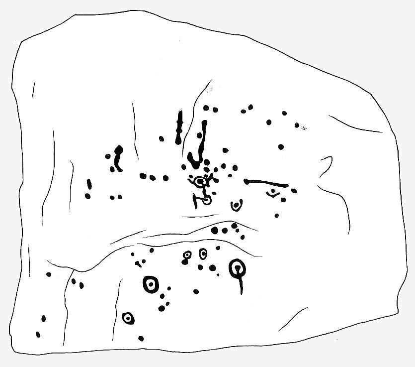
J.Romilly Allen’s 1879 images
As far as the textbooks are concerned, we find the first mention of this great carved boulder came from J. Romilly Allen at the end of the 1870s. By 1900, a number of people had been here and written of its grandeur; but, as with cup-and-rings in general, its non-linear form and design elicited the usual notions of bewilderment, druids and puzzled ideas. Much like today really!
Drawing of the central design (Hedges, 1986)
But this is a big and decent carving, with about 60 single cup-markings, 10 cup-and-rings, and various twizzly grooves and lines linking cups to others, and others going to seemingly nowhere. Some of these lines, of course, may be weathering, or weathered channels emerging from once shorter lines. We might never really know for sure what the original carving actually looked like. On the north-facing side is what looks like a decidedly human figurine etched onto this great boulder, in good old cup-and-ring style. I’ve shown this to a few hundred people and they all seem to make the same remark: it’s a woman with her legs wide open — an early form of sheela-na-gig on Ilkley Moor no less! But whether this was intentional (many folk think so), or just us seeing something we want to see (men in particular!), we might never know.
Ancient cup-marks with vandal marksMore cup-and-rings with vandal marks
The black-and-white illustration above that shows what seems to be just about all elements of the carving in considerable detail, may well be accurate, but it’s nothing compared to seeing the carving first-hand. When it comes to ancient rock-art, detailed drawings are one thing, but the real thing is altogether much much better! Check it out and see for yourself…
Folklore
I’m not too sure what credibility we should give to Nicholas Size’s (1934) extravagant claims, but this was one of the sites he alleged to have seen visions of druidic rites and ghostly figures!
References:
Allen, J. Romilly, ‘The Prehistoric Rock Sculptures of Ilkley,’ in Journal of the British Archaeological Association, 35, 1879.
Bennett, Paul, The Old Stones of Elmet, Capall Bann: Chieveley 2001.
Boughey, Keith & Vickerman, E.A., Prehistoric Rock art of the West Riding, WYAS: Wakefield 2003.
Hedges, John, The Carved Rocks on Rombalds Moor, WYMCC: Wakefield 1986.
Size, Nicholas, The Haunted Moor, William Walker: Otley 1934.
* It’s gotta be pointed out that Ilkley Moor’s ‘Land of the Dead’ extends much further than just the Green Crag. Much of the extended land above here to the south was an important area, where at some places rites of the dead were performed. The supposed ‘settlement’ nearby (as well as the lesser known one on the moor west of here, on the moor above Ilkley Crags, near Cranshaw Thorn Hill) was likely to be a place where the dead were rested for a period. But more about that in the section on the Green Crag Settlement…
Stone Circle (destroyed): OS Grid Reference – SE 0898 4393
Also known as:
Bradup Bridge
Brass Castle
Kirkstones Circle
Archaeology & History
Lay-out of the site, c.1929 (after Raistrick)
Not far from the little-known site of Beacon Hill, this once important megalithic ring was described by Arthur Raistrick in 1929 as “the finest stone circle” in West Yorkshire. Sadly however, the complete destruction of the place in recent years has now left us with nothing to go by (you would think such actions were illegal, but we’ll come to that shortly).
The site measured thirty feet across and, until only a few years back, had a distinct embankment surrounding it. In 1885 Robert Collyer described 18 stones here; but in Raistrick’s (1929) survey only 12 were visible. He told:
“The circle is situated on the west side of the Keighley to Ilkley road, in the rough pasture called ‘Brass Castle’…immediately south and west of Bradup Bridge. The circle is approximately 30 feet diameter, but has been very damaged at some period since 1885. At that date 18 stones were standing, but now only 12 remain, though there are large unfilled holes on the sites from which the other stones have been removed. There are slight traces of a bank, but the most notable feature is the large size of the stones (millstone grit from the neighbouring escarpment) of which the circle has been made. There are some traces of a double circle, but it is not possible to be sure of this now. It seems certain that the stones were removed from this circle to repair the neighbouring Bradup Bridge, an act of vandalism always to be deplored… There is no appearance of this circle having been used for interment, nor any record extant of exploration.”
When Eric Cowling (1946) visited the site in the 1930s, his notes indicate that it was much as Raistrick had described a few years prior, telling:
“This circle is situated at the west side of the Keighley-Ilkley road near Bradup Bridge on the Airedale side of Rombalds Moor, near the crest. Only twelve stones remain standing; these are large and apparently obtained from the nearby escarpment (Kirkstones, PB); holes mark the site of stones removed. The ring is thirty feet in diameter with some traces of a circular bank; the position of some stones suggests that the circle may have been continuous. I have heard this place referred to as ‘Kirkstones’ and ‘Brass Castle’, both suggestive names.”
A newspaper account of the site in 1960 reported that 12 stones were still in situ and that “there are large holes from which the other stones have been removed.” This fact was echoed by a local walker, Ken Pickles, who knew the site well and said:
“I first walked this moor in 1945,” he says. “In the late 1960s there were definitely 12 there. It was a perfect stone circle. It offends me that children should be denied things like this.”
As if to affirm the status and number of stones again, when archaeologist Ian Longworth (1965) wrote about it he told that,
“Twelve stones remain in this badly damaged circle, which measures about 30 feet across. The stones are of local millstone grit. Several seem to have been removed from the site to repair Bradup Bridge.”
Sid Jackson’s old drawing
By 1995 only one stone was in situ, but a very distinct, albeit low circular embankment was still in evidence. I sat here quite a few times when I was young, munching mi sarnies, having a rest, alone and with friends (once in the company of holy wells author Edna Whelan and fellow rock art researcher and author Graeme Chappell) before journeying back home. It looked that at least one other stone was buried just beneath the grassy surface on the northeastern side of the banking.
Bradup is included in the respective archaeological magnum opuses of both Burl (2000) and Barnatt (1989); where the latter visited the site in the 1980s and thought it may have been “the last vestiges of a cairn.”
Arthur Raistrick’s (1929) plan shows that at least two stones stood near the centre of the circle, which may have related to a solstice sunrise alignment with the old standing stone at nearby Black Knoll hill on Morton Moor (replaced at an unknown date in the past by a stone cross). And when Mr Raistrick told this to be the best stone circle in the region, he knew what he talking about! He had surveyed many other prehistoric remains and was the leading archaeological authority in the region at the time. Today, we have no such professional authority in the region who is worthy of such an accolade. The sorry series of events that led to the destruction of Bradup’s stone circle took a little time to emerge, but after a series of emails to various departments several years ago, the culpability seemed to spread across several people, each of whom made simple mistakes; but these were mistakes that have led directly to Bradup’s demise. I hope some of you will forgive me telling its story…
Bradup stones removed & dumped near wallBradup stone remains dumped in a pile
I first received an email from a colleague in 2002 asking whether or not I was aware of what seemed to be the final destruction of the Bradup stone circle, as the land-owner from Upwood Farm had been over the field and uprooted some buried stones — plus the last visible upright in the ring — and moved them into a pile at the top southern-end of the field in which the circle previously stood. So a small bunch of us went over to have a look and, much to our horror, found the report to be true. The field itself had been completely levelled and the circular embankment flattened, with the upright stone and any buried ones dragged and dropped into the pile of stones that obviously constituted the megalithic structure we’d sat within and visited so many times down the years up against the wall at the top of the field. Someone — the land-owner it seemed — quite recently in early 2002, had destroyed the Bradup stone circle.
How the hell had this happened…!? So, I contacted those who were supposed to look after the welfare of such monuments.
In 2006, Pippa Pemberton was the person working for English Heritage who had the stately title of ‘Field Monument Warden for West Yorkshire’ and elsewhere — and it was Pippa who told the sorry tale, albeit through the well-disguised erudition of avoiding blame to anyone. Amongst several allegedly ‘professional’ archaeologists who I emailed, it was one to Neil Redfern that was responded to, eventually. As you’ll read below, my email asks how this stone circle had been destroyed, with the lengthy ‘explanation’ giving the official reasoning:
Bradup Stone Circle Destroyed
From: Paul Bennett Sent: 10 March 2006 14:05 To: REDFERN, Neil Subject: Stone circle destroyed nr Ilkley
Hello there!
I sent you an email quite a long time ago (below) concerning the complete destruction of Bradup stone circle on Ilkley Moor, for which I have heard nothing since. I wonder, out of respect, if you could either let me know the circumstances surrounding my query, or perhaps pass me on to the relevant person:
“Out of interest (and on the same moorland region) I wonder if you could let me know who it was from English Heritage who de-scheduled a site once known as the Bradup stone circle (also known as Kirk Stones) after a visit to the place a few years ago? (SE 0897 4393) The incorrect site/location was examined and the real stone circle, close by, was subsequently destroyed by the adjacent land-owner. Evidence of the destruction is still there at the top of the field in the form of a few oddly-piled small boulders.
“I think it important that whoever de-scheduled this site should be taken to task for their error. (I don’t mean sack the poor soul, although it’s evident that some re-training is probably in order.) or perhaps the land-owner taken to task for the destruction of the site.
“I would be interested to hear what you, or one of your fellow workers, think about what’s happened here.
Best wishes – Paul Bennett”
Sometime later, I received the following response:
“Dear Paul
Your email was passed on to me by Neil Redfern, as I am currently the person dealing with scheduled monuments in West Yorkshire. Please accept my apologies for the delay in responding to you – we have been working with Heritage Action on this issue, and it was accidentally assumed that you were associated with that organisation too.
In response to your query I have copied an extract from a recent letter I sent to Heritage Action about Bradup, outlining the history of the case and the justification for its descheduling. I hope that this text answers your concerns. For your information, should you require any further assistance with this case, I recommend that you return to me quickly as I am due to start maternity leave at Easter and we do not yet know who will be dealing with this casework in my absence.
With best wishes
Pippa Pemberton,
English Heritage Yorkshire Region, Field Monument Warden – West Yorkshire & Districts of Scarborough & Ryedale.
Scheduling and location of the Bradup site
Scheduled Monuments are currently provided statutory protection under the 1979 Ancient Monuments and Archaeological Areas Act, which replaced earlier legislation and is itself currently under review by the government (DCMS) in their Heritage Protection Review. Scheduled Monuments are a land-based designation, which means that they are fixed in space, with defined boundaries within which specific protection applies. The legally protected location of a Scheduled Monument is recorded on maps and described in associated documentation. Together these documents provide the legal record of the site and are the basis on which protection is applied.
Our records show that a site at Bradup was scheduled as a stone circle in 1933 at grid reference SE 0895 4391, based on information provided by a partial survey of the site made by Dr A Raistrick in 1920 and on reports recorded in 1885. This site was known by the name of Bradup Stone Circle. The location of this site is shown on the map attached to this email.
Subsequently the Ordnance Survey visited the site in 1961, when R Emsley undertook a measured survey of the locations of the stones and hollows included within the scheduled site. However he noted that the stones appeared, by that stage, to be haphazard in their distribution and he appears to have been unconvinced by the description of the site as a stone circle. On the basis of this visit by Emsley, the Bradup stone circle was marked on the 6” Ordnance Survey map, with the location given by Emsley as SE 0895 4392. In addition, Emsley noted that the unscheduled site known as ‘Kirkstones’ was located nearby at SE 0907 4479, but did not describe this site. We have no information on file about this site.
Visits were then made to the scheduled Bradup site by two Royal Commission / English Heritage Field Monument Wardens in 1981 and 1985, with the purpose of monitoring the management of the site. Both of these officers found the site difficult to distinguish, noting stones in a rough pasture field.
Subsequently, it appears that several other locations have been claimed for the Bradup Stone Circle across several fields in the locality, including SE 0897 4393 (Paul Bennett). This latter would place the circle within the adjacent improved pasture field and outside the previously scheduled area.
Descheduling the site
During 1994, a visit made to the site at SE 0895 4391 under the English Heritage Monuments Protection Programme (MPP) noted that the site described by Raistrick does not correspond with the remains then visible. According to this MPP officer, the spatial relationships between the stones and stone holes differed from those Raistrick recorded whilst he also appeared to have omitted others. In their opinion, the scheduled site was not a stone circle, but “a haphazard group of rocks … situated on a hillside which has been quarried and has naturally occurring gritstone boulders. The site itself consists of a random collection of boulders and small holes left by stone quarrying on a slight rise and has a roughly rectangular hollow in the centre which may be an excavation.” “The site is lacking in any of the other features normally associated with stone circles … Whether the extra stones represented by the stone holes are taken into account or not there are no grounds for considering this site to be a stone circle or any other type of prehistoric monument. It is therefore recommended for descheduling”.
Subsequently the recommendation for descheduling would have passed by the officer to the Monuments Protection team, who would have passed it to the relevant Inspector of Ancient Monuments for their consideration and approval. It would then have been passed to a committee of archaeological advisors for their consideration and approval before finally being submitted to the Department of Environment (now DCMS) for their approval and action.
Review visit to the descheduled Bradup site
In response to Heritage Action’s concerns, a site visit was undertaken to the descheduled site by several members of English Heritage’s Heritage Protection team in November 2005. At SE 0895 4391 they observed a number of exposed stones in a rough pasture field, some earthfast, and also hollows that may represent removed stones. The team could not relate the remains at this location to either Raistrick’s description or the Ordnance Survey drawing and concluded that the remains at this location had been mis-attributed (comprising natural boulders and quarrying) and that descheduling was the appropriate action. If a stone circle had been located in the nearby improved pasture field, which was never protected by scheduling, then any remains have been removed. “Either way [they conclude], de-scheduling was the correct action, and unless evidence is produced that demonstrates surviving prehistoric remains no further action should be undertaken”.
Conclusion
In conclusion then, the site afforded legal protection between 1933 and 1995 as a Scheduled Monument was located in the rough pasture field at SE 0895 4391. Since the 1970s several successive archaeologists have been unable to locate the remains of a stone circle in this location, leading to an interpretation of mis-attribution and the descheduling of this site; an interpretation that has recently been upheld by the Heritage Protection team. There has been no landscape change in this area subsequent to descheduling, with the land-use remaining as rough pasture and the previously protected stones and hollows remaining in place.
Other accounts place a potential stone circle in a nearby field. This potential site was never subject to any legal protection as a designated Scheduled Monument, and any potential surface remains have been removed by the farmer, within his legal rights, during its conversion to improved pasture.”
In this reply, notice the remark describing the position of the circle: “Our records show that a site at Bradup was scheduled as a stone circle in 1933 at grid reference SE 0895 4391, based on information provided by a partial survey of the site made by Dr A Raistrick in 1920 and on reports recorded in 1885.” This is either deliberate misinformation, or bad record-keeping, as neither Robert Collyer’s 1885 reference, nor Arthur Raistrick’s 1929 account cites such a grid-reference. It is possible that when the Ordnance Survey lad, R. Emsley, visited here in 1961, that he looked at the wrong dubious ‘ring’ of low stones over the fence into the heather. Somehow he, or his subsequent record-keepers, mistook what Raistrick said were the “most notable feature (are) the large size of the stones”, for the small earthfast rocks over the fence. This is very poor when you consider that the 1970s 1:10,000 OS-map of this area clearly shows the circle to be in the field, indicating that the Ordnance Survey fella had been, seen and recorded it correctly.
One final element on this “grid-reference” error: I have in front of me the List of Scheduled Monuments in the Bradford District (“The Schedule is currently not available on” their website cos the people who get paid to do such a thing can’t be arsed), dated from the 1990s. The “Bradup stone circle near Bradup Bridge, Morton” is cited as being at “SE 0900 4400” and not the OS grid reference described in the explanation about the site’s destruction. Funny that innit…?
There’s much more that I could say in response to this excuse for de-scheduling and allowing the destruction of Bradup stone circle, but I’m hoping that people can see for themselves that ‘excuses’ are the order of the day in this report. Simply put: the Bradup stone circle was destroyed due to the ineptitude of ‘authorities’ mistaking several natural earthfast rocks at the grid-reference they give (if indeed even that’s the right one for it!) for the real prehistoric circle in the adjacent field. In short, they fucked up – and the email above is their attempt at an excuse to cover up their mistakes. We all know how they cover each others backs when they screw up. If you or I did this, we’d be in court.
Folklore
Also known as the Brass Castle and the Kirkstones (indicating it as a place of worship), Cowling (1946) told how “local lore suggests that the place is haunted.” The name Kirkstones derives from the rock outcrop 800 yards north of here, where the stones which made this site may have come from. A dowsing survey found there to be water beneath the circle, but this wasn’t mapped.


")
")


 Allen 1879")

")