Duncroisk Farm, Glen Lochay, Killin, Perthshire

Cup-Marked Stone:  OS Grid Reference – NN 53159 36409

Also Known as:

  1. Canmore ID 24170
  2. Duncroisk 1 carving (Canmore)
  3. Garnet Stone

Getting Here

Duncroisk Farm stone & Garnet Rock behind

Pretty easy to find this.  Go up Glen Lochay for 3 miles or so, on the road past the brilliant Stag Cottage carvings for a couple of hundred yards where you’ll see an old run-down army-looking building and past that is a curious large wooden and wire construction.  Go up the farm-track next to this, past Duncroisk Farm, taking the footpath through the gates that go up to the side and behind the farm.  You’ll see a rounded grassy knoll ahead of you.  Head straight for it!

Archaeology & Folklore

This carving would appear to have been described for the first time by Mr Cormack (1952) in his longer essay on the cross-marked stones nearby.  He said briefly:

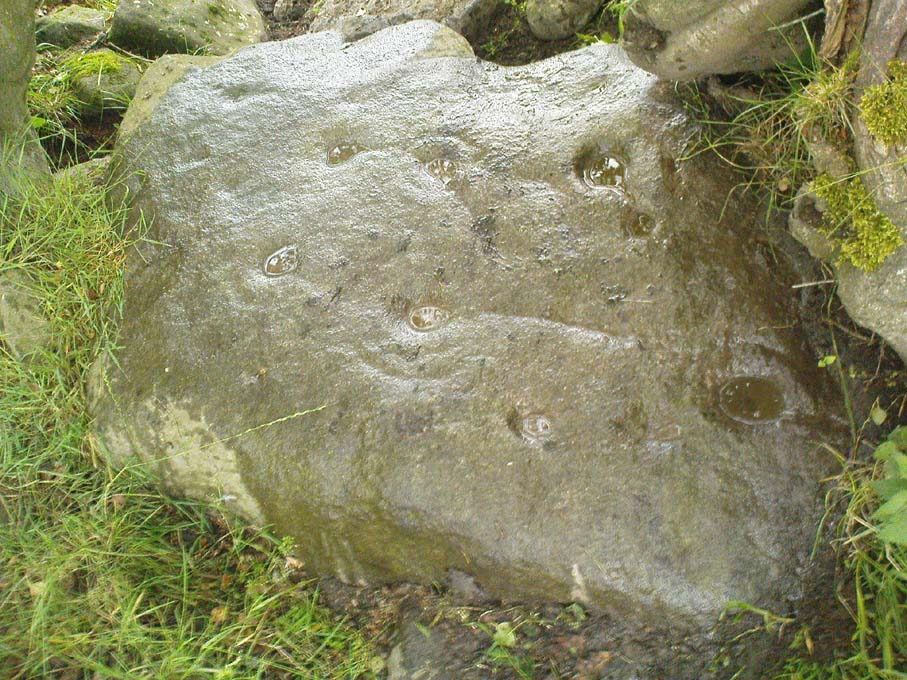
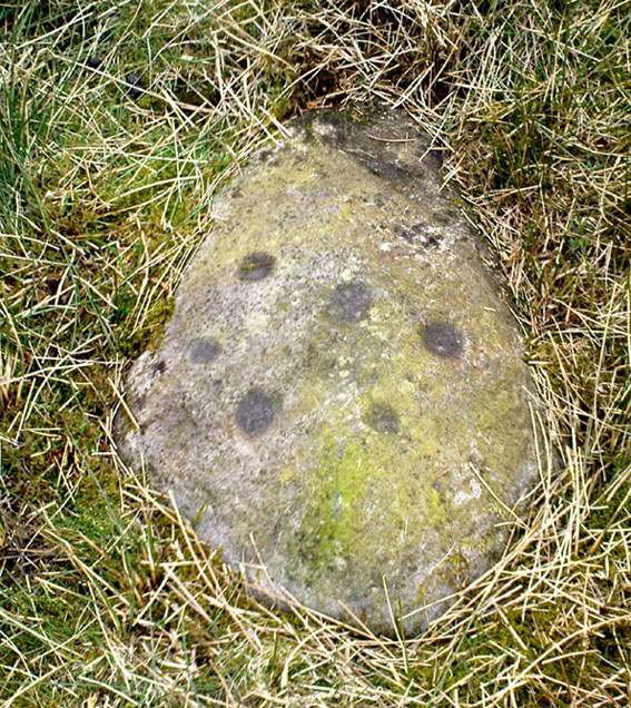
“On the top of a small rock-strewn knoll about 300 yards behind Duncroisk farmhouse is a recumbent boulder, at one corner of which is a group of five fairly deep cup-marks of 2- to 3-inch diameter.”

Little else has been said of the site and even Ron Morris (1981) only gave the carving a brief mention in his survey, saying in passing how “east of a prominent rocky knoll, on whose summit is a cup-marked boulder…”, as he journeyed further uphill to explore the fascinating Duncroisk 4 carving with its scant cup-marks, human figurine and other curious insignia.  And although this carving is probably only worthwhile for the real fanatics amongst you, I like the place — sad fella that I am!

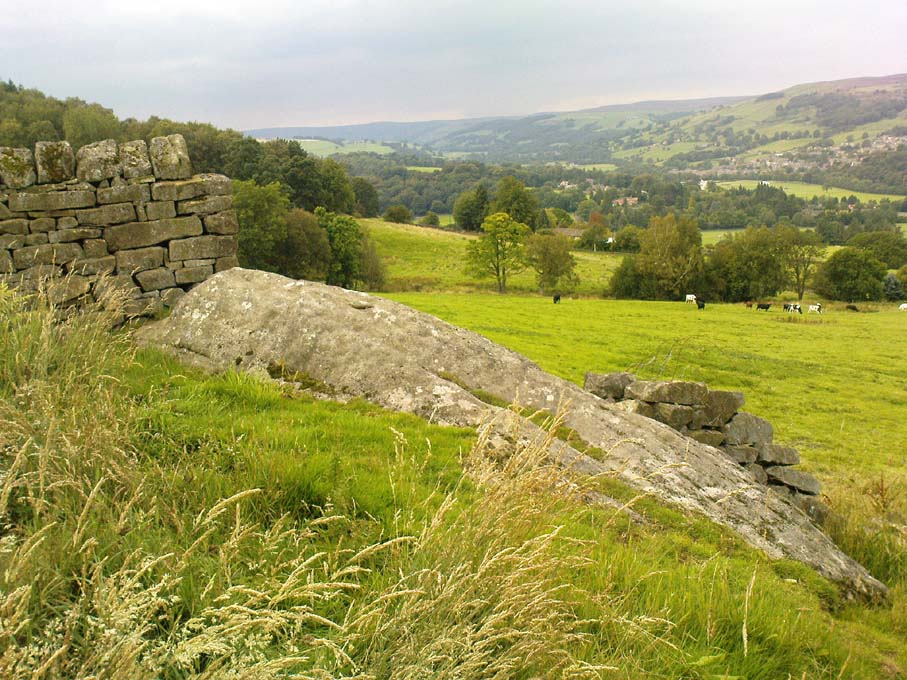
Cup-marked stone, looking south
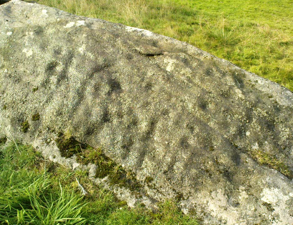
Close-up of cups

There are five very distinct cup-marks etched onto a small, almost triangular section of the rock, sat close to a couple of other larger stones on top of the grassy knoll overlooking the glen, not far from some iron age walling.  The cups are etched onto the topmost (northern) section of the rock, which is defined by a natural crack running across the surface, almost splitting one part of the stone from the other.  The five cups are in no discernible linear formation.  A possible sixth cup-mark and extended line may have been started on the other side of the crack on the stone, but its execution was stopped for some reason.  This is by no means certain though.

Of some note is the larger stone immediately adjacent on top of this knoll, which — as Paul Hornby pointed out  — is encrusted full of small garnets all over its surface.  This may or may not have some significance to the cup-marked stone here.  According to Mr Hornby, the nearby cup-and-ring stone at Duncroisk Burn also has garnets in it.

References:

  1. Cormack, E.A., “Cross-Markings and Cup-Markings at Duncroisk, Glen Lochay,” in Proceedings of the Society of Antiquaries, Scotland, volume 84, 1952.
  2. Morris, Ronald W.B., The Prehistoric Rock Art of Southern Scotland, BAR 86: Oxford 1981.
  3. Royal Commission on the Ancient & Historical Monuments of Scotland, Archaeological Sites and Monuments of Stirling District, Central Region, Society of Antiquaries of Scotland 1979.

© Paul BennettThe Northern Antiquarian 


Standing Stone Hill, Heptonstall, West Yorkshire

Standing Stone:  OS Grid Reference – SD 95355 30184

Getting Here

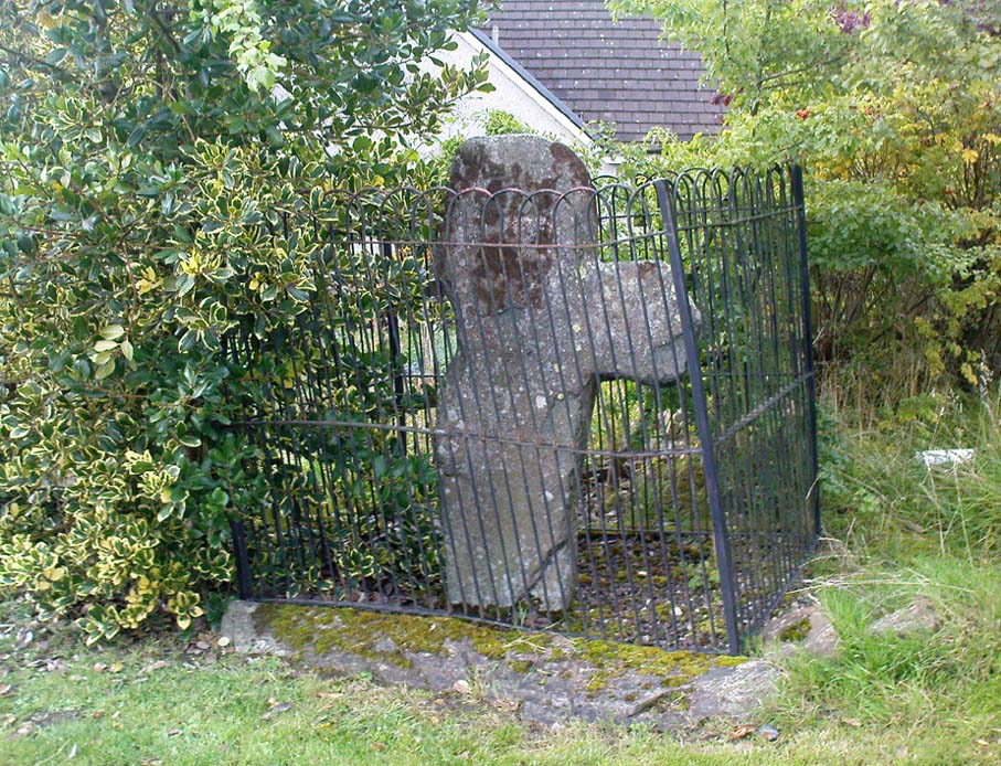
Standing Stone Hill monolith

From Hebden Bridge, go up the Heptonstall road, going round the village and onto and through Slack, keeping straight on the road until it goes uphill for a short distance, then levels out; then watch out for the small right-turn and the single-track road heading to a dead-end.  Go right to the end, the very end, and go through the gate and walk up the track onto the moor.  As you reach the ridge and the moorlands north open-up before you, note the small ‘standing stone’ on your right, about 10 yards off-path.  Go up past it, following the path up the small hill and keep going till you hit the triangulation pillar.  From here, keep walking on the same path ESE for another 200 yards.  Y’ can’t miss it!

Archaeology & History

The name of the place rather gives the game away a bit, yeah…?  When I first moved to nearby Hebden Bridge in the 1990s, I noted the conspicuous place-name ‘Standing Stone Hill’ on the maps — so when I met local earth-mystery enthusiast John Billingsley and asked him about any remains up here, he said, with conviction, “there’s nowt up there!” (or words to that effect)

“Are y’ sure?” I asked. To which he repeated his dictum. But I wasn’t convinced of his words and, like any decent chap with energy for old stones and such things, wouldn’t take ‘no’ for an answer and went to check for myself – and wasn’t too surprised when I found this lovely looking standing stone — and a fine specimen of a monolith it is indeed!

Standing stone, looking south
Standing Stone, looking east

Although not a tall specimen by any means, this rounded and weather-worn upright has fine character and age to it.  Standing more than 3 feet in height and nearly as wide, the stone has a faded but distinct artistic carving of the letter ‘T’ on its western face (which you can make out on the photo, hopefully).  It was thought this may have been an old boundary marking, but the stone aint on any boundary line so possibly relates to some local family who marked it with that deluded notion of ‘ownership’ of this part of the desolate moors.

It’s a beautiful spot up here, out on its own.  I’ve sat here many times, both alone and with good heathen friends, gazing across the endless silence on days coloured with snows, mists, bright sunshine and heavy rains.  It has that feeling of solitude, of being forgotten, of being truly untouched.

Standing Stone Hill on 1851 map

There are a couple of other possible standing stones on this section of moorland.  One in particular appears to have been taller in bygone times and is marked on the 1851 OS-map of the region about 100 yards southwest of the triangulation pillar (you’ll notice it on your right, off-path, as you’re walking towards the pillar—shown at the position on the map here, right).  Further west is the tall medieval Reaps Cross, where corpses were rested in their journey over the moors.

References:

  1. Bennett, Paul, The Old Stones of Elmet, Capall Bann: Milverton 2001.

© Paul Bennett, The Northern Antiquarian

Wytchley Warren, Edith Weston, Rutland

Tumulus (destroyed):  OS Grid Reference – SK 961 052

Also Known as:

  1. Wicheley Warren

Archaeology & History

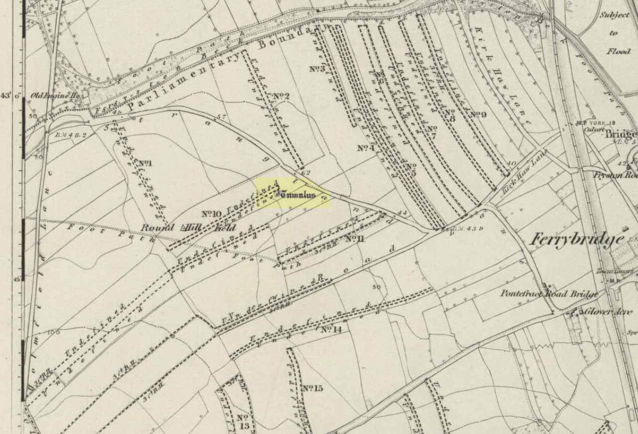
This tomb and, it would seem, another 200 yards away, have long since been smashed up.  The only decent reference to the site comes from Reginald Haines’ address to the Society of Antiquaries in January, 1903, where he told:

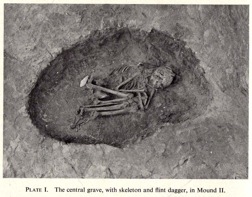
“In a quarry worked for freestone on Major Brathwaite’s land…was found in 1900 a skeleton, probably neolithic.  The body was in a crouching position, with ‘the knees tucked under the chin,’ at a depth of about 3 feet.  Unfortunately, no one interested in such things was at hand, and the remains were incontinently thrown aside and (are) presently buried under a mass of rubbish from the tunnels which were being worked for stone.  Mr V.B. Crowther-Beynon was only able to recover a few teeth, though he seems to have found a few fragments of animal bones and bits of pottery at or near the spot.

“In December 1901, at a point about 200 yards from the last, where a fresh excavation was being made, a second interment was found.  In this case the soil containing the remains came down in one block, and a few broken fragments of bone came to light, with a lower jaw.  The jaw is now in Mr V.B. Crowther-Beyson’s possession, who communicated with Lord Avebury on the subject, sending the jaw, and received the following reply:

“‘to judge from your description (i.e., of the interment) it is certainly probable that the interment you mention belonged to the stone (neolithic) age.  This, however, in the absence of weapons or implements, cannot be put higher than a probability.  I think that lower jaws like very this might be found among our existing people, though I fear with hardly such good teeth.  Their soundness and the way they were worn point strongly to a great antiquity.’

“Near the second interment occurred little patches of burnt soil of a conspicuously red colour.  These may have been the sites of hearths.”

Mr Haines makes a final note about the scarcity of prehistoric remains found hereby, saying that “the only other relics of the stone age that claim notice here are an arrow-head of flint, picked up in a field near Market Overton in November 1990, by Mr Wing” — which is quite a distance away!

References:

  1. Haines,  “Prehistoric Graves at Wicheley Warren,” in Proceedings of the Society of Antiquaries, volume 19, no.2, 1903.

© Paul Bennett, The Northern Antiquarian

St Austin’s Stone, High Hunsley, East Yorkshire

Legendary Rock:  OS Grid Reference – SE 93360 34443

Also known as:

  1. St. Augustine’s Stone
  2. St Austin’s Rock

Folklore

St Austins Stone on 1855 map

The folklorist John Nicholson (1890) wrote about this “block of natural concrete standing at the head of Drewton Dale, near South Cave” — which modern OS-maps call Austin Dale.  Legend told how it “derived its name from St. Augustine, who used to preach from this stone to the heathen, before Britain became christian.”  This obviously supplanted an earlier heathen site, but it’s difficult to work out what that may have been.  It could have been the lost ‘Rud Stone’ immediately west; or perhaps had some traditional relationship with the healing well which emerges a short distance away further down the valley.  Just above here as well, we find an ancient dragon’s lair at Drakes Hole, which could also hold a clue to this place.

A couple of years after Nicholson mentioned the site, John Hall (1892) published his excellent history of the township, in which he described St. Austin’s Stone thus:

“It’s a mass of rock projecting from the side of a hill and in its longest part, extending  from the hillside to the face of the stone, measures about 60 feet.  By some it is supposed to have formed a centre for druidical worship, and that the adjoining township took its name of Drewton (or Druid’s Town) from this fact.  When St. Augustine came to England…he is said to have visited this part of the East Riding; and that this stone took its name from his visit.”

St Austins Stone 1890 map

The site was also surmounted by a cross at some time in its recent history, but this has gone.  The earth mystery writer Philip Heselton (1986) told that the nearby Well was indeed a place connected to St. Austin’s Stone, in an early article in Northern Earth Mysteries, saying:

“St. Austins Stone near South Cave is a rock outcrop where Saint Augustine is said to have made converts, baptizing them in a nearby well. The site is used for church services.  Every seven years, part of the stone falls away, but it always grows again.”

The site should be examined for potential cup-and-ring markings; as well as reports on the status of the Well.  Any photos of the present situation of the site would be most welcome.

References:

  1. Gutch, Mrs E., County Folk-Lore volume VI: Examples of Printed Folk-lore Concerning the East Riding of Yorkshire, David Nutt: London 1912.
  2. Hall, John George, A History of South Cave and other Parishes in the East Riding of Yorkshire, Edwin Ombler: Hull 1892.
  3. Nicholson, John, Folk Lore of East Yorkshire, Simpkin Marshall: London 1890.
  4. Thompson, Thomas, Researches into the History of Welton and its Neighbourhood, privately printed: Kingston-upon-Hull 1869.

Links:

  1. St. Austin’s Stone (and Well) on “Yorkshire’s Holy Wells” website

© Paul Bennett, The Northern Antiquarian

Gwytherin Churchyard, Denbighshire

Stone Row: OS Grid Reference – SH 8767 6147

Also known as:

  1. Gwytherin Church Standing Stones
  2. The Four Stones

Getting Here

From the Denbigh road (A543 and A544) turn off at Llansannan for Gwytherin on the B5384 for 6 miles or so. At the village of Gwytherin St Winifred’s church stands roughly in the middle of the place at a junction of four roads. The church stands upon a small round hill and within the confines of the churchyard (north side) are four small standing stones – you can’t really miss them!

Archaeology & History

At the northern side of the churchyard near the wall there’s an alignment of four small standing stones probably dating from the Bronze Age.  The stones stand roughly 3 metres or 6 feet apart and are about 1 metre or 3 feet in height.  The westernmost stone has a Latin inscription carved onto it which is ‘VINNEMAGLI FILI SENEMAGLI’, or, ‘The Stone of Vinnemaglus, son of Senemaglus’, which is generally thought to date from the Romano-British period in the 5th-6th century AD and to be a grave marker.  Most probably the inscription was carved onto the prehistoric stone during the early Christian period — the stones themselves being from pre-Christian times.

The general thinking is that these stones belonged to a Bronze Age settlement that stood here long before any church was founded.  Perhaps there were other stones here forming a linear alignment that must have meant something to the ancient folks who lived here.  There has also been speculation as to whether the inscribed standing stone could actually mark the grave of St Winifred herself.

The churchyard is circular, indicating that it is a pagan sacred site.  Celtic churches being built on sites like this to Christianize them, but not entirely forget the meaning to the peoples of “the old religion,” as it’s called.  Also in the churchyard stand three ancient yew trees — yet another sign that the site is a holy one.

The first church in Gwytherin was founded by St Eleri (Elerius), a Welsh prince, in the mid-7th century.  He may be identical with St Hilary, a saint commemorated at a village of that name near Cowbridge, South Glamorgan.  Other than that, Eleri and his mother, Theonia, founded a double monastery here: one for men and the other for women, to which a young St Winifred (of Holywell) came to and was elected second abbess after Theonia.  St Eleri was probably a disciple of St Beuno, uncle to St Winifred, and also her cousin.  Here in 650 or 670 AD Winifred was buried in the churchyard — her relics being taken to Shrewsbury abbey in 1138.

References:

  1. Burl, Aubrey, From Carnac to Callanish, Yale University Press 1993.
  2. Houlder, Christopher, Wales: An Archaeological Guide, Faber & Faber: London 1978.
  3. Hulse, T.G., Gwytherin: A Welsh Cult Site Of The Mid-Twelth Century, (unpublished paper) 1994.
  4. Nash-Williams, V.E., The Early Christian Monuments of Wales, Cardiff, 1950.
  5. Westwood, J.O., “Early Inscribed Stones of Wales,” in Archaeologia Cambrensis, 18:255-259, 1863.

Copyright © Ray Spencer 2011


Nanny’s Grave, Steeton, West Yorkshire

Tomb:  OS Grid Reference – SE 022 448

Archaeology & History

Until we’ve isolated this site, it’s difficult to suggest an age for it.  It’s an all-but forgotten grave of some sort, last mentioned by John Clough (1886) in his rare work on Steeton township.  Although the folklore indicates some medieval date here, the site may have been a prehistoric tomb, as it was located in the same valley a mile east of another little-known prehistoric burial at Crosshills.  Mr Clough wrote the following of the site:

“Until AD 1790 the road to Kildwick would be down Pot Lane and past ‘The Lion’.  Near a field, now called Nanny Grave Hill; there were four land ends; there are three lane ends yet; there was what i’s called Devil’s Lane, the lanes towards Eastburn and Steeton, and Wood Street… The junction of these four lane ends is the scene of one of Steeton’s tragedies.  At this place is buried a suicide called Nanny, with “a stake in her inside.”  Some people point out the mound under which she’s buried.  When the suicide took place isn’t known, but it would certainly not occur later than the 17th century.”

But there are no records telling of the said ‘nanny’ and her death, nor archaeological accounts of any excavations hereby.  The epithet nanny is sometimes used in northern counties to mean a witch, and although we have no remaining lore telling of such a character, the old name Devil’s Lane certainly infers some pre-christian or supernatural history hereby, common to many ancient burial mounds throughout Britain and across the world.  Also a burial at an old crossroads is another heathen indicator; and the legend of the body having “a stake in her inside” is highly suggestive of further archaic death rituals, fixing the spirit of the dead at the site to prevent transmigration of any form, effectively ending the lineage of shaman or other heathen priestess.  Any further information about this site would be most welcome.

References:

  1. Clough, John, History of Steeton, S. Billows: Keighley 1886.

© Paul Bennett, The Northern Antiquarian
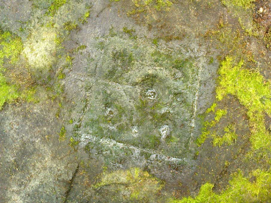

St. Helen’s Well, Thorp Arch, West Yorkshire

Holy Well:  OS Grid Reference – SE 45166 45800

Well on the 1849 OS-map

Getting Here

The well is all dried up today, but its remains are about 200 yards north of the river Wharfe. Sam Brewster (1980) told the easiest way to find it: “To get there from Thorp Arch you take the trackway that goes to the south of the church and follow this until you are walking alongside the river; eventually you will come to a barrier of barbed wire near some old disused water-works; get under or over this barrier and turn 90 degrees to your left, following the barbed wire until you come to a wood, the other side of the barbed wire; go into the wood and turn right; keep exploring near the edge of the wood until you find a tree under which is a hollow which used to be St. Helen’s Well.”  Once here you can see where the water used to flow down a narrow channel and under a little bridge.

Archaeology & History

Carved cross remains found near St Helen’s Well

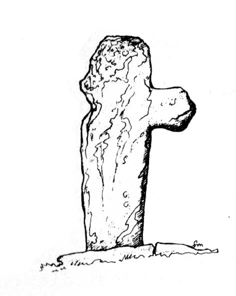
This ancient and well-known healing spring is shown on early OS-maps emerging a short distance north of the River Wharfe besides St. Helen’s Beck in Chapel Wood, adjacent to the Kirkstall Ing or field.  In the western fields close by was once an ancient chapel and, closer to the holy well, once “stood St. Helen’s (or St. Helena’s) Cross, which is somewhat crudely represented in Dr. Whitaker’s History of Craven“, (Speight 1902), illustrated here.

This well possesses a prodigious occult history yet is curiously absent from most studies on the subject.  The place is said to have been a respected holy site that was venerated long before the Romans arrived here. Found at a place called the Rudgate — but known locally as St. Helen’s Ford — it is also said to be haunted.  Angela Smith (n.d.) considers the traditions surrounding the well to be pre-Roman, and the curative waters would certainly have been known of at the time of their occupation here,

“because it lies at the side of Roman road No.280, just north of where it crosses the River Wharfe at St. Helen’s Ford, leading to the Roman fort at Newton Kyme.”

St Helens Well in 1900

Several species of psychoactive plants grow adjacent to the well, which are thought by Phillips, (1976) Devereux (1992) and I as serving ritual shamanic purposes. The likelihood is more so than not.  The oracular nature of the site which R.C. Hope (1893) and others have described here is particularly interesting: in traditions the world over, oracles were often consulted after the ingestion or use of sacred plants, such as are found here.

Due to the sacred nature of this spring and its importance in local folklore and history, it should be recovered from its present state.  The fact that this place was highly important as a ritual and sacred site to christians, pagans, Romans and peasants alike, and now hides all-but-lost and forgotten is a disgrace.

Folklore

A fascinating tale hangs over this still-revered holy well which legend tells had a chapel standing adjacent, dedicated to Helen in the 7th century – although no trace of it is visible today. Local historian Edmund Bogg (1904) recounted how a local sexton told of “padfoots and barguests and ‘that grim foul beast with clanking chain’ which on dark nights kept its vigil” near St.Helen’s Well. Padfoots and barguests are Yorkshire names for spectral black dogs, said to be bringers of death and misfortune (they are one of several remaining folk-ingredients from the Underworld myths in British shamanism).

St Helen’s Well, c.1935
St Helens Well in 1934

Folklorist Guy Ragland Phillips (1976), referring to an article in The Dalesman in 1971, told how a Mrs Dorothy Tate as a young girl used to visit the site and would tie pieces of rag on the bushes aside the place as grateful offerings to the spirit of the well. She said however, that she had gone about doing this in the wrong way, as according to tradition such offerings are to be done secretly. The article showed a photograph of Mrs Tate (from 1908) tying one of the memaws to the wych-elm tree overhanging the old spring.

People visited the well – probably on August 18 – to divine the future with the oracle which Hope (1893) described as being here, always in the dead of night without being seen, leaving before sunrise. It has been visited by thousands of people over the centuries, with gifts of rag-hangings, pins and other memaws. Such offerings continue even to this day. When Harry Speight (1902) visited St. Helen’s Well at the turn of the century, he related how as many as forty or fifty hangings would be left at any one time on the branches of the trees.  He wrote:

“The water is beautifully soft and clear, and in former times was much resorted to as a specific for sore or weak eyes. There are two other springs close by, which were also held to be sacred, but they do not bear any particular dedications. An old plantation a little north of the well is known as Chapel Wood, which commemorates St. Helen’s chapel and the ancient church at Bilton, three miles further north, and about a mile to the east of the Roman Rudgate, is also dedicated to St. Helen.”

A few years before Speight’s visit here, Dr Fred Lees and the botanist, Robert Baines, visited St. Helen’s Well, and wrote similarly of the lore and memaws they found there:

“There are veritably hundreds of these bedizenings affixed and removed surreptitiously (probably before sunrise), according to an unwritten law, for none are ever caught in the act. And yet during the summer months a careful observer may detect almost weekly evidence of a shy communicant with the ghostly genius of someone¾country maid or her dumb shy swain. What murmured litany (if any) had to be said is lost; most likely nothing more was necessary than the unspoken wish…Pieced together and codified, fact and heresay testify as follows: ‘The visitor to the grove, before rise of sun, has to face the tree [a wych-elm overhanging the well] to detach from his or her own person some garment, to dip it in the well, and having knotted or whilst hanging the fragment to any convenient twig…is to breathe a ‘wish’ telling no-one what that wish may be; these conditions strictly observed, what is desired shall come to pass.'” (in Phillips, 1976)

When the archaeologist C.N. Bromehead (1935) and geologist J.V. Stephens came to the site in the 1930s, despite the fall of the well, he was surprised to find local peasants still respecting the spirits of the site, reporting:

“There is now no well or visible spring, but from the position at the lower margin of a gravel terrace it is obvious that water would be obtained by digging a few feet; a small stream flows just east of the site… It is curious that the hanging of rags should survive when the actual well has vanished, but the writer has visited the spot many times in the last seven years and there are always plenty of obviously recent additions.  The custom is to stand facing the well (i.e., due west), preferably after sunset, wish, and then attach something torn from one’s clothing either to the big tree — wych elm — or to any of the bushes.  Probably the custom is largely maintained by vagrants who frequently camp in the wood, but it also has its attraction for courting couples from the neighbouring villages!”

Such offerings at the site of St. Helen’s Well are still left by locals and some of the plastic pagans, who tie pieces of artificial material to the remnants of the wych-elm and other trees, which actually pollutes the Earth and kills the spirit  here.  Whilst the intent may be good, please, if you’re gonna leave offerings here, make sure that the rags you leave are totally biodegradable.  The magical effectiveness of your intent is almost worthless if the material left is toxic to the environment and will certainly have a wholly negative effect on the spirit of the place here.  Please consider this to ensure the sacred nature of the site.

…to be continued…

References:

  1. Bogg, Edmund, Lower Wharfeland, the Old City of York and the Ainsty, James Miles: Leeds 1904.
  2. Brewster, Sam, ‘St. Helen’s Well,’ in Wind & Water 1:4, 1980.
  3. Bromehead, C.N., ‘Rag Wells,’ in Antiquity IX, March 1935.
  4. Devereux, Paul, Symbolic Landscapes, Gothic Image: Glastonbury 1992.
  5. Hope, R.C., Legendary Lore of the Holy Wells of England, London 1893.
  6. Ni’Bride, Feorag, The Wells and Springs of Leeds, PPP: Preston 1984.
  7. Phillips, Guy Ragland, Brigantia, RKP: London 1976.
  8. Smith, Andrea, ‘Holy Wells Around Leeds, Bradford & Pontefract,’ in WakefieldHistorical Journal 9, 1982.
  9. Speight, Harry, Lower Wharfedale, Elliott Stock: London 1902.
  10. Whelan, Edna, The Magic and Mystery of Holy Wells, Capall Bann 2001.
  11. Whelan, Edna & Taylor, Ian, Yorkshire’s Holy Wells & Sacred Springs, Northern Lights: York 1989.

© Paul Bennett, The Northern Antiquarian
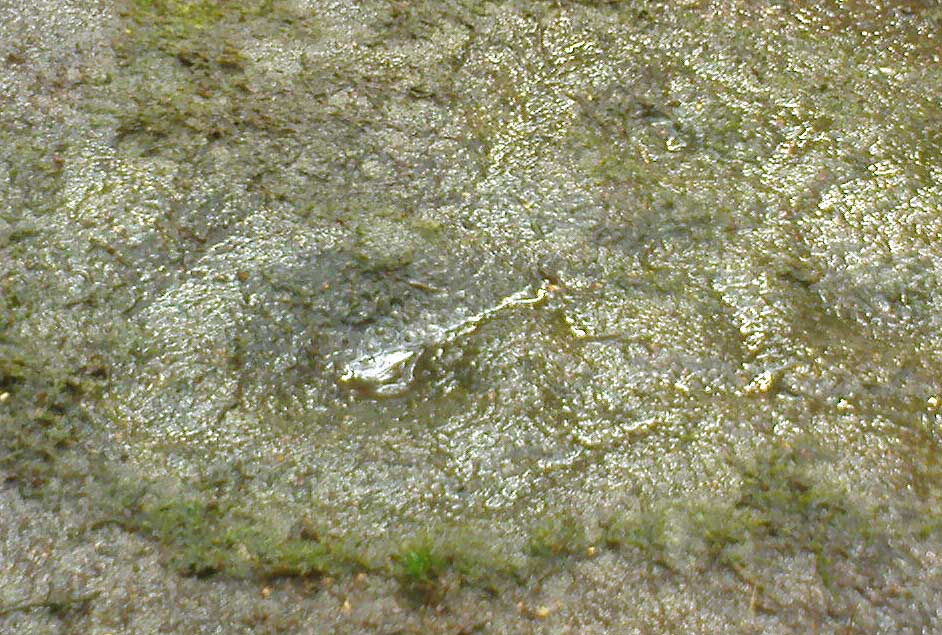

Thor’s Stone, Thurstaston, Cheshire

Legendary Rock:  OS Grid Reference – SJ 24474 84933

Also Known as:

  1. Thor’s Rocks

Archaeology & History

Thor’s Rock (after J.Picton)

On Thurstaston Common a 298 foot high hill has a large red sandstone outcrop, on the landward side, known as Thor’s Stone. One large rectangular block of stone that is 50 feet in length, 30 feet wide by 25 foot high has been eroded over thousands of years. Described by J.A. Picton in 1877 as “the Great Stone of Thor,” the village itself seemed to have gained its name from this prominent mass of rocks.  It was described first of all in the Domesday book, as Turstanetone, and both village and rocks have been written as variants on the original ever since.  The place-names writers Mills & Room (1998) ascribe the name to being a “farmstead or village of a man called Thorstein”; but it’s just as likely to derive from “a farmstead of/at Thor’s Stone.” (Harrison 1898)  As early landscape features were traditionally equated with animistic and mythic lore, the Viking god Thor is more probable than some unlikely chap called Thorstein.

More than 100 miles southeast of here, we find another Thor Stone in the village of Taston, showing similar megalithic etymology.

Folklore

Local folklore tells that the rock is named after the Norse god Thor – he who causes thunder and lightning.  Viking settlers from Thingwell apparently settled here in the 10th century AD and, according to legend, these settlers used the stone as a pagan altar with blood sacrifices taking place here.  A creation myth of the site tells that Thor tossed the large stone here in anger; and yet another says that the stone was raised here to commemorate the battle of Brunanburh in 937 AD.  In modern more times, Morris dancers meet here and enact their rites on Mayday mornings.

The outcrop has been eroded away over thousands of years by the weather, post glacial erosion and even quarrying, leaving strange shapes, features and projections in the soft sandstone. There is much recent graffiti to be seen all over the rock, especially on the summit and sides including one set of graffiti carved by Professor Taylor in 1879.  There used to be a “fairy well” near the stone but this disappeared long ago.  Children took flowers to the well to decorate it, while adults visited it to receive a cure for various ailments of the body.  At nearby Thurstaston Hall, Christina Hole (1937) reported there lived the ghost of a troubled woman.

References:

  1. Harrison, Henry, The Place-Names of Liverpool, Elliot Stock: London 1898.
  2. Hole, Christina, Traditions and Customs of Cheshire, Williams & Norgate: 1937.
  3. Mills, A.D. & Room, Adrian, A Dictionary of English Place-Names, Oxford University Press 1998.

© Ray Spencer, The Northern Antiquarian
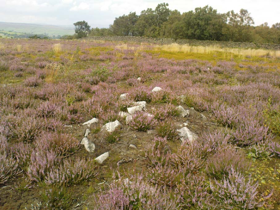

St Winefride’s Well, Holywell, Flintshire

Holy Well:  OS Grid ReferenceSJ 1851 7627

Also Known as:

  1. Ffynnon Gwenfrewi
  2. St. Winifred’s Well

Getting Here

St.Winifred’s Well

From the Chester ring road head into north Wales along the coast road (A548) from Connah’s Quay for about 13 miles taking you through Flint. After 12 miles turn left into Holywell town (Treffynnon). At the western end of the town go down the Greenfield-Mostyn road back towards the A584 taking you down a hill.  After 500 hundred yards you arrive at the holy well/shrine and pilgrimage centre on the right-hand side; there is parking on the opposite side of the road. There is a small entrance fee, but as well as the famous healing well and bathing pool, they have a gift shop, toilet facilities and a late medieval/Gothic two-storey structure that is built over the polygonal, vaulted well chamber, whilst at the side (at the corner of the hill) stands another Gothic chapel from 1500.

History and Legend

According to the well known legend, a young Welsh girl called Winefride or Gwenfrewi, was the daughter of patrician parents, Thenith (Thewyth) and Gwenlo, who lived at Bryn-y-Castell (Treffynnon) at the beginning of the 7th century AD.  She was a very religious girl who was known for her kindness and charities to people in the area that was then called Tegeingl (after the Decengle tribe).  Winefride grew up to be a very beautiful young woman which troubled her because she had no wish to marry, only to live a life of chastity and serve God as only she knew how.

St. Winefrides Well 1742

One day a local chieftain from Hawarden (Penarlag) called Caradoc ap Alyn came hunting in the area. He became very thirsty so stopped off at the house where Winefride lived with her parents.  However, on this particular day her parents were attending the local church where St Beuno, her uncle, was conducting a service.  Prince Caradoc soon began to seduce her so she ran to the church but with the prince in hot pursuit.  When he caught up with poor Winefride, she again resisted him so he took his sword and beheaded her.  Her severed head fell to the ground and rolled down a hill and where it came to rest a spring of water gushed forth from the ground.  Her parents and uncle came rushing out of the church at which point St Beuno cursed the evil prince, who was calmly wiping blood from his sword, causing him to sink into the ground — never to be seen again.  St. Beuno then placed the severed head back into place, restoring Winifred to life again but leaving her with a thin scar round her neck.

Later, Winifred was entrusted for her education to St Beuno whom sent her to various holy men including St. Elerius at Gwytherin near Llanwrst.  Here she became abbess of a convent that had been founded by Elerius, with his mother St. Theonia as first abbess; and it was here for the next 40 years that Winifred lived out her life.  She was said to have died at Gwytherin in either 65o or 670 AD.  Her body was first interred in the churchyard there, however in 1138 her relics were transferred to Shrewsbury Abbey.  Sadly however, her shrine there was destroyed in the 16th century and now only a few relics remain with a finger-bone being housed at a convent in Holywell.

Mythology and Folklore

St. Winefrides Well 1750

The holy well and shrine of St. Winifred at Holywell became a place of pilgrimage during the middle-ages and many miracles of healing were wrought there.  The sick were cured of infirmities of the legs and body; crutches were left at the well and many were cured of leprosy, eye complaints, loss of hearing, being not able to bear a child, mental illness, palsy and lung disorders etc.  During the Reformation the holy well suffered much, but from the 17th century onwards pilgrims were returning to the holy place and, more recently it has become the Welsh Lourdes and still pilgrims come in droves from all over Wales and beyond.  The vaulted Gothic structure covering the well shrine is richly carved with bosses depicting various characters including St Beuno, Earl Stanley, Lady Margaret Beaufort, biblical characters, animals and an abbot of Basingwerk abbey, but there is also much recent graffiti too.  A tall statue of St Winefride looks down over the well while candles burn all around.  In the larger bathing pool outside, a stone lies at one side — this is claimed to be where St. Beuno sat whilst teaching his young niece.  Red stains on stones at the front of the well-basin were long taken to be the martyr’s bloodstains, but now these are thought to be iron oxide pigmentation on the lichens.  Today the people still come either to bathe in the special pool, throw coins in the well, or fill bottles with holy water from a tap on the wall.  Faith in miracles of healing is still much in evidence here and may it continue to be for many years to come.  Everyone is welcome here, you don’t have to be a Roman Catholic!

References:

  1. UneXplained - LiebreichBord, Janet & Colin, Sacred Waters, Paladin: London 1986.
  2. David, Christopher, Saint Winefride’s Well  – A History and Guide, Gomer Press: Llandysul 2002.
  3. Edwards-Charles, Thomas, Saint Winefride and Her Well – The Historical Background, Holywell 1962.
  4. Heath, Sidney, In the Steps of the Pilgrims, Rich & Cowan: London 1950.
  5. Jones, Francis, The Holy Wells of Wales, University of Wales Press: Cardiff 1992.
  6. Liebreich, Karen, UneXplained: Spine-tingling tales from Real Places in Great Britain and Ireland, Kindle 2012.
  7. Simcock, Richard, North Clwyd At Random, Countryside Publications Ltd: Chorley 1986.
  8. Spencer, Ray, A Guide to the Saints of Wales and the West Country, Llanerch: Felinfach 1991.

Copyright © Ray Spencer 2011


Slade Carving (02), Blubberhouses Moor, North Yorkshire

Cup-Marked Stone:  OS Grid Reference – SE 1411 5431

Also Known as:

  1. Owl Stone
  2. Sunset Stone

Getting Here

Cup-and-rings, looking NE

Same directions as the Slade 01 carving.  But once you reach the upstanding stone cairn on the rocky hill, walk 220 yards (less than 200m) WSW and look around.  You’re damn close!  If you find the large cup-marked Slade 03 carving,  walk back east about 10-20 yards and you can’t really miss it!

Archaeology & History

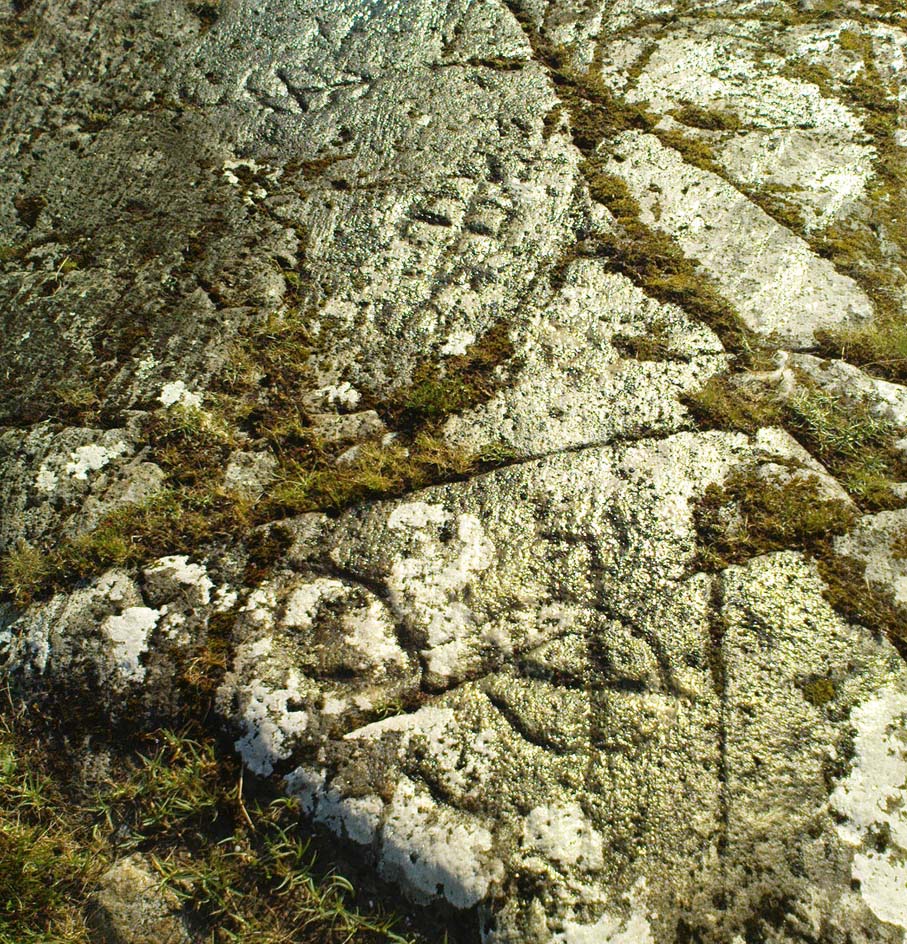
This is just one of at least seven previously undiscovered carvings on this section of moorland – and it’s worth looking for!  The two other names we gave it — ‘owl’ and ‘sunset’ — come from the very notable design: owl thanks to it having the appearance of large owl-like eyes, and sunset as the two cup-and-rings are etched on the western edge of the rock and, when we found it yesterday, the sun was setting (albeit to the NW) and the image prompted talks of setting suns, the land of the Dead and other such worldwide indigenous religious myths (Harvey 2000) — for without recourse to such ingredients, these carvings are vacuous archaeocentric museum pieces and nothing more.  And this carving at least deserves much more than mere cataloguing!  The internationally renowned archaeologist, O.G.S. Crawford (1957) would have entered this carving into his ‘eye’ and ‘owl’ motif, representative of goddesses or spirit-forms, as would Gimbutas. (1989)

…and from above

But this carving is archetypal, as we can see, though would appear to have no other etched features on the stone’s surface.  It is very close (if not within) the prehistoric graveyard that is plainly evident 30-40 yards south in the burnt heather and would very likely have had some mythic relationship with the dead (a symbiosis we have found in many cup-and-rings).  We plan further ventures here in the coming weeks in the hope that we can unearth other prehistoric remains.

References:

  1. Crawford, O.G.S., The Eye Goddess, Phoenix House: London 1957.
  2. Gimbutas, Marija, The Language of the Goddess, Harper Collins: New York 1989.
  3. Harvey, Graham (ed.), Indigenous Religions, Cassell: London 2000.

© Paul Bennett, The Northern Antiquarian