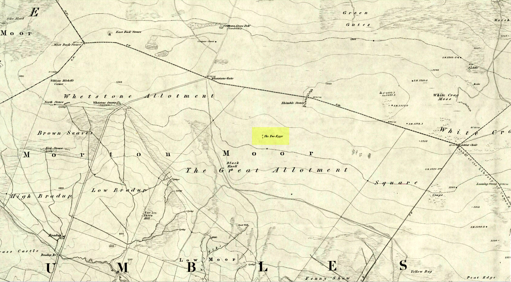
From Bainbridge, take the A684 road east to Aysgarth. Just out of the town, 200 yards over the bridge, take the right turn down Blean Lane. Nearly ½-mile along, take the minor road on your left and go along here for 1½ miles where, a few hundred yards before the solitary farm of Carpley Green (lucky buggers!), you can park up. (keep plenty of room for a tractor to get in the fields) Walk down the track past the farm and 250 yards along, where the first field ends, a gate leads you into the hills on your left. Go through here and then the next gate 120 yards on, then walk straight along th elong geological ridge ahead of you, veering to the top-side until it meets the walling. You’ll see the giant Stoney Raise cairn on the other side.
Archaeology & History
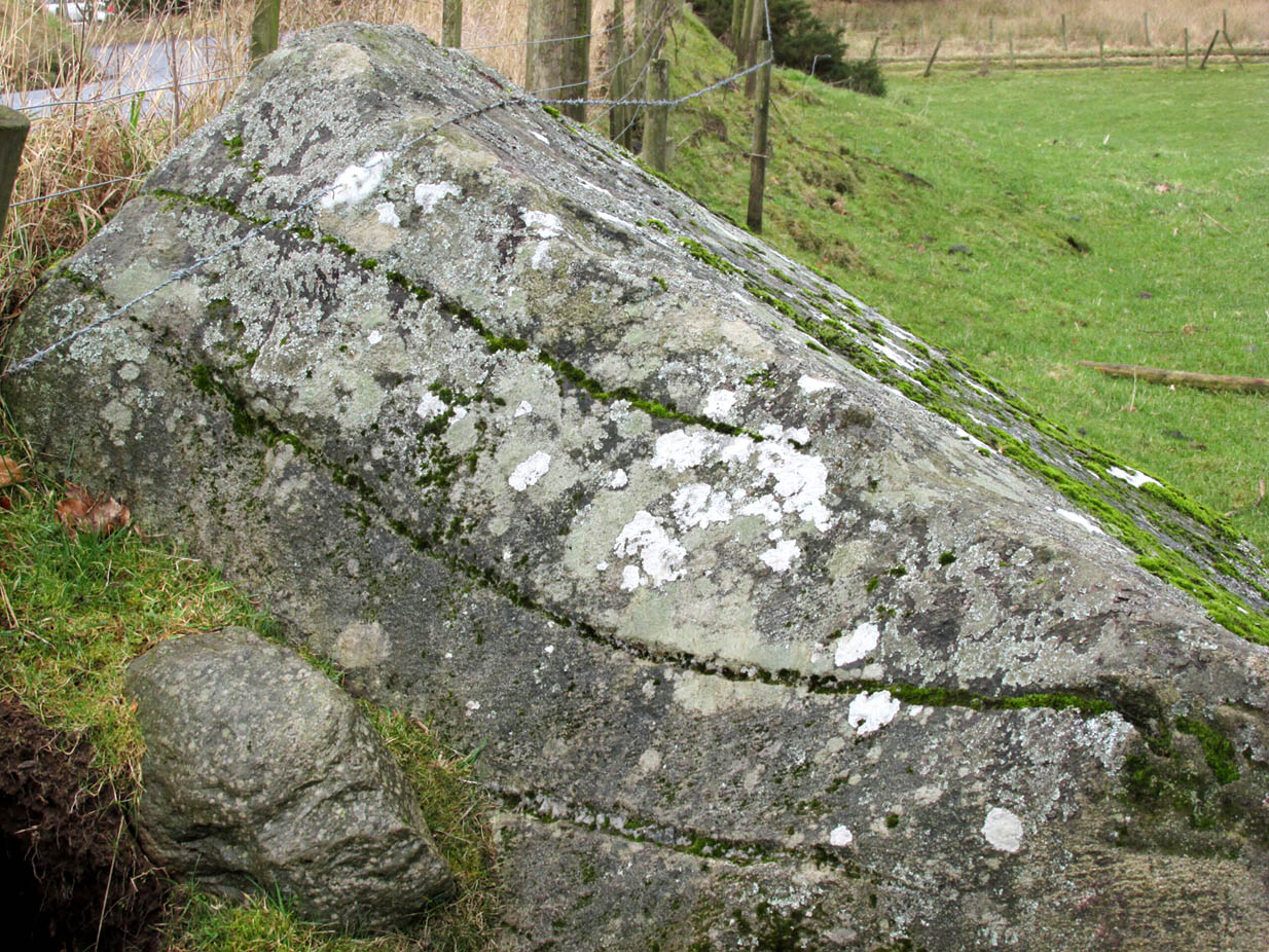
Stony Raise from above
The remains we find here are nigh-on immense! If giant cairns get you going (like the Great Skirtful of Stones or the denuded Devil’s Apronful near Pendle, etc), this one will blow you away! Along its widest axis, to this day it’s nearly 40 yards across and nearly 7 feet high! But in earlier times it was even bigger—much bigger! The first known description of the site was made by one Charles Fothergill, a Yorkshire-born politician and ornithologist, who wrote a diary of his walking excursions to various places in North Yorkshire at the beginning of the 19th century. (Romney 1984) His account of it was a good one for that period and thankfully he recorded information that would otherwise have been forgotten. After his visit here in September 1805, he told about this,
“wonderful tumulus called Stone raise which is a great curiosity: it is formed entirely of large stones piled up without earth or gravel, differing in that respect from any I have seen. Notwithstanding that upwards of a thousand, nay ’tis said several thousand, loads of stones have been led away from it to build walls with, it yet remains a stupendous monument of this species of antiquity: we measured the base of it as well as we could by our strides and made it 369 feet in circumference and of such an height as to be seen for a considerable distance. It has been most completely rifled…and it now presents a number of small craters formed by the investigations of the money searchers. It is situated upon a hill about half a mile south of Addlebrough. In addition to the particulars I formerly mentioned, I may say the men who first opened it about 50 years ago worked incessantly for 33 days. It stands on Thornton moor, and tho’ the Thornton men would not assist in the labour, they intended to share in the profit if there was any; but the adventurers who had all the work resolved they should not and they carried a large sword with them every day to defend the treasure in case they found any; the wise man who read ’till the stones shook and rattled was a schoolmaster at Bainbridge: the teeth they found were deposited in a hollow place in the bottom of the tumuli formed long and narrow like a coffin by a walling of stones. Tho’ the tumulus has apparantly been compleatly rifled, I do not believe the whole base has been sufficiently searched, but if it was to commemorate one great individual, which appears to have been the case, perhaps nothing more may be found.”
Fothergill’s description of “upwards of a thousand” cartloads of stone being removed from Stony Raise has been doubted by some archaeologists, but this claim should not be dismissed so lightly without evidence. There are immense tombs from northern Scotland to the unholy South that have remained untouched by the hand of industrialists that easily enter the category of such giants and this may have had equal stature.
A few years after Fothergill’s visit, Thomas Whitaker (1823) briefly described the site in his magnum opus, but added very little, simply telling that on the hills behind Addlebrough,
“there is still on that elevated spot a cairn, called Stone Raise, about 120 yards in circumference at the base, to which the usual tradition of its containing a treasure of gold having been attached, two persons were several years ago induced to make the experiment; but having penetrated to the centre, found, to their great disappointment, what an antiquary would have prepared them to expect, namely, a kist vaen of flag stones, with the remains of a human skeleton, the teeth of which were still pretty perfect.”
To this day the site remains unexcavated, so we don’t know too much about the place. It’s likely to have been constructed in neolithic times and its ancestral nature quite obviously venerated. It may have been re-used during the Bronze Age, but without excavations we may never know. A decent dig into this site is long overdue!
Folklore
This gigantic tomb is, not surprisingly, said to be haunted. Strange sounds and visions have been encountered here in bygone times. But the most well-known tale is that it was the site of a great treasure—perhaps hinted at by Fothergill. There are variations on the theme, but this is overall story:
Structured stonework
The tomb was said to be where a local giant had fallen and with him was buried a great chest of gold which he had dropped before he died. Some say that the ‘giant’ was a Brigantian chief – others a great warrior. The great treasure chest beneath the cairn is said to looked over by a fairy who lived by the giant’s tomb. It was this tale which gave the site its local name, the ‘Golden Chest on Greenber’. Several attempts made to find the treasure have all failed to uncover it.
However, by the time Edmund Bogg came to write of the place in 1908, the giant had by all accounts been found within! He told that,
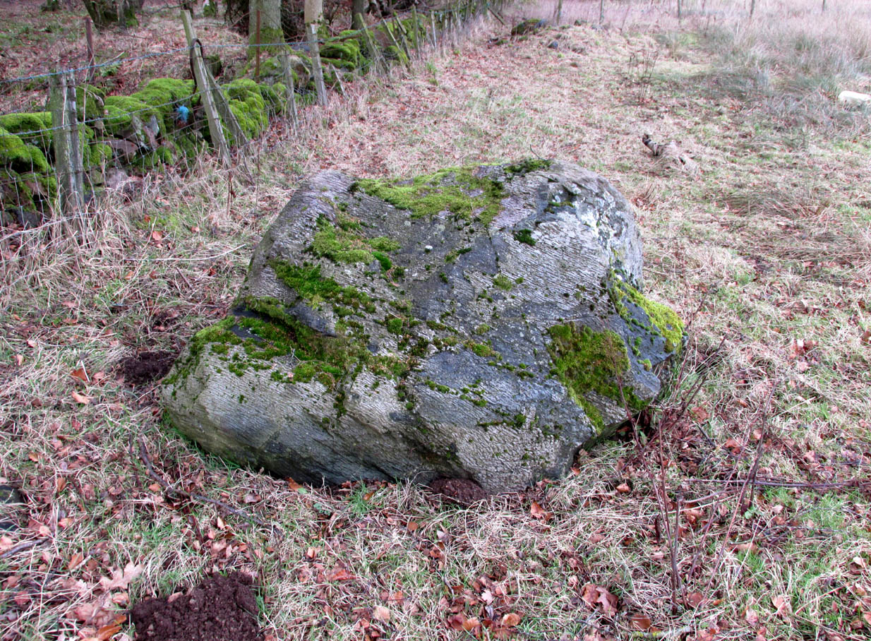
The giant’s cist cover?
“this Kist-vaen was opened, many years back, and the skeleton of a chieftain of great stature was unearthed; the treasure chest of that or some other primal savage was not, and has not yet been discovered – for, take heed ye matter-of-fact money hunters, it is said the lucky one must first see the wraith of the ancient warrior to whom it belonged, who will then shew under which part of the immense Raise it is hidden! May this help any reader who is imaginative enough to find it – having seen the wraith he must keep silence – he has then but to stretch out his hand, and draw it forth.”
There are variations on this tale that have subsequently been penned by a number of Yorkshire folklorists, but this is the general lore. There was also a short rhyme told of toney Raise, that speaks of its apparent use through history by various races:
Druid, Roman, Scandinavia,
Stone Raise in Addlebro’.
References:
Bogg, Edmund, Wensleydale and the Lower Vale of the Yore, E. Bogg: Leeds 1906.
Bogg, Edmund, Richmondshire, James Miles: Leeds 1908.
Elgee, F. & H.W., The Archaeology of Yorkshire, Methuen: London 1933.
Gutch, Mrs E., Examples of Printed Folklore Concerning the North Riding of Yorkshire, David Nutt: London 1899.
Lofthouse, Jessica, Countrygoer in the Dales, Hale: London 1964.
Parkinson, Thomas, Yorkshire Legends and Traditions – volume 2, Elliot Stock: London 1889.
Pontefract, Ella, Wensleysdale, J.M. Dent: London 1936.
Romney, Paul (ed.), The Diary of Charles Fothergill, 1805, Yorkshire Archaeological Society: Leeds 1984.
Whitaker, Thomas Dunham, An History of Richmondshire – volume 1, Longman Hurst: London 1823.
White, Robert, A Landscape through Time, Great Northern: Ilkley 2002.
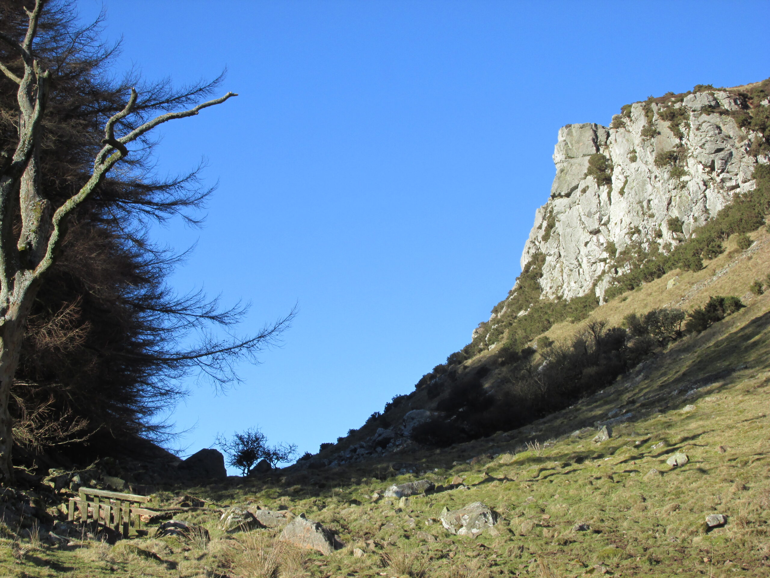
Make a day out for this one! You could, of course, go barely half-a-mile straight up the hill (southwest) from Ossian’s Stone in the Sma’ Glen below – but it’s steep as fuck and I know that most of you wouldn’t do it. So, park-up and take the gradual 3 mile walk into the mountains. Coming via Crieff, along the A85 road east, turn left up the A822 Dunkeld road at Gilmerton. 2½ miles on, you reach the Foulford golf course on the right-hand side of the road, whilst directly across the road a dirt-track leads you into the fields, past the large Foulford cup-and-ring stone. Keep along this track, bearing right just before Connochan Lodge and follow this dirt-track uphill on and on for another 2 miles where you’ll eventually see the cairn-peak in the distance. Another shallow track leads uphill after about 2 miles: we walked up to where the ground levels out, walked across the dodgy swamp-land and up again to the tomb. It’s well worth it!
Archaeology & History
Visible for many miles round here from the surrounding hills, this somewhat mutilated giant cairn, highlighted on the earliest Ordnance Survey map of the area in 1867, hasn’t fared well in archaeology tomes. Apart from a passing note in Margaret Stewart’s (1966) summary article on prehistoric remains in central Perthshire—where she erroneously told it to be 400 feet lower down that it actually is—almost nothing has been said of this place. Most odd.
Cairn spoil, looking SENew cairn atop of the old
Despite it being ransacked over the centuries, it was obviously of some considerable size in its early days. Today, surmounting it, is a very large walker’s cairn which, no doubt, has accrued some of its own foundations from the prehistoric tomb on which it sits. To the side of this recent cairn, another one is growing, thanks to stones brought from near and not-too-far. But the original creation can still be seen in outline and mass all around. Indeed, as you walk all round the modern cairn, you’re walking over much of the early collapsed stonework sleeping gently beneath the moorland vegetation, and once you walk away and below the cairn mass itself, looking back up at it you’ll notice the very ancient raised plinth of stone on which our modern one now lives.
Low walling on NW side
Its amorphous shape is somewhat amoeboid, measuring more than 22 yards across east-west, by 15 yards north-south, with a curious arc of low walling, very old indeed, on its northwestern side. Whether this walling outlines the original edge of the tomb, only an excavation will tell. The most notable remaining mass of ancient cairn material reaches out on its south-east to eastern edges, where some of it is beginning to fall away down the edge of the mountain slope.
Folklore
Local tradition assigns this cairn to be where the bones of the great hero-figure Ossian was removed to, when they were disturbed by the unruly mob of General Wade and his cohorts in the middle of the 18th century. Notes of the event were written at the time by one of Wade’s mob, a Captain Edward Burt, who told,
“the Highlanders, they assembled from distant parts, and having formed themselves into a body, they carefully gathered up the relics, and marched with them, in solemn procession, to a new place of burial, and there discharged their fire-arms over the grave, as supposing the deceased had been a military officer.”
This was essential, said Burt, as
Site shown on 1867 mapNew cairn on old, looking W
“they (the Highlanders) firmly believe that if a dead body should be known to lie above ground, or be disinterred by malice, or the accidents of torrents of water, &c. and care was not immediately taken to perform to it the proper rites, then there would arise such storms and tempests as would destroy their corn, blow away their huts, and all sorts of other mis-fortunes would follow till that duty was performed. You may here recollect what I told you so long ago, of the great regard the Highlanders have for the remains of their dead…”
Oral tradition tells us that this cairn, high above Ossian’s Stone, is where the rites occurred. It makes sense too.
References:
Finlayson, Andrew, The Stones of Strathearn, One Tree Island: Comrie 2010.
Acknowledgements:Huge thanks for use of the Ordnance Survey map in this site profile, reproduced with the kind permission of the National Library of Scotland.
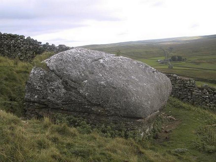
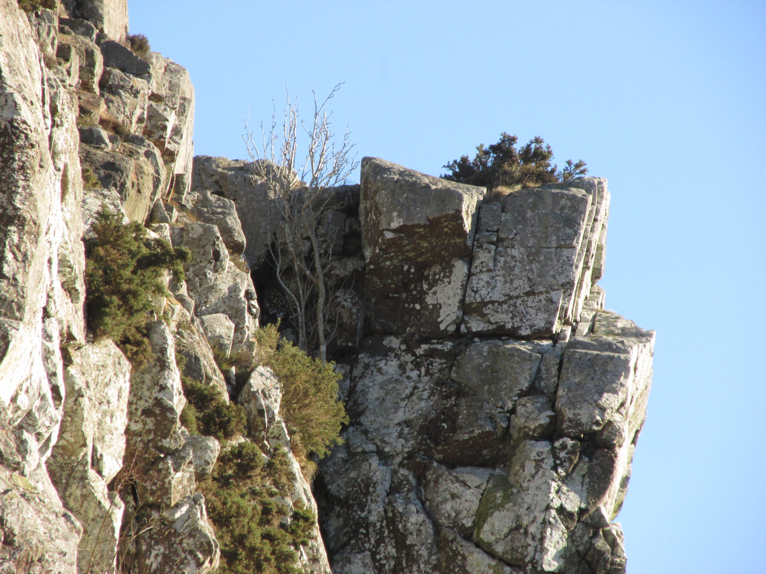
From the small town of Bainbridge, head south down the Carpley Green Road. Less than a mile before the end, look to the west-facing slope of Addlebrough Hill and this huge Devil’s Stone can be seen resting halfway up the slope, just by the wall. Y’ can’t miss it!
Archaeology & History
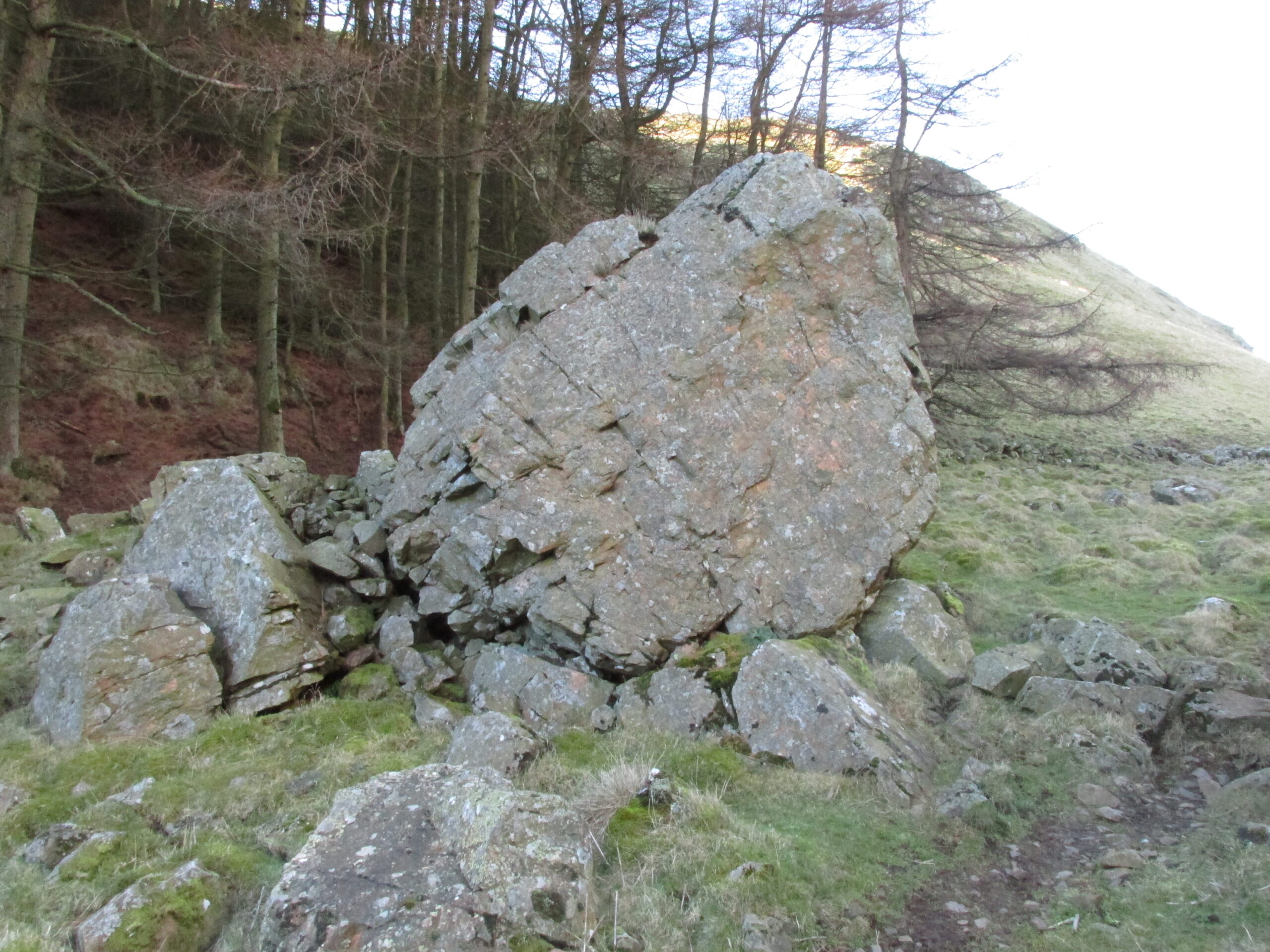
The Devil’s Stone
Highlighted on the 1856 Ordnance Survey map, one of the legends of this place suggested there might be cup-and-ring markings on the stone, but the curious markings on top of the rock seem to be natural. It’s a superb stone though, dropped here no doubt by some great glacier as it retreated north, in ages truly olde…
There’s a lot of archaeology around here that’s yet to receive the attention of the archaeology textbooks. But if you’ve ventured to see this, have a gander across to the massive prehistoric tomb known as Stony Raise, less than a mile southeast of here.
Folklore
One legend tells that long ago Addlebrough was the home of a great unnamed giant — but a friendly giant by all acounts. However, one day the devil turned up and wanted possession of the giant’s hill and so a fierce row broke out between them. Perched on the top of the crag — which is the rough ridge to the west of here — the giant who lived there hurled huge boulders down at the devil, but they fell short and landed at the side of Lake Semerwater (itself an important spot in local prehistory). In return, Old Nick himself began throwing boulders back — and one of those which the devil threw landed here, halfway up the western flank of Addlebrough Hill (a couple of the large boulders which the giant threw can be seen on the edge of Semerwater and are known as the Carlow and Mermaid stones). Hence it’s name of the Devil’s Stone!
In Edmund Bogg’s Richmondshire (1908), he told how, “the curious markings on (the Devil’s Stone) are accounted due to the pressure of the devil’s fingers” which were caused when he threw this giant stone from somewhere to here.
Site shown on 1856 map
This is a theme we find at countless other stone sites, i.e. the Devil burning holes into rock — and in some cases these devil’s “fingerprints” have turned out to be prehistoric cup-markings. Such tales relate to the pre-christian Creation Myth of a place and would, before the “devil” was supplanted onto a site, have had wider significance in the landscape as a whole, in a manner known only to local people. Devils usually replaced legendary giants, or the hero-figures who created the land in primordial times in the myths of our ancestors. A greater examination of the nearby sites in association with the folklore of the region would no doubt be quite profitable…
References:
Bogg, Edmund, Richmondshire, James Miles: Leeds 1908.
Romney, Paul (ed.), The Diary of Charles Fothergill, 1805, Yorkshire Archaeological Society: Leeds 1984.
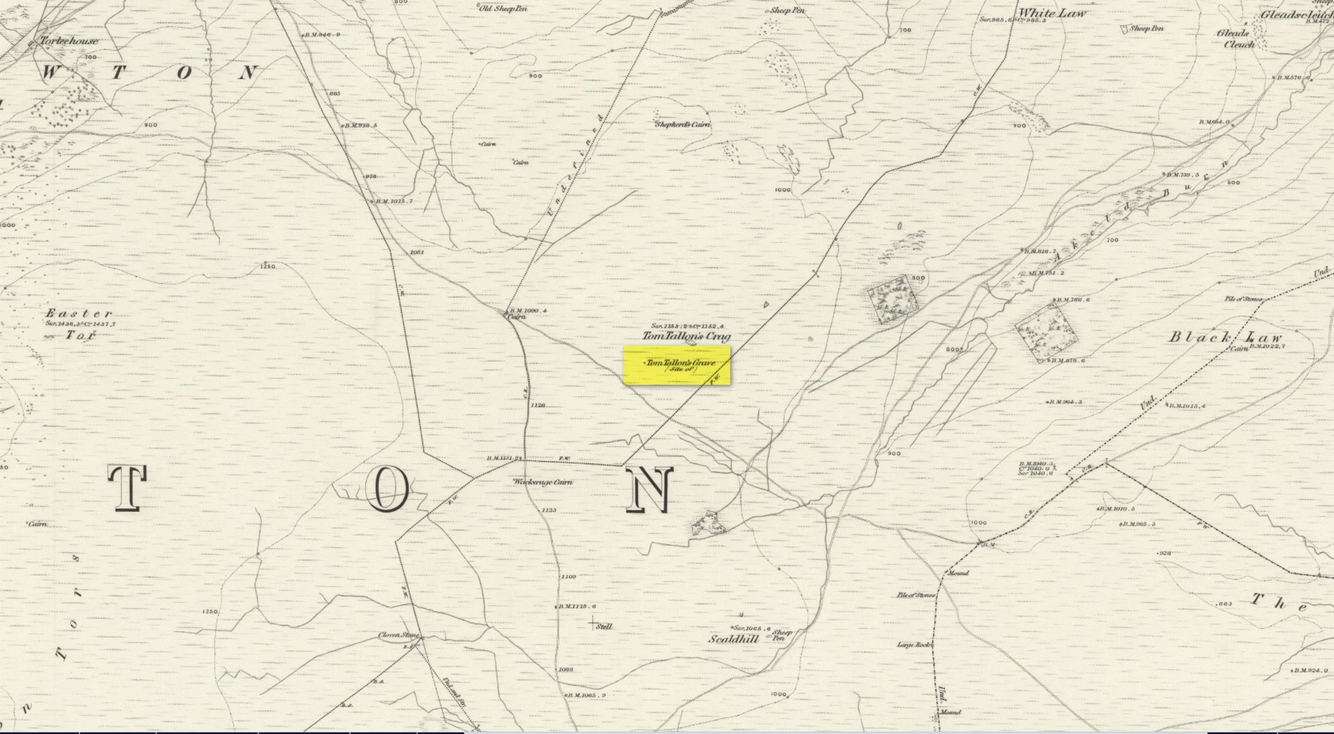
Tumulus (destroyed): OS Grid Reference – NT 9323 2800
Also Known as:
Auld Wife’s Apronful o’ Stanes
Tom Tallon’s Tumulus
Archaeology & History
Site on the 1866 OS-map
Highlighted on the earliest OS-maps about half a mile to the south of the great prehistoric camp of Yeavering Bell and 100 yards southwest of Tom Tallon’s Crag, there once stood an apparently “massive” Bronze Age tumulus, or cairn, called Tom Tallon. I’d hedge a bet that it was much older, from the neolithic period. It was described by P.A. Graham (1921) as “the largest cairn in the district,” but when it was visited by the antiquarian Henry MacLauchlan in July 1858, he reported that “it was being removed to make a fence”!!! Unbe-fuckin’-lievable… Who were the dickheads that did that?!
Folklore
The Ordnance Survey Name Book of 1860 for Tom Tallon’s Crag told that,
“There is a vague tradition about Tom Tallon having been a Warrior and Slain here – hence the name, but nothing authentic respecting Tom, can now be ascertained.”
The word tom derives from “a rounded hill”, sometimes associated with a tumulus and in Scotland (just over the border) associated “with a dwelling place of the fairies” with tallon suggested by Graham (1921) to derive from “tal, a forehead or promontory, and Llan, an enclosure.”
What is quite obviously an older name, or certainly one that was more recognised by local people, is its title of the Auld Wife’s Apronful of Stones: a title we find associated with a number of the giant cairns in northern England and Scotland. It relates to the creation myth of the site, whereby the countless stones that made up the cairn were dropped or thrown across the landscape by a giantess who inhabited this area.
References:
Hall, James, A Guide to Glendale, M. Brand: Wooler 1887.
MacLauchlan, Henry, “Notes on Camps in the Parishes of Branxton, Carham, Ford, Kirknewton and Wooller, in Northumberland,” in History Berwickshire Naturalists Club, volume 24, 1922.
Legendary Rock (destroyed): OS Grid Reference – HP 5223 0467
Archaeology & History
Whilst classifying this as a “legendary” rock, it was as much a functional stone that played an integral part of local village life in the 19th century and, most probably, way before that. This large stone possessed a large cavity in the shape of a giant human footprint, measuring 12 inch by 4 inch. It could be seen “above the Deeks of Bracon, North Yell, up Hena”, but when first described in 1865, it was said to be “no longer in existence.” Despite this, when an Ordnance Survey dood came looking for it in 1969, he reported it as “still in existence” and known of by local people. Is there anyone in the far far north who can tell us?
Folklore
The impression of the large footprint was natural, but the use to which local people made of it is valuable when we seek to understand pre-industrial customs. The Royal Commission (1946) lads echoed the folklore handed down by J.T. Irvine from 1865, telling that,
“Formerly the people used to wash in dew or rain-water that had gathered in the cavity and stand in it to get rid of warts. The tradition was that a giant had planted one foot here and the other on a stone on the Westing of Unst.”
Healing stones with such properties can be found everywhere on Earth.
References:
Royal Commission Ancient & Historical Monuments, Scotland, Inventory of the Ancient Monuments of Orkney and Shetland – volume 3, HMSO: Edinburgh 1946.
Legendary Rock (destroyed): OS Grid Reference – NJ 89397 49502
Also Known as:
Crawey Stone
Crawford Putting Stone
Crawstane
Devils Putting Stone
Archaeology & History
Stone shown on 1874 map
A site whose main claim to fame is its legendary nature. Seemingly buried or destroyed around the end of the 19th century, there have been suspicions that the stone might have had cup-marks on it (see Folklore below), but we’re not sure. Modern lore tells that when roadworks were done here in the 1950, a large stone was uncovered. A local man who was passing by told that he’d seen the Crawey Stone in his youth and that the stone they’d uncovered was one and the same.
Folklore
The story that used to be told amongst local people was thankfully preserved in an article by the pseudonymous “Mormond” (1889) in Scottish Notes & Queries. He told that:
“In the parish of New Deer, and in a field near the Old Castle of Fedderat, there is a large boulder of ten or twelve tons known as the Crawey Stone. I am unable to say if it still occupies its old site, or if it has been broken up for building purposes. The legend connected with this stone used to be well known in the parish, and a version of it appeared in The Aberdeen Magazine some 70 or 80 years ago. This version is substantially the same as the legend known in the district, and relates how a Crawford, the lord of the castle and lands, one day “as he looked o’er his castle wa’ ” — a phrase which often occurs in old ballads — observed a crunkled carl (old woman or witch, PB) inspecting the stone and afterwards successfully lifting up one end clear of the ground. Not to be conquered by such a shabby looking stranger, the laird, who was famed for his athletic powers, went out and challenged the carl; but on attempting to lift the boulder, burst a blood vessel; and the carl, who stood by watching him, suddenly disappeared in a flash of fire taking the remains of the laird along with her. The tradition is that the laird was not mourned for in the district, and the moral drawn was “He couldna hae expected ony ither en’.” When passing the boulder going to school, the legend was often referred to, and some indentations on it pointed out as the marks of the ill man’s fingers made at the time the superhuman feat was accomplished.”
These finger marks have been taken as possible cup-markings. They might have been, but we simply don’t know; they may just have been curious natural markings that gave rise to this animistic creation myth. Another tale told that the markings were due to an old giant in the neighbourhood who used the rock as a putting stone and rolled it to the spot where it used to stand. Giants are always attached to indigenous creation myths, some of which go back thousands of years.
“a large Stone of a roundish shape, built on an old fence, forming a side of the Public road leading from New Deer to Brocklay. Tradition asserts that it has been the putting Stone of a Giant in ancient times. There are Several holes in the Stone said to be the finger marks of the Giant.”
Chambered Cairn (destroyed): OS Grid Reference – H 277 998
Archaeology & History
Included in Eamon Cody’s (2002) magnum opus, this site has long since gone. It was highlighted on the 1845-47 OS-map of the area and the only subsequent information about it was written in the 1903 Ordnance Survey Name Book, where it was described as a “supposed Giant’s Grave” that was marked by a large spread of boulders.
Perhaps the only thing we can ascertain here is from the name Giant’s Grave. Invariably, giants are part and parcel of creation myths in early traditional societies. Such giants, as well as being huge mythical creatures, can also be the progenitor of tribes and communities, i.e., the person who laid the initial foundation of where the tribe came to live, usually an early queen, king or shaman figure. So, in the case of this Giant’s Grave, it was likely to have been known as the burial place of such a figure: mythical in importance as well as size.
References:
Cody, Eamon, Survey of the Megalithic Tombs of Ireland: Volume VI – County Donegal, Duchas: Dublin 2002.
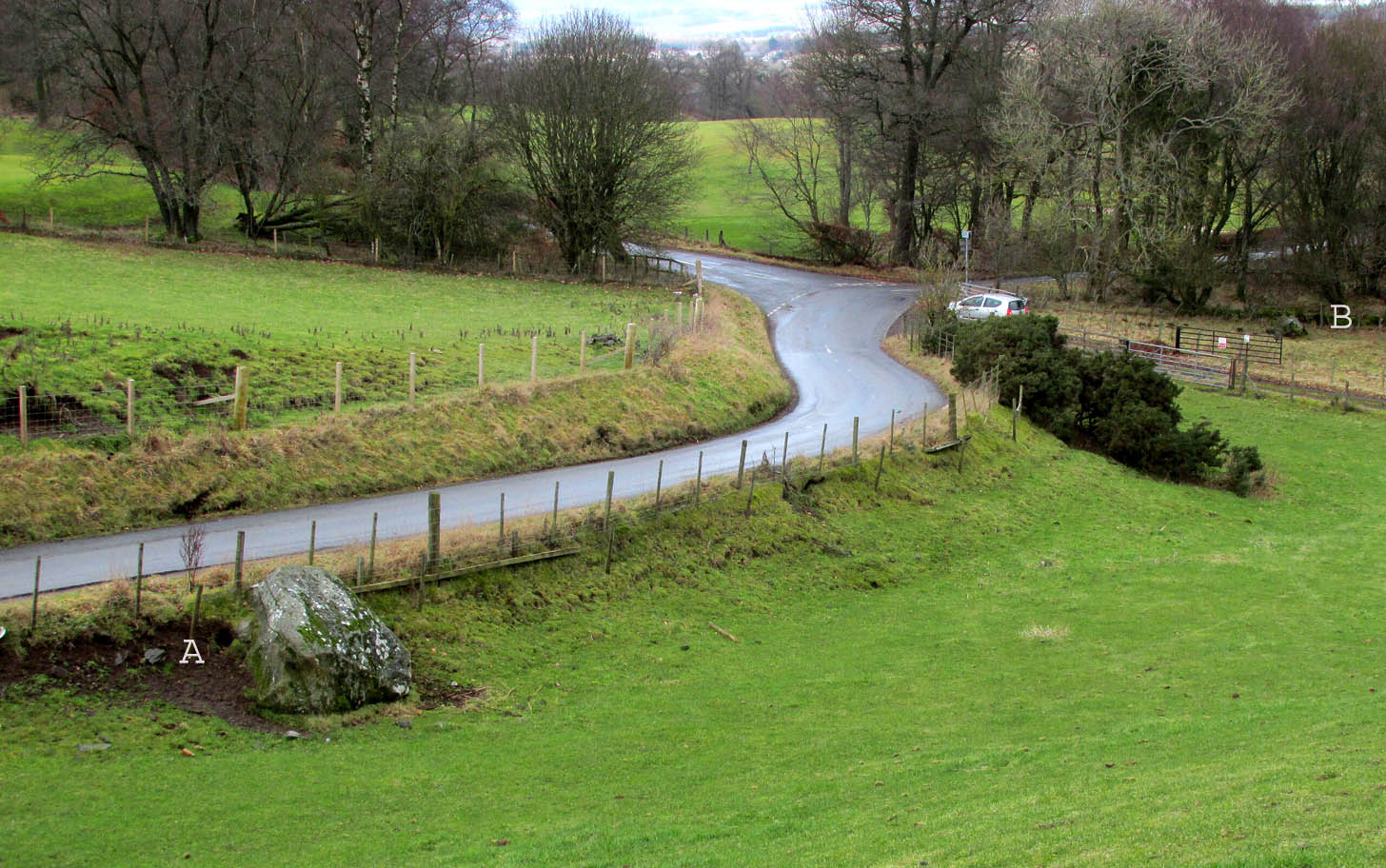
Travelling north from Perth on the A94, take the right turning for Murrayshall just before entering Scone, then take the first right and continue up to the road junction, and park up at the trackway opposite. You’ll see the big stone in the field to the right, up against the road embankment; and the small stone is in the paddock to the left of the trackway at the edge of the trees.
Archaeology & History
Two large glacial erratics which have acquired mythic status and picked up a Christian triumphalist message on the way.
Folklore
In Lawrence Melville’s (1939) excellent local history work, he thankfully put to pen an all-but-forgotten tale of oral tradition:
“Where the road from the Muir of Durdie leaves Kilspindie parish, a grass grown road leads north to Boglebee….. A few yards from the highway lie two large stones, said to have been flung from the Giant’s Hill in Collace parish – the flat topped eminence lying due north from the stones, about two or three miles away, better known as “Macbeth’s Hill”, or “Dunsinane Hill”.
The ‘string’ marks of legendThe smaller stone with its ‘string’ marks
“When the church dedicated to St John in Perth was being built and its tower began to appear, a witch living in Collace was enraged to see this proof of the approach of Christianity and determined to destroy it. She had a son, a giant (after whom the hill receives one of its names), whom she sent to the top of the hill, giving him two huge stones with which to destroy the rising church.
“By her incantations she had supernatural power and knew that when Christianity came her power would be destroyed. She gave him her mutch from her head to be used as sling and in it the giant put the two huge stones. Whirling it around his head, he aimed them in a line with the tower, but, just as he let them fly, the string of his mother’s cap broke and the stones only went the length of Boglebee. The marks on the stones are said to be the marks of the witch’s mutch strings.”
Another view of the larger stone
A familiar folkloric message is remembered the length of Britain: a giant, a devil or other supernatural being throwing stones that either spill out of an apron or otherwise miss their mark. And in this case an unsubtle message to anyone trying to take on the might of the church. But what was the original story of these stones as told by the old time oral storytellers before Christian missionaries stalked the land?
If the string hadn’t broken and the stones had followed their original trajectory they would have fallen south of St John’s Kirk, but it was the thought that counted….
Reference:
Melville, Lawrence, The Fair Land of Gowrie, William Culross: Coupar Angus, 1939.
The Rock and Leap may be seen from the B953 Bandirran to Abernyte road. Approach across the fields.
Archaeology & History
A large boulder perhaps 40 tons in weight lies in a ravine between Dunsinane and Black Hill. The ‘Leap’ is a flat topped ledge jutting out from the west side of Black Hill facing Dunsinane.
Folklore
Melville (1939) in his The Fair Land of Gowrie writes of the simple pleasures of the giant:
“From the farther side of the ravine [between Dunsinane and Black Hill], a precipitous rock juts out, which is called the “Giant’s Leap”. According to the lore of the Sidlaws, a giant, who once lived in these parts, leaped from this rock right on to the top of Dunsinane Hill. The giant also amused himself by tossing about a huge boulder which can be seen lying at the bottom of the ravine.”
And adds:
The Big Fellow’s toyGiant’s Leap from the north
“Fairies haunted the hills here and on summer nights they descended to the meadows, where they danced at a spot called “Fairygreen”. The Black Hill gets its name from the dark heath which covers it. Weird and bleak looking for most of the year, the lower slopes are brightened by glowing patches of purple flowers in late summer.”
Fairygreen Farm lies a mile almost due north of Dunsinane.
Reference:
Melville, Lawrence, The Fair Land of Gowrie, William Culross & Son, Coupar Angus, 1939.
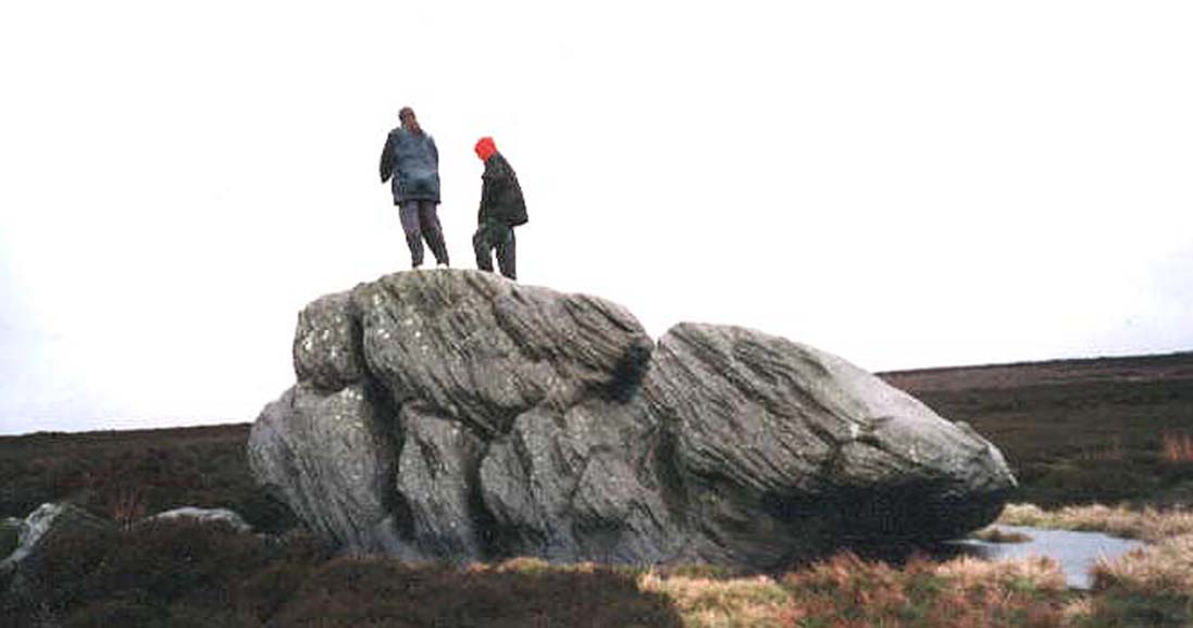
By whichever route you wanna take, get y’self to the prominent cup-and-ring marked rocks known as the Thimble Stones near the very top of these moors. From here, walk roughly 400 yards southwest onto the bare open moors (there are no footpaths here) and you’ll see these two isolated prominent boulders living quietly on their own. You can’t really miss ’em! You’re there.
Archaeology & History
Of the two giant boulders here, both are included in the petroglyph surveys of Hedges (1986) and Boughey & Vickerman’s (2003) as possessing “all natural” cup-marks on their top and vertical surfaces. Those on top of the rocks certainly seem to be Nature’s handiwork, whilst many of the seeming ‘cups’ on the vertical face of one (not the one pictured here) are due to gunshots. I’m not quite sure when they were done, but they certainly didn’t exist during the many visits I made here in the in the 1970s and ’80s.
They stones included in most of the standard antiquarian surveys of the 19th century, with the earliest being Forrest & Grainge (1869) who described them as,
“two detached masses of rock, standing alone upon the moor. The first is 14ft in length by 8ft in height, tapering to the ground; a set of cups and channels occupy the highest point. The other, distant 13 yards, is of an irregular square form, 45 yards in circumference and 7ft high. This stone appears to be tilted on its edge, presenting its cleavage upwards, and has hollows containing water, but is so much wasted above that if it has ever borne the cups and channels, they are now obliterated.”
On top of an Egg, c.1986
Collyer & Turner (1885) described “a number of cups” on the edge of the northern rock; and Romilly Allen (1896) likewise. Even that historical literary giant, Harry Speight (1900), added his own tuppence here, telling folks how both Eggs “are channelled and bear cups.”
It’s very possible that these isolated stones did have some sort of significance to our prehistoric ancestors. There are innumerable examples worldwide of rocks like this possessing ritual and mythic lore—and many in the British Isles too. And the cupmarks on the stones may have been enhanced by those same prehistoric ancestors. But we’ll never know for sure…
Folklore
The creation myth behind the Two Eggs is one echoed in traditions across the world. Folklore tells that the Eggs were said to have been laid here by a great dragon who lived within a hill some distance to the south. All other aspects of the tale have sadly long since been forgotten…
References:
Allen, J. Romilly, “Cup and Ring Sculptures on Ilkley Moor,” in The Reliquary, volume 2, 1896.
Bennett, Paul, The Old Stones of Elmet, Capall Bann: Milverton 2001.
Boughey, Keith & Vickerman, E.A., Prehistoric Rock Art of the West Riding, WYAS: Wakefield 2003.
Collyer, Robert & Turner, J.H., Ilkley: Ancient and Modern, William Walker: Otley 1885.
Forrest, Charles & Grainge, William, A Ramble on Rombald’s Moor, Northern Antiquarian: Bradford 2012 (1st published 1867-69).
Hedges, John (ed.), The Carved Rocks on Rombalds Moor, WYMCC: Wakefield 1986.
Speight, Harry, Upper Wharfedale, Elliott Stock: London 1900.


“wonderful tumulus called Stone raise which is a great curiosity: it is formed entirely of large stones piled up without earth or gravel, differing in that respect from any I have seen. Notwithstanding that upwards of a thousand, nay ’tis said several thousand, loads of stones have been led away from it to build walls with, it yet remains a stupendous monument of this species of antiquity: we measured the base of it as well as we could by our strides and made it 369 feet in circumference and of such an height as to be seen for a considerable distance. It has been most completely rifled…and it now presents a number of small craters formed by the investigations of the money searchers. It is situated upon a hill about half a mile south of Addlebrough. In addition to the particulars I formerly mentioned, I may say the men who first opened it about 50 years ago worked incessantly for 33 days. It stands on Thornton moor, and tho’ the Thornton men would not assist in the labour, they intended to share in the profit if there was any; but the adventurers who had all the work resolved they should not and they carried a large sword with them every day to defend the treasure in case they found any; the wise man who read ’till the stones shook and rattled was a schoolmaster at Bainbridge: the teeth they found were deposited in a hollow place in the bottom of the tumuli formed long and narrow like a coffin by a walling of stones. Tho’ the tumulus has apparantly been compleatly rifled, I do not believe the whole base has been sufficiently searched, but if it was to commemorate one great individual, which appears to have been the case, perhaps nothing more may be found.”


“there is still on that elevated spot a cairn, called Stone Raise, about 120 yards in circumference at the base, to which the usual tradition of its containing a treasure of gold having been attached, two persons were several years ago induced to make the experiment; but having penetrated to the centre, found, to their great disappointment, what an antiquary would have prepared them to expect, namely, a kist vaen of flag stones, with the remains of a human skeleton, the teeth of which were still pretty perfect.”