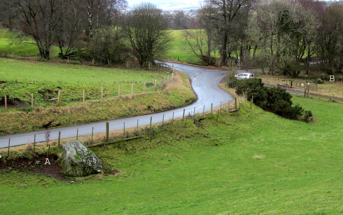
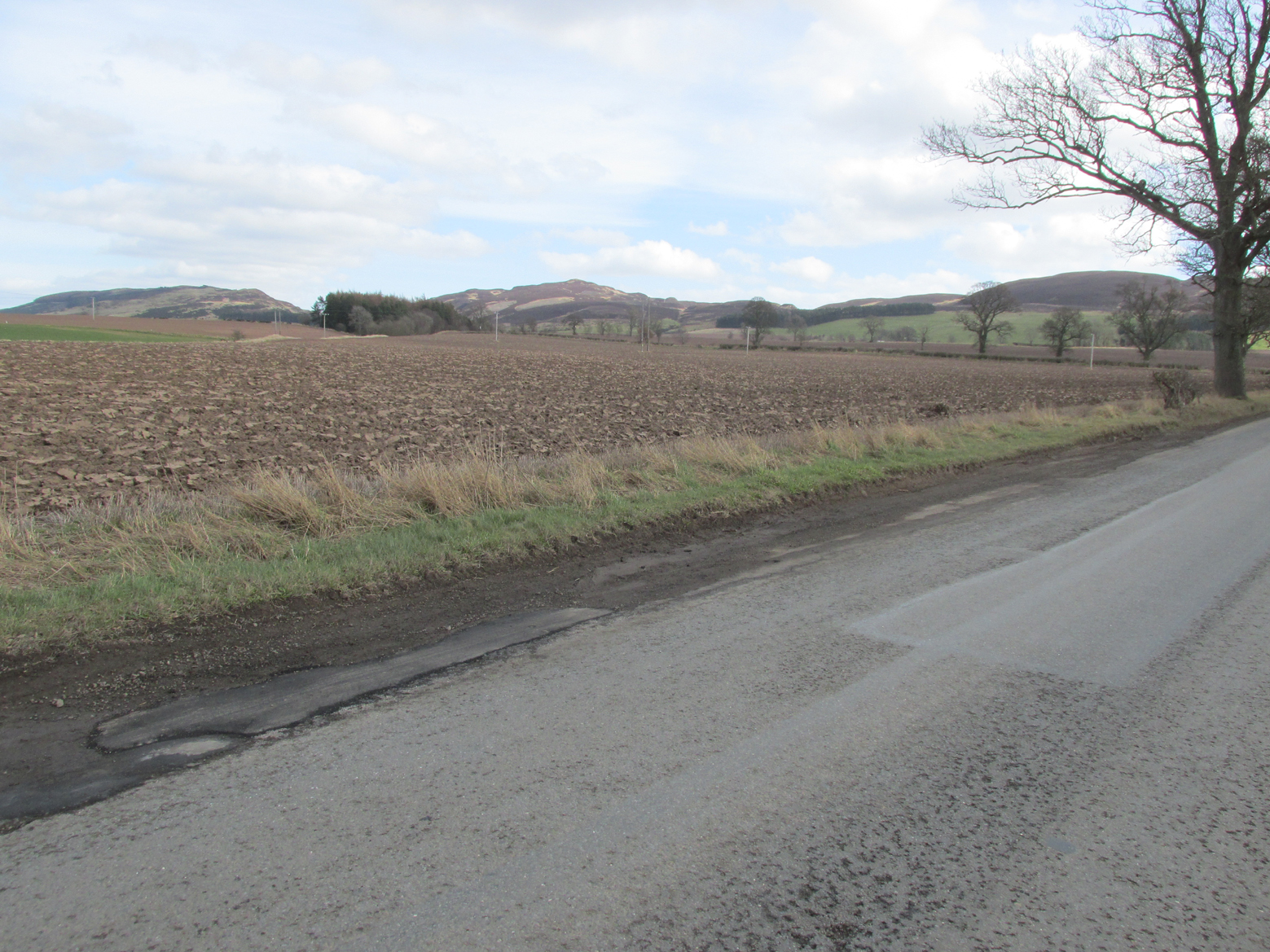
Travelling north from Perth on the A94, take the right turning for Murrayshall just before entering Scone, then take the first right and continue up to the road junction, and park up at the trackway opposite. You’ll see the big stone in the field to the right, up against the road embankment; and the small stone is in the paddock to the left of the trackway at the edge of the trees.
Archaeology & History
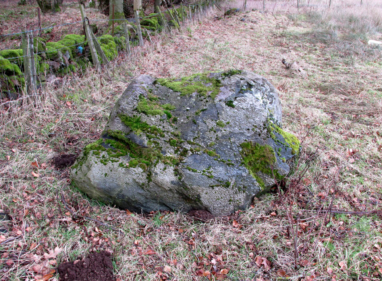
Two large glacial erratics which have acquired mythic status and picked up a Christian triumphalist message on the way.
Folklore
In Lawrence Melville’s (1939) excellent local history work, he thankfully put to pen an all-but-forgotten tale of oral tradition:
“Where the road from the Muir of Durdie leaves Kilspindie parish, a grass grown road leads north to Boglebee….. A few yards from the highway lie two large stones, said to have been flung from the Giant’s Hill in Collace parish – the flat topped eminence lying due north from the stones, about two or three miles away, better known as “Macbeth’s Hill”, or “Dunsinane Hill”.
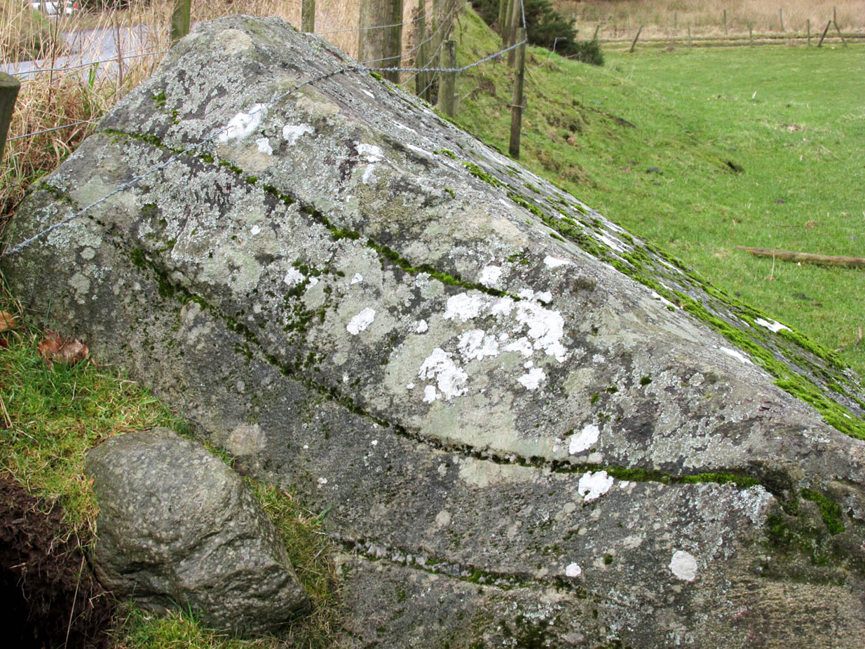
The ‘string’ marks of legendThe smaller stone with its ‘string’ marks
“When the church dedicated to St John in Perth was being built and its tower began to appear, a witch living in Collace was enraged to see this proof of the approach of Christianity and determined to destroy it. She had a son, a giant (after whom the hill receives one of its names), whom she sent to the top of the hill, giving him two huge stones with which to destroy the rising church.
“By her incantations she had supernatural power and knew that when Christianity came her power would be destroyed. She gave him her mutch from her head to be used as sling and in it the giant put the two huge stones. Whirling it around his head, he aimed them in a line with the tower, but, just as he let them fly, the string of his mother’s cap broke and the stones only went the length of Boglebee. The marks on the stones are said to be the marks of the witch’s mutch strings.”
Another view of the larger stone
A familiar folkloric message is remembered the length of Britain: a giant, a devil or other supernatural being throwing stones that either spill out of an apron or otherwise miss their mark. And in this case an unsubtle message to anyone trying to take on the might of the church. But what was the original story of these stones as told by the old time oral storytellers before Christian missionaries stalked the land?
If the string hadn’t broken and the stones had followed their original trajectory they would have fallen south of St John’s Kirk, but it was the thought that counted….
Reference:
Melville, Lawrence, The Fair Land of Gowrie, William Culross: Coupar Angus, 1939.
The site of the well is on the north side of the road between Saucher and Collace, just past the small stand of trees.
Archaeology and History
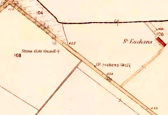
The site shown on the 1867 OS 25″ map
Nothing now remains of the well, but across the road on the strip of grass leading to the burn there is patchy Cotton Grass growth, evidence of the vestigial flow of the spring. A nearby water pumping station on the same side of the road as the former well is probably responsible for the spring well’s demise.
The site of the Well
There may have been a nearby chapel dedicated to the Saint, of which no trace remains, and in the 1860s, the Ordnance Survey recorded “A few yards from the site of the chapel there is an excellent spring well by the name of ‘St Teuchan’s Well.’” The Ordnance Survey further recorded “Mr James Stewart, Kinrossie,… supposes [the Saint’s name] to be a corruption from St Vigean’s. Ukans appears to be the common pronunciation, and the T or D of the authorities being silent the spelling Euchans will…answer either of them.”
Across the road from the Well, Cotton Grass provides evidence of the vestigial flow of the spring.
Saint Euchan was made the titular or patron Saint of Collace by Bishop de Bernham in 1242. The exact identity of the Saint is unclear but he is believed to be the Irish Saint Eoghan, the son of Caennach of Leinster who was ‘carried off in his early youth by pirates to Britain’ later spending some years at Whithorn, before returning to Ireland, where he became the master of St Kevin at Kilnamanach, the monastery he founded in County Wicklow, and Bishop of Ardstraw, County Tyrone. His saint’s day is August 23rd. As there seems to be some doubt as to the Saint’s true identity it is perhaps worth mentioning that Euken is a Basque man’s first name, but this is almost certainly coincidence.
Folklore
The well was at one time believed to have had healing properties.
References:
Forbes, Alexander Penrose, Kalendars of Scottish Saints, Edmonston and Douglas: Edinburgh 1872.
Collace Parish Millenium Committee, Off The Main Road, Kinrossie District Recreation Club, 2010
Scotland’s Place Names
Gizonezkoen ponte-izenak (Basque Men’s Names) – Euskaltzaindia, Bilbao 2015.
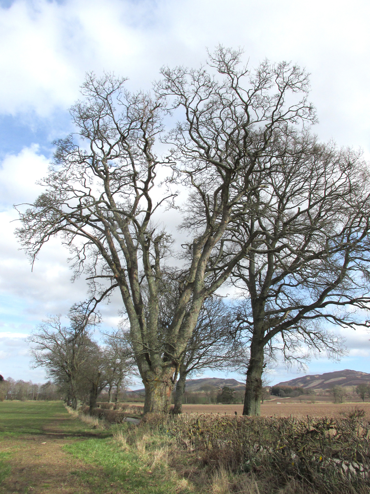
Perusal of a 25″ OS map of 1867 shows, in almost microscopic lettering, a feature marked ‘Bogle Bush’. I transferred the approximate location onto a modern map and set off to make a field visit, honestly not expecting to find anything almost a century and a half later.
The Bogle Bush
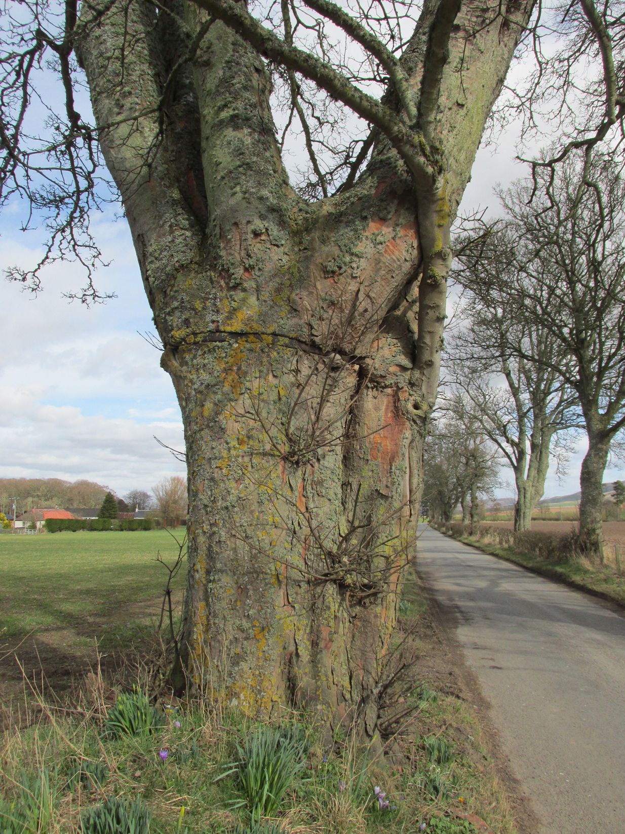
As I walked down the designated road I was drawn to an ancient multi branched or trunked tree, the trunks held together by a hefty iron band. The band had been placed there many years ago as it was being absorbed by the growth of the tree. Unlike the other trees in the road the foot of this tree had crocus and grape hyacinth in flower, as if deliberately planted.
The band was forged and fitted by Kinrossie Blacksmith and Kirk Elder David Gray at the end of the nineteenth century, following the collapse of one of the three trunks then standing.
The band holding the tree together
The online Ordnance Survey Name Books for Perthshire, compiled prior to the survey of the 1867 map, list Robert Millar of Flowerdale, Mr James Stewart of Kinrossie and Mr Fraser of St Euchans as the informants that ‘This name is applied to a Birch Tree situated on the north side of the road leading from Saucher to Kinrossie. Mr Millar says that there is a superstitious tradition existing in the locality that Bogles have been seen &c at this tree’.
Whether Mr Millar and his co-informants were trying to mischievously mislead the (probably) English Ordnance Survey officials, we will never know, but the tree is in fact a Sycamore! And the 1901 25″ OS map shows the tree as the ‘Bogle Busk’.
Folklore
There has been speculation that the Bogle Bush may have long forgotten links with Macbeth whose fortess at nearby Dunsinnan Hill overlooks it, adding the rider that Sycamores only live 200 years or so before falling and then regenerating on the same spot, implying that a mother tree could have been on the same spot in Macbeth’s time.
David Gray, Blacksmith and Kirk Elder of Kinrossie.
Local folklore states that ‘a great calamity will befall Kinrossie’ should the Bush collapse. The tree is a local icon that’s ‘aye been there’ according to a local resident and it seems to be a local geo-caching site, judging by the small container of ‘stuff’ hidden in a plastic container underneath a couple of pieces of bark at the base of the trunk on my visits.
Please note that if you decide to visit, this is not a wishing tree, so do not hammer coins into the bark or suspend rags from the branches. Respect the Bush and the local people to whom this is an iconic tree.
My thanks to local resident Morag Hislop for leading me to further information on this site.
In seeking out some of the monuments in the area north of Collace village, we enquired upon one of the landowners for anything they might know of the sites we were looking at. Whereupon (as happens occasionally), the gent concerned—a local man—after ascertaining that we weren’t from the National Trust or a similar group, informed us that many years ago he was ploughing the field over where a small subsidence had been, when his tractor fell into a large hole that appeared in the ground due to the weight of his vehicle! It was a souterrain, he told us; but once he managed to retrieve his tractor from the hole in the ground by calling upon one of his neighbours, he completely covered it and filled it in again.
Despite him telling us to keep it to ourselves, it does appear that aerial photography from the 1990s seems to have uncovered the location of the site. Indeed, by the look of things, there may be more than one!