Cup-and-Ring Stone (lost): OS Grid Reference – NT 98491 28424
Archaeology & History
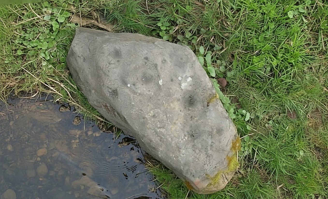
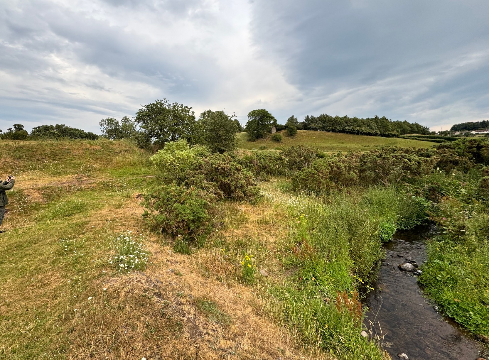
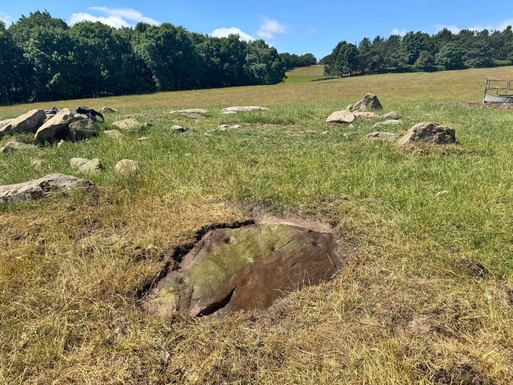
This carving was rediscovered by rock art explorer Jan Broewer in September, 2007, a few hundred yards out of Wooler on the way to Akeld and Kirknewton, in the field on the right-hand side of the road, on the embankment just a few inches above the waters of the High Burn. On a recent visit here by Tom Cleland and I, despite us rummaging amidst the gorse and other herbage all along the edge of the waters, we were unable to locate the carving and presume that it has either been destroyed or re-housed in someone’s garden, living a more comfortable life. We certainly hope it’s the latter!
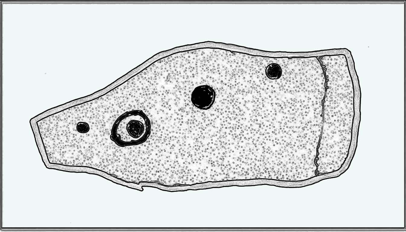
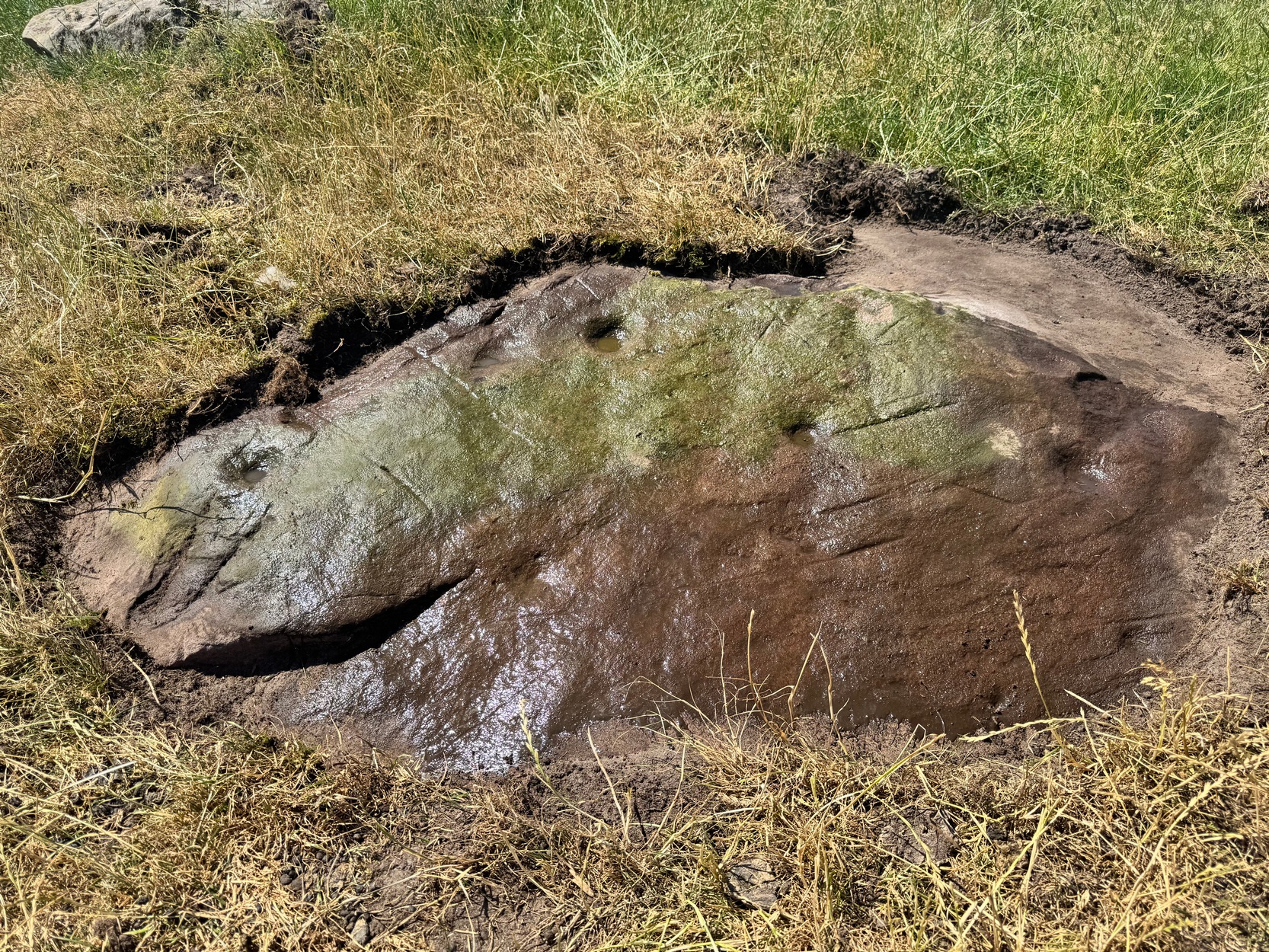
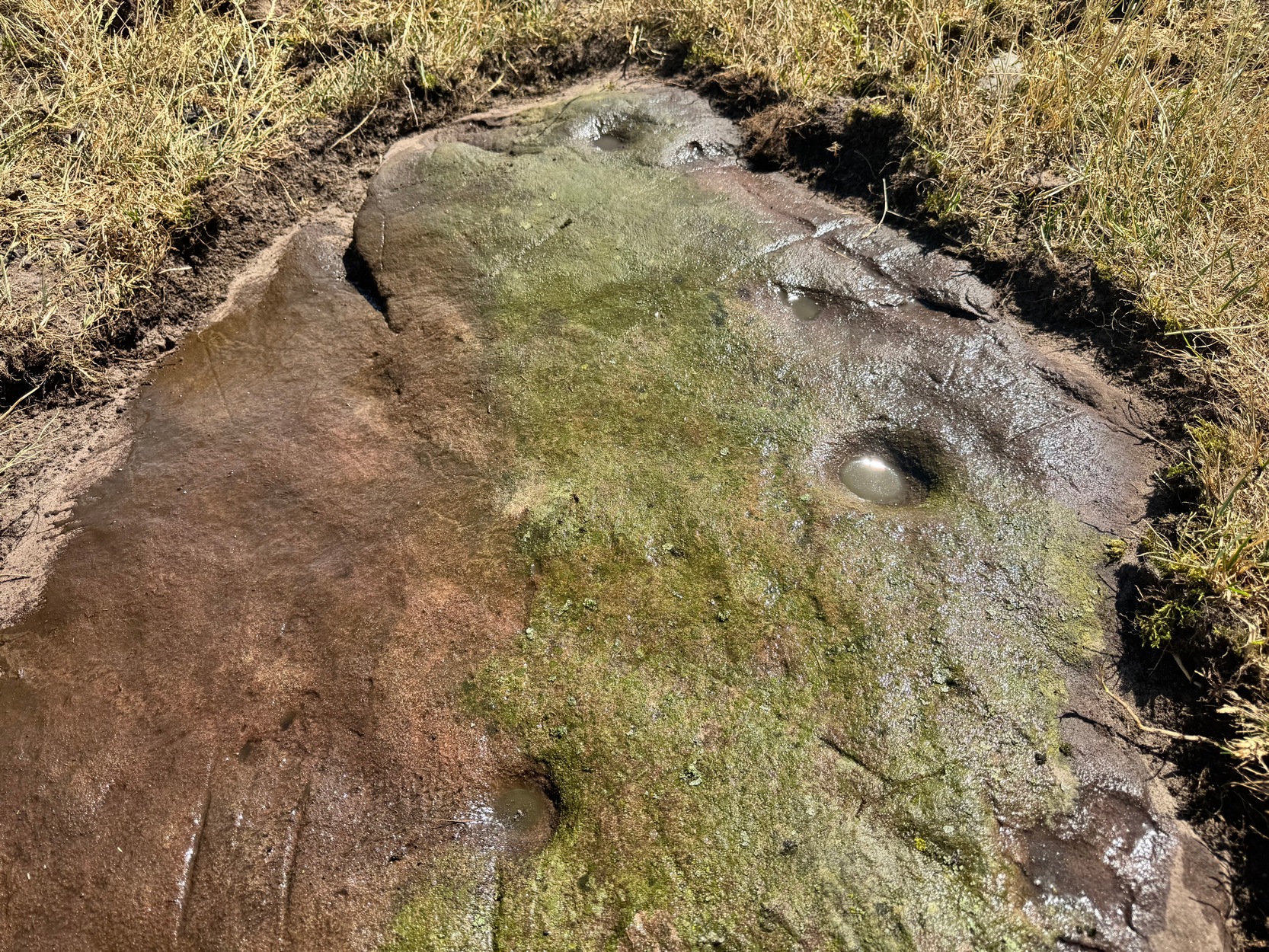
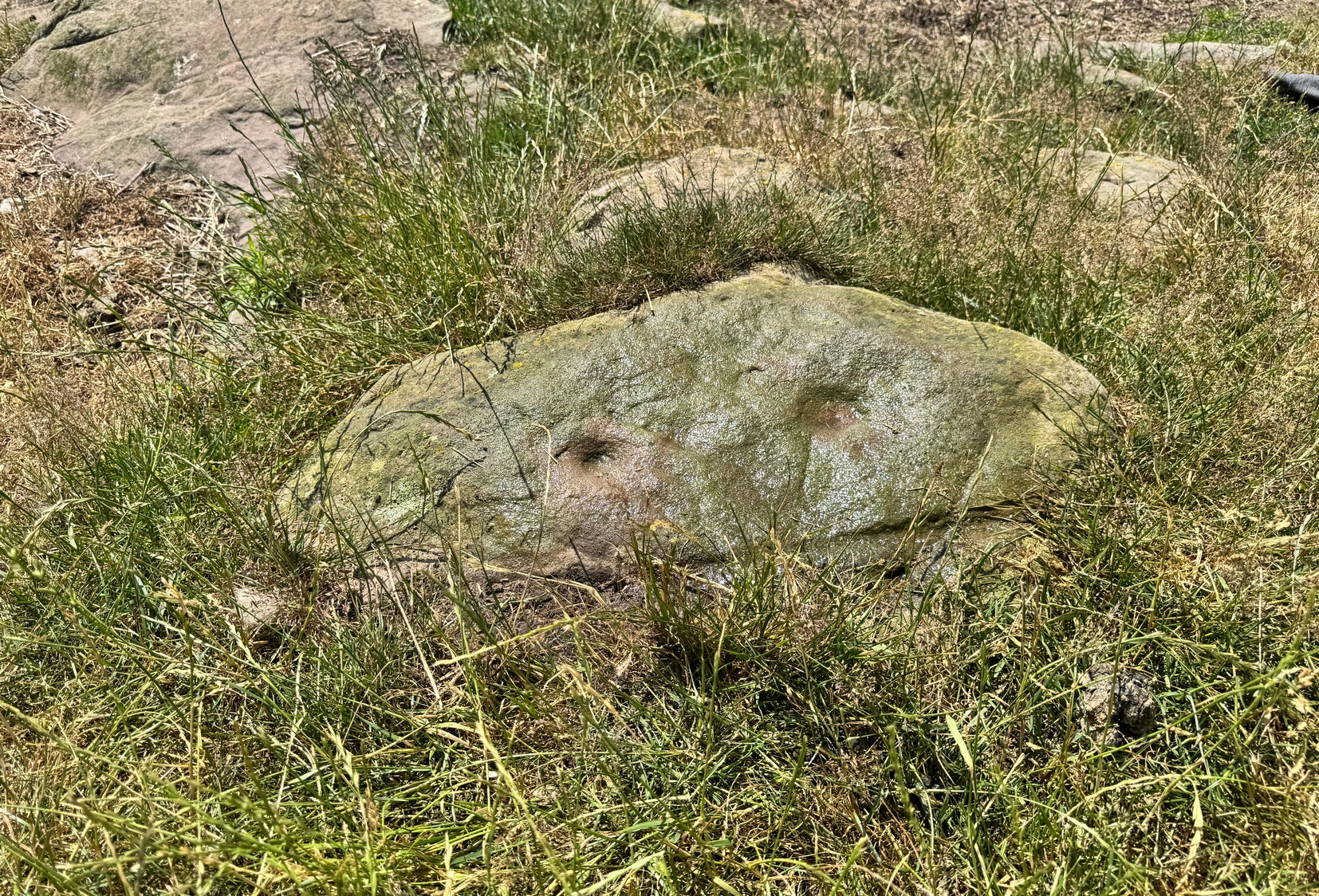
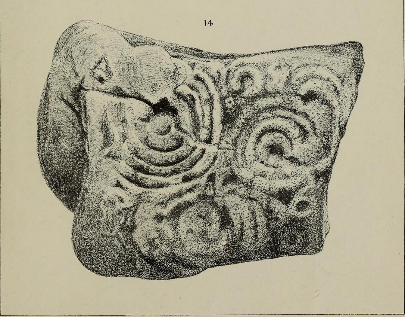
It’s design is nothing special: merely a singular, albeit scruffy cup-and-ring, with two other distinct pecked cup-marks and, possibly, a third shallow one just to the side of the cup-and-ring (but this is, in my opinion, highly suspect). The stone was obviously not in its original position when Jan first found it, and would seem to have come originally from the slope above the stream where a number of earthfast stones can be found. The numerous scratches across its surface shows that it’s been hit a few times by some (probably) metallic objects, or perhaps horses hooves, thus dislodging it from the slope above and rolling into the spot where Jan found it. Anyhow, we presently don’t know where it is or what’s become of it. Does anyone in Wooler know where it’s living?
Acknowledgements: Huge thanks to Pete Chattaway for use of his photo; and to Tom Cleland for helping the search party!

© Paul Bennett, The Northern Antiquarian
")
