Humbleton Hill, Wooler, Northumberland

Hillfort:  OS Grid Reference – NT 96706 28252

Also Known as:

  1. Cup and Saucer Camp

Archaeology & History
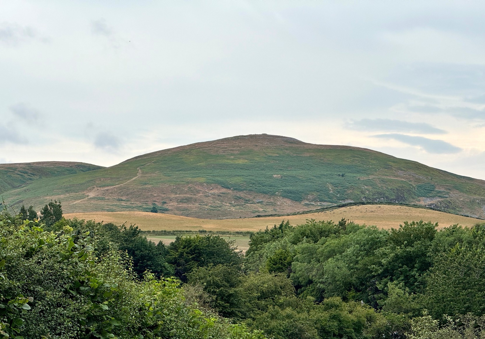
Humbleton Hill

On our first visit to Wooler, in seeking out (and not finding!) a cup-and-ring stone alongside the old burn just on the northern side of town, we looked up at the ridged hillside of Humbleton Hill ahead of us and proclaimed, something along the lines of: “That look’s like something man-made up there!”  And so it turned out.  But the heat of the summer kept us from ascending the hill, so just an old account must be penned, from the quill of the great rock art pioneer George Tate (Home & Tate 1857) who, following a visit here in May 1852 with various members of the Berwickshire Natural History Society, penned the following:

“On the north side of Humbleton burn is a conical hill truncated at the top, and rising abruptly about 100 feet above the level of the burn; the slope, though considerable, is less steep on the other sides. This was one of the strongholds of the ancient Hritons. A rampier (now obliterated) ran around that part of the hill not protected by the ravine of the burn. The summit of the hill is 180 yards in circumference, having a hollow in the centre of the area; it is surrounded by a rampier of stone and earth, which is yet in some parts 3 feet high. This entrenchment is commonly called ‘The Cup and Saucer Camp’.”

The Hillfort itself is in very good condition overall, is very extensive and has a very clear series of walled ramparts all round the summit of the hill.  It has yet to be excavated.

Folklore

The local folk-name given to this old hillfort—the Cup and Saucer Camp—related to the shape and lay-out of the enclosure, and with it, the tradition that the chiefs of the tribe inhabited the topmost enclosed section of the hillfort: the so-called ‘Cup’; whilst the tribal familes inhabited the realms immmediately outside and below the chief’s domain: the so-called surrounding ‘Saucer’.  On the northern edges of the outer ‘saucer’ walls are several ‘hut circles’ (for want of a better term), that would house people, or their animals—or both.

References:

  1. Home, Robert & Tate, G., “Address to the Members at the Anniversary Meeting, held at Embleton, Sept 8, 1852,” in Proceedings of the Berwickshire Naturalists’ Club, volume 3, 1857.

© Paul BennettThe Northern Antiquarian 

Mountain Farm, Whittingham, Northumberland

Cup-and-Ring Stone (lost):  OS Grid Reference – NU 053 128

Archaeology & History

This lost carving may have been brought to light as a result of field ploughing which, quite fortunately, uncovered a Bronze Age burial site with a cup-and-ring stone therein.  It was reported by the regional historian David Dixon (1895) in his classic work on this area, although his description was brief and he made no sketch of the design.  He told us:

“A stone-lined grave or cist, similar to that discovered at Mile, was found several years ago on Mountain Farm, in or near to which was a sandstone slab, covered with a fine example of the incised circles, such as are found in the rocks at Routin Lynn, Bewick Hill, Chatton Law and Lordenshaws Camp.”

These other petroglyphs he mentions are bloody impressive!  Sadly they’re not yet on TNA. (site profiles required of them are considerable in size – if anyone would like to write them 😉 )

References:

  1. Beckensall, Stan, Northumberland’s Prehistoric Rock Carvings – A Mystery Explained, Pendulum: Rothbury 1983.
  2. Dixon, David D., Whittingham Vale, Northumberland, Robert Redpath: Newcastle-upon-Tyne 1895.

© Paul BennettThe Northern Antiquarian

Whitelaw, Kirknewton, Northumberland

Cup-and-Ring Stone (lost):  OS Grid Reference – NT 942 295

Also Known as:

  1. Whitelaw Stone

Archaeology & History

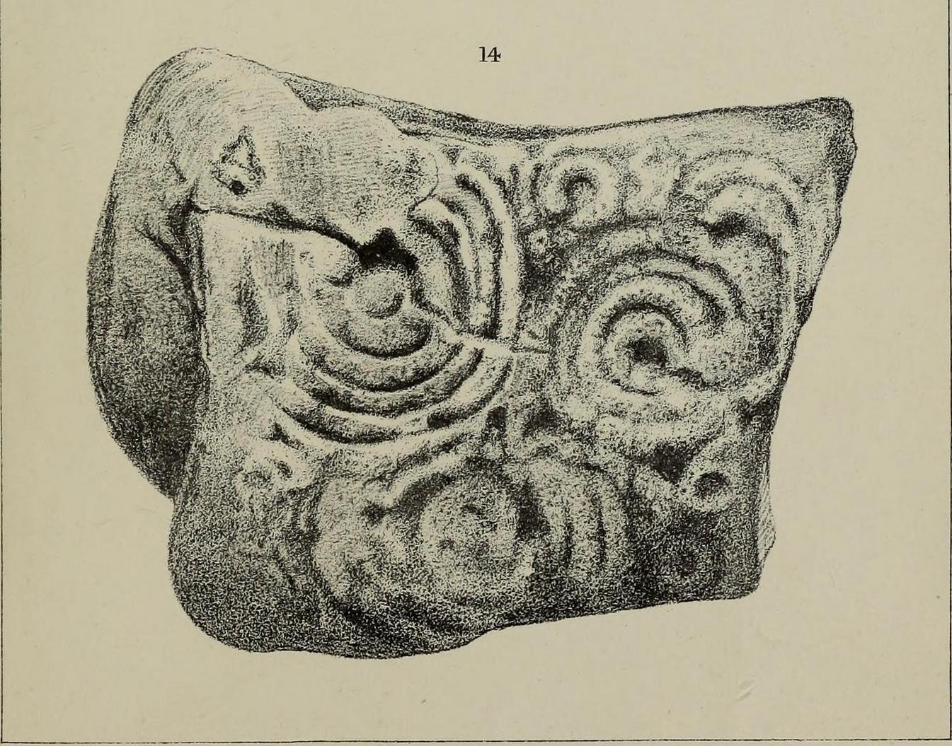
Sometime at the end of the 1860s, a local man—Mr William Wightman of Wooler—was in possession of this impressive-looking petroglyph which, we presume, he uncovered.  The carved stone was, as we can see, broken off from a larger piece and so it’s very evident that this was originally a larger design than the one illustrated here in Mr Middlemass’ (1872) drawing.  The only information we have about it are from his short notes,

The Whitelaw Stone

“was found on the north side of a hill called Whitelaw, the next eminence south-east from Yeavering Bell.  The stone is a very hard gritty sandstone, and bears distinctly the tool marks by which the circles have been cut. The tool must have been of iron or bronze, as the material is too hard to be operated upon by stone implements; moreover, the tool marks shew that the instrument used had a sharp round point, and must have been held in a similar way to the modern chisel.  The marks shew the size of the point.  The object of the artist evidently has been to fill the stone with ornament as between the two great circles; and at the corners he has placed smaller circles to suit the space. The similar nature of the circles on all the stones hitherto figured would seem to show that such stones, if monumental, were not legendary, but, most probably of a religious character; serving, like the Christian cross, to invite the traveller to pay his devotions on a spot rendered sacred by the emblems of worship.”

Searches for this have been made by Stan Beckensall (1983) and his acolytes, but it remains lost. (the grid-ref is an approximation)

References:

  1. Beckensall, Stan, Northumberland’s Prehistoric Rock Carvings – A Mystery Explained, Pendulum: Rothbury 1983.
  2. Middlemass. Robert, “On an Inscribed Stone in the Possession of Mr William Wightman, Bank, Wooler,” in History Berwickshire Naturalists Club, volume 6, 1869-72.

© Paul BennettThe Northern Antiquarian

Tom Tallon’s Grave, Kirknewton, Northumberland

Tumulus (destroyed):  OS Grid Reference – NT 9323 2800

Also Known as:

  1. Auld Wife’s Apronful o’ Stanes
  2. Tom Tallon’s Tumulus

Archaeology & History

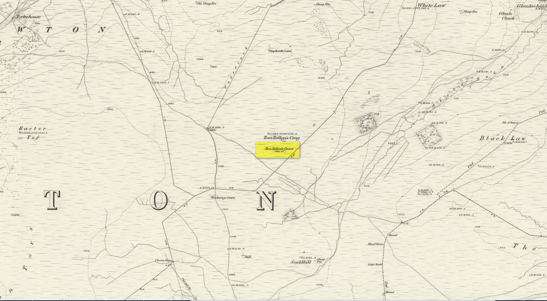
Site on the 1866 OS-map

Highlighted on the earliest OS-maps about half a mile to the south of the great prehistoric camp of Yeavering Bell and 100 yards southwest of Tom Tallon’s Crag, there once stood an apparently “massive” Bronze Age tumulus, or cairn, called Tom Tallon.  I’d hedge a bet that it was much older, from the neolithic period.  It was described by P.A. Graham (1921) as “the largest cairn in the district,” but when it was visited by the antiquarian Henry MacLauchlan in July 1858, he reported that “it was being removed to make a fence”!!!  Unbe-fuckin’-lievable… Who were the dickheads that did that?!

Folklore

The Ordnance Survey Name Book of 1860 for Tom Tallon’s Crag told that,

“There is a vague tradition about Tom Tallon having been a Warrior and Slain here – hence the name, but nothing authentic respecting Tom, can now be ascertained.”

The word tom derives from “a rounded hill”, sometimes associated with a tumulus and in Scotland (just over the border) associated “with a dwelling place of the fairies” with tallon suggested by Graham (1921) to derive from “tal, a forehead or promontory, and Llan, an enclosure.”

What is quite obviously an older name, or certainly one that was more recognised by local people, is its title of the Auld Wife’s Apronful of Stones: a title we find associated with a number of the giant cairns in northern England and Scotland.  It relates to the creation myth of the site, whereby the countless stones that made up the cairn were dropped or thrown across the landscape by a giantess who inhabited this area.

References:

  1. Hall, James, A Guide to Glendale, M. Brand: Wooler 1887.
  2. Graham, P. Anderson, Highways and Byways in Northumbria, MacMillan: London 1921.
  3. MacLauchlan, Henry, “Notes on Camps in the Parishes of Branxton, Carham, Ford, Kirknewton and Wooller, in Northumberland,” in History Berwickshire Naturalists Club, volume 24, 1922.

© Paul BennettThe Northern Antiquarian

Yeavering, Kirknewton, Northumberland

Cup-and-Ring Stone (lost):  OS Grid Reference – NT 931 302

Archaeology & History

Little is now known of this carving which was described briefly by Stan Beckensall (1983):

“A cup and ring marked stone was found in the field north of Yeavering Bell in the neighbourhood of the monolith.  The last heard of it, according to the Northumberland County History (14:67) was that it was in the grounds of Ewart Park.”

The monolith he speaks of would be the one called the Battle Stone (NT 9299 3038) and Ewart Park is 2 miles ENE of here.  The carving remains lost. (the grid reference where the stone was originally located is an approximation, but a pretty good one)

References:

  1. Beckensall, Stan, Northumberland’s Prehistoric Rock Carvings – A Mystery Explained, Pendulum: Rothbury 1983.

© Paul BennettThe Northern Antiquarian