The Rock and Leap may be seen from the B953 Bandirran to Abernyte road. Approach across the fields.
Archaeology & History
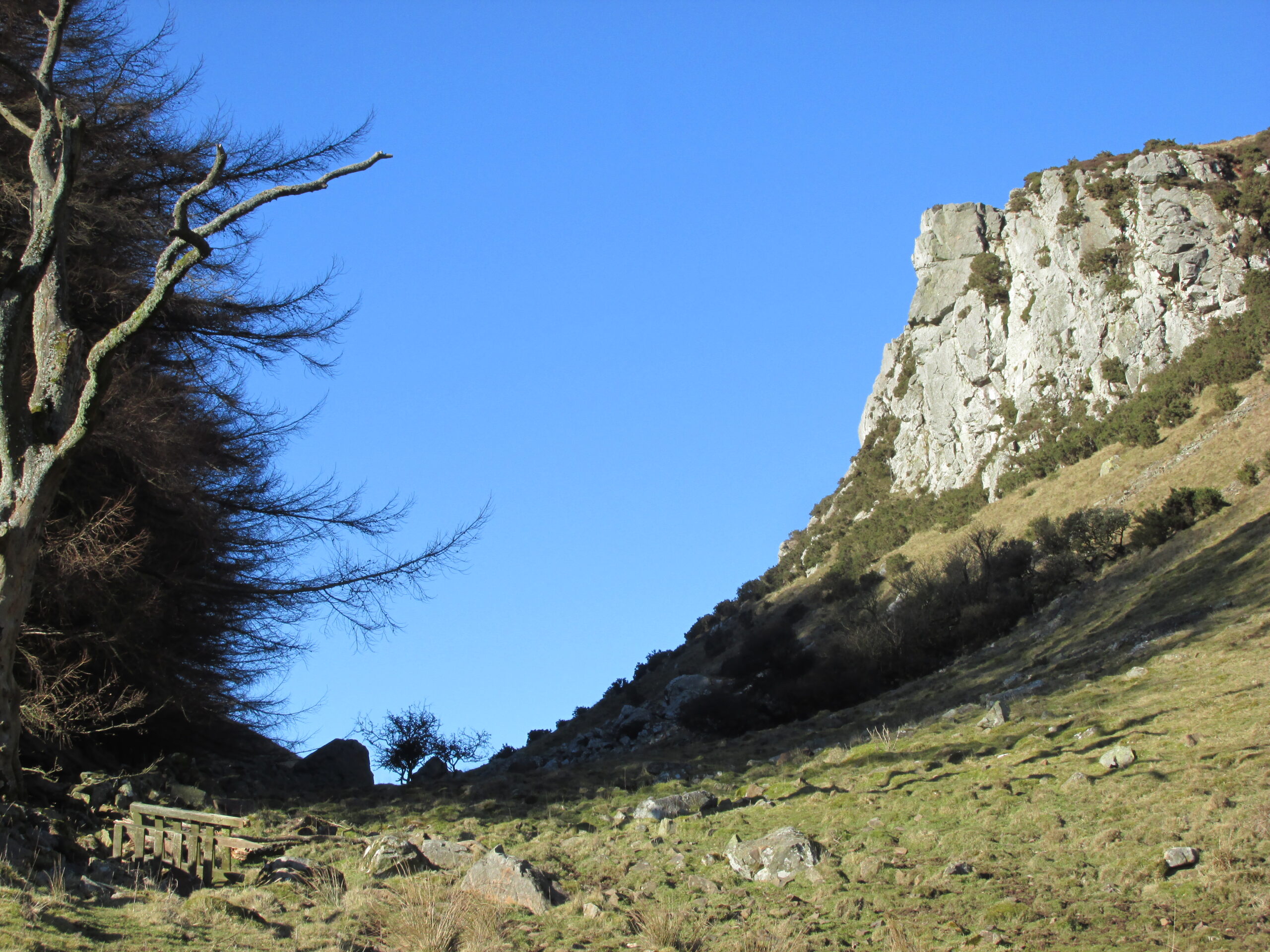
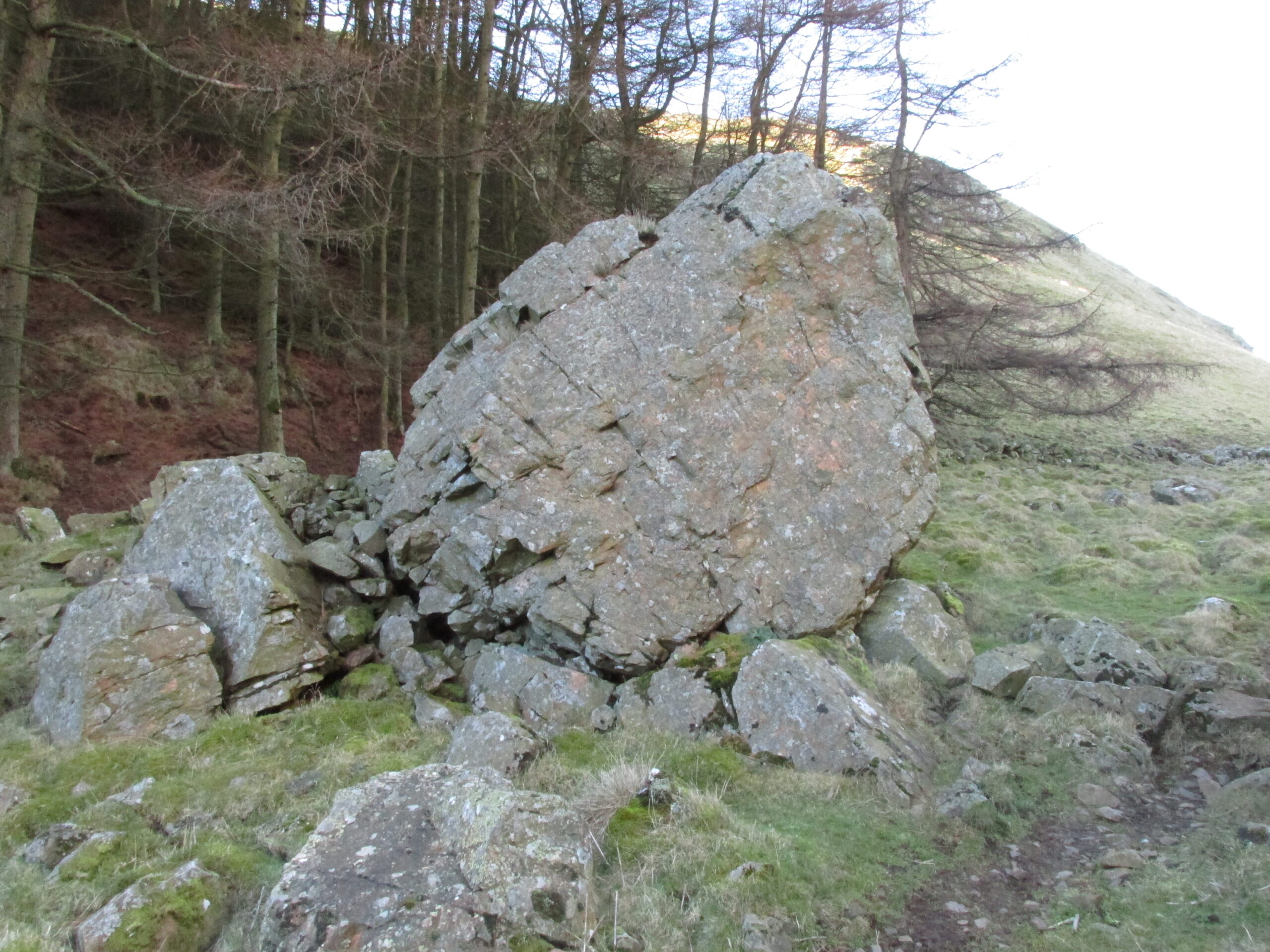
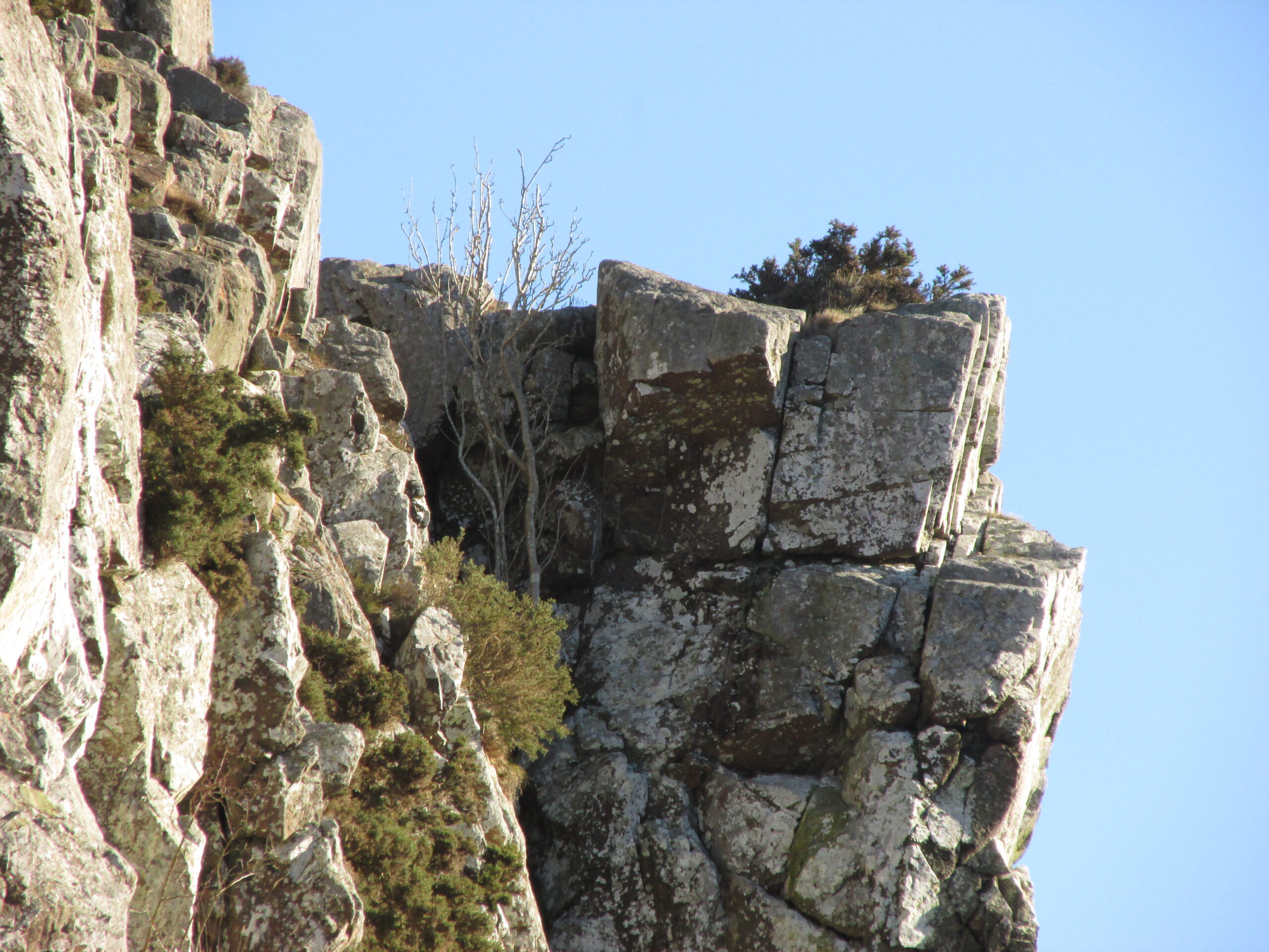
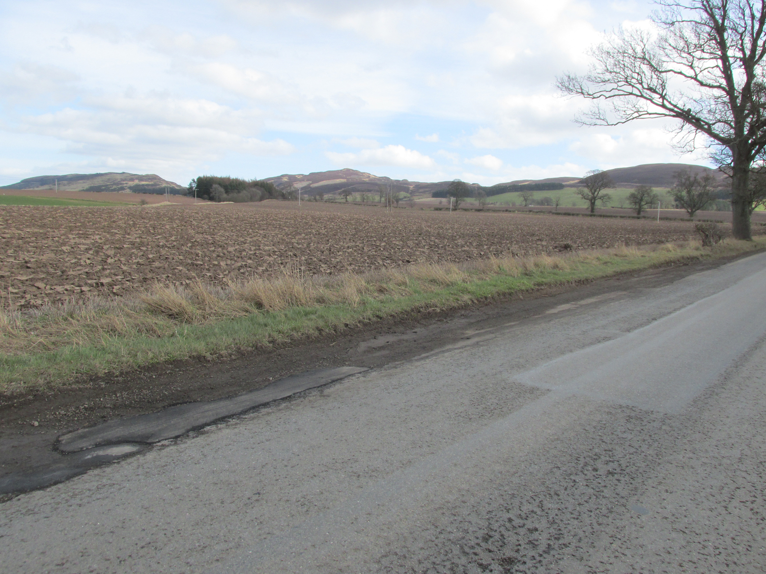
A large boulder perhaps 40 tons in weight lies in a ravine between Dunsinane and Black Hill. The ‘Leap’ is a flat topped ledge jutting out from the west side of Black Hill facing Dunsinane.
Folklore
Melville (1939) in his The Fair Land of Gowrie writes of the simple pleasures of the giant:
“From the farther side of the ravine [between Dunsinane and Black Hill], a precipitous rock juts out, which is called the “Giant’s Leap”. According to the lore of the Sidlaws, a giant, who once lived in these parts, leaped from this rock right on to the top of Dunsinane Hill. The giant also amused himself by tossing about a huge boulder which can be seen lying at the bottom of the ravine.”
And adds:
The Big Fellow’s toyGiant’s Leap from the north
“Fairies haunted the hills here and on summer nights they descended to the meadows, where they danced at a spot called “Fairygreen”. The Black Hill gets its name from the dark heath which covers it. Weird and bleak looking for most of the year, the lower slopes are brightened by glowing patches of purple flowers in late summer.”
Fairygreen Farm lies a mile almost due north of Dunsinane.
Reference:
Melville, Lawrence, The Fair Land of Gowrie, William Culross & Son, Coupar Angus, 1939.
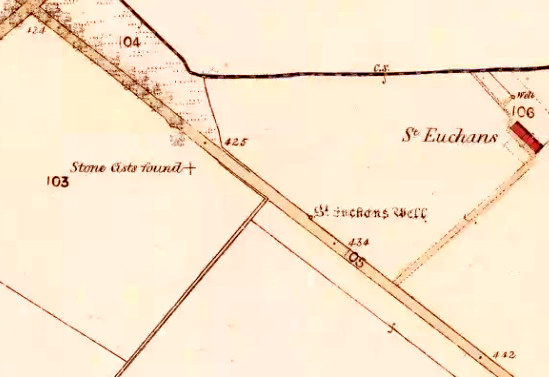
The site of the well is on the north side of the road between Saucher and Collace, just past the small stand of trees.
Archaeology and History
The site shown on the 1867 OS 25″ map
Nothing now remains of the well, but across the road on the strip of grass leading to the burn there is patchy Cotton Grass growth, evidence of the vestigial flow of the spring. A nearby water pumping station on the same side of the road as the former well is probably responsible for the spring well’s demise.
The site of the Well
There may have been a nearby chapel dedicated to the Saint, of which no trace remains, and in the 1860s, the Ordnance Survey recorded “A few yards from the site of the chapel there is an excellent spring well by the name of ‘St Teuchan’s Well.’” The Ordnance Survey further recorded “Mr James Stewart, Kinrossie,… supposes [the Saint’s name] to be a corruption from St Vigean’s. Ukans appears to be the common pronunciation, and the T or D of the authorities being silent the spelling Euchans will…answer either of them.”
Across the road from the Well, Cotton Grass provides evidence of the vestigial flow of the spring.
Saint Euchan was made the titular or patron Saint of Collace by Bishop de Bernham in 1242. The exact identity of the Saint is unclear but he is believed to be the Irish Saint Eoghan, the son of Caennach of Leinster who was ‘carried off in his early youth by pirates to Britain’ later spending some years at Whithorn, before returning to Ireland, where he became the master of St Kevin at Kilnamanach, the monastery he founded in County Wicklow, and Bishop of Ardstraw, County Tyrone. His saint’s day is August 23rd. As there seems to be some doubt as to the Saint’s true identity it is perhaps worth mentioning that Euken is a Basque man’s first name, but this is almost certainly coincidence.
Folklore
The well was at one time believed to have had healing properties.
References:
Forbes, Alexander Penrose, Kalendars of Scottish Saints, Edmonston and Douglas: Edinburgh 1872.
Collace Parish Millenium Committee, Off The Main Road, Kinrossie District Recreation Club, 2010
Scotland’s Place Names
Gizonezkoen ponte-izenak (Basque Men’s Names) – Euskaltzaindia, Bilbao 2015.
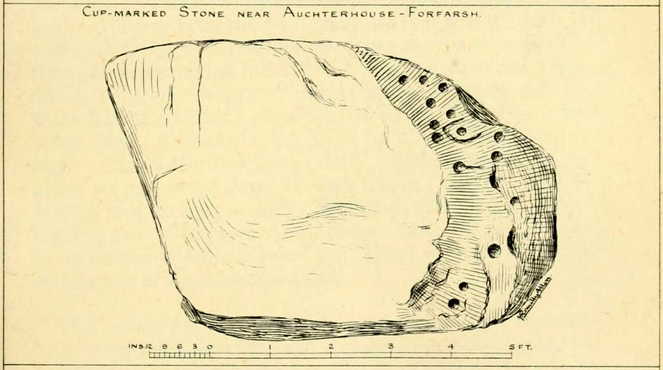
We have no precise location for this carving, nor several of its petroglyphic relatives who lived within this arena for countless centuries until (you guessed it!) the advance of the Industrialists brought their profane ways to the region, with the usual disregard for local people and their unwritten traditions. Which is a great pity, for there were obviously some old stories and important archaeology hereby. Aubrey Burl (1988) for one, thought this cup-and-ring carving may have played its part in being one of the stones in a larger “four-poster” stone circle, although local history accounts tell that it was part of an impressive prehistoric tomb.
One of the Witches Stones
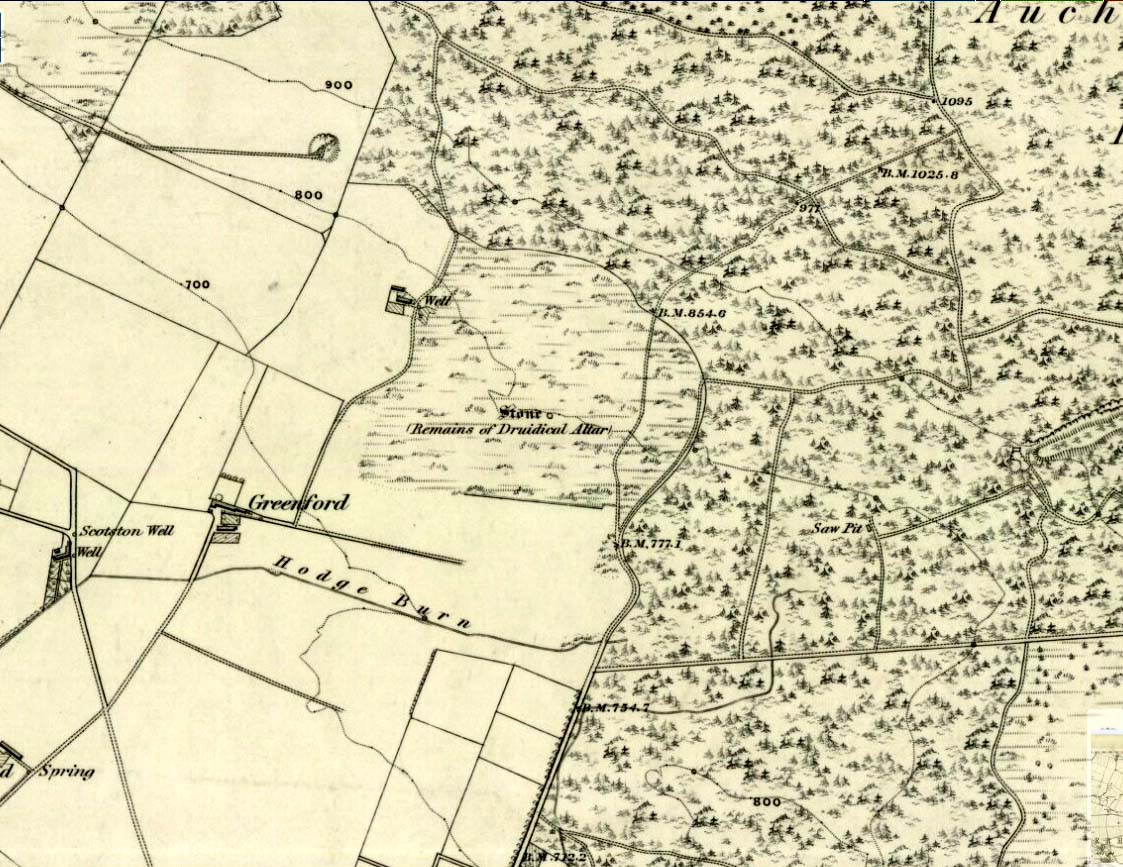
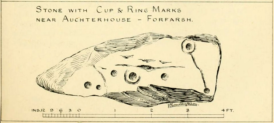
The Witches’ Stone we see illustrated here was one of at least two carvings in a cluster of stones. The great J. Romilly Allen (1881) wrote about the it, although it seems he never visited the site himself. Instead, his description came from that of a colleague, a Mr W. McNicoll, who told him that at the position marked on the early OS-map as a single “Stone” that was “Remains of a Druidical Altar” there were in fact
“two in number: one, an upright pointed stone, 5ft by 2ft by 3ft 6in high; ans the other lying 3ft 6in to the southwest, 7ft 6in by 5ft by 2ft 6in thick. The latter has fifteen cups, varying from 2 to 3in in diameter; one with a single ring carved on the sloping face at the south end of the stone. It lies horizontally and has two hollows, worn at the ends where the cups are, by the toes of persons climbing onto the top. The ground under this stone has been partly removed and it appears to rest on two others; but the whole appears to be natural and not a cromlech or rocking stone.”
Folklore
One of the Witches Stones
Reference was made to this “Witches Stone” in the 1860 Object Name Book of the region, where it was said to have been part of a larger group, “considered to have been used by the Druids as a place of worship.” This catch-all phrase of druidic relevance should be translated as “local traditional importance” where animistic rites of some sort would have occurred. Certainly we find the usual reverence or fear in the local tale told by Mr Hutcheson (1905) which he thankfully recorded following his visit to the site:
“Here…occupying a small knoll known locally as Greenfield Knowe, towards the western end of the plateau…two upright standing stones of boulder character formed a conspicuous feature. They were, if tradition be accepted, the survivors of a larger group. The same tradition records that the farmer of Greenfield Farm, requiring stones for the erection of dykes, removed some of the standing stones from Greenfield Knowe. He, however, speedily found unexpected difficulty in carrying out his intentions. The dykers whom he had employed absolutely refused to use the stones, alleging they would thereby bring misfortune upon themselves and families, , and threatened, rather than risk such calamities, to throw up the job.
“While in this quandry the farmer, it is said, had a vision: a ghostly figure appeared to him, and in a hollow voice warned him against interference with he stones on Greenfield Knowe, and concluded by the adjuration, “Gang ower the howe t’ anither knowe.” Needless to say, the farmer lost no time in obeying his ghostly visitor. Next morning he carted back the stones he had removed and sought material for his dykes elsewhere.”
This is probably the same tale, slightly reformed, which the local historian W.M. Inglis (1888) described, when he told that,
“About the beginning of the present century, when a worthy old parishioner was having some repairs carried out upon his house, he removed a few of the large stones with the intention of having them built into the walls. Throughout the night, however, an eerie feeling came over him, his conscience was on fire, he could get no rest. Accordingly he got out of bed, yoked his horse into the cart, and like a sensible man replaced yjr sacred stones where he found them, went home, and thereafter slept the sleep of the righteous.”
Looking dead straight from the Hill of Ballunie to Leys.
There seems to be nothing left of the stone circle described in Andrew Jervise’s (1879) immense work which, sadly, only described this stone circle in passing. He told us simply that hereby, “are also the remains of stone circles upon the hill of Ballunie,” which is just a few hundred yards along the road from the magnificent Keillor Pictish symbol stone. When we visited the place not long ago, no trace of any stones were visible hereby. The site is not listed in Burl’s (2000) magnum opus.
However, ley-hunters will love this place. Not only was this lost circle located at the edge of a dead straight road, running from the Keillor standing stone a short distant east, but as it runs downhill it reaches, a couple of miles below, the hamlet called Leys.
References:
Jervise, Andrew, Epitaphs and Inscriptions from Burial Grounds and Old Buildings in the North-East of Scotland – volume 2, Edmonston & Douglas: Edinburgh 1875.
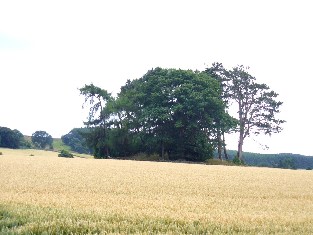
From the large village of Newtyle, take the straight road west as if heading to Kettins. About half-a-mile along, 100 yards or so past the turn-off to Kinpurnie Castle on your left – stop! In the second field after the turn-off, halfway up the slope you’ll see a large circular rise in the land with a crown of large trees sitting thereon. That’s the cairn!
Archaeology & History
Not far from the impressive Keillor standing stone is this huge prehistoric tomb. Measuring about 90 feet across and more than 7 feet high in places, the mass of rocks making up the site is now crowned by a healthy ring of trees. Near the middle of it you can see a collapsed tomb or cist, but there may be more than one inside this giant fella. Its size implies that it was a tomb or burial centre for tribal elders, leaders or shamans. When we visited the site last week, the field was still in full crop, so we couldn’t take a close look at it and must return again at a later date. Apart from a brief note of the site in the Royal Commission (1983) archaeology listing for the county, no details have been made of this huge cairn—which is incredible in itself!
References:
Royal Commission on the Ancient and Historical Monuments of Scotland, The Archaeological Sites & Monuments of Central Angus, Angus District, Tayside Region, HMSO: Edinburgh 1983.
Take the minor road that runs from the small town of Newtyle (in Angus) westwards to Kettins (in Perthshire). Less than a mile on, go up the first turn-off on your left to Kinpurnie Castle and continue (past the castle) for less than a mile. Keep your eyes peeled on the right-hand side of the road, opposite the drive to High Keillor – and you can’t really miss it!
Archaeology & History
Another feel of Keillor’s Stone
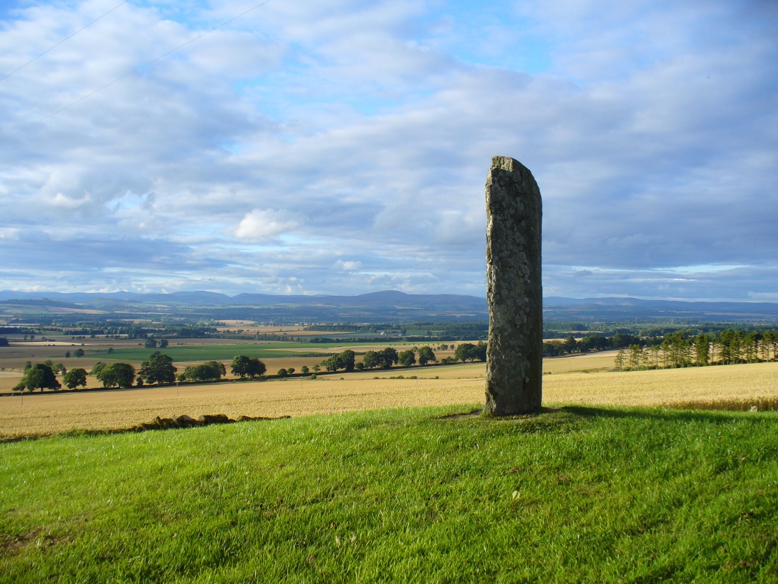
A fascinating site in an excellent setting. Here we have a 6-7 foot tall standing stone living upon a what is most probably a Bronze Age tumulus (possibly neolithic, but we aint sure), on whose south-face were carved a series of Pictish symbols many many centuries ago. In the surrounding district there is a vast wealth of similar sites (and many destroyed, like the lost Hill of Ballunie stone circle only a few hundred yards along the road), highlighting that this region was very important indeed to the prehistoric peoples of Strathmore and the Sidlaw Hills.
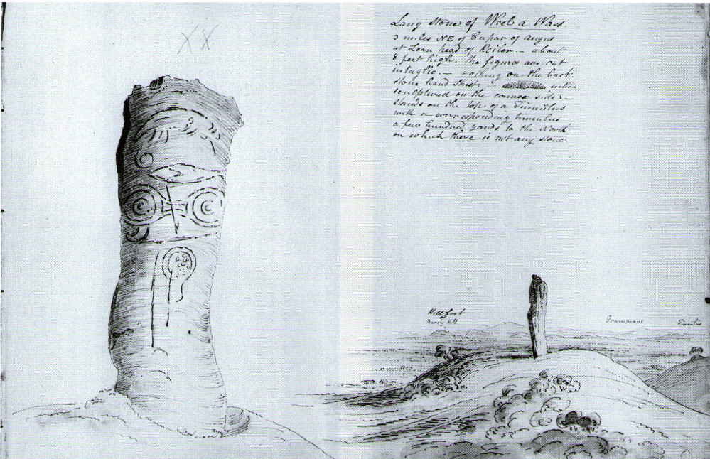
W.J. Skene’s 1832 drawing
The Keillor stone was described and illustrated by several of the giant Scottish antiquarians. When James Skene visited the site in the 1830s, the tumulus upon which the stone stands was still pretty complete, as his old drawing from 1832 clearly shows. Since then the track beside the monument has widened and the road took away half of the burial mound. But the place has lost little of its majesty.
Another 19th century historian, William Oliphant (1875), when describing the beauty and history of the Sidlaw Hills, below whose edges the old hamlet of Keillor stands, told of this,
“old and striking monument, making the spot on which it stands historical, though no syllable of the history has come down to us. It is, one writer says, “one of those remarkable sculptured monuments of the ancient inhabitants of Scotland, embellished, in this instance, with the rude outline of the boar.” Another writer says, “at Baldowrie there is an erect Danish monument six feet high. It contains some figures, but they are almost entirely defaced.”
In John Stuart’s (1856) superb magnum opus he told that this carved pillar with “a boar” on it, standing on an ancient “tumulus of earth and stones” was found to have evidence of several burials inside when a dig at the site occurred which, he told, “I was present (at) in the autumn of 1854.” He described the site as follows:
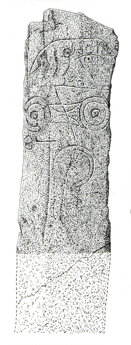
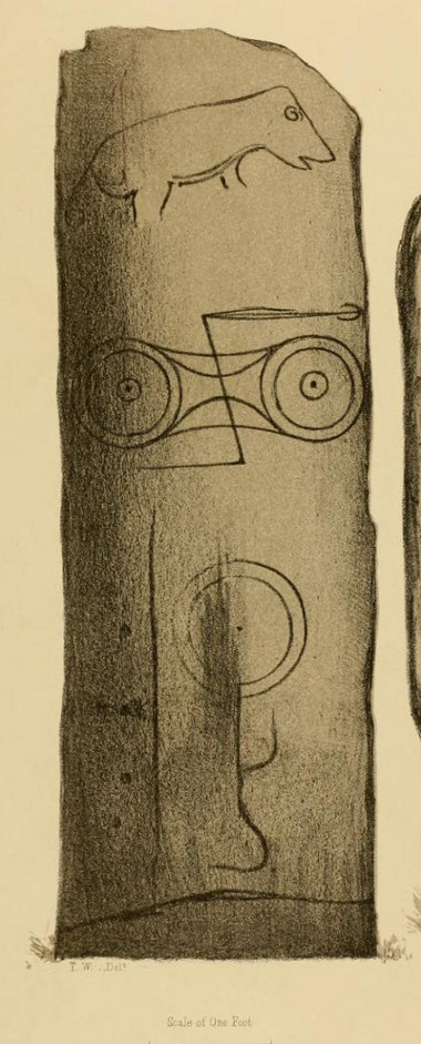
Stone with carved symbols (after RCAHMS 1994)Stuart’s 1854 drawing of the carved stone
“The Stone at Keillor is placed on a tumulus on the north slope of the Hill of Keillor, in the Parish of Newtyle, and Shire of Forfar. It is a rough stone, formed of gneiss, convex in front, and rugged behind. The tumulus on which it is placed is formed of earth and stones, and several cists containing bones have been found in it. Ancient sepulchral remains have also been dug up in various parts of the adjoining field.
“The stone was broken across some years ago about a foot above the ground, but the parts have recently been clasped together, and the stone replaced in its original site by orders of Lord Wharncliffe. The present drawing was made with much care by Dr. Wise, and is more perfect than the copy in Mr. Chalmers’ volume. The surface of the stone is so rough, that it is sometimes with difficulty that the incised lines can be satisfactorily distinguished from natural fissures, but having examined the stone in a variety of lights, and compared Dr. Wise’s sketch with the original, I am inclined to think that the drawing is as satisfactory as can now be obtained. There is a rough sketch of the stone among Dr. Hibbcrt’s papers, with a supposed Gaelic inscription at the top, meaning “the burying place of the slain,” furnished to Dr. Hibbert by the late Mr. Donald Gregory. Of such inscription 1 could see no trace.”
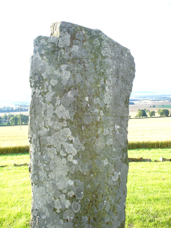
The old stone himselfFaint carvings just visible
And as far as I am aware, this Gaelic inscription has not subsequently been recorded. But considering the position of the stone in the landscape, it’s understandable if some of the carvings have eroded away by simple weathering. Indeed, when Paul Hornby and I visited here only a couple of weeks ago, despite the weather conditions being excellent, the carvings were difficult to make out. Modern interpretations differ between the topmost animal carving being either a wolf or a boar. Below this we see the more common Pictish symbol described as a double disc and Z-rod symbol, for which academia still struggles to afford cogent explanations.
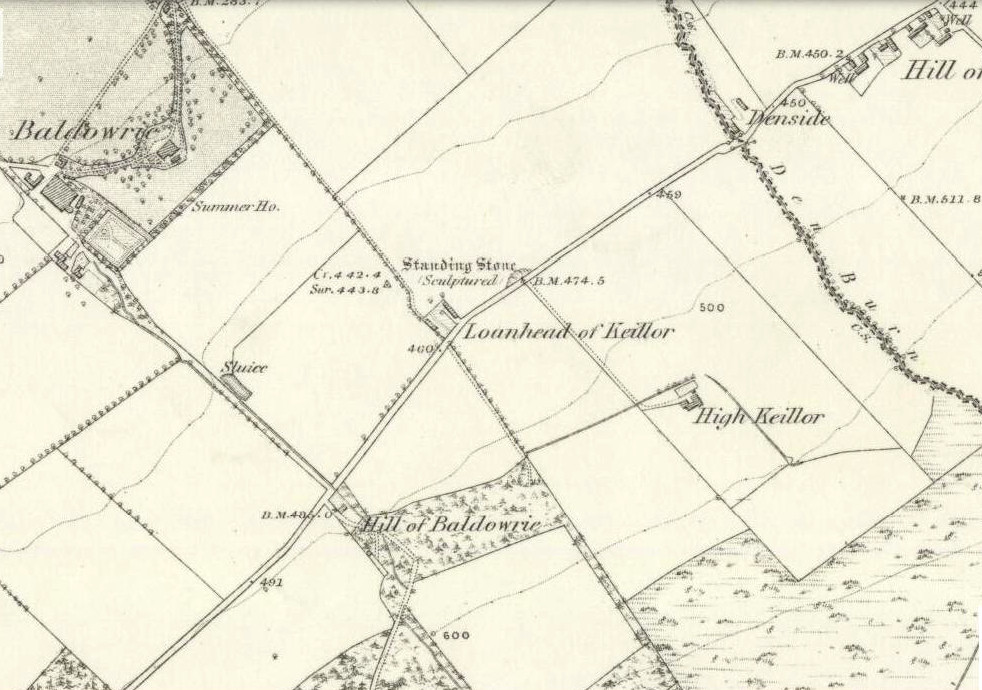
Keillor stone on 1865 map
Whilst the prehistoric age of the tumulus on which this stone stands is not in doubt, we don’t know exactly when this stone was first erected here. Whilst some of the early accounts—including the Ordnance Survey team who first visited here in 1860—describe it in an upright position, when A.J. Warden (1880) wrote about it in his massive survey of the region, he noted that wasn’t always the case:
“On the north slope of the Hill of Keillor, in the parish of Newtyle, there is a rough stone composed of gneiss, somewhat convex in front but rugged behind. It is placed on a tumulus formed of earth and stones, and several cists containing bones were found in it; while, in the adjoining field, ancient sepulchral remains have also been found. The stone was broken across about a foot from the ground, but the parts have been again united and the stone replaced on its original site. On the stone there is the figure of an animal, below which are the spectacle and other symbols, all incised.”
The stone presently stands on a modern plinth to protect it from the elements and such things. It was erroneously described in the Royal Commission’s 1999 survey of Pictish monuments as being just “1.4m in height”, whereas it is in fact some 6½ feet tall, or around 1.98m.
The Great Pyramid to the northwest
The view from here, east, north and west is superb. The high rolling hills of Angus stretch into the north and eastern skies; whilst more westerly are the grand olde mountain ridges into deepest Perthshire. And looking northwestwards from our old standing stone, one shapely mountain in particular is notable, standing out upon the ridge of distant hills: a great pyramid which I initially thought may have been Ben Vorlich. But thanks to the help of several local people, have found that it is in fact Schiehallion – the great Mountains of the Fairy Folk, about 50 miles away! Some folk think that it may have had relevance in the animistic formula with this monument—and I’ll hazard that it did too…
…to be continued…
References:
Allen, J. Romilly, Early Christian Monuments of Scotland, 1903.
Coutts, Herbert, Ancient Monuments of Tayside, Dundee Museum 1970.
Guthrie, James C., The Vale of Strathmore – Its Scenes and Legends, William Peterson: Edinburgh 1875.
Jervise, Andrew, Epitaphs and Inscriptions from Burial Grounds and Old Buildings in the North-East of Scotland – volume 1, Edmonston & Douglas: Edinburgh 1875.
Mack, Alastair L., Field guide to the Pictish symbol stones, Pinkfoot Press 1997.
MacPherson, J.G., Strathmore: Past and Present, S. Cowan: Perth 1885.
Marshall, William, Historic Scenes of Forfarshire, William Oliphant: Edinburgh 1875.
Royal Commission on the Ancient & Historical Monuments of Scotland, South-East Perth: An Archaeological Landscape, HMSO: Edinburgh 1994.
Royal Commission on the Ancient & Historical Monuments of Scotland, Pictish Symbol Stones: A Gazetteer, Edinburgh 1999.
The stone is situated on the north-facing slope of Carrot Hill (almost equidistant with neighbouring Dodd Hill actually) at 225 m OD. Use of a GPS and the co-ordinates above are very definitely recommended for finding this stone which lies flat on a heather covered hillside. You most likely won’t locate it without them. There is ample car parking space at the popular viewpoint car park on Carrot Hill (NO 464 408), walk to the summit trig point and follow your GPS from there.
Archaeology & History
This cup-marked stone was first noticed in February 2012. Remarkably, this stone seems to have been previously unrecorded despite lying just metres from a small path through the heather.
There are at least 15 cup marks on this sandstone boulder which was measured to be 1.2 x 0.7 x 0.2 m in size. There is no evidence of any rings around any of the cups.
The closest known examples of more rock art are just over four kilometers away to the west at Huntingfaulds where there is a cup and ring marked boulder.