Tom Tallon’s Grave, Kirknewton, Northumberland

Tumulus (destroyed):  OS Grid Reference – NT 9323 2800

Also Known as:

  1. Auld Wife’s Apronful o’ Stanes
  2. Tom Tallon’s Tumulus

Archaeology & History
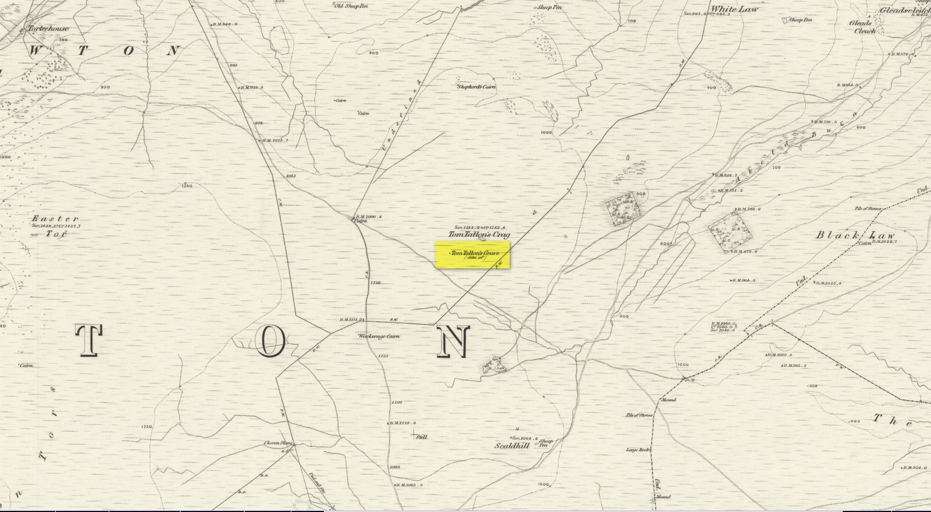
Site on the 1866 OS-map

Highlighted on the earliest OS-maps about half a mile to the south of the great prehistoric camp of Yeavering Bell and 100 yards southwest of Tom Tallon’s Crag, there once stood an apparently “massive” Bronze Age tumulus, or cairn, called Tom Tallon.  I’d hedge a bet that it was much older, from the neolithic period.  It was described by P.A. Graham (1921) as “the largest cairn in the district,” but when it was visited by the antiquarian Henry MacLauchlan in July 1858, he reported that “it was being removed to make a fence”!!!  Unbe-fuckin’-lievable… Who were the dickheads that did that?!

Folklore

The Ordnance Survey Name Book of 1860 for Tom Tallon’s Crag told that,

“There is a vague tradition about Tom Tallon having been a Warrior and Slain here – hence the name, but nothing authentic respecting Tom, can now be ascertained.”

The word tom derives from “a rounded hill”, sometimes associated with a tumulus and in Scotland (just over the border) associated “with a dwelling place of the fairies” with tallon suggested by Graham (1921) to derive from “tal, a forehead or promontory, and Llan, an enclosure.”

What is quite obviously an older name, or certainly one that was more recognised by local people, is its title of the Auld Wife’s Apronful of Stones: a title we find associated with a number of the giant cairns in northern England and Scotland.  It relates to the creation myth of the site, whereby the countless stones that made up the cairn were dropped or thrown across the landscape by a giantess who inhabited this area.

References:

  1. Hall, James, A Guide to Glendale, M. Brand: Wooler 1887.
  2. Graham, P. Anderson, Highways and Byways in Northumbria, MacMillan: London 1921.
  3. MacLauchlan, Henry, “Notes on Camps in the Parishes of Branxton, Carham, Ford, Kirknewton and Wooller, in Northumberland,” in History Berwickshire Naturalists Club, volume 24, 1922.

© Paul BennettThe Northern Antiquarian

Holy Well, Nether Heyford, Northamptonshire

Holy Well (lost):  OS Grid Reference – SP 66 59 (approximate)

Archaeology & History

In George Baker’s (1822) massive regional history work he spoke of the village being “well supplied with springs, one of which, called Holywell, is medicinal.”  But it would seem to have fallen foul of that thing called progress, as no one has spoken of it since then.  When the Northampton historian, Beeby Thompson, looked for the site early in the 20th century, his enquiries drew a blank and he reported simply that “at the present time no one in the village appears to know of such a well.”  A field-name survey of the area may prove worthwhile…

References:

  1. Baker, George, The History and Antiquities of the County of Northampton, J.B. Nichols: London 1822.
  2. Harte, Jeremy, English Holy Wells – volume 2, HOAP: Wymeswold 2008.
  3. Thompson, Beeby, “Peculiarities of Waters and Wells,” in Journal Northamptonshire Natural History Society, volume 17, 1914.

© Paul BennettThe Northern Antiquarian

Fairy Well, Liversedge, West Yorkshire

Sacred Well:  OS Grid Reference – SE 1977 2309

Getting Here

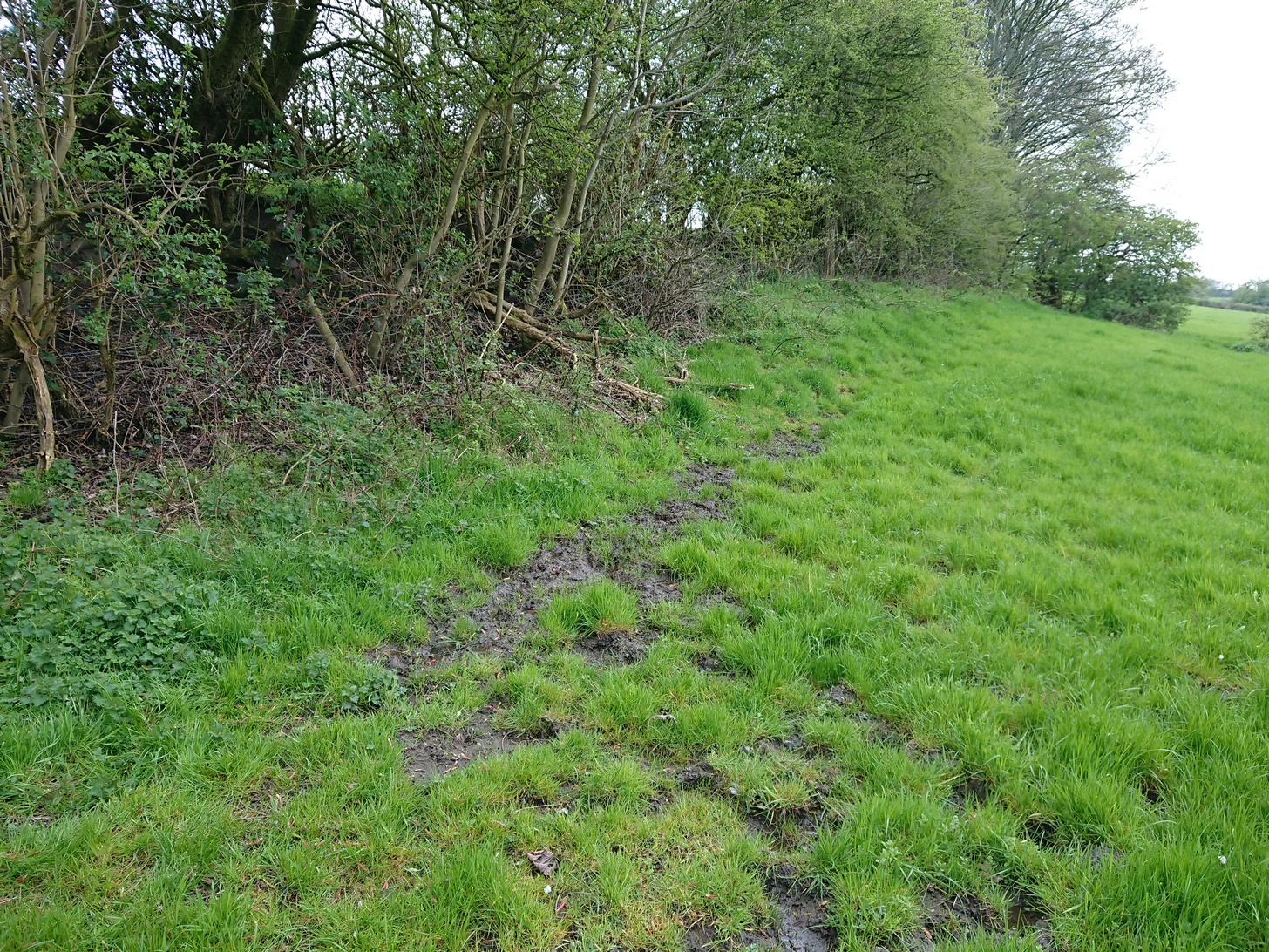
Fairy Well’s boggy ground

Best approached from Heckmondwike/Liversedge and going up Roberttown Road where, just past the Spen Valley High School parking spot, an almost dead straight footpath takes you down (northwest) into the woods.  Walk down here for about 100 yards and then go left over the stile into the small copse of trees.  Once you come out the trees at the other side, walk up the slope in the field that you’re now in.  As you approach the line of trees at the top, you’ll notice the ground gets very boggy.  Look carefully under the trees and you’ll notice an embedded flat stone protruding out and a somewhat trivial trickle of water into the grass at the front.  That’s it!

Archaeology & History

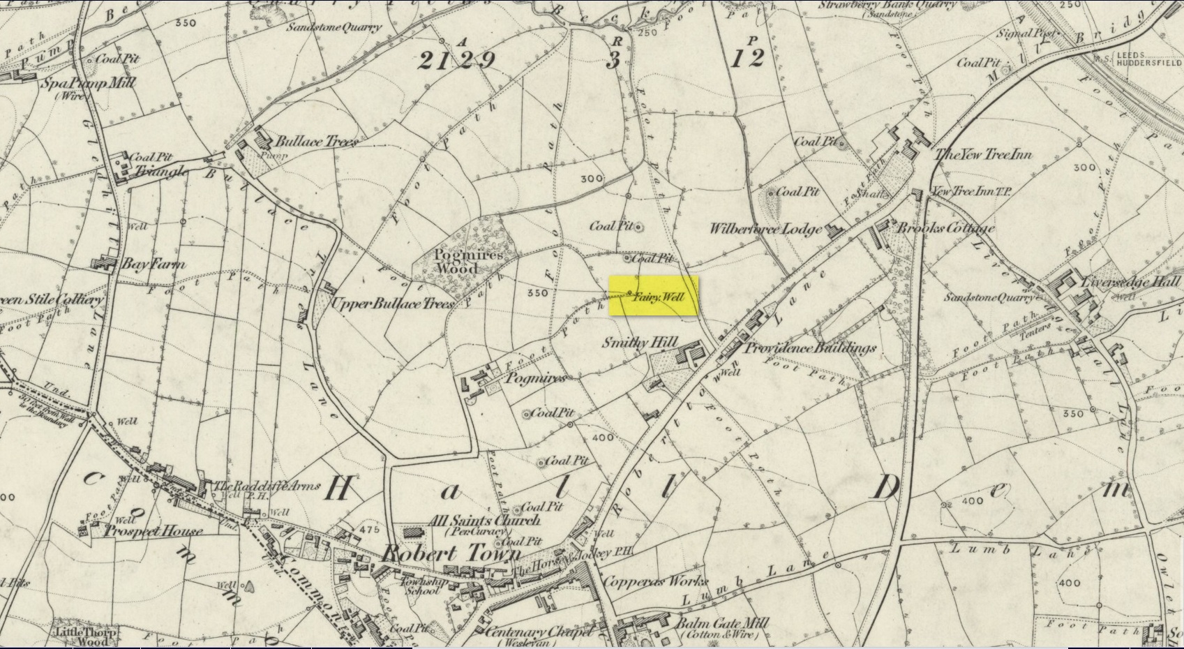
Site on the 1854 OS-map

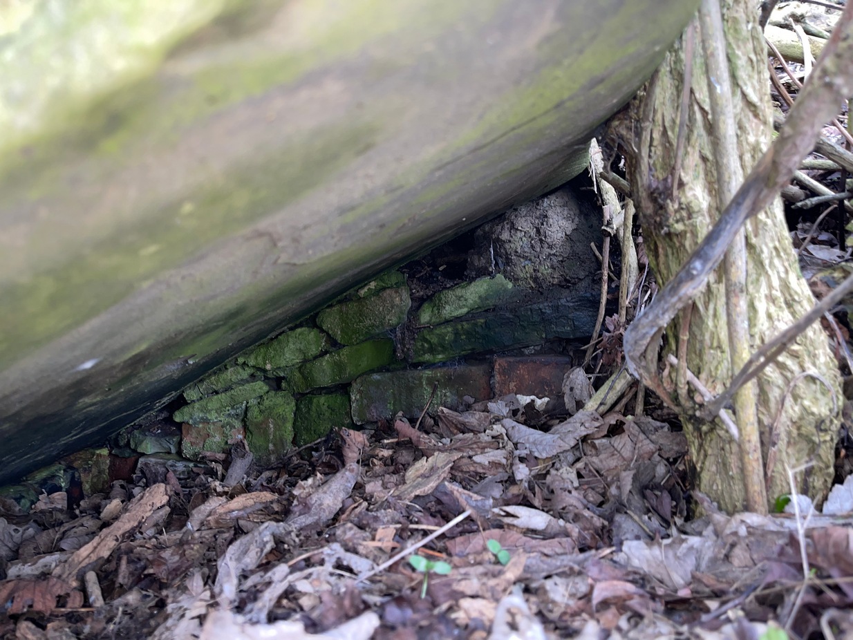
Highlighted on the 1854 Ordnance survey map of the area, this is a somewhat ruinous site which has seen better days.  Even after good downpours it’s not very obvious and, in truth, could do with being cleaned-up, cleared out, and brought back into the old life it once had.  If you look carefully beneath the roots of the covering tree, you’ll notice a  decent-sized flat worked stone sticking out at the bottom of the sycamore and below this, at the back, almost covered in earth, you can make out some brick walling at the rear.  It takes some finding!  This is evidently the remains of a small protective well-house, now in total ruin.

Old cover of the well

When we visited the place a few weeks ago, there seemed to be no water inside.  Instead, the water emerges into a small bog just below the tree-line a few yards away from the covering slab from whence it originally flowed.

Folklore

Obviously the abode of fairy folk in bygone days, all trace of the folklore and habits of them seems to have been lost long ago….

AcknowledgementsHuge thanks to mi old mate Gary Ferner for helping us uncover the source of the waters, which was almost completely covered in soil.

© Paul BennettThe Northern Antiquarian


Fairy Oak, Whitford, Flintshire

Sacred Tree:  OS Grid Reference – SJ 1577 7889

Folklore

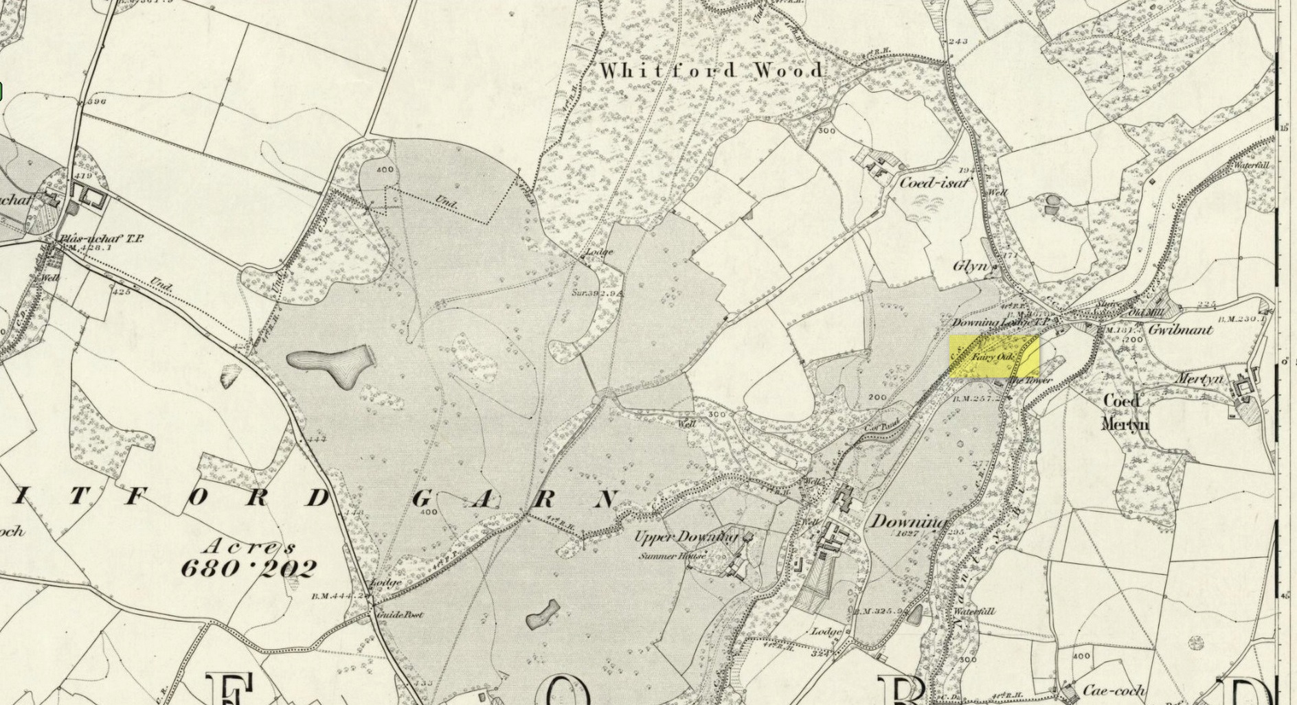
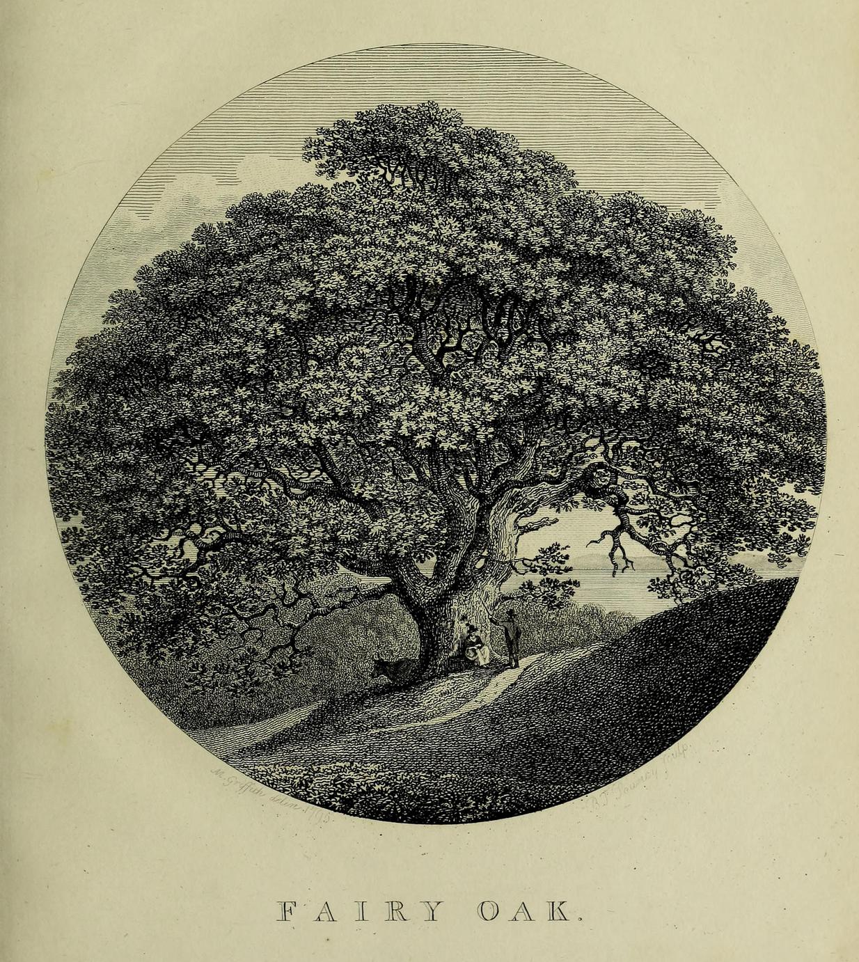
Highlighted on the earliest Ordnance Survey map of the region in 1878 and described much earlier by Thomas Pennant (1796)—almost as legendary as the fairies themselves in some parts—this ancient tree was obviously a place of great repute in the mythic history of the people in previous centuries.  Animistic relationships with the landscape were still deeply embedded in the daily lives of our peasant communities all across the country when Pennant wrote about this place.  In his antiquarian history of the area he described the great mansion of Downing Hall and in its grounds the ruins of Molandina Abbey.  “Above this,” he wrote,

Fairy Oak on the 1878 map
Pennant’s 1796 drawing

“is a spreading oak of great antiquity, size, and extent of branches: it has got the name of the Fairy Oak.  In this very century a poor cottager, who lived near the spot, had a child who grew uncommonly peevish; the parents attributed this to the fairy, and imagined that it was a changeling.  They took the child, put it in a cradle, and left it all night beneath the tree, in hopes that the tylwydd têg, or fairy family, or the fairy folk, would restore their own before morning.  When morning came they found the child perfectly quiet, so went away with it, quite confirmed in their belief.”

Nearby, and in the same grounds of the mansion, Pennant told there to be an even older and greater oak tree that “has in it furrows so deep, and of aspect so uncommonly venerable, as to render its shade as worthy of the solemn rites of the Druids.”

References:

  1. Pennant, Thomas, The History of the Parishes of Whiteford and Holywell, B. & J. White: London 1796.

© Paul BennettThe Northern Antiquarian 

Mount Lodge, Portobello, Edinburgh, Midlothian

Cairn (destroyed):  OS Grid Reference – NT 3071 7366

Archaeology & History

The only reference I can find of this long lost cairn is in William Baird’s (1898) massive history work of the area—but even in his day he reported that “it has long since disappeared.”  He wrote:

“We have a curious reference in a charter of Kelso Abbey, granted about 1466, to a cairn of stones which stood near the south-east corner of the garden wall at Mount Lodge, Portobello.  In the charter, where it is referred to as forming part of the boundary of the lands of Figgate, it is described as, ‘a certain heap of stones there deposited.'”

The cairn was likely of considerable size and, said Baird, “in all probability marked the site of an ancient place of sepulture.”

References:

  1. Baird, William, Annals of Duddingston and Portobello, Andrew Elliot: Edinburgh 1898.

© Paul BennettThe Northern Antiquarian

Balnadrum, Moulin, Pitlochry, Perthshire

Souterrain (lost):  OS Grid Reference – NN 9447 5890

Archaeology & History

In Hugh Mitchell’s (1923) survey of prehistoric sites in the Pitlochry district, this long lost souterrain was thankfully captured by his pen.  Two years later John Dixon (1925) also mentioned the site, but he was ostensibly copying what Mitchell had written.  We were told:

“About 50 yards west of Balnadrum Farmhouse there is a weem or underground Pict’s house, which was revealed a good many years ago by the plough lifting one of the stone covers.  The exact position of this weem has been lost site of, but could be found without much trouble.  It was about 50 feet long, slightly curved, having an inside width of about 3½ feet and a height of about 5½ feet.  Nothing was found in it and the cover was carefully replaced.”

The site was included in Wainwright’s (1963) standard survey, where he opted for some slight scepticism regarding its nature as a souterrain due to it being about 30 miles away, or, as he said, “far withdrawn from the main concentration (of souterrains) in Angus.”  A minor point to be honest…  Nevertheless, he gave attention to the words of a Mr William McLaughlan who was the farmer at Balnadrum until the end of World War 2:

“He was born in 1873 and he estimates that the discovery was made about 1885.  He also confirms the site—it is about 150 feet west of Balnadrum, or directly across the road from the gate which leads to the farmhouse.  This spot is now covered by modern houses and/or their gardens.  To this point there is no conflict in the evidence.  Mr McLaughlan however, does not remember a 50-foot passage, and he thinks that the structure was removed.”

Nonetheless, all are agreed that an underground structure of some sort existed at this spot.  Whether or not it still hides deep beneath the soils, filled in, or whether it was destroyed when the houses were built, we know not…

References:

  1. Dixon, John H., Pitlochry Past and Present, L. Mackay: Pitlochry 1925.
  2. Mitchell, H., Pitlochry and District: Its Topography, Archaeology and History, L. Mackay: Pitlochry 1923.
  3. Wainwright, F.T., The Souterrains of Southern Pictland, RKP: London 1963.

© Paul BennettThe Northern Antiquarian

Warsett Hill, Brotton, North Yorkshire

Round Barrows (destroyed):  OS Grid Reference – NZ 692 214

Archaeology & History

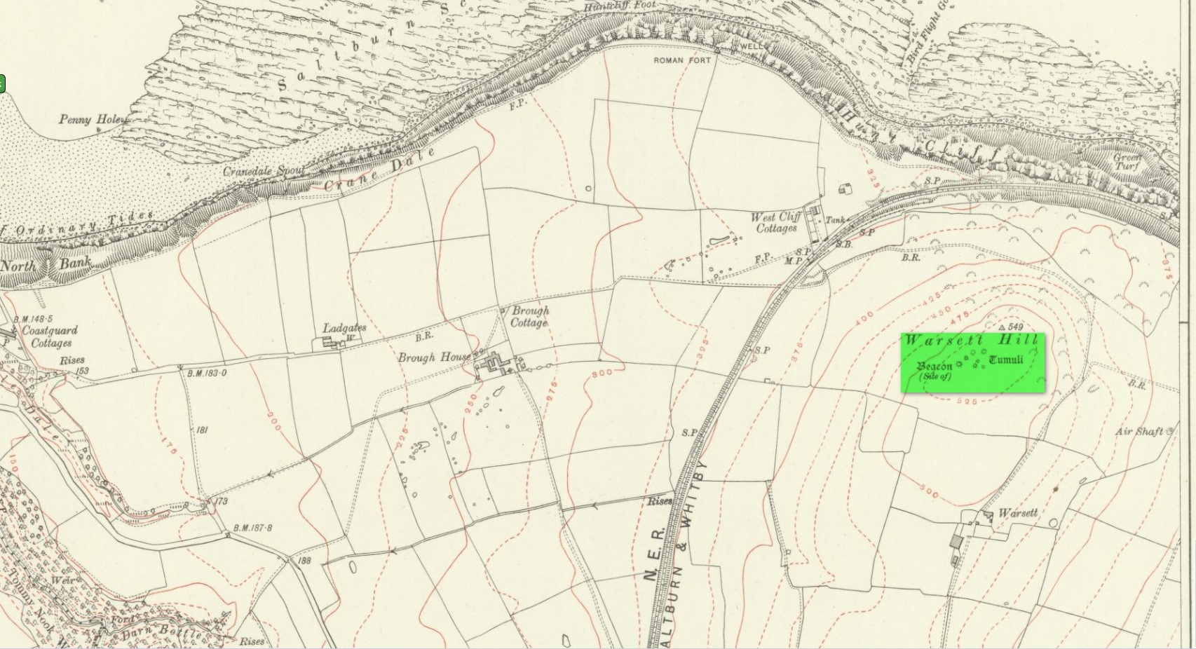
Tumuli shown on 1920 map

On top of the large plateau that is Warsett Hill, on the southwest side of the old trig-point, could once be seen a cluster of at least seven burial mounds or tumuli.  The mounds are shown on the first OS-map of the area, but merely as mounds.  It wasn’t until there’d been a subsequent investigation here by local historian J.C. Atkinson in the 19th century that they were highlighted on the 1920 map as “Tumuli.”  Sadly, since then, they’ve all been destroyed.

Very brief notes were written on six out of the seven tombs here by William Hornsby (1917), with only one of them receiving any real attention.  “Of the other six,” Crawford (1980) wrote,

“there is very little information; all were excavated by Atkinson prior to 1893, but his excavations revealed no finds and he stated that all of the mounds had been previously disturbed.  They were later dug by Hornsby, who stated that although he found no sepulchral deposits, all the mounds contained flints.”

In medieval times this became a beacon site, where bonfires were lit.  I can find no further information about this. (NB: This site should not to be confused with another Warsett Hill that exists two miles southeast of here above Skinningrove.)

References:

  1. Crawford, G.M., Bronze Age Burial Mounds in Cleveland, Cleveland County Council 1980.
  2. Hornsby, William & Stanton, R., “British Barrows near Brotton,” in Yorkshire Archaeological Journal, volume 24, 1917.

Acknowledgements:  Huge thanks for use of the Ordnance Survey map in this site profile, reproduced with the kind permission of the National Library of Scotland

© Paul BennettThe Northern Antiquarian

Cnoc Dubh, Moulin, Pitlochry, Perthshire

Stone Circle (destroyed):  OS Grid Reference – NN 9424 5871

Archaeology & History

Missing from the primary surveys of Burl (2000) and Barnatt (1989), a mention of this long lost site was made by local historian Hugh Mitchell (1923) in his survey of the area.  He told that,

“On the east side of the Moulin road beyond the Hydro Hotel a knoll and a clump of trees will be noticed on the right, inside the Hydropathic grounds; this knoll is known as the Cnoc Dubh, or “Black Knoll” and still bears an uncanny reputation as being an old site of Pagan worship.  There was at one time a stone circle on it, but the stones are said to have been broken up, fully 100 years ago, to build the old farmhouse of Balnadrum.”

Something ancient was there, obviously, as it was mentioned in another earlier account—albeit just a tourist guide of Atholl—which said that, on

“the knoll known as Knock-Dhu, within the (Pitlochry Hydro) grounds, are the remains of a pre-historic fort, now overgrown with pine trees.”

References:

  1. Anon., Atholl Illustrated, L. Mackay: Pitlochry c.1910.
  2. Dixon, John H., Pitlochry Past and Present, L. Mackay: Pitlochry 1925.
  3. Mitchell, H., Pitlochry and District: Its Topography, Archaeology and History, L. Mackay: Pitlochry 1923.

Links:

  1. Canmore

© Paul BennettThe Northern Antiquarian

Livister, Whalsay, Shetland Isles

Standing Stone (destroyed):  OS Grid Reference – HU 5577 6237

Archaeology & History

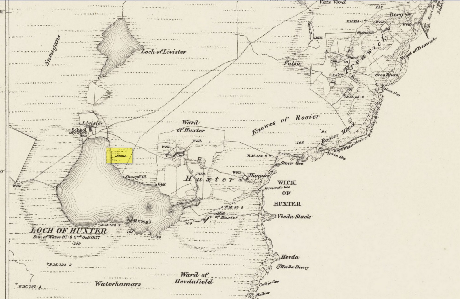
Site shown on 1882 map

Highlighted on both the 1880 (25-inch) and 1882 (6-inch) Ordnance Survey maps, this is another one of our ancient stones that has bitten the dust, so to speak.  Local folk said that it stood about five feet tall, but when the Royal Commission doods visited the place in 1935, it had gone.  They were told that it had been “broken up for building purposes in about 1912.”  No traditions were known of it.

References:

  1. Royal Commission Ancient & Historical Monuments, Scotland, Inventory of the Ancient Monuments of Orkney and Shetland – volume 3, HMSO: Edinburgh 1946.

© Paul BennettThe Northern Antiquarian

St. Tredwell’s Loch, Papa Westray, Orkney Isles

Sacred Loch:  OS Grid Reference – HY 495 509

Folklore

I’ve already added a site-profile of the standing stones that used to be close to this loch, and added to it the folklore below; but I realised that for students of water-lore, a separate profile for the loch itself is needed.  For those of you who are not into water-lore, I hope you can forgive this repetition.

The loch, its associated chapel and the standing stones were visited at the end of the 17th century by John Brand, who gave a good account of the rituals performed by local people at the time.  They regarded the waters here as very special indeed, with great medicinal powers.  The loch had sense of sacrality whose nature was intimately tied to the repetition and regeneration of the seasons, valorizing the healing function of the waters.

By the edge of the loch stood St Tredwell’s church, outside of which was a cairn of stones.  When people visited here to be cured of their various ailments, they would pick up one of them and cast it into the loch as an offering (some folk would cast money), so that its waters would heal their illness.  According to Mr Brand and the local minister, such cures were numerous.  The narrative is truly fascinating.  Brand told us that,

“nigh to the east end of which this chapel is, is held by the people as medicinal, whereupon many diseased and infirm persons resort to it, some saying that thereby they have got good; as a certain gentleman’s sister upon the isle, who was not able to go to this loch without help, yet returned without it; as likewise a gentleman in the country who was much distressed wifh sore eyes, went to this loch, and washing there became sound and whole, though he had been at much pains and expense to cure them formerly.  With both which persons he who was minister of the place for many years was well acquainted, and told us that he saw them both before and after the cure.  The present minister of Westra told me that such as are able to walk, use to go so many times about the loch as they think will perfect the cure, before they make any use of the water, and that without speaking to any, for they believe that if they speak this will marr the cure: also he told that on a certain morning not long since he went to this loch and found six so making their circuit, whom with some difficulty he obliging to speak, said to him they came there for their cure.”

For the curing of sore eyes, the loch was specifically resorted to at Easter and during Lent.  Traditions such as these are found at other lochs in Scotland and at lakes in many other parts of the world.

Another interesting feature related to the element of Kingship; for the waters of the loch were said to turn red when anything important was going to happen to a member of the royal family.

St Tredwell herself—also known as St. Triduana—has her saints day on October 8.

References:

  1. Banks, M. MacLeod, British Calendar Customs: Orkney and Shetland, Folk-lore Society: London 1946.
  2. Black, G.F., Examples of Printed Folk-lore Concerning the Orkney and Shetland Islands, Folk-Lore Society: London 1901.
  3. Brand, John, A Brief Description of Orkney, Zetland, Pightland Firth and Caithness, George Mosman: Edinburgh 1701.
  4. Eliade, Mircea, The Sacred and the Profane, Harcourt: New York 1959.
  5. Fergusson, Robert M., Rambling Sketches in the Far North, Simpkin Marshall: London 1883.
  6. MacKinlay, James M., Influence of the Pre-Reformation Church on Scottish Place-Names, William Blackwood: Edinburgh 1904.

© Paul BennettThe Northern Antiquarian