Cat Nab, Brotton, North Yorkshire

Tumulus (destroyed):  OS Grid Reference – NZ 6692 2154

Archaeology & History

Location on 1930 OS-map

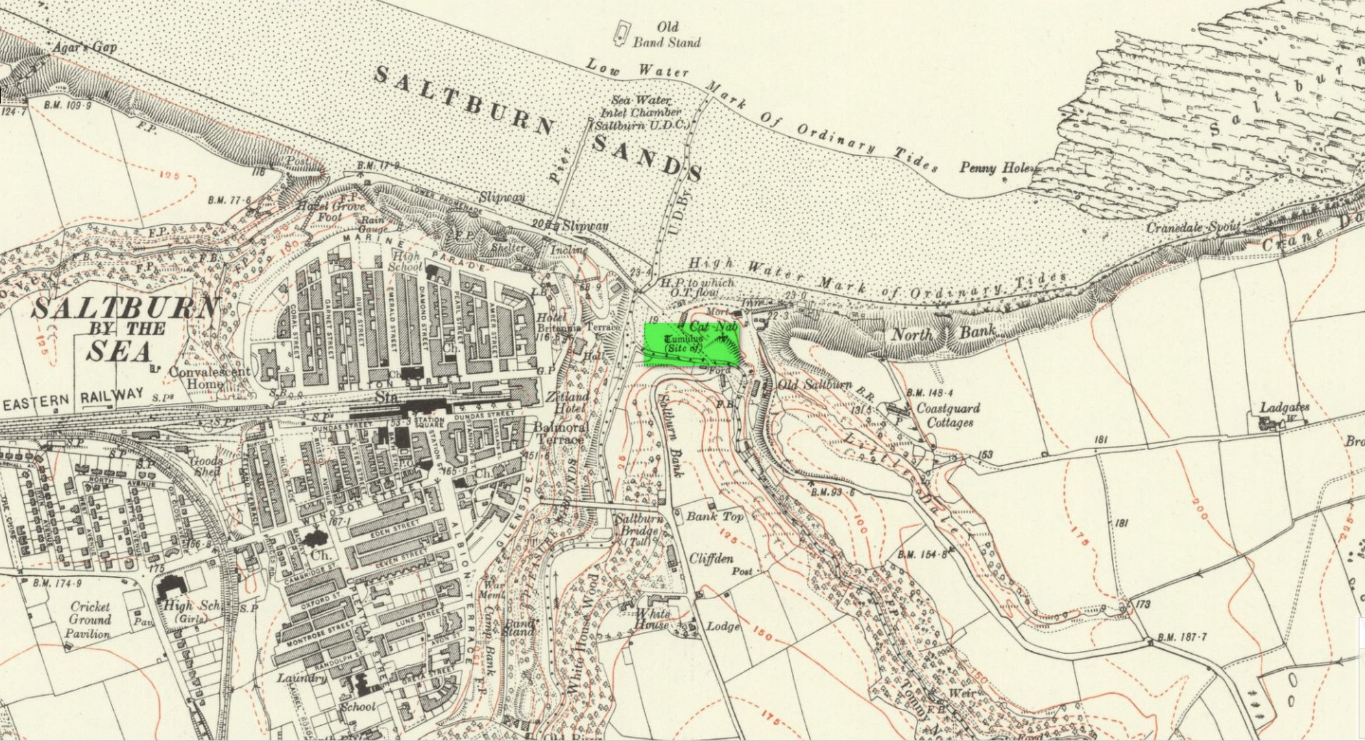
This long lost burial mound was first located by the local antiquarian William Hornsby in the early 20th century.  It had been constructed close to the summit of the prominent rise  of Cat Nab, immediately east above Saltburn.  Its position was shown on the 1930 OS-map of the area.  Destroyed by quarrying, it was thankfully excavated by Hornsby in 1913; and although his finds were never published, he left notes which told us that,

“there were two cremations and the sherds of at least three vessels: a collared urn, a pygmy cup and a vessel with an everted rim.” (Crawford 1980)

Crawford (1980) told that these finds could been seen in the Middlesborough Collection.

References:

  1. Crawford, G.M., Bronze Age Burial Mounds in Cleveland, Cleveland County Council 1980.

Acknowledgements:  Huge thanks for use of the Ordnance Survey map in this site profile, reproduced with the kind permission of the National Library of Scotland

© Paul BennettThe Northern Antiquarian


Warsett Hill, Brotton, North Yorkshire

Round Barrows (destroyed):  OS Grid Reference – NZ 692 214

Archaeology & History

Tumuli shown on 1920 map

On top of the large plateau that is Warsett Hill, on the southwest side of the old trig-point, could once be seen a cluster of at least seven burial mounds or tumuli.  The mounds are shown on the first OS-map of the area, but merely as mounds.  It wasn’t until there’d been a subsequent investigation here by local historian J.C. Atkinson in the 19th century that they were highlighted on the 1920 map as “Tumuli.”  Sadly, since then, they’ve all been destroyed.

Very brief notes were written on six out of the seven tombs here by William Hornsby (1917), with only one of them receiving any real attention.  “Of the other six,” Crawford (1980) wrote,

“there is very little information; all were excavated by Atkinson prior to 1893, but his excavations revealed no finds and he stated that all of the mounds had been previously disturbed.  They were later dug by Hornsby, who stated that although he found no sepulchral deposits, all the mounds contained flints.”

In medieval times this became a beacon site, where bonfires were lit.  I can find no further information about this. (NB: This site should not to be confused with another Warsett Hill that exists two miles southeast of here above Skinningrove.)

References:

  1. Crawford, G.M., Bronze Age Burial Mounds in Cleveland, Cleveland County Council 1980.
  2. Hornsby, William & Stanton, R., “British Barrows near Brotton,” in Yorkshire Archaeological Journal, volume 24, 1917.

Acknowledgements:  Huge thanks for use of the Ordnance Survey map in this site profile, reproduced with the kind permission of the National Library of Scotland

© Paul BennettThe Northern Antiquarian