Tumulus (destroyed): OS Grid Reference – NZ 6692 2154
Archaeology & History
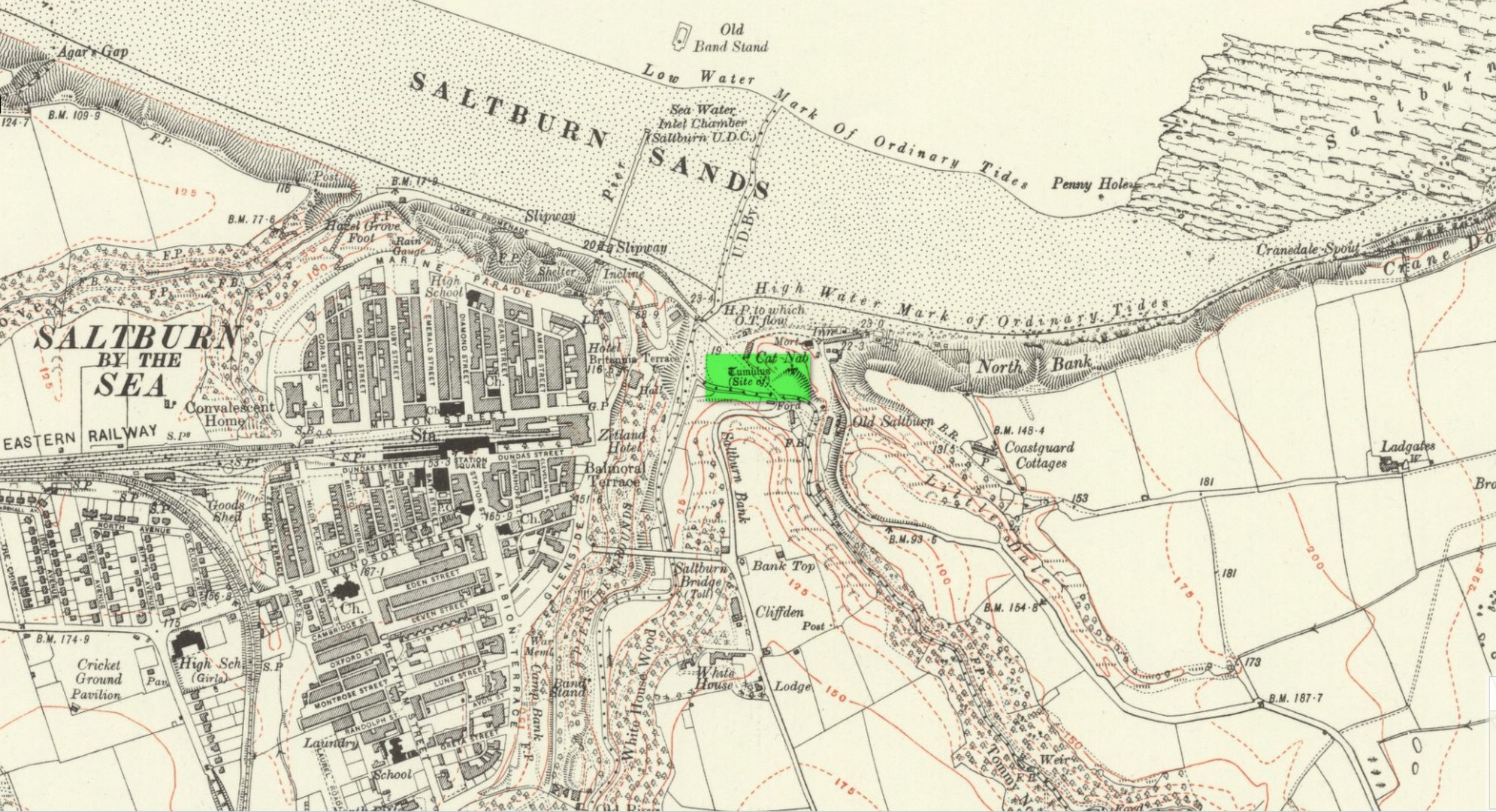
Location on 1930 OS-map
This long lost burial mound was first located by the local antiquarian William Hornsby in the early 20th century. It had been constructed close to the summit of the prominent rise of Cat Nab, immediately east above Saltburn. Its position was shown on the 1930 OS-map of the area. Destroyed by quarrying, it was thankfully excavated by Hornsby in 1913; and although his finds were never published, he left notes which told us that,
“there were two cremations and the sherds of at least three vessels: a collared urn, a pygmy cup and a vessel with an everted rim.” (Crawford 1980)
Crawford (1980) told that these finds could been seen in the Middlesborough Collection.
References:
Crawford, G.M., Bronze Age Burial Mounds in Cleveland, Cleveland County Council 1980.
Acknowledgements:Huge thanks for use of the Ordnance Survey map in this site profile, reproduced with the kind permission of the National Library of Scotland.
Round Barrows (destroyed): OS Grid Reference – NZ 692 214
Archaeology & History
Tumuli shown on 1920 map
On top of the large plateau that is Warsett Hill, on the southwest side of the old trig-point, could once be seen a cluster of at least seven burial mounds or tumuli. The mounds are shown on the first OS-map of the area, but merely as mounds. It wasn’t until there’d been a subsequent investigation here by local historian J.C. Atkinson in the 19th century that they were highlighted on the 1920 map as “Tumuli.” Sadly, since then, they’ve all been destroyed.
Very brief notes were written on six out of the seven tombs here by William Hornsby (1917), with only one of them receiving any real attention. “Of the other six,” Crawford (1980) wrote,
“there is very little information; all were excavated by Atkinson prior to 1893, but his excavations revealed no finds and he stated that all of the mounds had been previously disturbed. They were later dug by Hornsby, who stated that although he found no sepulchral deposits, all the mounds contained flints.”
In medieval times this became a beacon site, where bonfires were lit. I can find no further information about this. (NB: This site should not to be confused with another Warsett Hill that exists two miles southeast of here above Skinningrove.)
References:
Crawford, G.M., Bronze Age Burial Mounds in Cleveland, Cleveland County Council 1980.
Hornsby, William & Stanton, R., “British Barrows near Brotton,” in Yorkshire Archaeological Journal, volume 24, 1917.
Acknowledgements:Huge thanks for use of the Ordnance Survey map in this site profile, reproduced with the kind permission of the National Library of Scotland.
Cairn (destroyed): OS Grid Reference – NZ 6950 1886
Archaeology & History
Frank Elgee’s 1930 plan
Another old site that has sadly succumbed to that bollox called ‘progress’! It’s in the North Yorkshire region some halfwits have taken to calling Cleveland — but which a lotta local folk still correctly call Yorkshire. But that aside…
In an article by local students William Hornsby and Richard Stanton written in 1917, we find that this was just one of at least seven hillocks presumed to be barrows here — but all the others had gone even in their day. When Crawford (1980) came to survey the site in the late 1970s, he told that,
“this large barrow is now only visible as a low swell in an arable field… (but) the profile of the barrow is retained in the hedgeline that bisects it from north to south, but the whole of its eastern half has been obliteratd by the Brotton-Kilton road.”
Elgee’s 1930 photo of one of the carvingsE.T. Cowling’s drawing of one of the carvings
When Hornsby and Stanton checked the place out it measured 54 feet in diameter and had an extensive covering of small stones, like a large cairn, with a single grave at the centre, aligned north-south; and a tree-trunk coffin on the southwestern side. Of the stones which filled the central grave, eight of them were found to have cup-markings on them; whilst 16 stones covering the tree-trunk grave also possessed cup-markings. Roughly equidistant between the two burials was another stone found to be resting face-down on the original ground-level, and covered with 20 cups and 5 cup-and-rings! Awesome stuff!
G.M. Crawford’s (1980) description of the site was as follows:
“Howe Hill was excavated by Hornsby and Stanton in 1914; they discovered that the mound was made up with a clay floor, overlain by ‘a cairn 30 feet long and 3 feet high’ of diorite cobbles, capped by a layer of earth. Cut into the clay floor were two graves: the first was oriented north-south and measured 2m long by 0.9m wide at the old land surface and was 0.7m deep. The grave was filled with ‘medium sized stones’ with a ‘thin dark layer,’ thought to be an inhumation burial, on the floor; 8 of the stones bore cup-marks. The second grave, oriented northeast-southwest, was 2.5m long by 0.9m wide at the old ground surface, reducing to 1.8m long by 0.5m wide at its bottom, 1.3m below. This grave, which was filled with stones, also contained a tree-trunk coffin or oak, measuring 1.5m long… At the head (northeast) were found the unburnt skull fragments of a man laid on its right side. Unaccompanied cremations had been placed at both ends of the coffin. 16 cup-marked stones were among the infill of the grave.”
This was obviously a site of considerable importance and it’s a huge pity (if not a disgrace) that today no trace of the site remains.
References:
Cowling, Eric T., Rombald’s Way, William Walker: Otley 1946.
Crawford, G.M., Bronze Age Burial Mounds in Cleveland, Cleveland County Council 1990.
Elgee, Frank, Early Man in North-east Yorkshire, John Bellows: Gloucester 1930.
Hornsby, William & Stanton, Richard, “British Barrows near Brotton,” in Yorkshire Archaeology Journal, 24, 1917.
Smith, A.H., The Place-Names of the North Riding of Yorkshire, Cambridge University Press 1928.

")
")
")