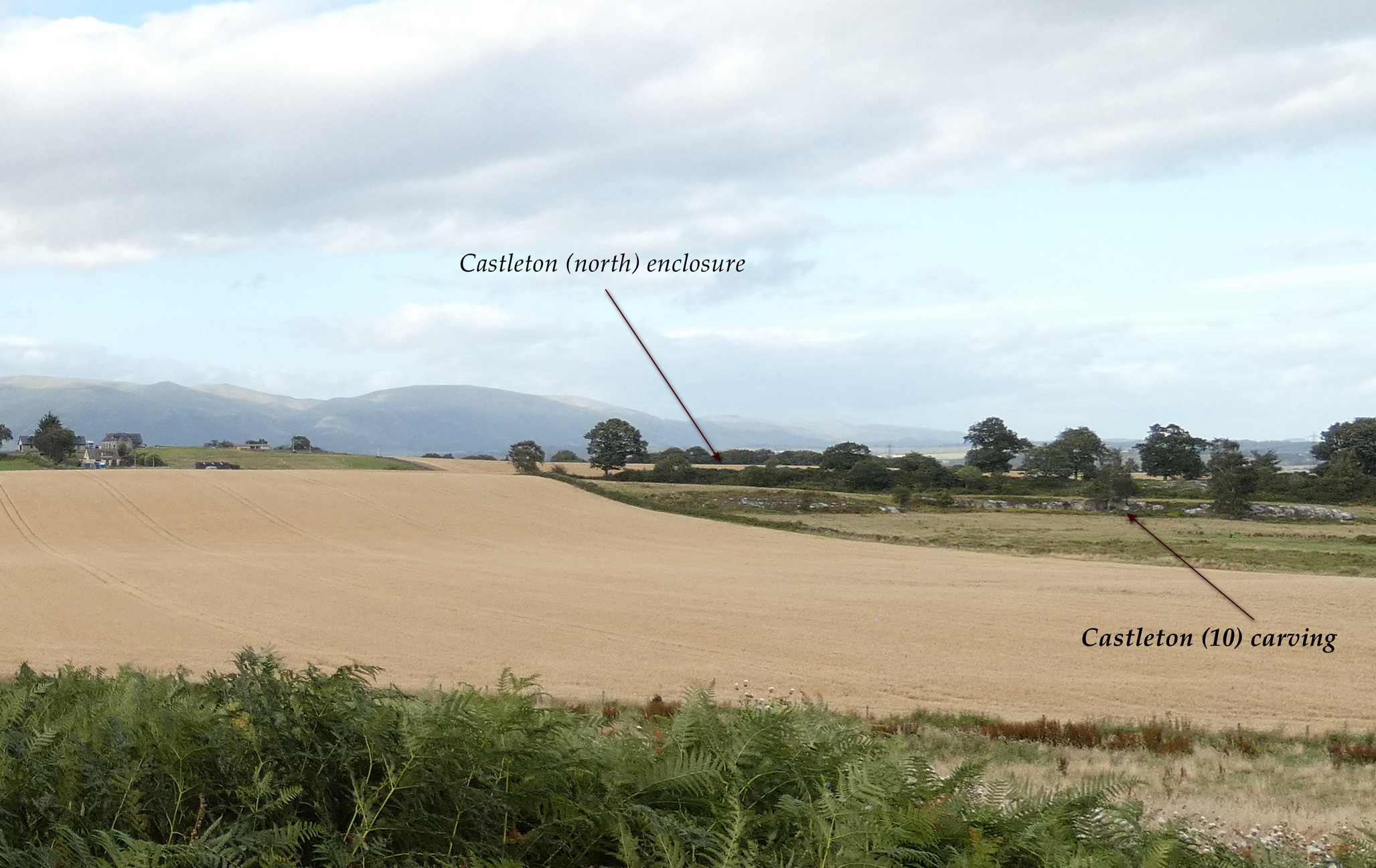
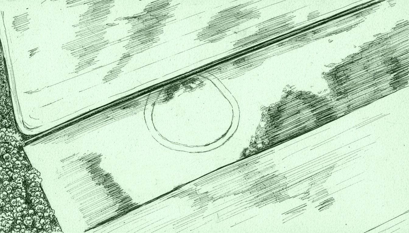
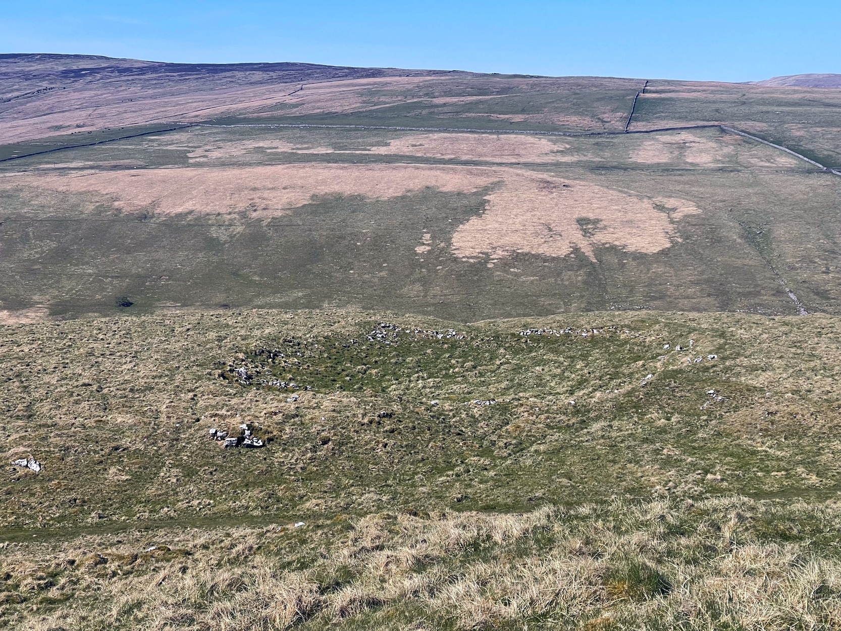
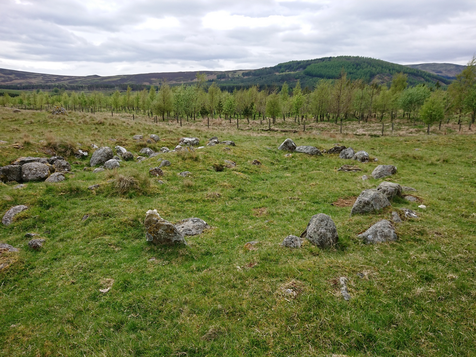
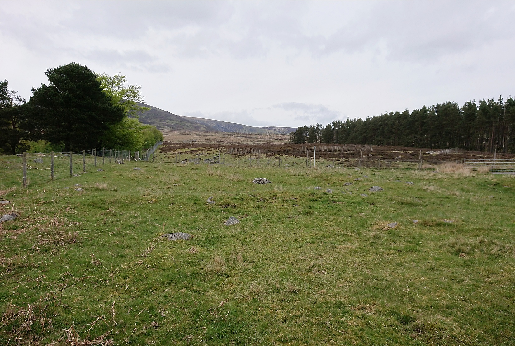
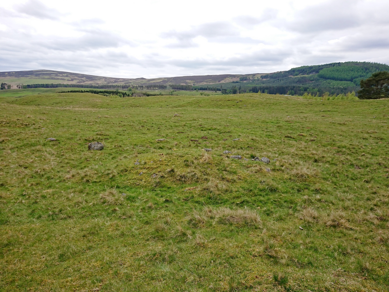
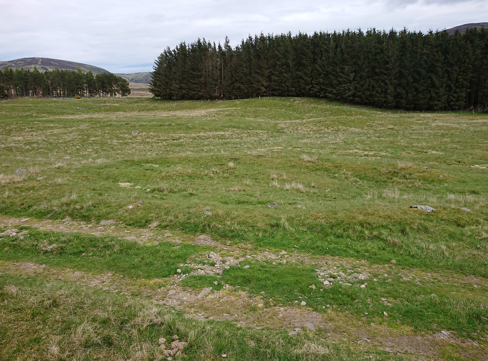
In the fields immediately above the northernmost of the Castleton petroglyphs, there was, in bygone times, a prehistoric settlement, forgotten and cast even from folk memory until very recently, when aerial photography revealed the ghostly outline of its former existence. Similar in design, but somewhat smaller than the prehistoric Gallamuir enclosure a half-mile southwest of the Castleton carvings, this double-ringed oval enclosure—thought by archaeologists to have been defined all round with large wooden stakes, or palisaded—measures, from outer edge to outer edge, 65 yards (SE to NW) across its longer axis, by 55 yards (SW to NE). The gap between the trenches that define the inner and outer wooden ‘walls’ is between five and six yards apart all round it. The entrance to the enclosure seems to have been on its southeastern side—although an excavation is needed to be sure about this. Sadly, almost nothing can be seen of the site at ground level. An archaeo-dig would be a good idea. 🙂
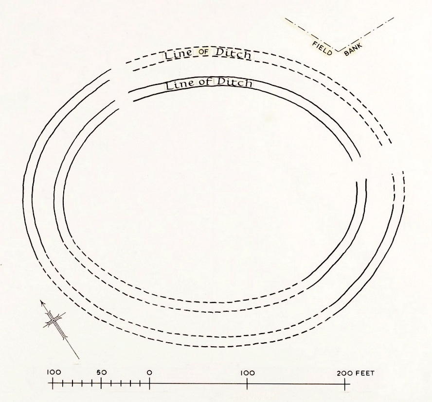
Rough sketch of site-plan
‘Palisade enclosures’ tend to be neolithic in origin and were in use for many centuries, sweeping into the Bronze Age. I highlight this long period in time due to the proximity of the extensive and very ornate cup-and-ring carvings that start just 300 yards southwest of the settlement on the first rock outcrop that you meet. It’s a good one too! Petroglyphs were also created mainly during the neolithic and Bronze Age periods; and as the enclosure here is on the slight rise in the land overlooking the various small rocky ridges below, many of which are decorated in ornate cup-and-rings, it’s likely that some of the people who lived here were probably the people who did them…
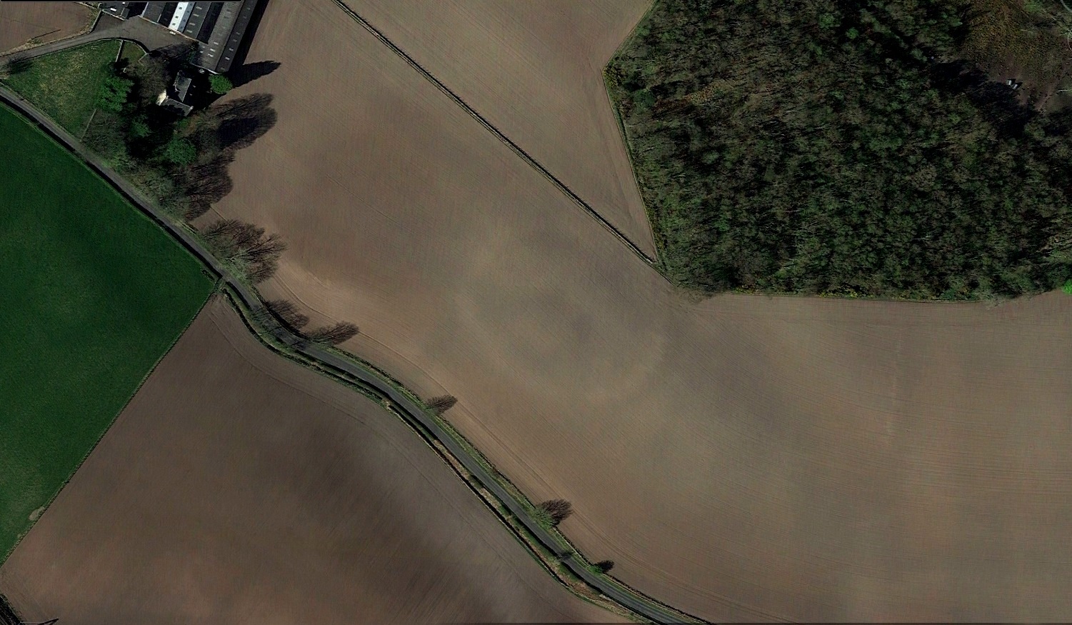
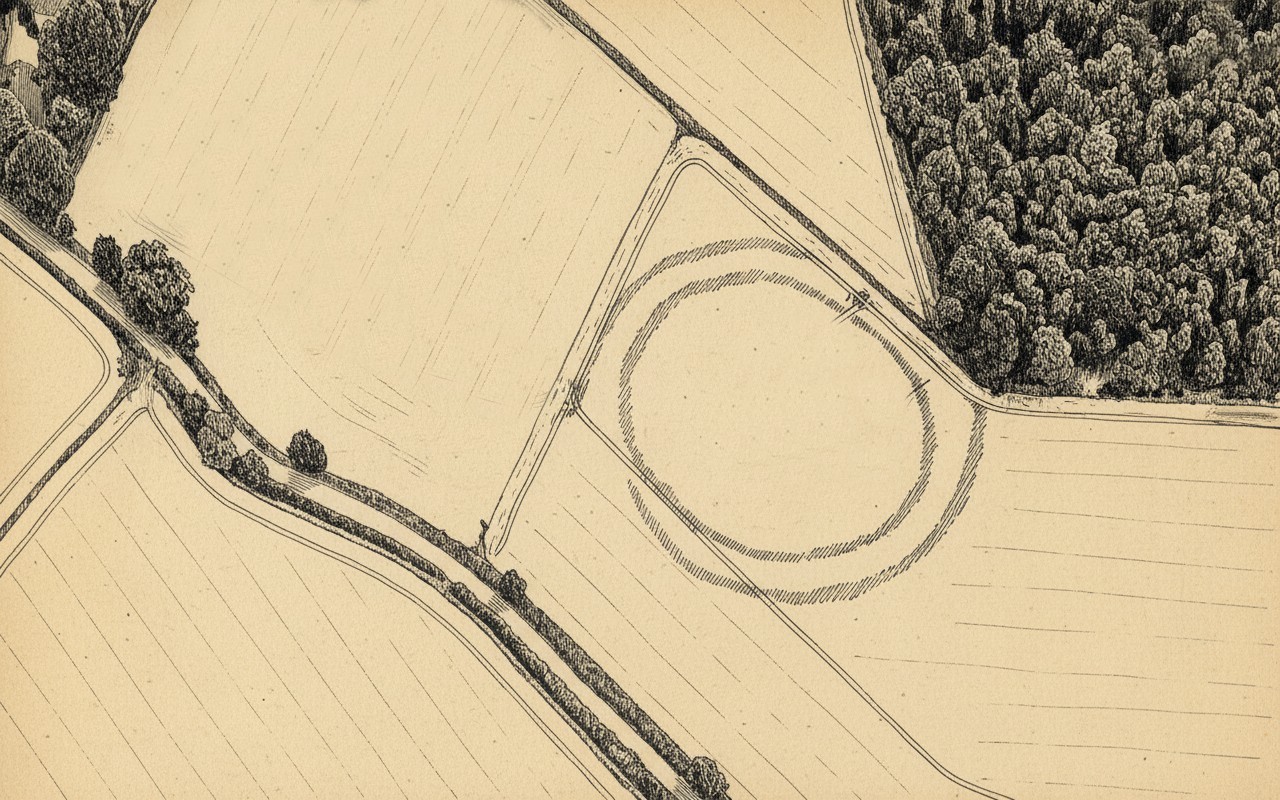
Just over a half-mile (1km) south-west of the major rock art complex at Castleton, in the fields just east of Gallamuir Farm on the north side of the B9124 road, could once be seen a decent double-ringed enclosure, prehistoric in nature. At ground level today there is nothing to be seen as agricultural practices have ever so slowly eroded it away. It wasn’t in a good state when the dudes from Royal Commission (1963) had a look at it in October, 1951—although they did tell us that some faint remnants were discernible, but it was fading fast! They wrote:
“No traces of this structure can normally be seen on the surface, but at the date of visit, when the site was covered with wheat stubble, stretches of both ditches were clearly visible, as shown on the plan (below), by reason of the stronger growth of the stubble overlying them. The ditches are from 20ft to 30ft apart, and the enclosed area measures 300ft from ESE to WNW, by about 240ft transversely. Two narrow gaps in the inner ditch on the north and east arcs respectively, may represent original entrances.”
Outline sketch of the enclosureRoyal Commission plan
Nothing remains of it today apart from the shadow-marks of its former existence when looked down from above. The double embankment that constituted the enclosure initially suggested it to be Iron Age in nature, akin to the larger hillforts up and down the country, but the outline is more consistent of a standard settlement enclosure. As far as I’m aware, no excavations have taken place here, so we’re at a loss to know whether the people living here had anything to do with the rock art just across the fields at Castleton. If we found that it had a Bronze Age or neolithic date, a connection could be likely. But we may have to look at the enclosure immediately north of the Castleton complex to be more sure of our petroglyphic culprits….
References:
Lock, Gary & Ralston, Ian, An Atlas of Hillforts of Great Britain and Ireland, Edinburgh University Press 2022.
Royal Commission on the Ancient & Historical Monuments Scotland, Stirling – volume 2, HMSO: Edinburgh 1963.
Royal Commission on the Ancient & Historical Monuments of Scotland, Archaeological Sites and Monuments of Stirling District, Central Region, Society of Antiquaries of Scotland 1979.
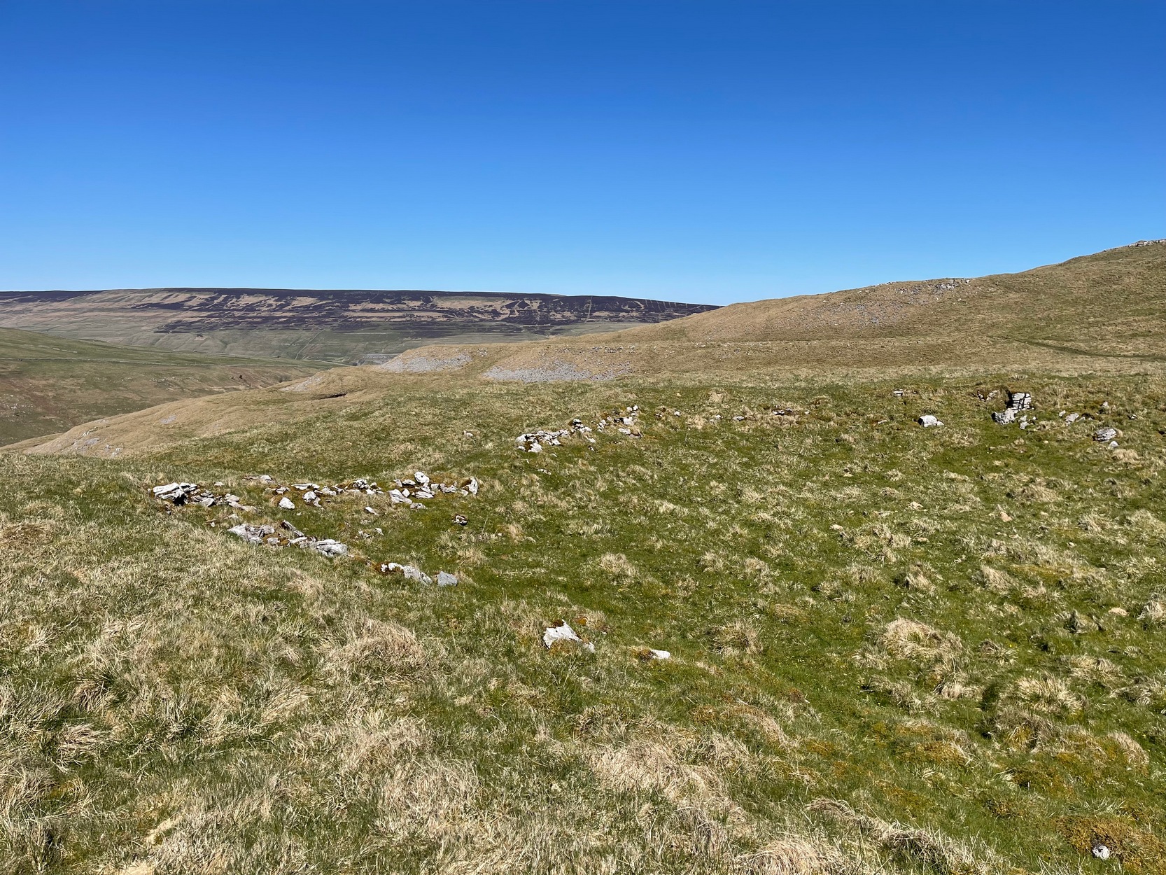
From Arncliffe village, walk past the front of the Falcon Inn village pub and along the track called the Monk’s Road. After a short distance it becomes a dirt-track where the old house lives. Less than 200 yards past the old house, a footpath takes you over the wall, then you walk 200+ yards southwest and through another wall, then up the curvaceous footpath diagonally WSW up the steep hill until you go over another wall where the land levels out. Follow the footpath along the edge of the steep drop for just over a mile where you’ll cross the fifth wall (the Clowder (1) enclosure is up above you by the rock outcrop to the left) and 100 yards along, just north of the footpath, you’ll see a large hollow defined by rocks and low walling. You’ve arrived!
Archaeology & History
The south & eastern walls
Amidst the scattered remains of the extensive Dewbottoms settlement complex, this large hollowed walled enclosure is pretty clear to see. Measuring 40 yards north-south across its longest axis and 31 yards east-west, the structure is like an erratic rectangle in shape, with entrances in the middle of its northern wall and, perhaps, another along the southern side too. It’s quite deep too, being several feet lower than the land around it, keeping it protected from any strong winds above: an ingredient that would obviously have been taken into consideration when it was being built. The walling that defines the structure is a contrived mix of Nature’s own semi-circle of earthfast limestone rock, with intermittent gaps filled-in with thousands of small stones placed there by humans, 2-3000 years ago. It’s quite impressive when you see it in the flesh.
Northern wall & dipped entranceThe west & northern walls
The site appears to have an Iron Age to Romano-British pedigree – although I’m hedging a bet that the place was probably still in use during medieval times. The enclosure has the appearance of some sort of prehistoric village hall. There are no hut circles or any other walled structures inside the overall enclosure, meaning it may have been used, perhaps, for tribal village gatherings; or it might just have been a large enclosure for cattle. Only an excavation would tell us one way or the other.
Anyhow, if you’re coming up to see the Dewbottoms complex from Arncliffe, this is the first main thing that you’ll come across. From here, to your immediate south and west, there’s a mass of prehistory beneath your feet. Make a long day out of it as you’re gonna be somewhat overwhelmed by the magnitude of it all.
References:
Charlesworth, D., ‘Iron Age Settlements and Field Systems,’ in Proceedings of the Archaeological Journal, 125, 1968.
Dixon, John & Phillip, Journeys through Brigantia – volume 2, Aussteiger: Barnoldswick 1990.
Raistrick, Arthur & Holmes, Paul F., Archaeology of Malham Moor, Headley Brothers: London 1961.
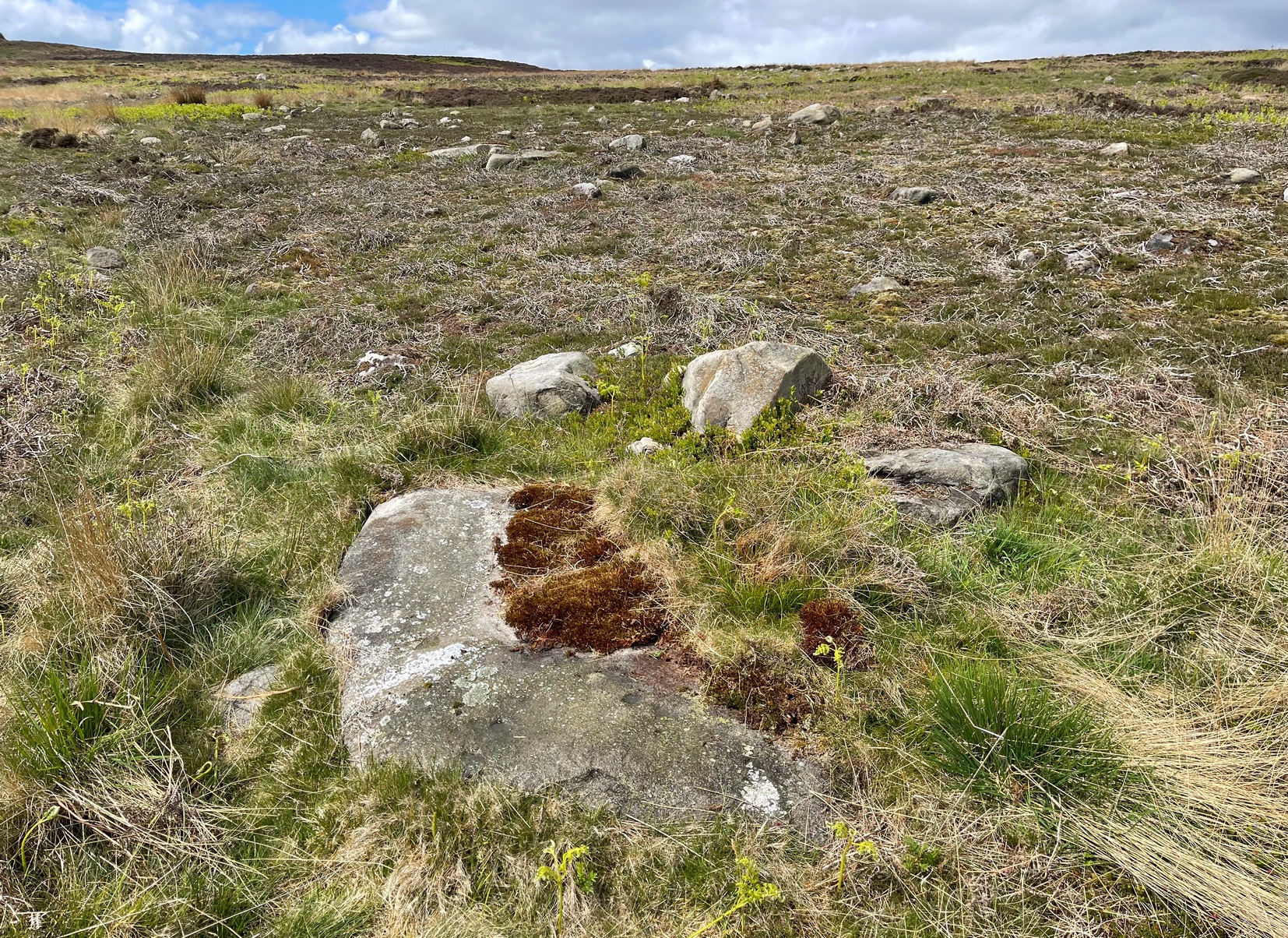
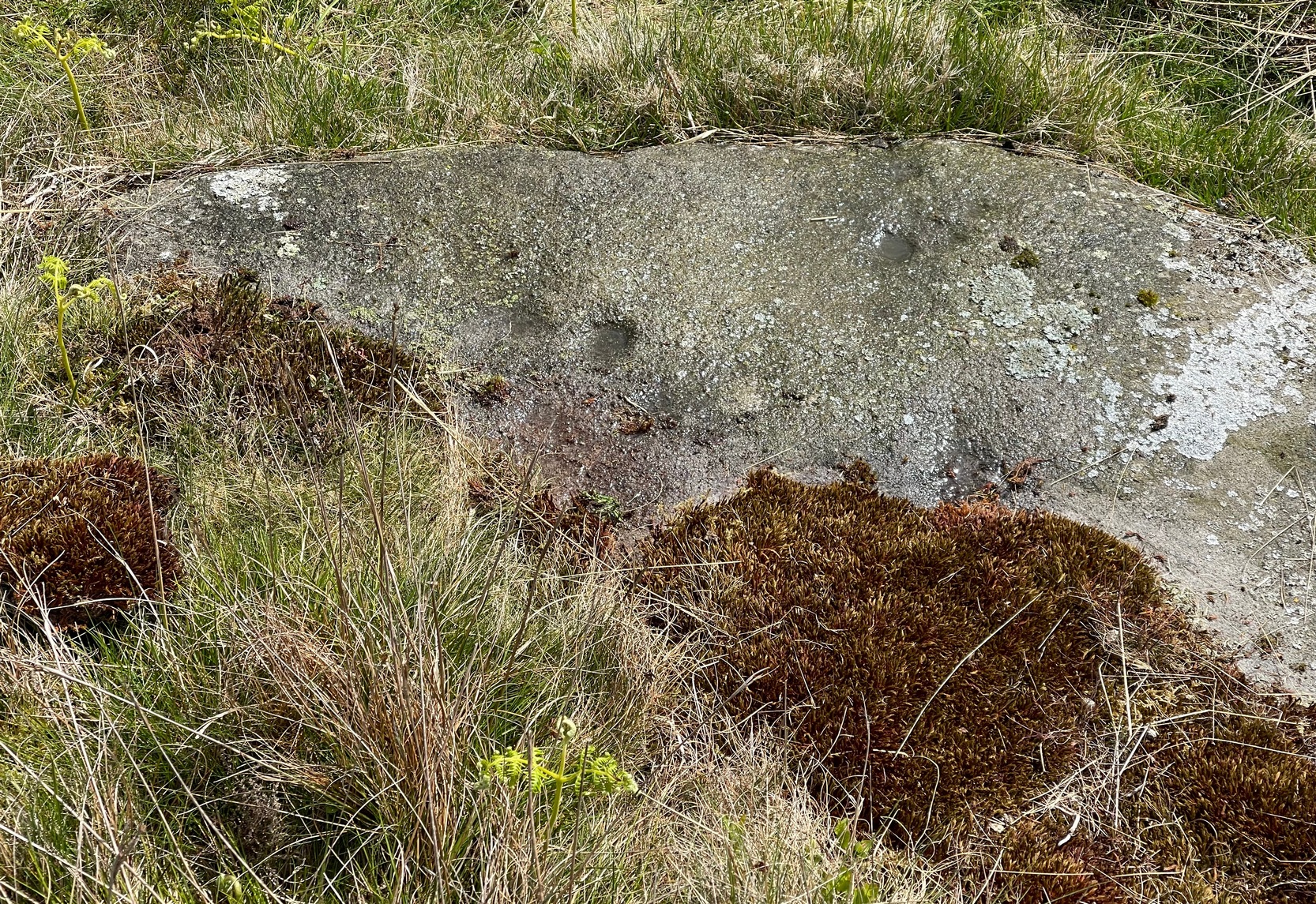
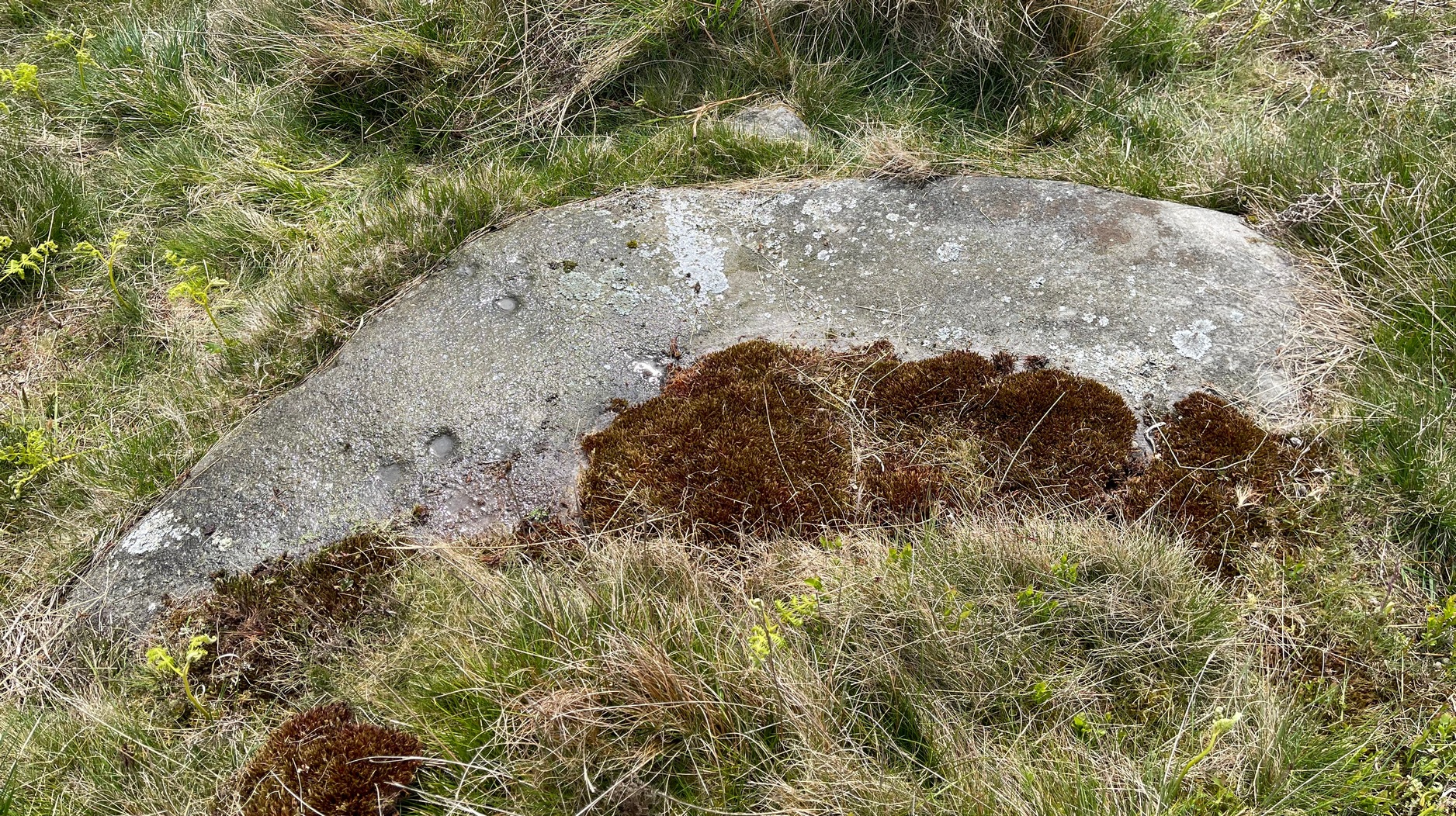
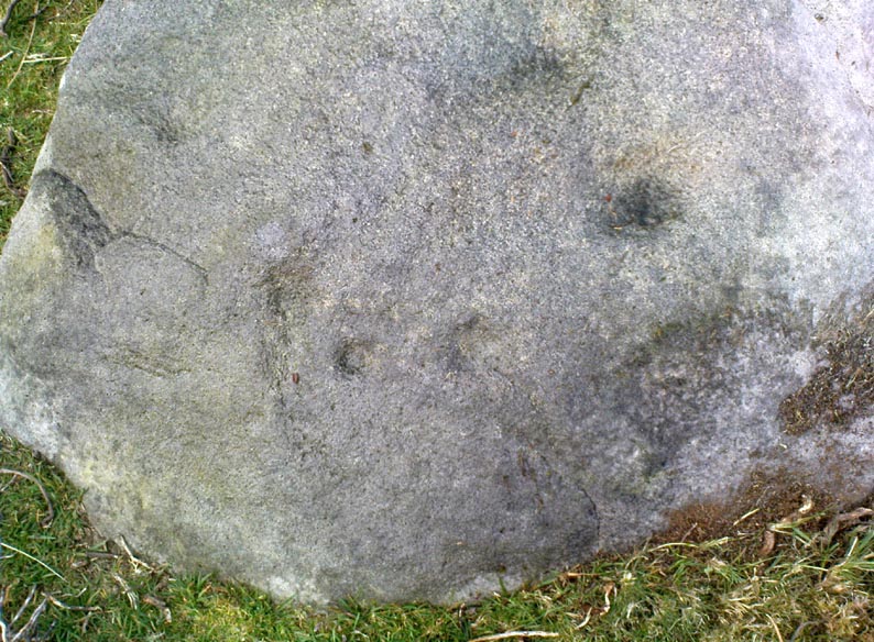
If you’re looking for this carving, you’ll have been to the impressive Tree of Life stone first. From there, you need to walk further away from the walling, 30-35 yards southwest, across the other side of the footpath. There’s a scattered mass of stones all over the ground here: you’re looking for a low-lying long curved stone—longer than most of them hereby. If the heather’s grown back over the stone, it might take some finding!
Archaeology & History
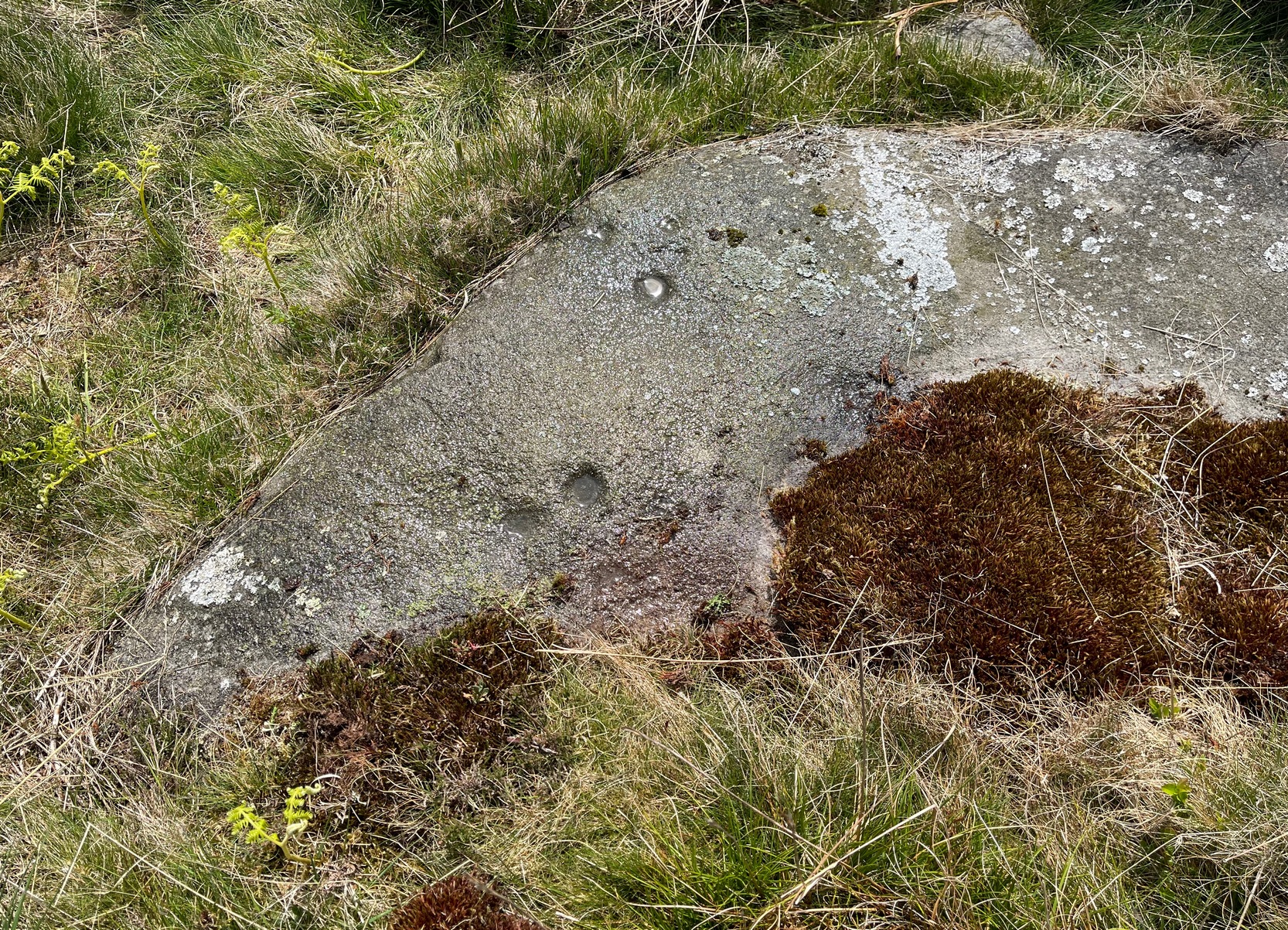
Close to a line of prehistoric walling (seemingly a section of a settlement), this typically curvaceous female stone is possessed of two pairs of faint cup-marks on the eastern side of the rock. It was included in Boughey & Vickerman’s (2003) survey where they described the carving as being, “two small cups visible and two further cups under heather.” A third possible cup exists close to one of the pairs. The carving is found in an area rich in untouched prehistoric remains.
References:
Boughey, Keith & Vickerman, E.A., Prehistoric Rock Art of the West Riding, WYAS 2003.
From Kirriemuir town centre up the B956 Kinnordy Road, turn left where it goes along the B955 road for several miles towards Cortachy, following the same route as if you’re going to the curious Whitehillocks stone circle. Literally two miles (3.2km) along the road past Whitehillocks farmhouse, a large “parking” spot is at the right-hand side of the road. From here, walk along the road for 230 yards and go thru the gate on your left. The first low-rise hut circle is to your immediate right; and from here, meander along the track ahead of you, keeping your eyes peeled…
Archaeology & History
Despite being initially difficult to make out (as the photos here indicate), once your eyes have adjusted to the landscape morphology, you realise what an impressive prehistoric complex you’re wandering through. Saying that, it’s primarily a site that’s gonna be of interest to antiquarians, archaeologists and historians, as this is a settlement you’re looking at, lacking in megaliths, petroglyphs and similar ritual sites.
First enclosure, through the gate on your right
Cairn in the meadows
The first site that you’ll probably notice is visible from the road—but it’s not the first part of the settlement that you’ll pass. Immediately through the gate (as I’ve said) is the embanked rise of earth—only one or two feet high—making up the first notable hut circle (NO 36612 70453), measuring roughly 15 yards across. The shape and form of this circle typifies the others in the arena ahead of you, so that once you’ve made yourself aware of what this one looks like, you’ll be able to see the others with greater ease. Another low embanked circle of roughly the same size is just a few yards away at NO 36605 70439.
Straight back onto the track you’ll notice another larger D-shaped enclosure immediately on your left (NO 36622 70406), about 17 yards across; this is accompanied by what looks like a cairn immediately right of the track (NO 36609 70413), but this is actually a much smaller D-shaped enclosure, just right for one or two people.
The small rounded hill in front of you has what may be a circular enclosure on its top, but I wasn’t too sure about it. But looking down from this hill is the most visible of all the structures in the settlement (NO 36580 70307)—and the one I mentioned as being visible from the road. At first it’s a little deceptive in appearance, as you get the impression that the oval of stones (top photo) is what constitutes this hut circle, when in fact this element may be mediaeval in nature as it’s been built on top of an earlier Iron Age (?) enclosure. You can barely see this earlier form at ground level, so it’s best to walk back up the rounded hillock and cast your gaze back and forth and round the side of the ring of stones. You’ll see, eventually, the shallow overgrown walling of a larger oval-shaped enclosure, measuring eighteen yards across, whose edges start from the bottom of the hillock and arc around to the outer edges of the stone construction.
Hut circle, NO 36573 70230
Back onto the track and further into the meadows, the next hut circle you’ll meet is (keep your eyes peeled) right by the track-side (NO 36573 70230). It has wide embanked walls that are low to the ground and completely overgrown, measuring 15 yards (E-W) by 18 yards (N-S), with what looks to be the original entrance or door on its south-side. A similar large circle exists on the other side of the track a little bit further along (NO 36499 70138).
There’s much more to this settlement, including lengths of walling in the grasslands below the last two circles and where, if you look carefully, you’ll see one of at least two cairns in this area. On the other side of the road are one or two other small hut circles and a much larger construction in the field further down the road, measuring 25 yards in length (NO 36569 70481). This would seem to be the largest of the lot.
The age of this settlement probably covers a considerable period of time: beginning perhaps in the Bronze Age, certainly in the Iron Age and all the way through into the mediaeval period where, all down Glen Clova, remnants of such hamlets still live beneath the soil. This entire arena is bathed in silence, save the wind and call of the birds. Tis a beautiful space to spend a few endless hours…
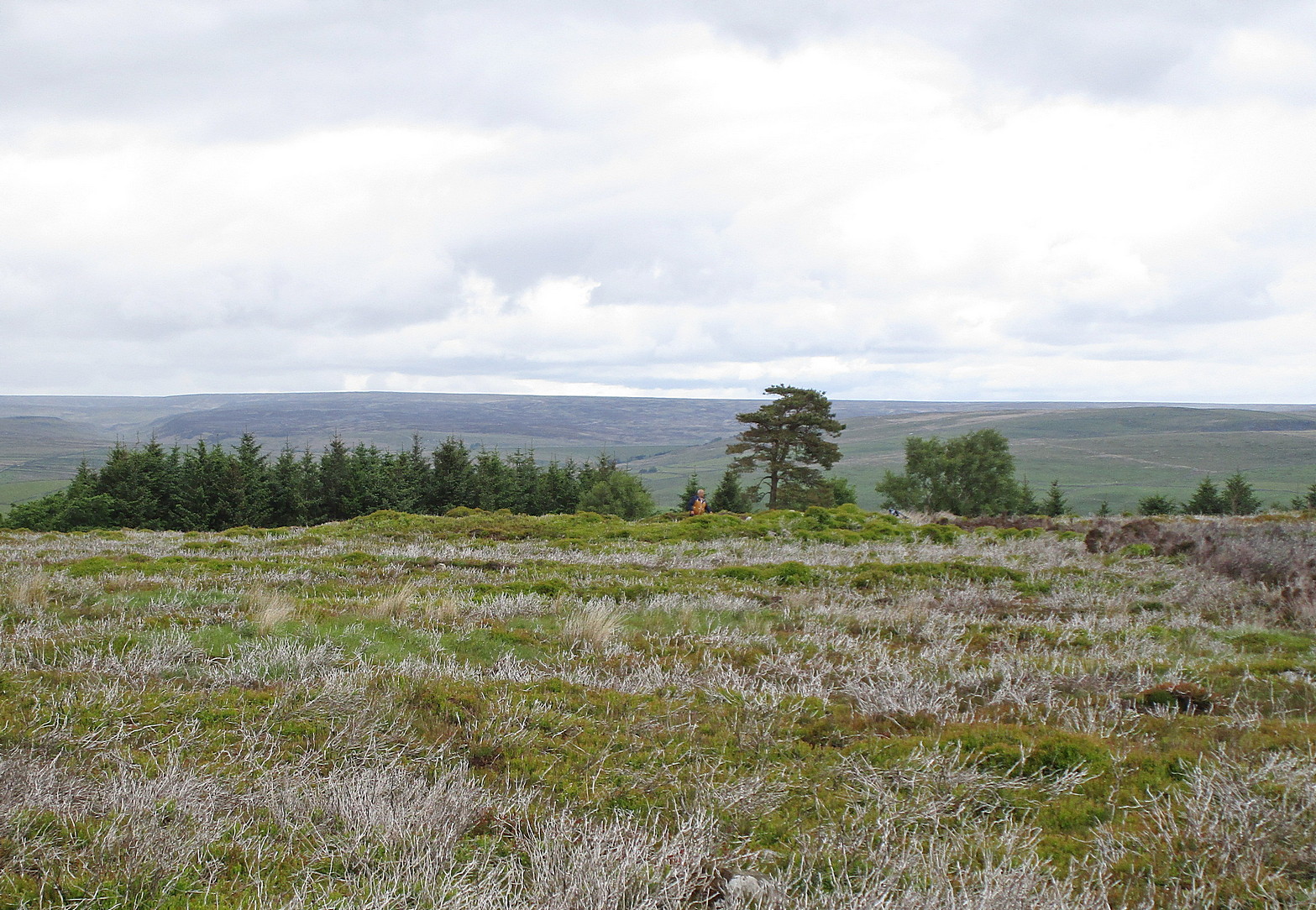
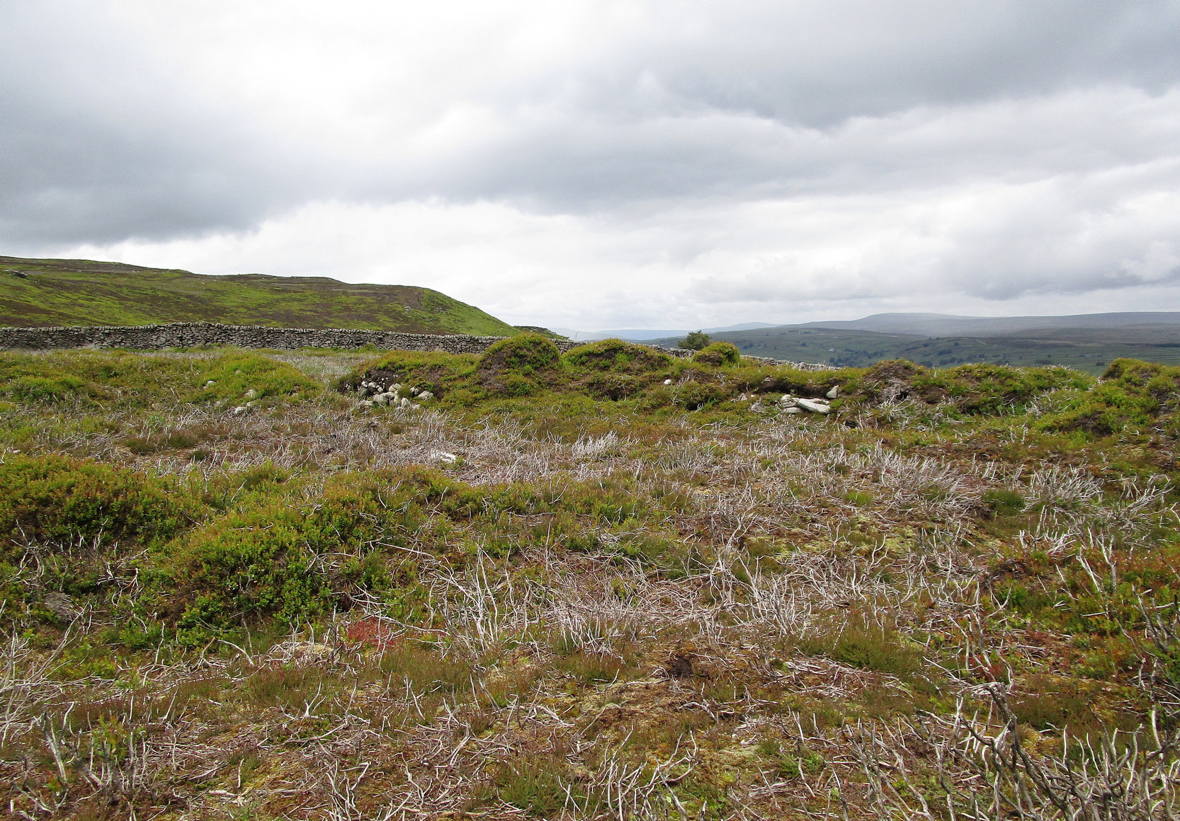
It’s easier to explain how to get here if you’re coming from the Burnsall-side of the B6160 road that leads to Bolton Abbey. A half-mile out of Burnsall village you a small woodland with a small parking spot. From here, a footpath runs up the steep hill above the parking spot. It zigzags a little and you eventually come out on the south-side of the trees where it meets some tall walling. Follow this walling further uphill for more than 600 yards (past more woodland) until the land starts to level out. Hereby, go thru an opening in the wall and less than 100 yards away (west) amidst the overgrown heather, you’ll see what you’re looking for.
Archaeology & History
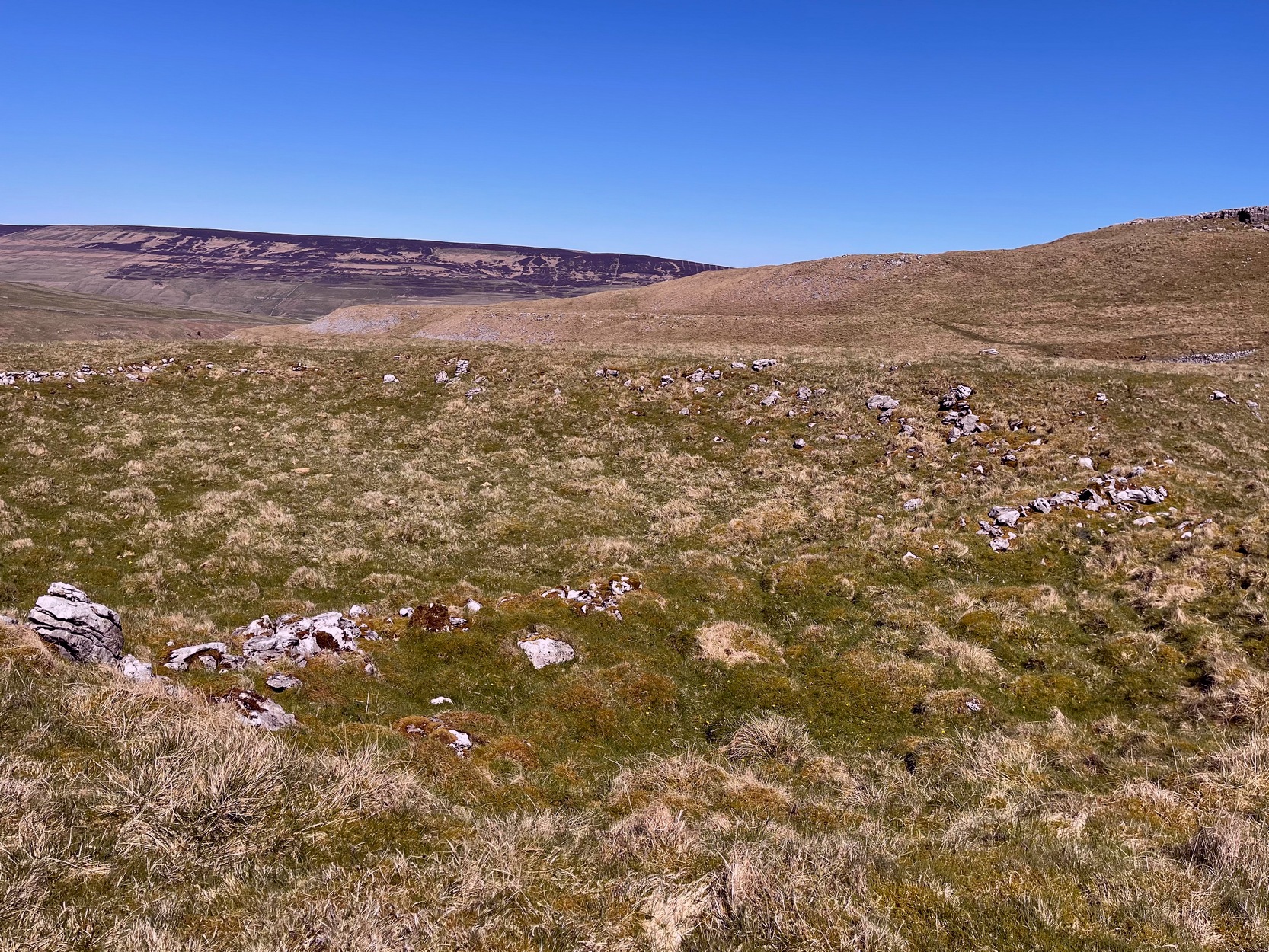
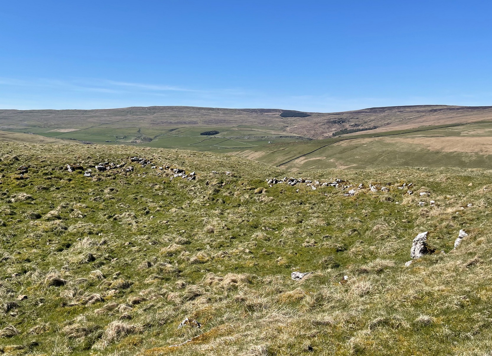
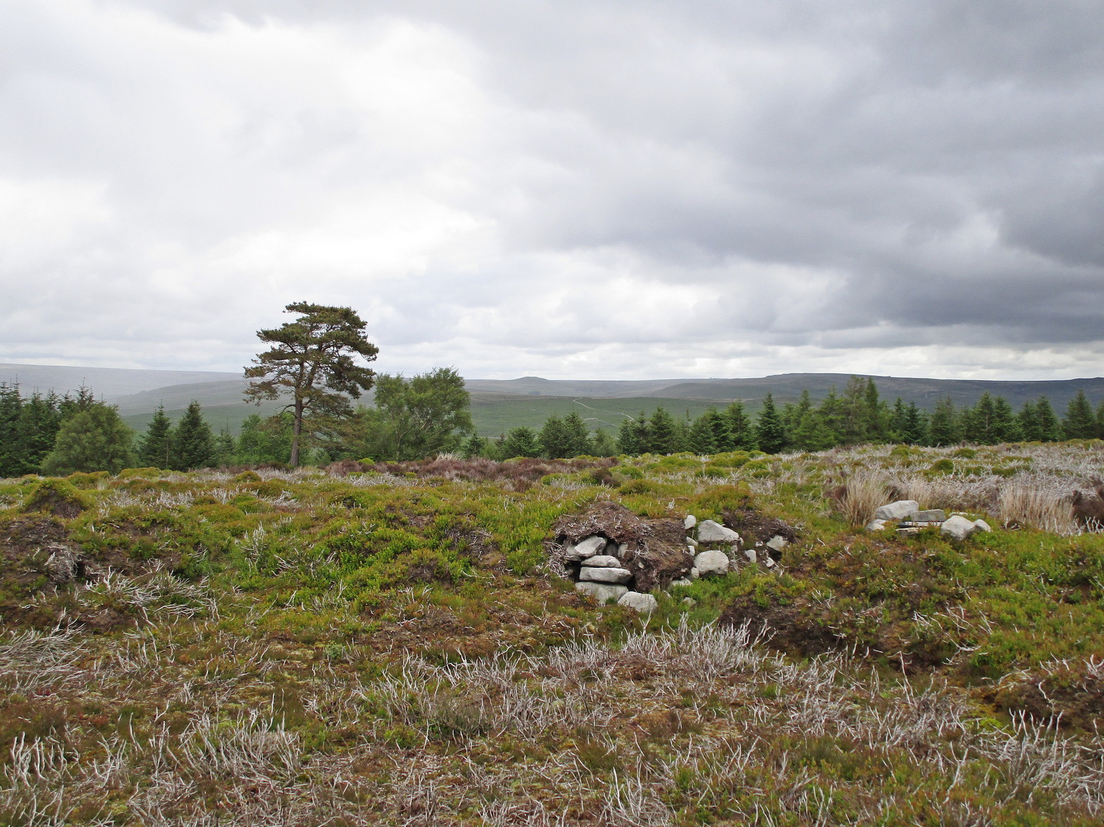
A large but peculiar site resting on a moorland plateau on the eastern edges of the mighty Barden Moor. Peculiar inasmuch as it’s completely isolated from any other monument of the same age and type anywhere on these huge moors. A few miles east, on the moors around Appletreewick, Thruscross and Beamsley we have a plethora of prehistoric sites—but up here on Barden Moor there’s apparently nowt else! I find that hard to believe….
Inner rubble walling
Rubble walling, looking N
Listed on official websites as being a ring cairn, it’s difficult without a detailed excavation of the site (there hasn’t been one) so say that’s what it is. But we’ll stick with it for the time being. My initial impression of the site was that it was a crude form of a collapsed Scottish dun: impressive large circular monuments—buildings if you like—with very well-built large stone walls, usually several yards thick, a little bit like the Scottish brochs (mighty things indeed!). This thing at Folly Top isn’t quite as impressive, but it’s like a collapsed version of a dun.
Arc of western walling
The site consists of large ring of raised collapsed rubble walling, more than a yard high in places, and about three yards thick all the way round, measuring roughly 21 yards (N-S) by 19 yards (E-W) from outer wall to outer wall. There are “entrances” on the east and west sides; but there seemed to be little of any note in the middle of the ring, although the site was somewhat overgrown on our visit here. Outside of the ring there was also nothing of any note. It’s a pretty isolated monument which seems to have more of an Iron Age look about it than the Bronze Age—but until there’s an excavation, we’ll not know for sure.
It’s well worth checking out—and from here, walk onto the huge moorland above you to the west….
Acknowledgements: Huge thanks to the Crazy-gang of Sarah, Helen and James for their awesome assistance on our venture up here. A damn good day indeed! Cheers doods. 🙂
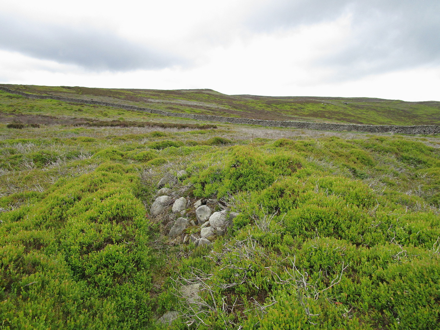
Make your way to the Black Beck tomb and walk west for some 50 yards. If the heather has grown any more than a foot tall, it’s impossible to see.
Archaeology & History
Near the northernmost section of the Hawksworth Shaw prehistoric graveyard, some 50 yards west of the Black Beck cairn, exists the remains of a small prehistoric enclosure whose walling is deeply embedded in the peat. Although I describe the place as an ‘enclosure’, we don’t know for certain whether it is a ruined settlement or large hut circles (although this latter idea is the more improbable).
Walling, looking N
Arc of walling, looking S
Two large open arcs of walling—like large letter “C’s”—with their open sides to the east, have been constructed next to each other, virtually coming together in the shape of an inverted number “3”. The walling in the southern arc—measuring some 33 yards in length and barely higher than 1 foot above ground level—consists of standard stones and rubble, similar to some of the hut circles that are found in greater abundance on the north-side of Ilkley Moor. The smaller, less visible arc of stones—some 18 yards of it—is lower in the earth. Both lines of walling may have been robbed in part to construct some of the extensive cairns close by, as neither of the two arcs were very high and it was very difficult to work out even what sort of structure they might have been.
Like many other prehistoric sites on Rombalds Moor, only an excavation is going to tell us precisely what was going on here…
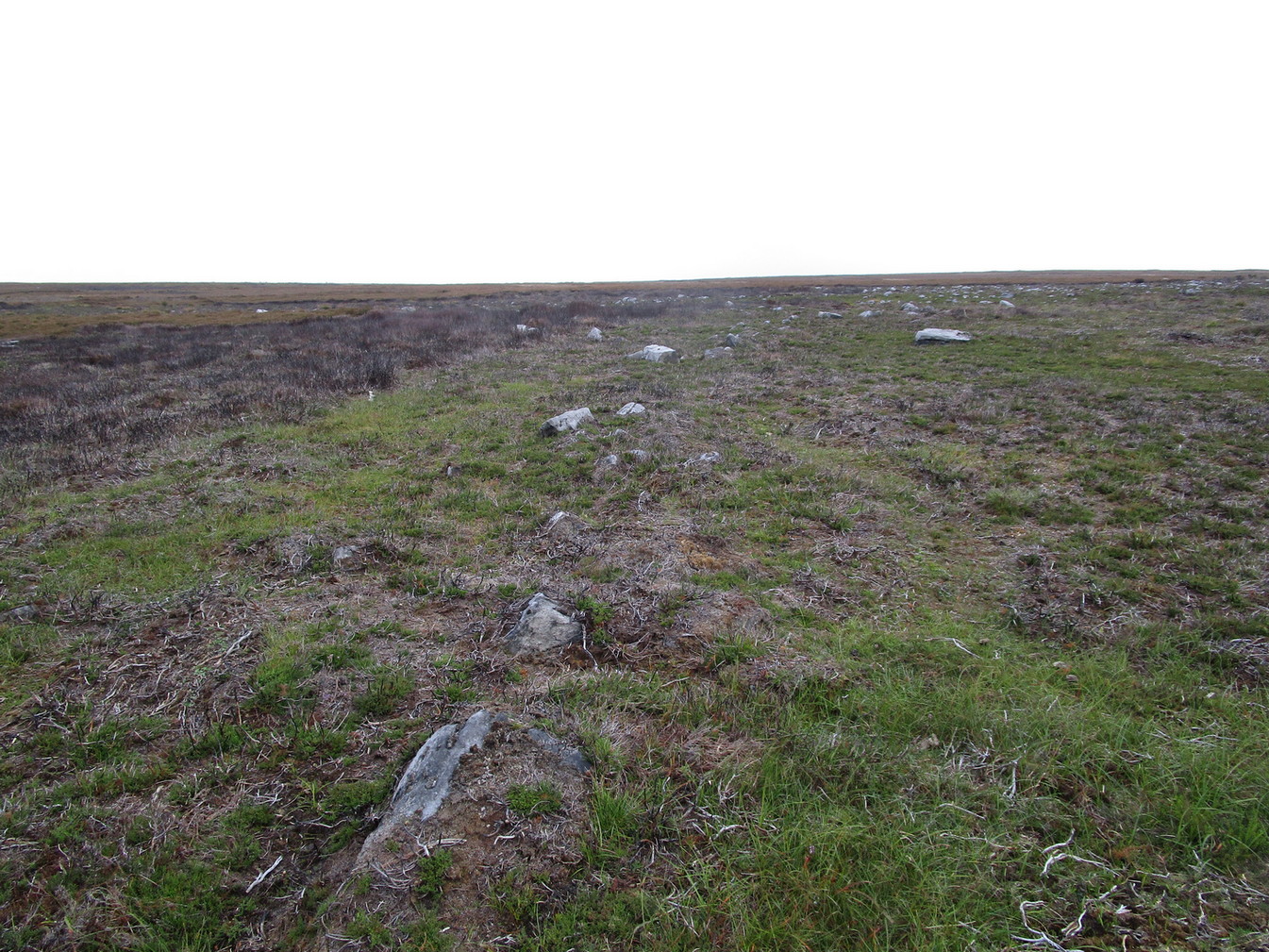
Start at the Askwith Moor parking spot on Askwith Moor Road, then walk down the road (south) 300 yards till you reach the gate and track on the other side of the road, heading southeast. Following the track onto the moor and take the footpath on your right after 75 yards. Follow this along until you hit the gate & fence. Climb over this, then follow the same fence along (left) and down, and keep following the fence and walling all the way on until you reach the very bottom southwestern edge of Askwith Moor itself. Now, walk up the slope to your right and, near the top of this rise 250 yards away, past Lower Lanshaw 01 carving, in some ancient walling, you’ll find it!
Archaeology & History
A very faded cup-and-ring carving can be found about 30 yards northeast of the Lower Lanshaw cup-marked stone, just as the hill slopes down to the overgrown stream. It rests on the lower edges of the prehistoric (probably Bronze Age) enclosure in which other archaeological remains can be found. Although the photo here highlights what seems to be 3 cups on the south-face of the rock, only one of them seems authentic. A pecked “line” also seemed evident, but the light conditions were poor when we were here. It does seem that there’s a faded ring around one of the cups, as you can see in the photo.
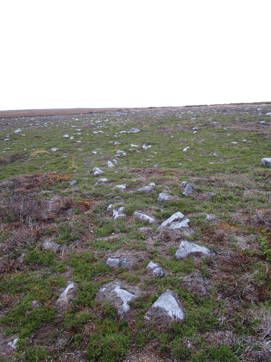
From Ilkley, take the Cowpasture Road up past Cow & Calf rocks, the hotel and along the moorside. A few hundred yards further, just before the next farm-building on your right, walk up the Rushy Beck path to the top. Crossing the stream at the top, now walk diagonally south-ish into the heather for some 200 yards, a short distance before the hillside begins to rise up again onto the next ridge. Remains of this ‘enclosure’ is all around you!
Archaeology & History
When the normal moorland vegetation covers this prehistoric site, you’d barely know there was anything here apart from various rocky rises and undulations in the ground and perhaps, if you were seeking out old stuff, what would seem to be lines of stone walls bending away onto the moor. But when the heaths have been burnt back, a whole new vista unfolds itself! You see before you a fantastic, well-preserved, unexcavated prehistoric enclosure, whose origins are probably neolithic, but whose history and use stretched through the Bronze Age and into the Iron Age—and it’s not alone! East, west and south of this particular enclosure, other prehistoric walled structures are found stretching all across the landscape hereby, structurally similar and also used over very long periods in prehistory. For antiquarians and historians alike, this is a truly impressive place indeed. In all honesty, the description I give here does not do the place justice!
Northwestern section of enclosure walling
Things like ‘settlements’ and ‘enclosures’ are traditionally relegated by purist archaeologists to be little more than domestic or utilitarian sites: places where our ancestors kept cattle; or were used for defensive purposes; or lived for long periods of the year. Of course, these simple ideas are effective and true at some places; but here at Woofa Bank—in this particular enclosure—something more than just domestic activity was enacted, and over the period of many centuries by the look of things. We surmise this by the incidence of at least fifteen cup-and-ring stones being found within the enclosure itself; and at its very centre is a small standing stone, not previously recorded, that has perhaps five petroglyphs around it. The presence of such a large cluster of cup-and-ring stones close together within the enclosure would seem to suggest ritual activity.
Carved rock & central stone
Close-up of, dancing anthropomorphic figure?
One of the carvings at the centre of the enclosure (listed in the Boughey & Vickerman survey as Carving 372) has been suggested to represent a dancing human figure (the image here shows the anthropomorphic element), which it may well be. The incidence of this central stone and its surrounding petroglyphs has important magico-religious implications, relating it as a site used for creation myth narratives and repetitions (transpersonal explorations at this site may prove worthwhile). The wider extended enclosure with more petroglyphs contained inside it, suggest that additional ritual performances were enacted here; these may have had something to do with the cluster of prehistoric tombs scattered on the moorland plain 100 yards to the west, but we might never know.
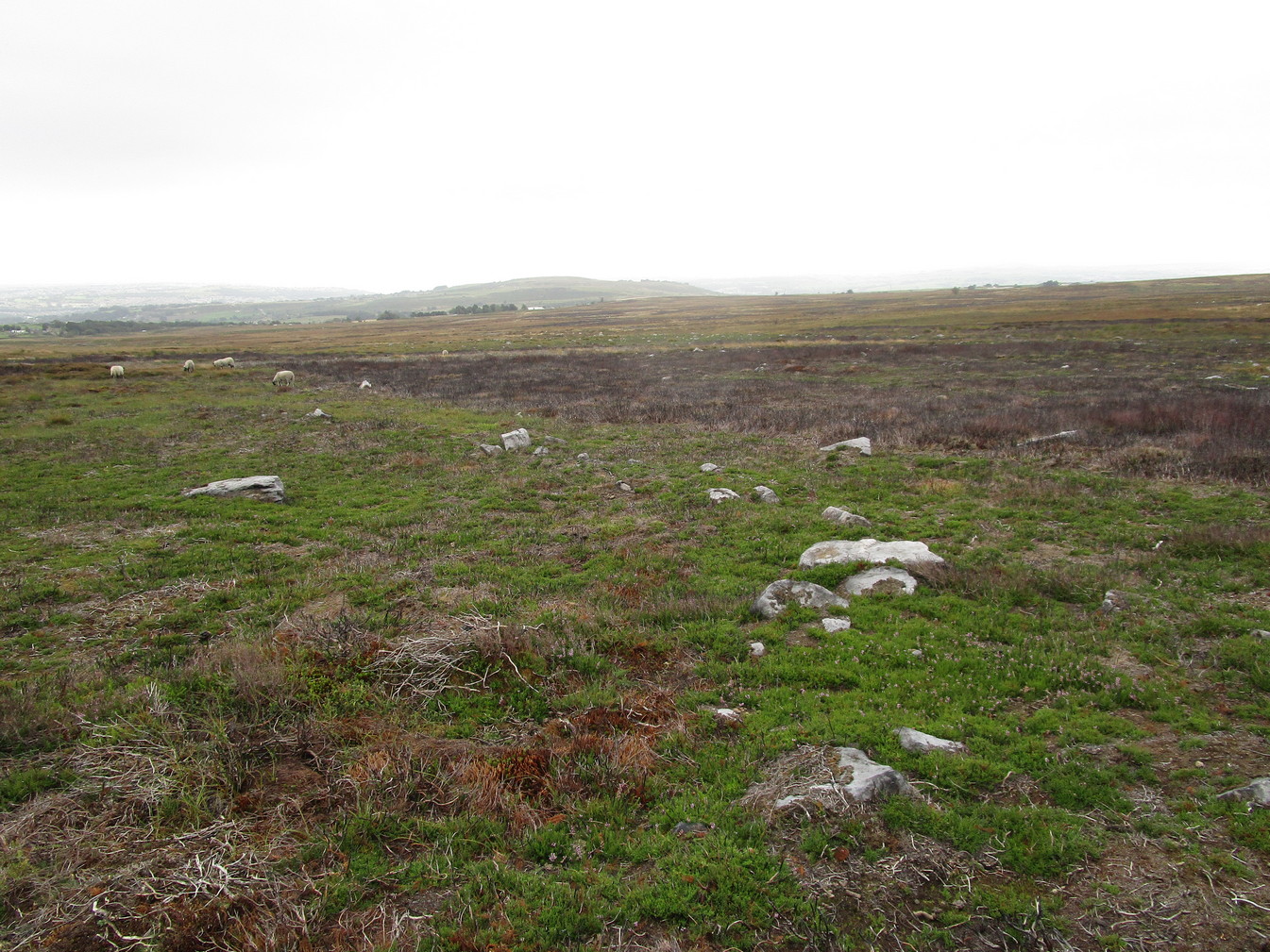
Easternmost standing stone
It seems that the walled enclosure itself was constructed around the earlier cup-and-ring stones, probably many centuries later—but we need excavations here to give us more precise details. Much of the enclosure walling itself has the hallmarks of being late Bronze Age to Iron Age, whilst we know that prehistoric rock art can date back into the neolithic period; and from this period Eric Cowling (1946) reported that, at Woofa Bank, “at the western end of the ridge,” just above this enclosure, a neolithic flint site existed.
Cowling’s 1946 plan
Cowling (1946) himself was one of very few archaeologists to even mention this impressive site, in a section exploring the “Iron Age” sites along Green Crag Slack at the eastern end of Ilkley Moor. He wrote:
“At the other end of the site under the shadow of Woofa Bank and near the source of the Rushy Beck, is another D-shaped enclosure apparently unfinished. The plan is of a circle with a flattened side and does not exceed twenty-four yards across in any direction. Here the enclosing wall shows five or six courses at the lower end side and a simple entrance to the west.”
Western entrance to enclosure
Stone marking eastern entrance
Though Cowling’s measurements are way out! The enclosure itself is much larger than he describes. For the most part, three-quarters of it give the impression of it being a large oval shape, but the design and outline of the walling changes on its southeastern side and kinks inward, in an arc, to eventually meet the walling in the middle eastern section. Its entire circumference measures approximately 220 yards all the way round; it is 65 yards across east-west; and about 61 yards north-south. The average height of the main walling is between 2-3 feet tall, and is made up of many large rocks, some of them positioned upright as standing stones, all packed together with earth and countless thousands of smaller stones. The walling itself is between 2-3 yards wide in many places and has two main entrances: one near the middle of the western wall and the other almost opposite to the east. The eastern entrance is marked by a standing stone between 3-4 feet tall. No gaps are visible at all on the northern curved section of the enclosure. On the overgrown southern edges, not all of the walling is visible and much of it is overgrown. On the whole it’s still very much as Cowling found it, with the arc of walling in this part of the enclosure difficult to make out clearly. There is also another line of walling that runs off to the east, beyond the main enclosure itself.
Carved rock in western wall
The clearer, more visible western line of walling, running south of the entrance on that side, has a large singular cup-and-ring stone laid right along its axis (carving 366 in the Boughey & Vickerman [2003] survey), a short distance before the walling changes direction east-west and runs along the bottom of the slope.
Folklore
Tradition tells that the tribal people from this site were involved in a battle with the Romans along this moorland plain.
References:
Bennett, Paul, The Old Stones of Elmet, Capall Bann: Chieveley 2001.
Boughey, Keith & Vickerman, E.A., Prehistoric Rock Art of the West Riding, WYAS: Wakefield 2003.
Cowling, Eric T., Rombald’s Way, William Walker: Otley 1946.
Eliade, Mircea, Images and Symbols, Harvill Press: London 1961.
Hedges, John (ed.), The Carved Rocks on Rombalds Moor, WYMCC: Wakefield 1986.
Size, Nicholas, The Haunted Moor, William Walker: Otley 1934.