From Ford village, take the track that goes uphill (west) running near the edge of the forest-line. Keep going until you hit the top of the forest and the large rocky hill above you (on your right) is where you need to be heading. The rise to your left is Dun Chonallaich. Walk around the bottom of the hill until you get to the other side (you should be 100 yards or more above the tree-line) where you’ll notice a ‘pass’ running west, with a rocky knoll above you on your right. That’s it!
Archaeology & History
Thought to date from the Iron Age, the remains here cover an area 15 yards by about 25 yards. Remains of walling around the edge of the summit nearly a yard wide in places define quite clearly where the ‘fort’ was centred. The entrance to the site was found on the northwestern side. In more recent times however, animal pens have intruded on the remains here and the archaeological remnants are much denuded.
Folklore
Samhain fires were lit on the larger ridge above this ruined fort until recent years, as some old local folk will tell you. These Halloween fires (done to celebrate the old New Year) were stopped a short time after the new ‘owner’ of the Auchinellan Estate (on whose land Dun Dubh is found) took exception to them and, for all intent and purpose, deemed them a fire hazard! The lady in question who inherited the Estate was in fact a devout christian who took exception to the local “pagan” goings-on, contrary to the beliefs of the previous Estate owner, who not only allowed such old events, but played a part in them. Local folk hereabouts, not surprisingly, aint too keen on their part-time dictatorial christian neighbour.
The fires up here were also related to the linear cemetery at Kilmartin. Here the giant tombs all line up & point to Dun Chonallaich, behind which hides the more flattened top of Dun Dubh. When the Halloween fires were lit on top of this, the glow from behind the great pyramid of Chonallaich all the way down the Valley of the Kings, was spectacular! One wonders just how long the local people had been doing this. Quite a long time I imagine….
References:
Royal Commission on the Ancient & Historical Monuments, Scotland, Argyll – volume 6, HMSO: Edinburgh 1988.
A beautiful place found along the roadside towards Seil Island, on the B844 a few miles south of Oban. When you get near the south end of the loch right by the road, have a gander! If the waters are low you can sometimes see the ghostly island appear above the waves…
Archaeology & History
You’re lucky to see anything here – as the crannog has all but submerged. This old artificial island could once be clearly seen less than 400 yards south of Duachy farmhouse, near the southwestern edge of the loch. It measured roughly 10 yards by 8 yards, was built of stones, seemingly “with a boat-slip on the west side and a ‘square place’ on the east as if for a landing stage.” All trace of the causeway linking it to the shore has apparently vanished. But if you do stop here, check out the Duachy Standing Stones on the hillside behind you!
References:
Royal Commission on the Ancient & Historical Monuments of Scotland, Argyll – volume 2: Lorn, HMSO: Edinburgh 1974.#
Not too hard to find really. On the far western edge of the King’s Park golf course, head for the highest point where the small cliffs drop down. From here, walk down the footpath on the slight slope south, just below where the small copse of trees are, and you’ll see the singular small flat stone in the grasses near the footpath you’re walking along. If you can’t find it – look around!
Archaeology & History
A little-known but fascinating isolated carving, first described by David Morris at the sixth meeting of the Stirling Natural History and Archaeological Society in 1901. It is found on the western edge of the town, above the rocky edges not far from the pond of St. Thomas’ Well on the far edge of the golf course. Morris’ finding was written up in their fine journal, where he wrote:
“In the King’s Park, about 50 yards east of the cliff where a seat overlooks the Douglas Terrace sand quarry, there is a smooth surface of rock showing through the turf, measuring two-and-half feet by one-and-half feet… On it is a cup-shaped hollow, outside the rim of which is a well-marked hollowed ring, beyond which is another faintly marked, concentric circular groove. The cup-mark measures one-and-a-half inches across; the inner rim of the first circle is 4 inches, and the outer rim is 6 inches in diameter. The outer circle, if complete, would be 9 inches in diameter. The depth of the central hollow is half-an-inch, and of the inner groove fully one-quarter of an inch. The markings are plainly artificial…”
King’s Park CR – central design, pointing to northernmost cup
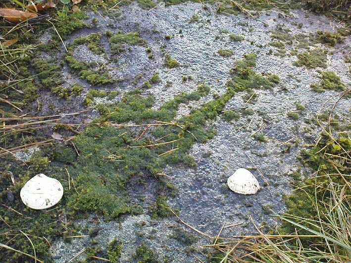
In good sunlight, it is obvious that the carving is a fine example of a double-ringed cup-and-ring carving – though the outer ring may not be complete. The Scottish Royal Commission lads told that “this rock outcrop bears three cup marks” – one of which has the rings surrounding it. In the first photo here, the southernmost cup-marking is highlighted in the centre of the two shells which were on the rock when we arrived.
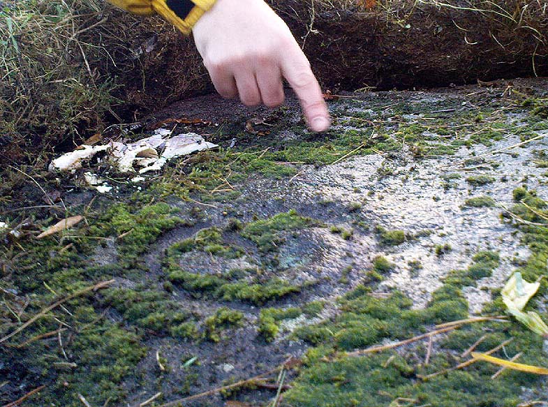
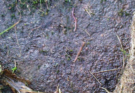
However, there’s definitely more to this carving than previous investigations have outlined. It seems that the northernmost cup-mark has a ring and a possible outer-ring. There is also a distinctive linear carving, which at first seems like a primitive triangle, just below the southernmost cup – as we’ve tried illustrating here in the photo which Mikki Potts took. It’s faint, but once you see it, it’s obvious that it’s there. Other faint lines of similar nature also seem apparent near the northernmost cup-marking, but we will have to wait for rubbings and further visits in better light to ascertain the full image on this rock. Well worth checking out if you like your rock art! (can any of you Scottish rock-art fanatics have a closer look at this? – take a rubbing of it and see what other aspects are on this design)
Faint linear carvings on southern end of the rock
One other thing which seemed apparent when we were here: this site has all the geomantic hallmarks of accompanying a burial at some time in the ancient past. Its isolation here is unusual and the carving is only 50 yards from the highest point hereabouts, where you have 360-degree views all round, typifying the position of many prehistoric tombs.* Does anyone know about such features, or have records of any field-name surveys taken, which might confirm or deny this thought? Twouldst be good to know!
References:
Feachem, Richard, Prehistoric Scotland, Batsford: London 1963.
Morris, David B., “Cup and Ring Marked Rock Surface in King’s Park,” in Stirling Natural History & Archaeology Society Transactions, 1900-1901.
Morris, Ronald W.B., The Prehistoric Rock Art of Southern Scotland, BAR 86, Oxford 1981.
Royal Commission on the Ancient and Historical Monuments of Scotland, Stirlingshire – 2 volumes, HMSO: Edinburgh 1963.
Royal Commission on the Ancient & Historical Monuments of Scotland, Archaeological Sites and Monuments of Stirling District, Central Region, Society of Antiquaries of Scotland 1979.
* Since writing the above, thanks the correspondence of Paddybhoy, we’ve learned that there definitely were prehistoric tombs close by; one being just at the bottom of the ridge below the carving, on Douglas Terrace. Records describe several other prehistoric tombs nearby at Birkhill House, the Birkhill Sandpit and Coneypark Nursery. However, I still think it most probable that there were other tombs and more rock art, probably along the edges of King Park, aswell as the Cambusbarron plain. These need locating.
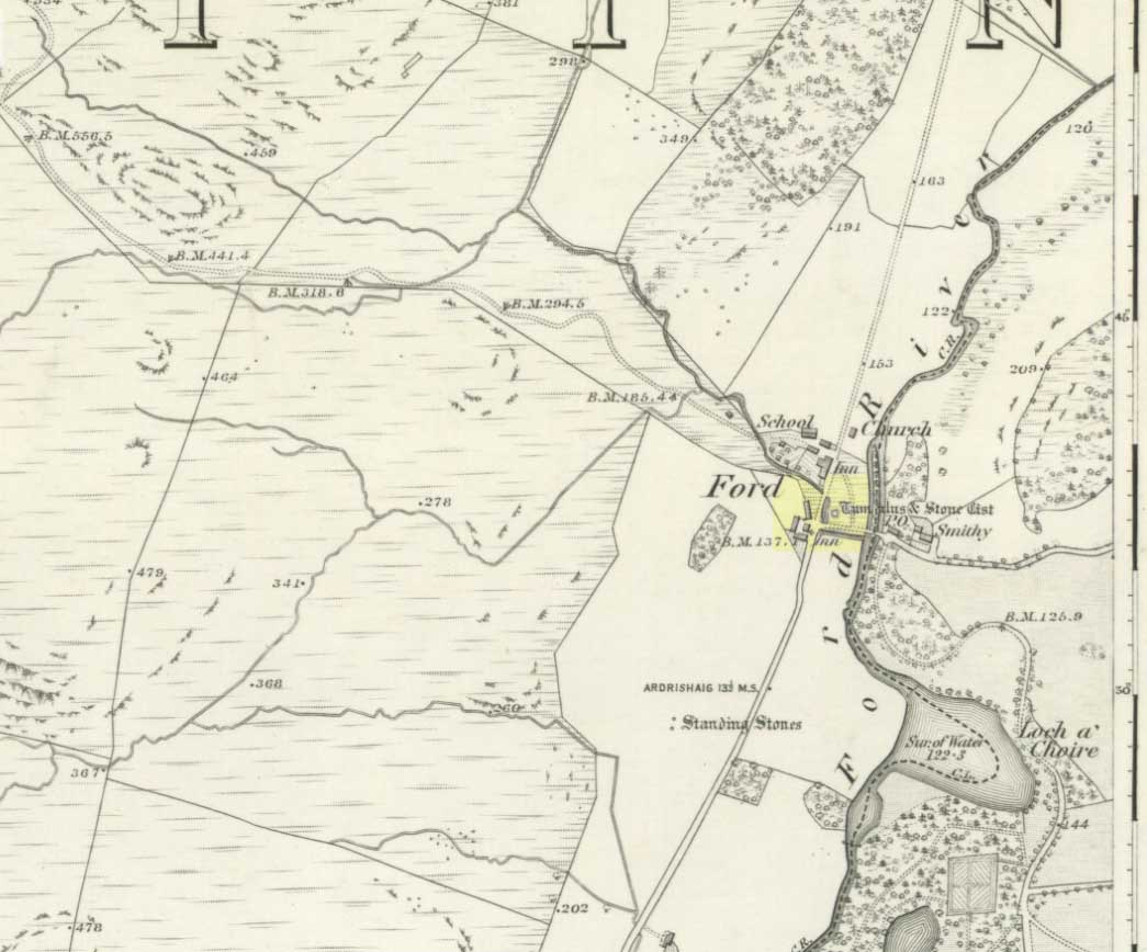
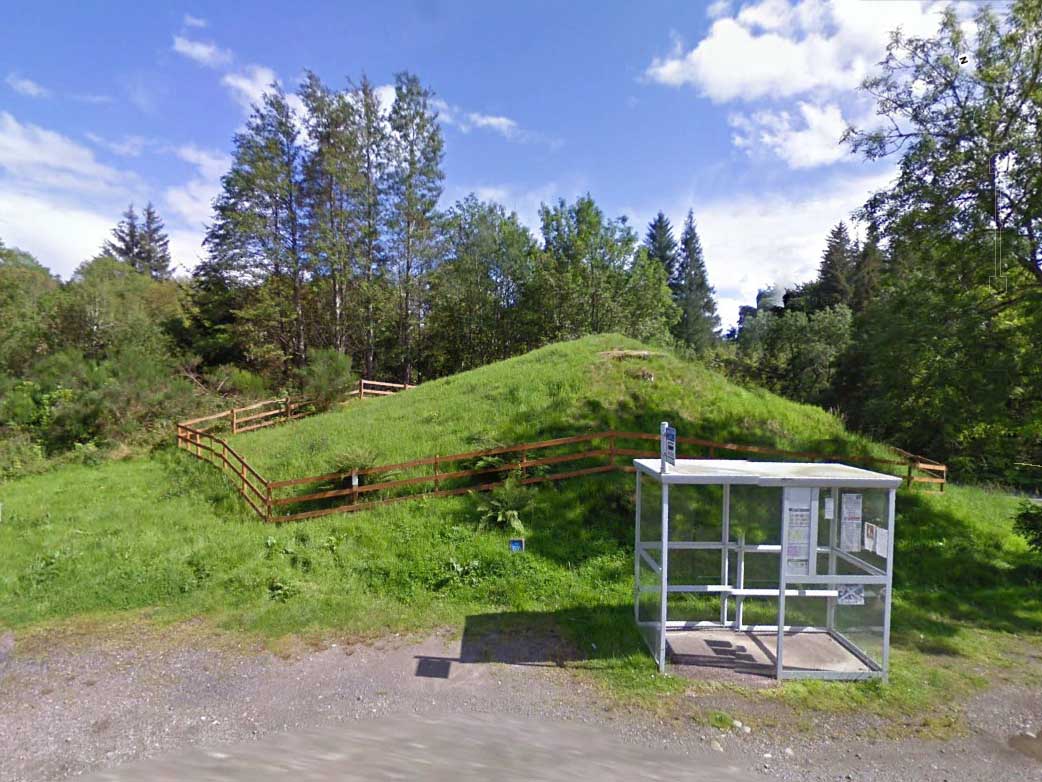
Although I describe this site in association with the township of Kilmartin, it is in fact several miles north of there – but I reckoned that if I say it’s near Kilmartin, then those of you who don’t really know this region, will have some idea of its locale. So – from Lochgilphead, go up north thru Kilmartin, another coupla miles on, till you reach the small road to your right (signposted ‘Ford’). Just keep driving for a couple more miles until you hit the village. If you park by the only shop, you’re just past the old tomb. Diagonally across on the opposite side of the road from the Ford Hotel, right by the road-junction, just before the little shop, you’ll see a notable rounded mound overgrown in shrubs. Embedded in this are the remains of an old tomb.
Archaeology & History
Ford tumulus (photo, couresty J. Reid)
This typical-looking fairy-mound just by the road junction in the village is where me and my daughter used to scramble around, sometimes playing and sometimes seeing if we could find anything of note in this ancient hillock, but all trace of any prehistoric stonework seems to be well-buried. When excavators explored the site in bygone times, a small stone cist was found, which aligned (yet again) north-south and measured internally, roughly, 3ft x 2ft. Only small!
A food vessel in Edinburgh’s central museum, “found in a cist in the neighbourhood of the lower end of Loch Awe” is thought to have come from this tomb.
References:
Royal Commission on the Ancient & Historical Monuments of Scotland, Argyll – volume 6: Mid-Argyll and Cowal, HMSO 1988.
Go up the A93 road from Blairgowrie, after 5 miles turn right at the Bridge of Cally and up Glen Shee. After another 3½ miles, keep your eyes peeled for the iny road on the right signposted to the Drumturk Cheese farmshop. Go up this long tiny winding road, a mile up past the cheese place (which are gorgeous btw!) and onto the open moors. Keep on this road for another 2¼ miles where you can park up near the entrance to the huge wind-farm. Walk up the track to the windmills, bearing right at the first junction, then right again at the next one. From here, walk to the second windmill and from its base walk down, east, into the heather for about 80 yards. You’re damn close!
Archaeology & History
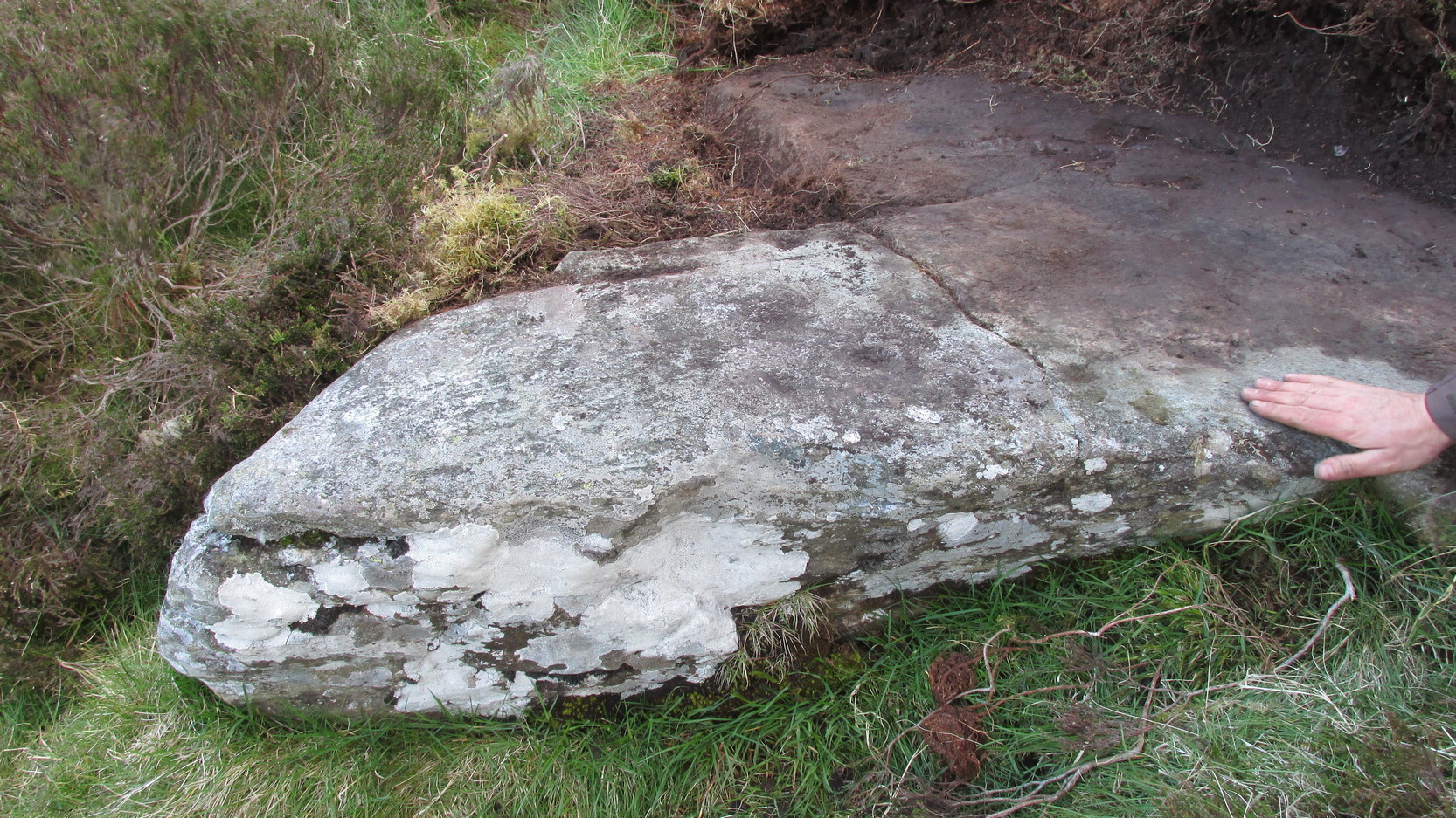
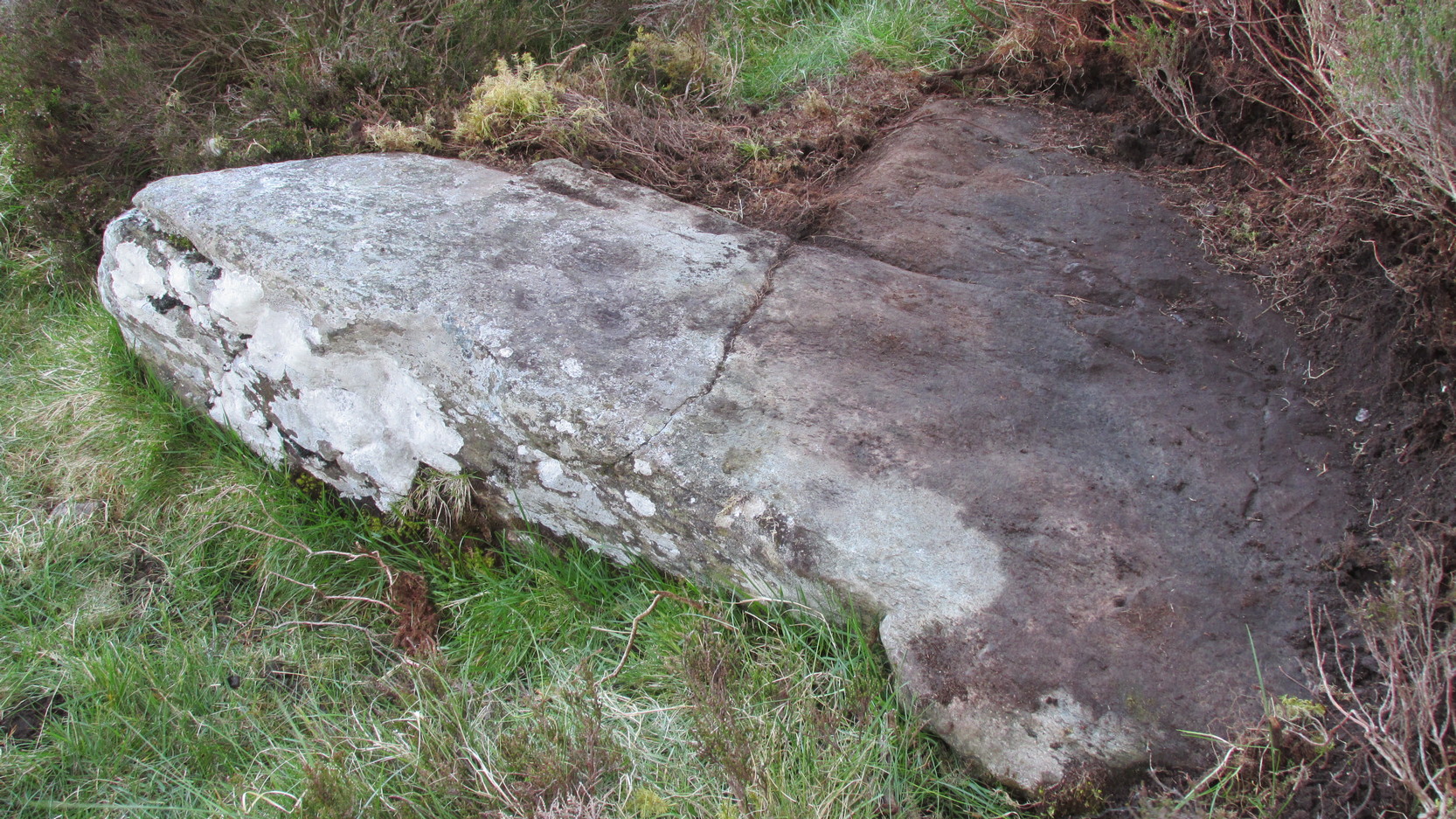
Drumderg (3) carving
On this T-square-shaped earthfast stone, a hundred-and-twenty yards north of the impressive Drumberg (2) petroglyph and just 10 yards below the remains of an impressive hut circle, we find this somewhat plain cup-marked design. It was covered pretty deeply beneath the heather when we came here and it took some time before we could see what we were looking at. The grey skies and poor daylight didn’t help matters either, as the cups were difficult to make out at first, but, thankfully, you can just about see them in the photos.
There are between five and seven shallow but distinct cup-markings on the flat surface, one of which may have a faint ring around it. In truth, this carving’s only gonna be for the real geeks amongst you.
We were up here again in July 2009, but I’ve still not been across onto the island itself — just stared from the lochside, dying to swim across and spend a night or three alone on the island amidst this legendary landscape. Basically, get to Talladale on the A832 (halfway between Gairloch and Kinlochewe), then walk up to the loch-side to your right (east) for a mile till you reach the small wooded outcrop. Look north, betwixt the two isles and its the one in the middle with the Crag of the Bull and Maire’s Cairn rising up the mountain face behind. But you can reach it via a boat trip from one of the local harbours. Staying there overnight however, would seem more troublesome. It seems that a winter visit seems best!
Folklore
This ‘holy well’ has a prodigious occult history which, sez my nose, is still maintained by one or two old Highland folk up here. This small island (one of many in this long loch) was the Isle of the Druids in old days: legend telling it to be the teaching ground of these shady priests. Even the Iona druids came here. The main relics on on the island are the old holy well, accompanied by an old legendary tree into which all local people flocked and wedged coins at least once in their life. This devotional rite eventually took its toll, with so many of the coins covering the old tree with metallic scales to a height of nine feet, eventually killing it.
The well itself was said to cure insanity — no doubt the remedial quality given to the waters after neophyte druids had spent many days of ritual solitude here, eventually sipping its life-giving fluid to revive them from their ordeal.
It eventually became sanctified by the Church: legend saying it was St. Maelrubha (the same dood who turned the healthy Applecross heathens into church-goers) who was the guilty party. Indeed, the name Maree itself, was proclaimed as deriving from this old saint, though local lore tells it to derive from the pagan ‘ane god Mourie.’
Elizabeth Sutherland (1985) reported that remains of the sacred tree were still visible. It is also said that no-one makes ritual commemmoration here anymore. Hmmmm… don’t always believe what you read.
In the 18th century, when Thomas Pennant visited this sacred well, he described that,
“in the midst is a circular dike of stones… I expect the dike to have originally been druidical, and that the ancient superstition of paganism had been taken up by the saint (Maelrubha) as the readiest method of making a conquest over the minds of the inhabitants.”
References:
Dixon, John, Gairloch in North-west Ross-Shire, Co-op: Edinburgh 1886.
MacKenzie, Kenneth C., Loch Maree: The Jewel in the Crown, privately printed 2002.
MacKinlay, James M., Folklore of Scottish Lochs and Springs, William Hodge: Glasgow 1893.
Pennant, Thomas, A Tour in Scotland and Voyage to the Hebrides, MDCCLXXII, John Monk: Chester 1774.
Polson, Alexander, Gairloch, George Souter: Dingwall 1920.
Sutherland, Elizabeth, Ravens and Black Rain, Constable: London 1985.
Watson, W.J., Place-Names of Ross and Cromarty, Northern Counties Printing: Inverness 1904.
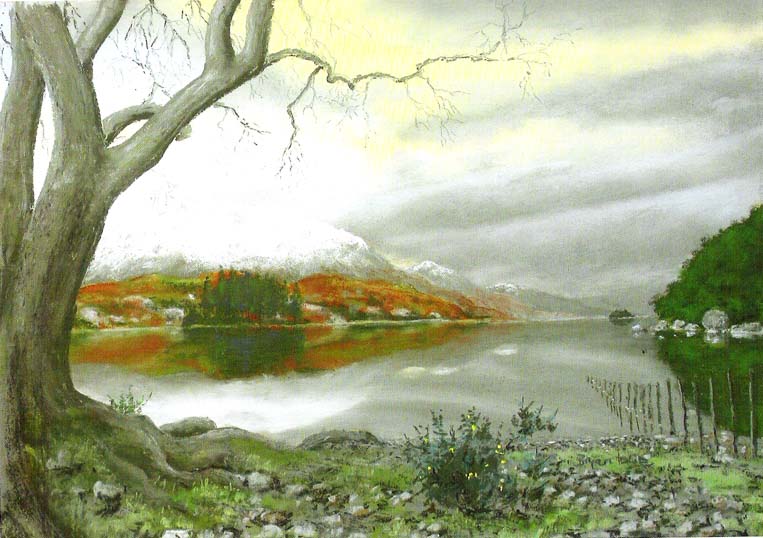
* This beautiful painting is one of many done by local artist, Bryan Islip. It is taken from his 2010 Calendar, Scotland’s Wester Ross, and is available direct from him. If you’d like to know more, or want copies of his calendar or other artworks, email him at: pico555@btopenworld.com – or check his website at www.picturesandpoems.co.uk