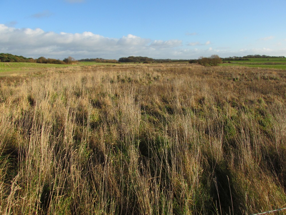
Stone Circle (destroyed): OS Grid Reference – NN 857 489
Archaeology & History
In an early essay on the rock art around Aberfeldy, Hugh MacMillan (1884) remarked on what he thought was a tumulus on the southern slope above the town and where a large old petroglyph once lived. Subsequently (MacMillan 1901), in his beautiful artistic foray through upper Tayside, he revised his earlier remarks telling that:
“On the side of a high, tree-covered hillock, rising up abruptly behind the central part of Aberfeldy, called the Tullich, there was once a Druidical circle, one of the huge stones of which, called the Clachmore, forms part of a garden wall on the old military road passing along its base.”
The circle was mentioned in Mackay’s (1954) excellent work, albeit in the past tense, and he could add no more to it other than his memory of the whereabouts of the Clach Mhor (as it was more accurately known), on which were numerous cup-markings. (Note: the grid-reference to this site is an approximation)
Folklore
In bygone times the people of Aberfeldy observed the celebration of Samhain, the old pre-christian New Year’s Day—a.k.a. Hallowe’en—on November 11th. Interestingly for us, “bonfires were numerous and there was always a great blaze on the Tullich,” said Dr John Kennedy. (1901) Considering the small area of The Tullich, it would be unusual if such festivities did not have some relationship with the stone circle. Samhain relates primarily to the passing over of the dead in the cycle of the year: the spirits of the ancestors moving through the worlds. If this circle had such a relationship with the bonfires, it may have been a ring cairn and not a free-standing stone circle.
References:
Kennedy, John, Old Highland Days, Religious Tract Society 1901.
Mackay, N.D., Aberfeldy Past and Present, Town Council: Aberfeldy 1954.
In days of olde an old stone cross used to stand “at the crossroads just outside the churchyard,” wrote Alfred Pope (1906); but even in his day he told that “the cross has long since disappeared.” He continued:
“The Rev A.S.B. Freer, vicar, informs the writer that the site is still known as ‘The Cross’, and is never called by any other name by the villagers.”
The church in the village is dedicated to All Saints, whose festival date was known in older times to be the pre-christian New Year’s Eve, or Halloween, when the spirits of the dead move across the landscape.
References:
Pope, Alfred, The Old Stone Crosses of Dorset, Chiswick Press: London 1906.
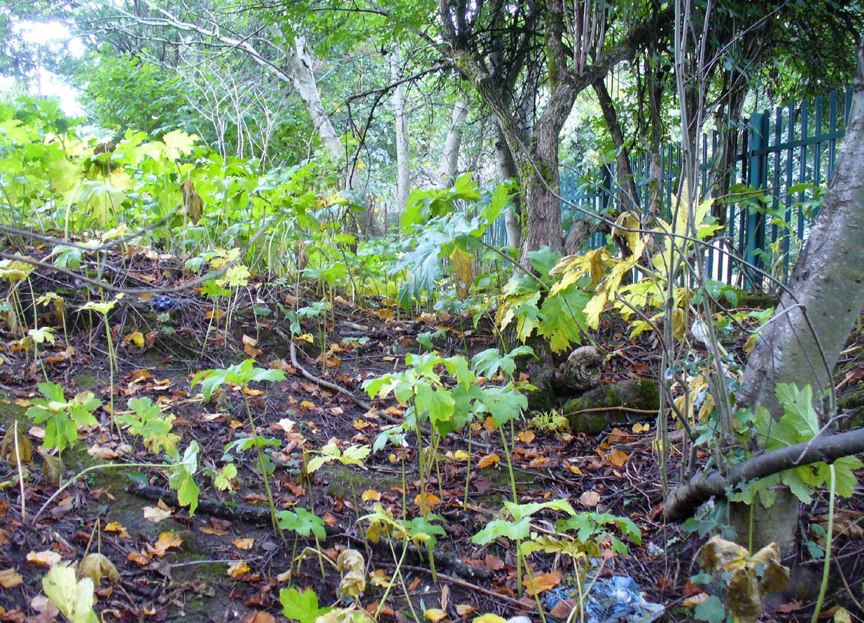
Site of St Conval’s Well, off-centre beneath the tree
This all-but-forgotten holy well was becoming nothing but a faded memory even in the middle of the 19th century. Excluded from all of the previous Scottish holy well surveys, the site is mentioned in George Campbell’s Eastwood (1902) where, in his description of the obscure saint, St. Conval or Convallus—to whom Eastwood parish was dedicated—the position of the well is mentioned. When St. Conval first came to the area, said Campbell,
“The particular spot which the saint selected for his cell would be determined, as was so commonly the case, by the then remarkable spring which can still be traced in the lower part of what was the glebe before the excambion in 1854. Within the memory of man, even of my own, as I resided for a year in the old manse, before its removal from the early site, this well, as stated in the last Statistical Account, discharged about eleven imperial pints a minute, and was perennial, affected neither by drought nor rain. Up to that date the water was sufficiently abundant to supply the manse and all the families in what was still a bit of a hamlet, the remains of the Kirkton, as it was formerly called. But coincident to the removal of the last living remains of an ecclesiastical establishment from the spot, it has well nigh dried-up, through disturbances caused, it is believed, by the working of pits and quarries in the neighbourhood; but it is confidently hoped that what remains of it may be preserved, and a memorial erected over it of the long-departed past, situated as it is within the enclosure of the now extended burial ground. There can be no doubt that in its waters our fathers were baptised when they renounced Druidism, or whatever was their pagan form of faith, and a sacredness would thus naturally attach to it in former times…”
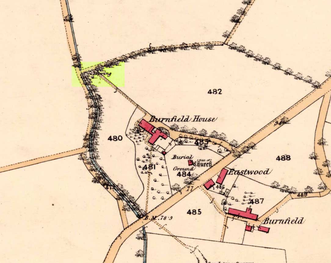
Site on 1863 map as ‘Spring’
When we sought out this well in the furthest corner of the old churchyard—where Ordnance Survey placed the ‘Spring’ on the 1863 map—we were greeted by a completely dried-up site, long since fallen back to Earth, with little hope of it ever resurfacing unless good local people choose to do something. The well was surrounded by excrement and litter and it truly needs a good clean-up and a dig down to bring the waters back to the surface.
In an Appendix to Campbell’s Eastwood, he tells that he came across a map-reference to the site, where it was shown as “St. Ninian’s Well”, but I have been unable to locate this.
The 6″ OS map of 1913 has a ‘Fairy Well’ marked on the northern edge of Preesall Hill. Travelling north through the village on the B5377, the Hill is to your right. Immediately past it is a stile, cross over this and go straight on with the hill to your right. The approximate site of the fairy well is now marked by a boggy area at the foot of the hill.
Archaeology & History
Almost a footnote in Reverend William Thornber’s 1852 paper on the Britons, Saxons and Danes in the Foreland of the Fylde, here is how this site is described by him in the quaint (to our eyes) language of the mid-nineteenth century:
“…the hill of Presal, (the ‘Pressonde’ of Domesday), with its well all but deified; and although the votaries, like those in the pool of Laconia, may not have cast into it cakes of bread-corn to Juno,* yet a bush was named ‘Beggar’s bush,’ from the circumstances of the offerings of rags and clouts being affixed to it, over which a prayer was said; for Bishop Hale ridicules a superstitious prayer for the blessing of clouts for the cure of diseases.”
In addition, the following reference was found on-line:
“…If the travellers had lingered, however, they would observe the inhabitants placing half eggshells on the edge of the Fairy Well at the foot of Preesall Hill; a practice of the local school children even at the beginning of the 20th century. Recording some of the traditions of the country areas of 19th century Wales, Sir John Rhys in his “Celtic Folklore”, mentioned how half eggshells were left out for the fairy folk to use as cooking pots in which to prepare food and brew beer for the reapers at harvest time.”
Close-up of the boggy waters
The Beggar’s Bush is long gone, but the red colour of the deposits in the adjoining ditches would indicate a chalybeate (iron-bearing) spring rather than a well, and the northern slope of the hill seems to have become an unofficial children’s play area. Curiously, at the top of the hill, next to the playground of the Fleetwood’s Charity School, there is a modern ‘beggar’s bush’, festooned with white and yellow plastic strips, in a small nature trail area…
* quoted from Borlase, in his Natural History of Cornwall (1758): “…In Laconia they cast into a pool, sacred to Juno, cakes of bread-corn; if they sunk, good was portended; if they swam, something dreadful was to ensue.”
¶ http://www.lancastrians4ever.homecall.co.uk/lancastrians4ever/precha1.htm – Believed to be an online digest of out of print Preesall history publications by Stan Jones
References:
Thornber, William, ‘Traces of the Britons, Saxons and Danes in the Foreland of the Fylde,’ in Proceedings and Papers of the Historic Society of Lancashire and Cheshire, Liverpool 1852.
Acknowledgements: – My thanks to the staff of the Local Studies Department, Borough of Blackpool Library Services for their assistance
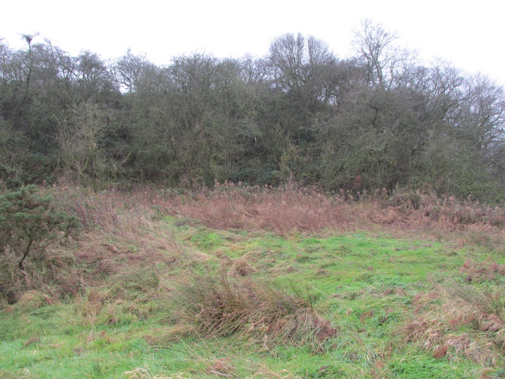
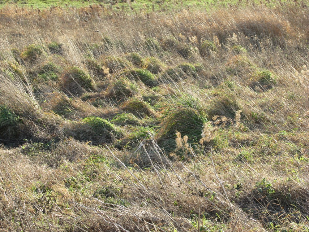
The boggy ground of the Bull Spring – from the site of possible cairn
To get here, leave Staining village along Mill Lane, turning right at the windmill along Smithy Lane. Walk along Smithy Lane, then 2-300 yards past a derelict piggery on the left go into the gated trackway on the right, and Bull Meadow is to the south-east, a boggy area at the western end of OS parcel 356. Be prepared to cross barbed wire fences.
Archaeology & History
Like the Staining Wrangdomwell or Fairy Spring recorded elsewhere, knowledge of this site owes its historical survival to the writings of Blackpool cleric, Rev. William Thornber (1803 – 1885), who wrote in 1851 about the now forgotton ‘Teanla’ or Hallowe’en bonfire cairns of Hardhorn:
“…but here adjoining the cairns are attached two wells, the one celebrated as Fairy or Wrangdomwell, and the other, issuing from a huge oblong mound of stones, as Bel spring or vulgarly Bull spring, in the Bull meadows, evidently bearing the same name as Beltain Meadow in Blackpool. Here on this Hardhorn oblong cairn, ceremonies were observed for the purpose of obtaining health to the herds of the farmers of the township – to free the wheat-land from tares, weed &c. – to bring good luck to the votaries, and to enquire into the secrets of futurity.
The ceremony was thus:- first, large fires were lighted, two or three families joining at a circular cairn, the ashes of which were carefully collected. Then the white stones, which at first, had circled the fire were thrown into the ashes, and being left all night, were sought with anxious care at sunrise, when the person who could not distinguish his own particular boulder was considered fey, i.e. some misfortune would happen to him, during the course of the ensuing year¹.
As a finale, the stones recognised were thrown, as an offering, on the oblong cairn to the god or saint who presided over it, and the well, and thus, such collections were made in a succession of years, as to astonish the curious. The water of the wells also had a sovereign virtue for healing the disease of men and cattle….”
The healing procedure at the wells is transcribed in the description of the nearby Fairy Well. Mr Thornber continues:
“The site of the large circular cairn (at Bull Meadow) is not now easily to be distinguished, since Mr. Fisher, the proprietor of the field, has carted away upwards of twenty loads of the refuse that composed it, but the soil around it is burnt red and black. This farce was carried on in its pristine glory long after the reformation; for rational Christianity (sic), which had been almost lost previously, progressed but slowly in the district of the Fylde. Even the waters of Marton Mere (SW of Bull Meadow),…were held sacred.”
Perusal was made of the Schedule to the 1839 Tithe map which revealed a ‘Bull Meadow’, owned and occupied by William Fisher, and from this, its location was able to be identified on the OS map.
Possible source of the waters
Like Wrangdom Well, half a mile to the north-west, the Bull Spring issues from an area of swampy ground, and the exact place of issue was hard to pinpoint when this writer visited in December (see photo the right). The oblong cairn—if indeed that is what it is—can still be identified, about 2 feet above the marsh, it is firm to stand on but not easy to distinguish owing to the amount of vegetation.
¹ Writing in the January 1883 edition of the The Folk-lore Journal, the Reverend Walter Gregor describes ‘ristin the halla-fire’ a broadly similar Scottish ritual carried on in the Fraserburgh area up to the late 18th century.
References:
Thornber, William, ‘Traces of the Britons, Saxons and Danes in the Foreland of the Fylde,’ in Proceedings and Papers of the Historic Society of Lancashire and Cheshire, Liverpool 1852.
Tithe Map & Schedule Transcript – ‘The Township of Hardhorn with Newton’ Surveyed by Thomas Hull in 1838, with Schedule dated 1839.’
Acknowledgement: My thanks to the staff of the Local Studies Department, Borough of Blackpool Library Services for their assistance.
One and a half centuries of neglect have not been kind to the Wrangdomwell, which is now in the middle of a large area of swampy land, reached from Staining village along Mill Lane, turning right at the windmill then walking along Smithy Lane. Just before a derelict piggery on the left go into the field, and Wrong Well Meadow is on the right at the back of the piggery, with the spring issuing from the boggy ground. Be prepared to cross barbed wire fences, and to meet some friendly ponies.
Archaeology & History
Were it not for the researches and writings of an eccentric cleric, this site would almost certainly now be lost to history. The Reverend William Thornber recorded, in his 1837 History of Blackpool that:
“The fairies of our fathers…were kind good natured creatures, at times seeking the assistance of mortals, and in return liberally rewarding them. They had a favourite spot between Hardhorn and Staining, at a cold spring of water, called Fairies’ Well to this day.”
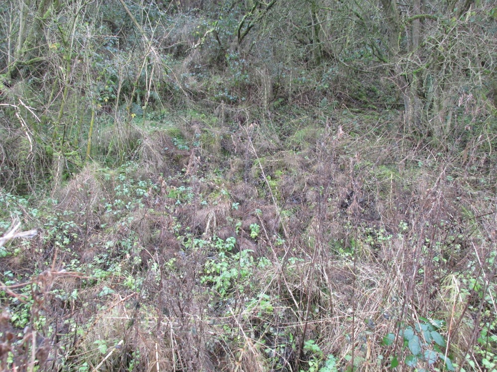
The legendary waters hide in the rushes
Writing in a paper published in 1851, Thornber described the Fairy Well or Wrangdomwell in the context of the “Teanlas”, the enormous Hallowe’en bonfires (4) that were still at that time being lit at ritual cairns of stones in parts of west Lancashire. One of these fire cairns once adjoined the Fairy Well, which in 1850 was still being visited for its,
“sovereign virtue for healing the diseases of men and cattle. To succeed in obtaining a cure, the patient, escorted by his friends, was made to pass through the cairn, then he was sprinkled or dipped in the well, and lastly, he made an offering of a shell, pin, a rusty nail or a rag, but principally three white stones burnt in the Teanla fire. It is surprising in what numbers pieces of iron may be picked up. I have found since the meadows were ploughed, nails, an old shaped knife, leather thongs etc.”
Thornber wrote that the cairn no longer existed, and gave no precise location for the well.
Looking at the area between Hardhorn and Staining on the 1891 25″ OS map revealed only one ‘spring’; in land parcel 295. This parcel of land is recorded in the Schedule to the 1839 Tithe map as ‘Wrong Well Meadow’, occupied by Thomas Dobson, and owned by ‘School of Marton’, a charitable endowment established in 1717. Adjoining Wrong Well Meadow are Old Meadow and Nickers Meadow (‘Old Nick’?), which might appear to show the Wrangdomwell as in the past having been part of a larger heathen ritual locality. Notwithstanding this, the Church was happy to take its tithe.
References:
Thornber, William, The History of Blackpool, Smith Market Place: Poulton-le-Fylde 1837 (republished in 1985 by the Blackpool and Fylde Historical Society).
Thornber, William, ‘Traces of the Britons, Saxons and Danes in the Foreland of the Fylde,’ in Proceedings and Papers of the Historic Society of Lancashire and Cheshire, Liverpool 1852.
Tithe Map & Schedule Transcript, ‘The Township of Hardhorn with Newton’ Surveyed by Thomas Hull in 1838, with Schedule dated 1839.’
Michelle Harris & Brian Hughes, in their ‘The History of the Wyre from Harold the Elk to Cardinal Allen‘ (4th ed. 2007) p35, write – “According to Tom C. Smith’s ‘History of the Parish of Chipping‘ published in 1891: ‘Teanlaes was the name given to fire celebrations, observed until quite recent years on May 1st, Midsummer Day, August 31st, and November 1st.’ These dates, it should be said, are at variance with Henry Taylor who, in his 1899 publication ‘Ancient Crosses of Lancashire’, quotes Atticus as saying: ‘The ceremony observed on Teanlow night, the last night of October, consisted of making bonfires on all the neighbouring hills.'”
Acknowledgements: My thanks to the staff of the Local Studies Department, Borough of Blackpool Library Services for their assistance.
From Ford village, take the track that goes uphill (west) running near the edge of the forest-line. Keep going until you hit the top of the forest and the large rocky hill above you (on your right) is where you need to be heading. The rise to your left is Dun Chonallaich. Walk around the bottom of the hill until you get to the other side (you should be 100 yards or more above the tree-line) where you’ll notice a ‘pass’ running west, with a rocky knoll above you on your right. That’s it!
Archaeology & History
Thought to date from the Iron Age, the remains here cover an area 15 yards by about 25 yards. Remains of walling around the edge of the summit nearly a yard wide in places define quite clearly where the ‘fort’ was centred. The entrance to the site was found on the northwestern side. In more recent times however, animal pens have intruded on the remains here and the archaeological remnants are much denuded.
Folklore
Samhain fires were lit on the larger ridge above this ruined fort until recent years, as some old local folk will tell you. These Halloween fires (done to celebrate the old New Year) were stopped a short time after the new ‘owner’ of the Auchinellan Estate (on whose land Dun Dubh is found) took exception to them and, for all intent and purpose, deemed them a fire hazard! The lady in question who inherited the Estate was in fact a devout christian who took exception to the local “pagan” goings-on, contrary to the beliefs of the previous Estate owner, who not only allowed such old events, but played a part in them. Local folk hereabouts, not surprisingly, aint too keen on their part-time dictatorial christian neighbour.
The fires up here were also related to the linear cemetery at Kilmartin. Here the giant tombs all line up & point to Dun Chonallaich, behind which hides the more flattened top of Dun Dubh. When the Halloween fires were lit on top of this, the glow from behind the great pyramid of Chonallaich all the way down the Valley of the Kings, was spectacular! One wonders just how long the local people had been doing this. Quite a long time I imagine….
References:
Royal Commission on the Ancient & Historical Monuments, Scotland, Argyll – volume 6, HMSO: Edinburgh 1988.
Pretty easy really. Get to the ancient St. Michael’s Church on the dead-end road just outside of Linton village. As you approach it, look into the field on your right. Y’ can’t miss it!
Archaeology & History
Linton ‘Standing Stone’
This is an oddity. It could perhaps be little more than one of the Norber erratics found a few miles further north — but it looks more like a smaller version of one of the Avebury sarsens! Just under six-feet tall, it was shown to me by Adrian Lord yesterday (when the heavens subsequently opened and an outstanding downpour-and-half followed), who’d come across it only a week or two earlier themselves when they visited the ancient church next door. The stone certainly aint in any archaeology registers (no surprise there); and as one local man we spoke to yesterday told us, “there used to be several other standing stones in the same field, cos I remember ’em when I was a kid. ” The gent we spoke to seemed to know just about everything about the local archaeology and history of the area (one of those “damn good locals” you’re sometimes lucky to find!). He told us that the other stones which used to be there had been moved by the local farmer over the years, for use in his walls. So it seems that this is the last one standing. What looks like several other fallen stones can be seen further down the field, just next to the church. But this one’s pretty impressive.
Close-up of gnarled rockLooking south-ish!
The church of St. Michael next door was, tells the information inside, built upon some old pagan site — which gives added thought to this upright stone perhaps being the ruin of an old circle, or summat along those lines. The church, incidentally, is built right next to the River Wharfe.
Not far from here we find an almost inexhaustible supply of prehistoric remains at Grassington and district (less than a mile north). A huge excess of Bronze- and Iron Age remains scatter the fields all round the town. And aswell as the Yarnbury henge close by, there is — our local man told us, “another one which no-one knows abaat, not far away”!
Folklore
The folklore of this area is prodigious! There is faerie-lore, underworld tales, healing wells, black-dogs, ghosts, earthlights – tons of the damn stuff. But with such a mass of prehistoric remains, that aint too surprising. And although there appears no direct reference to this particular stone (cos I can’t find a damn reference about it), the old Yorkshire history magus, Harry Speight (1900), wrote of something a short distance away along the lane from the church. He told that,
“In the field-wall beside the road may be seen some huge glacial boulders, and there is one very large one standing alone in the adjoining field, which from one point of view bears a striking resemblance to a human visage; and a notion prevails among the young folk of the neighbourhood that this stone will fall on its face when it hears the cock crow.”
Just the sort of lore we find attached to some other standing stones in certain parts of the country. And in fact, from some angles, this ‘ere stone has the simulacrum of a face upon it; so this could be the one Speight mentions (though his directions would be, unusually, a little out).
There are heathen oddities about the church aswell: distinctly pre-christian ones. An old “posset-pot” was used for local families to drink from after the celebration of a birth, wedding or funeral here. And at Hallowtide – the old heathen New Year’s Day,
“certain herbs possessed the power of enabling those who were inclined to see their future husbands or wives, or even recognizing who was to die in the near future.”
And in an invocation of the great heathen god (the Church called it the devil), Speight also went on to tell that:
“The practice at Linton was to walk seven times round the church when the doomed one would appear.”
In a watered down version of this, local people found guilty of minor transgressions in and around Linton (thieves, fighters, piss-heads, etc),
“was compelled to seek expiation by walking three time around Linton Church.”
This would allegedly cure them of their ‘sins’! Rush-bearing ceremonies were also enacted here. On the hill above, the faerie-folk lived. And until recently, time itself was still being measured by the three stages of the day: sunrise, midday and sunset; avoiding the modern contrivances of the clock, and maintaining the old pre-christian tradition of time-keeping. Much more remains hidden…
References:
Speight, Harry, Upper Wharfedale, Elliott Stock: London 1900.