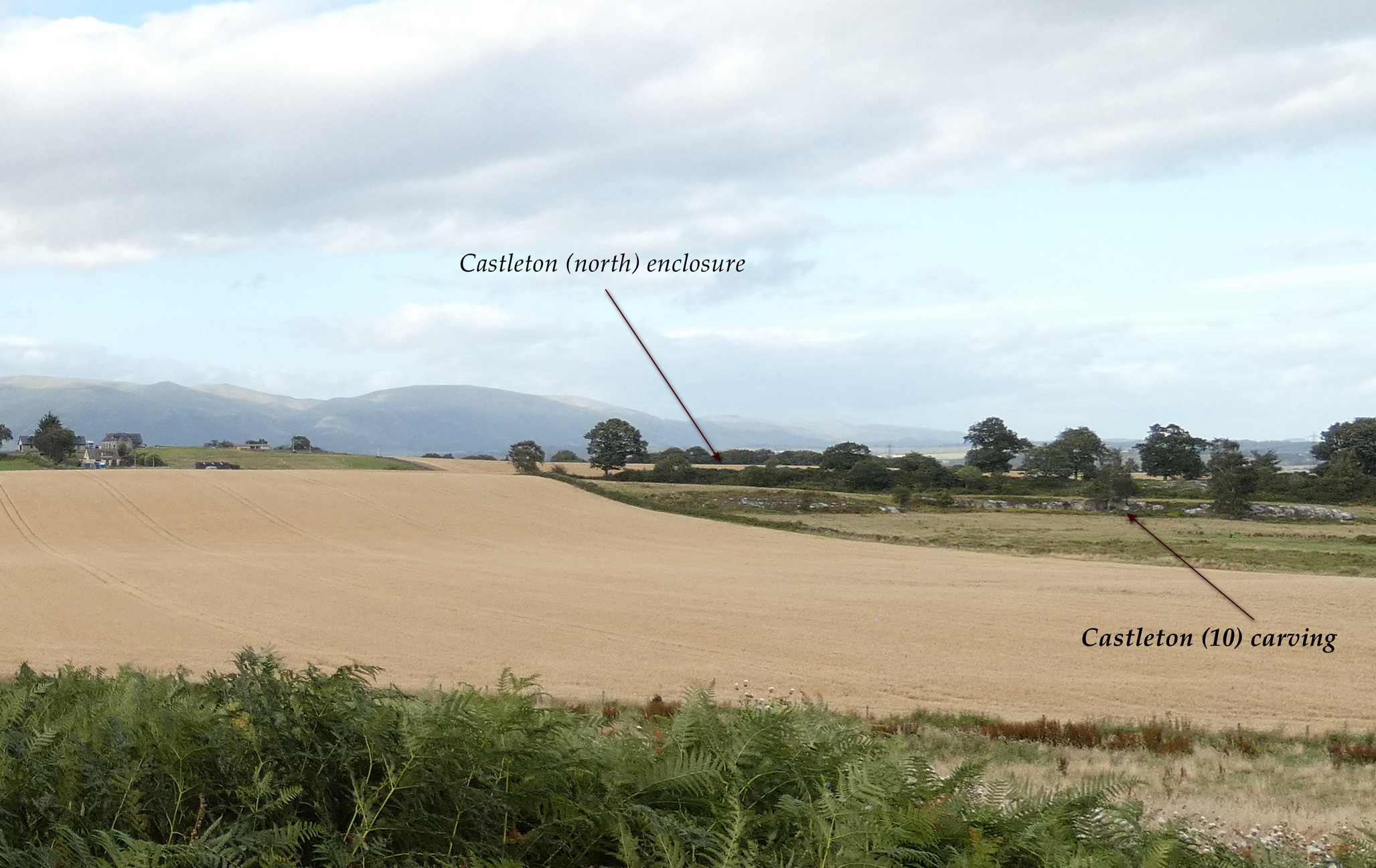
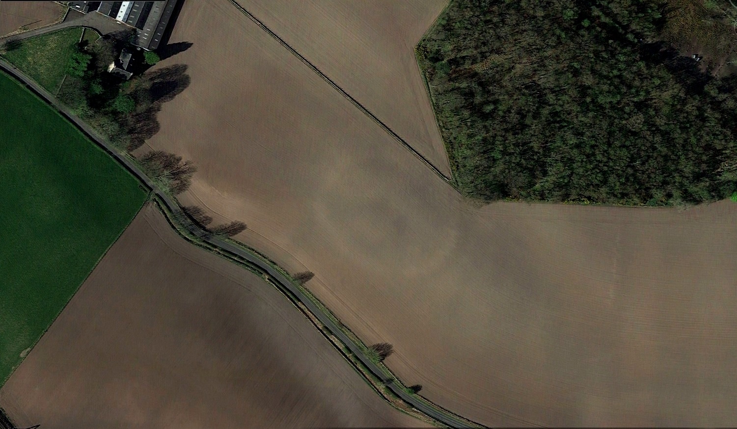
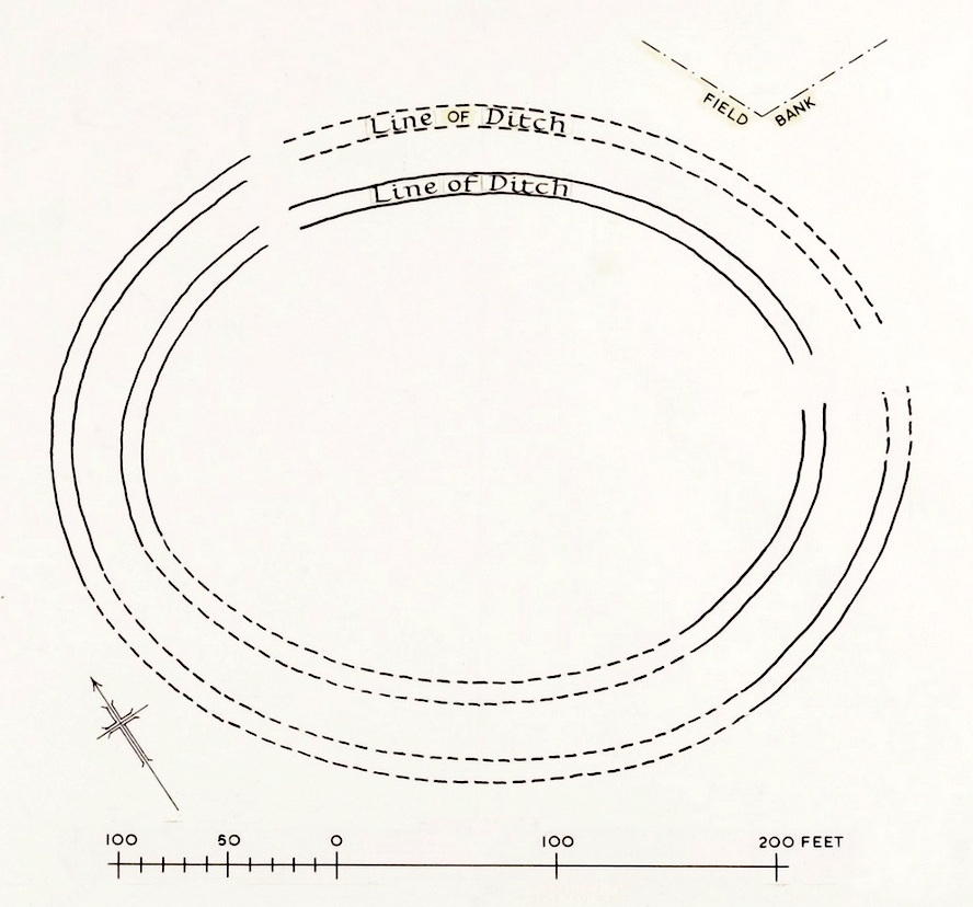
In the fields immediately above the northernmost of the Castleton petroglyphs, there was, in bygone times, a prehistoric settlement, forgotten and cast even from folk memory until very recently, when aerial photography revealed the ghostly outline of its former existence. Similar in design, but somewhat smaller than the prehistoric Gallamuir enclosure a half-mile southwest of the Castleton carvings, this double-ringed oval enclosure—thought by archaeologists to have been defined all round with large wooden stakes, or palisaded—measures, from outer edge to outer edge, 65 yards (SE to NW) across its longer axis, by 55 yards (SW to NE). The gap between the trenches that define the inner and outer wooden ‘walls’ is between five and six yards apart all round it. The entrance to the enclosure seems to have been on its southeastern side—although an excavation is needed to be sure about this. Sadly, almost nothing can be seen of the site at ground level. An archaeo-dig would be a good idea. 🙂
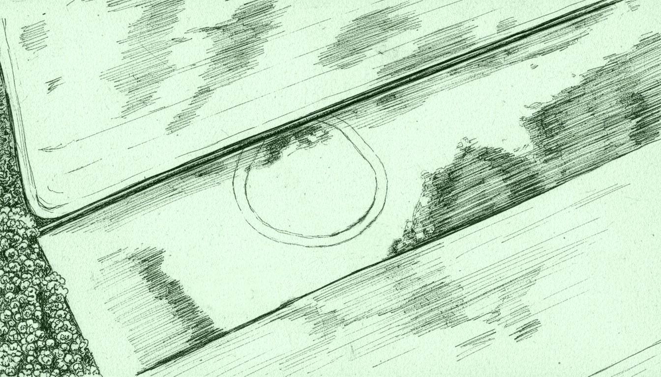
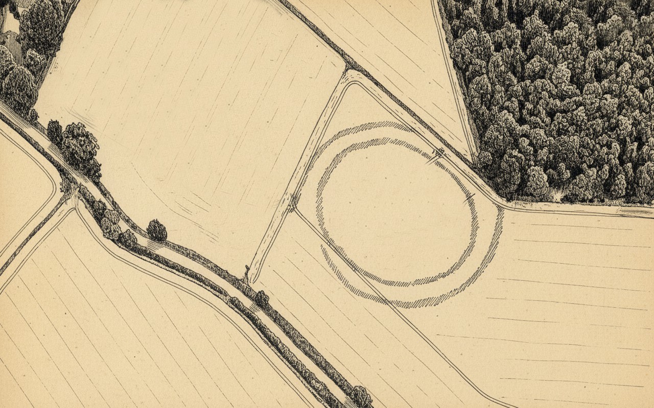
Rough sketch of site-plan
‘Palisade enclosures’ tend to be neolithic in origin and were in use for many centuries, sweeping into the Bronze Age. I highlight this long period in time due to the proximity of the extensive and very ornate cup-and-ring carvings that start just 300 yards southwest of the settlement on the first rock outcrop that you meet. It’s a good one too! Petroglyphs were also created mainly during the neolithic and Bronze Age periods; and as the enclosure here is on the slight rise in the land overlooking the various small rocky ridges below, many of which are decorated in ornate cup-and-rings, it’s likely that some of the people who lived here were probably the people who did them…
Just over a half-mile (1km) south-west of the major rock art complex at Castleton, in the fields just east of Gallamuir Farm on the north side of the B9124 road, could once be seen a decent double-ringed enclosure, prehistoric in nature. At ground level today there is nothing to be seen as agricultural practices have ever so slowly eroded it away. It wasn’t in a good state when the dudes from Royal Commission (1963) had a look at it in October, 1951—although they did tell us that some faint remnants were discernible, but it was fading fast! They wrote:
“No traces of this structure can normally be seen on the surface, but at the date of visit, when the site was covered with wheat stubble, stretches of both ditches were clearly visible, as shown on the plan (below), by reason of the stronger growth of the stubble overlying them. The ditches are from 20ft to 30ft apart, and the enclosed area measures 300ft from ESE to WNW, by about 240ft transversely. Two narrow gaps in the inner ditch on the north and east arcs respectively, may represent original entrances.”
Outline sketch of the enclosureRoyal Commission plan
Nothing remains of it today apart from the shadow-marks of its former existence when looked down from above. The double embankment that constituted the enclosure initially suggested it to be Iron Age in nature, akin to the larger hillforts up and down the country, but the outline is more consistent of a standard settlement enclosure. As far as I’m aware, no excavations have taken place here, so we’re at a loss to know whether the people living here had anything to do with the rock art just across the fields at Castleton. If we found that it had a Bronze Age or neolithic date, a connection could be likely. But we may have to look at the enclosure immediately north of the Castleton complex to be more sure of our petroglyphic culprits….
References:
Lock, Gary & Ralston, Ian, An Atlas of Hillforts of Great Britain and Ireland, Edinburgh University Press 2022.
Royal Commission on the Ancient & Historical Monuments Scotland, Stirling – volume 2, HMSO: Edinburgh 1963.
Royal Commission on the Ancient & Historical Monuments of Scotland, Archaeological Sites and Monuments of Stirling District, Central Region, Society of Antiquaries of Scotland 1979.
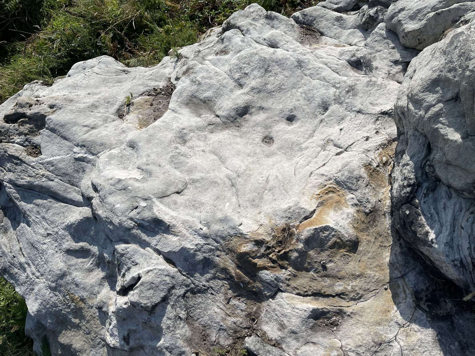
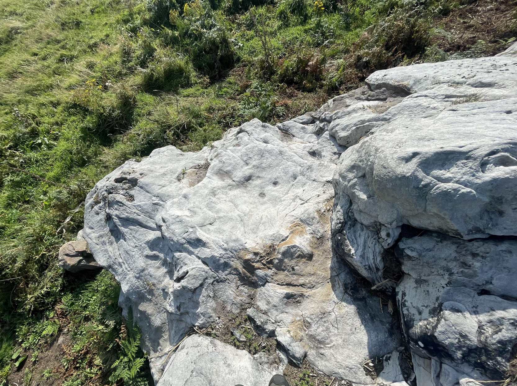
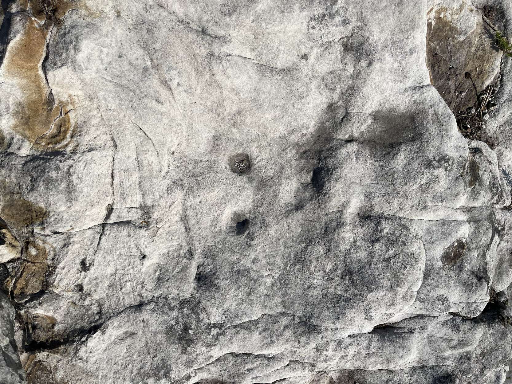
Follow the directions as if you’re visiting the impressive multi-ringed design of the Castleton (10) carving. Once there, walk south-east along the geological ridge for 45 yards where the small cliff drops down to the field. Just where this drop occurs, on a lower horizontal level of the rock face (only a small section) you’ll notice two distinct “cups”. You can’t really miss it!
Archaeology & History
This very basic cup-marked stone was, until recently, covered in dense gorse, making access to the site almost impossible. But following a fire that happened here not too long ago, the smoldering remains needed to be cleared and, once the job was done, we were able to see the two distinct ‘cups’ that were first described in Maarten van Hoek’s (1996) survey. But the cups that he described are, most likely, little more than Nature’s handiwork. I’m somewhat skeptical of them as being the real deal. In the same survey, he added another site, which are just natural bowls in the rock just over 100 yards southwest of here as being cup-marks — which they’re not!
References:
van Hoek, M.A.M.,”Prehistoric Rock Art around Castleton Farm, Airth,” in Forth Naturalist & Historian, volume 19, 1996.
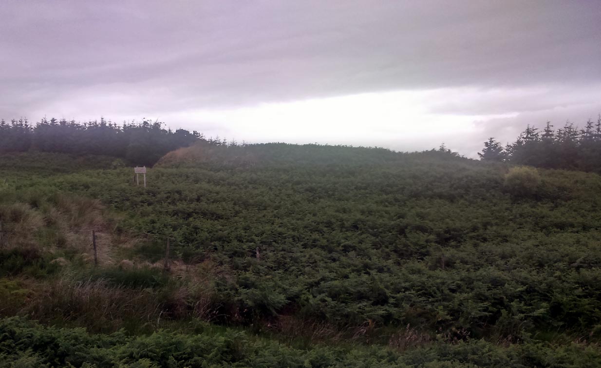
Going west out of Stirling or St Ninians, you need to take the minor road/s that cross the M9 and head past the wooded hills, past Graystale and Wallstale. A mile or so on, keep right when you hit the small road junction past Shielbrae. A mile past here, where the edges of the road disappears into the moors and the forest grows to your right, park up where the small parking spot takes you down the track into the trees on the right-side. Walk down here for a coupla hundred yards and keep yer eyes peeled for the rounded fairy-mound on the heaths about 30 yards above you.
Archaeology & History
When we visited this place a few weeks ago, the Dark was almost upon us when we arrived and the clouds were low with a deathly silent mist breathing from the trees and reaching up to meet the low clouds not far above. It was a curious feeling, borne from the darkening landscape, feeling almost as if the dead were around us—which I suppose they were, in this prehistoric tomb at least. At the clap of our hands, a great echo rang loudly from the misty silence and the land in which it lived. Twas almost hypnotic in its lull…..
Looking to the NW
King’s Yett cairn, looking NE
This site isn’t always gonna have this feel to it of course. If we’d have visited it on a nice clean blue-sky day, no such feelings would have greeted us—and the tomb would, perhaps, have been little more than an uninteresting-looking mound, overgrown with heather and grasses. But Nature breathes and casts such entrancements to our central nervous system every now and then—and such states are as worthy of sincere attention as any intellect preys to insist otherwise…. and I should know!
The King’s Yett cairn has yet to be excavated, but it has all the hallmarks of a traditional Bronze Age signature in its structure. When the Royal Commission lads came here in 1954, after a report describing the mound, their brief account of it (1963:1) later told, simply:
“A cairn is situated on open moorland, a quarter of a mile W of King’s Yett, at an elevation of 950ft OD. It consists of a grass-covered, stony mound which measures about 30ft in diameter and stands to a height of 4ft 6in. A rectangular boulder which lies in the S arc of the base of the cairn, and which appears to be in situ, may have formed part of a peristalith.” (i.e., an encircling ring of stones, PB)
Adjacent circular mound nearby
This singular fallen stone is now covered in vegetation and there is little evidence of any stone circle around the tomb. But immediately west, 70 yards WNW on the other side of the forestry track, rises an even larger circular mound, deeply covered in heather and consisting of earth and stones beneath the surface. It looks for all the world like another giant cairn (up to 6ft high and measuring about 26 yards (23.9m) E-W, by 27.5 yards (25.2m) N-S) upon which new trees have recently been planted. It might not be, of course—but we’re gonna look at this again when She gives us more daylight and clearer skies…..just in case…
Locally there are various tales of the Sma’ Folk or little people, fallaciously ascribed by romantic intellectuals as ethereal spirits, but which were and are known to have been tribal people in these uplands; and although such stories excel in this area, we have nothing specific relating to the rounded mound of King’s Yett – yet!
References:
Royal Commission on the Ancient & Historical Monuments Scotland, Stirling – volume 1, HMSO: Edinburgh 1963.
Royal Commission on the Ancient & Historical Monuments of Scotland, Archaeological Sites and Monuments of Stirling District, Central Region, Society of Antiquaries of Scotland 1979.
West of Dunipace and the M9, go along the B818 for 3-4 miles until you hit the pub at the tiny crossroads of Carron Bridge. Take the lonely road up to your right and after several miles, just where the forest on your left finishes, a bend in the road takes you over a small river. Stop here and walk up the track left, to Craigengelt. Before you reach the farmhouse at the end, note a small clump of trees ahead of you. Just before this, a seemingly natural rounded hillock in the field, just off the trackside, is where the monument used to be.
Archaeology & History
No trace remains of this once-important and seemingly impressive prehistoric ‘tomb’ or ritual death chamber, just off the trackside before old Craigengelt farmhouse. The standard history of the site, repeated variously by Royal Commission (1963) and elsewhere, was first sourced in the New Statistical Account of the region in 1845:
“About two years ago the tenant was engaged in levelling and improving a field on the eastern extremity of Craigengelt in which there was a large cairn or mound, known in the country by the name of the “Ghost’s Knowe.” It was quite circular, exactly 300 feet in circumference at the base, and which was flanked around by twelve very large stones, placed at equal distances, and it was 12 feet high, with a slight inclination to one side, and fiat on top. On removing the turf and soil, it was found that the interior consisted of large and small stories built together with great care, which led the proprietor to think that it must have been a place of Druidical sepulture.
“About 6 feet from the centre, there stood four upright stones, each about 3 feet in height, describing an oblong figure like a bed. Within this a coffin was found, the length of which was about 7 feet, at broad, and at deep. The under part or bottom of the coffin was whin-flag, as was also the upper part or lid. Within this were found the remains of a human body of the ordinary size. The hones, except a very small part of the skull, were of the consistence of soft chalk, the body had been enveloped in something like a mixture of decayed vegetable matter and tar, which, when exposed to the atmosphere, emitted a strong odour.
“Strict orders were given to the labourers that if anything like a coffin should be found, they were not to open it until either the proprietor or tenant were present. But one of them, an old schoolmaster, who knew something of antiquities, went during the night, and carried off a variety of articles, the nature and number of which are not now likely ever to be ascertained. With reluctance, he gave up a stone axe of beautiful workmanship and a gold ring. The ring had had a jewel in it; but the jewel was out, and it was what is called “chased,” and must have been worn on a very small finger. A labourer in the neighbourhood sold a variety of things of a rare description to a gentleman in whose possession, it is believed, they still are. The axe and the ring were the only things obtained by the proprietor, J. Dick, Esq. of Craigengelt, and they are still in his possession.”
When Daniel Wilson (1851) visited the site a few years later, he discovered a little more about the valuable items discovered in the tomb:
“among which was a golden horn or cup, weighing fourteen ounces, and ornamented with chased or embossed figures. This interesting relic was purchased from one of the labourers by a gentleman in Stirling, and is believed to be still in existence, though I have failed, after repeated applications, in obtaining access to it. The exact nature or value of the whole contents of this cairn is not likely ever to be ascertained. The only articles secured by the proprietor, and now in his possession, are a highly polished stone axe or hammer, eight inches long, rounded at one end and tapering at the other; a knife or dagger of the same material, eighteen inches long, which was broken by one of the stones falling on it when opening the cist; and a small gold finger-ring, chased and apparently originally jewelled, though the settings have fallen out.”
The structure of the Ghost’s Knowe is similar in size and stature to another, large unrecorded round cairn or tumulus, 2.25 miles (3.62km) NNW of here, that still requires our full attention.
Folklore
Despite the name and the tale said by local people that “the place was haunted”, I can find no details that tell the story of the hauntings here. Does anyone know?
References:
Royal Commission on the Ancient & Historical Monuments Scotland, Stirling – volume 1, HMSO: Edinburgh 1963.
Royal Commission on the Ancient & Historical Monuments of Scotland, Archaeological Sites and Monuments of Stirling District, Central Region, Society of Antiquaries of Scotland 1979.
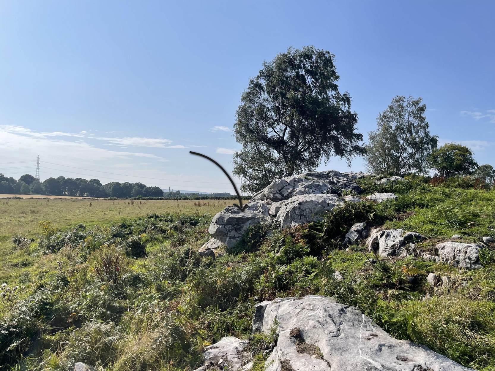
Take the Gateside Road from St Ninians or Polmaise Road out of Torbrex across the M9, heading out west onto the southern moors of Touch Hills, passing the Wallstale dun in the trees and then the Castlehill dun just off the road. Keep going uphill for just over half-a-mile, keeping your eyes peeled on the right for where the MOD lads play some of their war-games. Walk along the track here, following the line of the woods, until it gets to the spot where it doubles back on itself. Just here, about 30 yards in front of you, a rounded walled knoll gives the game away!
Archaeology & History
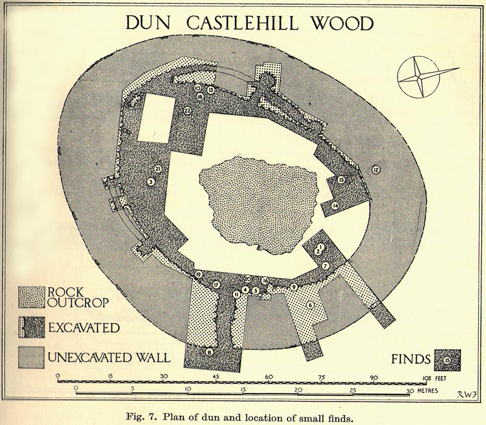
Artists impression of the reconstructed site (PSAS 1959)
An impressive-looking site, not too far off the moorland road, it is one of more than half a dozen hillforts and duns found to the west of Stirling, all of them relatively close to each other—showing that a lot of human activity was going on here in the Iron Age and, probably, much earlier. Looking like a cross between a broch and a traditional hillfort, the site is best visited in the Winter and Spring months before the bracken starts to encroach and cover it.
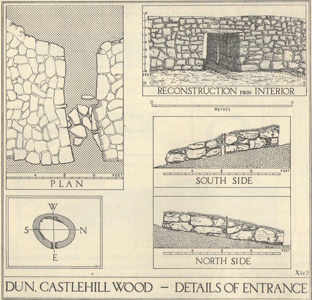
Officially rediscovered in 1952 and excavated three years later, it was thought to have been built in the 1st century AD and used for a few hundred years thereafter. As you walk up to the eastern edge of the monument, a large entrance, 4½ feet wide, allows you into the large open space within. From here, and walking around both the inner and outer walls, you get an idea of the huge amount of work it must have taken to build this structure. The walls alone which constitute the main of Castlewood Dun are, on average, 16 feet thick! The Royal Commission report for the area (summarizing the archaeological work of F.W. Feacham in the ’50s) gives the basic architectural features of the place:
“The dun is oval in plan…and measures 75ft from NE to SW, transversely within a drystone wall 16ft thick. The faces of the wall are composed of large, angular blocks, and the core of boulders, small rubble and earth. The entrance in the E arc, is provided with door-checks. Within these, the passage measures 4ft 6in in width, and outside them 3ft 9in. A few paving-stones were laid to level the rough rock surface of the passage-floor. Traces of what might have been the bottom step of a stair, rising up the inner face of the wall, were found at a point 8ft N of the entrance. The dun had no mural stair or galleries, but two sets of mural chambers were located, one in the W and the other in the S acr of the wall. The former consisted of an entrance-passage, 6ft in length, which varied in width from 2ft at the outer to 3ft at the inner end, where it opened into a circular chamber 4ft in diameter. From either side of the passage a narrow duct or flue, about 19ft in length and 1ft 6in in width, led off obliquely through the core of the wall to debouch into the interior of the dun. The construction in the S arc consisted of a similar passage, one flue and a smaller chamber. Ash and a clinker of very light weight were found in the form of deposits in both passages and all the flues. …The excavator suggested they might have been corn-drying installations.”
Groundplan of site (PSAS 1959)
Entrance details (PSAS 1959)
Apart from a small piece of Roman glass, quern fragments, anvils stones and a pot lid, the excavators found very little inside the dun—not even any hearths. The walling on the southwest and western edges was built onto a small cliff, making access slightly difficult from that side.
From the site itself, views are excellent, particularly in an arc through the north, east and southeast, with the western skylines being only a short distance away. This enabled relatively easy tribal communication with people at the other brochs, duns and forts in the area, across an otherwise large but difficult landscape in prehistoric times. A few hundred yards to the northeast, on the other side of the recently planted tree-farm (forestry plantation), a large D-shaped structure—possibly Iron Age, possibly medieval— is accompanied by lines of ancient walling running down the slopes.
An impressive prehistoric cairn of some considerable size was in evidence on the lands of Old Sauchie, near Sauchie farmhouse, until the Industrial Age brought an end to its presence. First mentioned in the New Statistical Account (‘Stirlingshire’, volume 7), the Royal Commission lads reported,
“Nothing now remains of the cairn that once existed ‘on the lands of Sauchie’, about 3 miles SSW of Stirling. It was examined in the early 19th century and is said to have measured more than 20ft in height and 90ft in diameter, to have been made of stones, and to have contained two cists, one somewhat larger than the other. It is possible that Wilson (1863) is referring to this cairn when he mentions a quantity of ‘silver coins recently found in a cist exposed on the demolition of a cairn on the lands of Sauchie.’ The coins were very thin, and were described as having been ‘struck through from the back,’ with ‘figures’ on one side only. Some of them had loops for suspension, and there can be little doubt that they were silver bracteates. All have been dispersed and lost.”
If anyone has further information about this obviously important and seemingly lost site, please let us know!
References:
Royal Commission on the Ancient & Historical Monuments, Scotland, Stirlingshire – volume 1, HMSO: Edinburgh 1963.
Wilson, Daniel, The Archaeology and Prehistoric Annals of Scotland – volume 2, Sutherland & Knox: Edinburgh 1863.
To be found on the wooded hill about 160 yards north of Wallstale Farm, on the Polmaise Road on the western side of the M9, a mile or so south of Cambusbarron, below the hugely impressive Murrayshall Quarries. Walk up the steep slope into the woodland and when you reach the level you’ll find the stonework remains. It’s on the edge of the slope in the trees.
Archaeology & History
This old fortified walled structure is best seen in the winter months when all the vegetation has fallen back to Earth. If you come here in the summer, the woods are nice but the monument can’t be seen as clearly. Found at the top of the slope above the roadside, it was described in the Stirlingshire Royal Commission (1963) account as follows:
Ground-plan of Wallstale Dun (after RCAHMS 1963)
Wallstale Dun, up there somewhere!
“It is almost circular in plan…measuring about 45ft in diameter within a ruined stone wall some 11ft in thickness. Except on the ESE side, where the entrance was probably situated, the wall can be traced continuously by patches of rubble core, and round the east half outer facing-stones are visible up to a maximum height of four courses. In contrast, the inner face is only exposed for a short distance on the ENE. The interior of the dun is featureless. On the NW side the dun is protected by a rock-cut ditch of substantial proportions which traverses the spur; it measures 26ft in width at the top and the scarp is 5ft 6in in depth.”
References:
Royal Commission on the Ancient & Historical Monuments Scotland, Stirling – volume 1, HMSO: Edinburgh 1963.
Pretty easy to find. Head down the B8051 road south, out of Stirling, for a ¼-mile. Keep your eyes peeled for the central police station on your right as you come out of town. The stones are on the grassy forecourt in front of the police station!
Archaeology & History
It’s amazing that these stones are still standing! Jut out of the city centre, very close to the main road and right outside the central police station: if these standing stones would have stood anywhere in England, they’d have been destroyed. Thankfully, the Scots have more about them regarding their history, traditions and antiquities.
Randolphfield stone SW
NE Randolphfield stone
Of the two stones that remain here, they stand in (just about) the same position that they were shown as on an 1820 map of Stirling. The northernmost of the two is about 3½-feet tall and rests upright against the edge of the track and lawn; whilst its taller companion — knocking close on to six-feet tall — stands proudly near the middle of a well-kept lawn less than 50 yards away. Once you’ve found one, the other’s easy to spot!
It’s obvious that the larger of the two stones was cut down at some time in the recent past, as there are several blatant cuts where the standing stone had been snapped into at least three portions — but whoever did the damage was given a bittova bollocking, as the stone was cemented back into its near-original form and stood back upright again. To this day, as one of the female officers coming out of the station indignantly told me, “they’re protected!” Long may they stay that way!
In Mr A.F. Hutchinson’s (1893) early description of these stones he told that they stood “in a line from SW to NE — the line of direction making an angle of 235° with the magnetic north.
“The southwest stone stands 4ft above the ground. The portion underground measures 2ft 5in; so that in all it measures 6ft 5in. Its girth is 6ft 6in. It is four-sided in shape—nearly square—three of the faces measuring each 21 inches, and the fourth 15 inches. The northeast stone is smaller and less regular in form. Its height above ground is 3ft 6in, and its girth 4ft 6in. Both stones are pillars of dolerite, of the same material as the pillar stones of the Castle rock, from which place they have apparently been brought. The larger stones shows some marks on it, which have been supposed to be artificial. They are , however, merely the natural joints characteristic of these blocks…”
Folklore
Like many standing stones scattering our isles, this site possesses the old tradition of them marking a battle — in this case, the Battle of Bannockburn. Once again, Mr Hutchinson (1893) wrote:
“The local tradition as to the origin and meaning of these stones is well-known. It is thus stated by (William) Nimmo in his History of Stirlingshire, p.84…: ‘Two stones stand to this day in the field near Stirling, where Randolph, Earl of Murray, and Lord Clifford, the english general, had a sharp encounter, the evening before the great battle of Bannockburn.’ Again, p.193:- ‘To perpetuate the memory of this victory…two stones were reared up in that field and are still to be seen there.’ …The Old Statistical Account of St. Ninians (Rev. Mr Sheriff, 1796), makes the same statement, p.406-8:- ‘In a garden at Newhouse, two large stones still standing were erected in memory of the battle fought on the evening before the battle of Bannockburn, between Randolph and Clifford.'”
Yet the name ‘Randolphfield’ is apparently no older (in literary records) than the end of the 17th century and the thoughts of Hutchinson and other local historians is that the two stones here, whilst perhaps having some relevance to an encounter between the Scots and the invading english, were probably erected in more ancient times.
References:
Hutchinson, A.F., “The Standing Stones of Stirling District,” in The Stirling Antiquary, volume 1, 1893.
Royal Commission on the Ancient & Historical Monuments Scotland, Stirling – volume 1, HMSO: Edinburgh 1963.