Take the A917 road southeast out of St Andrews, heading towards the hamlet of Boarhills about 4 miles away. However, about a half-mile before you get to Boarhills, keep your eyes peeled for a small minor road on your right, signposted to Dunino, 3 miles. Go along here for about 350 yards where you’ll reach a track cutting across the road. Walk up the gently sloping field here on your right and you’ll see, 400 yards from the road whence you’ve parked, a tall thin upright stone standing alone…
Archaeology & History
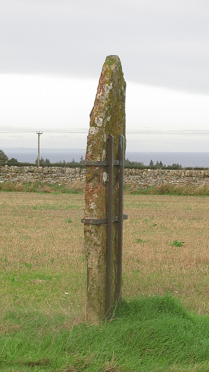
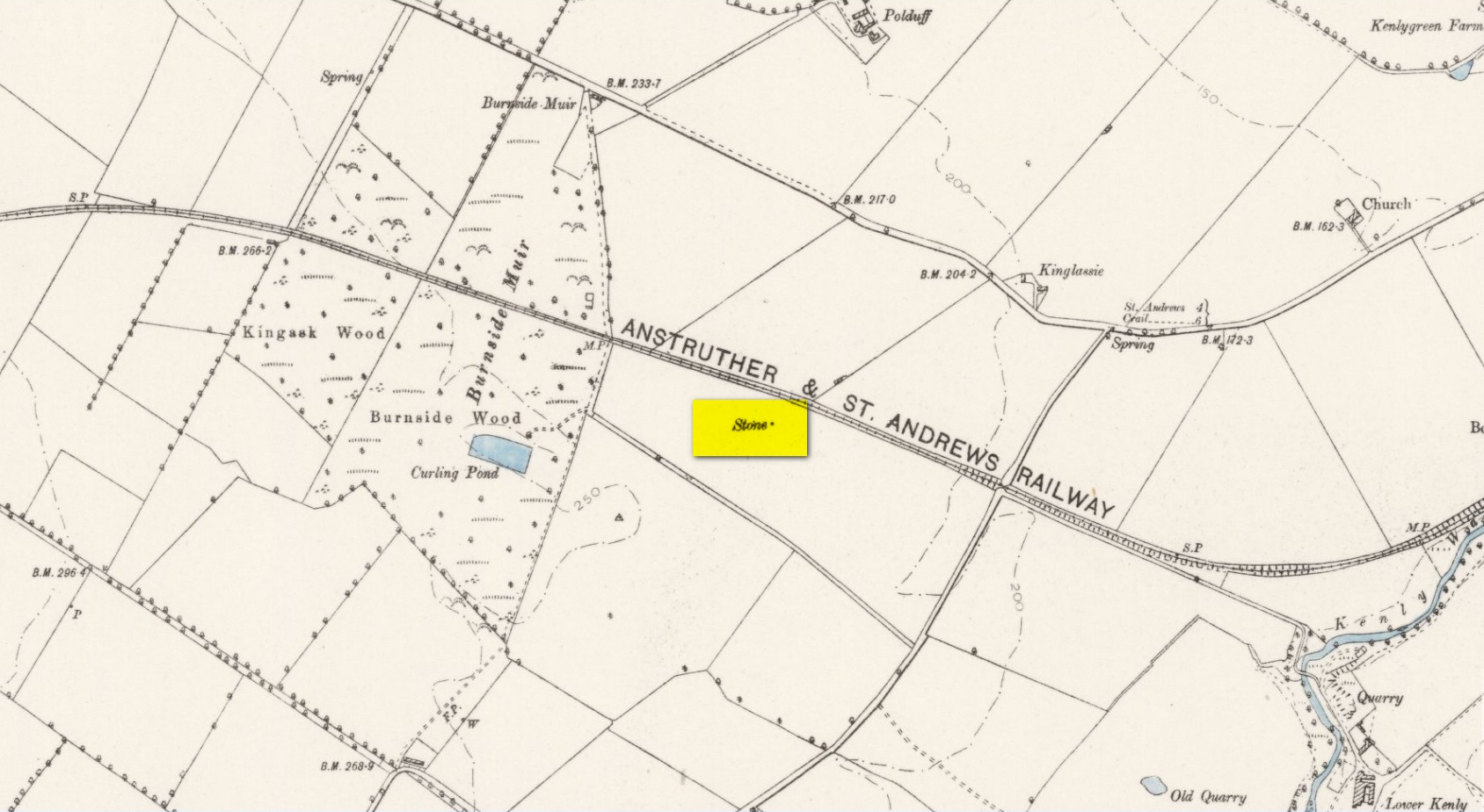
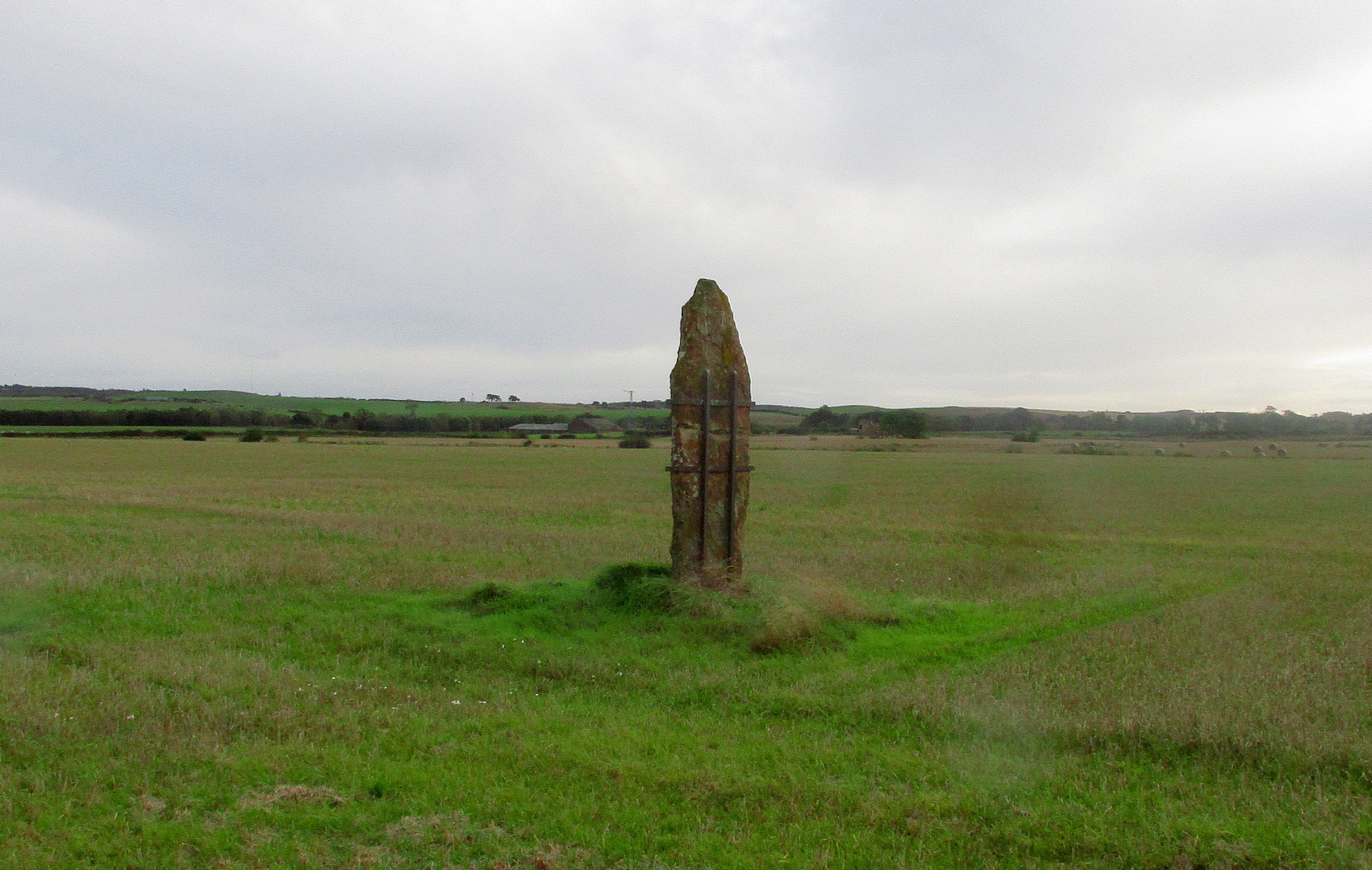
Highlighted on the 1893 and 1896 OS-maps (as merely a “Stone”), this tall and incredibly skinny standing stone has seen better days. After many-a-millenia, the god of storms cut the stone to the ground not too many years ago, leaving it broken in the middle o’ the field where once it stood. Thankfully however, local folk ensured that it was eventually resurrected and fixed into position once more, albeit in a somewhat ugly cage—or corset as Mr Hornby called it!
The Royal Commission (1933) lads checked the stone out for inclusion in one of their damn good surveys, they told us the following:
“About midway between the farms of Polduff and Peekie, and on the south side of the Anstruther and St Andrews Railway, 200 feet above sea level, there is a fine block of red sandstone, which rises to a height of just over 9 above ground. It averages 4¼ inches in thickness and measures 2 feet 4 inches wide across the broad faces. The stone has been set up with the major axis north-east and south-west and has been well packed round the base with smaller stones.”
Interestingly—to me anyhow—when the monolith was recently stood back in its upright position, the archaeo’s found a spring of water beneath it. Many dowsers (and I don’t mean the ones who fallaciously reckon they’re finding ‘energy lines’ all over the place) have found the crossing of underwater streams and water sources to be a common feature beneath megalithic sites.
Folklore
In Richard Batchelor’s (1997) short work on the ancient sites of this area, he calls attention to what a Mr N. Dow thought was a ley-line passing from the cairn on top of Kellie Hill 4¾ miles (7.64km) away, northeast to the Peekie Stone, and which Mr Batchelor points out is close to the major lunar standstill.
References:
Batchelor, Richard A., Origin of St Andrews, Shieling: St Andrews 1997.
Royal Commission on the Ancient & Historical Monuments, Scotland, Inventory of Monuments and Constructions in the Counties of Fife, Kinross and Clackmannan, HMSO: Edinburgh 1933.
Acknowledgements: Huge thanks to Paul Hornby for use of his photos.
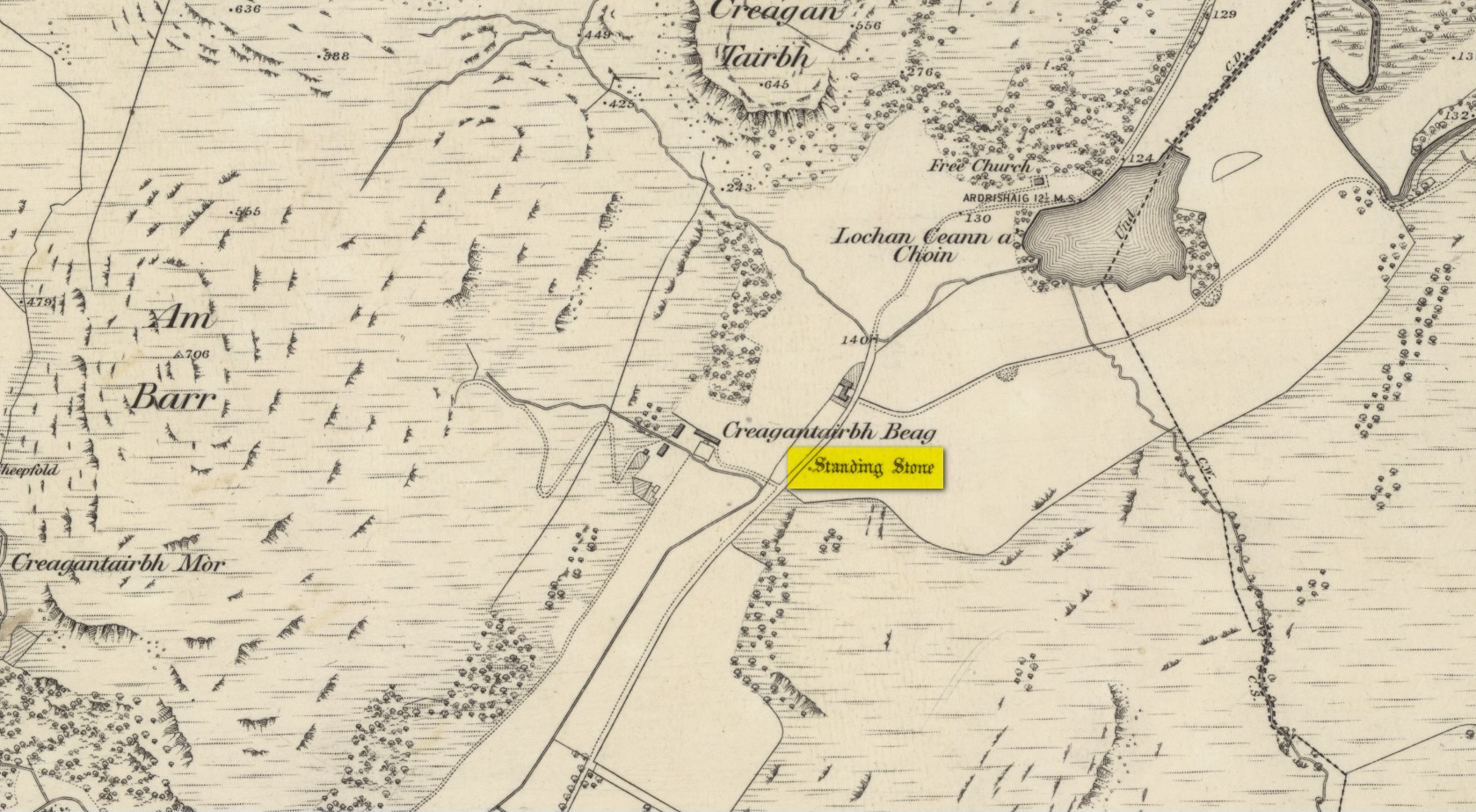
From Kilmartin go north on the A816 Oban road, and after 1½ miles watch out for the small B840 road on your right, to Ford and Loch Awe. Less than a mile along the winding road, just after the track to the farmhouse on your left, keep your eyes peeled for the standing stone on your right, whose top is peeking over the old walling. If you’re not careful you’ll miss it!
Archaeology & History
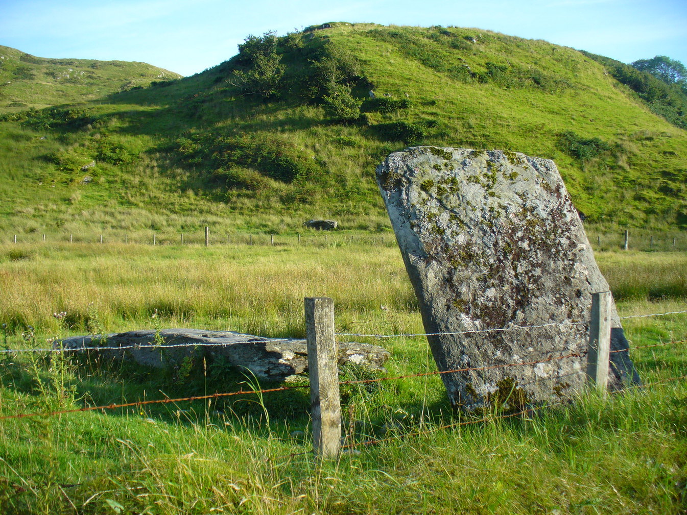
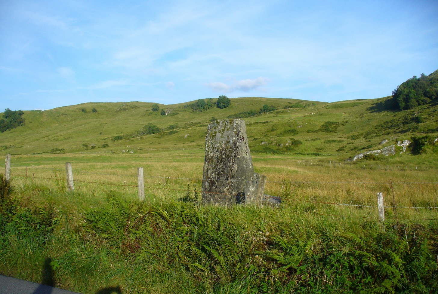
From the roadside this looks like just a reasonably small standing stone, but closer inspection shows it’s been snapped halfway up—apparently in a great storm in December 1879. If you look over the wall, just a couple of yards behind the upright you’ll see the larger section of stone that was attached to the 6-foot upright before its calamitous fall. Originally it was said to have been 16 feet tall!
Broken bit laid flatFrom the roadside
The first description of the stone is thought to be by the great J. Romilly Allen (1880) in his brief visit to Ford, saying simply that the stone “is close to the road on the east side, 1 mile from Ford. It is 14 feet high and 3 feet by 4 feet at the base. The material is slate. It inclines considerably from the perpendicular”—meaning, that he saw it before the stone had been broken. Lucky bugger!
More than twenty years later David Christison (1904) visited the site and wrote his of his finds in an essay for the Society of Antiquaries, although in truth he said little more than anyone before and after has been able to say:
“A mile and a quarter south-south-west of Ford Church, 130 yards east by south of Creagantairbh Beag farmhouse, close to the west side of the highway, stands the base of an obelisk, at the foot of which the shaft lies prostrate. The base is 5 feet 6 inches high,’and has an oblique ledge, half way up on to which the shaft would accurately fit. If restored, the height of the stone would be 16 feet 2 inches above ground, and it must have had a very handsome appearance, tapering in width as it gradually does from 2 feet 6 inches to 2 feet. It is 18 inches thick at the base and 10 inches to 12 inches at the top.”
Christison’s 1904 sketch
The name Creagantairbh derives from the Crag of the Bull, which is the sharp hill immediately in front of you to the north; and its geological consort, the Creag a’ Chapuill (or Crag of the Horse) rises to its immediate northwest. A few hundred yards further along the road towards Ford is the large Auchinellan standing stone.
Folklore
When I lived in Ford many years ago, the olde folk told me how, in bygone centuries, bulls were sacrificed on the Creagantairbh above.
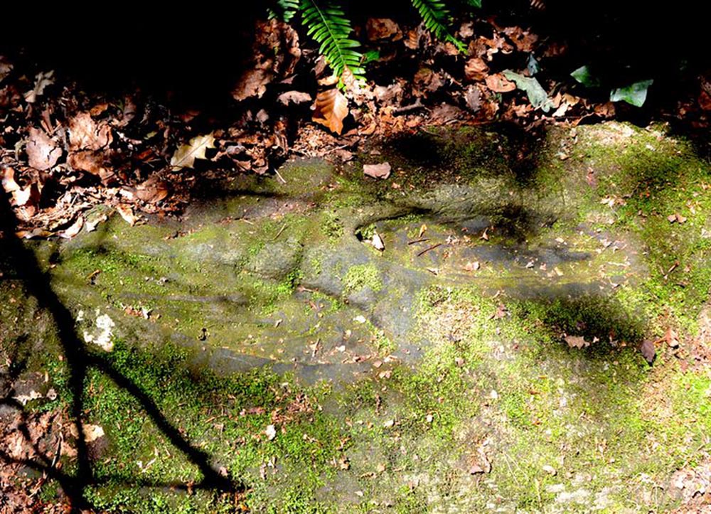
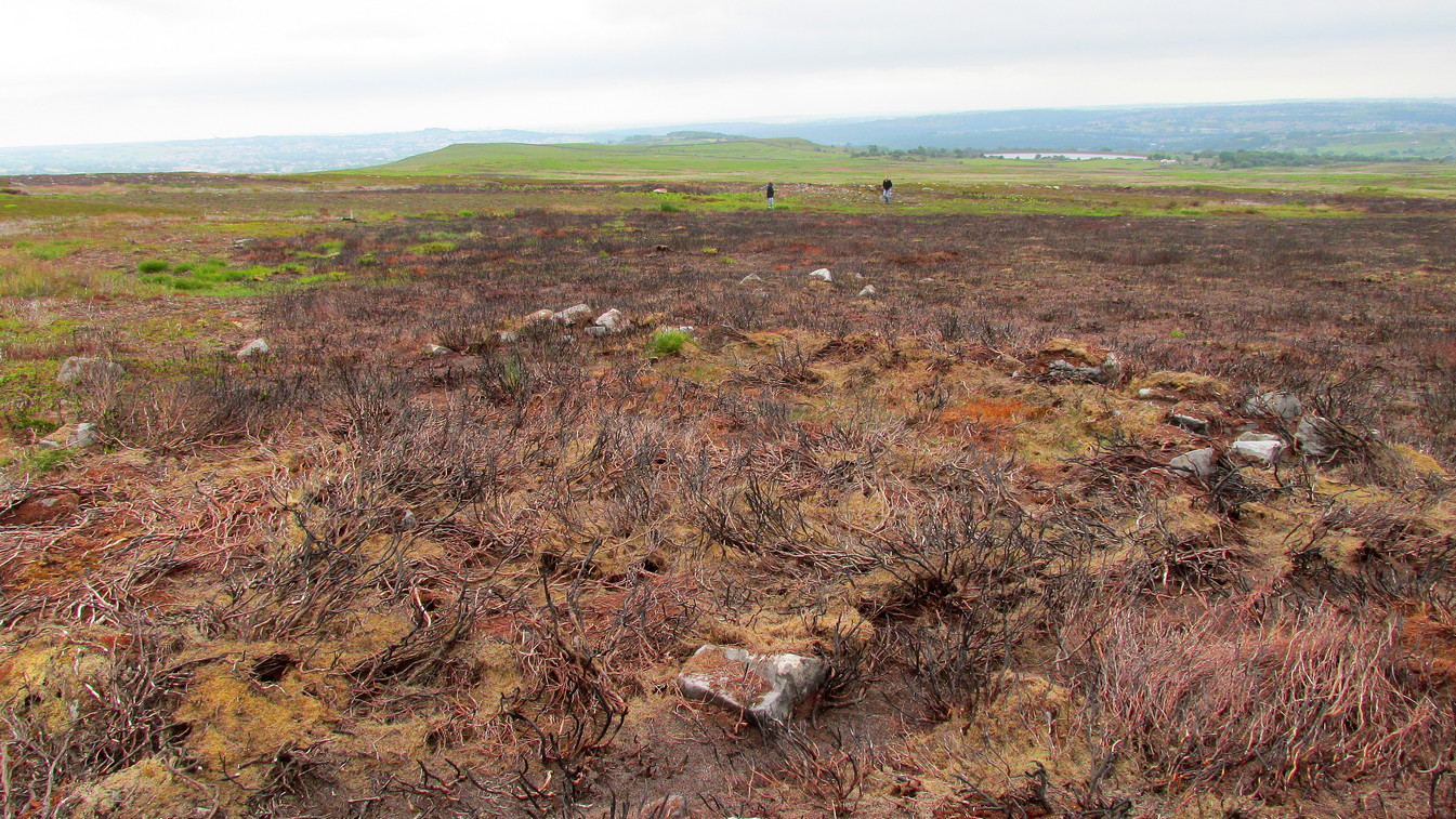
Make your way to the Black Beck tomb and walk west for some 50 yards. If the heather has grown any more than a foot tall, it’s impossible to see.
Archaeology & History
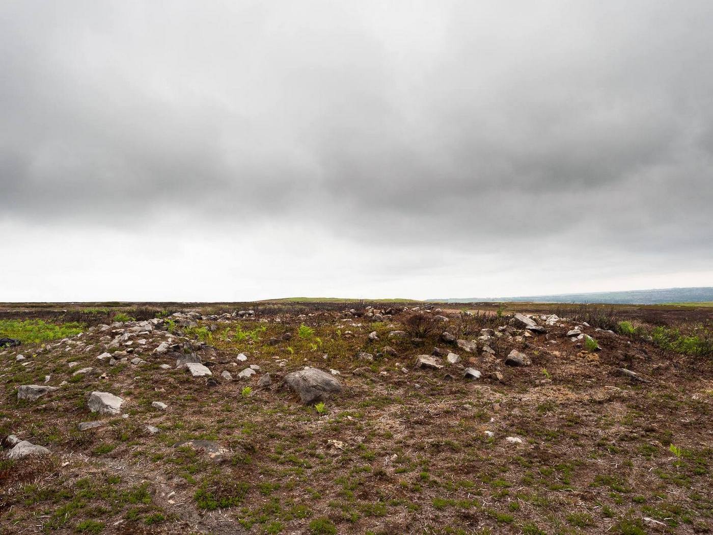
Near the northernmost section of the Hawksworth Shaw prehistoric graveyard, some 50 yards west of the Black Beck cairn, exists the remains of a small prehistoric enclosure whose walling is deeply embedded in the peat. Although I describe the place as an ‘enclosure’, we don’t know for certain whether it is a ruined settlement or large hut circles (although this latter idea is the more improbable).
Walling, looking NArc of walling, looking S
Two large open arcs of walling—like large letter “C’s”—with their open sides to the east, have been constructed next to each other, virtually coming together in the shape of an inverted number “3”. The walling in the southern arc—measuring some 33 yards in length and barely higher than 1 foot above ground level—consists of standard stones and rubble, similar to some of the hut circles that are found in greater abundance on the north-side of Ilkley Moor. The smaller, less visible arc of stones—some 18 yards of it—is lower in the earth. Both lines of walling may have been robbed in part to construct some of the extensive cairns close by, as neither of the two arcs were very high and it was very difficult to work out even what sort of structure they might have been.
Like many other prehistoric sites on Rombalds Moor, only an excavation is going to tell us precisely what was going on here…
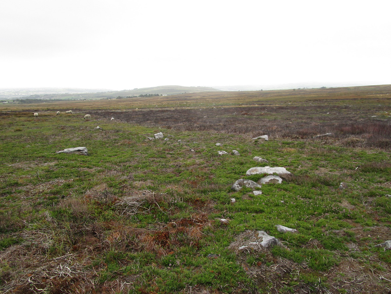
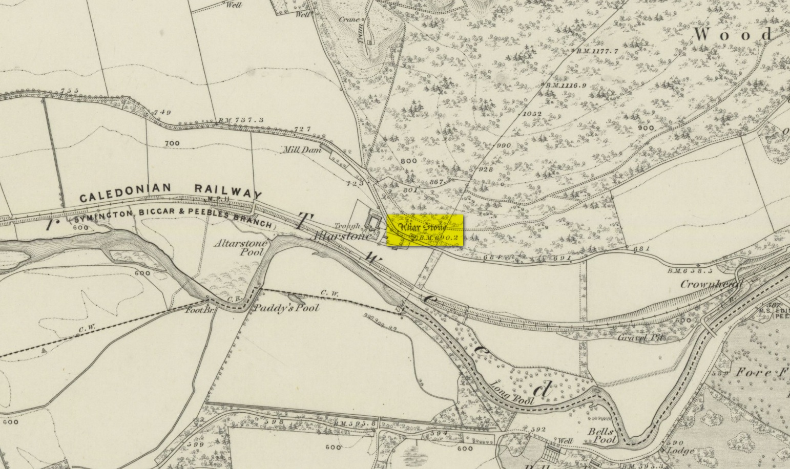
Various ways to get here. From Peebles take the A72 road west to Kirkurd, but after 4 miles turn left onto B712. Several miles down, go past Stobo village and before crossing the bridge over the River Tweed, turn left up minor road leading to Dreva and Broughton. The track into Altarstone Farm is about a mile along and the stone is across the road from there. The other way is going south along the A701 from Broughton village, where you take the left turn towards Stobo. Go along here for just over 3 miles where you reach the woodland (park here where the small track goes into the woods). A coupla hundred yards further along is Altar Stone Farm on your right and the stone is above the verge on your left.
Archaeology & History
Altar Stone, Stobo
Archaeologically speaking, there’s nowt much to say about this site apart from the usual tedium of its measurements and the rock-type. I’ll give the latter a miss, but the stone stands at nearly five feet high and nearly as broad; with its upper face relatively smooth and the top of it pretty flat. A section from the top of this stone was cut and sliced off a few centuries ago and this was said to have been taken to Stobo church a few miles away, where it was fashioned into a stone font for baptisms. If this is true, then it’s possible that this was once an authentic prehistoric standing stone, but we’ll probably never know for certain. Also on top of the stone you can see a number of geophysical scratches, one of which looks as if it may have been worked by human hands and which has some relevance to the folklore of the stone.
It is shown on the 1859 OS-map of the area and was mentioned in the Ordnance Name Book where they told how it was “supposed to have formed the Altar of a druids Temple or some such object,” but they could find no local verification of such lore at the time of their visit… or at least, no one was telling them anything about it…
Folklore
This fascinating bit of rock—or possible sliced standing stone—is of note due to its association with that old shaman of shamans known as Merlin! Near the end of His days, when He’d truly retired from the world of men and wandered, they say, mad amidst the great lowland forests, an old christian dood by the name of Kentigern—later known as St Mungo—who’d been trying to convert our old magickian away from the animistic ways of Nature, was said to have finally succeeded here, at this very stone. The old Scottish traveller Ratcliffe Barnett (1925) wrote:
“Merlin is the real genius of Drumelzier. Dumelzier means the Ridge of Meldred, a pagan prince of the district. And it was Meldred’s shepherds that slew Merlin the bard. The heathen bard was present at the battle of Arthuret in the year 573, when the christian army gained a victory over the Heathen Host. Merlin fled to the forest of Caledon at Drumelzier and there ever after the old Druid spent his life among the wild hills with a repute for insanity. This poet priest was doubtless heart-broken at the defeat of his pagan friends. The old order was changing. But the christian king had brought his friend, St Kentigern or Munro, to preach the gospel in upper Tweedside at Stobo. One day Kentigern met a weird-looking man and demanded who he was. “Once I was the prophet of Vortigern (Gwendollen). My name is Merlin. Now I am in these solitudes enduring many privations.”
“So Kentigern preached the gospel to the old nature worshipper and won him to Christ. Up yonder, at the east end of the Dreva road, you will find the rude Altar Stone where, it is said, Kentigern received the Druid into the christian church and dispensed the sacrament. But in those dark days of the faith, the Druids and their pagan adherents fought hard against the new religion. So immediately after the admission of Merlin to the Church, the shepherds of Meldred sought him out, stoned him to death on the haugh of Drumelzier, and there, where the Powsail Burn falls quietly into Tweed, Merlin the Martyr was buried. For long his grave was marked by a hawthorn tree.”
These shepherds were said to have stoned him and then threw his body upon a sharp stake and then into the stream. (stone – wood – water)
If there is any hint of truth in this tale, it is unlikely Merlin would have given himself over to the christian ways unless—as any shaman would—he knew of his impending death. In which case it would have done him no harm to pretend a final allegiance to the unnatural spirituality that was growing in the land. But whatever he may have been thinking, it is said that this Altar Stone was where he made such a deed.
Scratch-marks of the mythic hareAltar Stone, Stobo
An equally peculiar legend—variations of which are found at a number of places in the hills of northern England and Scotland—speaks of another shamanic motif, i.e., of humans changing into animals and back. For here, legend tells, an old witch was being chased (by whom, we know not) across the land. She’d turned herself into the form of a hare and, as she crossed over the Altar Stone, her claws dug so deeply into the rock that they left deep scars that can still be seen to this day. From here, the hare scampered at speed downhill until reaching the River Tweed at the bottom, whereupon transforming itself back into the form of the witch, who promptly fled into the hills above on the far side of the river.
One final thing mentioned by Barnett (1943) was the potential oracular property of the Altar Stone:
“You have to only place your hand on top of this rude altar, shut your eyes, and if you have the gift you will see visions.”
References:
Ardrey, Adam, Finding Merlin, Mainstream 2012.
Barnett, Ratcliffe, Border By-Ways and Lothian Lore, John Grant: Edinburgh 1925.
Buchan, J.W. & Paton, H., A History of Peeblesshire – volume 3, Glasgow 1927.
Crichton, Robin, On the Trail of Merlin in a Dark Age, R. Crichton 2017.
Glennie, John Stuart, Arthurian Localities, Edmonston & Douglas: Edinburgh 1869.
Moffat, Alistair, Arthur and the Lost Kingdoms, Phoenix: London 1999.
Rich, Deike & Begg, Ean, On the Trail of Merlin, Aquarian: London 1991.
Wheatley, Henry B., Merlin, or, The Early History of King Arthur – 2 volumes, Trubner: London 1865.
Acknowledgements: Big thanks for use of the 1st edition OS-map in this site profile, Reproduced with the kind permission of the National Library of Scotland.
Souterrain (lost): OS Grid Reference – NC 6601 6315
Archaeology & History
In the middle of the 19th century the opening to a prehistoric souterrain used to be in evidence on the north-side of the single track road running past old Skerray Mains house. It was mentioned in Hew Morrison’s (1883) historical guide, albeit briefly and without ambiguity:
“Below the house of Skerra Mains is an artificial cave that enters from below the road and extends 40 or 50 yards in length. Two urns were found it when it was discovered but they soon crumbled away on being exposed to the air.”
More than thirty years later, the Royal Commission (1911) lads ventured to check it out, only to find that it had just recently been covered up:
“At the farm of Skerray Mains is an earth-house, the mouth or entrance to which was recently exposed by the farmer. It is situated about 15 feet distant from the northeast window of the dwelling-house, and is now entirely covered over again.”
Of the old locals I met here, only one of them remembers hearing of it, but the precise location of its entrance had been forgotten. Surely it aint gonna be toooo difficult to find it again?
References:
Morrison, Alex, “Souterrains in Sutherland,” in J.R. Baldwin’s Province of Strathnaver, SSNS: Edinburgh 2000.
Royal Commission on Ancient & Historical Monuments, Scotland, Second report and inventory of monuments and constructions in the county of Sutherland. HMSO: Edinburgh 1911.
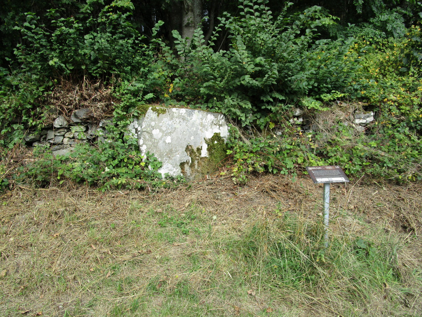
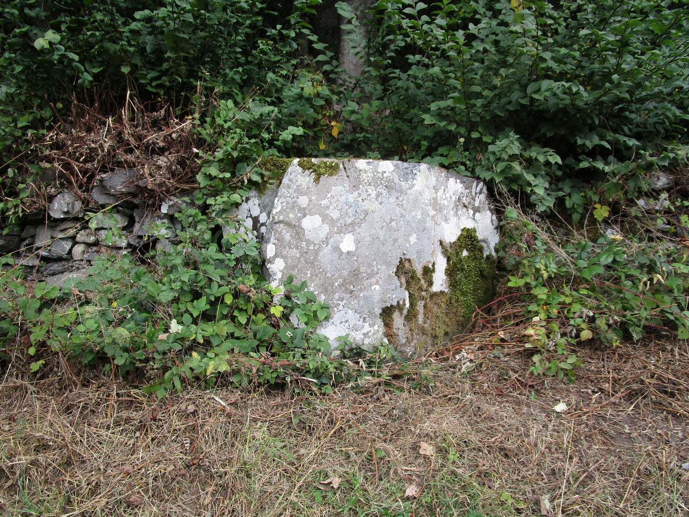
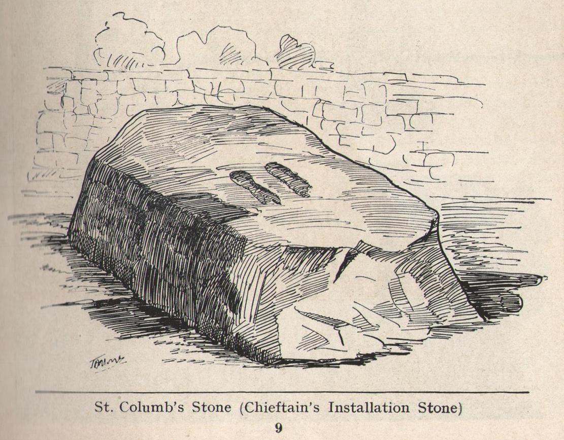
To be found in the grounds of Belmont House School, just 1¾ miles (2.8km) north of Derry’s otherColumba’s Stone, this is one of the many petroglyphic “footprints” that folklore ascribes to Ireland’s saint Columb/Columba/Columbkille (and other variants). Said to have originally been carved at the great fortress of Grianan of Aileach, 4½ miles (7.2km) to the west, this great block of stone—roughly 6 feet square on top—has the distinct sculpturings of two feet, each about 10 inches long, etched into its sloping surface. Archaeologically speaking, there’s little more to say about the stone; but its traditions are another thing altogether and are of considerably greater importance…
Folklore
Like the carved footprint on top of Dunadd in Argyll with its association of tribal initiations, the traditions relating to this footprint follows the same path, so to speak. It was H.P. Swan (1938) who gave us a good summary of the olde lore here, telling that,
“It is almost absolutely certain that it was brought from the Grianan of Aileach after its destruction, probably by an O’Doherty for his own installation. If so, the task of removal was no joke, for the stone weighs some seven tons. It was the “crowning stone” of the Kinel-Owen, or, in other words, the stone upon which the chieftains of the great O’Neill clan were inaugurated. They reigned in Aileach for many centuries.
“At his installation, as supreme head of the clan, the newly-chosen chief was placed upon this stone, his bare feet in the footmarks; a peeled willow wand was put into his hand, as an emblem of the pure and gentle sway he should exercise over his tribe; an oath was administered to him by the chief ecclesiastic in the neighbourhood, that he should preserve inviolable the ancient custom of his country, and deliver the succession peaceably to his tanist (successor); after which, descending from the stone, he turned himself thrice backwards and thrice forwards, to signify that he was ready to meet all foes, from whatever quarter they might come; and was then, with wild acclamations, hailed as their chief by his assembled clan.
“At the time of Ireland’s conversion to christianity by St Patrick, that holy man visited the Grianan (about AD 443), where this stone had been so used for centuries before; Owen was then King; he was converted from Paganism to the new faith and baptised by Patrick; at the same time, the saint consecrated this stone, and blessed it as the crowning-stone of the Kinel-Owen for ever. Time, however, has proved his blessing futile, as may be read in the account of the Grianan, which was deserted by the Kinel-Owen after its destruction by the O’Briens in 1101.”
The ritual described here cannot be taken lightly, nor seen as a presentation of fiction, for its ingredients are found echoed in kingship rites in many cultures.
References:
Swan, Harry Percival, The Book of Inishowen, William Doherty: Buncrana 1938.
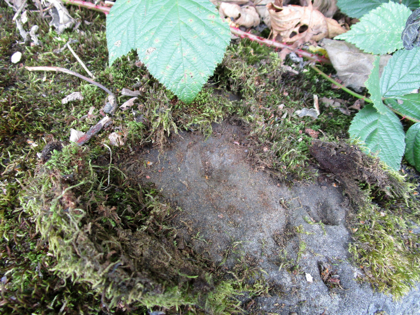
St Columbkille’s place in Irish history was considerable and, said Maghtochair (1867), he was said to have “founded more than one hundred churches and religious houses.” His feet, also, have been carved or burned into a number of rocks scattering the Irish landscape. Not to be confused with his ‘feet’ that are carved near Londonderry, the ones here have been classed in the archaeological inventories as a bullaun and, wrote Brian Lacy (1983) in the Donegal Archaeological Survey, can be found on,
“A 2m long ledge of rock outcrop containing two depressions, c.0.33m in diameter x ).1m deep. They are known locally as St. Columbkille’s footprints.”
As can be seen in the above photo, the ‘footprints’ seem to have been artificially outlined at some time long ago, to make them more notable.
References:
Lacy, Brian, Archaeological Survey of County Donegal, Donegal County Council 1983. p.307
Maghtochair, Inishowen – Its History, Traditions and Antiquity, Journal Office: Londonderry 1867.
Sconce, James, “Cup-Marked Stones,” in Transactions of the Edinburgh Field Naturalists, volume 5, 1907.
Swan, Harry Percival, The Book of Inishowen, William Doherty: Buncrana 1938.
Acknowledgements: Big thanks to Catherine, of the We Love Donegal website.
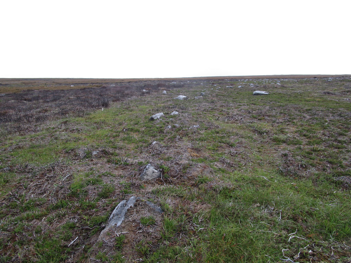
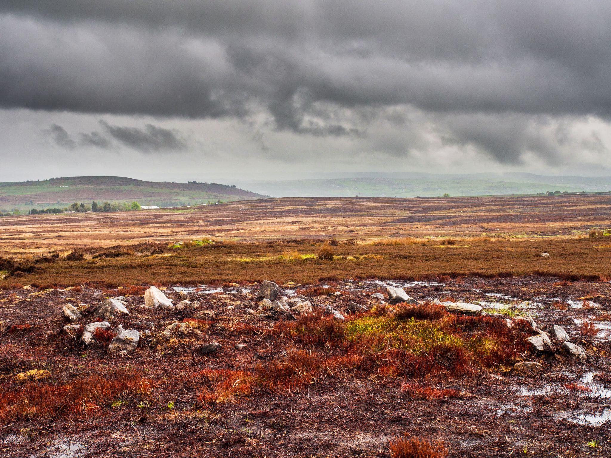
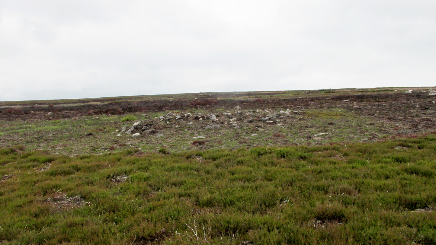
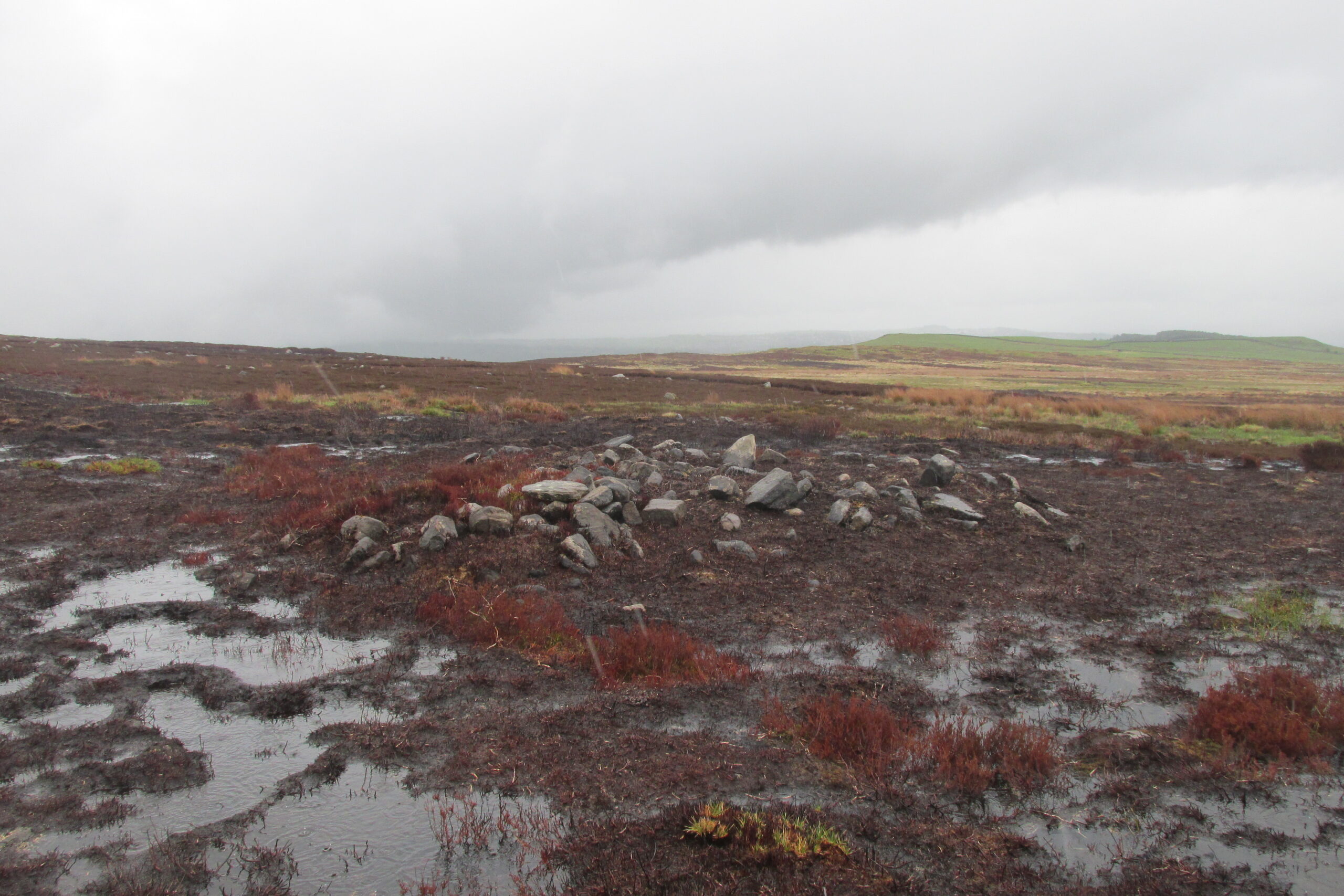
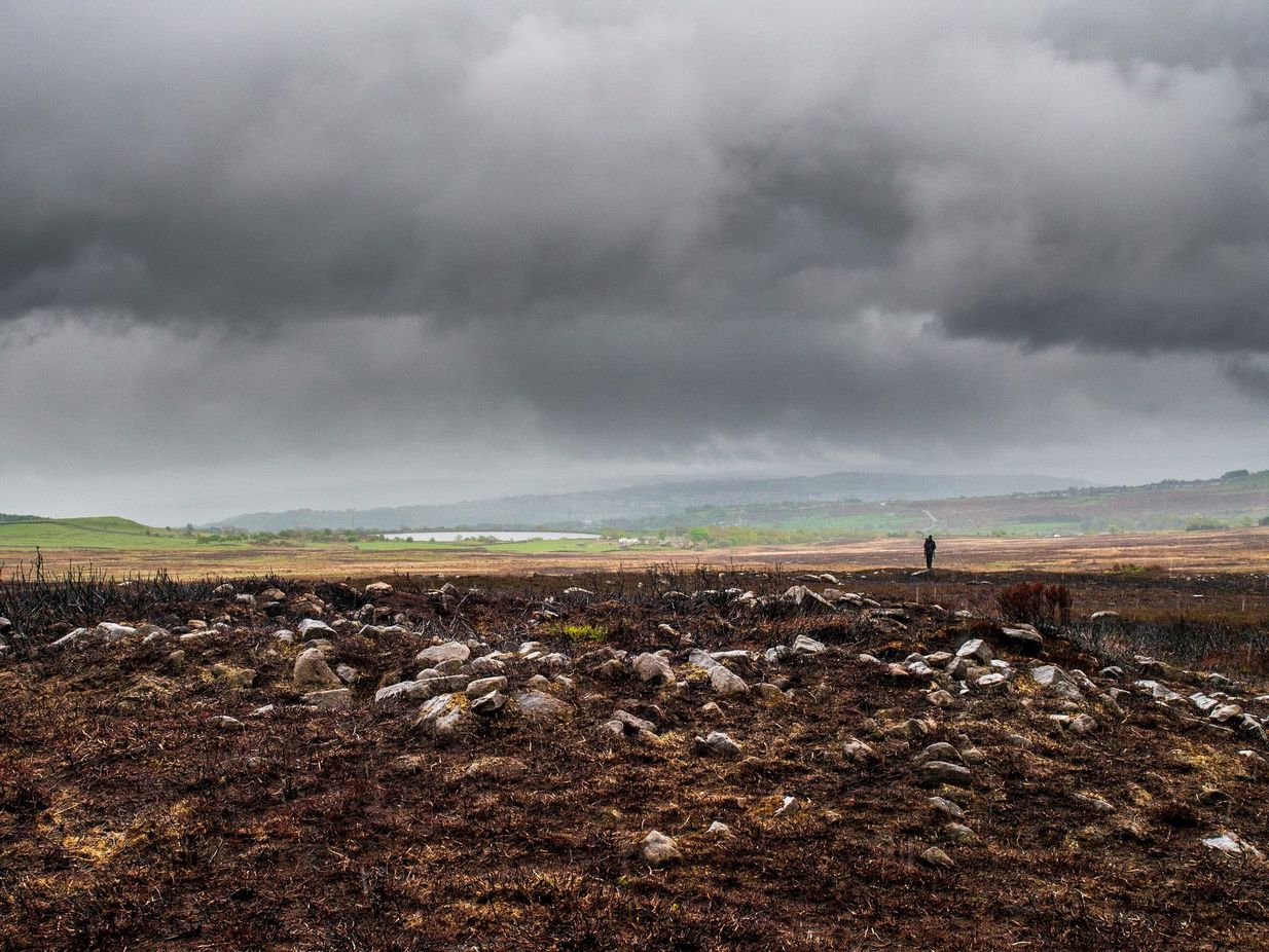
It’s a bittova pain-in-the-arse locating this site unless you’re into walking off-path, through excessive dense heather or burnt coarse ground. You can either follow the directions to the Black Beck tomb, or set off from Horncliffe Circle and walk up parallel to the fencing for nearly 300 yards (275m). From here, walk due east for nearly half a mile through the deep heather until you reach an overgrown track that keeps you eastwards towards a line of grouse butts abaat 275 yards (250m) on. Naathen, walk on the north-side of this path-track and for a few yards and you’ll begin to see either small piles of stones, or heather-covered mounds. Zig-zag about. You’re in the middle of the cemetery!
Archaeology & History
This cairnfield, or burial ground, or necropolis (choose whichever term you prefer) is a bittova beauty! Although some of the tombs here had been ‘officially’ noticed a few years back, the magnitude of it was understated to say the least. On a visit to the place a few months ago in the middle of one fuckova downpour, James Elkington and I found not only the large Black Beck tomb, but scattered clusters of many more cairns. But it wasn’t until a few weeks after that we got a longer time to check it over and, even then, I think the job was only half-done. So this site profile is merely an overview of some of what we found there. Along with the Black Beck tomb, we found more than thirty examples of prehistoric cairns—probably Bronze Age in nature—around the Hawksworth Shaw area near the middle of Hawksworth Moor, scattered around (seemingly) in no particular order.
…and another one…Round cairn in foreground
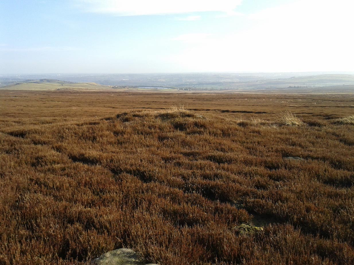
Three types of cairns were identified in this large cairnfield. The majority of them are of the standard circular form, averaging 3-4 yards across and rising to about two feet high. They are of the same architectural form as those found in the Hawksworth Moor cairnfield 4-500 yards northwest of here (there is the possibility that the two of them are part of the same necropolis, but unless we can locate an unbroken continuity between the two groups, it’s best to present them as separate clusters). When we looked at them a couple of weeks ago, most cairns of the ’round’ type were overgrown, albeit in low growth, as a couple of the photos here show. The main cluster of the round cairns are just a few yards off the aforementioned track, but there are others scattered here and there at other points on this part of the moorland. A number of these cairns seem to have have been damaged and robbed of stones to build a line of grouse butts close by.
One of the ‘long cairns’Another ‘long cairn’ during an utter downpour!
The second type of cairn in the necropolis—close to the main cluster of round cairns—are curious small, long cairns. Each one of them measures between 8-10 yards in length, are up to three yards across, and rise to a height of about one yard. They are built of the usual mass of small stones typical of the huge number of other cairns on Rombalds Moor, but have been constructed in an elongated form, in contrast to the more usual circular ones. Four of them are very close to each other with a fifth further away from this main group. A sixth one appears to be under the heather 50-60 yards away to the northeast. Unlike some of the nearby round cairns, this group looks as if it’s barely been touched by the hand of man, with only fallen scatters of stones around the outer edges of them. Tis an interesting group…
The third architectural cairn-types are scattered unevenly across the necropolis and are characterized as smaller, mini-versions of the round cairns, i.e, small piles of stones between 1-2 yards across and and just one or two feet high. Each of this type of cairn are more deeply embedded in the peat with more vegetational growth covering them due to their small size. This makes them much more difficult to see in comparison to their larger compatriots. One example (at SE 1423 4404) can be seen in the photo, above left, some 50-60 yards north of the Black Beck tomb; with another, above right, some 100 yards away to the southeast. There is the possibility they may be so-called ‘clearance cairns’, although I have some doubts about this and believe they are more likely to be individual graves…. but I could be wrong…
There’s little doubt that other tombs are hiding away in this area, waiting for fellow antiquarians to uncover them. Equally probable is the existence of hut circles or similar living-quarters lost beneath the heather. Two such sites have been found on recent ventures here: one a short distance west of the Black Beck tomb and another hiding away nearly 300 yards southwest, right beside the Black Beck. The main thing lacking up here are cup-and-ring stones. Apart from several uninspiring cup-marked rocks it seems few exist hereby; but there are, no doubt, some hiding away that have been hidden for millenia…
One final thing: the grid-reference given for this necropolis is based loosely on where some of the cairns can be found, but there are others whose positions lies slightly beyond that grid-ref, as you’ll find if you potter about.
Acknowledgements: With huge thanks, as always, for James Elkington for use of his photos. Also to the evolving megalith and landscape explorer Mackenzie Erichs; and to Linzi Mitchell, for additional input…
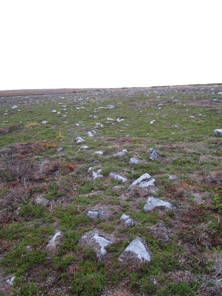
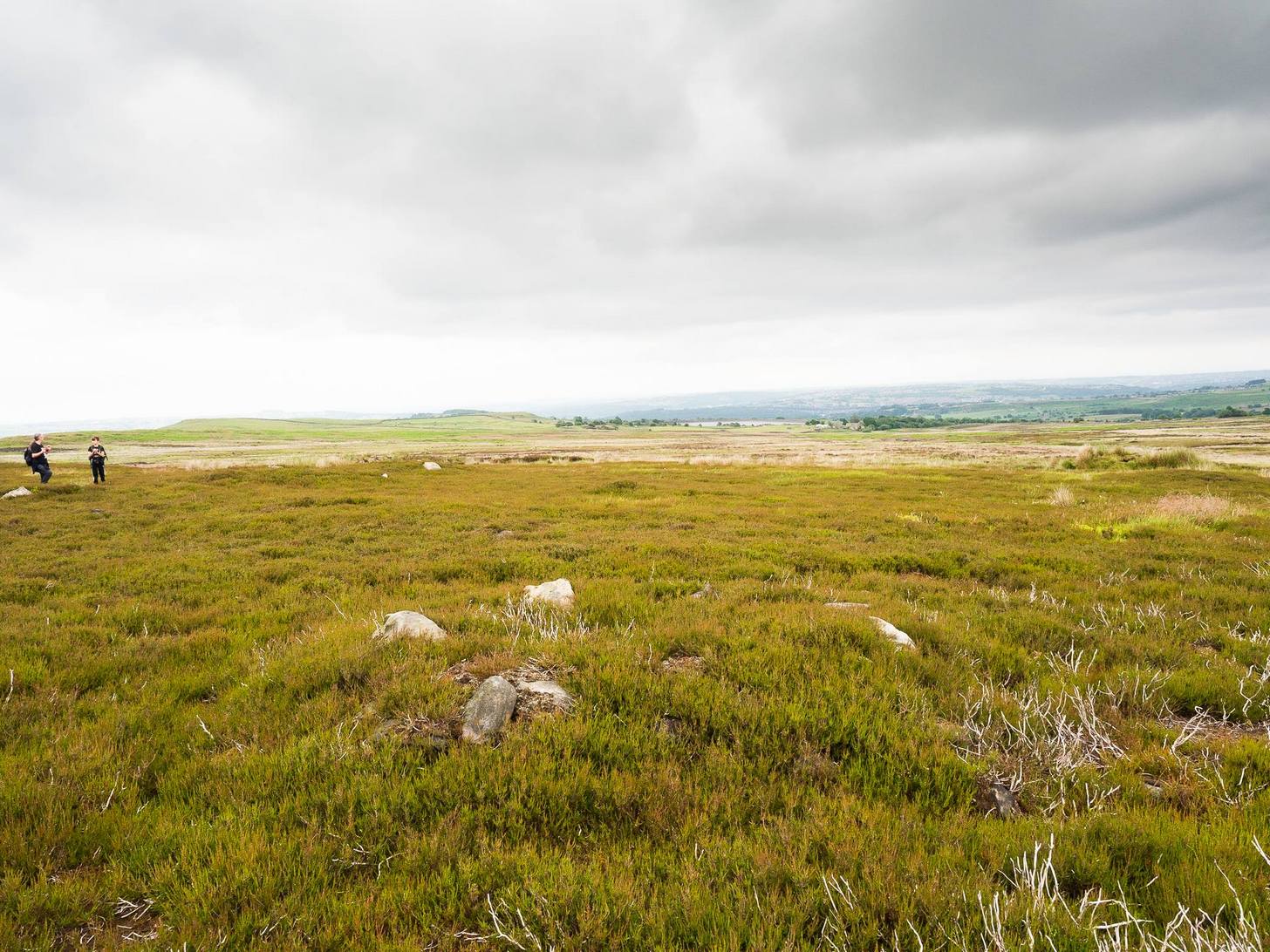
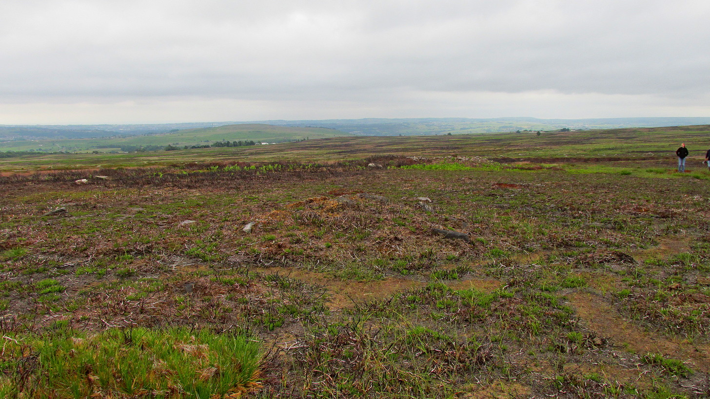
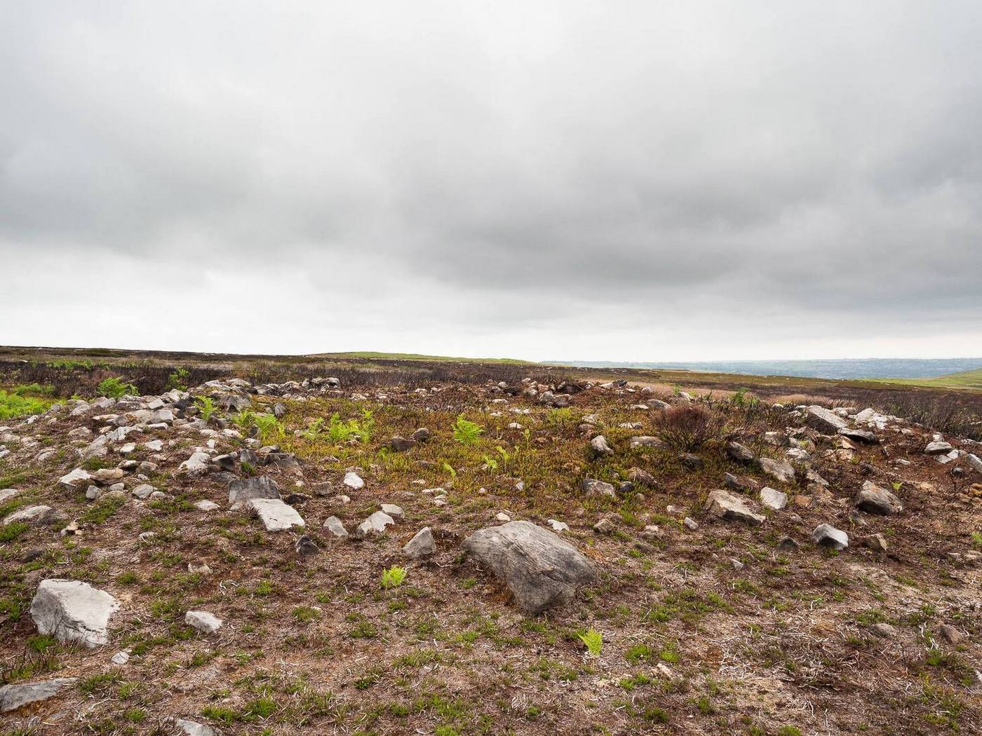
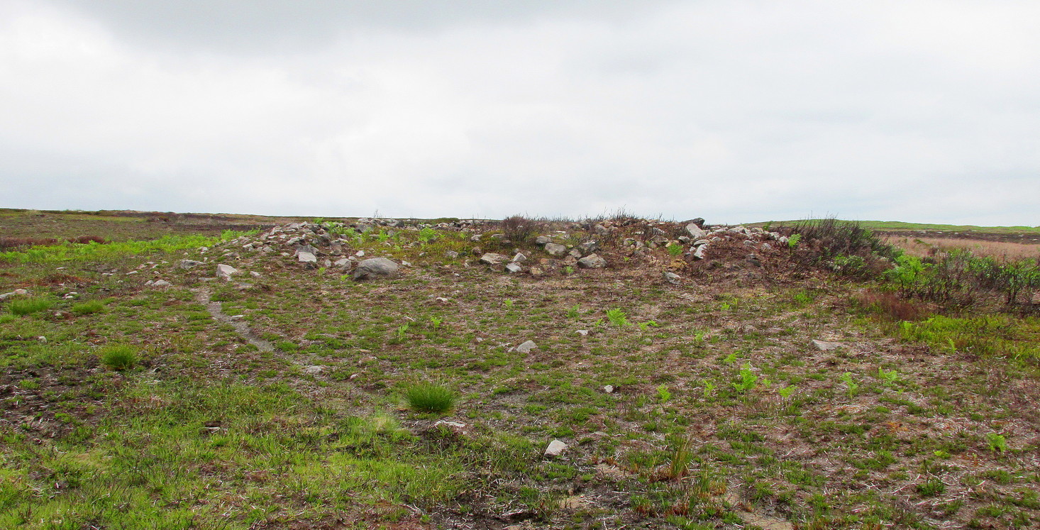
Probably the easiest way to find this is to use other sites as guides. From the Great Skirtful of Stones tomb, get over the fencing and follow it eastwards for exactly 500m (238 yards) where you’ll meet a small footpath on your right that goes southeast up the small slope of Craven Hall Hill and onto the moorland. Go along here for literally 0.2km (223 yards) and, just where the path bends slightly to the left, drop diagonally down the slope to where the moorland levels out close to the Craven Hall Hill (2) tumulus. From here walk WSW onto the flat moorland for literally ⅓-km (0.21 miles; 365 yards) where you’ll find either a large rounded mass of stones, or a large heather-covered mound—depending on whether there’s been a burning. Best o’ luck!
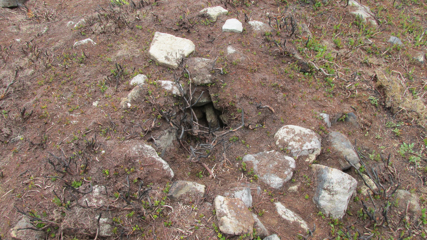
Very troublesome to locate when the heather’s fully grown, this large prehistoric tomb was uncovered very recently as a result of extensive moorland fires. It’s the largest such structure in a cluster of more than thirty cairns near the middle of Hawksworth Moor, many of which were rediscovered at the end of May, 2021. Due south of the Great Skirtful of Stones, this smaller skirtful of stones measures some 45 feet across and is more than three feet high in parts. Probably built in the Bronze Age, the tomb looks as if it’s been deliberately robbed at some time in the past, probably before the Victorians by the look of things—although only an excavation would tell us for sure. Primarily, the cairn has been robbed from its centre outwards mainly on its western side, where you’ll also see a small and rather dodgy cup-marked stone. Scattered into the surrounding peat are visible remains of where some of the loose stones have been cast.
Small hole in the middleNorthern edge of cairn
A possible alternative to this being simply a large cairn, is that it’s a much-disturbed ring cairn. Some sections on the north and western edges give the impression that the mass of stones may be collapsed rubble walling. There are also a couple of internal features beneath the overgrowth of peat and compressed vegetation: one being a small circular piece of stonework that has either fallen in on itself, been dug into, or is the home of an animal; and a yard or two from this is what looks like another internal U-shaped stone structure – again, deeply encased by centuries of encroaching peat. But I must emphasize that these features are far from certain and can only be proven one way or the other by an excavation.
The site is well worth seeing, not only for its own merit, but also because of its place in a much wider prehistoric cemetery in the middle of Hawksworth Moor. There are at least six small single cairns (which may be clearance cairns) scattering this area—the closest of which from here is some 20 yards to the north. A more curious group of at least five small long cairns exist about 100 yards to the south; and below these is the largest cluster of standard tombs in the form of small round cairns. A curious D-shaped hut circle structure can be found less than 100 yards to the northwest, and what seems to be remains of a larger deeply embedded enclosure exists beyond the long cairns. Check ’em out!
Acknowledgements: With huge thanks, as always, for James Elkington for use of his photos. Also to the evolving megalith and landscape explorer Mackenzie Erichs; and to Linzi Mitchell, for additional stimuli…
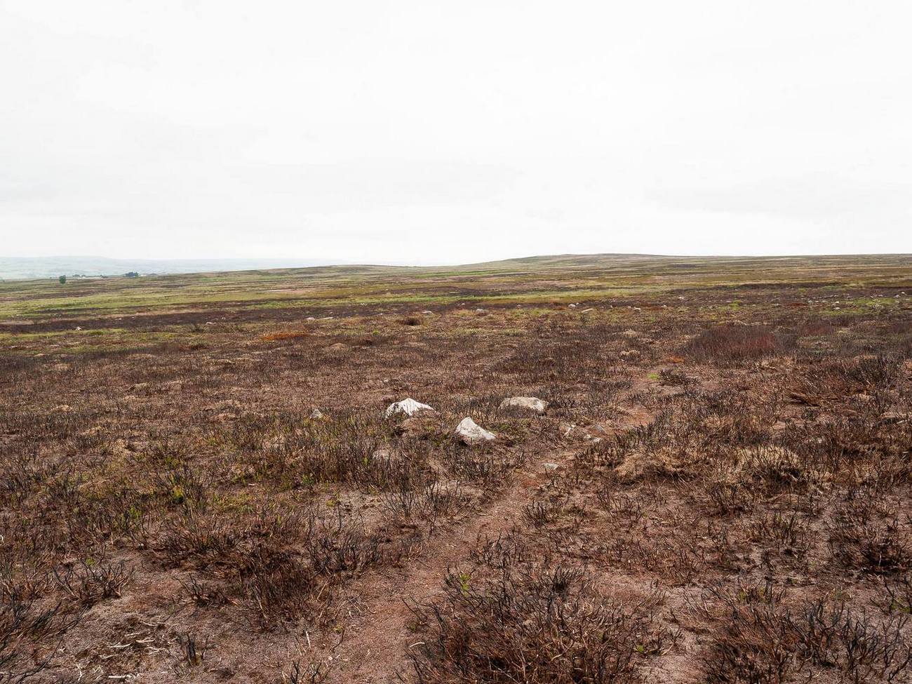
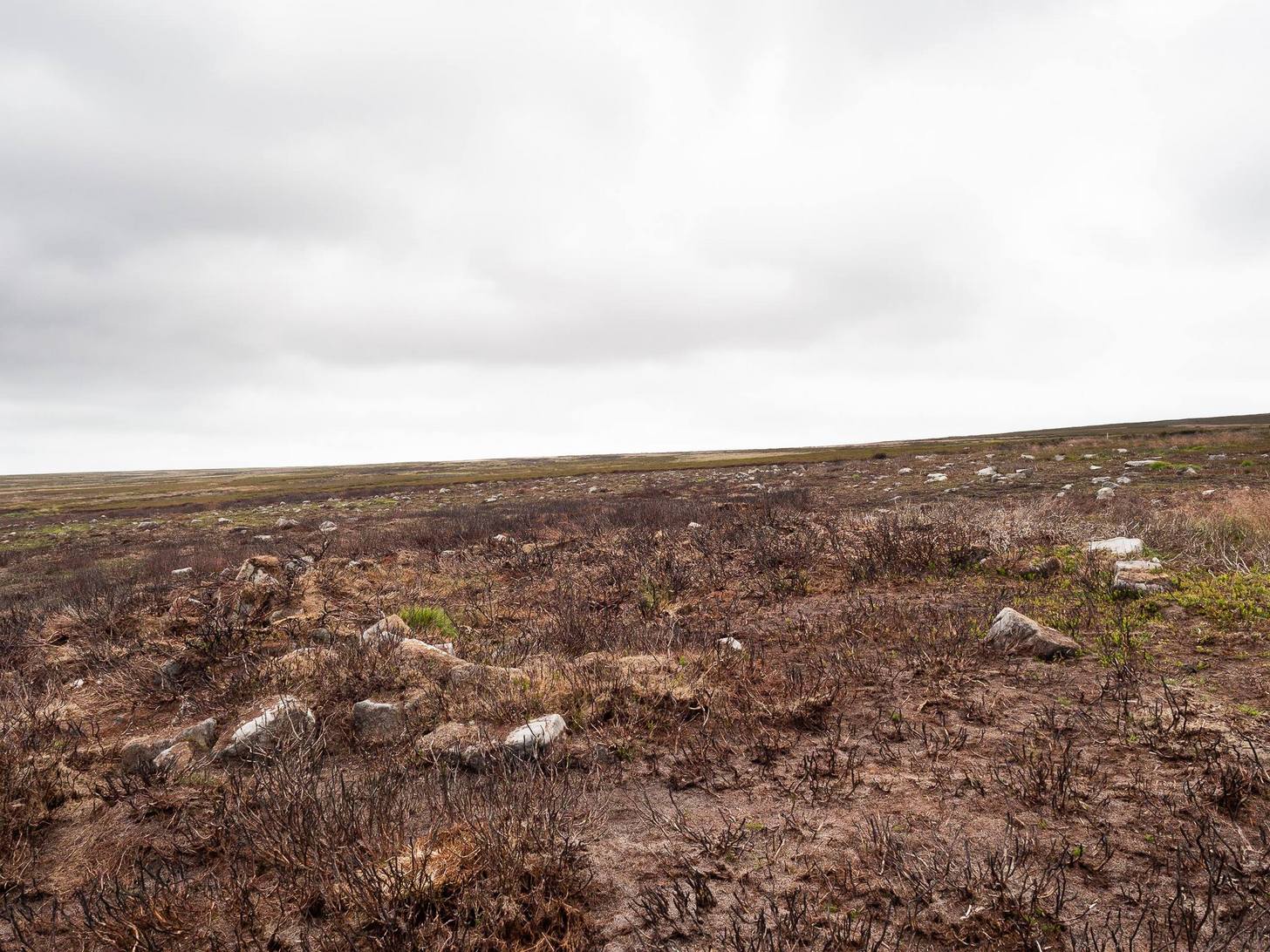
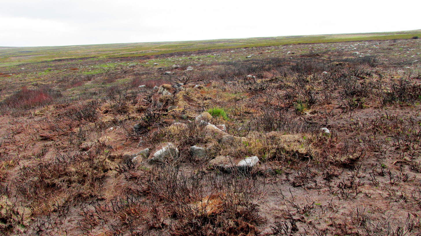
Take the same directions as if you’re going to visit the Black Beck cairn. From here, walk through the heather northwest for about 60 yards. If the heather’s been cleared, you’ll see it low down, otherwise you’re pretty much screwed when it comes to finding this one!
Archaeology & History
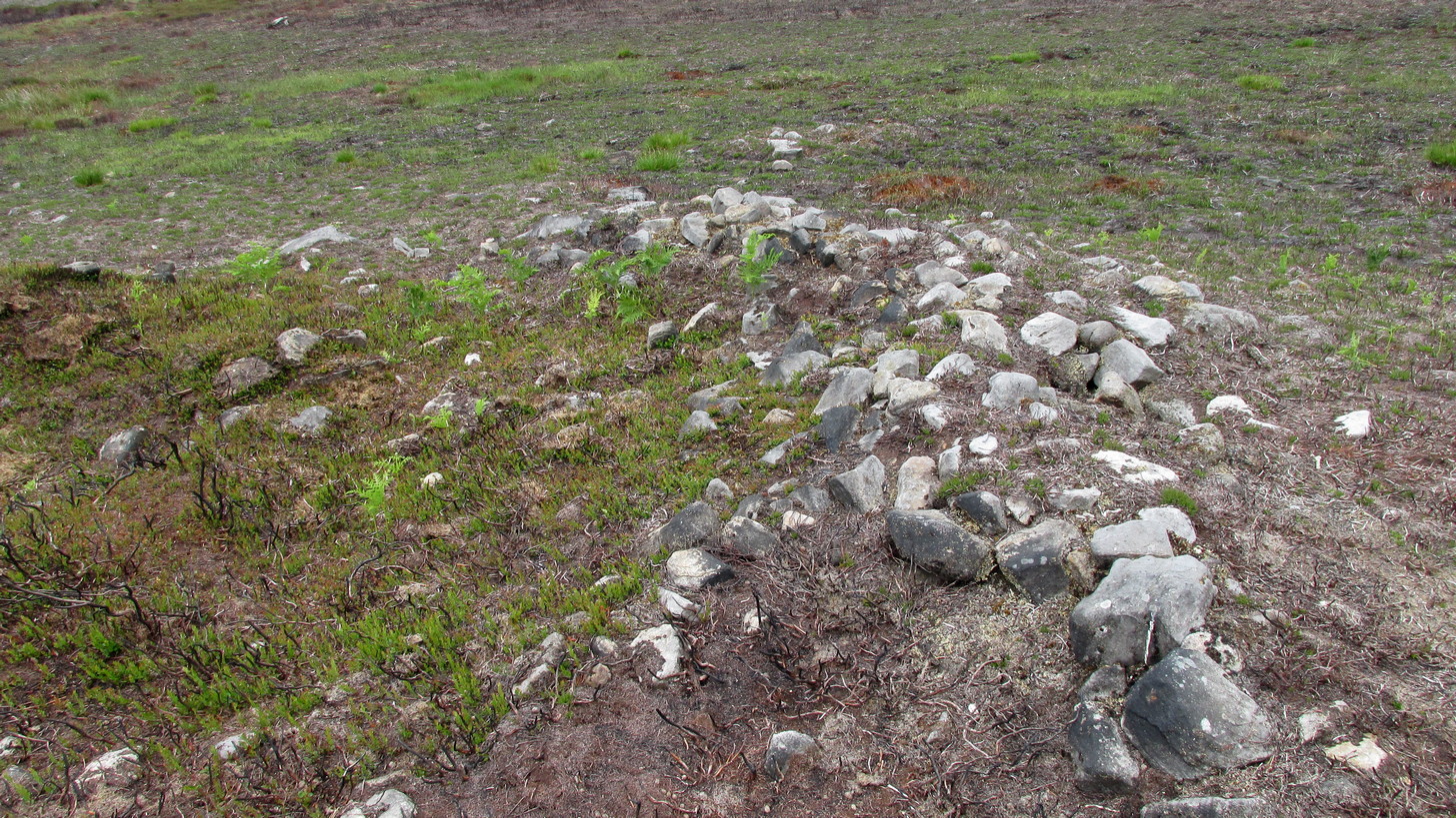
Seemingly in isolation, this low-walled, D-shaped hut circle is presently the only the structure of its kind known to exist on this part of Hawksworth Moor; although to be honest we should expect there to be such structures in the area when we consider the size and proximity of the associated cairnfields immediately north and southeast of here.
Southern arc of wallingNW section of walling; Black Beck tomb to rear
As with most hut circles, it’s nowt special to look at in all honesty. The south side of the structure is rubble walling typical of these structures, curving round as usual; but its more northern section straightens out, creating a D-shaped structure. This line of straight walling seems attached to another, outer parallel wall 3 feet away, creating its very outer edge. The rubble walls themselves average three feet across; whilst the hut circle measures 6-7 yards across. We assume that it was constructed during the same period as the adjacent prehistoric necropolis.
Acknowledgements: With huge thanks, as always, for James Elkington for use of his photos. Also to the evolving megalith and landscape explorer Mackenzie Erichs; and to Linzi Mitchell, for additional input…
 Highlighted on the 1893 and 1896 OS-maps (as merely a “Stone”), this tall and incredibly skinny standing stone has seen better days. After many-a-millenia, the god of storms cut the stone to the ground not too many years ago, leaving it broken in the middle o’ the field where once it stood. Thankfully however, local folk ensured that it was eventually resurrected and fixed into position once more, albeit in a somewhat ugly cage—or corset as Mr Hornby called it!
“About midway between the farms of Polduff and Peekie, and on the south side of the Anstruther and St Andrews Railway, 200 feet above sea level, there is a fine block of red sandstone, which rises to a height of just over 9 above ground. It averages 4¼ inches in thickness and measures 2 feet 4 inches wide across the broad faces. The stone has been set up with the major axis north-east and south-west and has been well packed round the base with smaller stones.”