Castle Dykes, Aysgarth, North Yorkshire

Henge Monument:  OS Grid Reference – SD 9822 8728

Also Known as:

  1. Castle Dyke

Getting Here

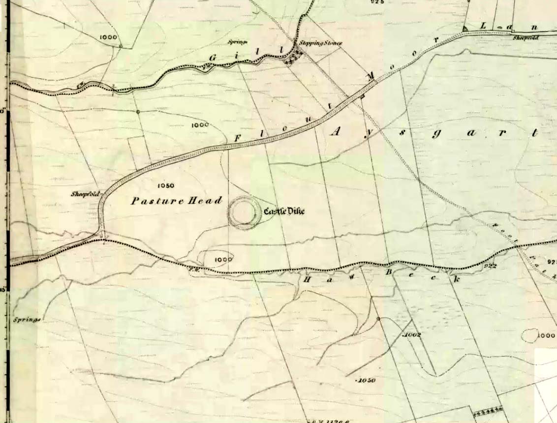
Castle Dyke on 1856 map

Go west through Aysgarth village along the A684 road and, just as you’re coming out of the town, take the left turn on the Thornton Rust road, past Town Head Farm, and turn left up the track (called Folly Lane).  Go past the house where the track veers to your right and follow it straight on (don’t turn up the track on your left a short distance along).  Keep walking on here for nearly a mile (about 10 mins), keeping your eyes peeled for the embanked rise in the field on your left, which is where the henge can be found!  You’re damn close!

Archaeology & History

A.H. Allcroft's 1908 plan
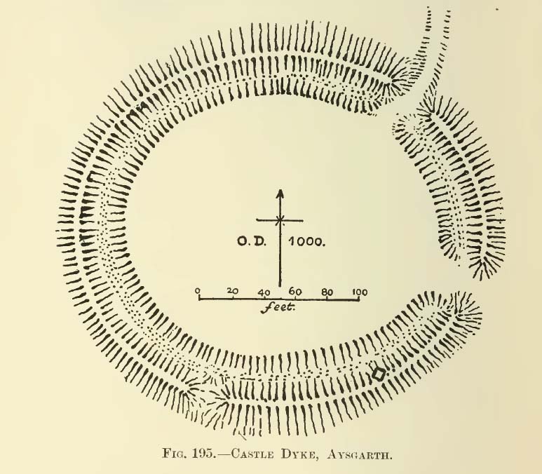
A.H. Allcroft’s 1908 plan

One of the earliest accounts I’ve found describing the Castle Dykes henge is in Mr Barker’s (1854) lovely literary exploration of Wensleydale, where he describes, “on Aysgarth Moor, which is now enclosed, may be seen a circular encampment, probably Danish” in origin.  But he tells no more.  When Edmund Bogg (c.1906) came here fifty years later, he added little extra, simply telling of, “the earthworks known as ‘Castle Dykes’, probably Angle or Danish, although Roman relics have been found here.”  However, the brilliant Mr Speight (1897) gave what seems to be the earliest real description of the site when he described “the Celts” and the earliest settlers of the region, saying how:

“The so-called ‘Castle Dykes’ at Aysgarth betrays a probable connection with the same settlers.  It is an irregular circular rampart, measuring about forty yards across its longest diameter, and not unlike the earthwork on Harkaside called ‘Maiden Castle’… A ditch completely encloses the mound, which, it should be noted, is unusually low, being little higher than the outer bank or upcast from the trench.  It is totally different from the elaborate burh at Middleham; indeed, from its low and simply form, as well as from its situation in Celtic territory, there seems little doubt that it was the work of these early people.”

Ditch of Castle Dykes henge, looking east (photo credit – Richard Stroud)

Speight also made a suggestion that the place-name of Aysgarth itself may derive from this monument.  He may have a point.  A.H. Smith (1928) and other place-name authorities tell the name to derive from “an open space” either surrounded by, or — in some way — defined by oak trees.  We might never know for sure…

Not long after the works of Speight and Bogg came the first real survey of British prehistoric earthworks by A.H. Allcroft (1908) — and amidst the mass of archaeological curiosities (as many were at the time) was another description of this great ceremonial monument.  Allcroft told that here,

“a weak vallum of earth encloses a perfectly regular oval area measuring from crest to crest of the vallum 257 feet (east to west) by 217 feet (north to south).  Immediately within the vallum is a broad fosse varying from 25 to 32 feet in width.  The vallum at its highest (east) rises not more than seven feet above the floor of the fosse.  The “island” measures 196 by 160 feet and is perfectly flat.  There is no berm and no outer fosse.  The vallum is broken by three gaps, of which that to the southeast is apparently original, as the fosse has never been excavated across it.  The other gaps point respectively northeast and south-southwest, the latter being a mere depression like that to be seen at the eastern side of the northern ring at Thornborough.  At one point in the vallum, on the southeast, a single large stone rises slightly above the turf which otherwise covers the whole work, and certain depressions observable at other points suggest that other such blocks have been removed —that, in fact, it originally had a peristalith standing upon the vallum.  The principal entrance looks towards Pen Hill…”

Around the same time, the early scientific discipline of astroarchaeology was taking root and in Sir Norman Lockyer’s Nature journal, the reverend J. Griffith (1908) explored the potential astronomical orientation of Aysgarth’s Castle Dykes, thinking that the main entrance to the site gave indications of an alignment towards either Alpha Centauri or Capella.  Y’ never know…

Although many visitors and local people knew of Castle Dykes, it was pretty late before the site gained status as a henge monument.  This happened following a visit here by the pedantic archaeologist R.J.C. Atkinson (1951) in September of 1948.  Following his visit, Atkinson described the place, saying:

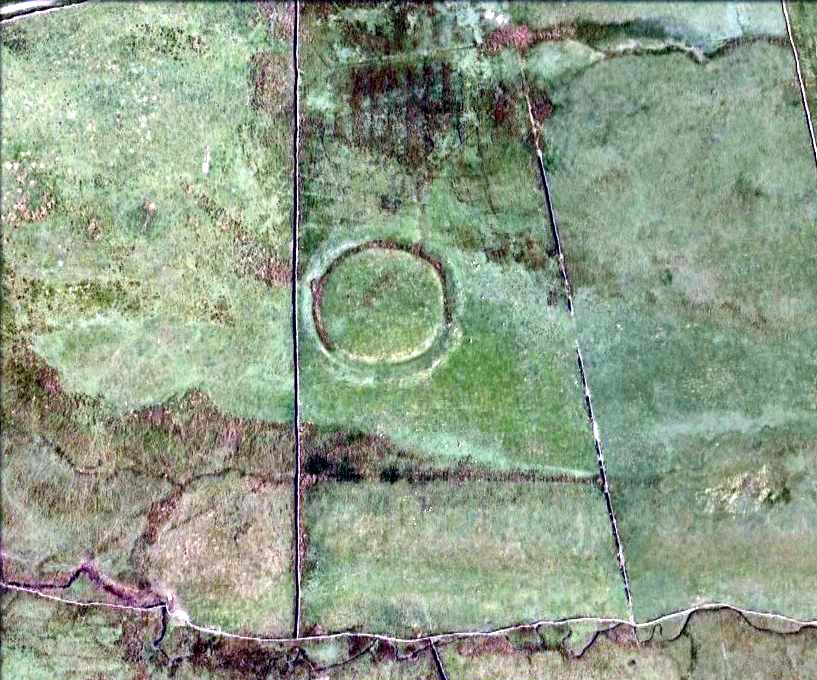
“It consists of an oval enclosure bounded by a well-preserved ditch and external bank, with an entrance on the East side.  Two small gaps in the bank, without corresponding causeways across the ditch, were probably made in recent times to allow the escape downhill of the surface water which collects in the ditch.  The dimensions in H. Allcroft’s plan are incorrect.  The markedly oval shape is probably in part dictated by the situation, in order that as much as possible of the enclosed area should lie on the level ground topping the ridge.  There is no sign of any stone structure in the central area, but the district abounds in stone walls, for which the site may have been robbed in the past.”

Aerial image

In more recent years, archaeologists have speculated that the site was a sacred site or meeting place, aswell as a site where trade occurred, particularly a place where axes were traded; but this latter idea is  more due to the projection of a modern religious notion, of ‘The Market’ with little veracity in terms of the site’s function.  This increasing imposition of ‘economics’ and ‘trade’ (see Brown 2008:44-6)  as vital ingredients to this and other sites has little relevance outside of a simple epiphenomenalistic adjunct to magical and tribal exchanges.  But such notions are outside of archaeological frameworks, so we shouldn’t be surprised at so prevalent an error.

But this place is damn impressive — though with the exception of Mr Griffith, one notable ingredient archaeologists seem to have forgotten about was the position of this site in the landscape.  The views surrounding the henge are excellent, giving a 360° arena all round.  If the monument once had a ring of stones around it, as Allcroft suggested, the views would still have been the same.  A modern excavation here might prove worthwhile and, as a result, open up once again, the potential for further astronomical investigations with the many hills and notches along the living horizon.  This site, whilst requiring analysis of it as a ‘specimen’, must also be placed in the context of the wider living environment which, to all early traditional cultures, were such important and integral ingredients.

We have also found some previously unrecorded prehistoric remains nearby which, hopefully, we’ll be able to explore a little more in 2011 and report here.

…to be continued…

References:

  1. Allcroft, A. Hadrian, Earthwork of England, MacMillan: London 1908.
  2. Atkinson, R.J.C., “The Henge Monuments of Great Britain,” in Atkinson, Piggott & Sandars’ Excavations at Dorchester, Oxon (Department of Antiquities: Oxford 1951).
  3. Barker, W.G.M.J., The Three Days of Wensleydale, Charles Dolman: London 1854.
  4. Bogg, Edmund, Wensleydale and the Lower Vale of Yore, E. Bogg: Leeds (c.1906).
  5. Brown, Paul & Barbara, Prehistoric Rock Art in the Northern Dales, Tempus: Stroud 2008.
  6. Griffith, Rev. J., “English Earthworks and their Orientation,” in Nature, volume 80, 18 March 1909.
  7. Harding, A.F., Henge Monuments and Related Sites of Great Britain, BAR 175: Oxford 1987.
  8. Smith, A.H., The Place-Names of the North Riding of Yorkshire,Cambridge University Press 1928.
  9. Speight, Harry, Romantic Richmondshire, Elliot Stock: London 1897.

AcknowledgementsMany thanks to Richard Stroud for use of his photo of the henge.

© Paul Bennett, The Northern Antiquarian

Temple of Anaitis, Lusta, Waternish, Skye

‘Stone Circle’: OS Grid Reference – NG 2725 5273

Also Known as:

  1. Annait
  2. Temple of Annait

Getting Here

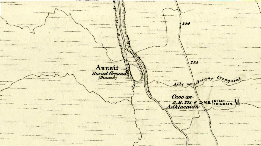
1880 map of Anaitis
1880 map of Anaitis

Otta Swire (1961) told how to find this place, thus: “The Waternish road turns off to the north at Fairy Bridge, whence it runs along the valley of the Bay river. On the left of the road, though at some little distance from it, where the river cleaves its way through a gorge to the sea, stands the mound which is now all that remains of the ‘Temple of Anaitis’ (so called).”

Archaeology & History

This is a curious place, full of archaeological potential if the folklore and history records are owt to go by, yet little of any substance remains to substantiate what may have been an important stone circle or other heathen site in earlier times. It seems to have been described first of all in the famous Hebridean journeys of Boswell and Johnson in the late 18th century.  Amidst his insulting description of both the landscape and local people, on Friday 17th September 1773, James Boswell visited the site and told:

“The weather this day was rather better than any that we had since we came to Dunvegan. Mr M’Queen had often mentioned a curious piece of antiquity near this which he called a temple of the goddess Anaitis.  Having often talked of going to see it, he and I set out after breakfast, attended by his servant, a fellow quite like a savage.  I must observe here, that in Skye there seems to be much idleness; for men and boys follow you, as colts follow passengers upon a road. The usual figure of a Sky boy, is a lown with bare legs and feet, a dirty kilt, ragged coat and waistcoat, a bare head, and a stick in his hand, which, I suppose, is partly to help the lazy rogue to walk, partly to serve as a kind of a defensive weapon. We walked what is called two miles, but is probably four, from the castle, till we came to the sacred place. The country around is a black dreary moor on all sides, except to the sea-coast, towards which there is a view through a valley, and the farm of Bay shews some good land. The place itself is green ground, being well drained, by means of a deep glen on each side, in both of which there runs a rivulet with a good quantity of water, forming several cascades, which make a considerable appearance and sound.  The first thing we came to was an earthen mound, or dyke, extending from the one precipice to the other.  A little farther on, was a strong stone-wall, not high, but very thick, extending in the same manner.  On the outside of it were the ruins of two houses, one on each side of the entry or gate to it. The wall is built all along of uncemented stones, but of so large a size as to make a very firm and durable rampart. It has been built all about the consecrated ground, except where the precipice is deep enough to form an enclosure of itself. The sacred spot contains more than two acres. There are within it the ruins of many houses, none of them large, a cairn, and many graves marked by clusters of stones. Mr M’Queen insisted that the ruin of a small building, standing east and west, was actually the temple of the goddess Anaitis, where her statue was kept, and from whence processions were made to wash it in one of the brooks. There is, it must be owned, a hollow road visible for a good way from the entrance; but Mr M’Queen, with the keen eye of an antiquary, traced it much farther than I could perceive it. There is not above a foot and a half in height of the walls now remaining; and the whole extent of the building was never, I imagine, greater than an ordinary Highland house. Mr M’Queen has collected a great deal of learning on the subject of the temple of Anaitis; and I had endeavoured, in my journal, to state such particulars as might give some idea of it, and of the surrounding scenery” —

But in all honesty it seems Mr Johnson was either too lazy to write about the place, or simply didn’t actually get there, in spite of what he alleged!  But later that evening, Boswell dined with the same Mr MacQueen, who told him more of this site.  In the typically pedantic tone of english supremacy (which still prevails in some idiots who visit these lands), he continued by saying:

“Mr Macqueen had laid stress on the name given to the place by the country people, Ainnit; and added, ” I knew not what to make of this piece of antiquity, till I met with the Anaitidis delubrum in Lydia, mentioned by Pausanias and the elder Pliny.”  Dr. Johnson, with his usual acuteness, examined Mr Macqueen as to the meaning of the word Ainnit, in Erse, and it proved to be a water-place, or a place near water, “which,” said Mr. Macqueen, “agrees with all the descriptions of the temples of that goddess, which were situated near rivers, that there might be water to wash the statue.”

There ensued a discussion between Mr MacQueen and Samuel Johnson about the etymology of Anaitis, with one thinking it was of a goddess, and another that it represented an early christian site.  To this day it is difficult to say what the word means with any certainty.  In W.J. Watson’s (1993) fine work he tells us,

Andoit, now annaid, has been already explained as a patron saint’s church, or a church that contains the relics of the founder.  This is the meaning in Ireland and it is all we have to go upon.  How far it is held with regard to Scotland is hard to say… They are often in places  that are now, and must always have been, rather remote and out of the way.  It is very rarely indeed that an Annat can be associated with any particular saint, nor have I met any traditions connected with them.  But wherever there is an Annat there are traces of an ancient chapel or cemetery, or both; very often, too, the Annat adjoins a fine well or stream…”

The great Skye historian and folklorist Otta Swire (1961) also wrote about this mysterious site, mainly echoing what’s said above, but also adding:

“This name of Annait or Annat is found all over Scotland. It has been interpreted as meaning the ‘Water-place’ from Celtic ‘An’ = water, because many are near water. Others suggest ‘Ann’ = a circle (Celtic) and claim that most Annats are near standing stones. The most-favoured derivation seems to be from Ann, the Irish mother of the Gods, and those who hold this view claim that the Annats are always near a revered spot, where either a mother-church or the cell of a patron saint once stood. Probably Annat does, in fact, come from an older, pre-Celtic tongue, and belongs to an older people whose ancient worship it may well commemorate. The curious shape of the Waternish Temple of Anaitis and its survival make it seem likely that it was something of importance in its day, built with more than usual care and skill. Perhaps the Temple tradition is correct – but whose, if so, and to what gods? One cannot help wondering if cats played any part in its ritual, and if so, if any faint memory remains, for the nickname of the people of this wing was ‘Na Caits’ = The Cats, and not far off, by one of the tributary burns on the right of the roadway, there stands a small cairn, crowned by a long, sharp stone somewhat resembling a huge claw. This is the ‘Cats’ Cairn’.”

The Cats’ Cairn (NG271526) is said to mark the grave of a young boy from the 18th century, who was buried where he died and its story is told elsewhere on TNA.  Another example of the Annait place-name can be found elsewhere on Skye at the megalithic site, Clach na h’annait.

References:

  1. Boswell, James, The Journal of a Tour to the Hebrides with Samuel Johnson, National Illustrated Library: London 1899.
  2. Swire, Otta F., Skye: The Island and its Legends, Blackie: Glasgow 1961.
  3. Watson, W.J., The History of the Celtic Place-Names of Scotland, Birlinn: Edinburgh 1993.

© Paul Bennett, The Northern Antiquarian
Devil’s Blue Stane, Crail, Fife

Legendary Rock:  OS Grid Reference – NO 614 079

Also Known as:

  1. Devil’s Blue Stone

Folklore

This curious rounded boulder sitting outside the parish church was described by Alexander Polson in his survey of witch-lore.  He told us that “when the old church was being built, the devil, as a mason out of work, came here and was employed.”  But it wasn’t long before a local christian discovered his disguise and, uttering some magickal biblical words, the devil became furious.

“Immediately he heard this there was a clap of thunder and the fiend flew away to the Isle of May,” about five miles away to the south. “Here in his anger he seized a huge rock and hurled it at the church. It fell quite near, did no harm, and a part of it lay at the church’s door, with the mark of the devil’s thumb on it.”

On the north end of the Isle of May are the Altar Stanes (NT 652 997), thought to have been where the devil stood (close to the holy well of St. Andrew [NT 652 994]) and threw this stone at Crail several miles north.  In pre-christian mythic terms, north is the direction or airt of greatest symbolic darkness.  A variation on the creation myth for this stone tells that when it was thrown from the island, one half of it split off and it fell by the coast in Balcombie, Fife.

References:

  1. Polson, Alexander, Scottish Witchcraft Lore, W. Alexander: Inverness 1932.

© Paul Bennett, The Northern Antiquarian


Weeping Stone, Fladaigh Chuain, Skye

Legendary Rock: OS Grid Reference – NG 3638 8091

Getting Here

Unless you’ve got your own boat, forget it!  This one’s miles out on the isolated uninhabited island of Fladda-chuain about 5 miles off the northwest tip from Duntulm, Trotternish.  I wouldn’t mind a coupla weeks alone on the isle though – if anyone can get me there!

Archaeology & History

The little rocky island itself was allegedly another of the many visiting places of St. Columba in his many ventures to sell his religion to the peasants and displace the druids, who were alleged to practice pre-christian rites here and deemed it as sacred.  St. Columba’s chapel on this island was built to displace the heathen traditions.

Folklore

In Otta Swire’s (1961) excellent work on the folklore and history of the Isle of Skye, she wrote:

“In Duntulm Bay lies Tulm Island and beyond it, in clear weather, Fladdachuan, Fladda of the Ocean, can be seen. In olden times this was a sacred spot, held by many to be Tir-nan-Og, the Isle of Perpetual Youth, which lay in the west; here it is always summer and the sun never sets. The puffins recognized its sacred nature and never began any venture until they had circled the island three times sunwise; this they did also on arriving in Skye and before leaving it. It was held by some to be the reason why in Skye people used to turn three times sunwise before starting a new enterprise. The Druids held it in veneration and St. Columba caused a chapel to be built there. On its altar lay a black stone which some say was the original altar stone of the Druids and which was known as the Weeping Stone because it was always wet. Until fairly recently fishermen used to land on the island and pour three handfuls of seawater on the stone to procure favourable winds or to stop bad floods. The Weeping Stone no longer exists, or at least is no longer to be found where the altar once stood.”

I can’t find anything more about this place.  Does anyone know owt more about it?

References:

  1. Swire, Otta F., Skye: The Island and its Legends, Blackie & Son: Glasgow 1961.

© Paul Bennett, The Northern Antiquarian
Mudbeck Ring, Arkengarthdale Moor, North Yorkshire

Stone Circle:  OS Grid Reference – NY 95626 07618

Also Known as:

  1. Arkle Beck Stone Circle
  2. Thom L6/5

Getting Here

Truly takes some finding this one and you’ve got those energy-depleting tribbles (tussocks) to contend with in your journey here!  But if you’ve good ankles and enjoy bouncing the moors, it aint too bad.  It’s 4 miles east of Tan Hill, some 700 yards west of the confluence of Mud Beck and Arkle Beck, and some 300 yards north of Arkle Beck amidst the grassy open moorland.  Look around and you’ll find it!

Archaeology & History

Located on a prominent position on a ridge at the head of a pass into Upper Arkengarthdale, this site was first found in 1982 by local Shepherd William Stubbs, who informed Tim Laurie, who then contacted Archibald Thom – son of the legendary Alexander Thom – who went on to survey the site in 1983.  Thom “recorded five stones in the ring, one slab buried on the line of the perimeter, and a small stone just inside the ring.” He reckoned the outlying stone 55 yards ENE was also part of the original complex. His survey found its geometry to be a perfect circle in design.  And, in good old-fashioned Alex Thom fashion, measured the diameter of the circle at precisely 22.53 megalithic yards; that’s about 20 yards to you and me!

All the stones in the ring are pretty small and unassuming and the site gives more an impression of having burial associations, but I’m unaware of any such finds.  There are other little known sites scattering this region and we need a few ventures scouting around to see what more can be found…

References:

  1. Curtis, Ronald, ‘The Geometry of Some Megalithic Rings,’ in Records in Stone (edited by Clive Ruggles), Cambridge University Press 1988.

© Paul Bennett, The Northern Antiquarian

Delf Hill, Extwistle, Burnley, Lancashire

Ring Cairn:  OS Grid Reference – SD 9006 3373

Also Known as:

  1. Delph Hill Pasture

Archaeology & History

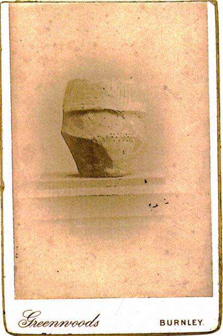
Rare 1842 photo of urn from Delf Hill

Described in Walter Bennett’s (1946) magnum opus as a “stone circle” and repeated in Aubrey Burl’s (2000) magnum opus under the same category, the site here seems more likely to have been an old cairn circle, or perhaps even a simple tumulus — and a small one at that!  It was first noted in June of 1842 when the antiquarian, Mr F.C. Spencer of Halifax, “had his attention called to a circle of stones in a field called Delph Hill Pasture by Jonas Lee, a Thursden farmer, and a somewhat noted character in his day” who knew the location very well. It didn’t take long for Mr Spencer to realise that this was “an ancient British barrow,” as he called it, and made plans to excavate the site soon after seeing it.

Following Spencer’s dig, a short account of the finds was made in the Gentleman’s Magazine, telling of the remains of this “small circle of stones” and the burials therein.  The account said:

“The circle originally consisted of rock pillars (five of which remain) , standing about 18 inches above the surface, and being about 2 feet square.  The diameter of the circle is about 5 yards.  Mr Spencer directed an excavation to be made without delay, the result of which was the discovery of two very antique earthen urns, curiously marked, containing fragments of human bones, of small dimensions, mixed with charcoal and black mould.  The tops of the vessels were covered with small flat slate-stones, but little larger than the urns, over which larger heavy stones were placed for their protection.   The urns were found about 2 feet beneath the surface of the field, in the centre of the circle, embedded in soft clay, with many pieces of charcoal interspersed.  About 300 yards from the barrow are the bold remains of a British circular camp…”

A few years later, Tattersall Wilkinson (1893) told that “three unglazed urns, with human remains and flint arrowheads” (my italics) were found at the locale.  Curiously there has been some confusion as to the number of urns that were actually found at Delf Hill by different authors over the last 175 years (numbering between 1 and 3, depending on whose account you read!), but it would seem this has occurred due to the proximity of other tombs close by.

An excursion to Delf Hill a few years after Spencer’s first dig is described in an article by L. Clement (1874), where several members of a local history society reported that the mound here consisted of a “small circle of stones, seven in number, fourteen feet in diameter”, that probably surrounded the hillock.  One of the stones had been knocked over and moved, so the group took it upon themselves to place the monolith back into what they thought was its original setting within the monument.

References:

  1. Abraham, John Harris, Hidden Prehistory around the North West, Kindle 2012.
  2. Barnes, Bernard, Man and the Changing Landscape, Merseyside County Council 1982.
  3. Bennett, Walter, History of Burnley – volume 1, Burnley Corporation 1946.
  4. Booth, Thomas, Ancient Grave Mounds on the Slopes of the Pennine Range, R. Chambers: Todmorden 1899.
  5. Burl, Aubrey, The Stone Circles of Britain, Ireland and Britanny, Yale University Press 2000.
  6. Clement, L., “Roman Remains in Marsden, Briercliffe and Extwistle,” in Transactions of the Burnley Literary & Scientific Club, volume 1, 1874.
  7. Gomme, George Laurence, The Gentleman’s Magazine Library: Archaeology – Part 1, Houghton, Mifflin & Co.: Boston 1886.
  8. Watson, Geoffrey G., Early Man in the Halifax District, HSS: Halifax 1952.
  9. Wilkinson, Tattersall, “Extwistle Moor, Burnley,” in Transactions of the Lancashire & Cheshire Antiquarian Society, volume 11, 1893.

© Paul Bennett, The Northern Antiquarian

Parc-y Meirw, Llanychaer, Pembroke

Standing Stones:  OS Grid Reference – SM 9988 3591

Also Known as:

  1. Parc y Marw
  2. Parc y Meirw

Archaeology & History

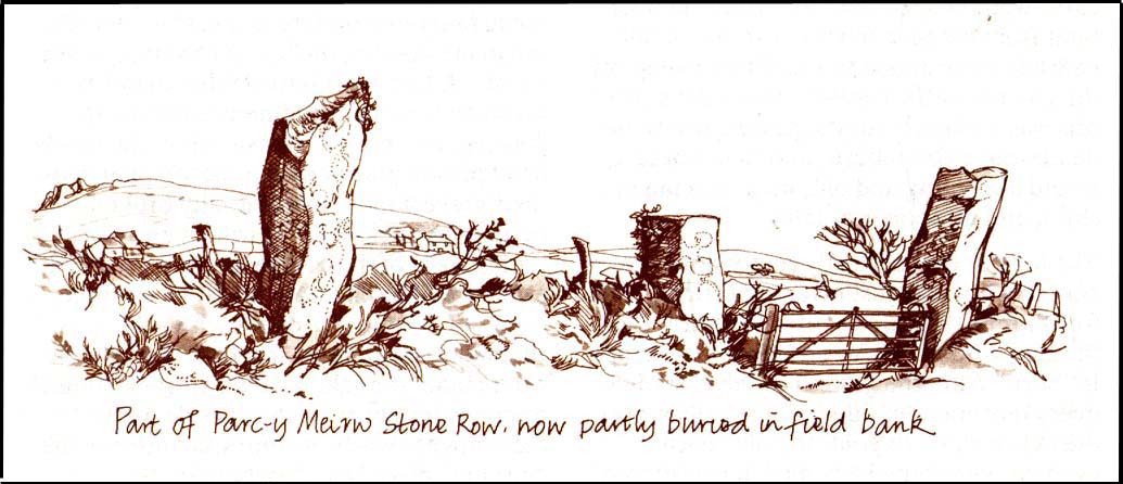
Parc y Meirw - by Liz Haines
Parc y Meirw – by Liz Haines

This is an impressive and well-known megalithic stone row, found just 4-5 miles inland from the coastal town of Fishguard.  The drawing here is used courtesy of Elizabeth Haines, landscape artist, and gives a fine representation of the site as I’m sure you’d agree!  Consisting of at least eight standing stones — four still upright and four laid down — aligning northwest to southeast, the tallest stone stands at the southerly end measuring 11 feet tall.  The stone row is found in a region rich in prehistoric remains.  Aubrey Burl (1993) said of the place:

“Four of the eight stones in this unusual row still stand, trapped in a  field-wall, tow of them now gateposts.  Thom suggested that the line, 131ft (40m) long, was laid out downhill towards the WNW and the minor northern moonset just north of Mount Leinster ninety-one miles away across the Irish Sea.”

Quite a distance!  And perhaps because of this, Burl thought that the nature of this line of stones was more archaeological than astronomical, with its focal point being more likely up the slope to the ESE instead.

Folklore

There was once an adjacent chambered tomb here which, when it was “destroyed for a house in 1844 brought the owner no luck” (Thom, Thom & Burl 1990) – which is damn good to hear!  There was a piece of folklore mentioned by E.L. Barnwell (1868) and other writers that the fields here marked the fall of three Welsh princes in the Battle of Mynydd Carn in 1084.  In Roger Worsley’s (1988) fine tour of Pembrokeshire’s historical sites, he tells how these megaliths in the “field of the dead” are also haunted, saying:

“A local tale tells of Ladi Wen, a ghostly White Lady wandering about the fields at night, and who will kill anyone who ventures near; it was enough to keep villagers away from the site well into this century, though the stone row is over five thousand years old.”

References:

  1. Barber, Chris & Williams, John Godfrey, The Ancient Stones of Wales, Blorenge: Abergavenny 1989.
  2. Barnwell, E.L., “Alignments in Wales,” in Archaeologia Cambrensis, volume 14, 1868.
  3. Burl, Aubrey, From Carnac to Callanish, Yale University Press 1993.
  4. Thom, Alexander, Thom, A.S. & Burl, Aubrey, Stone Rows and Standing Stones, BAR 560: Oxford 1990.
  5. Worsley, Roger, The Pembrokeshire Explorer, CCP: Abercastle 1988.

ACKNOWLEDGEMENTSA huge thanks to Elizabeth Haines, Landscape Artist, for use of her drawing of Parc-y Meirw.

© Paul Bennett, The Northern Antiquarian 

Stannary, Halifax, West Yorkshire

Stone Circle (destroyed):  OS Grid Reference – SE 088 256

Archaeology & History

The place-name authority A.H. Smith (1961), in searching for the meaning behind the old region in Halifax known as “stannary”, just west of the town centre, was puzzled by its implications and found it wanting, so he took the most likely option as he saw it, writing,  “probably it is a stone circle,” from the archaic verbs stan (stone) and hring (ring).

First recorded in the Halifax Court Rolls of 1575 as “Stannerying”, this implied it to be a place where tin-ware was sold in a field, “though that word belongs rather to Cornwall,” he said, and it appeared out of place at the time it was written.  So he looked elsewhere.  The Halifax Parish Registers of 1578 didn’t help much, describing the place as “Stanerye.”  However, the Halifax Rent Records of 1588 named it as “Standeringe”, which is much closer to Smith’s idea.  With each written instance we certainly find the old English stan, but the suffix in two instances is difficult to assess with firm conviction.

If we could locate additional folklore or other historical data that might throw further light on this, it would be an important find.  The finding of prehistoric burial remains less than a mile south of Stannary on the other side of town shows that ancient man was in Halifax, but it would be good if we could find more…

References:

  1. Smith, A.H., The Place-Names of the West Riding of Yorkshire, Cambridge University Press 1961-63.

© Paul Bennett, The Northern Antiquarian

Bryn Celli Ddu, Llandaniel Fab, Anglesey

Chambered Cairn:  OS Grid Reference – SH 50761 70185

Also known as:

  1. Bryncelli Ddu
Bryn Celli Dhu in 1847

Archaeology & History

An excellent passage grave tomb that’s been described by many historians over the last two hundred years, and was subject to a fine excavation in the first half of the 20th century.  Ascribed as neolithic in origin, recent finds of human activity on the edge of the surrounding henge indicates people have been “up to things” hereby since at least 6000 BC.  Deriving its name from “the mound of the black grove,” the site as we see it today has been much restored and is so different to when it was visited by Thomas Pennant and other antiquarians.

According to an anonymously written essay in Archaeologia Cambrensis in 1847, the site was first described by Henry Rowlands (1723) where, in relation to another site, he told were,

“the remains of two carnedds, within a few paces of one another: the one is somewhat broken and pitted into on one side, where the stones had been carried away; the other having had its stones almost all taken away into walls and hedges, with two standing columns erected between them.”

A somewhat more detailed description came from Thomas Pennant a few years later.  He wrote:

“A few years ago, beneath a carnedd similar to that at Tregarnedd, was discovered, on a farm called Bryn-celli-ddu…a passage three feet wide, four feet two or three inches high and about nineteen feet and a half long, which led into a room about three feet in diameter and seven in height.  The form was an irregular hexagon, and the sides composed of six rude slabs, one of which measured in its diagonal eight feet nine inches.  In the middle was an artless pillar of stone, four feet eight inches in circumference.  This supports the roof, which consists of one great stone near ten feet in diameter.  Along the sides of the room was, if I may be allowed the expression, a stone bench, on which were found human bones, which fell to dust almost at a touch: it is probable that the bodies were placed on the bench… The diameter of the incumbent carnedd is from ninety to a hundred feet.”

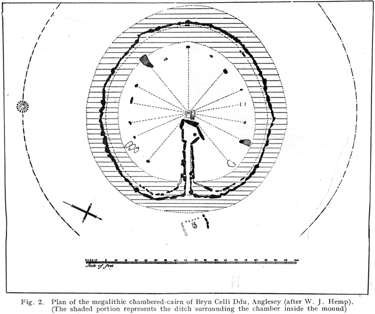
Ground-plan

But the main excavation work at Bryn Celli Ddu was done in the late-1920s by W.J. Hemp (1930) and his team, who, as usual following such digs, ended up with just as many questions about the site as they had answers!  One of the best descriptions of Hemp’s excavation work was by W.F. Grimes (1932) in an essay he wrote for the East Anglian Prehistoric Society where he gave the following detailed description of the finds:

“The cairn here was circular, with a chamber of some 160ft and an original maximum height of at least 12ft.  The chamber is a polygonal structure of large stones augmented…with dry-stone walling, entered on the northeast side by a long passage built in the same way.  Many of the stones had been dressed and in the chamber stood a single pillar which had been artificially rounded and smoothed, but which had never actually supported the capstone.

“These features had been more or less apparent for many years.  But the reparation work soon showed that this was by no means all.  In the first place, it was found that the chamber had been surrounded by four circles of standing stones.  The first of these, around the outside of the mound at its base, had disappeared, although early accounts and a single hole found in the course of the work of excavation, are evidence of its existence.  The second and third circles were found when the entrance to the passage wall was being cleared.  Here the walls of the passage were found to merge into an outer circle of large stones and an inner of smaller, set close together and elaborately packed and sunk in a ditch six feet deep and eighteen wide, enclosing the chamber in such a way that passage, chamber and circles together form a gigantic unbroken spiral, with the chamber itself as an unbroken loop in it.  The fourth and innermost circle was in the area enclosed by the ditch (which is represented on the plan by the shaded portion).  This consisted of a number of stones of various sizes, irregularly placed and in some cases inclined outwards.  Under some of them were deposits of burnt human bones.  Lines connecting these stones diametrically were found to intersect at the centre of the monument, directly behind the chamber, and here was found a slab-covered pit which contained an elaborate filling whose purpose is unexplained.  Beside the cover-stone of the pit was a second larger slab of grit, lying flat, the faces of which were covered with an elaborate and continuous pattern of spirals, scrolls and zig-zags.  The position of this stone is shown beside the central stone on the plan.  Of it purpose it can only be said that it was probably magical…

“As if the elaborate features already described thus badly were not enough, a uniform floor of purple clay was found to cover the old natural surface within the area enclosed by the ditch, and there were on the floor, in the ditch, and in many other places extensive traces of fire in the form of burnt patches, blackening and quantities of charcoal.  In addition there were outside the entrance, a line of post-holes and remains of walls suggesting the former existence of some kind of forecourt crossed by a temporary barrier.  Here also were traces of fire and of elaborate ritual.  It must be emphasized of course, that all these features, with the exception of the outer circle of stones and the forecourt, had been completely concealed by the mound, so that they were not visible once the monument was completed… Moreover…the entrance to the chamber had been closed with an elaborate blocking which suggested that once closed the chamber had not been intended to be re-opened.”

Although many questions emerged following the excavation, perhaps that relating to the chronology and evolution of the site (after its ritual use) was most important.  The site as we see it today sits within the confines of a henge monument (which should also be given an independent entry account) and once a stone circle.  And although present day field evidence is inconclusive about which came first, archaeologists like Richard Bradley, Clare o’ Kelly and others are not without opinion.  Bradley (1998) told:

“O’ Kelly argued that there had been two successive monuments on the site.  The earlier one was a stone circle, enclosed by the earthworks of the henge.  In a later phase this was replaced by a passage grave which was built over the surviving remains of the stone circle, its outer kerb being bedded in the ditch of the older monument.”

But Bradley himself doubts this for various reasons, himself interpreting,

“the sequence at Bryn Celli Ddu is to suggest that in its first phase it consisted of a circular unrevetted mound about 15m in diameter, containing a passage grave.  Around the edge of this structure was a stone circle, and beyond that there was a quarry ditch.  When the monument was enlarged, not on one occasion but twice, the passage was extended as far as the earlier ditch and a significantly larger mound was bounded by kerbstones.”

Though adding himself that there is also a trouble with this idea!  As with many other sites, Bryn Celli Ddu appears to have been aligned to the summer solstice.  This notion was first propounded by astronomer Sir Norman Lockyer (1909) in his hugely revised work on the astronomical function of megalithic sites.  It was nearly 100 years before any archaeologist got off their backside and tested Lockyer’s original proposal and found the scientist to have been way ahead of them at their own discipline.  Not unsurprisingly, archaeologist Mike Pitts (2006) was a bit slow in his gimmicky headline in British Archaeology, where he deemed Steve Burrow’s personal observation as “sensational.”  Oh how common this theme seems to be in archaeology.  Twenty years previously Miranda Green (1991) posited that the chamber alignment from Bryn Celli Ddu aligned towards “May Day sunrise” — which doesn’t seem to work.  And on a similar astronomical note, archaeologist Julian Thomas (1991) thought that five post-holes found some five yards beyond the entrance were somewhat reminiscent of the “A” holes at Stonehenge and related to some lunar alignments, thinking that:

“It seems likely that  (they) record a series of observations upon the rising of some heavenly body in order to ascertain its standstill position.”

A point that Clive Ruggles (1999) explored with a little scepticism, pointing out:

“The only possibility is the northern minor limit of the moon, and while the adjacent posts are ranged on the correct side to record the position, say, of the midwinter full moonrise in years before and after the minor standstill, many other interpretations of these posts are doubtless possible.”

There’s been lots written about this place and lots more could be added with various archaeologists showing their relative opinions about the place.  But perhaps more worthwhile is a visit to the place, later on, when the tourists have fallen back under a starlit sky…

References:

  1. Anonymous, “Cromlech at Bryn Celli Ddu, Anglesey,” in Archaeologia Cambrensis, volume 2, 1847.
  2. Barber, Chris & Williams, John G., The Ancient Stones of Wales, Blorenge: Abergavenny 1989.
  3. Bradley, Richard, “Stone Circles and Passage Graves – A Contested Relationship,” in Prehistoric Ritual and Religion, edited by Alex Gibson & Derek Simpson (Sutton: Stroud 1998).
  4. Green, Miranda, The Sun Gods of Ancient Europe, Batsford: London 1991.
  5. Grimes, W.F., “Prehistoric Archaeology in Wales since 1925,” in Proceedings of the Prehistoric Society of East Anglia, 7:1, 1932.
  6. Hemp, W.J., “The Chambered Tomb of Bryn Celli Ddu, Anglesey,” in Archaeologia, volume 80, 1930.
  7. Lockyer, Norman, Stonehenge and other British Stone Monuments Astronomically Considered, MacMillan: London 1909.
  8. Lynch, Frances, Prehistoric Anglesey, Anglesey Antiquarian Society 1991.
  9. o’ Kelly, Clare, “Bryn Celli Ddu: A Reinterpretation,” in Archaeologia Cambrensis, volume 118, 1969.
  10. Ruggles, Clive, Astronomy in Prehistoric Britain and Ireland, Yale University Press 1999.
  11. Thomas, Julian, Rethinking the Neolithic, Cambridge University Press 1991.

© Paul Bennett, The Northern Antiquarian

Broad Stones, Clatford, Wiltshire

Stone Circle (destroyed):  OS Grid Reference – SU 161 684

Also Known as:

  1. Clatford Stone Circle

Archaeology & History

John Aubrey’s early drawing (soz about the crap quality)

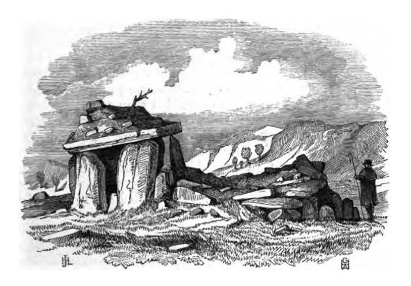
Also known as the Clatford Circle, it was described by both of the old pioneers, John Aubrey and William Stukeley: Aubrey saying the monument could be found “in a lane leading from Kennet to Marlborough… (consisting) of eight huge large stones, roughly hewn… in a circle, which never could be by chance.”  Will Stukeley reckoned that four other stones close by, “may possibly have been the beginning of an avenue.”  We might never know for sure.

The local Avebury authority, Pete Glastonbury, showed us a spot which he thinks may have been the where the circle stood, and where a couple of decent-looking stones lay by the side of the track that could have once been a part of this circle.  It looked as good a contender as anything else.  Has all trace of this monument truly been destroyed?

References:

  1. Burl, Aubrey, Prehistoric Avebury, Yale University Press 2002.

© Paul Bennett, The Northern Antiquarian