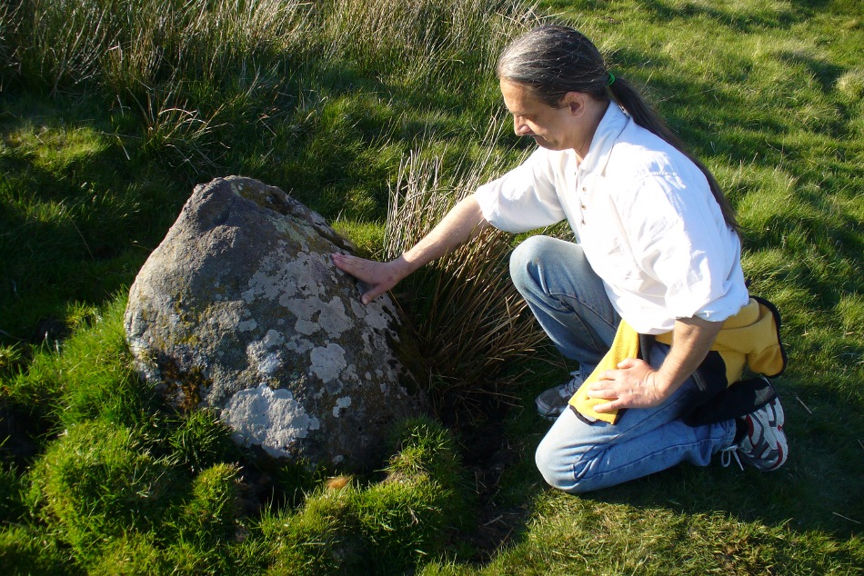
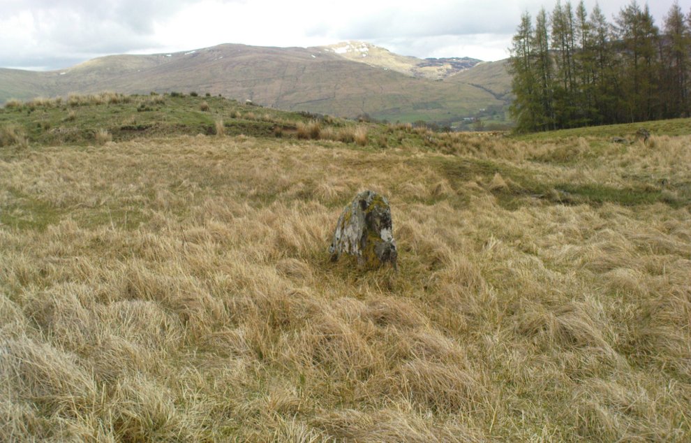
Take the A923 road through Dunkeld and across the river, making sure that where the road veers sharply to the right as you go out of town, you go the left as the road bends round. 100 yards along, past the trees on your left, fields open up. A few hundred yards along on the left, you’ll note the small standing stone about 50 yards in the field below the wall, getting close to some trees again. That’s the spot!
Archaeology & History
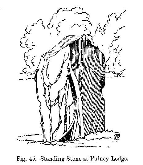
The stone is given only a passing mention in the Royal Commission’s (1994) poor work on the region, describing neither its height nor form and erroneously relating it to what is probably a much earlier series of pit alignments in the same field. Thankfully we had a better description from the early 20th century antiquarian Fred Cole (1908) who visited and drew the site and who told us:
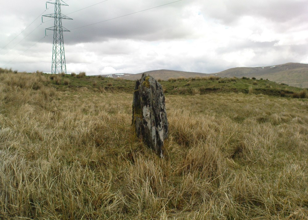
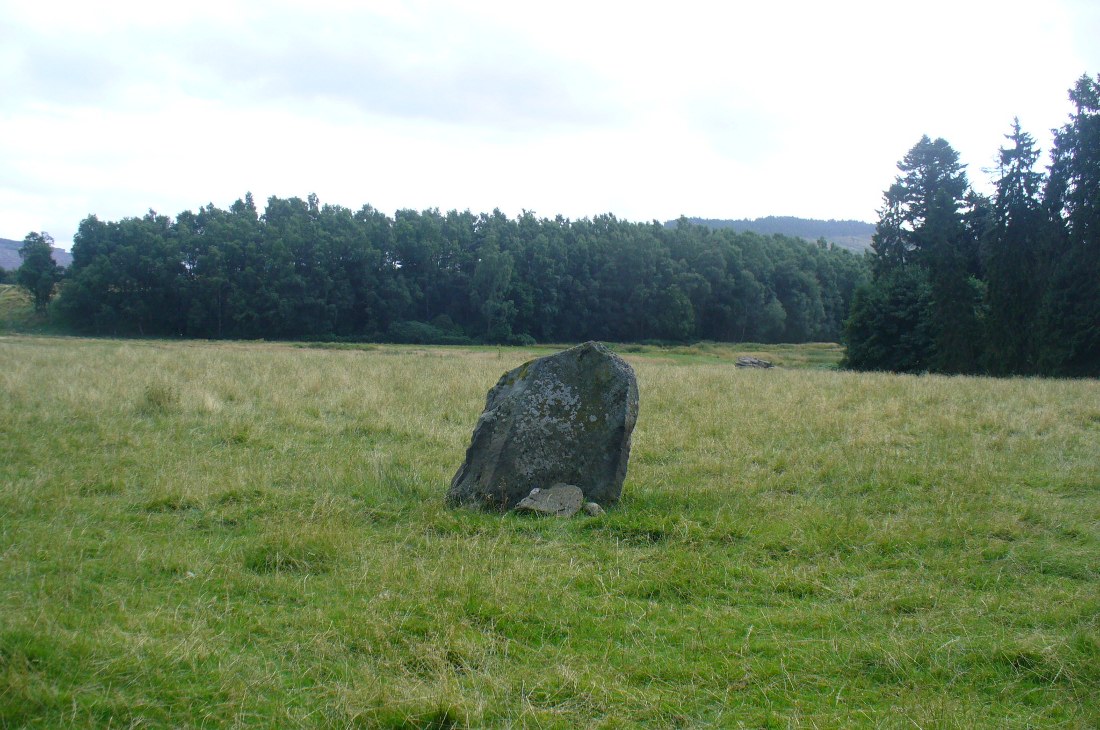
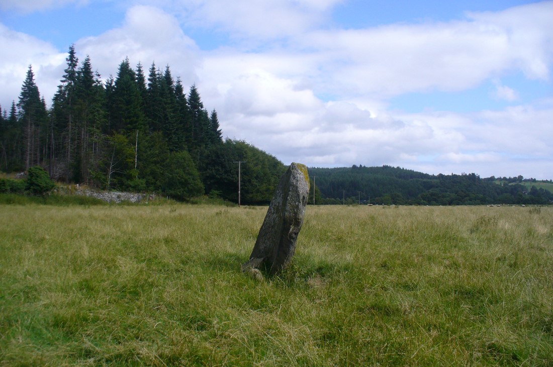
Standing stone, looking NEDunkeld Stone looking north
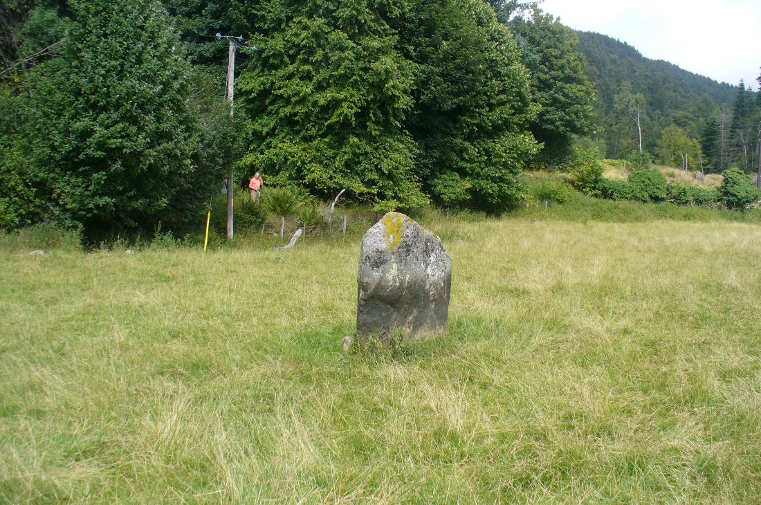
“This Stone is marked on the Ordnance Map in a field behind the Lodge, at a height above sea-level of 300 feet, and styled “sepulchral.” In size and character it much resembles the Kilmoraich monolith, and seems to have stood solitary for ages. It is a roughly oblong slab of schist, set with its longer axis nearly east and west, the north face measuring 4 feet and the south 4 feet 9 inches, and the basal girth about 10 feet 7 inches. It is 4 feet 9 inches in height. The grandly-timbered policies of the ducal estate enclose this site on all sides. In the illustration…the Stone is drawn as seen from the east.”
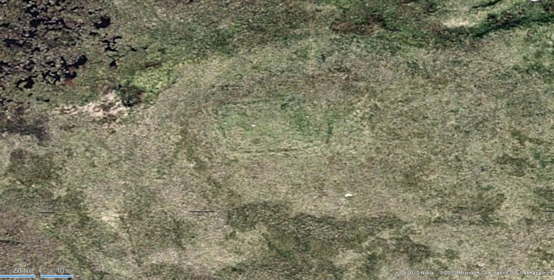
Close to the walling on the WNW just a few yards away, we see a cluster of small rounded stones and a couple of larger stones, much overgrown, giving the impression that they were field clearance. There is a possibility that they may have had something to do with the standing stone in earlier times; the small stones being very worn and perhaps being part of a cairn—although there seems little evidence of this in the on-line aerial surveys. The stone was also mentioned in Elizabeth Stewart’s Dunkeld (1926), where she wrote:
“In the park near Polney Loch, one mile from Dunkeld, is a Standing Stone, quite noticeable from the Highland road. This monolith is one of those styled sepulchral, and is a rough oblong slab of schist, its basal girth being 10 feet 7 inches, and its height 4 feet 9 inches. Mr. Coles, who describes this stone in the “Proceedings of the Society of Antiquaries”, supposes it to have been part of a circle. It is not far from the ancient stronghold on King’s Seat.”
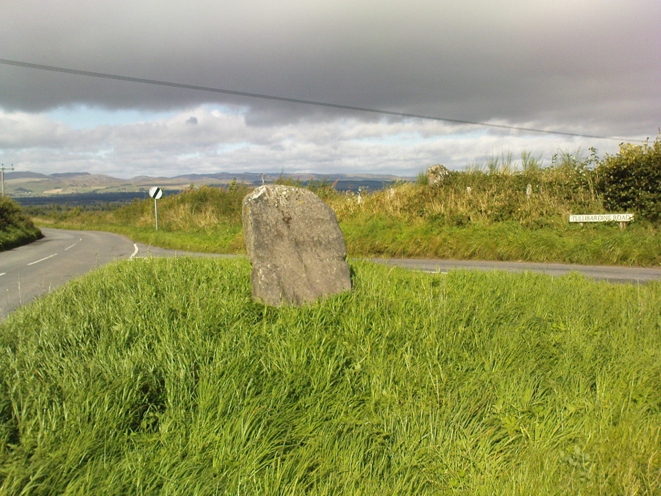
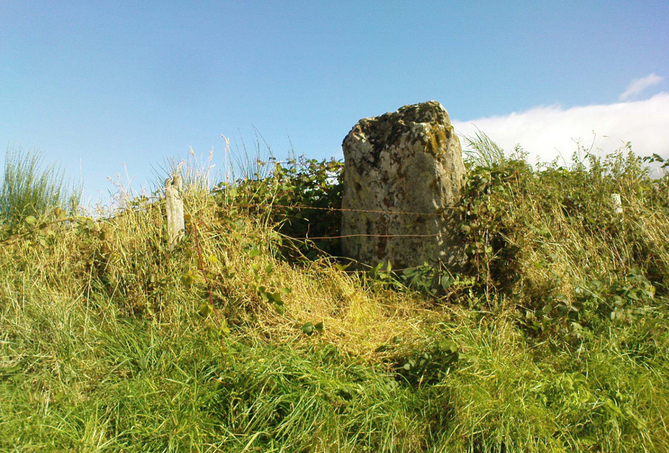
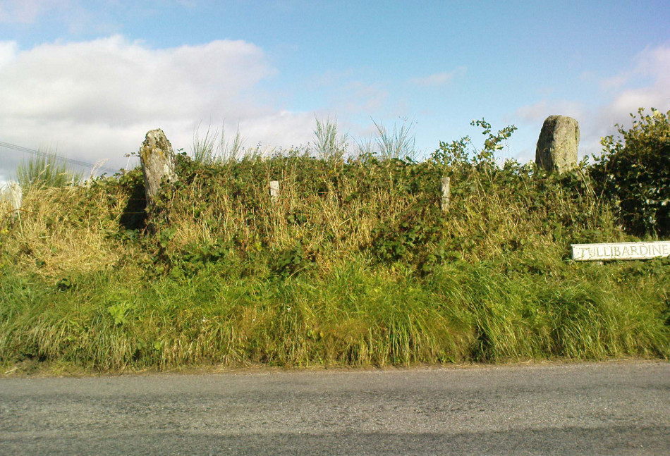
From Auchterarder’s A824 main street, going out towards the golf course take the Orchil Road on your right and then about fifty yards along, turn right again up Tullibardine Road. Park up somewhere about a hundred yards along, then just walk further down the road until you’ll see the standing stone right at the road junction. Look into the field on your right, above you, and another two are hiding in the brambles and grasses.
Archaeology & History
Included in Andy Finlayson’s (2010) fine local survey, this is an intriguing little group of three standing stones (and a fourth buried beneath the turf), all very close to each other. They are shown on the modern Ordnance Survey maps as “standing stones”, but have been catalogued by archaeologists as the denuded remains of a ‘Four Poster’ stone circle. Despite this, the circle wasn’t included in Aubrey Burl’s (1988) definitive work on the subject, nor his megalithic magnum opus. (Burl 2000)
Northern hedgerow stone…and two in the hedgerow
Of the two uprights above the roadside at the field edge, a faint carved hand can be found on the upright west-facing side of the southernmost of the two standing stones. Although faint, this doesn’t appear to be ancient. Written accounts of these stones are few and far between it seems. The earliest seems to be in the lengthy essay written by Mr Hutchison (1893), in which he gave an excellent account:
“Less than a mile to the west of (Auchterarder)…is a fine group of stones, two only of which are now standing. These stand on the summit of what has been a well-defined mound, and the stones now lying where the roads unite seem to have stood originally at the same height. The road has been driven through the group at a lower level than the summit of the mound, and the stones have been thrown down and laid in the waste space at the point of junction. The small mercy to be thankful for is that they have not been broken up altogether and used for road metaL This has probably been due to the circumstances that one of these stones has a curious encircling groove running round it, which perhaps impressed even the vandal roadmakers with the idea that it might be worthy of preservation. It would be interesting to know whether, when the circle or group of stones was cut through, any cist or interment was found. One would expect such to be the case, but I have not yet got any information on the point. There are several stones lying on the spot which may or may not be pieces of the original standing stones. Two considerable bits of old red sandstone, at least, look as if they were fragments of an original whole. Two great stones, however, are unmistakably prostrate standing-stones; and from the positions in which they lie, it seems to me as if the persons who had uprooted them had laid them down as nearly as possible on the sites they had occupied (at the original higher level, of course) when standing.
“The direction in which both of the standing stones point is 236º, and a line taken from each of the prostrate stones to the opposite standing one gives very nearly the same angle (240º). The prostrate stones are of metamorphic schist. The northerly one measures 7 feet in length by 3 feet in width, and is from 12 to 18 inches thick. A grove or furrow, 2 inches deep at its greatest depth, and from 2 to 4 inches wide, appears to run right round it, at a distance of 2 feet 10 inches from the end, which may have been about the middle height of the stone when erect. The lower side of the stone cannot be seen, but the appearance at the edges indicates that the furrow is carried all the way round. It looks just such a hollow as might be worn in stone by the long continued attrition of an iron chain. The more southerly prostrate stone is 6 feet in length, 4 feet wide, and has an average thickness of 18 inches. The two stones still standing are on the high bank above the road, just inside the hedge. These are both of old red sandstone, thinnish slabs, facing in the direction already mentioned. That to the south is 4 feet 10 inches in height, 2 feet 8 inch broad at the base, and 10 inches thick. The other is 5 ft. 3 in. at its greatest height, 3 feet 10 inches wide, and from 13 to 15 indies thick. On its northern face it shows a number of depressions or indentations curiously resembling prints of human feet. These Mr Kidston considers to be due to natural weathering.”
Southern carved stone
Yet the “prints of human feet” are very much man-made. A closer examination of these carvings is obviously needed.
Whether these stones originally played a part in an old tumulus, a cairn circle, or a typical stone circle, is hard to say with any certainty now. We are in a landscape where megalithic remains were once in great excess: with the standing stones of Blackford to the south; the lost circle of Gleneagles nearby; the megaliths near Muthill and many many more…
References:
Burl, Aubrey, Four Posters: Bronze Age Stone Circles of Western Europe, BAR 195: Oxford 1988.
Finlayson, Andrew, The Stones of Strathearn, One Tree Island: Comrie 2010.
Hutchison, A.F., “The Standing Stones of Stirling District,” in The Stirling Antiquary, volume 1, 1893.
Strachan, Favid (ed.), A History of Blackford, Blackford Historical Society 2010.
Follow the directions to reach the Rollrights stone circle, from Chipping Norton. Walk past the entrance to the circle along the road for a coupla hundred yards, keeping your eyes peeled looking into the field on your right. You’ll notice the large rocky mass of these Knights a hundred yards down in the field, which can be reached by a footpath running straight along the old hedge from the roadside straight to the collapsed tomb.
Archaeology & History
The Whispering Knights
A brilliant site—albeit nowhere like how it once was—where I slept a few times when I lived in the old hut at the Rollright stone circle down the road. A field-mouse lived here when I slept at the place and, hopefully, its ancestors still reside hereby (Rollright Trust’s poisons notwithstanding!). On my first encounter with the little fella, I felt him running into my waist-side whilst laying, dozing in the old tomb. He nudged into me—then again —and yet again; before I leaned over to see what was going on! And the little mouse looked up at me, without a care in the world, as if to say, “What are you doing lying on my path!? Can I get past please?” (though I’d not had a bath for a good 3 months, so didn’t smell like any modern human, which I think explained his total lack of fear)
Laying there, I smiled at the little fella, who then decided to jump up the side of my waist and walk over the top of me to get to the other side! He jumped down into the grasses and disappeared! However, a few minutes later, I felt another tiny ‘thud’ at my side and looked down to see the same lovely mouse wanting to go back along his obviously traditional route – and looking up at me again, whiskers twitching inquisitively, realised I was still here; and so once again took it upon himself to climb over the scruffy smelly human-sort who was blocking his route!
He was a gorgeous little mouse and we got to know each other quite well over the unwashed springs and summers I slept here….. But anyway, that’s not what you folks are interested in hearing about! Back to the archaeo-shit….
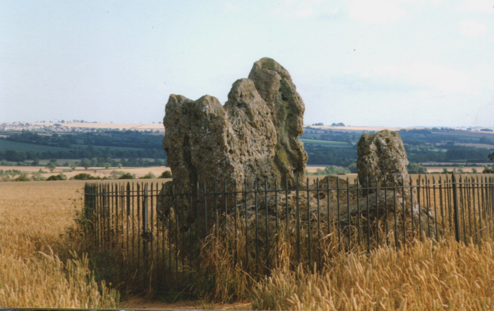
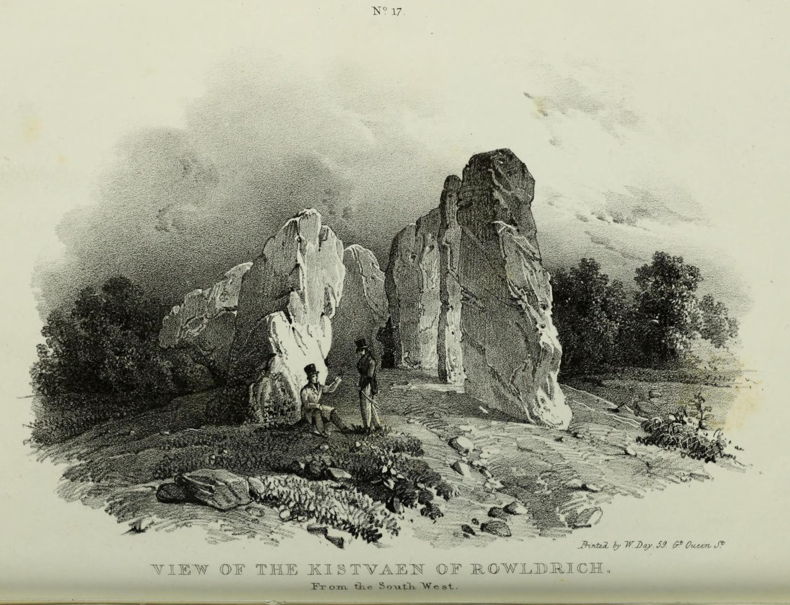
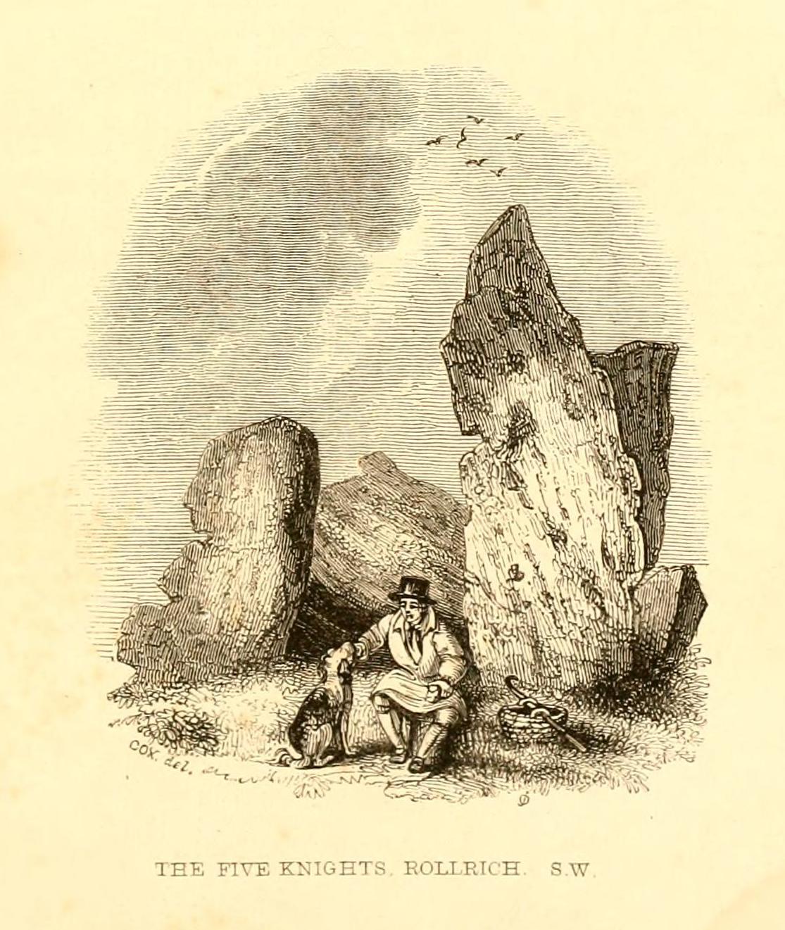
The Whispering Knights is one of the main sites in the cluster known collectively as the Rollright Stones, which also comprises of the standing stone commonly called the King Stone, plus the King’s Men stone circle a coupla hundred yards down the road from the Knights. They all sit atop of the ridge which separates the counties of Oxfordshire and Warwickshire along the edge of the prehistoric road known as the Jurassic Way. The sites are non-contemporaneous having been erected over a period of many centuries. The Whispering- or Five Knights are by far the oldest part of the complex dating from a period never previously anticipated. They comprise of four upright megaliths in close proximity, and a fifth fallen stone which is said to be the capstone on the original monument. This stone alone weighs some 10 tons.
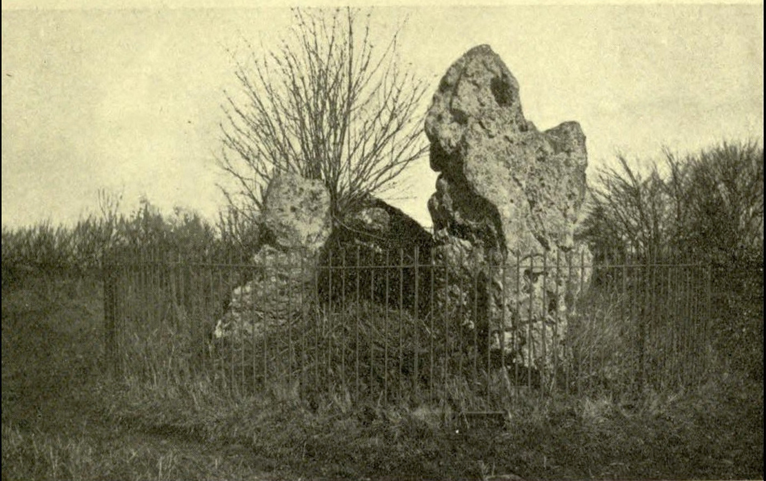
The general archaeological opinion is that the place is a ‘portal dolmen burial chamber’ of which the capstone has fallen. The Oxford archaeologist George Lambrick (1988) postulated the stones to have been covered with a mound of earth, but any evidence supporting this has long since gone.
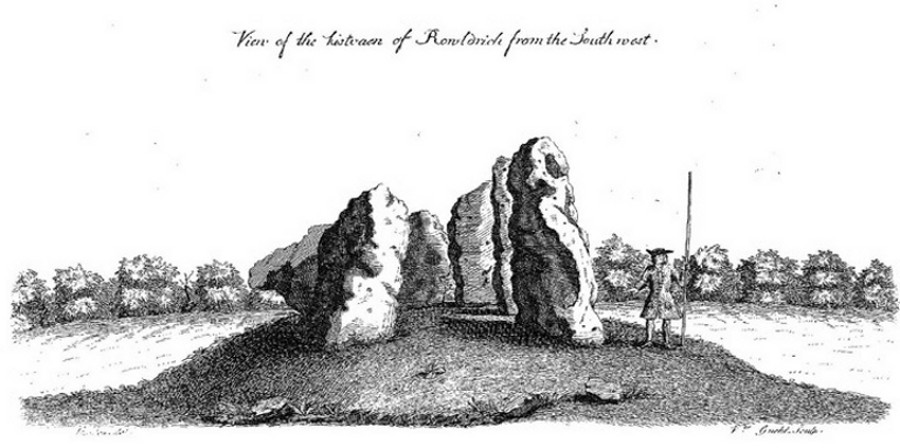
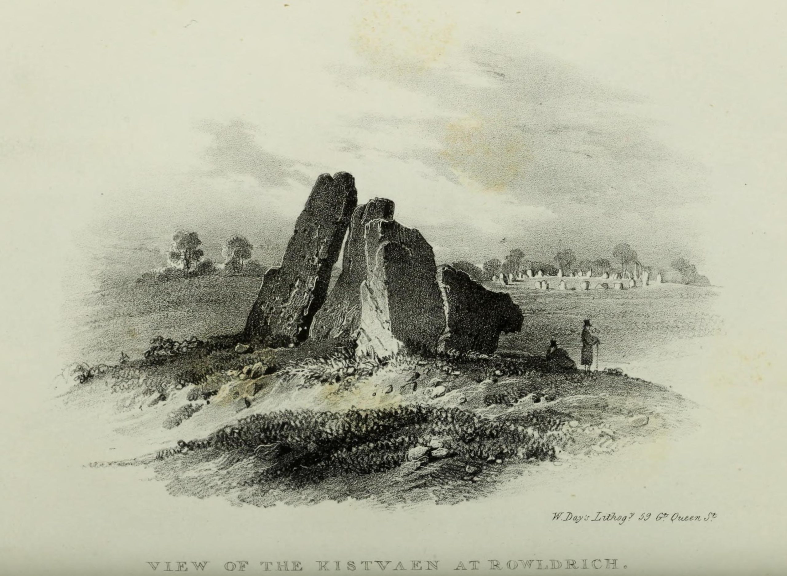
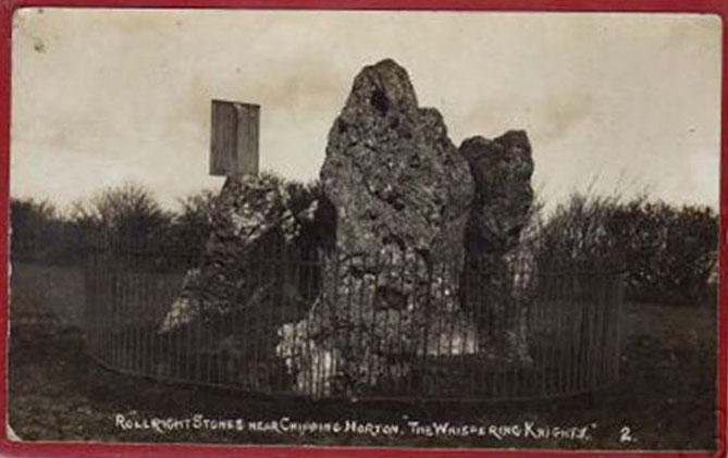
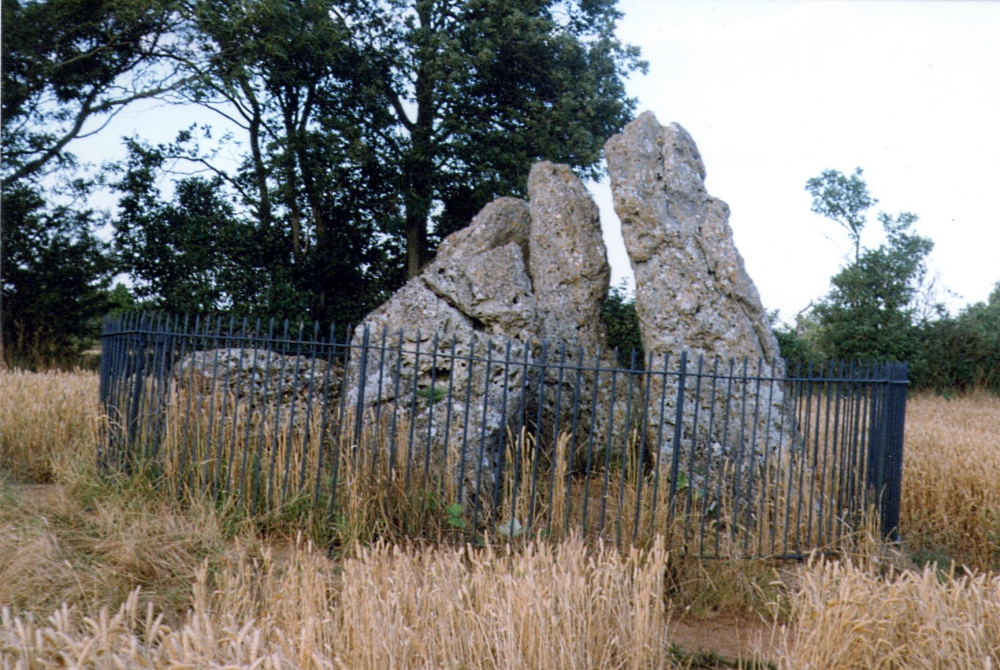
1920s postcard of the siteThe Knights in 1995
This great monument was initially thought by archaeologists to have been built sometime around 1800 BCE—a favourite date of academics for many an unexcavated site for many decades—until they turned their astute attention to the place in the 1980s. And what they found was astonishing. Well…astonishing for the archaeologists! Affirming the local folk tradition that the Knights were the “oldest monuments in Oxfordshire,” the dates truly went back. Way back! Datable remains at the site gave results from between 3500 and 3800 BCE: two thousand years earlier than anyone had ever expected of them.
Although five stones remain of the site, when the great William Stukeley (1743) visited the Whispering Knights, he described six of them to be visible with the great stones here to be sat upon a tumulus, saying:
“Tis composed of six stones, one broader for the back part, two and two narrower for the sides, set square to the former; and above all, as a cover, a still larger. The opening is full west to the temple or Rowldrich. It stands on a round tumulus, and has a fine prospect southwestward down the valley, where the head of the Evenlode runs.”
O.G.S. Crawford (1932) told us of a description which Sir Henry Dryden gave of the Knights in 1898, when he wrote:
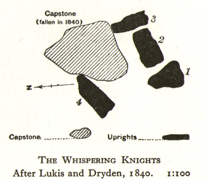
“About 356 yards E from the (Rollright) circle and S of the road, is the dolmen about to be described, called the Five Whispering Knights. It is in a ruinous state. It now consists of four stones, upright, or nearly so, and one prostrate, all of coarse limestone…
Height, 8ft 3ins (4ft by 2ft 6ins)
” , 7ft 3ins (3ft 6ins by 1ft 10ins)
” , 6ft 7ins (3ft 8ins by 1ft 4ins)
” , 5ft 4ins (4ft 9ins by 2ft)
Capstone (then fallen), 8ft 4ins by 5ft 9ins, by 2ft 4ins
“The chamber appears to have been about 5 feet 6 inches W and E, and the same N and S. If, as usual, there was an entrance, with or without a passage, it was probably to the ENE… There is not, so far as I know, any record of remains having been found in this dolmen. In a small stone pit about 700 feet NE by E from the circle it is stated that 12 skulls were found in 1835. In another stone pit near it was found in 1836 an urn and beads…”
1840 plan by Lukis & Dryden
During the last century, very little has really changed at the Knights. The ring fencing surrounding the stones has kept it pretty much protected, despite it ruining all sense of healthy ambience. But they have gained greater and greater attention the older they have got. Archaeologists are not the only ones exploring the site. Fascinated astronomers, engineers and architects have been and seemingly uncovered other mythic ingredients here.
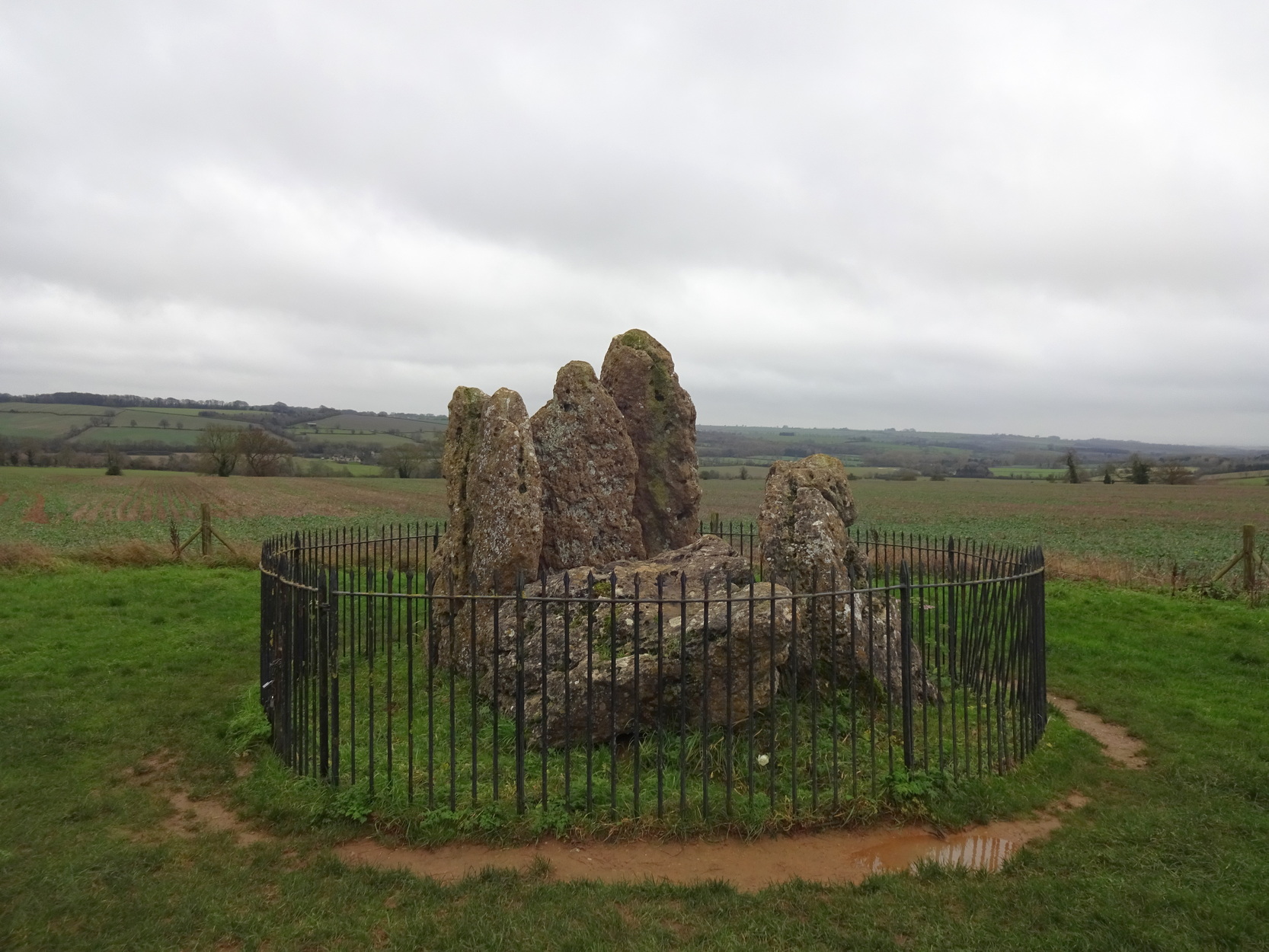
Whispering Knights, 2016
When the legendary Alexander Thom came here, he used the archaeological data that was being espoused at the time, which said the Knights and the Rollright stones had both been built around 1750 to 1800 BC. With these dates as his guide, he found that someone standing at the centre of the Rollright circle, on the morning of the equinoxes—March 21 and September 21—the sun would rise right above the Whispering Knights. And the effect, he thought, was a notable one: with the light from the rising sun going straight through a hole in one of the stones in the circle as it rose up behind the Knights. It would have looked both spectacular and eerie in the rising mists of first light, like a laser cutting through the still morning air… However, although Thom’s measurements were very accurate, the archaeologists had got their dates wrong. Very wrong! For the Whispering Knights were about 1500 years older than the stone circle—and so the alignments Thom pronounced, based on the archaeologist’s erroneous proclamations, were also incorrect.
There may be other alignments connected to the Rollright complex. In a survey of the site as part of the Dragon Project experiments conducted here in June 1980, Leslie Banks and Christopher Stanley flew over the place and found, adjacent to the Whispering Knights, a quite distinct “trace of two dark green parallel lines in a field of ripening corn” running northwest to the roadside. To this day nobody quite understands the nature of this enigmatic alignment:
“In the absence of excavation we can only speculate,” said Stanley. “But the most likely explanation is that it is what archaeologists refer to as a Cursus. Cursuses are thought to be prehistoric religious processional ways.”
As with many of the alignments described here, the jury is still out on this one!
Folklore
Whispering Knights, 1829
The folklore here is prodigious! The prime story of the neolithic tomb of the Whispering Knights tells that originally they were in fact a group of traitors who moved away from a King and his army in ages past, and who were plotting against him, when the great Witch of Rollright (a southern version of the great cailleach, found in more northern counties, Scotland and Ireland) turned them all to stone (this tale is intimately bound up with the King’s Men stone circle and the associated King Stone).
Whispering Knights, 1841
Another tale tells how the King Stone and the Whispering Knights venture, at midnight, less than half a mile south to drink from a spring in the small woodland at Little Rollright Spinney, although it is difficult to ascertain precisely which of the two springs the stones are supposed to visit. In some accounts, the stones reputedly drink from the well every night, but others tell that they only go there at certain times of the year, or on saint’s days. When Arthur Evans (1895) wrote of these tales he described there being a “gap in the bushes… through which they go down to the water,” but the terrain has altered since his day.
Other accounts imbuing the stones with life tell how they only ‘awaken’ when disturbed by humans. A story well-known to local people is that of when the Knights had its capstone removed one day by a farmer who used it to build a bridge across the stream at Little Rollright. As Evans told us,
“it took a score of horses to drag it down the hill, for at first it would not move, and they had to strain and strain to get it along till every bit of the harness was broken. At last they got it to the brook by Rollright Farm, and with great difficulty laid it across to serve as a bridge. But every night the stone turned over back again and was found in the morning lying on the grass.”
Three nights of this led the farmer to think he should replace the stone which, so the fable goes, took only one horse to move it back uphill and into position. A variation of the same tale was told by T.H. Ravenhill, who wrote:
“The Lord of the Manor of Little Rollright desired to possess the King’s Stone in order to bridge Little Rollright brook. So he dug it up and tried to cart it away, but found that he had not enough horses. He hitched on more, and yet more, and still he found that he could not move the stone. Finally he succeeded and hauled the stone away to the Manor House. The same night he was alarmed by strange sounds about the house, which he attributed to the presence of the King’s Stone, and decided, therefore, to replace it on its mound. No sooner had he harnessed the first horse to the cart than it galloped away up hill with ease, taking with it the stone, which leapt to position on reaching its resting place.”
There are still more variations that are worth mentioning. One from 1876,
“said that a miller in Long Compton, thinking the stone would be useful in damming the water of his mill, carried it away and used it for that purpose, but he found that whatever water was dammed up in the day disappeared in the night, and thinking it was done by the witches (at Long Compton) and that they would punish him for his impertinence in removing the stone, he took it back again; and, though it required three horses to take it to Long Compton, one easily brought it back.”
In yet another version, the stone was wanted by a local farmer for his outhouse. In taking it downhill, the horses that pulled his wagon died and the vehicle itself was irreparably damaged. It got even worse for the poor chap: his crops failed, his family were taken ill and his cattle died. Eventually when all but his last horse remained, he made another cart and it pulled the stone back uphill with ease. Thereafter, so the tale goes, all his adversities stopped and he lived a normal life. In one version of this tale, the great monolith was said to have been taken north-north-west down to the stream at The Hollows, Long Compton. Tales such as these are, once more, found throughout the world.
The truth of these stories was seemingly unquestionable to some local people in the 19th century,
“one man going as far as to say that there were those now living who had spoken to men who had helped to bring the stone down and up again.”
In William Stukeley’s day, one Farmer Baker was so troubled by his actions that he couldn’t rest until he returned the old stone.
The doyen of the early geodelic sciences or Earth Mysteries movement, John Michell, suggested how the legends of megaliths moving of their own accord harked back to ancient days when the people of those times were more attuned to the terrestrial magnetic flows of the Earth.
The Whispering Knights were also a place where “young girls of the neighbourhood (use it as) a kind of primitive oracle.” One local told Arthur Evans that around barley harvest the young women of the district visited the Five Knights to listen to them whisper. One at a time they would rest their ears against the strange shapes of stone and, if fortune and conditions were right, they would hear the future told. This mass of animistic lore is very revealing indeed, telling us much about the way our peasant ancestors viewed the living world around them. (Eliade 1958)
In more recent times, the site has been explored by dowsers and ley hunters, who claim to have found a veritable bags of fascinating lost material around the Knights. Although originally ‘leys’ were described by Alfred Watkins as quite acceptable prehistoric trackways linking site to site to site, in recent years the original theory has been ignored and superceded with a host of almost incredulous fluctuations. Leys these days can run just about anywhere – and do!
One writer who tells about the leys around Whispering Knights is Lawrence Main. (1997) He dowsed and found a ley running south to the famous White Horse at Uffington. Roy Cooper (1979) was the first person to write about this alignment and extended it further north to the impressive and legendary Brailles Hill. That one seems reasonable. However,
“Other leys I dowsed,” said Main, “Linked the King Stone, the stone circle, and the Whispering Knights with each other; the King Stone with Banbury Cross; the Whispering Knights with Hook Norton church; and the stone circle with the churches at Todenham and Stretton-on-Fosse.”
Another dowsing ley hunter is Dennis Wheatley (not The Devil Rides Out dood). He wrote a couple of short works on his lengthy experiments at the Rollright stones and reported how he found a
“tangential aerial energy course…across the country (which) latches on to a solitary standing stone, six miles south, known as the Hawk Stone.”
Perhaps of greater importance here is that Wheatley also discovered how,
“all of the Rollright ring’s stones engage in aerial energetic cross-talk with the King Stone producing a triangulation of energy lines.”
This cross-talk of Wheatley’s involves more than seventy energy lines running between the circle and the King’s Stone. He tells us that a greater “aerial cross-talk” also occurs between the circle and the Knights; and “a lesser energetic triangulation” runs between the King and the Knights.
Along similar lines are the findings of the dowser Reginald Smith. (1980) Beneath the Whispering Knights he claimed to have found,
“a concealed spring which runs underground to the northwest and may betoken a consecrated site; but 100 feet to the east there seems to be another blind spring with issue to the northeast.”
References:
Bennett, Paul & Wilson, Tom, The Old Stones of Rollright and District, Cockley Press: London 1999.
Burl, Aubrey, Great Stone Circles, Yale University Press: New York & London 1999.
Cooper, Roy, ‘Some Oxfordshire Leys,’ in The Ley Hunter 86, 1979.
Crawford, O.G.S., Long Barrows of the Cotswolds, John Bellows: Oxford 1932.
Devereux, Paul, Places of Power, Blandford: London 1990.
Devereux, Paul, The Sacred Place, Cassell: London 2000.
Eliade, Mircea, Patterns in Comparative Religion, Sheed & Ward: London 1958.
Evans, Arthur J., ‘The Rollright Stones and their Folklore (3 parts),’ in Folklore Journal, 1895.
Gelling, Margaret, The Place-Names of Oxfordshire – volume 2, Cambridge University Press 1971.
Graves, Tom, Dowsing: Techniques and Applications, Turnstone: London 1976.
Grinsell, Leslie V., The Ancient Burial Mounds of England, Methuen: London 1936.
Lambrick, George, The Rollright Stones: The Archaeology and Folklore of the Stones and their Surroundings, Oxford Archaeology Review 1983. (Reprinted and updated in 1988.)
Main, Lawrence, Walks in Mysterious Oxfordshire, Sigma: Wilmslow 1997.
Ravenhill, T.H., The Rollright Stones and the Men Who Erected Them, Little Rollright 1926.
Robins, Don, Circles of Silence, Souvenir Press: London 1985.
Smith, Reginald A., ‘Archaeological Dowsing,’ in Graves, Tom (ed.), Dowsing and Archaeology (Turnstone: Wellingborough 1980).
Stanley, Christopher C., ‘A Rollright Processional Way?’ in The Ley Hunter 90, 1981.
Stuart, Sheila, Lifting the Latch, Oxford University Press 1987.
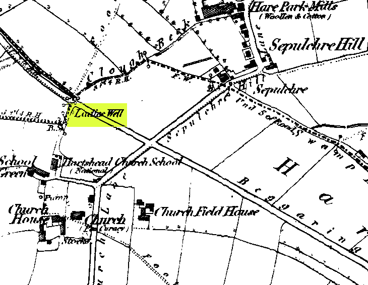
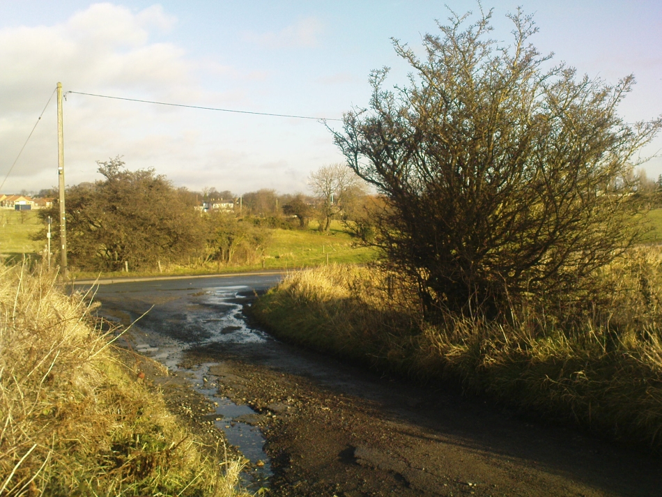
This can take a little bitta finding if you don’t know the area. So it’s best starting from Hartshead church, right on top of the hill here. From whichever direction you’re taking to reach Hartshead, ask a local when you get close and they’ll direct you there. From here, walk out of the churchyard and turn left. Walk barely 50 yards and turn left again along Lady Well Lane. Past the old houses and bear right where it becomes a dirt-track. This then turns left, then again right and – with the fields on either side of you – note the single hawthorn tree ahead of you by the walling. Go into the field at the back of the hawthorn and look under its shady bough. Tis there, I assure you!
Archaeology & History
The holy well is beneath this hawthorn tree
Emerging at the edge of the field beneath an old hawthorn tree at the side of the track running to the adjacent church, the waters from here are clean and fresh—though the stone trough into which it flows is constantly clogged up and the ground around it very boggy. The well has given its name to Lady Well Lane, which leads to the 12th century St. Peter’s Church, with its own ancient and legendary history. The well is thought to derive its name from ‘Our Lady’, the Virgin Mary, indicating it would have had considerable importance in the religious traditions of the christians who named it, but moreso the original animistic traditions of normal local people who would have used it for much longer…
Close by this old stone trough appears to be another one, covered by moss and the encroaching field. Whatever medicinal properties the waters may once have had, have long since been forgotten. Around Lady Well is a healthy abundance of flora: elder, chickweed, nettle, clover, bramble, dandelion, sow thistle, dock and shamanic species.
Folklore
The overgrown Lady Well
Marion Pobjoy (1972), like her predecessors, suggested that this was one of many sites in Calderdale used by St. Paulinus to perform baptisms. Local folklore tells that Robin Hood stopped here to drink the waters—but then we find an abundance of the pagan outlaw’s activities all round here. The nearby church of St.Peter is aligned to the equinoxes and may well be an indication of when pre-christian celebrations occurred here. The yew tree in churchyard was where Robin Hood was supposed to have taken wood to fashion one of his bows. Modern folklore also ascribes the well to be along a ley line.
References:
Heginbottom, J.A., ‘Early Christian Sites in Calderdale,’ in Proc. Halifax Ant. Soc., 1988.
Pobjoy, Harold N. & Marion, The Story of the Ancient Parish of Hartshead-cum-Clifton, Riding 1972.
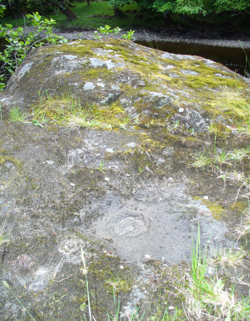
Troublesome to get to unless you’re reasonably fit. Probably the easiest route is to get to the Duncroisk 3 cup-and-ring stone. Keep walking along the riverside, climb over the first tall wooden fence and onwards till you reach the rocky crag reaching into the river Lochay. By whichever means possible, get yourself up and round this crag, but keep by the riverside till you get to the easier walkable rocky outcrop protruding into the river on the other side of the drop. Hereby, on one of the stones, look and you’ll find these faint cup-and-ring symbols.
Archaeology & History
Although this carving was first described in Edward Cormack’s (1952) essay on the prehistoric carvings of the district, they have subsequently proved difficult to locate by the Royal Commission lads and other archaeologists. I’ve been here a few times looking for it and never managed to find it — until last week. When Mr Cormack first told of the design, he said:
“On a smooth rock surface just above the mouth of the small burn running into the Lochay, immediately west of the cup-marked ridge, are two cup-and-ring markings a yard apart. The rings are curiously rough edged, and do not give the same impression of weathering as those on the ridge; possibly they have been silted over shortly after being cut, and exposed again relatively recently.”
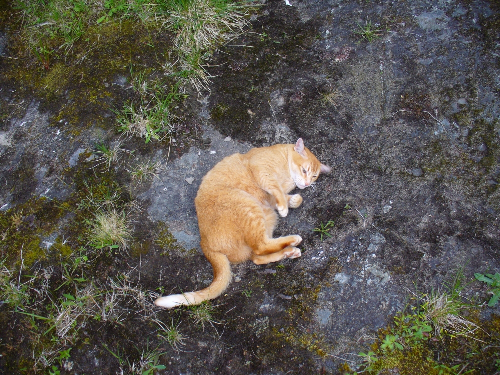
Flambeau the Cat uses the carving as his bed!
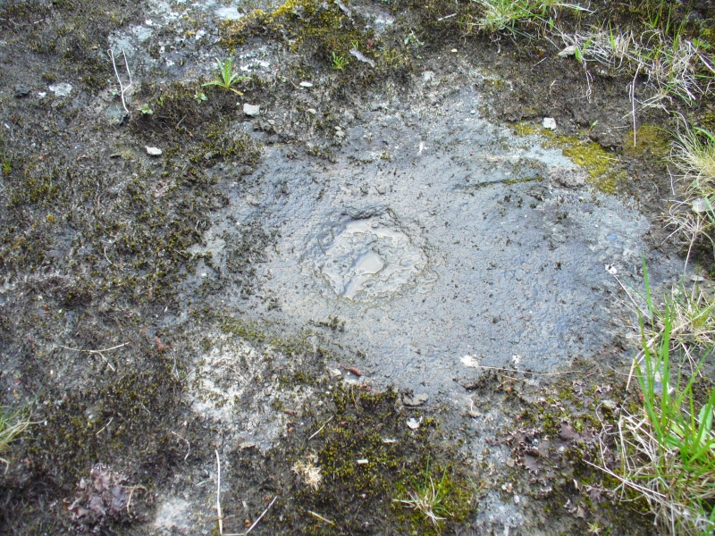
A few decades later, Ron Morris (1981) came across the carving, 10 yards “southeast of an elbow of River Lochay”, as he put it. Described as “hard to find”, he went on to give a basic outline of the design as he saw them, telling there to be “2 cups-and-one-ring, both probably complete, up to 16cm (6in) diameters, with radial grooves from cup to ring—up to 1cm deep.” Or more simply, two cup-and-rings, each with a line running from the centre to the surrounding ring.
After trying to find this carving on several occasions, without success (somehow!), it was brought to my attention under the brilliant guidance of a local cat called Flambeau only last week (no lies!). In a venture down to the riverside, the great cat (in tandem with Pip the dog, who also ventures out with me to find ancient sites in this region) got to the riverside on the rock in question and began rolling about in the dust on the stone, mewing and purring away merrily! It was really brilliant to watch. Sincerely heart-warming (soz…but I can’t help it!).
Primary cup-and-ring at Duncroisk (2)
I stepped over and complimented him as he looked superb (hence the photo, above) and he just kept purring. Then, curiously, he stood up and began scratching at the dried earth on the rock, mewing away whilst doing this. Twas very odd indeed. But there, exactly where Flambeau has been scratching and rolling about, it seemed a faint cup-mark was apparent. And such it was! So I got on my knees and began cleaning away the dirt from the rock — and there, right where he’d been purring and playing, was the lost cup-and-ring carving!
Its location would suggest that the carving had some relationship with water: be that the spirit of the place, or a good site where fish can be had, or a place where someone had drowned, etc. We’ll probably never know… But it’s a beautiful spot, with the impressive Stag Cottage carvings in the adjoining field, and the newly discovered Corrycharmaig East carvings on the other side of the river — plus many others in the area.
Folklore
The River Lochay where this carving is found is named after a dedication to the Black Goddess, according to Prof. W.J. Watson. (1926) The stream by the side of the carving which runs into the River Lochay has been the place where faerie music has been heard by local people in times past.
Morris, Ronald W.B., The Prehistoric Rock Art of Southern Scotland, BAR: Oxford 1981.
Royal Commission on the Ancient & Historical Monuments of Scotland, Archaeological Sites and Monuments of Stirling District, Central Region, Society of Antiquaries of Scotland 1979.
Watson, W.J., The History of the Celtic Place-names of Scotland, Edinburgh 1926.
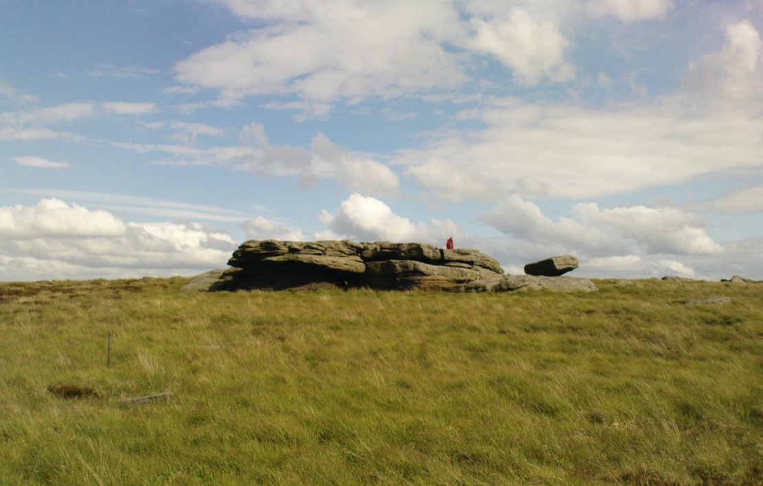
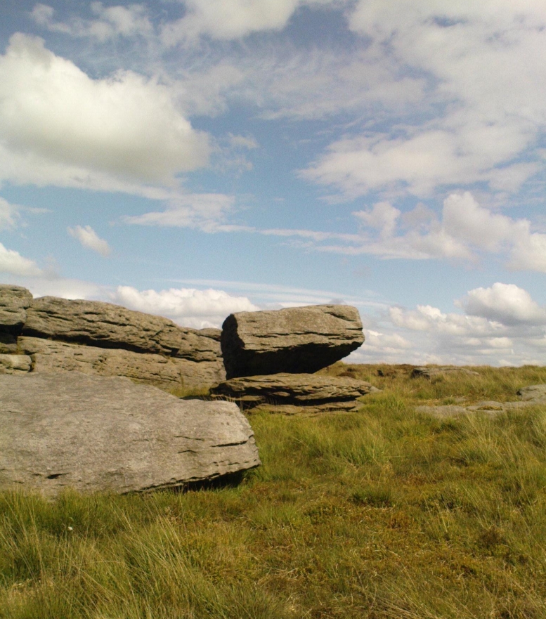
From Denholme, take the A6033 Hebden Bridge road up, but shortly past the great bend turn off right up the steep road towards the moorland windmills until you reach the flat dirt-tracked road, past the reservoir below. A coupla hundred yards past the track to the reservoir, take the footpath south into the tribbly grasslands and moor. A few hundred yards down you’ll note the large rock outcrop ahead of you. The rocking stone is there!
Archaeology & History
The old rocking stone
A small moorland arena with a neglected history. Many lost memories surround this site, with barely legible ruins from medieval and Victorian periods prevailing against scanty snippets of neolithic and Bronze Age rumours and remains. The rocking stone here—which moves slightly with a bit of effort—sits amidst a gathering of other large rocks, some of which have debatable cup-markings on their smoothly eroded surfaces.
Our rocking stone, resting 1350 feet (411m) above seal level, was first mentioned in John Watson’s (1775) magnum opus, who gave a quite lengthy description of the site, telling us that,
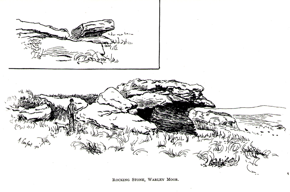
“On a common called Saltonstall-moor, is what the country people call the Rocking-stone… The height of this on the west side (which is the highest) is, as I remember, about three yards and a half. It is a large piece of rock, one end of which rests on several stones, between two of which is a pebble of a different grit, seemingly put there for a support, and so placed that it could not possibly be taken out without breaking, or removing the rocks, so that in all probability they have been laid together by art. It ought to be observed, that the stone in question, from the form and position of it, could never be a rocking stone, though it is always distinguished by that name. The true rocking stone appeared to me to lie a small distance from it, thrown off its centre. The other part of this stone is laid upon a kind of pedestal, broad at the bottom, but narrow in the middle; and round this pedestal is a passage which, from every appearance, seems to have been formed by art, but for what purpose is the question.”
Dubious cupsWatson’s 1775 drawing of the Rocking Stone
Watson then goes onto remark about other rocking stones in Cornwall and further afield with attendant “druid basins” on them, noting that there were also “rock basins” found here on Warley Moor, a few of which had been “worked into this rocking stone,” which he thought, “helps to prove that the Druids used it.” And although these rock basins are large and numerous over several of the rocks on this plateau, like the cup-markings that also scatter the surfaces, they would seem to be Nature’s handiwork.
Turner’s 1913 drawing
Some 60 years later when the literary thief John Crabtree (1836) plagiarized Watson’s words verbatim into his much lesser tome, it seemed obvious he’d never ventured to explore the site. But in the much more valuable historical expansion written by John Leyland around 1867, he at least visited the site and found the old stone, “still resting on its shady pedestal.” Later still, when Whiteley Turner (1913) ventured this way on one of his moorland bimbles, he added nothing more to the mythic history of these west-facing megaliths…
Folklore
Still reputed locally to have been a site used by the druids; a local newspaper account in the 1970s also told how local people thought this place to be “haunted by goblins.”
References:
Bennett, Paul, The Old Stones of Elmet, Capall Bann: Milverton 2001.
Crabtree, John, Concise History of the Parish and Vicarage of Halifax, Hartley & Walker: Halifax 1836.
Leyland, F.A., The History and Antiquities of the Parish of Halifax, by the Reverend John Watson, M.A., R.Leyland: Halifax n.d. (c.1867).
Smith, A.H., The Place-Names of the West Riding of Yorkshire – volume 3, Cambridge University Press 1961.
Turner, Whiteley, A Spring-Time Saunter round and about Bronte Lane, Halifax Courier 1913.
Watson, John, The History and Antiquities of the Parish of Halifax, T. Lowndes: London 1775.
Takes a bitta finding this one. Best found by going along the gorgeous, little-known Dunning Glen in the eastern Ochils, till you reach Littlerig house. Cross the road from there and follow the line of the burn and forest till it veers sharp left. Keep along the fencing until the marshland levels out and streams fall away both east and west. From here, walk uphill until you reach level ground, then, looking down the Borland Glen, zigzag downhill for 100 yards. Keep your eyes peeled for stones emerging from the Juncus grasses.
Archaeology & History
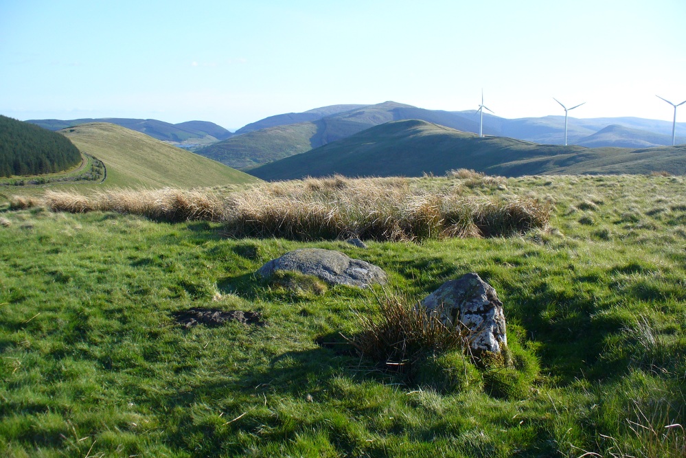
This four-poster stone circle isn’t included in Aubrey Burl’s (1988) survey of that name, nor his 2000 AD magnum opus on megaliths. The site appears to have only recently been rediscovered. Shown on modern OS-maps in non-antiquated lettering, this may be due to verification being required to authenticate its prehistoric status. It’s certainly in a peculiar position in the landscape here — and seems more likely to have been built just 100 yards uphill on the level grassland plain where views east, south and west open up almost with the majesty of Castlerigg!
Fondling & puzzling over cup-marks on one of the stones
When Paul Hornby and I ventured here yesterday, we mistook the arc of three stones on the flat plain with the ring of stones that are down the Borland Glen slope ahead of us, so good was the position! But at least one thing came of this: of the arc of three stones shown in the photos here, one of the rocks possesses cup-markings, which you can make out here in one of the close-ups.
The dimensions of the four stones that make up the ‘circle’ down the slope was measured and described by the Scottish Royal Commission lads as follows:
It comprises four stones, which define a trapezium measuring 3.2m along its N and W sides, 2.7m along the S and 2.5m along the E. All the stones are set square at the corners with their long axes lying E and W, and they present a long flat face to the interior. The two on the N are markedly larger than the others, and that on the NW is also the tallest. The dimensions of the stones are as follows: NW – 1m by 0.5m and 0.65m high, NE – 0.8m by 0.4m and 0.3m high, SE – 0.73m by 0.43m and 0.2m high and SW – 0.73m by 0.38m and 0.4m high.
One of the most notable features a visitor to this site will find, is the utter silence as you walk up the slopes to reach the place. And then, once away in the opening landscape, a view of velvet Earth in all Her beautiful shades surrounds you – assuming you go here on a sunny day! Well worth the wander if quiet hidden megaliths are your pleasure…
References:
Burl, Aubrey, Four Posters: Bronze Age Stone Circles of Western Europe, BAR 195: Oxford 1988.
Burl, Aubrey, The Stone Circles of Britain, Ireland and Brittany, Yale University Press 2000.
Acknowledgements: Many thanks to Paul Hornby for use of his photos.
Along the A827 Loch Tay road between Morenish and Lawers, keep your eyes peeled for the Carie farmhouse on the mountain-side of the road (Tombreck is on the other side). The farmer here is very helpful and will let you walk up the land behind his abode if you ask. Go behind the trees round the back of his abode, following the small burn up for a couple of hundred yards until you see the stone in the long grasses on the right. It’s not too difficult to find.
Archaeology & History
Carie Stone, looking south
Nothing seems to have been written about this small standing stone, found close to the large cluster of cup-and-ring stones of Ben Lawers. It sits alone in now-boggy ground, in a small dip of land near the stream above Carie Farm. The stone is barely a foot thick, but stands 3½ feet tall and is more than 4 feet wide. Its isolation is curious and makes it difficult to contextualize; but the stone is worth visiting if you’re exploring the rock art on the slopes above.
This really take a lot of effort to find. From Alva, go up through the graveyard past St. Serf’s Well, turning left and across cross the lane. A gate into the field takes you past Rhodders Farm then up the zigzagging track up the steep hill called The Nebit and into the Ochils. Where the track stops zigzagging, keep your eyes peeled for a left turn (west) about 1000ft up. Go along this, parallel above Alva Glen, for about 2 miles till you reach the sheep fanks. Naathen – go straight uphill towards Bengengie peak, steering to the right (north) side, avoiding the cliffs and onto the level moorland. Once there, you’ll see a rounded hillock a coupla hundred yards ahead. That’s the spot!
Archaeology & History
Southeastern corner of the ditch & bank
This is a bittova long hike to see a very overgrown site – but if you really enjoy the hills, it’s a good little side-track to visit. I came across it recently on a long bimble over the Ochils, on my way back home after travelling to three of the Ochil peaks. Walking carefully across the swampy heights of the Menstrie Moss, a rounded hillock north of Bengengie seemed to have the pimple of a cairn on its top—so I veered over to have a look.
The cairn was small and overgrown, with just a half-dozen rocks visible above ground, and a collection of others in the same pile beneath the heathland grasses. It was obviously a man-made assemblage, but I couldn’t say for sure whether this was the grave of a person or someone’s favourite sheep a few centuries back!
Small cairn inside the enclosure
It was when I walked around the cairn to try and get some photos of it, that another very distinct feature—not immediately visible—stood out and gave this single cairn a series of additional ingredients that really brought this site to life! For just a few yards east of the cairn I noticed an obvious ditch and outer embankment, running roughly north-south, which may have relevance to the pile of stones. And so I walked along the edge of the embankment, for about 10 yards, only to find that it turned to the right and continued onwards, east-west, for some distance. This then turned at a similar angle again about 30-35 yards along, and then again, and again, until I returned to where I had stood initially a few minutes earlier!
There was no doubt about it: this was a man-made, roughly rectangular-shaped enclosure, whose bank and ditch averaged 1-2 yards across. The maximum height of the outer embankment is less than 3 feet. Its eastern and western lengths measured roughly 17-18 yards long, and the longer lengths north and south were between 30 and 35 yards at the most. The cairn feature that I’d initially noticed is found at the near-eastern edge of the enclosure. Apart from that, my initial ramble here indicated few other internal features that were visible, except several small stones.
Southern line of bank & ditch, running left to rightEastern section of ditch & bank, looking north
The great majority of the site is very overgrown and, as you can see, the photos of the ditch and bank constituting the enclosure are sadly not that easy to make out. You can see it mostly by the colour changes of the vegetation, running in lines either across or up through the middle of the photos. I need to get up there again and try get some better images sometime soon—and also to see if there are other features hiding away on the heights of these old hills, long since said to have been the abode of one of the great Pictish tribes (there is also a considerable mass of old faerie-lore in these hills, indicating considerable ancient activity of people whose cosmos was inhabited by spirits and forms long since forgotten in the consensus trance of most moderns).
As for the age of the enclosure: it’s difficult to say on first impression and I’m not keen on making a guess on this one. It’s certainly old, as the overgrown vegetation clearly shows, both on the photos and when you see it first-hand. It’s already been suggested by one graduate as possibly neolithic, but I’m a little sceptical about that, as its linearity isn’t consistent with neolithic features we know about in the mid-Pennines. However, this geographical arena is new landscape for me and so the possibility remains open until better, more competent investigation gives us a clearer time period.
Dale Abbey is a small and interesting village not far from Ilkeston. It can be found by taking the A6096 from Ilkeston and after passing through Kirk Hallam, take the first turning on the left called Arbour Hill. At the Carpenter’s Arms in the village turn right and park near the church. The well lies within the private garden of Church house, although it can be easily seen in the winter from the field in which the footpath below the church passes through, as well from the church yard.
Archaeology & History
R.C. Hope (1893) gives two versions of the story of how the hermit found the well and cave, taken from the Chronicle of Thomas de Musca quoted in Glover’s History of Derbyshire:
“A hermit once going through Deep Dale being very thirsty, and for a time not able to find any water, at last came upon a stream, which he followed up to the place where it rose; here he dug a well, returned thanks to the Almighty, and blessed it, saying it, should be holy for evermore, and be a cure for all ills. Another version is that the famous Hermit of Deep Dale, who lived in the Hermitage which is close by the well, discovered this spring and dug the well, which never dries up, nor does the water diminish in quantity, however dry the season and blessed it.”
In another version of the story, Hope (1893) notes:
“There was a baker in Derby, in the street which is called after the name of St. Mary. At that period the church of the Blessed Virgin at Derby was at the head of a large parish, and had under its authority a church de onere and a chapel. And this baker, otherwise called Cornelius, was a religious man, fearing God, and, moreover, so wholly occupied in good works and the bestowing of alms, that whatsoever remained to him on every seventh day beyond what had been required for the food and clothing of himself and his, and the needful things of his house, he would on the Sabbath day take to the church of St. Mary, and give to the poor for the love of God, and of the Holy Virgin. It happened on a certain day in autumn, when he had resigned himself to repose at the hour of noon, the Blessed Virgin appeared to him in his sleep, saying, ” Acceptable in the eyes of my Son, and of me are the alms thou hast bestowed. But now, if thou art willing to be made perfect, leave all that thou hast, and go to Depedale where thou shalt serve my Son and me in solitude; and when thou shalt happily have terminated thy course thou shalt inherit the kingdom of love, joy, and eternal bliss which God has prepared for them who love Him. The man, awakening, perceived the divine goodness which had been done for his sake; and, giving thanks to God and the Blessed Virgin, his encourager, he straightway went forth without speaking a word to anyone. Having turned his steps towards the east, it befel him, as he was passing through the middle of the village of Stanley, he heard a woman say to a girl, ”Take our calves with you, drive them as far as Depedale, and make haste back.” Having heard this, the man, admiring the favour of God, and believing that this word had been spoken in grace, a, it were, to bin’, was astonished, and approached near, and said, “Good woman, tell me, where is Depedale?” She replied, “Go with this maiden, and she, if you desire it, will show you the place. When he arrived there, he found that the place was marshy, and of fearful aspect, far distant from any habitation of man. Then directing his steps to the south-east of the place, he cut for himself, in the side of the mountain, in the rock, a very small dwelling, and an altar towards the south, which hath been preserved to this day; and there he served God, day and night, in hunger and thirst, in cold and in meditation.
And it came to pass that the old designing enemy of mankind, beholding this disciple of Christ flourishing with the different flowers of the virtues, began to envy him, as he envies other holy men, sending frequently amidst his cogitations the vanities of the world, the bitterness of his existence, the solitariness of his situation, and the various troubles of the desert. But the aforesaid man of God, conscious of the venom of the crooked serpent, did, by continual prayer, repeated fastings, and holy meditations, cast forth, through the grace of God, all his temptations. Whereupon the enemy rose upon him in all his might, both secretly and openly waging with him a visible conflict. And while the assaults of his foe became day by day more grievous, he had to sustain a very great want of water. Wandering about the neighbouring places, he discovered a spring in a valley not far from his dwelling, towards the west, and near unto it he made for himself a cottage, and built an oratory in honour of God and the Blessed Virgin. There, wearing away the sufferings of his life, laudably, in the service of God, he departed happily to God, from out of the prison-house of the body.”
The well is a delightfully rustic one and certainly contains old stonework if not from the hermit’s time than the period of the Abbey. It is an oval structure with eight stones around the mouth, a three foot rectangular stone covers half of the well and has a semi-circular cut placed in the middle. Mossy steps lead from the higher end of the garden into the little dell where the well arises. The well has been dressed in the early 2000s but has now disappeared into obscurity. Indeed, some believe that it is does not exist in the first place…
Folklore
First noted in 1350 in association with the legend of the foundation of the Abbey, Hope (1893) notes it was curative and was a wishing well; being visited on Good Friday, between twelve and three o’clock, water being drunk three times.
References:
Hope, Robert Charles (1893), Legendary Lore of the Holy Wells of England, Elliott Stock: London.
Parish, R.B. (2008), Holy wells and healing springs of Derbyshire.
“In the park near Polney Loch, one mile from Dunkeld, is a Standing Stone, quite noticeable from the Highland road. This monolith is one of those styled sepulchral, and is a rough oblong slab of schist, its basal girth being 10 feet 7 inches, and its height 4 feet 9 inches. Mr. Coles, who describes this stone in the “Proceedings of the Society of Antiquaries”, supposes it to have been part of a circle. It is not far from the ancient stronghold on King’s Seat.”