Along the A907 Stirling to Alloa road, turn onto the B9096 through Tullibody, turning up Menstrie Road until, on your right, you reach the old graveyard. Walk along the track past the old section and go into the new graveyard. The second pathway down, keep your eyes peeled on the floor and you’ll see it.
Archaeology & History
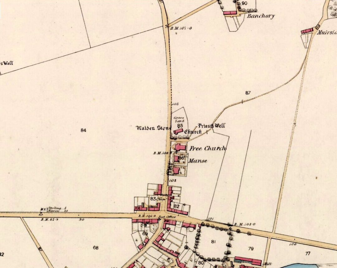
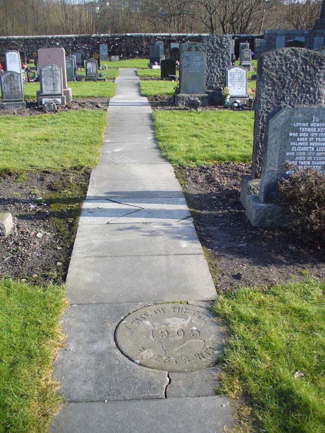
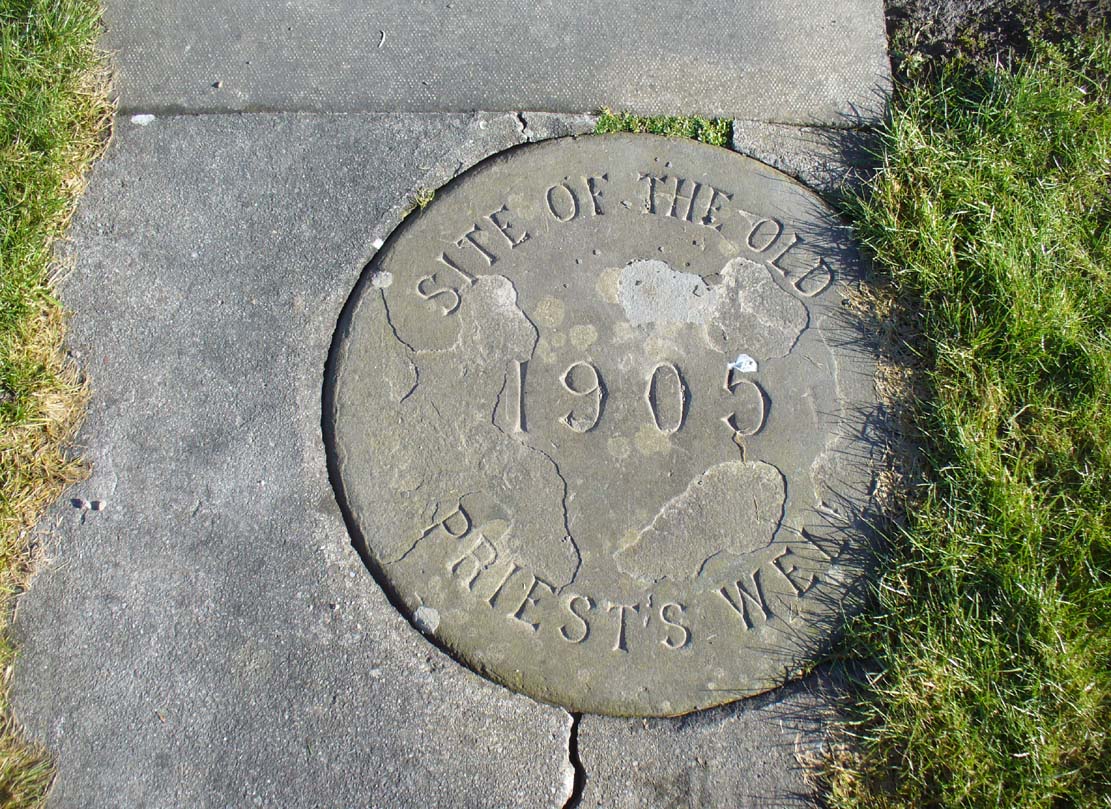
Just a flat carved stone laid in the expanded graveyard is all that remains to mark the site of this once sacred well. On it, the inscribed slab reads, “Site of the old Priest’s Well – 1905.”
In the 19th century when the waters were still used by local villagers, Robert Kirk (1890) wrote the following,
Site of the old well
Carved commemorative stone
“Like the trees, we will now keep outside the dyke (round the old graveyard) and come to the Priest’s Well. This well, an adjunct of the ancient building, appears to be coeval with the Old Church, and lay a few yards south of the Parsonage, which was demolished at the Reformation. A small piece of ground in the immediate vicinity is known as the ‘Priest’s Croft’, and the adjacent field, tradition imagines to be the site of the original hamlet. When this well, from its proximity to the Churchyard, was condemned as unfit for human use, one old wife was heard to exclaim, “Na, na, I aye like a drink o’ the guid sweet priest.”
Despite being cited in the various Scottish holy wells reports, all mythic history of the site seems to have been forgotten.
Kirk, Robert, Historical Sketch of Tullibody, Alloa 1890.
Royal Commission on the Ancient & Historical Monuments, Scotland, Inventory of Monuments and Constructions in the Counties of Fife, Kinross and Clackmannan, HMSO: Edinburgh 1933.
Simpkins, John Ewart, County Folklore – volume VII: Examples of Printed Folk-Lore Concerning Fife, with some Notes on Clackmannan and Kinross-Shires, Folk-Lore Society: London 1914.
Walker, J. Russel, “Holy Wells in Scotland,” in Proceedings Society Antiquaries Scotland, volume 17, 1883.
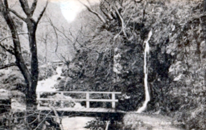
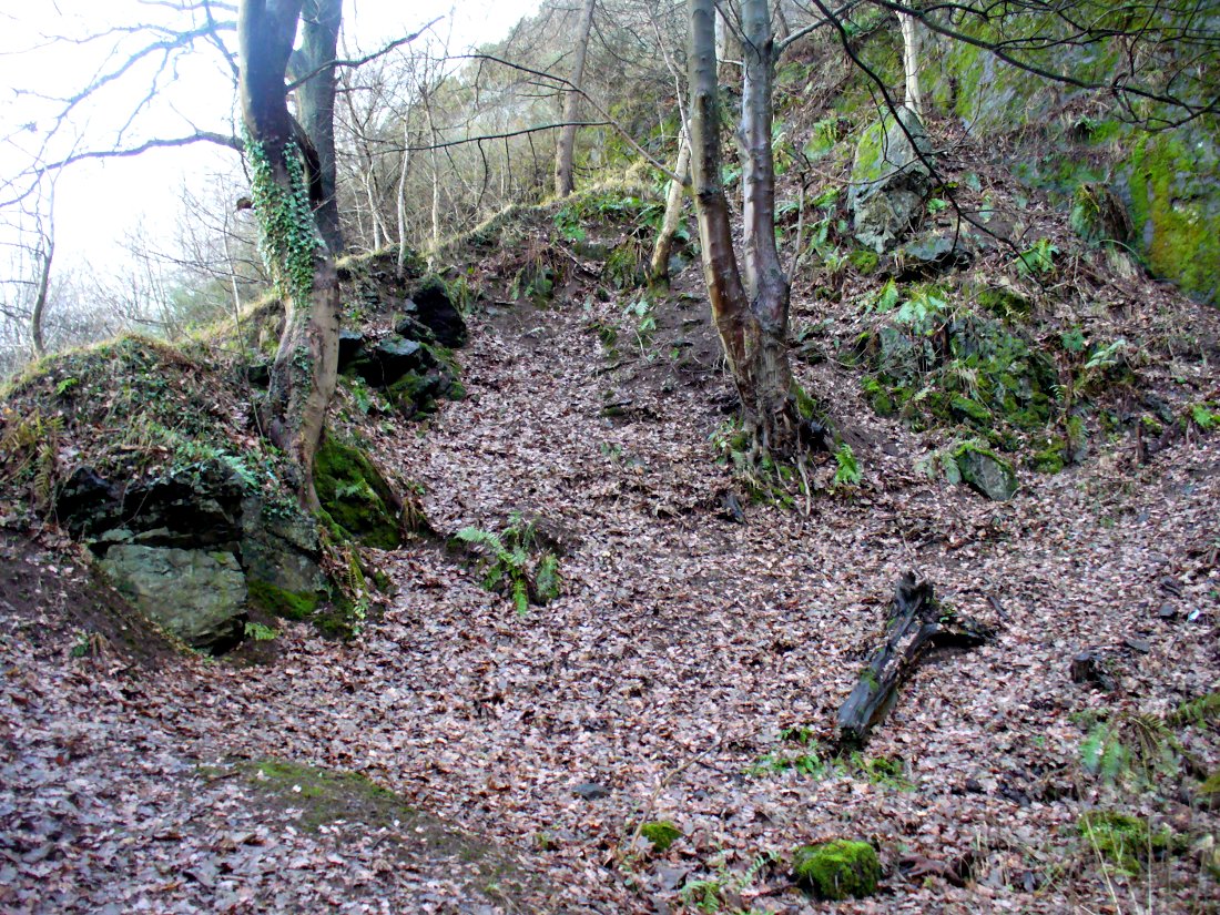
From Alva, take the signs to walk up the gorgeous Alva Glen gorge, past the site of the Dwarf’s Tomb, over the bridge past the first waterfall and up the footpath and into the glen proper. The path runs parallel with the gorge and a few hundred yards along you’ll reach a small footbridge. Immediately before this, on your right, coming down through the crags by the side of the path, the waters fall from the well in question. It’s easy enough to see.
Archaeology & History
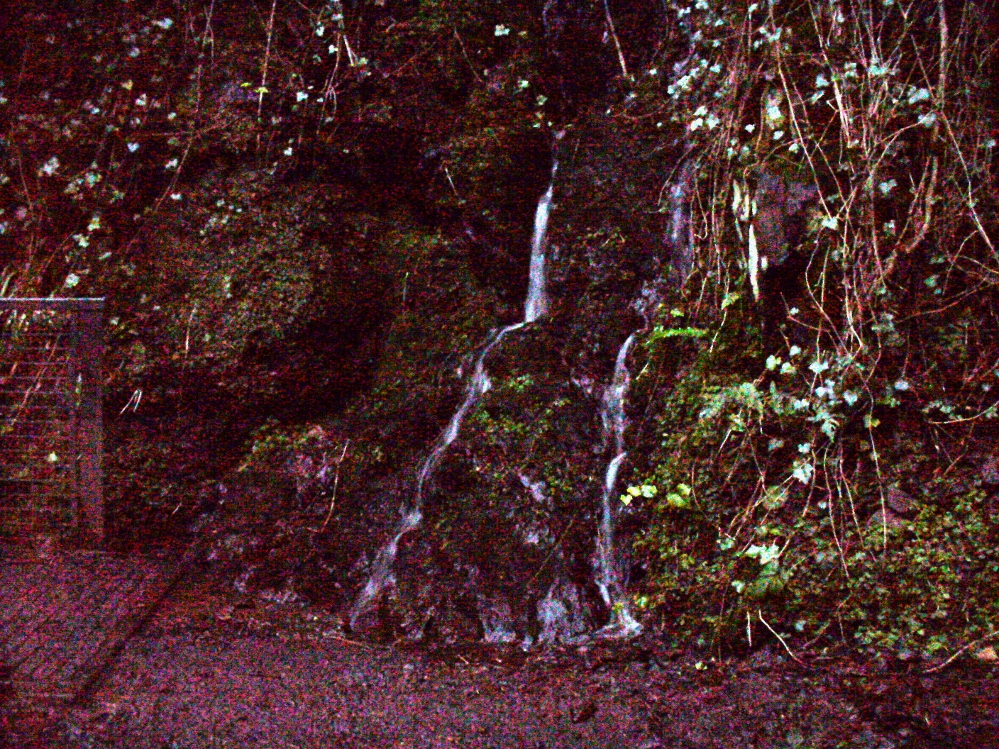
Waters of the Lady Well on a dark, grey evening
The history of this site is seemingly hidden. Little has been written of it and its dedication to some ‘Lady’ is an oddity. I can find no specifics telling who the ‘lady’ in question is. The other Lady Well at Tillicoultry, a mile or two east, is equally bereft of historical certitude. Whether it is another dedication to the supposed ‘virgin’ Mary of the christian cult, or a local lady whose name has long since been forgotten, we do not know. Additional info on this site would be most helpful.
Shown on an early postcard of the Alva Glen and highlighted in Mr Pithie’s (1982) work, the waters here—running down the crag-face from a spring at the top—are fine, fresh and almost sweet-tasting, rich in minerals and healthy nutrients no doubt. Without doubt, I’d recommend a drink of this every time you walk past here! (apologies for the dark photo – I’ll get a better one next time we’re up there)
References:
Corbett, L., et al., The Ochil Hills, Forth Naturalist & Historian 1994.
Pithie, A., Views of Alloa and the Neighbourhood, Clackmannan District Libraries 1982.
Acknowledgements: Grateful thanks to Lisa Samson for help with directions.
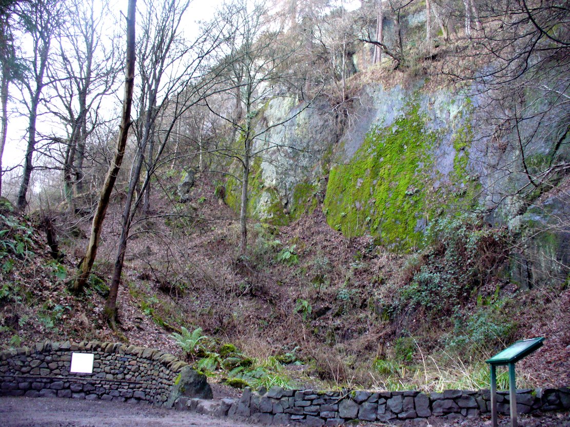
From the main street through Alva, between the Co-op and the corner shop, go up the small road at the side of the Johnstone Arms Hotel (Brook Street) and, at the small crossroads, straight across as if following the sign to the golf course. Stay along the track parallel with the Alva Burn waters and as you go into the trees a hundred yards or so along, to your left is a disused quarry, with a couple of plaques telling you its brief history. This is the spot!
Archaeology & History
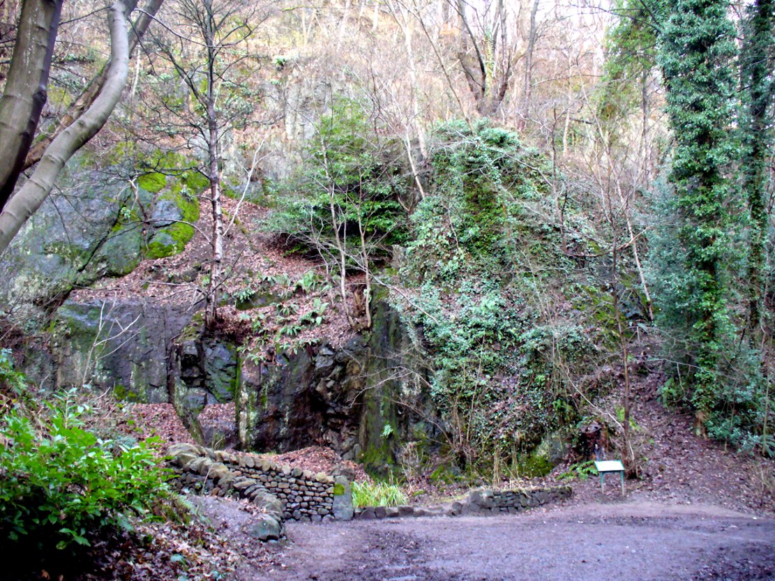
This is a truly fascinating site for a number of reasons. Sadly, we can no longer see what had been here for oh so many thousands of years thanks, as usual, to the industrialists destroying the land here. Although in this case, without them we’d be unaware of its very existence. Additionally, there is a twist to the industrial’s find, which seems to have stopped further quarrying by some local people….
The tomb was somewhere in the left-middle
Listed in the relative Royal Commission accounts (1933; 1978), without comments, the tale is a simple one, but was narrated in some detail by J.G. Callander (1914) in Scotland’s prodigious Society of Antiquaries journal. During some quarrying operations over the Christmas period of 1912, James Murdoch “uncovered the remains of a human skeleton which had been buried in a natural cavity in the rock.” Three weeks later, local police officer George Donald and Dr W.L. Cunningham of Alva, accompanied Mr Callander to the site and made a detailed assessment of what had been found. He wrote:
“The quarry in which the grave was found is situated at the mouth of Alva Glen, a few yards distant from the right bank of the burn which flows through it. The body had been placed in a cavity or rock shelter in the face of the cliff, about 40 feet from the base, and about 200 feet above sea-level, and a rough, curved wall of dry-stone building, about 1 foot in thickness, had been built across the opening, which faced the east, the ends of the wall being still in situ when I visited the site. The space enclosed measured about 4 feet 6 inches from north to south, and about 5 feet from east to west. Subsequent to the burial the whole face of the rock and the walling had been covered, to a thickness of probably some 6 feet, by soil and detritus washed down from the hill face above. The greater part of the floor of the cavity was formed of clean, broken, angular stones, but the space on which the body was placed had been covered with a thin layer of soil preparatory to the burial. No charcoal or charred wood, which is so often seen in prehistoric graves, was found in this deposit. The skull lay in the north end of the grave, on its right side, facing the rock to the west, the vertebrae and ribs followed a line to the south, and the nether limbs were inclined towards the interior of the cavity. The whole face, including all the teeth and the lower jaw, was a-wanting. Apparently the body had been placed in a flexed position, half on its side and half on its back. Nothing else was found in the grave but a quantity of snail shells, probably twenty or thirty, which were nearly all broken, the few complete examples being in a very fragile condition.
“Elsewhere it has been stated that these formed a necklace, but while they were strewn out in front of the skeleton for a distance of over 3 feet, none of them showed any signs of artificial perforation. The species of Helixis is probably hortensis, the common garden snail.”
Mr Callander then included a lengthy description of the body itself, some of whose bones were fractured. He told that a certain
“Professor Bryce states that the skeleton is that of a dwarf of about 4 feet 2 inches in stature. The epiphyses are all fully united, although the line of union is visible on the surface at some points. Growth must therefore have been completed, and the person must have been, if the union of the epiphyses of the long bones had pursued its normal course, over twenty-one years of age…”
Regarding the sex of the dwarf, Mr Bryce wasn’t 100% certain, but told:
“The calvaria shows the general characters of a female skull, but it cannot be stated definitely that the individual was a woman, because the cranial characters are such as might have been present in a dwarf of the male sex. The calvaria is of moderate size, and is well formed.”
Bryce concluded as a whole that this person was in reasonably good health and, from the condition of the bones, showed “there was no evidence of the disease known as rickets.” In his final remarks he told:
“The general conclusions to which a careful examination of the skeleton leads, is that we have here to do, not with a representative of a dwarfish race, but with an individual who from premature union of the epiphyses was to a remarkable degree stunted in growth. The condition is a well-known one, and the class of dwarfs, in which this individual must be included, is well recognised.”
Probable spot of the lost tomb
The exact spot of the tomb appears to have been destroyed, or at the very least is certainly covered over and no longer visible. The section of the quarry looking east, into which the tomb was built, is all-but gone and no initial evidence prevails to show its exact location. However, it would seem from the description to have been close to the tops of the tree-line, perhaps giving a clear view to the rising sun in the east. Perhaps…
The position of this tomb, enclosed high up in the cliffs, hidden away at the entrance to the deeply cut ravine of the Alva Glen, is intriguing in that it is a rarity. Ravines like this are always peopled by olde spirits in animistic tribal traditions — and this dangerous glen with its fast waters and high falls would have been no different, especially to the Pictish people who we know were still here even after the Romans had buggered off. Is it possible that this figure was a guardian to the Glen itself, a medicine woman or shaman, whose very Glen was her home? We know from traditional accounts in many of the North American tribes that dwarves were accessories to the spirit worlds, and some were shamans. (Park 1938) In northern and central European lore, these small people are “the mysterious craftsmen-priests of early civilizations.” (Motz 1987) Whilst in Scottish lowland lore, the ‘Brown Man of the Muirs’ was a dwarfish creature described by Briggs (1979) as “a guardian spirit of wild beasts”, or watered-down shaman figure. There is more to this burial than meets the eye of dry academia…
Folklore
The Alva Glen—in addition to being beautiful and home to the Ladies Well—was long known to be one of many places in the Ochils that were peopled by the faerie folk. (Fergusson 1912) Local people still say this place is haunted by the spirit of a dangerous witch called Jenny Mutton.
It’s worth reiterating the words of Mr Callander (1914) regarding the finding and subsequent death of the man who uncovered this fascinating tomb, as some folk (then as now) think his demise was as inevitable as the man who planned on building turbines in Glen Cailleach:
“On the 24th December last, while quarrying stone for road metal in a quarry at the foot of the Ochils, at Alva, James Murdoch uncovered the remains of a human skeleton which had been buried in a natural cavity in the rock. Two days later he was killed at the same spot by the fall of a mass of overhanging rock, a tragic sequel, which not long ago would have been considered a judgement on him for disturbing the dead.”
References:
Briggs, Katherine M., A Dictionary of Fairies, Penguin: Harmondsworth 1979.
Corbett, L., et al., The Ochil Hills, Forth Naturalist & Historian 1994.
Drummond, A.L., “The Prehistory and Prehistoric Remains of the Hillfoots and Neighbouring District”, in Transactions Stirling Natural History & Antiquarian Society, volume 59, 1937.
Fergusson, R. Menzies, The Ochil Fairy Tales, David Nutt: London 1912.
Gimbutas, Marija, “Slavic Religion,” in Encyclopedia of Religion – volume 13 (editor M. Eliade), MacMillan: New York 1987.
Motz, Lotte, “Dvergar,” in Encyclopedia of Religion – volume 4 (editor M. Eliade), MacMillan: New York 1987.
Park, Willard Z., Shamanism in Western North America: A Study in Cultural Relationships, Evanston: Chicago 1938.
Royal Commission on the Ancient & Historical Monuments, Scotland, Inventory of Monuments and Constructions in the Counties of Fife, Kinross and Clackmannan, HMSO: Edinburgh 1933.
Royal Commission on the Ancient & Historical Monuments, Scotland, The Archaeological Sites and Monuments of Clackmannan District and Falkirk District, Society of Antiquaries of Scotland 1978.
This really take a lot of effort to find. From Alva, go up through the graveyard past St. Serf’s Well, turning left and across cross the lane. A gate into the field takes you past Rhodders Farm then up the zigzagging track up the steep hill called The Nebit and into the Ochils. Where the track stops zigzagging, keep your eyes peeled for a left turn (west) about 1000ft up. Go along this, parallel above Alva Glen, for about 2 miles till you reach the sheep fanks. Naathen – go straight uphill towards Bengengie peak, steering to the right (north) side, avoiding the cliffs and onto the level moorland. Once there, you’ll see a rounded hillock a coupla hundred yards ahead. That’s the spot!
Archaeology & History
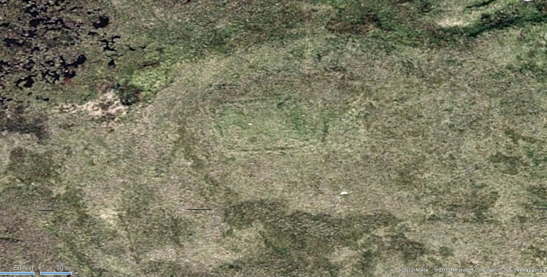
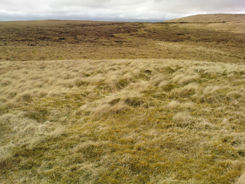
Southeastern corner of the ditch & bank
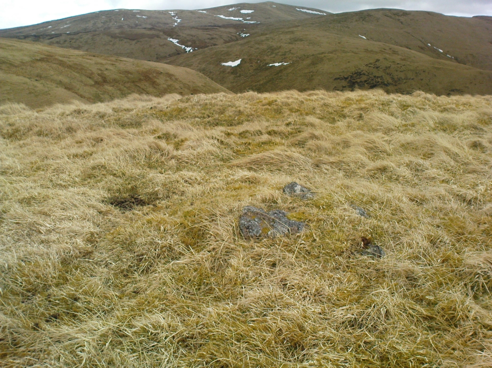
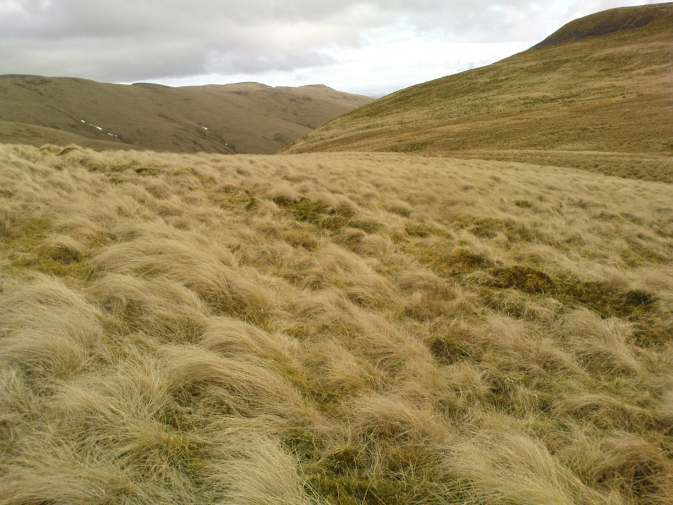
This is a bittova long hike to see a very overgrown site – but if you really enjoy the hills, it’s a good little side-track to visit. I came across it recently on a long bimble over the Ochils, on my way back home after travelling to three of the Ochil peaks. Walking carefully across the swampy heights of the Menstrie Moss, a rounded hillock north of Bengengie seemed to have the pimple of a cairn on its top—so I veered over to have a look.
The cairn was small and overgrown, with just a half-dozen rocks visible above ground, and a collection of others in the same pile beneath the heathland grasses. It was obviously a man-made assemblage, but I couldn’t say for sure whether this was the grave of a person or someone’s favourite sheep a few centuries back!
Small cairn inside the enclosure
It was when I walked around the cairn to try and get some photos of it, that another very distinct feature—not immediately visible—stood out and gave this single cairn a series of additional ingredients that really brought this site to life! For just a few yards east of the cairn I noticed an obvious ditch and outer embankment, running roughly north-south, which may have relevance to the pile of stones. And so I walked along the edge of the embankment, for about 10 yards, only to find that it turned to the right and continued onwards, east-west, for some distance. This then turned at a similar angle again about 30-35 yards along, and then again, and again, until I returned to where I had stood initially a few minutes earlier!
There was no doubt about it: this was a man-made, roughly rectangular-shaped enclosure, whose bank and ditch averaged 1-2 yards across. The maximum height of the outer embankment is less than 3 feet. Its eastern and western lengths measured roughly 17-18 yards long, and the longer lengths north and south were between 30 and 35 yards at the most. The cairn feature that I’d initially noticed is found at the near-eastern edge of the enclosure. Apart from that, my initial ramble here indicated few other internal features that were visible, except several small stones.
Southern line of bank & ditch, running left to rightEastern section of ditch & bank, looking north
The great majority of the site is very overgrown and, as you can see, the photos of the ditch and bank constituting the enclosure are sadly not that easy to make out. You can see it mostly by the colour changes of the vegetation, running in lines either across or up through the middle of the photos. I need to get up there again and try get some better images sometime soon—and also to see if there are other features hiding away on the heights of these old hills, long since said to have been the abode of one of the great Pictish tribes (there is also a considerable mass of old faerie-lore in these hills, indicating considerable ancient activity of people whose cosmos was inhabited by spirits and forms long since forgotten in the consensus trance of most moderns).
As for the age of the enclosure: it’s difficult to say on first impression and I’m not keen on making a guess on this one. It’s certainly old, as the overgrown vegetation clearly shows, both on the photos and when you see it first-hand. It’s already been suggested by one graduate as possibly neolithic, but I’m a little sceptical about that, as its linearity isn’t consistent with neolithic features we know about in the mid-Pennines. However, this geographical arena is new landscape for me and so the possibility remains open until better, more competent investigation gives us a clearer time period.
Very troublesome for so little a stone. But to the nutters or climbers who enjoy a good bimble: if you’re coming on the A91 from Tillycoultry take the dirt-track up to Harviestoun, but if you’re coming from Dollar, take the dirt-track up past Belmont House – either way, keep walking till you get to Kennel Cottage. Walk past here and into the woods, then follow the burn (stream) uphill. It’s a steep climb, with waterfalls and mossy rocks. Once out of the woodland, keep following the stream. Several hundred yards uphill, you’ll pass a large rounded hillock on your left. Keep walking up the stream for another 200 yards, then walk to the right of the stream for about 100 yards. You’re damn close!
Archaeology & History
White Stane on the 1819 map
An obscure and little known site outside of the Ochils region, this stone seems to have been described for the first time in 1769 – though local people would obviously have known of its presence and mythic history centuries before this. It was then shown on the 1819 Plan of The Estates of Harviestoun and Castle Campbell, as shown here. The White Stane is a rounded quartz block about four feet long in the grasses, laid down and hard to find, it would have been impressive had it stood upright – which it may have done in ages not so long ago – in which case we would have had a shining standing stone on the edge of the steep slope halfway up the mountain. A curious ‘D’-shaped carving that seems to be etched on the top of the rock may simply be one of Nature’s simulacra.
The White Stane, looking south
When I arrived at the stone – after taking a typically circuitous bimble up the hillsides, and passing a variety of archaeological relics on the slopes east of the burn – the view was outstanding, looking some 60 miles south into the distant peaks of the Scottish Lowlands, with the sun casting itself over the entire landscape. The quartz rock by my side was gleaming brightly in the fresh daylight. Sitting down by its side, the cold wind cutting over us, a quietude befell the place and, and as I relaxed by its side, fell into a sleep for an hour or so. All was quiet and still in both mind and heart at the stone – then when I came round, I realised the sun was going down and thought it best to get off the mountains before dark!
In Angus Watson’s (1995) survey he told us,
“The 1860 OS Name Book says this is something of a mixture of whinstone and white marble, that the local tradition was that it had been erected to commemorate a battle between Wallace and the English, and that there was “no doubt whatsoever” that it was ‘druidical’!”
Watson also informs us that the name of the rock – Tom baird – is from the Gaelic, meaning the “bard’s knoll”. However, Bruce Baillie (1998) would have it that the The White Stone of Tam Baird,
“has possibly been derived from the Gaelic Tam a Bhaird, ‘the knoll of the enclosure.’”
And there is a large five-sided enclosure on the ridge of Dollar Hill, but that’s quite some distance away and would have little bearing on the naming of this quartz stone.
References:
Baillie, Bruce, History of Dollar, DMT: Dollar 1998.
Watson, Angus, The Ochils: Placenames, History, Tradition, PKDC: Perth 1995.
Acknowledgements: Huge thanks to Marion Woolley for directing us to the 1819 Estate map!
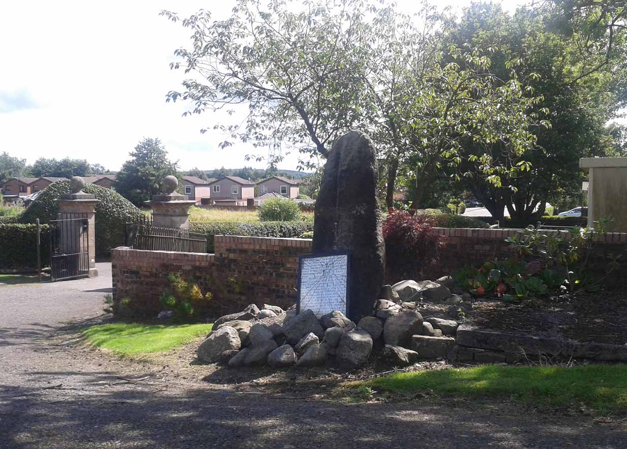
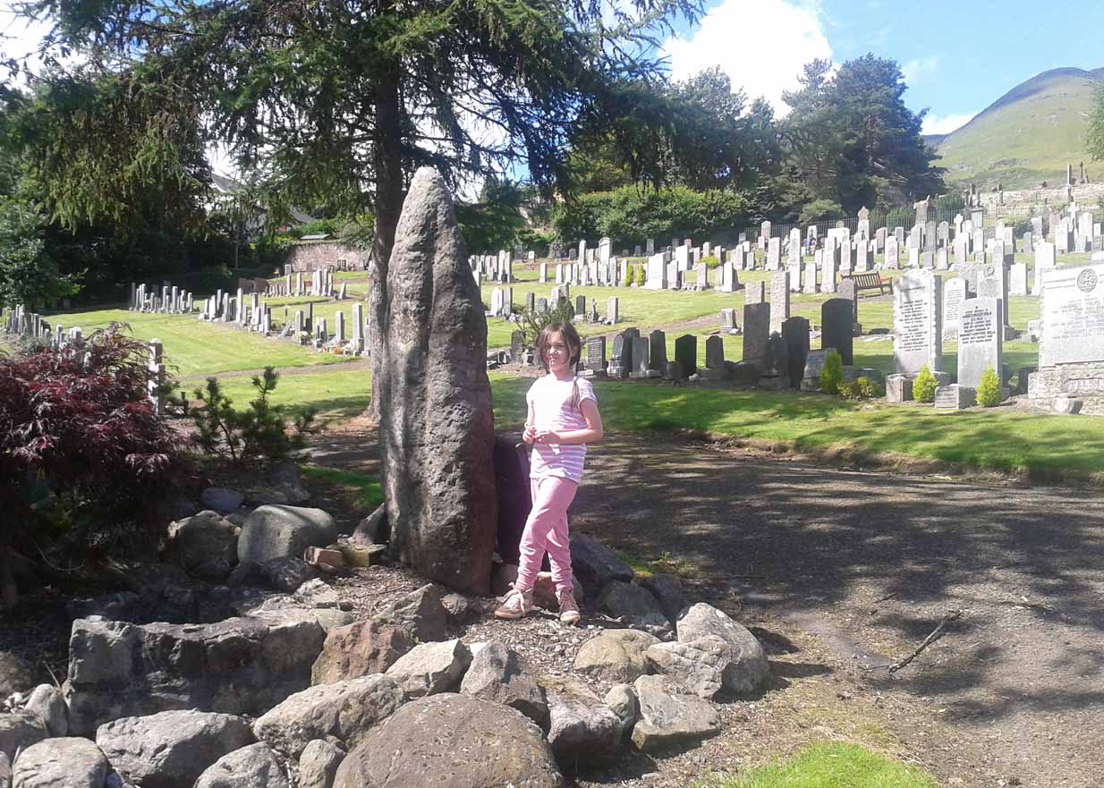
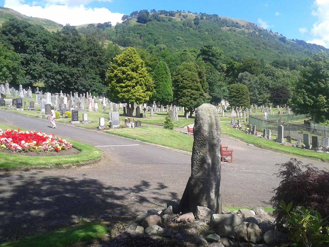
Go on the A91 through Alva, eastwards, and just before you go out of the town, note the small road on your left up to the graveyard. As you go into the graveyard, keep your eyes peeled on your left-hand side. You can’t really miss it!
Archaeology & History
Reported as “lost” or “destroyed” in many official reports, one of at least two standing stones that were reported in the Old Statistical Account of 1795 can still be found at the bottom of the graveyard, adjacent to the old holy well of St. Serf, at the edge of Alva town Very little has been written about it, and when it was mentioned in the OSA, the stones were only added in a foot note to the impressive stone cross on the outskirts of Alloa, saying:
“There are two stones resembling this one, in the neighbouring parish of Alva, at no great distance from the church, but not close to one another. They are both near the foot of the Ochils.”
A little person by its sideFrom the stone, looking NE
When some of the lads from the Scottish Royal Commission came here in July 1927, they could find no remains of any such standing stones and simply reported that they “no longer exist.” However, as visitors can plainly see, a tall upright standing stone still remains here, albeit repositioned by the good local people of Alva several decades ago. Standing more than seven-feet tall, the stone is very weather-worn on one side, with a plaque at the bottom.
References:
Royal Commission on the Ancient & Historical Monuments, Scotland, Inventory of Monuments and Constructions in the Counties of Fife, Kinross and Clackmannan, HMSO: Edinburgh 1933.
A helluva climb to get here. Take the last road up towards Mill Burn at the west end of Tillicoultry and go to the picnic area & carpark, just below the footpath that takes you up the eastern slopes of the gorge. Walk up and up the steep footpath for nearly a mile and, as the landscape begins to level out a bit and turns more into a slope, watch out for a split in the paths and make sure you hit the one that veers you to the right, towards King’s Seat instead of the one that runs alongside the edge of the Gannel Burn valley below you. Walk along this path for a few hundred yards and you’ll come across a large pile of rocks placed atop of a much older and overgrown mass of stones, right by the path side. .
Archaeology & History
View of the green cairn, looking north
Due northwest of the curiously named Elistoun Hill, is this seemingly isolated overgrown prehistoric cairn. Measuring some 8 yards across and more than a yard tall, this compacted fairy-mound of a hillock has the crown of many large, more recent blocks on top, thankfully highlighting it making it much easier to find! But its isolation here is truly curious – as is the location halfway along hillside, quietly hidden away, calling out for no attention to any ancient traveller. It was listed as an ancient monument when surveyed by Ordnance Survey in the 1970s, although I have to be honest in saying that I doubt the prehistoric prevenance of the site. I may be wrong, but an excavation here would prove worthwhile.
Along the main street running through Alva, towards Tillicoultry, watch out for the roman catholic church on your left, then shortly past it the house of St. Serfs. Just next to this is the small road called Lovers Loan. Walk up here and just before the graveyard, walk right, into the overgrown boggy marshlands. The first presence of the holy waters here are about 12-15 yards into the grasses, where you’ll walk right into it!
Archaeology & History
A sacred well that was named after the little known character of St. Serf, who was said to have been the hermit and tutor of the more renowned St. Mungo.
Highlighted on the 1866 Ordnance Survey map of the area as St. Servanus’ Well, 100 yards southeast of the church, it was included in MacKinlay’s (1893) fine survey, though without comment. However it was said by Mr & Mrs Morris (1982) to be “near the south entrance of the churchyard.” The boggy remains of the spring can indeed be found at the southern edge of the graveyard, up Lovers Loan, just below the edges of a large mound. In Mrs Drummond’s (1936) survey of Alva, she too told that the “Well of St Servanus”,
“contained healing waters and was still to be seen in St. Serf’s Glebe in 1845, nbut it is now just a marsh on the west wisde of the lower cemetrary gate.”
The original waters have in fact been completely capped and the well is now covered by a modern concrete block, standing right next to the resurrected remains of one of Alva’s remaining standing stones.
References:
Drummond, Mrs A., The History of Alva and District from the Early Christian Period to 1900, in Transactions Stirling Natural History & Antiquarian Society, volume 58, 1936 (reprinted by Clackmannan District Libraries 1981).
MacKinlay, James M., Folklore of Scottish Lochs and Springs, William Hodge: Glasgow 1893.
From the main road running through the town, head west towards Alva, and where the golf course begins, take the footpath uphill at its edge which heads towards the giant quarry. Where the dirt-track begins, keep walking along the edge of golf course, noting that where the open field starts, a gate on your right. Go through this, and walk up the side of the fence for some 30 yards, then go through the large gate. 10 yards in front of you, note the small stream crossing the track, and a scatter of overgrown rocks just on the other side of the wire fence. You’re here!
Archaeology & History
Thought by Angus Watson (1995) to have been possibly dedicated to ‘Our Lady’: in this context it’s difficult to know whether the dedication was to the christian Virgin, or to the heathen ‘Lady Alva’, whose web of snow and other natural garments clothe the mountains and glens of the Ochils hereby.
The first account of the place seems to be in William Gibson’s Reminiscences (1883) where he told that,
“In the year 1839, a Mr John Henderson built the only woollen mill…the water for the steam engine of which was got from the Ladies Well”,
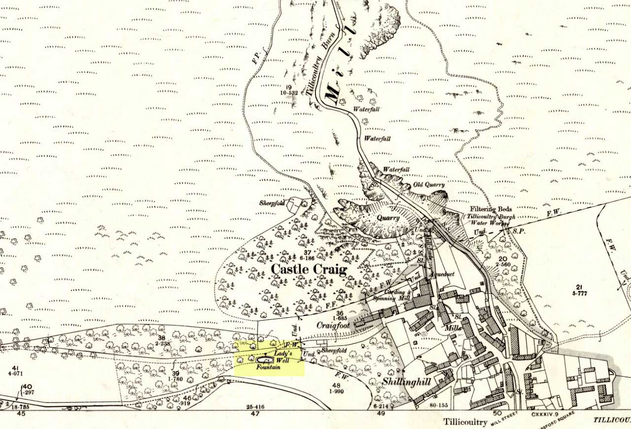
Ladys Well on 1899 map
which was barely 100 yards to the west. It was later highlighted on the OS-map in 1899 with an associated ‘fountain’, right by the track-side. A water-pumping station shown at the same time on another map was, of course, the one that was built to supply the mill with water.
The present water source is slightly higher in the field than when it was shown on the early OS-maps, and it does still flow continuously—although the source is much neglected and could do with being recovered: as the photo here shows, an ugly pipe appears to be taking much of the healing waters which are now mainly feeding a large pond in the garden just below.
References:
Gibson, William, Reminiscences of Dollar and Tillicoultry, Andrew Elliot: Edinburgh 1883.


002")