Stone Circle (destroyed): OS Grid Reference – NN 9020 0985
Also Known as:
Blackford Glebe
Brookfield House
Archaeology & History
In the 18th Century there stood, on the slight rise of the land about 150 yards south of Brookfield House, one of those “circles of stones…in the glebe”, of the sort that “are supposed to have been places of Druidical worship,” wrote John Stevenson. (1792) Sadly, sometime in the 19th Century, the entire site was uprooted and destroyed, leaving no trace of the place. Not good…. 🙁
References:
Stevenson, John, “Parish of Blackford,” in The Statistical Account of Scotland – volume 3, (edited by, John Sinclair) William Creech: Edinburgh 1792.
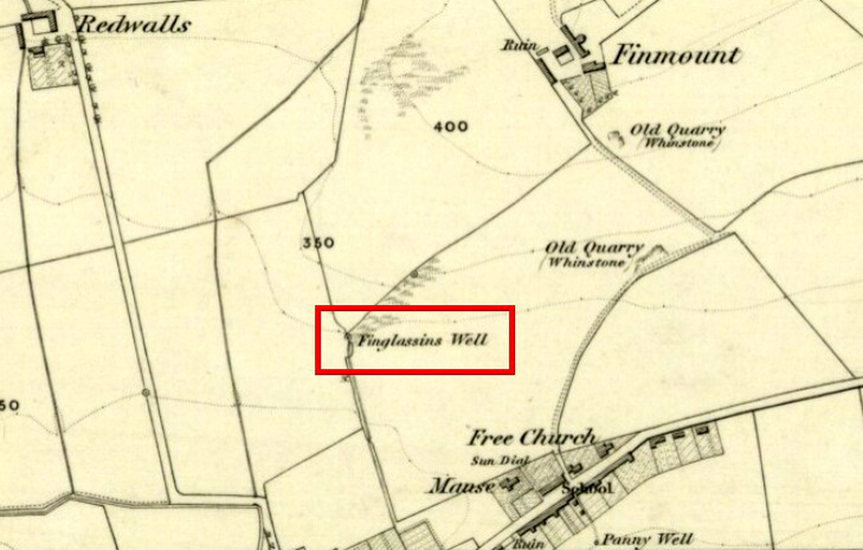
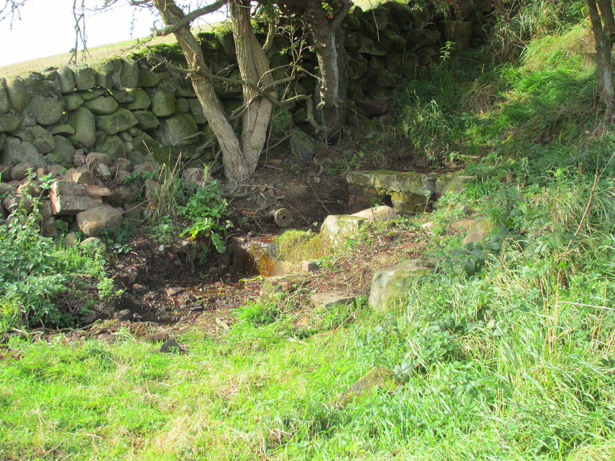
In Kinglassie village, from the Main Street follow Redwells Road and turn right where it forks and follow the track until you get to the derelict ground; then turn left up the slope, following the eastern (right hand) edge of the wall up to the well.
Archaeology & History
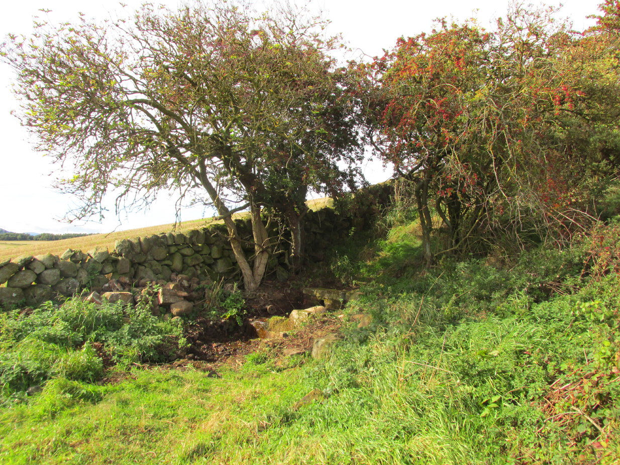
Under its bower of hawthorn & elder
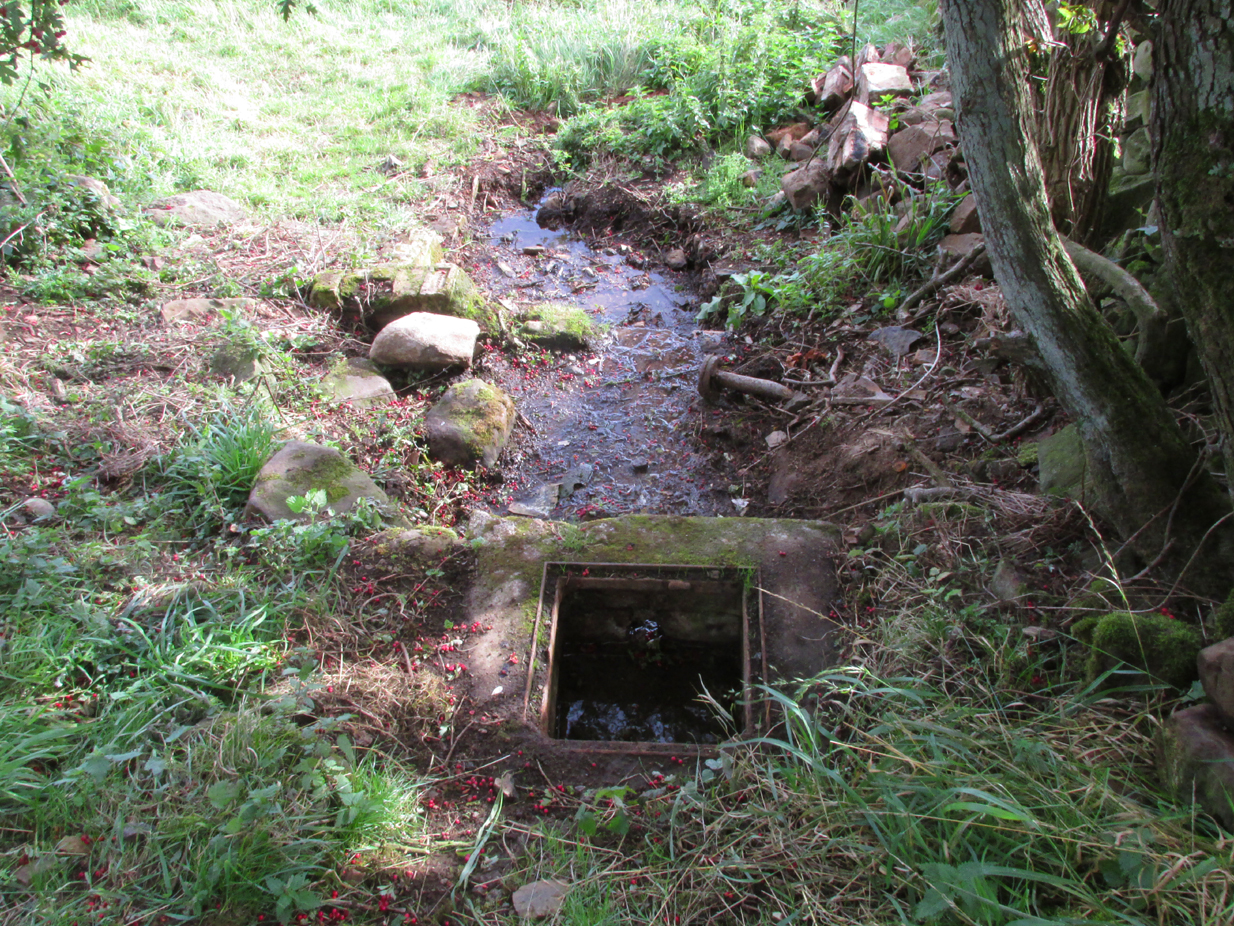
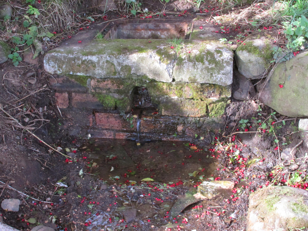
Sheltered under its bower of hawthorn and elder bushes, at a distance it has the romantic look of an ancient holy well. But close up, the spring issuing from Finglassins Well shows evidence of having been connected up to the public water supply, with ugly brickwork and pipes obliterating any previous structures that may or may not have existed there. There even seems to be doubt as to its name. Ordnance Survey and Nicolson Street Atlas show it as ‘Finglassins Well’.According to the Canmore citation, which lists it as ‘St Finglassin’s Well’ or ‘St. Glass’s Well’:
This spring is now piped into a trough. There are several boulders nearby but no dressed stone and it is doubtful if there was ever any structure here. It is known by both names.
A well of fine water…
Past industrial despoilation..
So who was the patronal saint, who is remembered variously as Finglassin, Glass, Glascianus, and Glastian? There seems to be some difference of opinion among the various sources, even as to whether any saint existed at all. Alban Butler, in his Lives of the Saints, tells:
“St. Glastian, Bishop and Confessor in Scotland: HE was a native of the county of Fife, and discharged in the same, during many years, the duties of the episcopal character with which he was honoured. Amidst the desolation which was spread over the whole country, in the last bloody civil war between the Scots and Picts, in which the latter were entirely subdued, St. Glastian was the comforter, spiritual father, and most charitable protector of many thousands of both nations. He died in 830, at Kinglace in Fifeshire, and was particularly honoured in that country, and in Kyntire. According to the ancient custom of that country, his name is frequently written Mac-Glastian, the word Mac signifying son.”
Bishop Forbes of Brechin, writing of St Glascianus in Kalendars of Scottish Saints:
“Of the life of the saint we have no details. The collect in the Breviary runs in these terms – ‘Grant we beseech Thee, Almighty God, that we, who celebrate the anniversary of blessed Glascianus, Thy confessor and bishop, may by the intercession of his devout prayers, be deemed meet to attain to eternal joys through out Lord’ He is known in the parish of Kinglassie (or Kinglassin), near Kirkcaldy, of which frequent mention is made in the Register of Dunfermline.”
In the Old Statistical Account of 1792, Reverend James Reid, writing of the origins of Kinglassie:
“It is the opinion of some, that the name is originally Gaelic, and expressive of the situation; others trace it from a saint, whose name was Glass, and point out a well of fine water, called St. Glass’s well.”
Reverend J.M.Cunnynghame, in the New Statistical Account of 1845 wrote:
“While some have supposed that the village after which the parish is called, derives its appellation from a spring denominated St Glass’s Well, others, with apparently greater reason, have traced the name to Gaelic words signifying the ‘head of grey land’. This idea seems to be corroborated by the large extant of inundated, marshy, and mixed surface which….still stretches itself to the immediate vicinity of the village. The preferable conjecture concerning the the derivation of the name acquires additional support from the circumstance, that a locality, somewhat elevated above the channel, along which the water runs from the swamp alluded to, has received the appropriate designation of ‘Finglassie’ signifying the ‘termination of the gray land, or mixed bog.”
W.J.Watson, in The Celtic Place Names of Scotland gives the derivation of Kinglassie from the gaelic ‘cill glaise’ – ‘church of the brook’, and further:
“A well near the church is known as St Glass’s Well or St Finglassin’s Well. Here again, the stream ‘glais’ on which the church stands has been made into a saint; Findgassin is ‘find glaisín’ – ‘holy streamlet’. Near the church is an eminence called Finmont, for ‘finn monad’, later ‘fionn mhonadh’ – ‘white hill’, here probably ‘holy hill’. The real saint of Kinglassie is unknown.”
A closer view
I am inclined to discount Cunnynghame’s laboured interpretation in view of Watson’s later linguistic analysis, as well as bearing in mind he was a minister of a Kirk that went out of its way to deny and denigrate the native pre-Reformation saints. Because of its position and ambience despite past industrial despoilation, I am inclined to a saintly attribution to the well, which as in so many cases in Scotland has lost its true history owing to the depredations of the Reformation. If Watson’s interpretation of ‘Finmont’, ½ mile north-east of the well, is indeed ‘Holy Hill’ then Finglassins Well may have been a part of an ancient, perhaps heathen ritual landscape.
References:
Reid, James, Parish of Kinglassie, Old Statistical Account, Fife, 1792.
Cunnynghame, J.M. Parish of Kinglassie, New Statistical Account , Fife, 1845.
Butler, Alban, The Lives of the Fathers,Martyrs and Other Principal Saints, James Duffy: Dublin 1866.
Take the A823 road up from Gleneagles to Glendevon and at the top of the long hill, where the road starts to level out and slightly drop, where the two glens meet up, take the right turn (west) and park up by the cattle-grid. Walk back onto the A823 and walk about 200 yards south towards Glendevon, to the small copse of trees past the cottage. As you get to the trees, look by the fencing and you’ll see one archetypal rounded standing stone, with another one next to it. You’re here!
Archaeology & History
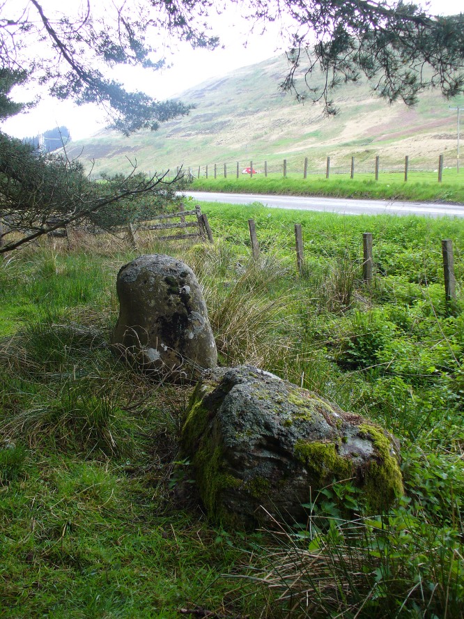
Stones by the roadside at Fourstanes
At long last my huge nose is twitching back to its authentic sniffing-out lost sites in the landscape. During a visit to the St. Mungo’s Well a few days ago, on the way back to the car I kept saying to my fellow antiquarian Paul Hornby that “there’s something missing round here.”
“Wotcha mean?” he said.
“Summat missing Paul. It feels there should be a four-poster or summat like that here — where the two glens meet up. I can smell it. Summat should be here, or was here in the past.”
I said it several times as we walked back along the old track to the car. We took the photos and he set off to give me a grateful lift back home. But as we got back onto the road, we noticed a couple of upright stones just set back at the edge of a small copse of trees. One was very rounded and about four-feet tall, with a smaller companion next to it. But we didn’t stop to check them out as it was getting late.
A few days later Paul rang me to ask if I’d had a look at the old maps of the region where we’d visited and seen the old place-name where we’d been.
“No, why?”
“It’s known as the ‘Four Stanes’,” he said. “And right where those stones were standing by the trees!”
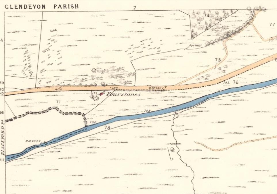
A few happy expletives came out, as usual for me. So I sought out the map he was talking about and, as we can see above, the “Fourstanes” (or Stones) are right where my ‘feelings’ and the stones were seen.
On the 1860 Ordnance Survey map of the area, a small building is shown and named as ‘Fourstanes’ right by the roadside, on the south side. It was also named as such in an earlier account of 1851 and was told to be inhabited by a Mrs Foote in 1866. Sometime after this the cottage appears to have been left to neglect and no trace of it now remains. According to evidences of the place-name societies in England and Scotland and the studies of Smith (1956), Scott (2004) and others, unless the term derives from the Gaelic fuar, meaning cold or chilly, it is usually evidence of ‘four stones’ in relation to megalithic remains like those found from Shetland to the more southerly counties in England. Dr Aubrey Burl (1988) shows clearly in his textbook of the same name, that “four poster stone circles” are common megalithic architectural features in the Perthshire landscape — where this happens to be! He also states that such place-names should be listed and checked as possible “sites of destroyed four posters.” So we did just that!
Although the stones look very good contenders in the photos and also when you first see them close up, there are some elements here that need highlighting that throw a more sceptical view of them as authentic megaliths. The larger of the two stones—very rounded and worn, typical of other four-poster remains—is three feet high. The lichen vegetation covering it on all sides is old—except on its back (northern) upright face, where there is almost no vegetation at all. Indeed, this face is almost entirely clear of any natural plant growth, showing it was moved into this position from a lower horizontal level and pushed upright, I would say within the last century. The smaller, lower stone next to this upright oddity, is laid down and covered on all sides by an excess of vegetation expected of a monolith that has been in this position for several centuries at least. The lichen growth on this stone is very old.
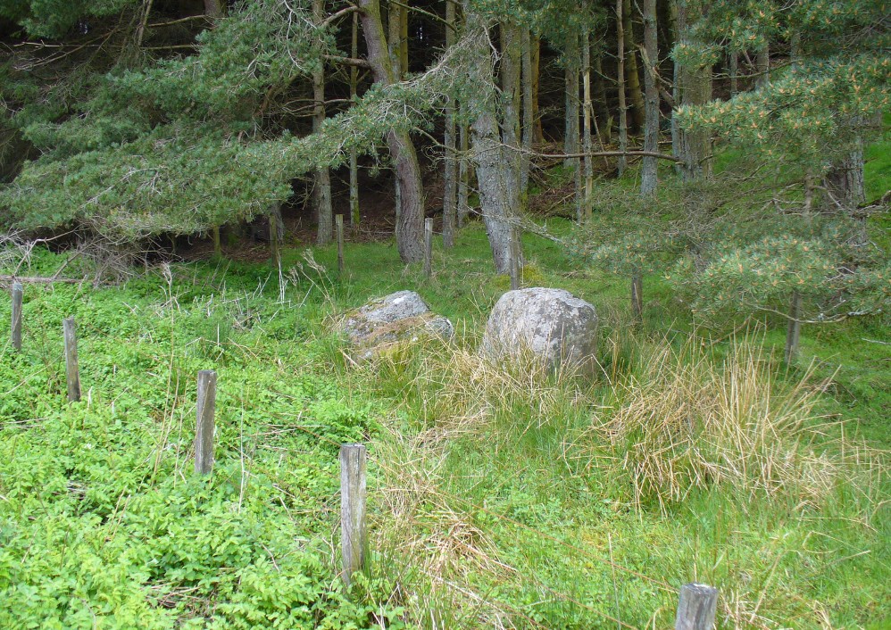
Both of these stones occur along the line of an old wall and may have originally been a part of such a structure, instead of any four poster megalithic feature. However, the road that runs past here replaced the earlier track (which you can still walk along on the other side of the river 100 yards away) running through Glen Devon and into Glen Eagles. This “new road” as it was then, was made sometime in the 19th century. It may be that, upon the construction of the new road, the ‘fourstanes’ themselves were “in the way of Progress” (as they like to say) and so were rolled down the side of the new road and into the position they now occupy. It’s difficult to say.
There is one additional element that needs exploring. The hill immediately above Fourstanes is called ‘The Law.’ Although this word can be a simple “hill”, there are additional historical factors to a place-name. In Laurence Gomme’s (1880: 260-77) excellent work on the subject, he illustrates time and again across Scotland that heathen gatherings, tribal meetings and early court sessions or ‘moots’ were held at places with this place-name element. It should come as no surprise then, that at other megalithic sites in Britain called the Four Stones, ancient pagan moot were also held there. (Gomme 1880; Grinsell 1936, 1976)
We’re going back onto The Law itself in the next week or two, just to see if these ‘fourstanes’ are hiding away in the heather on the tops, where oh so many megalithic rings tend to be found….
…to be continued…
References:
Burl, Aubrey, Four Posters: Bronze Age Stone Circles of Western Europe, BAR 195: Oxford 1988.
Dwelly, Edward, The Illustrated Gaelic-English Dictionary, Gairm: Glasgow 1973.
The best way here is to walk a mile to find it. All the way up the road from Gleneagles Standing Stones to Glendevon, right at the very top where the two glens meet, there’s a small road heading to the Fishery. 100 yards along, park up. Then take the old green road back down the Glen, north towards Gleneagles, parallel with the new road. A mile or so down you’ll reach the farmhouse, but a coupla hundred yards before this, in a wooden gap in the electric fence, you can walk straight downhill to the large pool below you. Y’ can’t really miss it!
Archaeology & History
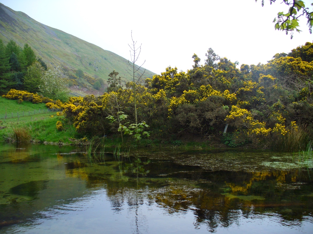
The strong cold spring of water known as St Mungo’s Well, now gathers into a large crystal clear pool and is gorgeous to drink and very refreshing! All around the edges are the brilliant yellow masses of gorse, held amidst widespread vivid hues of green in this most rocky of landscapes. Tis a gorgeous setting here….
St Mungo’s Well, 1860 map
Unfortunately there is no literary information that tells us why this spring of water, amongst the many others all around these hills, gained the ‘blessing’ of one of those roaming christians and was deemed to be ‘holy’. The greatest likelihood, as usual, is that the waters had some important heathen association which our peasant ancestors would have been able to tell us about if their animistic tales hadn’t been outlawed and demonized by the incoming cult — but we’ll probably never know for sure. As a result, we know nothing now of its medicinal qualities or old stories.
The transference of its old name (whatever it may have been) to their ‘St. Mungo’ may date from when the character was wandering with his christians in the 7th century, but we have no literary account proving as such. The name ‘St Mungo’ was an alternative name (a nickname if y’ like) of St. Kentigern — or at least that’s what the church historians tell us. There is no history of Kentigern or St Mungo up the glen, but we do have a more prosaic account that tells of a Mr Mungo Haldane of Gleneagles, a member of the Scottish parliament in 1673 onwards; he was succeeded by another Mungo Haldane MP in 1755. However, it’s highly unlikely that these political characters gave their name to the well.
The clear waters, looking southCrystal clear perfect drinking water
Even the Scottish holy wells surveys are pretty silent on this beautiful site. It was mentioned in Morris’ (1981) survey, but with no real information. The earliest account seems to come from an article written in the Perthshire Advertiser in 1856, and thankfully reproduced in the otherwise tedious genealogical history of the Haldane (1880) family; but even here, the narrative simply mentions the presence of the well and no more. Described in a walk up Gleneagles, it told:
“Journeying westward along the desolate moor…we soon came in front of Gleneagles, a narrow picturesque glen in the Ochils, through which the old road from Crieff leads into Kinross-shire. The hills here, as throughout the whole range, are strictly pastoral, but in no place more so than Gleneagles. Crowning the heights on both sides of the glen, we have craigs ragged and bare enough; but their show of beetling hard sterility is as nothing to the winding receding mass of grassy heights that bound the view. In looking on that quiet, sunny, Sabbath-like retreat, one would be apt to deem the name a misnomer, and yet it is not much above a hundred years since the monarch of birds had a home among its cliffs. There, too, the Ruthven Water that dashes past Auchterarder has its rise — not in a scarcely seen bubbling spring almost covered with moss, but issuing at once into daylight at the bottom of yonder steep in volume sufficient to drive a mill. In ancient times, as now, it must have been an object of mark, as it is called St. Mungo’s Well; but who this St. Mungo or St. Magnus was — whether the ghostly patron of Glasgow, Auchterarder old chapel, or the guardian saint of this particular spot, we cannot tell. But he seems to have relished cold water; and it is satisfactory to know that he must have got his fill of it there, if his cell happened to be in the vicinity.”
The well was mentioned in passing in the Object Name Book in 1860 and shown on the earliest Ordnance Survey maps.
Folklore
Apart from the fact that the waters here never run dry, we have no other folklore. However it should be noted that St. Mungo’s Day was January 14th — which may have been when the qualities of the spring were deemed most efficacious, or when olde rites were enacted here. However, a hundred yards down we pass the stream known as Bride’s Burn, probably in honour of the heathen Queen St. Brigit, whose name and myths are integral to our great Earth goddess, the Cailleach and whose celebration date is only two weeks later than that of Mungo. Hmmmmmmm…..
References:
Attwater, Donald, Penguin Dictionary of Saints, Penguin: Harmondsworth 1965.
Haldane, Alexander, Memoranda Relating to the Family of Haldane of Gleneagles, C.A. MacKintosh: London 1880.
MacKinlay, James M., Folklore of Scottish Lochs and Springs, William Hodge: Glasgow 1893.
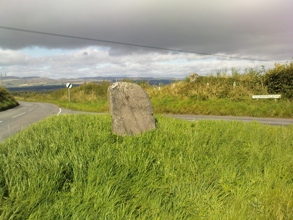
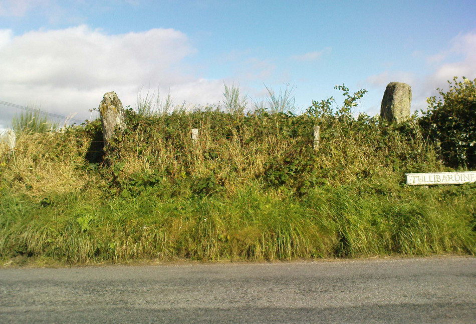
From Auchterarder’s A824 main street, going out towards the golf course take the Orchil Road on your right and then about fifty yards along, turn right again up Tullibardine Road. Park up somewhere about a hundred yards along, then just walk further down the road until you’ll see the standing stone right at the road junction. Look into the field on your right, above you, and another two are hiding in the brambles and grasses.
Archaeology & History
Included in Andy Finlayson’s (2010) fine local survey, this is an intriguing little group of three standing stones (and a fourth buried beneath the turf), all very close to each other. They are shown on the modern Ordnance Survey maps as “standing stones”, but have been catalogued by archaeologists as the denuded remains of a ‘Four Poster’ stone circle. Despite this, the circle wasn’t included in Aubrey Burl’s (1988) definitive work on the subject, nor his megalithic magnum opus. (Burl 2000)
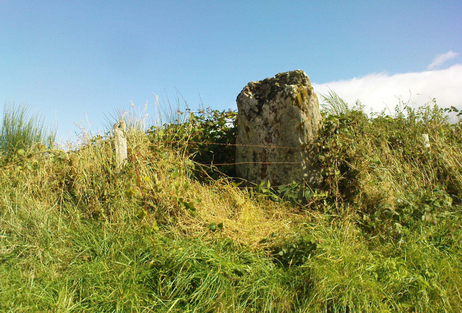
Northern hedgerow stone…and two in the hedgerow
Of the two uprights above the roadside at the field edge, a faint carved hand can be found on the upright west-facing side of the southernmost of the two standing stones. Although faint, this doesn’t appear to be ancient. Written accounts of these stones are few and far between it seems. The earliest seems to be in the lengthy essay written by Mr Hutchison (1893), in which he gave an excellent account:
“Less than a mile to the west of (Auchterarder)…is a fine group of stones, two only of which are now standing. These stand on the summit of what has been a well-defined mound, and the stones now lying where the roads unite seem to have stood originally at the same height. The road has been driven through the group at a lower level than the summit of the mound, and the stones have been thrown down and laid in the waste space at the point of junction. The small mercy to be thankful for is that they have not been broken up altogether and used for road metaL This has probably been due to the circumstances that one of these stones has a curious encircling groove running round it, which perhaps impressed even the vandal roadmakers with the idea that it might be worthy of preservation. It would be interesting to know whether, when the circle or group of stones was cut through, any cist or interment was found. One would expect such to be the case, but I have not yet got any information on the point. There are several stones lying on the spot which may or may not be pieces of the original standing stones. Two considerable bits of old red sandstone, at least, look as if they were fragments of an original whole. Two great stones, however, are unmistakably prostrate standing-stones; and from the positions in which they lie, it seems to me as if the persons who had uprooted them had laid them down as nearly as possible on the sites they had occupied (at the original higher level, of course) when standing.
“The direction in which both of the standing stones point is 236º, and a line taken from each of the prostrate stones to the opposite standing one gives very nearly the same angle (240º). The prostrate stones are of metamorphic schist. The northerly one measures 7 feet in length by 3 feet in width, and is from 12 to 18 inches thick. A grove or furrow, 2 inches deep at its greatest depth, and from 2 to 4 inches wide, appears to run right round it, at a distance of 2 feet 10 inches from the end, which may have been about the middle height of the stone when erect. The lower side of the stone cannot be seen, but the appearance at the edges indicates that the furrow is carried all the way round. It looks just such a hollow as might be worn in stone by the long continued attrition of an iron chain. The more southerly prostrate stone is 6 feet in length, 4 feet wide, and has an average thickness of 18 inches. The two stones still standing are on the high bank above the road, just inside the hedge. These are both of old red sandstone, thinnish slabs, facing in the direction already mentioned. That to the south is 4 feet 10 inches in height, 2 feet 8 inch broad at the base, and 10 inches thick. The other is 5 ft. 3 in. at its greatest height, 3 feet 10 inches wide, and from 13 to 15 indies thick. On its northern face it shows a number of depressions or indentations curiously resembling prints of human feet. These Mr Kidston considers to be due to natural weathering.”
Southern carved stone
Yet the “prints of human feet” are very much man-made. A closer examination of these carvings is obviously needed.
Whether these stones originally played a part in an old tumulus, a cairn circle, or a typical stone circle, is hard to say with any certainty now. We are in a landscape where megalithic remains were once in great excess: with the standing stones of Blackford to the south; the lost circle of Gleneagles nearby; the megaliths near Muthill and many many more…
References:
Burl, Aubrey, Four Posters: Bronze Age Stone Circles of Western Europe, BAR 195: Oxford 1988.
Finlayson, Andrew, The Stones of Strathearn, One Tree Island: Comrie 2010.
Hutchison, A.F., “The Standing Stones of Stirling District,” in The Stirling Antiquary, volume 1, 1893.
Strachan, Favid (ed.), A History of Blackford, Blackford Historical Society 2010.
Along the A9 dual carriageway between Blackford and Auchterarder, take the A823 road south, up Glen Eagles as if you’re going towards Pool of Muckhart and Dunfermline. Less than 100 yards up the road, turn immediately to your right and park-up. On the overgrown grassy land on the right-hand side of the road, you’ll see this solid monolith calling for your attention. You can go through the gate. You can’t really miss it!
Archaeology & History
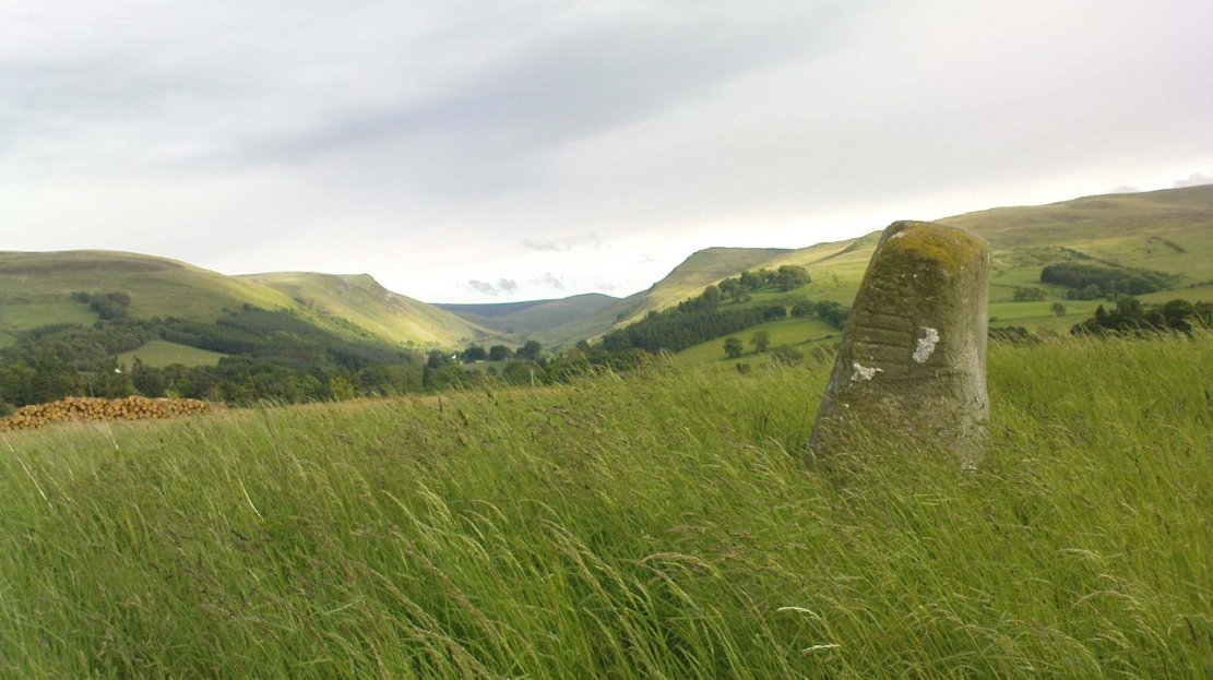
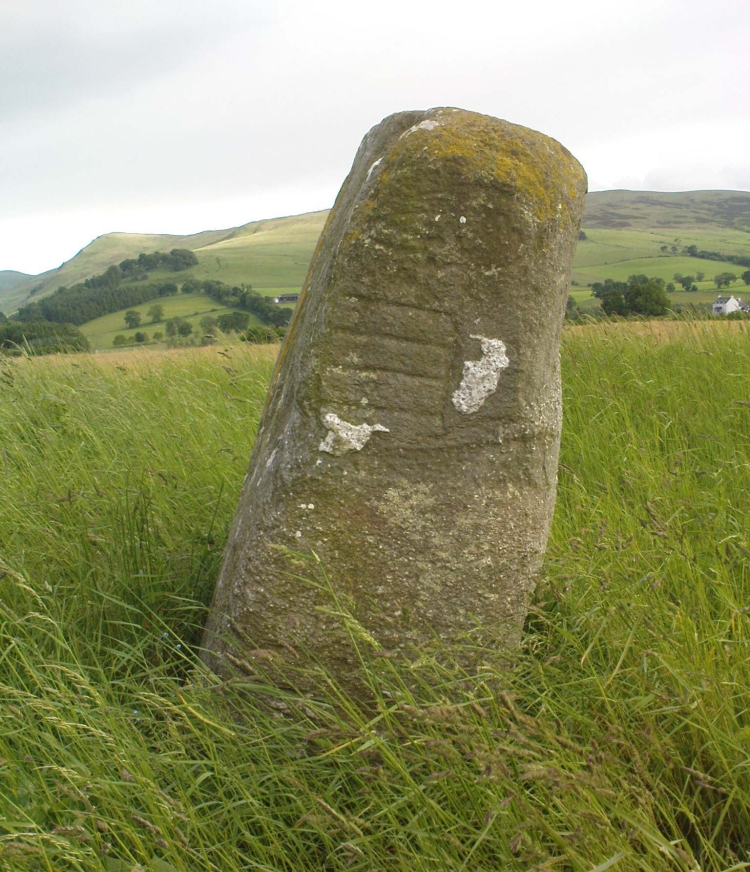
Looking south, to the fairy-haunted Ben Shee
Described by archaeologists as a Class 1 Pictish Symbol Stone (and shown on OS maps as such), this is a fine solid standing stone more than 5 feet tall, with a lovely view up Gleneagles to the fairy mountain of Ben Shee beckoning in the distance. Immediately north on the other side of the dual carriageway, the tree-lined mound 100 yards away is an ancient fort (which we’ll deal with in another entry); and of course we have the nearby companion of the Gleneagles A standing stone a coupla hundred yards west. Whether or not this stone and its western companion ever had anything to do with the lost stone circle of Gleneagles, we might never know.
Close-up of the carved designsCharles Calders drawing of the carvings
Although it seems consensus opinion that the standing stone here is prehistoric, the monolith was of some venerable importance to the Pictish people of the Ochils, who, according to the Royal Commission lads (1999) carved on this stone “the faint symbols of a goose and rectangle.” The rectangle, however, is in fact a parallelogram—as the images here clearly show. Archaeologist Richard Feachem (1977) thought the design was in fact “a double-sided comb.” I have my doubts (a much smaller and probably more recent parallelogram design was recently identified on the upright face of the large Dunruchan D standing stone, about 10 miles WNW of here). The ‘goose’ is carved above this geometric form and is much fainter, which may imply it was carved much earlier. In Elizabeth Sutherland’s (1997) survey, she suggests the bird may be an eagle. It is equally possible that it is a swan.
The earliest detaied account of this stone and its companion is in Mr Hutchison’s (1893) fine essay, where he wrote:
“On the south side of the road from Blackford to Auchterarder, about 150 yards west from Loaninghead where the line of the road is crossed by that from Gleneagles to Crieff, stands a fine stone of Highland grit. It measures 4ft. 10in. in height above ground, 10ft. in girth at the base, and 6ft. 9in. in circumference at top. It shows four sides of nearly equal measurement:— that facing north being 2ft 4in., south 2ft. 8in., west 2ft 5in., and east 3ft. On the north is an incised figure in the form of an parallelogram, 10in. broad by 9in. high, divided into three equal portions by two horizontal lines.”
Virtually nothing is known of a stone circle that was described in the 18th century old Statistical Account of Scotland, where a ring of stones was seen “in the parks of Gleneagles.” Its exact whereabouts remains unknown and the grid-reference given for the circle is an approximation. The writer told that this was “supposed to have been places of Druidical worship,” and it is mentioned alongside the megalithic sites at nearby Sheriffmuir and the Glebe.
The circle is mentioned without further details on the Canmore website. A number of stones above St. Mungo’s Well looked promising when I was bimbling in the area the other week — and as the landscape levels out above the well towards Glen Devon, we have a promising panorama, but there was nothing there. It would be good to have a team of us bimbling round here to see what could be found. However, the site may well have been destroyed. Any further information about this site would be hugely welcome!
References:
Sinclair, John, The Statistical Account of Scotland, 1791-1799 – volume 3, EP: Wakefield 1979.
Along the A9 dual carriageway between Blackford and Auchterarder, take the A823 road south, up the Glen Eagles road as if you’re heading towards Pool of Muckhart and Dunfermline. Less than 100 yards up the road, turn immediately right and go past the standing stone of Gleneagles B for a coupla hundred yards or so, where there’s a left turn (down to Peterhead Farm). Stop here and look into the field in front of you. You can’t really miss it!
Archaeology & History
Gleneagles ‘A’, gazing west
This short standing stone, more than 3ft tall, has an elegance about it which megalith lovers alone will understand! Maybe it’s the setting; maybe the feel of the land; or maybe something else. I dunno… On my first visit to the site, Nature was wearing a grey overcast cloak, but the site and I didn’t seem to care; and although the view from here doesn’t have the same grandeur of Glen Eagles to view as its companion stone a few hundred yards to the east might have, there felt a greater welcoming at this smaller stone. Odd, considering this monolith had been knocked over and re-positioned by the farmer in the not-too-distant past. Anyway…less of this subjective nonsense of feelings from the landscape and megaliths! Utter drivel all of it!
The earliest measured account of the stone is to be found in Mr Hutchison’s (1893) essay, where he notes this and its companion close by, giving us the dimensions of this monolith:
“This (stone) is roughly columnar in shape, but wider at the base than above. Its height is 3ft above ground; circumference at base 6ft. 5in., diminishing to 4ft. 2in at the top. It is of metamorphic schist. The line of direction between these two gives a horizontal angle of 260°.”
Since that day, in the mass of archaeology essays that have been scribed, this smoothed upright gets only a minimal description. Charles Calder’s (1947) account is typical, saying simply that it is,
“Somewhat cylindrical in form with a girth of 7 feet at the base, it rises with a decided tilt towards the west to a height of 3 feet 10 inches above ground-level.”
The stone fares better in Andrew Finlayson’s (2010) fine local survey of megalithic ruins, where he points out that this and its compatriot stone Gleneagles B, are in an alignment with the fallen Boat Stone and the upright White Stone, a few miles to the southwest. This line works on 1:50,000 map, but when transferred to larger-scale surveys, the alignment misses each outlying site by 20-30 yards here and there.